Bale Mountains National Park treks

Ethiopia. Guided.

Nominated in 2009 to the World Heritage Tentative List, Bale Mountains National Park (BMNP) is a national park in Ethiopia with one of the highest incidences of animal endemicity of any terrestrial habitat in the world. …

Bale Mountains National Park is open year-round although the most popular time to visit is November through April when the rains have stopped. The Park can be reached by private car or public transportation from Addis Ababa. Visitors may choose to trek throughout the Park either by horseback or on foot, or alternatively to visit the Park entirely by car. Treks range from one to 12 nights and travel through all the different ecosystems of the Park. …

map

Download the FREE Park guide (PDF):

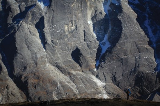
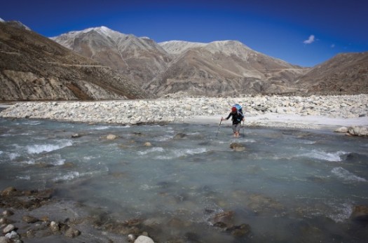
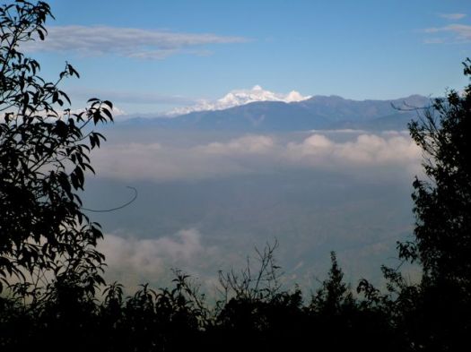
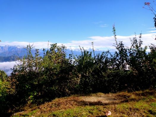
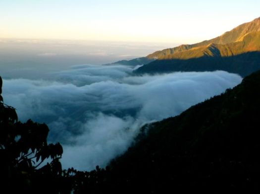
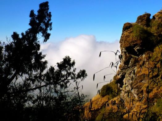
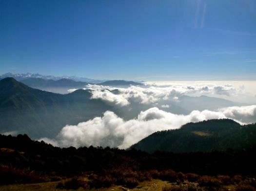
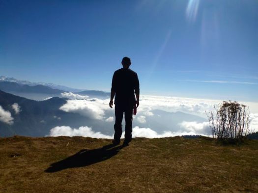
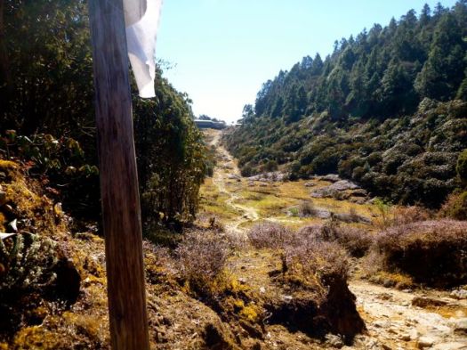
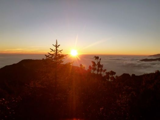
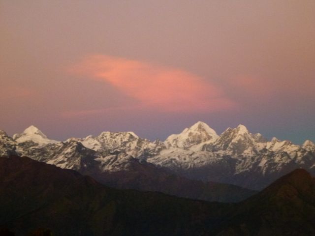
Treks range from 3,000m to above 4,000m altitude. Explore all habitats of the Bale Mountains National Park as you trek across the home of the Ethiopian wolf, mountain nyala, giant molerat and Bale monkey. Experience stunning Afroalpine mountains and natural scenery while heading deep into the heart of the Sanetti plateau – a floating land.

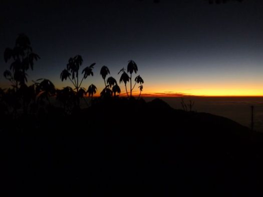
Explore vast moorland and discover Afroalpine plants as you camp in the wilderness. Hike amongst rock pinnacles etched out of the lava flows by millions of years of ice and winds, and pass waterfalls and alpine lakes. Camping in the Harenna forest may reward you with a sighting of the elusive animals that live there. Wildlife that can be seen along the way includes the olive baboon, warthog, rock hyrax, Starck’s hare, klipspringer, grey duiker, African wild dog, giant forest hog, leopard, lion and birds of prey. …

Bale

Makalu Base Camp 2015?

For my 6th trip to Nepal, where should I hike?

Dolpo? Mustang? Kanchenjunga?

So far I’m leaning towards Makalu. You can fly to the start, avoiding horrendous overland travel. 🙂

Known for its rural farming villages and a diversity of flora and fauna, the area receives few trekkers due to its relative inaccessibility.

OVERVIEW

Starting at 400m in Tumlingtar along the banks of the Arun River, you’ll need strong legs to carry you for an elevation gain of 5120m to reach Makalu Base Camp. A rustic teahouse trek (don’t expect deep-fried snickers bars), you’ll find yourself at the foot of Mt. Makalau (8485m), the world’s 5th highest mountain, with Lhotse (8,516m), Everest (8,850m), Baruntse (7,220m) and Chamlang (7,319m) not far off.

It is a culturally rich perspective on Nepal best suited for people who have been trekking in Nepal before.

Trekking Partners

Makalu Base Camp

related – 2012 trip report by sathya

Great Himalayan Trail

The Great Himalaya Trail is a proposed trail of more than 4500 km stretching the length of the Greater Himalaya range from Nanga Parbat in Jammu & Kashmir to Namche Barwa in Tibet thus passing through Kashmir, India, Nepal, Bhutan and Tibet. When completed, it will be the longest and highest alpine walking track in the world …

It will never be “completed”. There are many GHT routes, higher and lower. They can be hiked continuously or by section.

map

Check out two main websites, both pretty good:

greathimalayatrail.com

thegreathimalayatrail.org

The second mostly covers GHT Nepal.

The guidebook I’m researching is from Trailblazer – Nepal Trekking & the Great Himalaya Trail 2011 by Robin Boustead.

He’s got a coffee table book, as well, that I’ve never seen – The Great Himalaya Trail.

The-Great-Himalaya-Trail-413x272

Stuart Bilby solo’d the Nepal GHT Nepal in 127 days in 2014, an incredible accomplishment. No cars, buses, planes, donkeys or yaks for transport. Stuart lost 19kg body weight. Actually, the first half he did with Lisa Lee-Johnson.

Linda Bezemer published a (much more reasonable) GHT Low Route electronic guidebook which you could use with an iPad on the trail. 1550km broken into 11 sections.

Seth, Kathleen and John did a 2014 east-west GHT Nepal traverse.

But my favourite is Gerda Pouler’s account of her 2012 very personal adventureGreat Himalaya Trail: 1,700 Kilometres Across the Roof of the World [Kindle Edition].

Great Himalaya Trail – Gerda Pouler

… This path is perhaps the ultimate walk.
51eu9+Onr6L._AA278_PIkin4,BottomRight,-44,22_AA300_SH20_OU15_In 2012, Himalaya veteran Gerda Pauler set out to walk the length of the trail to raise awareness of autism in Nepal.
Travelling across the country with open eyes and ears, ascending high passes, visiting isolated villages and drinking tea with the locals allowed her to see and hear things many of us might never hear, never experience — and never know.
Beautifully written like many great travel books and with a foreword by Sir Chris Bonington, this is so much more than a travel diary — it is a collection of stories from the very heart of Nepal and its people. From Tibetan tea and local beer to corrupt politicians and child marriage; cold nights and monsoon rain to incredible views and searing heat; and from angry yaks and giant spiders to Mr Bean and Jack Nicholson…

Sherpani Col

home page – gerdapauler.info

Gosainkund & Helabu trek information

We’ve added a  information page for those who might want to do Gosainkund and Helambu in the future.

World → AsiaNepal → Gosainkund & Helambu

One of the best hikes in the world

 Gosainkund & Helambu

Ridge walk with sacred lakes, high Laurabina pass and Shivapuri National Park.

P1320458
trek above the clouds

AT A GLANCE

Nepal
Nepal
  • 6-8 days
  • 3rd most popular trekking area of Nepal after Everest & Annapurna, but comparatively uncrowded
  • majority of hikers hire a guide, porter guide and/or porters but it’s  easy to hike independently
  • sleep and eat in basic lodges (tea houses)
  • mid-October to mid-December best months
  • beginning of March to mid-May next best. (Laurabina pass MIGHT stay closed until early May. Many Langtang trekkers do Gosainkund after Langtang.)
  • days are short in the Autumn. There’s much more light in the Spring.
  • tea houses are not expensive, but many spend more than they anticipate on luxuries. We spent about $30/day in 2014. Cheapskates about $20/day.
  • be clear — you might have to QUIT if by bad luck or rushed ascent you suffer altitude sickness (Acute Mountain Sickness or AMS).
  • some suffer respiratory problems, headache and fatigue.

Click PLAY or watch David Vanneste’s solo, independent highlights Feb 2014 on YouTube. Off season. Lots of snow. A lovely edit.

Gosainkund and Helambu information page

best treks in Nepal

Updated after our November 2014 visit.

NEPAL TOP 10

There are many more great hikes in Nepal! … This list just scratches the surface.

I’m looking at Makalu Base Camp for my next trip. Perhaps November 2015.

Rick farewell Nepal

Gosainkund & Helambu – day 6

Trip report by site editor Rick McCharles

Chisopani 2165 – Sundarijal 1460m

Last day. I’d bus to Kathmandu from Sundarijal, the end of the Helambu.

Up before dawn again.

P1320661

P1320663

Pot of milk coffee on the hotel roof.

P1320664

The Helambu finishes with a walk through Shivapuri Nagarjun National Park, established 2002.

The trails have been recently improved. That means stairs, stairs, stairs.

P1320666

And some trenches.

P1320671

There are brief glimpses of the high peaks all the way to the capital.

P1320667

P1320669

I was feeling pretty mellow, my long trek ending. It had been a success.

P1320675

P1320677

What would the world do without Peruvian potatoes?

P1320678

It’s a bit surreal walking back into civilization.

sidewalks?

P1320680

Here’s one of the main water supplies of Kathmandu.

P1320682

You can’t get lost finishing if you follow the water pipe.

P1320696

I got lost.

P1320687

P1320686

Finally, a local musician pointed me the right direction to the bus park.

P1320695

P1320685

P1320697

One of the finest Tibetan artists in the world sat down beside me. How about that? He and his wife were on the way to Sikkim, India for a big commission. He’d have between 40-60 artist assistants on the project.

It took about an hour to get back to Kathmandu by bus, far better than the 7 ½ hours it had taken to get started.

The Army was using scissors to cut the grass on the main square. Very Gandhi.

P1320700

The crappy streets of Thamel were being paved. 🙂

roller

What’s going on?

Nothing is ever fixed in Kathmandu.

Ah ha. A few days after I quit Nepal, there’s a major international forum in Nepal. The South Asian Association for Regional Cooperation. I’m happy to get away before that happens.

In the afternoon I relished in the best travel bargain in Asia, a Nepali barber shave. Smooth as a baby.

P1320701

I finished the Helambu with a Korean couple who I’d been with on and off for the past 13 days. They are Himalayan fanatics, this being their 3rd major trekking holiday. They took me to their favourite Korean restaurant, Festival.

P1320703

P1320704

Cost of this meal was about $5.

Crazy good value. Better than anywhere in Korea. The chef had lived their 14yrs and was fluent in language and cooking. 🙂

see all my high resolution photos from this day

day 1 | day 2 | day 3 | day 4 | day 5 | day 6 | info | … Langtang

Gosainkund & Helambu – day 5

Trip report by site editor Rick McCharles

Mangengoth 3420m – Chisapani 2165

Though I struggled to wake in time, I did walk back up to the Green View viewpoint for dawn.

P1320614

P1320618

This morning the teahouse owner led the trip up to point out all the mountains from Annapurna to Everest. In fact, this might be the very best of many famed Himalayan viewpoint hills.

P1320621

This same owner told the story of a big stupa near Phedi. One like this.

P1320636

He’d been commissioned to build it in 1992 by the family of a young Japanese man who’d been killed when a Thai Airlines plane crashed into the mountain.

I talked most to 3 young Germans just starting their adventure, hiking the opposite direction. (The wrong way.)

P1320620

One keener was planning to cycle from Munich to the Rio Olympics.

This day I got on the trail as quickly as possible. I had a long, long way to go to get to the famed viewpoint of Chisapani, a hill station popular with residents of Kathmandu.

It looked pretty easy on the map. Long but mostly downhill. Unfortunately Nepali down = equal ups and downs.

P1320631

P1320628

Quite quickly I was back in summer. Rice was still being harvested!

P1320635

P1320637

P1320640

The ridge walk went on and on.

P1320643

I stopped only twice this day, once here for lunch.

P1320655

My dogs were barking.

Down. Down.

P1320656

The sun was failing. I was worried. Late in the afternoon there’s nobody left on the trail.

P1320658

Exhausted, I finally stumbled up hill in the dark to the relatively luxurious lodges of Chisapani 2165m. You should never hike the Himalayas in the dark. I’d done it 3 times so far this trip!

P1320660

see all my high resolution photos from this day

day 1 | day 2 | day 3 | day 4 | day 5 | day 6 | info | … Langtang

Gosainkund & Helambu – day 4

Trip report by site editor Rick McCharles

Gopte 3439m – Mangengoth 3420m

Good morning Gopte.

P1320555

P1320556

Nepali toilets are as unsanitary as any in the world. I walked past down the mountain past this one to do my business.

P1320562

P1320564

There’s a strange and popular instrument here, called the sarangi, with a carved dragon? head. Something like a fiddle. But with only 4 strings. Nepali Bluegrass. 🙂

P1320561

Starting out today late, I’m happy to be still above the clouds. 🙂

P1320576

Have you ever seen frost like this? Like hair?

P1320571

P1320572

Nobody talks about distance in the Himalaya, only elevation change. Today I dropped only 19m, my easiest day yet. I wanted a rest after the exhausting day over the Pass.

I stopped for lunch at Thatepati, the only hiker to do so that day. It’s a little off the beaten track.

P1320579

P1320580

Egg Veg Noodle soup, my usual.

P1320581

High on a ridge, the owner had to make several trips down a day carrying up barrels of water. The Helambu trail is mostly on a ridge. And there’s not much water available on ridges.

Hotel Green View, Mangengoth came highly recommended. And it was worth the stopover.

P1320592

P1320593

One of the best viewpoints in Nepal is a 25min climb from the guest house. My first thought was to tent up there, to see both sunset and sunrise. The Green View owner (who looked ex-military) and another guide both felt that was a bad idea. I deferred to their judgement. Even hiking independently you get a lot of smothering advise in Nepal.

P1320599

P1320604

I walked down in the dark.

P1320612

see all my high resolution photos from this day

day 1 | day 2 | day 3 | day 4 | day 5 | day 6 | info | … Langtang