

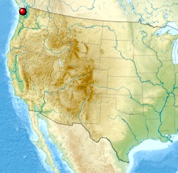
World → North America → Pacific NW → High Divide Loop
One of the best hikes in the world
High Divide Loop (7 Lakes Basin)
If you only have time for one overnight hike in the Olympic Mountains, this should be it.
– Douglas Lorain
Note: This page is a stub. You can recommend improvements by leaving recommendations or links in the comments on this page. Our editors will consider them. Thanks for your help!
 AT A GLANCE
- the jumping off point (and best finish) for the High Divide Loop is Sol Duc Hot Springs in Olympic National Park
- the turn-off to the Hot Springs is on U.S. Route 101 highway 29mi (47km) west of Port Angeles, Washington.
- 20.3mi (32.6km) including sidetrips to Lunch Lake and Bogachiel Peak
- must carry a tent and be completely self-sufficient
- cumulative elevation 5200ft
Why We Like This Hike
- wildflowers, wildlife,
- Mt Olympus and Mt Tom vistas, especially from atop Bogachiel Peak
- long, open ridge walks on the High Divide Trail

- pristine mountain lakes

- old growth forest: Douglas fir and Western hemlock
- good footing on excellent trails (though they can be muddy)
- pit toilets at many campsites. Use them. Please. 🙂
- no mountain bikes nor pack animals
- popular with trail runners
- campsites are widely separated. You can have privacy.

- group camps available
- it’s well managed. You’ll see Rangers in high season.

- we love bear grass 🙂

Considerations
Best months late July to mid-October. Check with Rangers in advance. In 2015, for example, due to little snow the previous winter, the Circuit was already clear in June. Other years snow remains on the north side of the high ridges and in the basin well into August.
Good weather is essential as views of Mt Olympus are one of the main reasons to hike the Circuit. If you have some flexibility, wait for clear skies. Phone the Park the day before you want to start hiking to double check. It’s not uncommon to have blue skies in Port Angeles while the Circuit is socked in.
- water must be treated.
- there is no water on the ridges
- guidebook author Douglas Lorain spotted 14 black bears during late summer on one circuit. We saw none and no signs of any on a June trip.
- late summer and fall are best for wildlife sightings
- huckleberry attracts bears in the autumn
- bear canister required (available free at Ranger stations – $3 donation / trip suggested)
- no dogs
- maximum groups size is 12
- you can carry firearms, but not use them. One of many silly American compromises on guns.
- mosquitos can be a problem, especially around the lakes
- urinate on the trail or on stones as salt deprived mammals sometimes dig up the soil
- campfires not allowed above 3500ft. Ask the Ranger to book you at a lower campsite if you want one.
- hypothermia is a real risk if you get wet

Cost
Campsite reservations required May 1st – Sept 30th. About half are available in advance. The other half first come, first served the morning you wish to start.
Permit fees are $5 / person / night (15 yrs old and younger free). Very inexpensive. 🙂
In addition, a Parks pass is required for your vehicle:
- $80 (2015) – one year National Parks and Federal Recreational Lands Pass … or a $10 – 7 day Olympic National Park pass on arrival
Routes
- make your way to Sol Duc Hot Springs, 3.5hrs drive from Seattle, 3hrs or less from Victoria, B.C. crossing to the USA on Blackball ferry

- Sol Duc Hot Springs makes a good base camp. Choose between a good campground and a number of different kinds of cabins.
- drive or walk to the Sol Duc Falls trailhead

- the large parking area is often crowded as the day hike to Sol Duc Falls is popular. Don’t leave any valuables visible overnight.

All available campsites are good, but if you like to sleep as high up as possible, here are two recommended itineraries:
night 1 – Lunch Lake campground
night 2 – Heart Lake campground
Two nights are enough. But if you’d like some leisure time, or some hours to wander 7 Lakes Basin, an extra night is recommended.
night 1 – Lunch Lake campground
night 2 – Cat Basin campground
night 3 – Heart Lake campground
Most hikers bypass the ridge walk towards Cat Basin. Yet the best Olympus views of all are about 1.3mi past the turn-off to Cat Basin campground.

Another good option is Silver Snag campsite on the High Divide Trail with great mountain views as well (during good weather), but there’s no water on a ridge. You’d need to melt snow. Or carry all you need. Ask Rangers for advice if you want to camp on the ridge.

You can do the circuit in either direction, but most ascend towards Deer lake. Descend towards Heart lake. That way the ascent is steep, the descent more gradual.
Trekking Guides
It’s easy to do this hike on your own. No guide is necessary.
Logistics
- this adventure is weather dependent
- regardless of how you plan to get to Sol Duc Hot Springs, telephone the Olympic National Park Wilderness Information Center in Port Angeles in advance – (360) 565-3100. Ask about the weather on the ridge.
- if weather looks bleak in the high mountains, head to another hike. Perhaps the Ozette Triangle on the coast. Ask the Rangers for advice on an alternative.
- if weather looks good, arrive at the Wilderness Information Center in Port Angeles as early in the morning as possible. It opens 8am.
- half the campsite reservations are available on a first-come, first-served basis. If you arrive close to 8am, you’ve got a good chance for good sites. Book the best campsites available at the time based on Ranger recommendations.
- If the dates of your High Divide Loop hike are fixed, reserve in advance by applying with a Wilderness Camping Permit Reservation Request form.
Local Information
Best Trekking Guidebooks
- Top Trails: Olympic National Park and Vicinity: Must-Do Hikes for Everyone by Douglas Lorain 2014
- Hiking Olympic National Park: A Guide to the Park’s Greatest Hiking Adventures by Erik Molvar 2015
We used Lorain’s book in 2015. It’s excellent. But we’ve used Molvar’s books in the past. Also excellent.
Best Travel Guidebooks
- Lonely Planet – Washington, Oregon & the Pacific Northwest 2014
Get the most recent editions of guidebooks.
Best Maps
- Olympic National Park (National Geographic Trails Illustrated Map) 2011
No topo map is needed for this adventure. But they do make good souvenirs.
Best Web Pages
- Olympic National Park – High Divide Loop (7 Lakes Basin)
- Olympic National Park – Wilderness Trip Planner
- Olympic National Park – Wilderness Information Center

Best Trip Reports
- Washington Trails links to many recent trip reports. Scroll down this page.
- besthike editor Rick McCharles June 2015
- My Hiking Blog
- Mountain Tracks media
- ProTrails
- Seeking Ultra (February)
Movies
Click PLAY or watch likenhiken’s video on YouTube.
Questions? Suggestions? Leave a REPLY on this page. Our editors will reply.
