This is a MAJOR long distance adventure like the Pacific Crest Trail. You need do a lot of advance planning. If 500 miles is too much we recommend 3 highlight sections:
Silverton (Molas Pass) to Durango (4-5 days) <trip>
AT A GLANCE
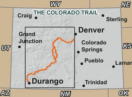
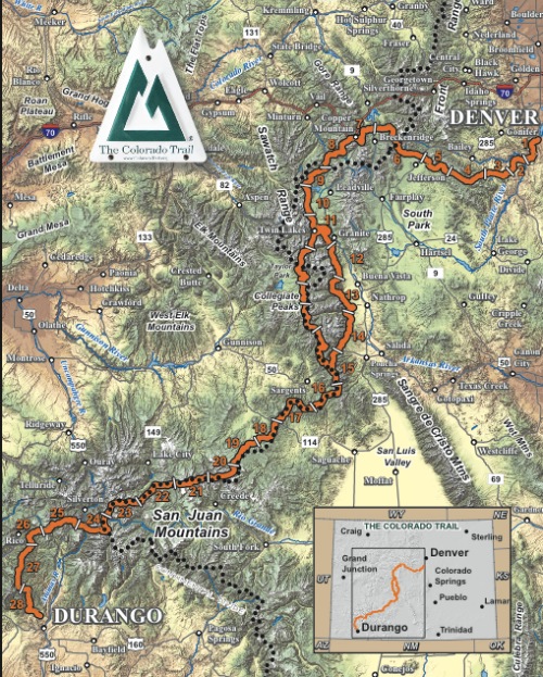
486mi (782km) from Denver to Durango
shares 234 miles with the Continental Divide Trail
4-6 weeks
highest point is 13,240ft (4035m)
average elevation about 10,347ft (3048m)
long stretches where resupply is difficult
no permits required
wildflowers best in July
Why We Like This Hike
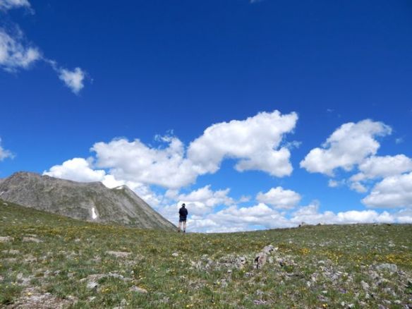
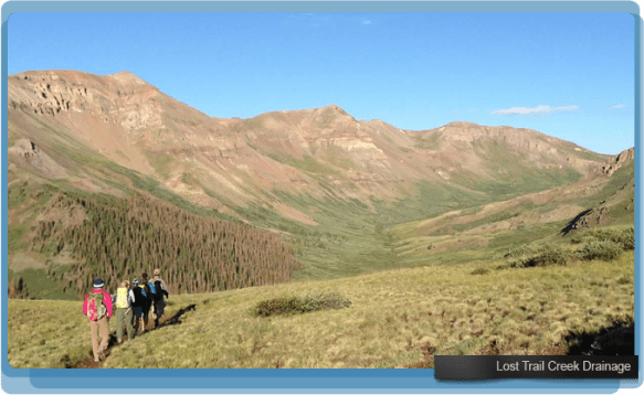
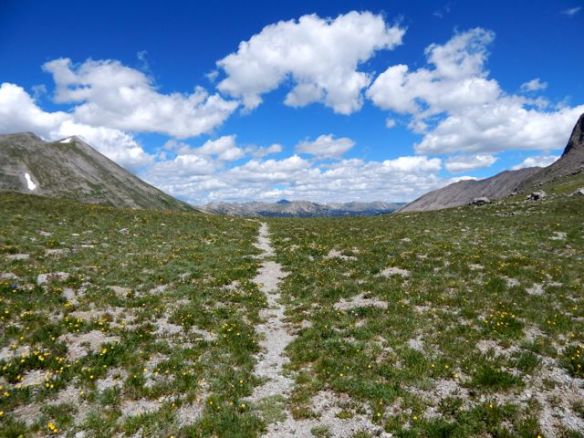
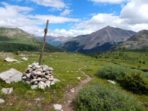
sprawling above-the-treeline mountain vistas
wildflowers, alpine meadows make you think you’ve died and gone to hiker’s heaven
dispersed camping – no rules
Colorado Trail Foundation does a terrific job maintaining and even improving the CT
miles of new singletrack has been built – mostly by volunteers – to replace logging road sections
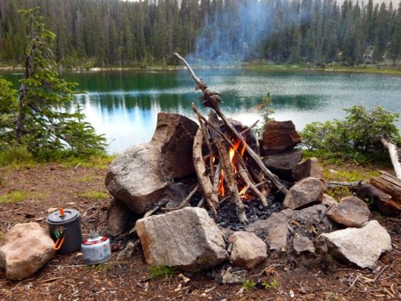
open fires are (sometimes) allowed
dogs are allowed on the CT (aside from the section near the Denver trailhead – Waterton Canyon)
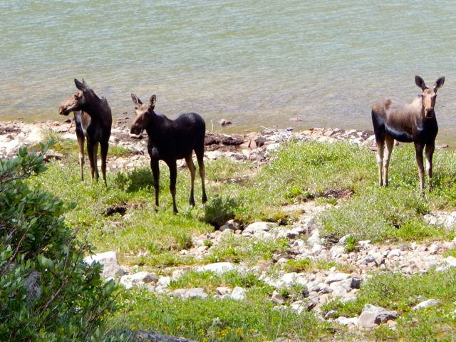
wildlife🙂 – elk, marmot, pica
moose
Considerations
Start hiking early. Thunderstorms start brewing around 1pm many afternoons. You don’t want to be caught high up and exposed if and when that happens. Consider taking a siesta mid-day. Wait and see what happens. By late afternoon you may be able to continue hiking.
“monsoon season” mid-July to mid-late August. Lots of torrential downpours in the afternoon. Lightning danger.
sections shared with mountain bikes and horses
availability of water is a concern in some sections. It can be 20 miles between good sources
sun protection is essential
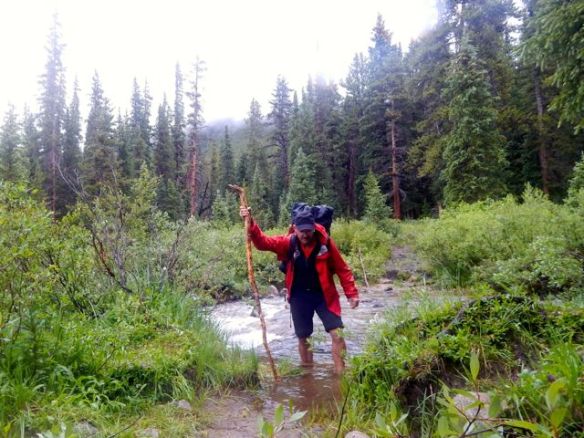
if water is high, you may need to do some creek crossing
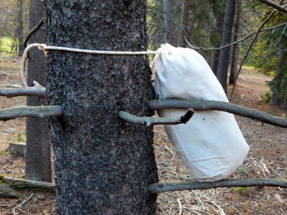
black bears on the Colorado Trail pose not nearly the same problem as the California Sierra bruins. But you still need to store your food away safely.
plan on mosquitoes
it’s difficult to find good bear hanging branches. Consider bringing a bear vault orUrsack.
Cost
There is no way to spend any money on the Colorado Trail itself.
most often hiked east-to-west, north-to-south from Denver to Durango
start no earlier than mid-late June. Finish no later than late September/ early October.
We recommend you walk from Denver towards Durango. Hikers call it “south” when on the trail. The start easier, the end more challenging. Save the spectacular San Juan’s for the finish.
But walking north extends the window of hiking by one or two weeks to early-mid October. Elevation / snow storms are less an obstacle on the last days arriving Denver.
If ready to start planning, click over to a page titled Colorado Trail Resources by Segment. It links to maps and information for 33 different sections plus alternatives.
Trekking Guides
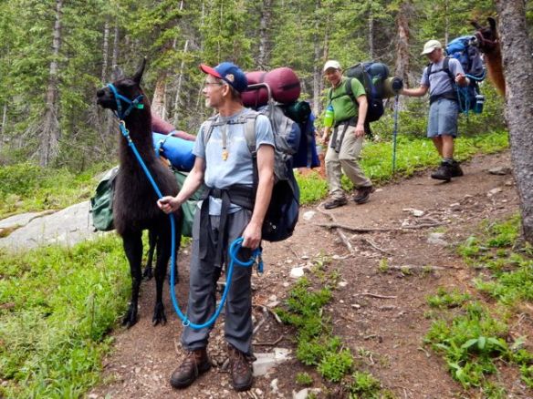
The Colorado Trail Foundation offers guided hikes.
They can transport your gear. You’d only carry a day pack.
Leave a comment if you can recommend other companies that guide parts of – or all of – the Colorado Trail.
Logistics
Since no permits or fees are required, you can start and stop wherever you like.
Camp wherever you like. (If water is available.)
Transportation to-and-from trailheads are your biggest issue. Starting and finishing. And heading off the trail to resupply with food and fuel.
To plan transport get your hands on a copy of a good guidebook well in advance. For example – The Colorado Trail.
Local Information
The Colorado Trail Foundation 710 10th Street, Room 210 Golden, CO 80401
The Colorado Trail Databook (4″x 7″) is enough for most hikers. It includes maps, elevation profile charts, GPS waypoints and highlights of each of the 28 segments of the trail in a compact format.
We used the heavier, more detailed official guidebook – The Colorado Trail.


The very first part of this guide”One of the best hikes in the world” is so darn true. Colorado, in general, is one of my favorite places.