
World → South America → Patagonian Andes → Argentina → Nahuel Huapi
One of the best hikes in the world
Nahuel Huapi Traverse
One of the most physically challenging of our best hikes in the world.
Click PLAY or watch it on YouTube.
 AT A GLANCE
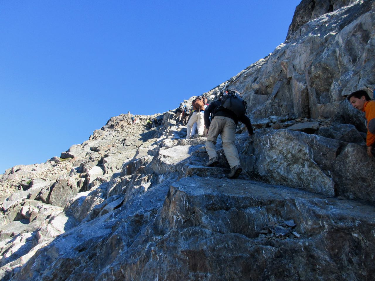
- high level ridge walking with scrambles. Some exposure. And route finding unless you have a GPS track to follow.
- Nahuel Huapi is pronounced nah-well-wah-pee
- translates as “island of the jaguar” from the native Mapuche people
- December to March are the best months
- Nahuel Huapi National Park is the oldest in Argentina
- the tourist mecca jumping off point of San Carlos de Bariloche is a transportation hub
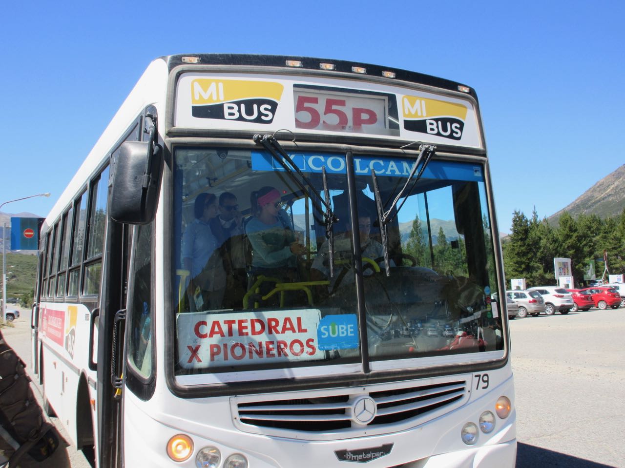
- convenient city bus service whisks you 20km from Bariloche to the trailhead at Villa Catedral, a popular ski resort
- Villa Catedral to Puente Lopez is only 36.5km (23mi) but they are some of the most difficult trails you’ve hiked
- it’s easy to shorten this 4 day adventure by exiting early down a number of different valleys
Why We Like This Hike
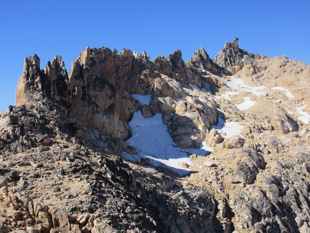
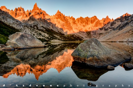
- craggy peaks
- stunning alpine lakes. About 20% of the Park is covered with water.
- highlight sections are on high ridges with fantastic views
- easy access
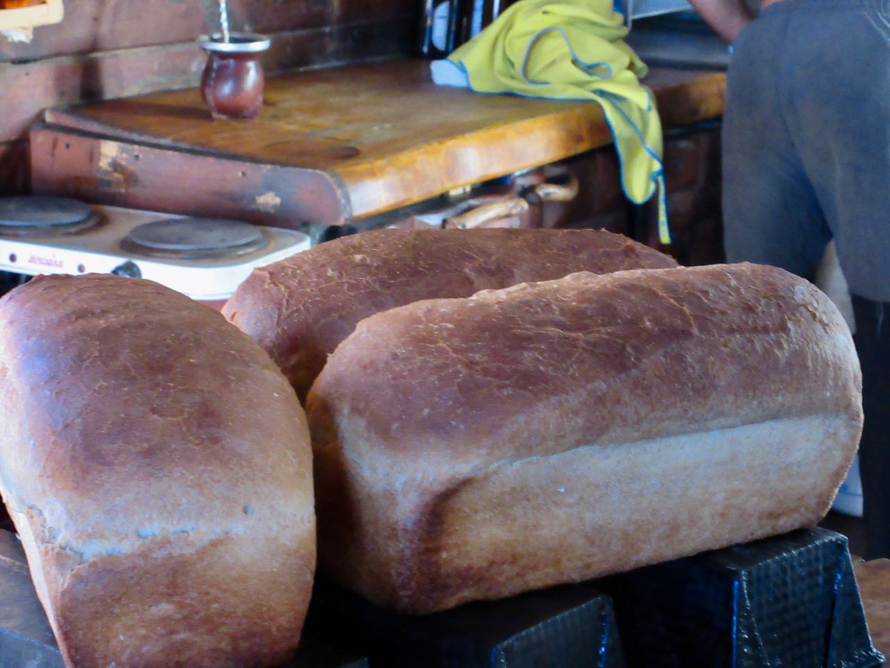
- sleeping in alpine refugios is an option
- eating in the refugios is another option
- altitude sickness is not a concern. (max. elevation 2060m)
- the days are long in Patagonia during their summer
- you can hike nearby Tronador to Otto Meiling on the same Bariloche trip
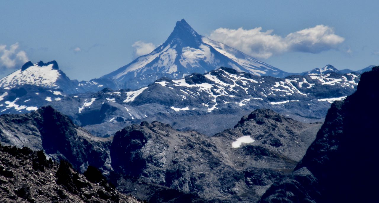
- astounding views of Volcán Puntiagudo (2,493m) across the border in Chile

Considerations
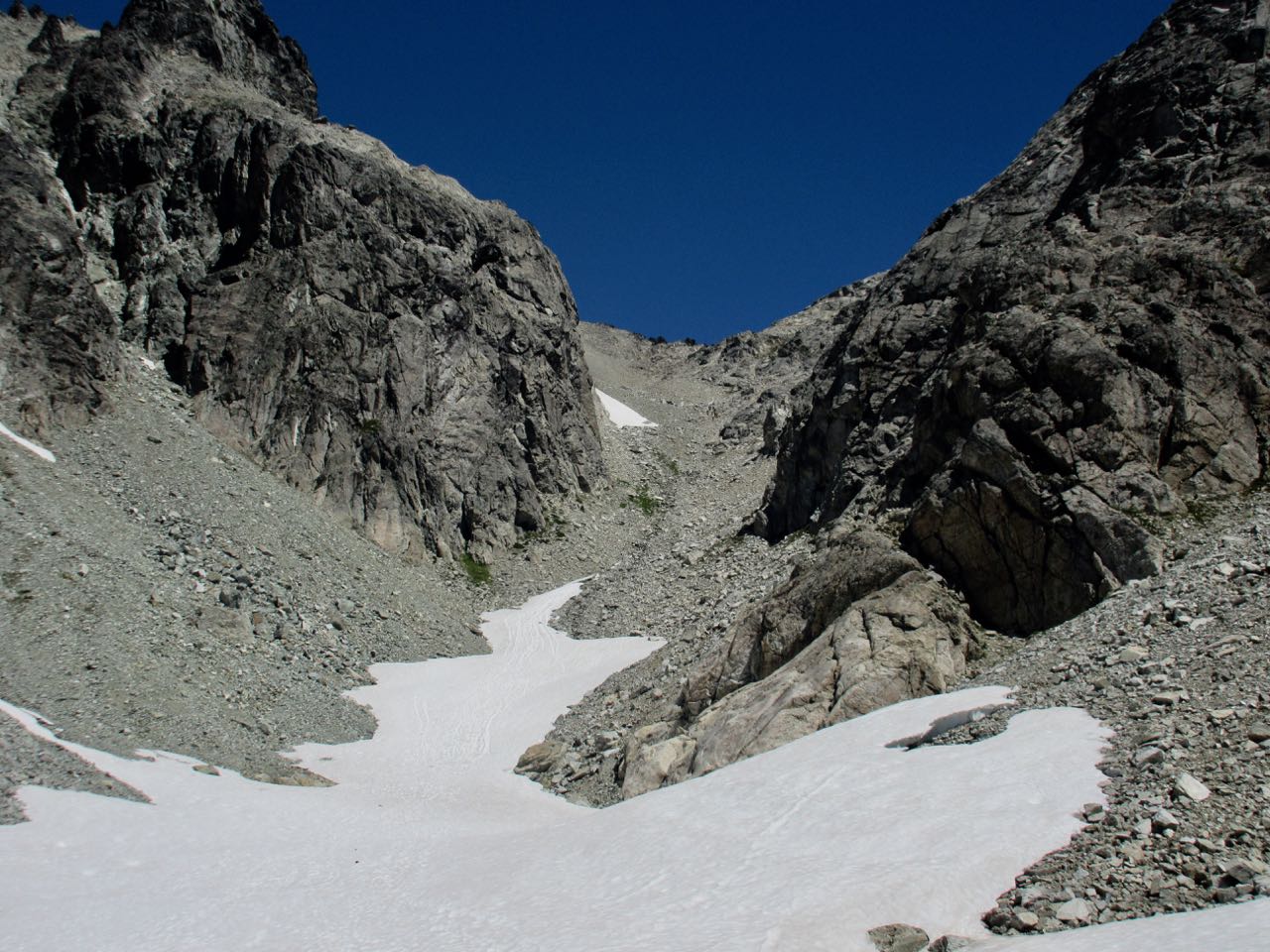
- much of this adventure is a route, not a trail
- you spend a lot of time looking for the next paint splash
- long, steep, dangerous descents through scree and/or unstable boulders
- most of the trail is above the tree-line. There’s not much protection from sun, wind and weather.
- very little water on the high ridges
- speak conversational Spanish if you want to do the trek on your own
- July 2017 Refugio Jakob was destroyed by fire. A new building was well underway when we were there February 2018.
- refuges are open between October/Novermber to April aside from Refugio Frey which is open year round
- snow on the high passes lasts into late November and sometimes into December
- you are unlikely to see any mosquitoes, but annoying Andean horse-flies (called los tábanos) may be a pest
Cost
- if you tent and cook your own food, there are no costs on the Traverse
- it’s easy to spend money if you decide to sleep, eat or drink at the refugios
- the bus to and from Bariloche costs a couple of dollars
- if you opt to take the lift at Catedral ski resort — Amancay to Dientes de Caballo — the cost was $24 in 2018
Trekking Guides
The easiest and safest way to do the Nahuel Huapi Traverse is with an adventure travel company:
- Swoop Patagonia (Traverse to Pampa Linda)
We’d recommend, however, you hike these mountains on your own. There’s no need to hire a guide for a trek accessed by city bus unless you need help on the day 3 climb.
Logistics
This section is for those who would like to do the Nahuel Huapi Traverse independently.
We recommend you sleep in a tent rather than the refuges as they are somewhat crowded, noisy and dirty during high season. Treat all water unless you see it coming out of the mountain high up.
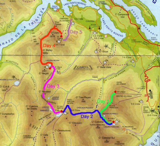
Getting organized for this adventure is fairly easy for the Andes, but there is one likely roadblock. You MUST have a reservation to tent at Frey. It’s usually booked with rock climbers during high season. Assuming you won’t be able to get a reservation, our recommended route suggests an alternative. Instead of going to Frey on the first night, camp close to a place called Cascada Rucaca (day 2) on the map below.
- San Carlos de Bariloche is the jumping off point. It’s a climbing, hiking and snow sports mecca.
- Bariloche has plenty of tourist accommodations at every price point including dozens of hostels
- check in at the Club Andino Bariloche (CAB) Mountain Info Center in central Bariloche for advice and recent updates on the trail.
- Carrefour is the biggest and best supermarket we found
- many outdoors shops are available for last minute gear. Prices are HIGH.
- all kinds of camping fuel are available. Try Patagonia Anglers, 205 Moreno street. They have maps, as well.
- bus #55 runs hourly during the hiking season from Bariloche to Villa Catedral Ski Resort parking lot. It may be signed “Cerro Catedral” or “Catedral” rather than #55. Ask at tourist information where to catch #55 as it takes two different routes heading out of town.
Free and compulsory registration should be completed each time you go treking in the Nahuel National Park
-
- write down your intended route (you do not have to stick to it)
- register in person in Bariloche at either National Park Office or the Club Andino Bariloche (CAB) Mountain Info Center
-
-
Alternatively you can fill out the confusing form online:
http://www.nahuelhuapi.gov.ar/intro_registro.html — scroll to the bottom of that page and click the “I’ve read the recommendations” link
-
Routes
From Bariloche there are two #55 buses taking two different routes to the ski resort. Check with locals to see where to catch the correct bus.
Two choices to start your trek up to Frey:
1. Ski lift – Amancay to Dientes de Caballo
2. Walk Arroyo Van Titter
(Early in the season the high route via the ski lift may be impassable due to snow and ice. Check with CAB in Bariloche to confirm.)
The classic (difficult) Traverse has you sleeping 4 nights in the mountains. No reservation for tenting is required except at Frey
- Refugio Frey (alternative Cascada if Frey is booked)
- Refugio San Martin (Jakob)
- Refugio Segre (Italia)
- Refugio López
Unless you are exhausted, there’s no need to stop at López. It’s only 3.5km to the highway bus stop near Puente López, walking distance from the town of Colonia Suiza.
You may need to wait an hour or two for the bus back to Bariloche. Check at the Puente López food kiosk on your arrival at the highway.
From Frey, San Martin and Segre there are easier exits (escapes) down green valleys in case of bad weather, fatigue or injury.
Local Information
- Club Andino Bariloche (CAB) Mountain Info Center
- Nahuel Huapi National Park Office
Best Trekking Guidebooks
- Lonely Planet Trekking in the Patagonian Andes (out of print)
- Las Montañas de Bariloche by Raul Izaguirre (Spanish) 1996 might be available in town
We LOVE that 2003 L.P. guidebook. But certainly wish LP would update.
Best Travel Guidebooks
- Lonely Planet Argentina … or buy just the chapters you need in digital format
Best Maps
- ask at Club Andino Bariloche what map they recommend. There are several available.
- some hikers with maps felt they did not have enough detail. A GPS track would be better.
Best Web Pages
- TrekBariloche.com
- Wikipedia – Nahuel Huapi National Park
Best Trip Reports
- site editor Rick McCharles 2018
- Maryna Sulym
- Ramblin’ Boy
- Prescription to Travel 2015
- Bariloche’s 4 Refugios: Not for the faint of hearted 2011
- Cam Honan 1997
- Desk to Glory 2016
Check an alternative route – Colonia Suiza to Refugio Otto Meiling
Questions? Suggestions? Leave a REPLY on this page. Our editors will reply.

Hello,
Thank you for this great site!
A few questions please –
1) Can I rent a tent at the refugios?
2) Is it possible to recharge the phone at the refugios?
3) Are there showers (with hot water) at the refugios?
Thank you,
-Noam