

World → Asia → Turkey → Carian Trails DRAFT
One of the best hikes in the world
The Carian Trails
So new you may see no other hikers on this Trail for days.
‘Launched’ in 2013, the Carian Trail was explored and mapped beginning 2009 by Yunus Özdemir, Altay Özcan and Dean Livesley
 AT A GLANCE
- 800+ km long
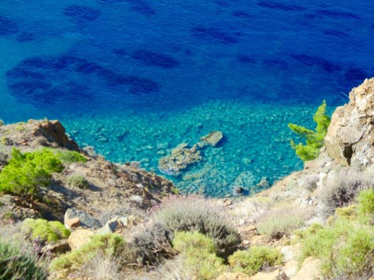
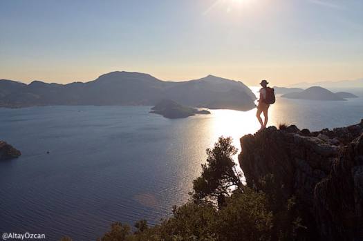
- some of the best coastal hiking in the world
- trail is named after the Carian civilization
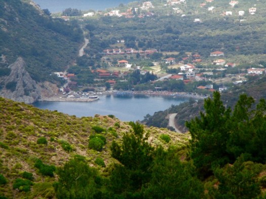
- stone caravan roads and mule paths connect villages along the coast and up into the hills
- best months are probably April and May. September and October are good too but water sources will have dried up. Summer is too hot.
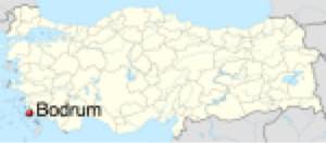
- many international hikers fly to Bodrum to organize. From there you can arrange transport to the section you wish to hike.
- the only guidebook and official map are not sufficient to safely hike these routines. You’ll need GPS.
- you can hike in either direction on any section
- unlike the Lycian Way, on the Carian Trail you really do need a tent. Be completely self-sufficient.
While we were there in 2017 the Turkish President’s actions were resulting in very negative headlines. Tourism suffered. Many visitors had been warned not to travel to Turkey.
That said … we’ve not heard of any issues that have ever affected tourists on the Carian.
Why We Like This Hike
- great Mediterranean climate. Virtually no rain falls from mid-May to September.
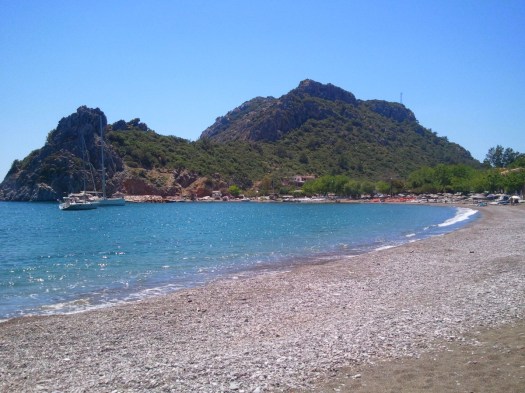
- gorgeous beaches
- pine forest slopes, olive terraces, almond groves
- very easy to tent almost anywhere for free.
- wild flowers in the Spring
- historical ruins
- spectacular coastal vistas
- local transportation via small shuttle vans is good. But you may spend time locating one.
- free wifi is surprisingly easy to find in Turkey at restaurants and pensions. Speed is good.
There’s no need to thru hike. Pick and choose the sections you want to see. Be quick to jump on public transit or into a taxi if you are not enjoying any sections.
Considerations
- finding water is problematic in some sections, especially late in the season. We carried as much as 4 litres / person at times.
- water should be treated
- some sections are boring, on pavement and/or cluttered with trash.
- outside major towns and hotels not much English is spoken. It’s well worth the time to learn a few words of Turkish. Carry a device that can translate for you.
- trail is waymarked with red and white stripes, the Grande Randonnee convention. Despite good intentions, most hikers get lost at some point nearly every single day.
- frequent steep ascents and descents
- heat emergencies are a real worry, especially in the summer. You’ll appreciate shade and trees.

- scorpions are a worry. Be careful picking up rocks and putting your hands somewhere without checking first
- snakes are poisonous we were told. But not deadly. You will see some.
- dogs are a bigger risk. Be ready to wave a stick or threaten to throw a stone if one approaches.
- mosquitoes are occasionally a problem. Other flying insects including bees, wasps, hornets and flies did not seem to want to bother with us in May.
- restaurants are available in villages and towns en route.
You can’t fly with camping gas. In Turkey it’s not all that easy to find canisters. Check this page – Backpacking stoves and suppliers for Turkey.
Cost
In 2017 you could pay £74 / day for a guided 6 nights (Akbuk to Boirum) with BeSpoke Turkey.
Or you could do the same 6 nights camping independently and spend as little as $20 / night for food, transportation, etc.
For best value bring Pounds, Euros or dollars. Change those to Turkish lira in cities as needed.
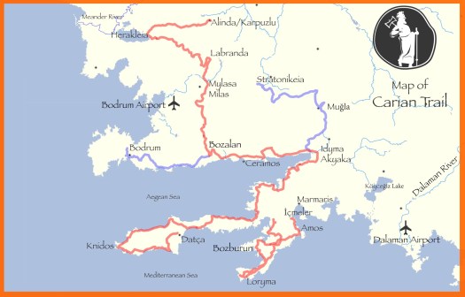
Routes
The Carian Trail consists of six sections:
- Bozburun Peninsula: 141.2 km
- Datça Peninsula: 240.7 km
- Ceramic Gulf (Gulf of Gökova): 139.2 km
- Carian Hinterland: 174.2 km
- Muğla Environs
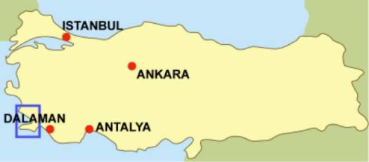
- Dalyan: 11 km
Deciding where to go is a problem. Datça is a rugged coastal section. It appeals to us. The Bozburun even wilder with fewer roads.
Trekking Guides
- Self-guided Turkey
- … leave a comment if you have a guide to recommend
Local Information
By far the best source of up-to-date information .
Guidebooks
- Carian Trail by Altay Özcan, Dean Livesey, Yunus Özdemir
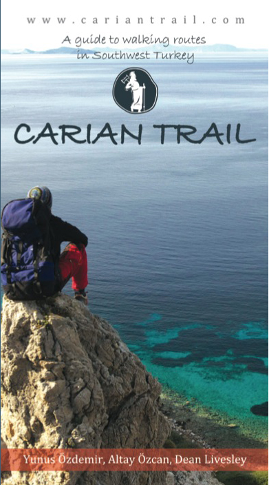
You can purchase the Carian Trail guidebook online via that link or in persona at the Cultural Routes Society office in Antalya. There are a few other places you might pick it up.
Needless to say this book is being quickly outdated as changes are made. You truly need GPS navigation. Download the most recent GPX or KLM files from those authors.
Best Travel Guidebooks
LP is still our favourite.
Best Maps
The Carian Trail guidebook includes a very simplistic map. It’s useless for navigation. Compare the route against something with far more detail. A map on your phone, for example.
Our best advice is to download the most recent files from the official website (GPX or KLM). Use your own GPS to navigate.
Best Web Pages
- cariantrail.com
- wikipedia – Carian Trail
- tripadvisor – Carian Trail
Best Trip Reports
- Aimless Hitchhiker (2015)
- BestHike editor Rick McCharles (2017) – 2 days independently on Datça
- Aaron Millar – Turkey on two feet
- Nigel Richardson – Walking holidays in Turkey: the ancient stones of the new Carian Trail (2014)

Movies
Click PLAY or watch a Russian hiking group on YouTube.
Questions? Suggestions? Leave a comment on this page. Our editors will reply.
