The Windhone Lake route is an alternative which also starts in Puerto Williams, getting you even further south. Some choose Windhone when Dientes looks impassable due to snow.
Note: You can recommend improvements by leaving recommendations or links in the comments on this page. Our editors will consider them. Thanks for your help!
AT A GLANCE
world’s most southerly major hike?
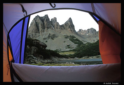
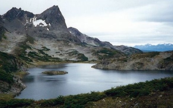
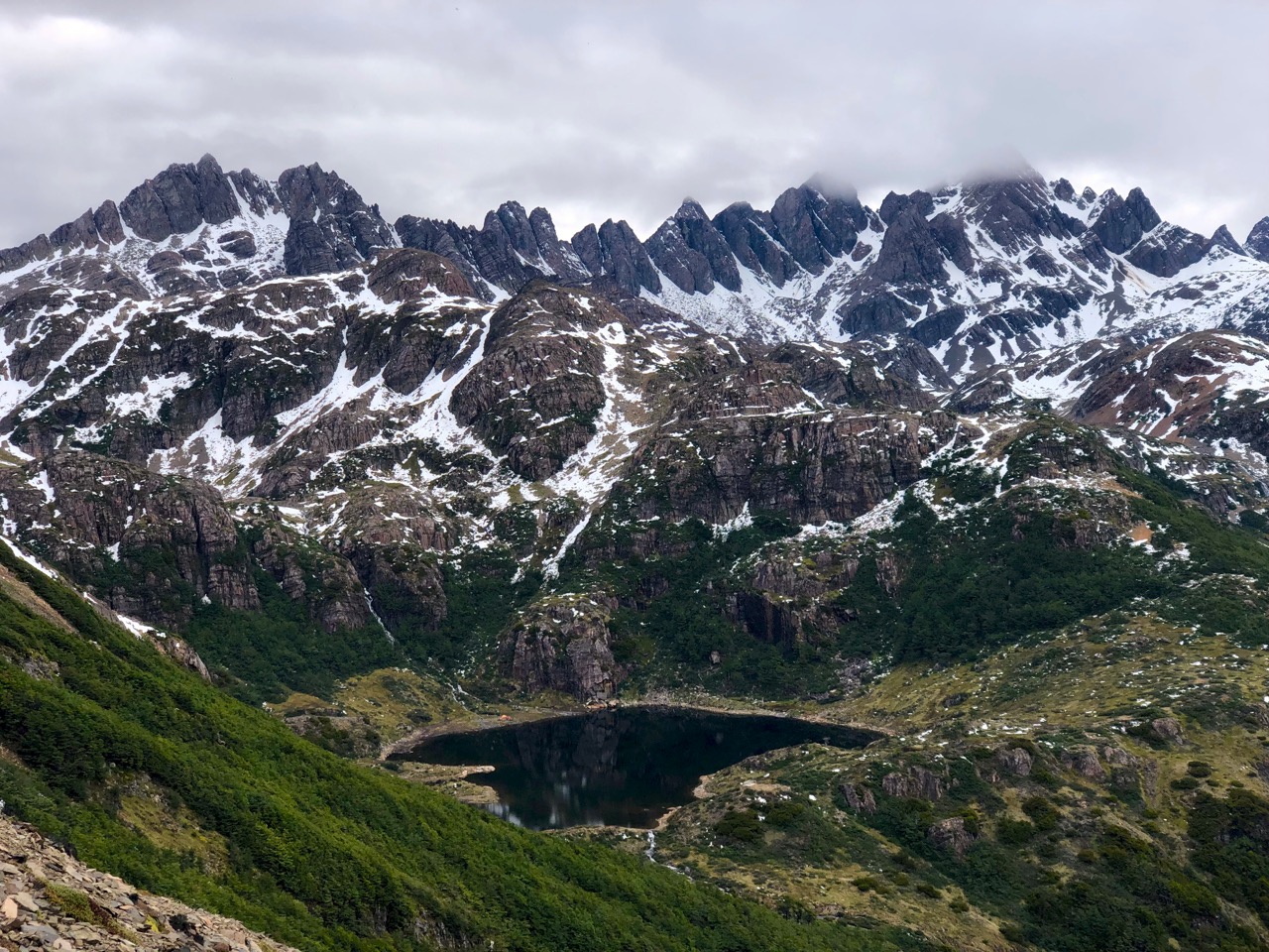
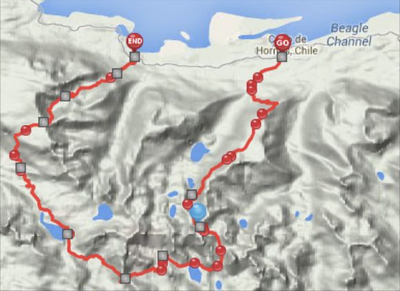
circumambulate the jagged spires of Cordon de los Dientes
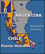
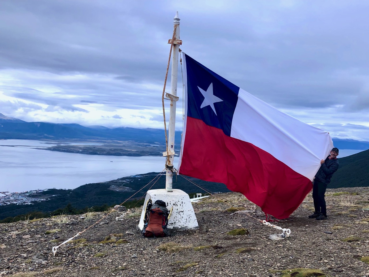
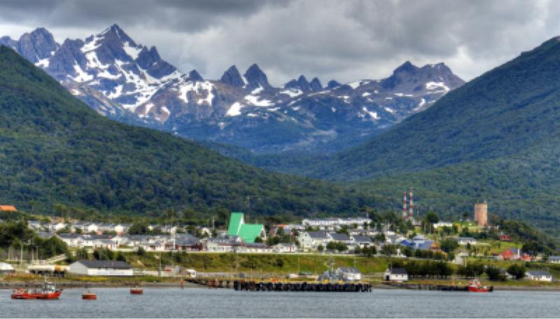
out of Puerto Williams, Chile, on Isla Navarino (pop. 2,262 last time we counted)
recommended 5 days, 4 nights in the past. Most hikers are doing it in 4 days, 3 nights now as the route is better cairned and signed.
Why We Like This Hike
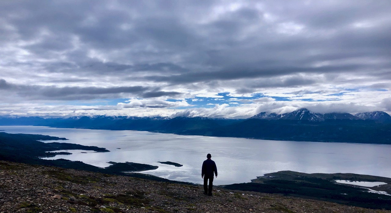
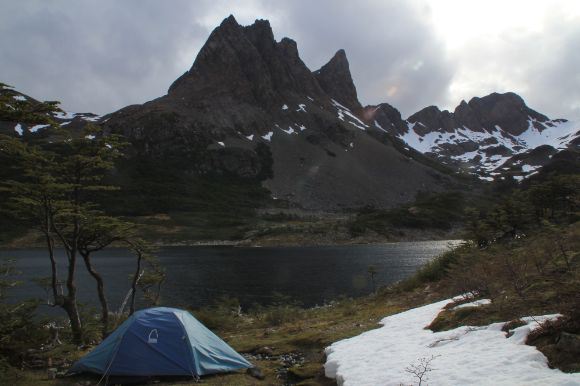
great views, most of the trek is above the treeline
vista over the islands making up Cape Horn (about 150km south)
condors, guanaco & beaver may be seen
it’s relatively close to Paine & Fitz Roy and Huemul, our favourite hikes in Patagonia
no risk of altitude sickness
Radek Tezaur
Considerations
extreme weather is your greatest concern
prepare for howling winds & unexpected snowfall
hypothermia is a risk
late February 2019 many were unable to get through due to early snowfall
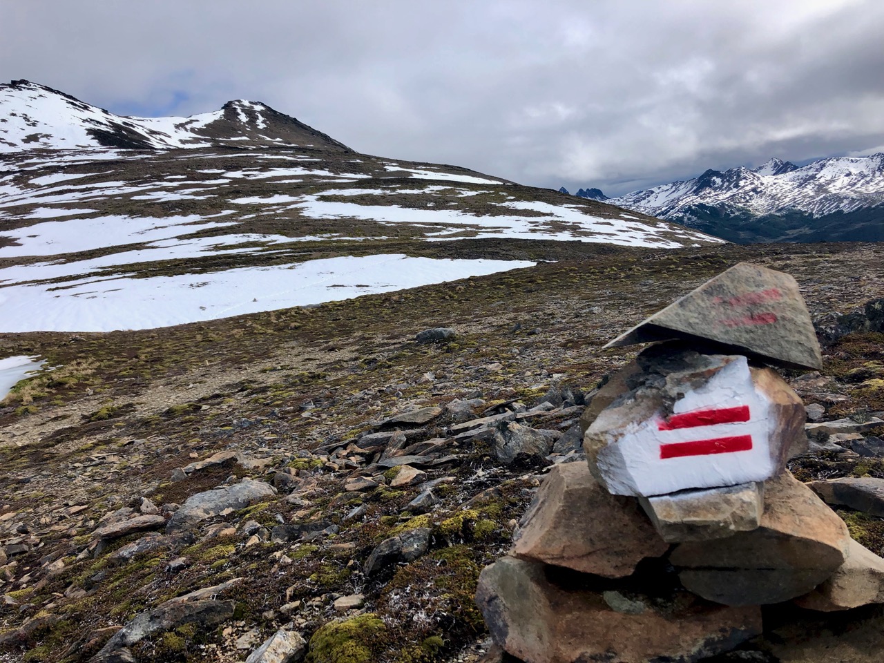
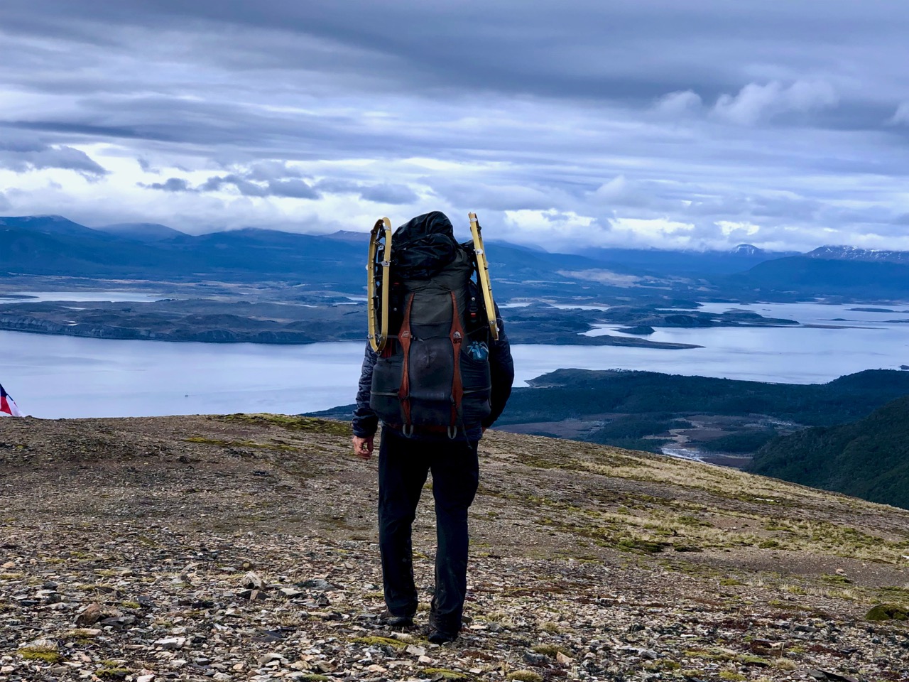
scrambling & bushwhacking may be needed
painted stones & cairns mark the main route
you need a strong tent & good tie-downs to survive the wind
Dec to March are the best months to hike
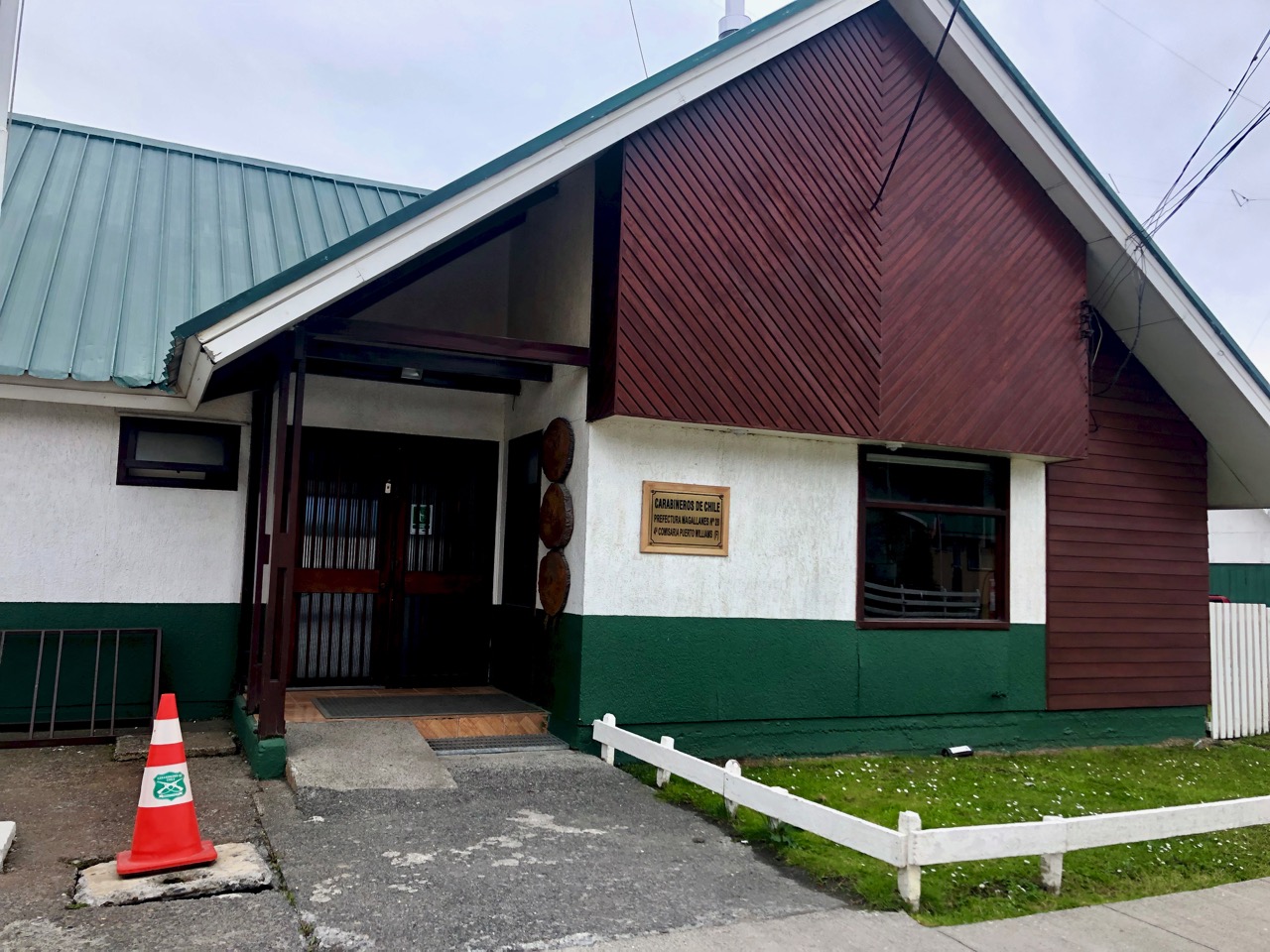
free registration at the Police station in Puerto Williams is required
stove fuel is available. In fact, there are stacks of stove fuel left behind in hostels from previous hikers who flew out of Puerto Williams
there is no official rescue service. Be responsible for your own safety.
campsites do not provide much shelter
views often obscured by cloud
as your feet get very wet, you will be cursing the introduced beavers
conversational Spanish is needed
Cost
Brian Spurling was there in 2017. He found it expensive compared with the other great Patagonian hikes.
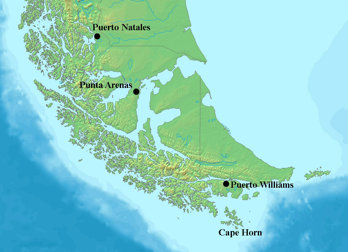
FIRST you need pay to get to the end of the world. That’s Puerto Williams (pop. 2000) on the island of Navarino.
There are three ways:
flight on small plane from Punta Arenas ($150 one way 2019)
First … you need to get to remote Puerto Williams. Late December through February are the best months.
As of 2023 there were 6 weekly flights (December to March) on Aerovías DAP from Punta Arenas .
Or you can take the long, scenic ferry from Punta Arenas. A new multipurpose pier will open in stages 2024-26.
Next you’ll need good gear. And enough food for 4 days plus an extra day in case of emergency.
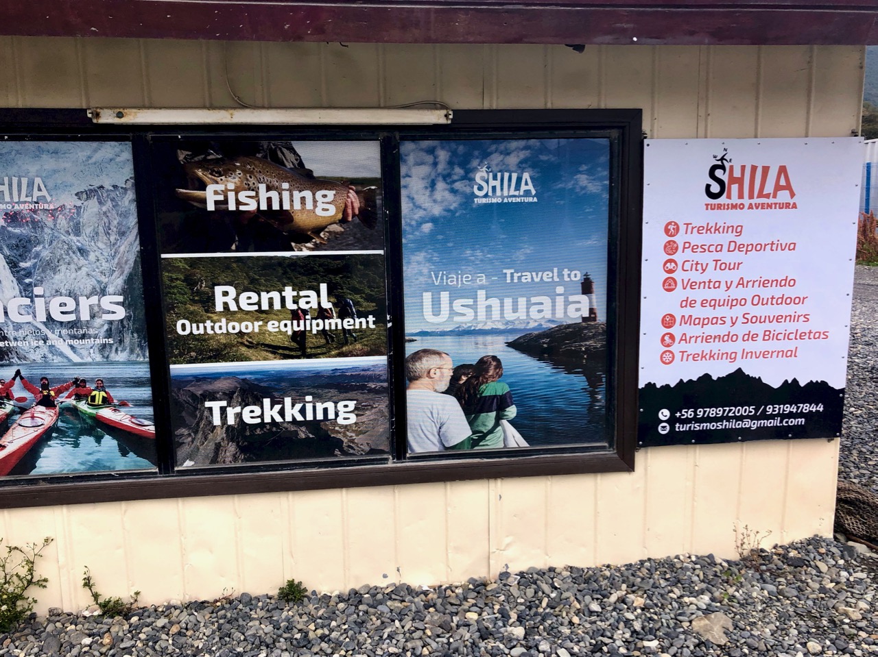
The main gear store —Shila — sells and rents some types of stoves, knives, tents, sleeping bags, etc. You can also rent a GPS there that has the circuit route uploaded.
End of season 2019 many hikers were renting snowshoes ($3 / day)
Small supermarkets have basic food supplies. Bring any speciality foods with you to Puerto Williams.
Local Information
When you get to Puerto William, ask if there are any hikers who have recently returned. They will be the best source of last minute advice on trail conditions.
Hotels and hostels in Puerto Williams have all the information you need to organize the trek. There is no Ranger or trail maintenance once you get out there.
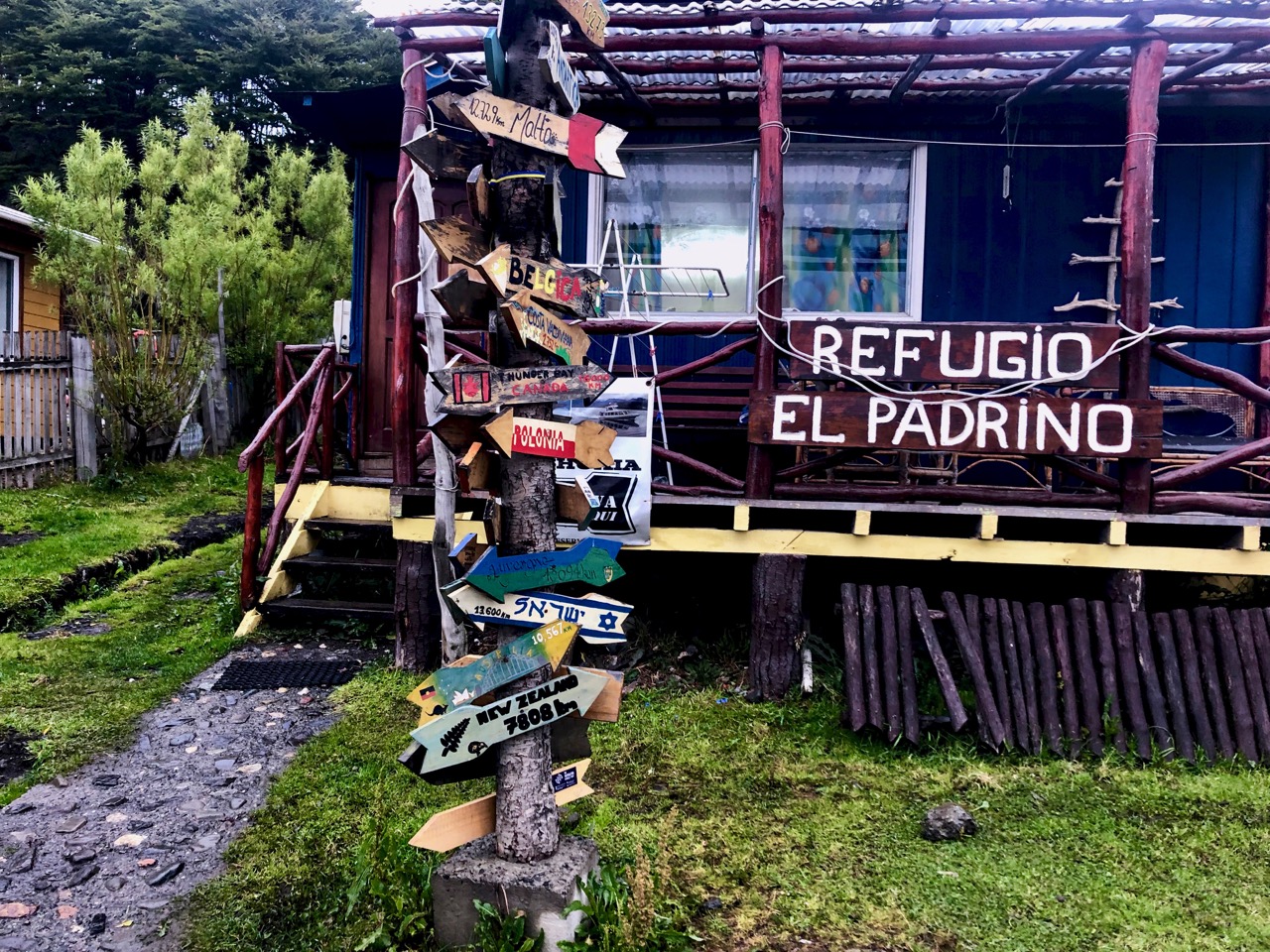
Many hikers stay at the inexpensive El Padrino hostel or their camp ground.
Actually, it was Lonely Planet’s Clem Lindenmayer who popularized Dientes in the 1992 first edition of that guidebook.
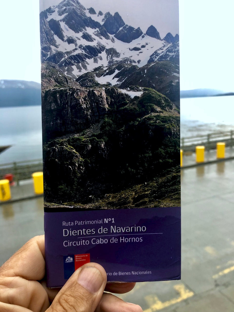
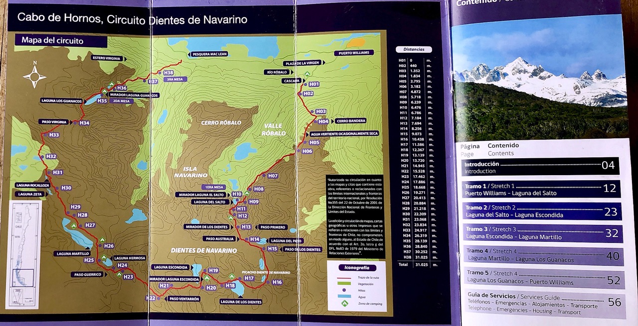
In 2019 all you need is this free pamphlet widely available in Puerto Williams. We can’t recall a better free hiking brochure anywhere else in the world.
In Spanish with English translation, it’s crystal clear. All you need for navigation.
A simple map of the trek can be purchased in Puerto Williams. If you like souvenir maps. Many hotels and hostels have maps left behind by previous guests.
This video posted 2024 is over an hour long, but very comprehensive. Fast forward through any sections you do not need. Click PLAY or watch it on YouTube.
Thank you for this very usefull and recent information! Actually at this moment we are in Punta Arenas and are considering to do this trek. However your comment about many hikers returning because of snowfall end Feb 2019 is making us think twice. In your opinion, do you think the snow that has already fallen (i assume there was little thaw since then) will form a big hinderance for trekkers at this time? Or is most of the hinderance during snowfall due to low visibility, wind, etc. Do you have any advice for us?
We would be very grateful for any additional information you can provide.
I haven’t heard anything since I left March 2nd … but my guess is that you have a 50/50 chance of getting through.
Hello mate nice postt