

World → South America → Patagonian Andes → Chile → Villarrica Traverse
One of the best hikes in the world
Villarrica Traverse
You want volcanos? This is the place. 😊

 AT A GLANCE
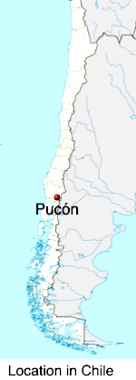
- jumping off point is Pucón, 780km south of Santiago
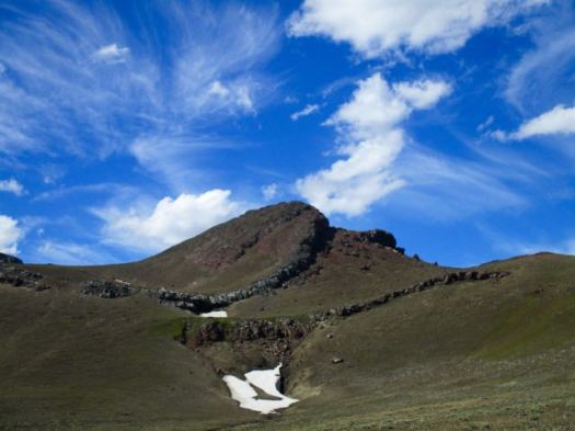
- Villarrica, still active, last erupted 1971, almost reaching town
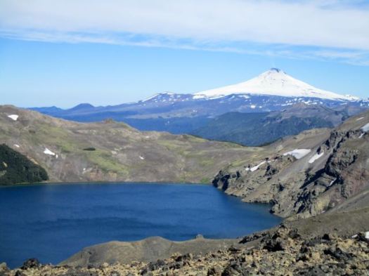
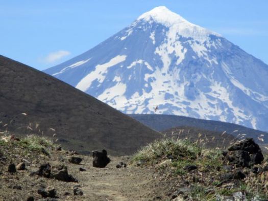
- Lanín volcano is highest and most impressive of the group
- Traverse is 81km (challenging)
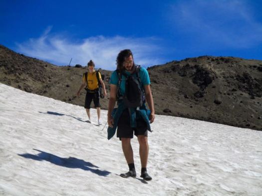
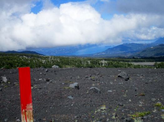
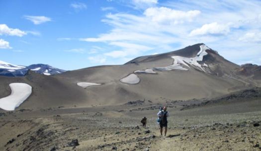
- non-stop views of a series of volcanos
- lava fields and ash trails
- late December to March
- recommended 5-6 days
- interesting birds, including large woodpeckers
- alpine lakes
Why We Like This Hike
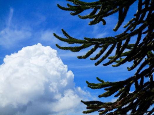
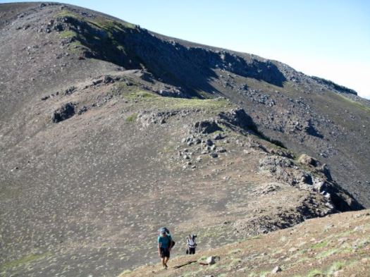
- stark, weird and beautiful volcanic vistas
- mostly above the tree line
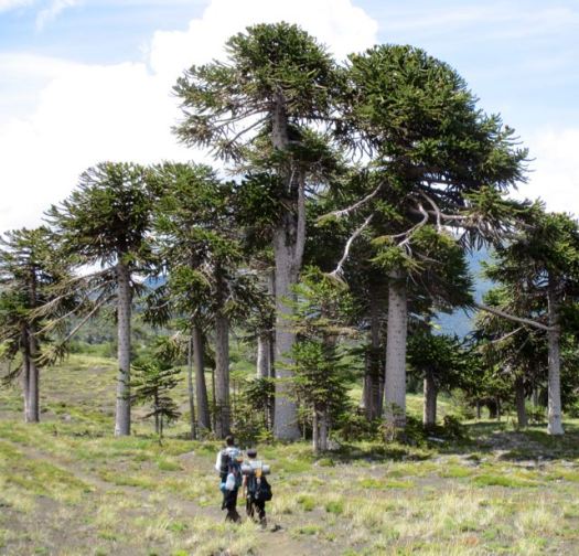
- monkey puzzle forests
- notros – a springtime fire-red flower
- easy access out of the adventure tourism mecca of Pucón
- Villarrica 2847m is the most climbed volcano in Chile
- relatively uncrowded
- no risk of altitude sickness
- the days are long in Patagonia during their summer — it is light until at least 9pm
- no fees for the campsites
- hot springs en route
- we did see condors … but no indigenous mammals aside from large hares
- screeing volcanic ash is FUN
- wildflowers in the desert are astonishing
Considerations
Horseflies are numerous and bothersome in January – but we didn’t see many other biting insects. No mosquitoes. And only a few sand flies.
Called the Tábano by locals, these guys could ruin your entire hike. 😟
They don’t actually bite very successfully. Covering up and wearing headphones reduced the annoyance considerably.
- finding clean drinking water is a challenge. Carry at least 4 litres capacity.
- plan for terrible weather — rain, sleet, even snow is possible
- snow field crossings
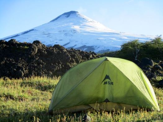
- tent & camp stove essential
- no toilets at the wild camps
- the “Puelche”, a strong wind from Argentina, could blow you off the mountain
- burrs cling on to your clothing at lower elevations
Cost
- Chile is one of the most expensive countries to travel in South America. Budget a minimum of US$40 a day. Days on the trek will save you money.
- In 2016 the cost for the Traverse was Ch$5000 for Chileans or Ch$7000 (about $10) for foreigners
- Back country campsites are free. Those near roadways may charge 3-4000 pesos / person / per night.
Routes
In fact, the Traverse is two hikes separated by a road walk. There’s no need or reason to do the two hikes connected. Both are great. But if you only have time for one or the other, pick the second half.
The first half is best hiked from the ski resort as you start high, finish low. That’s about 29kms from road to road. Possible as a day hike. But challenging.

The second half could be hiked in either direction.

Trekking Guides
- Travel Aid out of Pucón
Leave a comment if you know of others.

Logistics
Most arrive from and depart to Pucón. Wait on good weather. There’s no use slogging through fog on the volcanos.
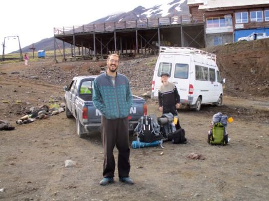
To do the full Traverse, ask at Tourist Information how to get to the Ski Center on Volcano Villarrica. There will likely be no public transit so you’ll need to hire a cab. Or hitchhike.
From the highway the road to the volcano is paved for the first two kilometers then becomes rough gravel. At 9km check in with Conaf. Register and pay your entry fee. A cab will possibly take you only this far.
 There are 8 more kms to the Ski Center where you start. Try to hitch a lift to the top.
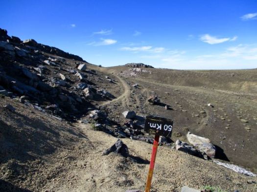
It’s not difficult to find the trailhead. From there, follow the stakes. Simple.
At the end of the first half you’ll reach a second Conaf building. From there you could walk about 7km of road to Palguin hot springs, an alternate entrance/exit. Especially if the weather turned bad.
Or you could detour there for a wash and restaurant meal as we did.
Otherwise, take the steep climb up from Conaf and regain the Traverse. To the end. The paved roadway – International Pass Mamuil Malal or Tromen. Here you can try to hitchhike or walk 3,4 kilometers to Puesco where there is another Conaf office. Regular local buses can return you to Pucón from there.
You could keep hiking. Google the “Momolluco” Trail and “Lagos Andinos” Trail.
Local Information
- Conaf (Corporación Nacional Forestal) is responsible for Parks in Chile. Spanish.
Best Trekking Guidebooks
- Lonely Planet Trekking in the Patagonian Andes 2009 does include this route. While not perfect, it’s the english language guide we used. Unfortunately it’s not available for sale online – not even in digital format.
- Trekking por Chile 40 Rutas 2015 (Spanish) … widely available in Chilean bookstores does include the Traverse.
Best Travel Guidebooks
- Lonely Planet Chile (get the most up-to-date edition)
Related Books
- Enduring Patagonia – Gregory Crouch
Crouch is ideal reading when tentbound due to weather. 🙂
- In Patagonia – Bruce Chatwin
- Baja to Patagonia – Larry Rice
- Nowhere Is a Place: Travels in Patagonia – Bruce Chatwin, Paul Theroux, Jeff Gnass
- Patagonia: Wild Land At The End Of The Earth – Tim Hauf, Conger, Jr. Beasley, Gregory Crouch
- Lonely Planet Trekking in the Central Andes 2003
Best Maps
While a map is not essential, we wished we had one for better calculating distances, times … and possible escape routes.
Best Web Pages
- wikiexplora – Villarrica Traverse
- Travel Aid – 1st half – Ski Center to Chinay
- Travel Aid – 2nd half – Chinay to highway
- Trek Bariloche
Best Trip Reports
- besthike editor Rick McCharles – Jan 2016
- Chris Vervaeke – Hiking the Villarrica Traverse 2015 (last half)
Click PLAY or watch a 2019 Traverse on YouTube.
Click PLAY or watch a Traverse on YouTube.
Note: This page is a stub. Questions? Suggestions? Leave a REPLY on this page. Our editors will reply.
