BUT climbing one of the many alternatives might be better and far less expensive.
Eibhlis Gale-Coleman lays out some of the options:
Mount Kenya
Mount Meru, Tanzania
Mount Ololokwe, Kenya
Mount Ras Dashen, Ethiopia
Mount Ngaliema (Mount Stanley), Uganda
Oldoinyo Lesatima (Mount Satima), Kenya
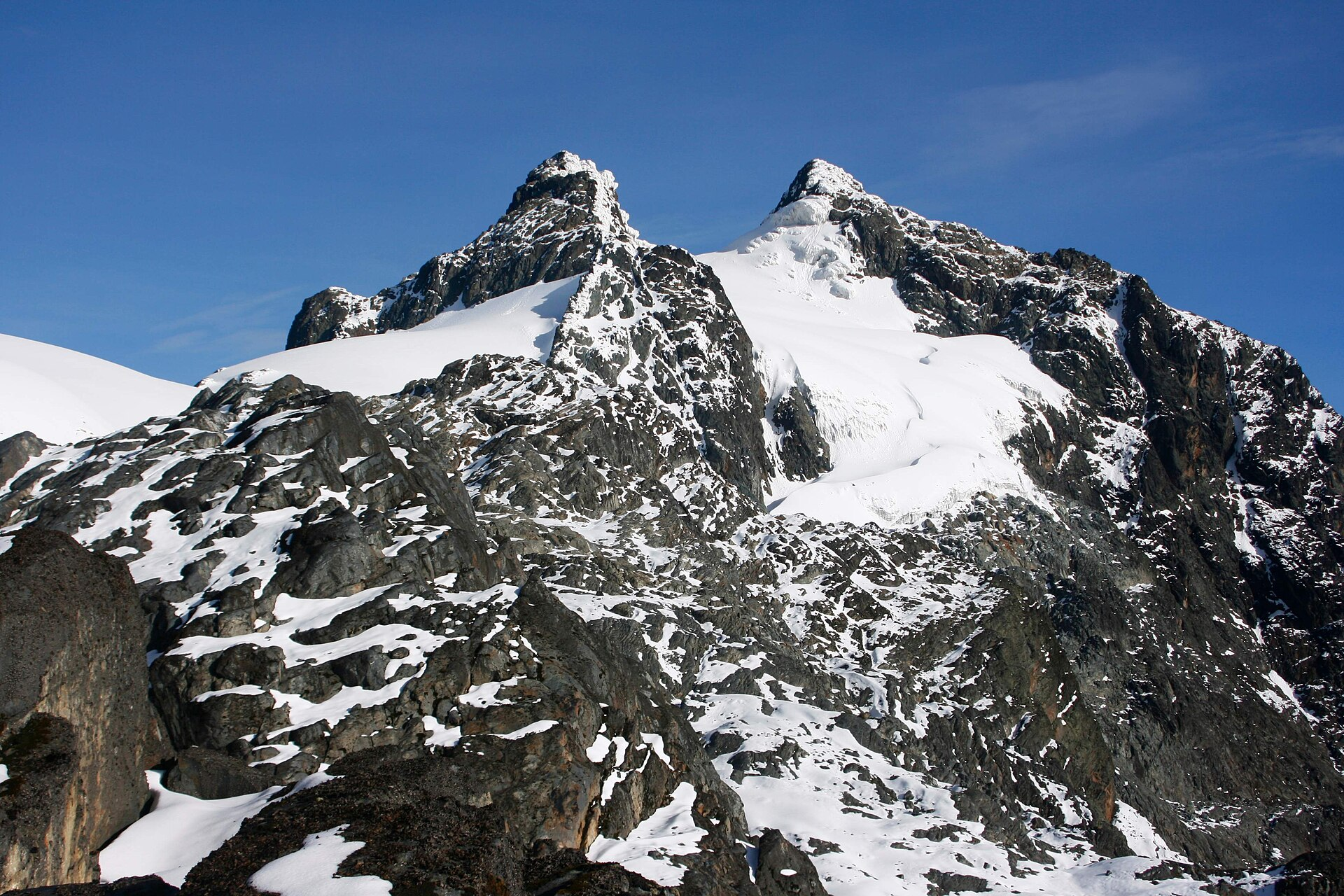
Mount Ngaliema is no mean feat. Perched in the Rwenzori Mountains National Park, it stands at 16,761 feet (5,109 meters), and is the third-highest peak in Africa. The terrain begins in rainforest and ends with a glacier traverse that necessitates crampons: Arrive expecting a pole-assisted trudge, and you’ll be overwhelmed. …
El Camino de Costa Rica is a breathtaking 280 km / 174 mile hike from the Atlantic to the Pacific Ocean, which is no easy feat even for the most experienced hikers.
While it can be intimidating to take on this type of adventure, there are so many incredible things to see and do while trekking this route, from tropical beaches and dense trails to mountain villages and indigenous communities.
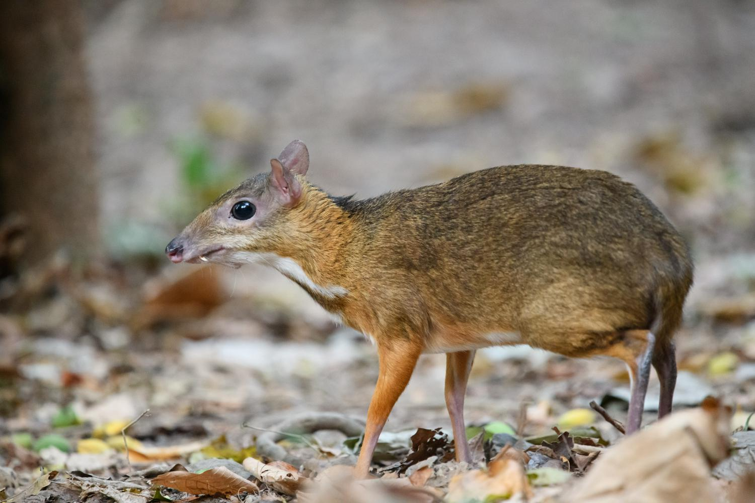
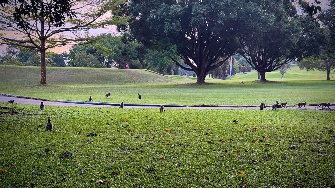
Not expecting these little guys — about 45 cm (18 inches) and 2 kg (4.4 lb) — my first thought seeing them in the foliage is that they were GIANT RATS. 😀
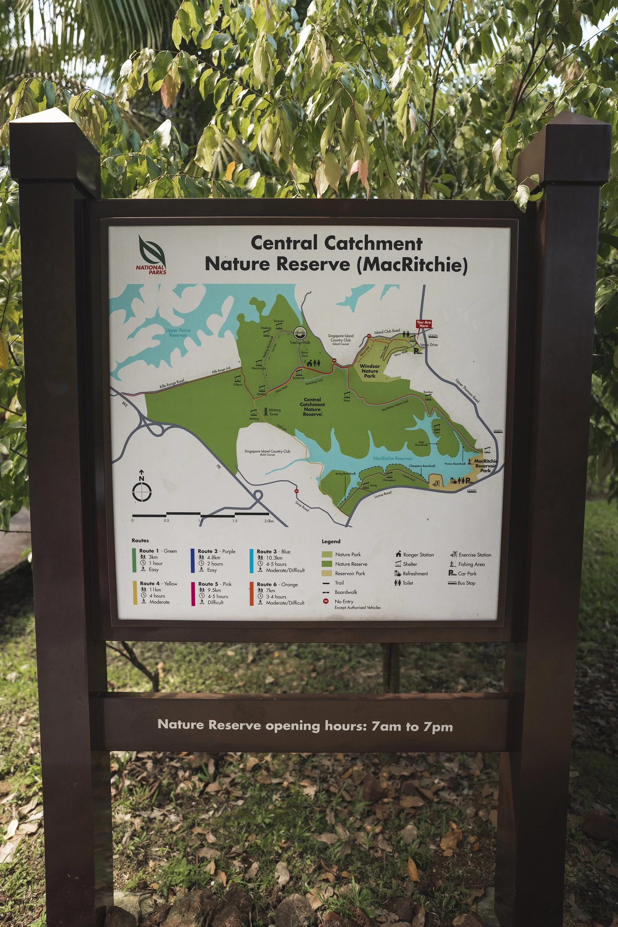
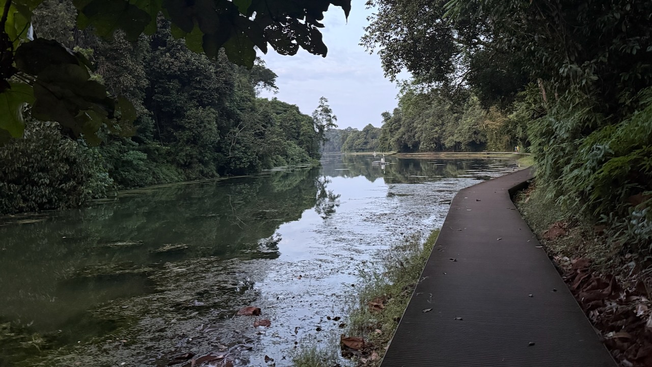
You can hike a multitude of trails at MacRitchie ➙ or go kayak / canoeing.
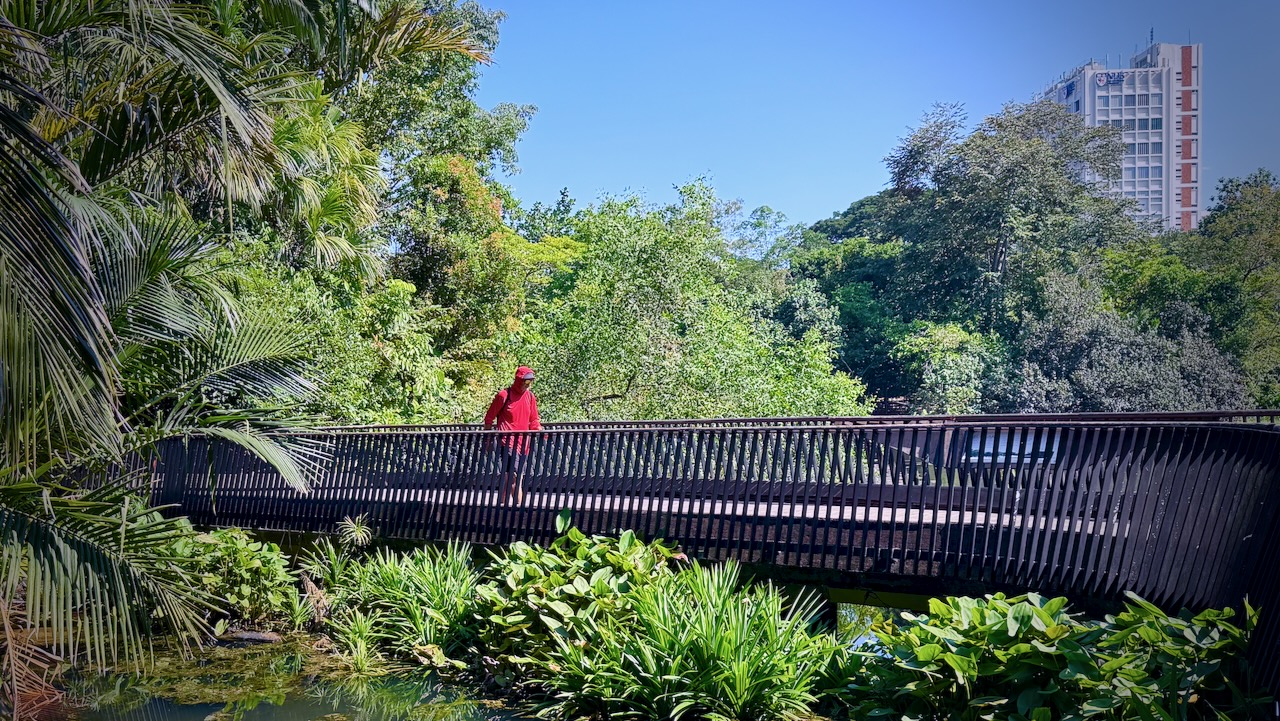
More than 10,000 species of flora are spread over its 82 hectares (200 acres) area, which is stretched vertically; the longest distance between the northern and southern ends is 2.5 km (1.6 mi).
The Botanic Gardens receives about 4.5 million visitors annually. …
The National Orchid Garden is the main attraction within the Botanic Gardens. Located on the mid-western side of the Garden, the hilly three-hectare site has a collection of more than 1,000 species and 2,000 hybrids of orchids. …
The park is free. But there is an extra admission cost for the Orchard Garden.
It’s Singapore, so everything is done with quality.
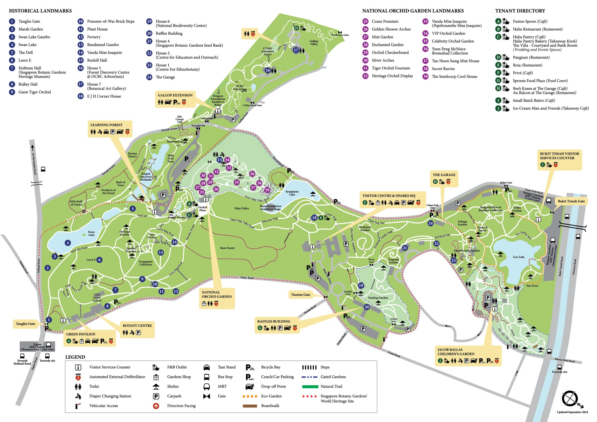
Desert Landscape
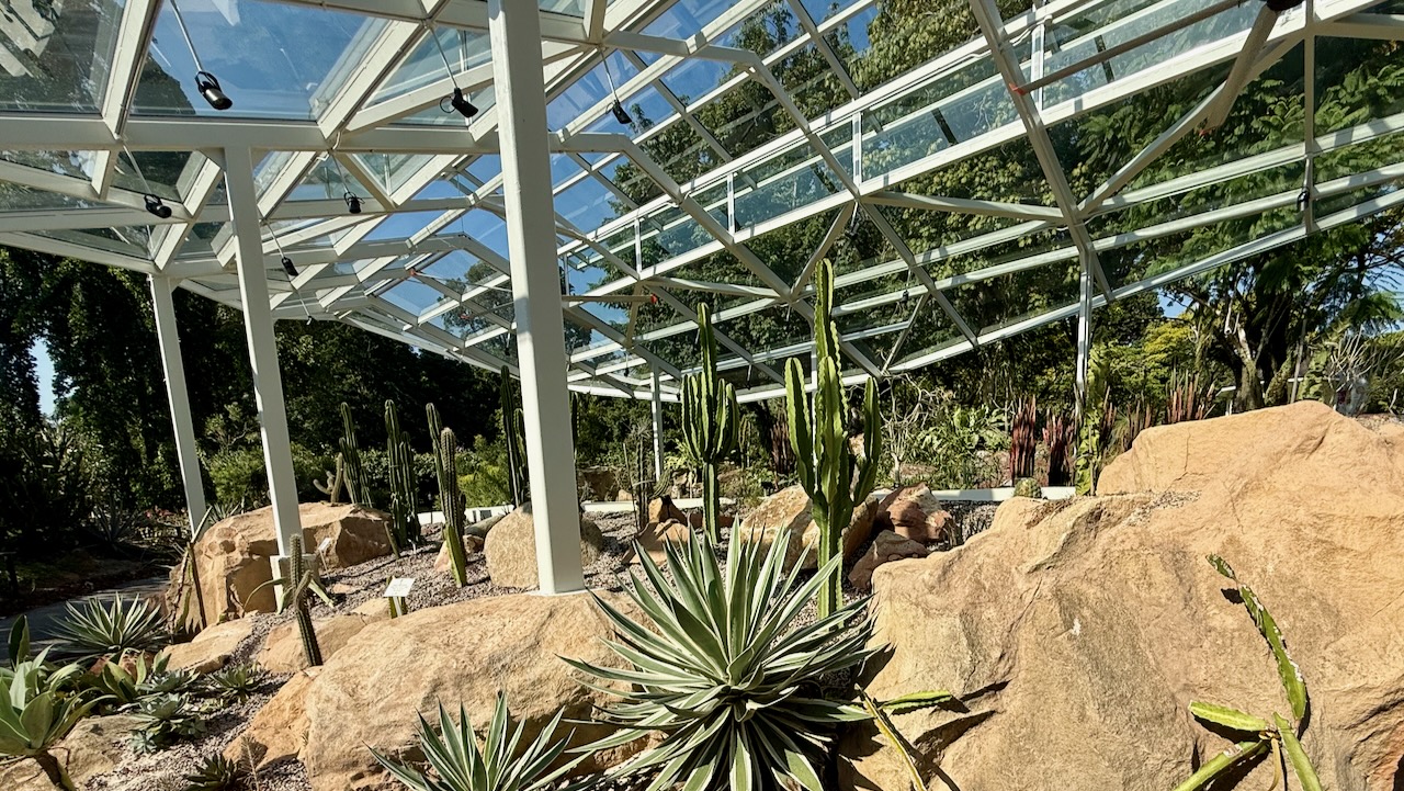
You’ll see many different birds. Chickens. But the most interesting for me are the many Monitor Lizards. Mostly carnivorous. Growing to a length of 1 – 1.5m.
‘Sponsored by Heineken (1995) to reach the parts other explorers cannot reach, itinerant traveller Mark Eveleigh sets off on foot and by canoe across the heart of Borneo.
On the way he endures shipwreck, malaria, leeches and exhaustion, not to mention enforced alcohol abuse and barbecued mouse-deer foetus.
Such hardships, you would imagine, might be enough to put a man off his boiled fish and rice, but the author confronts each challenge with a spirit that is as understated as it is refreshing.
All too often travelogues dwell on the downside of discovery, but Mark’s unique blend of enthusiasm and humour is genuinely absorbing and immensely readable.’
– Global AdventureMagazine.
I really enjoyed the book while sailing between Indonesian islands, myself.
The most astonishing takeaway for me, however, is the narrator of the audiobook.
Excellent.
“Narrated by: Virtual Voice” indicates an audiobook that was not narrated by a human, but by an AI-generated voice created by a technology like Amazon’s Virtual Voice on KDP (Kindle Direct Publishing).
This computer-generated speech technology creates audiobooks from ebooks, offering authors a way to produce an audio version at a low cost or no cost.
The narration quality varies by title, and Audible (and other platforms like Amazon and Alexa) will clearly label these audiobooks and provide samples for listeners to evaluate before purchasing.
The Bukit Campuhan Ridge Trail is super popular with Ubud tourists as you can walk there from almost any accommodation in the city.
I went early and saw very few, other than morning trail runners.
You can continue to the end — but I turned back after about 2km when the paved-block track ended — at buildings and roadway.
The trail starts at the evocative Gunung Lebah Temple as you’ll see in the video.
The word “Campuhan” itself means “where two rivers meet”. You’ll be on a ridge between those rivers. Vistas are mostly overgrown so you don’t actually get to see much water. 😀


