The trail is well-balanced, easy to follow, doesn’t require good fitness level or hiking experience. In fact anybody relatively fit can do this hike just choose your own pace and go. We were pleasantly surprised by the trail conditions and the service level.
The trail has signs, distance marks, names etc., the huts are very clean, freshly painted with good ablutions and the park rangers are great very friendly and helpful. …
All huts have bunk beds and basic facilities, three have electricity and hot showers. It makes the hike easy you don’t need to carry a tent or mattress only a sleeping bag. …
Windmuelnek hut
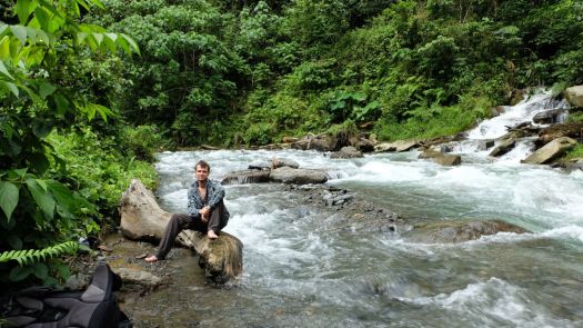
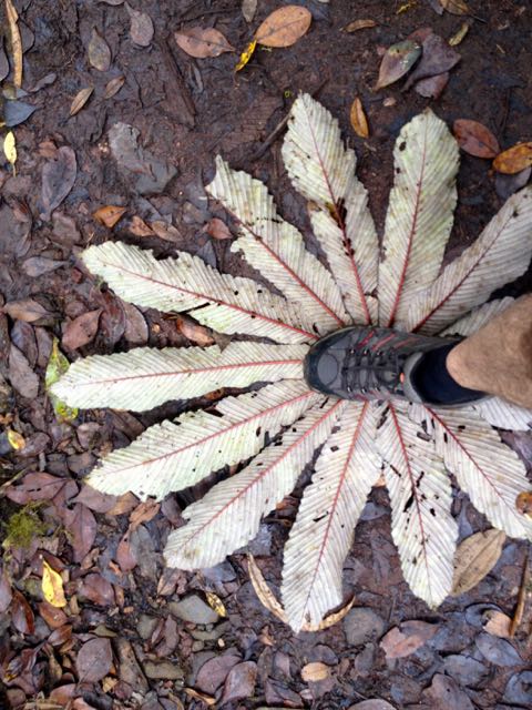
The scenery on the hike changes all the time; from forest to top of the hills, from river banks to fern jungle.
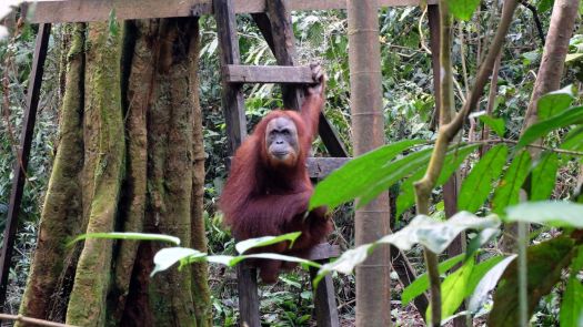
… the largest wilderness area in South-East Asia and an UNESCO world heritage area since 2004. It is further part of the tropical rain forest heritage of Sumatra, allowing for spectacular experiences in this fortunately still widely untouched nature.
The hike itself is a unique experience for several reasons:
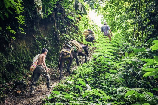
No trails are available and one totally has to rely on the guide to find the way through the jungle (mainly following former rebel trails).
4-6 porters accompany you and provide you with the most delicious hiking food you’ll ever get to taste (don’t forget to tip).
You will not see ANYONE other than your party during the whole hike.
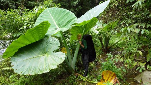
The wilderness of the jungle and its inhabitants is just breathtaking.
Swarms of aqua-blue butterflies, foaming waterfalls, hidden swimming lagoons, lime-green parakeets and chirping songbirds high up in the trees – this was what I’d come to find in the verdant Colombian jungle, along the winding trail to the Lost City.
… the first person in history to successfully walk the entire length of Madagascar, summiting its eight highest mountains on the way. …
How do you feel after walking 1,600 miles for 155 days from the south end of Madagascar to the northernmost point?
When I actually arrived & finished at the most northern point (Cap’D Ambre), I had to walk two days back the same way to reach civilisation, the small tracks were too bad for any car to attempt to pick us up. But it was a surreal, exciting and an extremely satisfying feeling!
Why did you choose to take on this challenge?
I knew it would be amazingly unique: over 80 per cent of all fauna and flora are found nowhere else in the world – so that alone would mix things up. I knew barely anything about Madagascar and hardly anyone talks about it. I wanted to get into its interior and really discover what it’s about deep within the island.
The island is also constantly changing, from desert, shrub land, jungle, savanna and mountains …
I was free for a half day. This is one of the few FREE hikes in Monteverde. So I tried it.
There is some signage. Not great.
If you hadn’t been told by a local to zig rather than take the obvious zag, you’d be lost.
I got lost.
Eventually I did find the service road up.
Whenever the clouds momentarily clear above Monteverde and Santa Elena you can see the radio, television and phone towers topping Cerro Amigos. (1842m)
The access road to the top is used by the occasional maintenance crews but it’s also a great route for a short steep hike – free and open to the public. …
The highlight was seeing 2 resplendent quetzal. Another Canadian saw 4 the same day. May is breeding season.
… The “song” is a treble syllable described as kyow or like “a whimpering pup”, often in pairs, which may be repeated monotonously. …
It was something closer to a puppy whimper than a kitten’s sound.
… classified as near threatened on the IUCN Red List due to habitat loss. …
The Monteverde Cloud Forest Reserve (Reserva Biológica Bosque Nuboso Monteverde) … founded in 1972 … visited by roughly 70,000 visitors a year. …
… extremely high biodiversity, consisting of over 2,500 plant species (including the most orchid species in a single place), 100 species of mammals, 400 bird species, 120 reptilian and amphibian species, and thousands of insects, has drawn scientists and tourists since. …
I hiked all the trails in less than 4 hours. A number were closed. They looked to me to be closed permanently.
I did take one of the closed trails for a few hundred metres, just to compare. It seemed about the same but without trail maintenance.
For lunch I propped myself up against my pack under a giant tree. And enjoyed it so much that I left behind a Summit Stone.
A second highlight was the bridge through and above the forest canopy. Dangling plants living only on “air” are amazing.
Cost for entry in 2015 was $20 for a foreign adult. Locals consider that high compared to a similar experience in the other reserves.
On the other hand, this is the only official local hiking area that reaches the continental divide.
Though you are not likely to see any animals … (I saw only one mammal fleetingly) … I recommend this hike.
Transportation between San Jose and Monteverde is relatively painless. You can easily get to the Arenal volcano, as well.
Tom Mangan tipped us off to this well loved day hike.
The trail leads through the spectacular Parque Nacional Alejandro de Humboldt (Alexander von Humboldt National Park), which UNESCO recognizes as “one of the most biologically diverse tropical islands sites on earth.” Careful where you step: you will pass some of the world’s smallest vertebrates on your way to the El Majá Waterfall, which cascades over 82 feet.
The trail begins at the first narrow section of the Santa María River …
Your hike will take you to the source of the Santa María River—El Majá Waterfall, more tban 82 feet (25 meters) high—where you can rest in the shade before treating yourself to a refreshing dip.
Duration: 5 hours
Distance: 4.3 miles (7 kilometers)
A cable car will open September 2015 or sooner, degrading the hiking experience. The Sapa area is great, but trek elsewhere in the region. This summit will soon be flooded with suitcase tourists. 😦
Below is our old information page, no longer being updated.
Update (this is an exception 🙂) from patriciaoprea March 2017:
I paid about 60 USD the night before (I’m so last minute) for a tour from Sa Pa
It was 2 days,1 night.
The good thing about this? We arrived at the summit at 7:00 in the morning.
The cable car is built, but NOBODY is there at that hour, because it hasn’t opened yet!
I loved this hike, go for it 🙂
AT A GLANCE
3,143 meters (10,312ft), it’s the highest in Indochina
Northwest region of Vietnam, near the Chinese border
9km southwest of Sapa (Sa Pa), a gorgeous hill station developed by the French
1-3 days hiking
pine forests, bamboo thickets and jungle
best months October through April. Some say April and May are best as it’s warmer. And the flowers are in bloom.
avoid the wet season from June to September, with heaviest rainfall occurring in July and August
record for scaling Fansipan is one hour and thirty-five minutes, in case you want to better that time. 🙂
Panoramic views of the mountain ranges of northwest Vietnam, if you get any views at all. The summit is famously shrouded in cloud.:-(
Why We Like This Hike
about 2,024 floral varieties and 327 fauna species (sadly many of the larger animals have been hunted out)
no ropes or technical climbing skills are needed
plaque at the peak placed February 2007
colourful minority ethnic people, especially on market days
ridge walk sections were our favourite
Considerations
malarial mosquitoes can be a danger some months of the year
bring warm clothes. Temperatures below freezing are frequent.
snow is possible
climb is rough, wet, muddy and cold. Some bring rubber boots.
gloves with good grips recommended for ladders and rock scramble
scramble ladders and tree roots
you may be clutching bamboo at points
we’ve seen warnings about poisonous snakes, leeches, rodents, perhaps exaggerated
dogs are a worry, both in Sapa and on the trail. Even if you don’t carry a trekking pole, you might want to carry a stick
Sapa is a tourist trap. Touts are a pest.
Cost
Guided trips are no longer asinexpensive as they once were. Seems the government got stricter with guide requirements.
We paid $95 for a one day, up-and-down for 1 person October 2014.
A two day trek costs $180 for 1 person October 2014. You can negotiate on price with some agencies.
Shop around. The official government tourist information office quoted $120 for the $95 tour. Assume the difference is commission.
Routes
There are a number of options, including a 1 day guided up-and-down.
It’s possible to do independently. But we wouldn’t recommend it unless you are familiar with the route.
click for larger version
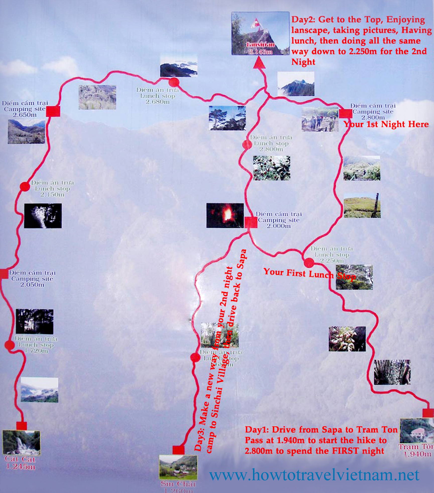
There are three routes to the mountain. One is from Tram Ton, the others from the villages of Sin Chai and Cat Cat.
The first route is a more gradual climb because it has been selected for tourists. The trip can be made in a day.
The route from Sin Chai is shorter but more adventurous, requiring climbers to sometimes use ropes or other special facilities for climbing.
The route from Cat Cat is the longest, but mixes some challenging climbs with great scenery. After one day of climbing, there’s a break at 2,200m above sea level. Climbers can have a meal cooked by a Mong porter and camp, followed by a second camp at 2,700m before reaching the peak on the third day.
Most climbers chose a tour from Sa Pa at a cost of about VND1.5 million excluding train fare from Ha Noi, and tours should be booked a month in advance.
many hikers arrive by overnight train from Hanoi to Lao Cai, then bus from Lao Cai to Sapa. Those tickets sell out during high season, especially during holidays, as Sapa is super popular with Vietnamese.
even better, some feel, is the night sleep bus direct from Hanoi
we stayed at the Sapa Unique Hotel for about $35 / night. It gets rave reviews.
We recommend you hire a guide. Let them do the logistics. You simply enjoy the journey.
on the most popular route up from the Ranger Station Camp 1 is located at around 1,500m (4,920ft). Simple accommodation and food are offered.
at 2,800m (9,190ft) is Camp 2. Sleeping is communal in a very poorly maintained ‘hut’. Might have rodents. Have your agency bring tents, instead. Camp 2 is trashed and unsanitary.
Fansipan is a mountain in Vietnam, the highest in Indochina (comprising Vietnam, Laos, and Cambodia), at 3,143 metres (10,312 ft). …
Update. I’m just about to book my flight. I hope to climb Fancy Pan end of October.
“the Roof of Indochina”
AT A GLANCE
3,143 meters (10,312ft), it’s the highest in Indochina
Northwest region of Vietnam, near the Chinese border
9km southwest of Sapa (Sa Pa) Township
1-3 days hiking
pine forests, bamboo thickets and jungle
I’ll travel to the jumping off tourist town of Sa Pa. Hang out for a day or two looking at guided options. If I feel good, and the weather is reasonable, I’ll try for the one day up-and-down. About 10 hours total.
The best trip report I’ve seen was posted on mymilez:
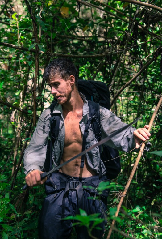
We did not expect the climb to be so heavy. The trail was very steep and mostly ran in the rain forests and bamboo groves, by wet and slippery roots and rocks. …