I did Markha Valley independently. But for Kuari Pass I finally signed on with a guided trek.
The hiking infrastructure in India is not well developed. Getting to and from trailheads often a headache. Next time I go to India I’ll likely sign on for trips guided by IndiaHikes.
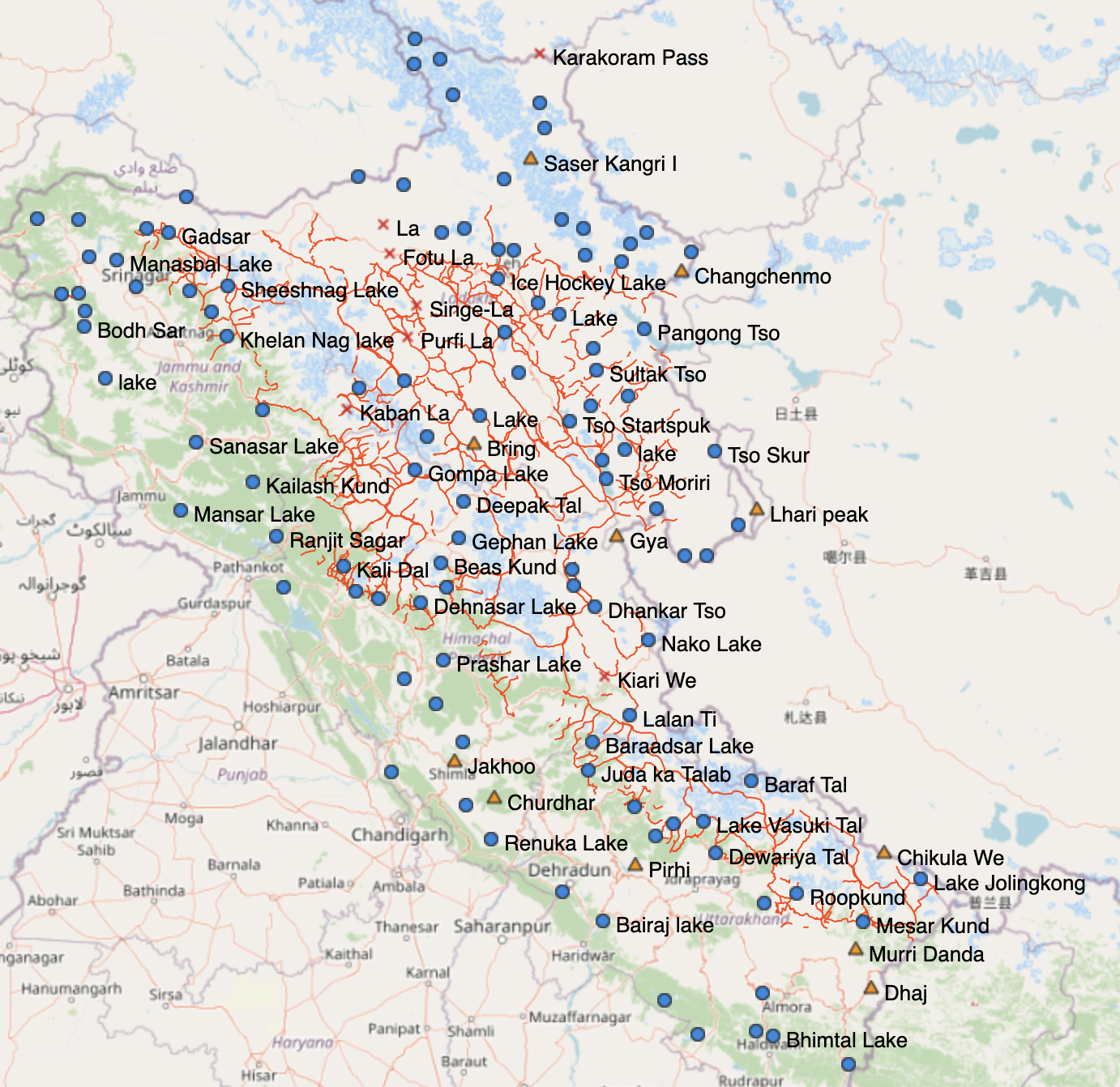
So far, he has pulled together over 1,000 trails across Uttarakhand, Himachal Pradesh, Ladakh and Jammu and Kashmir.
It shows 600 passes, 700 high-altitude lakes and more than 10,000 reference points. …
It allows hikers to see elevation profiles and download GPS logs onto their phones rather than having to carry multiple, less detailed paper maps.
“The map has more trails than anyone could ever cover in a lifetime,” he says.
“It took me months to plan a long traverse across the Himalaya. With this new digital map, you have all the information in a single place.” …
Everything is open sourced, so can be accessed with any Open Street Maps viewer or mobile app (for free). Other hikers can add information to it and help the resource grow. …
UPDATE. As of April 1, 2023 the Nepal government required that major treks can no longer be done independently. Hiring a guide for Everest is mandatory. The obvious alternative is the Indian Himalaya. We’ll leave this post PUBLISHED in case the government reverses this policy sometime in future.
December 2019. I’m just back from Nepal, my first trip since 2014 where I hiked Langtang.
Around 9,000 people diedduring the Nepalearthquake of 25 April 2015.
One tiny village in the Langtang Valley accounted for 243 of them: 175 villagers, 27 local tourism staff (guides and porters), and 41 foreign trekkers.
Yet in the 2018-19 fiscal year, a record 21,945 tourists (16,386 foreigners and 5,559 Nepalis) visited Langtang National Park.
So far as I could see, Nepal trails are busier than ever. And easier than ever as you could connect to the internet almost everywhere with a Nepal Telecom (Namaste) SIM card in my mobile phone. I didn’t once have to pay for electricity in the mountains.
The big 3 trekking areas for those who want to hike independently are
The 2-3 week adventure in green connecting those 3 hikes would be far more enjoyable than the Annapurna Circuit.
You can do all on the same permit.
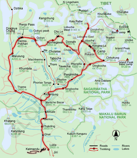
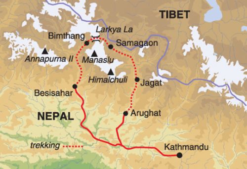
Best independent hikes – Langtang Region
Our recommended route. Perhaps 14-16 days.
Drive to Syabrubesi, trekking Langtang first (top of the map). Then backtracking to the Gosainkund & Helambu trek, walking most of the way back to Kathmandu.
map via NepalSanctuaryTreks.com
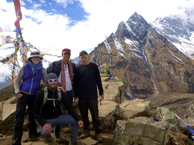
Our group atop Kyanjin Ri (4773m) Langtang
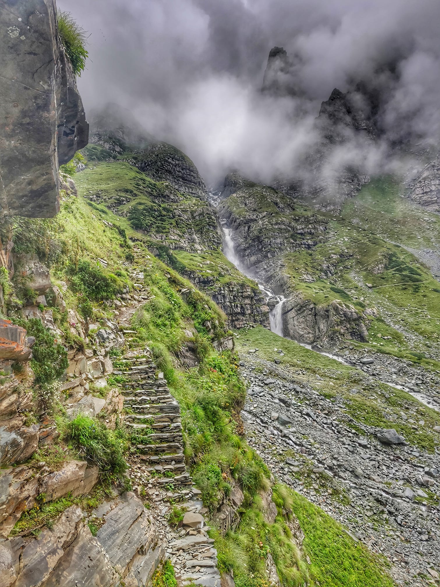
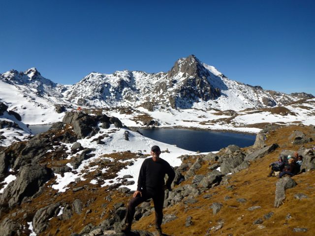
Laurebina Pass (4600m) on the Gosainkund & Helambu
This will be far less crowded than either Everest or Annapurna regions.
You can easily and inexpensively hire a guide and/or porters on any hike in Nepal for your whole trip … or short sections. But we’d recommend you do those listed above independently.
If we were to do a guided hike we’d choose areas of Nepal where guides are mandatory. For example:
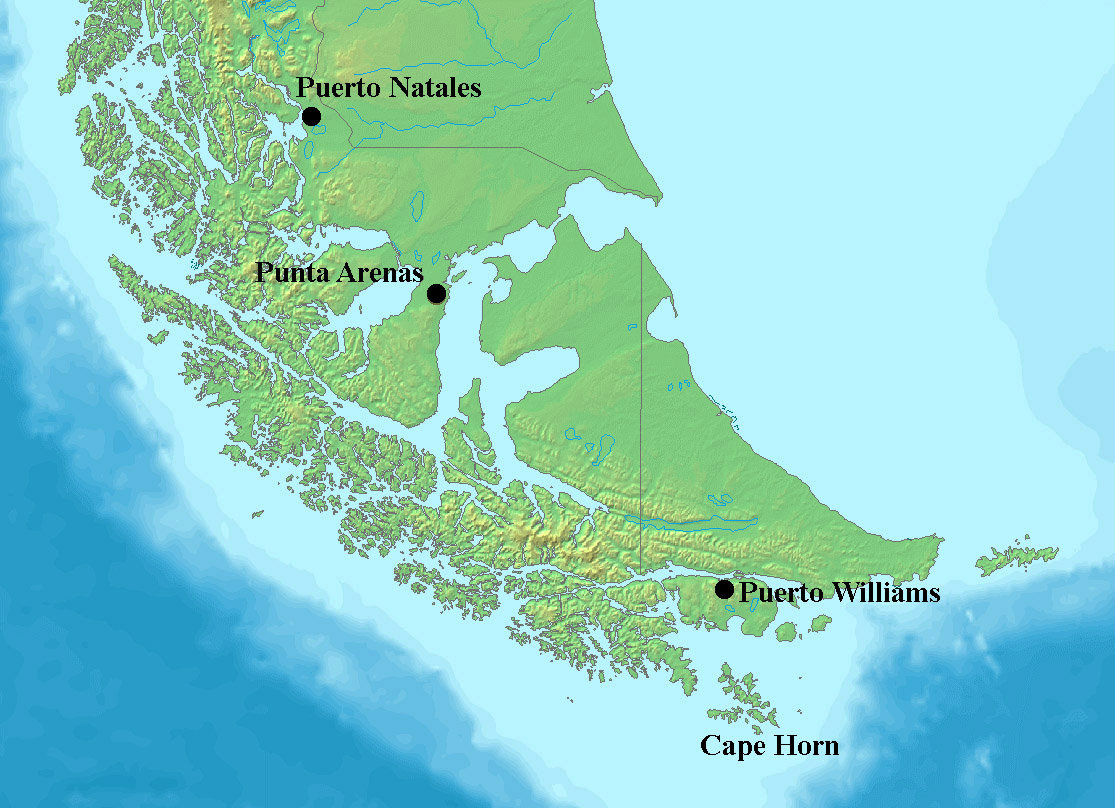
Dientes de Navarino (Teeth of the Navarino) is one of the best hikes in South America. The island of Navarino has the most southerly established trails in the world.
The jumping off point is Puerto Williams.
Most do the 50km over 4 days.
FIRST you need get to the end of the world. That’s Puerto Williams (pop. 2000) on the island of Navarino.
There are three ways:
– flight on small plane from Punta Arenas ($150 one way 2019)
– fast boat from Ushuaia (45min) and shuttle van (45min) about $100 one way 2019
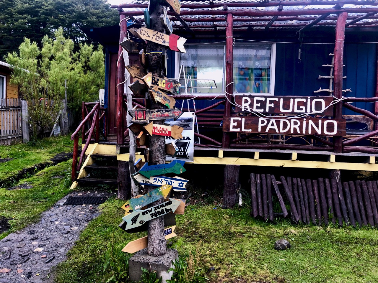
I stayed at the friendly and relaxed El Padrino hostel. Most people there are either coming from or going to a hike. It’s a great place to get maps and up-to-date information.
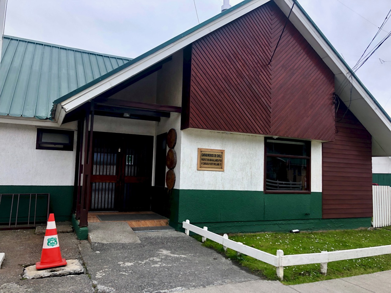
For overnight hiking you are asked to register (free) at the police station. I found it fast and efficient.
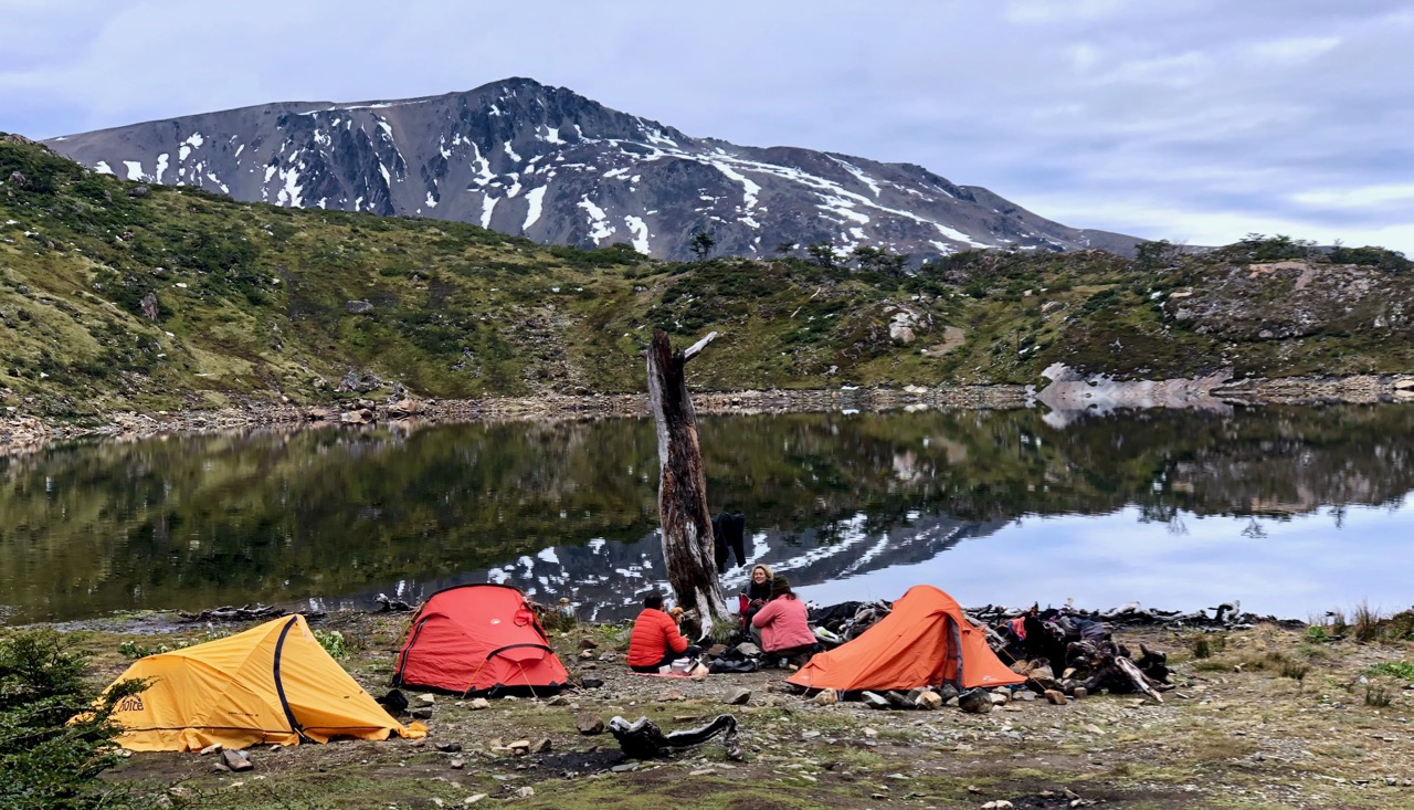
The day of my departure some left the hostel at 8am. As is often the case, I was last to get on the trail. I left town at 1pm. It was only 4-6 hours to the first campsite.
I had a hot un-dehydrated last meal for lunch. 🙂
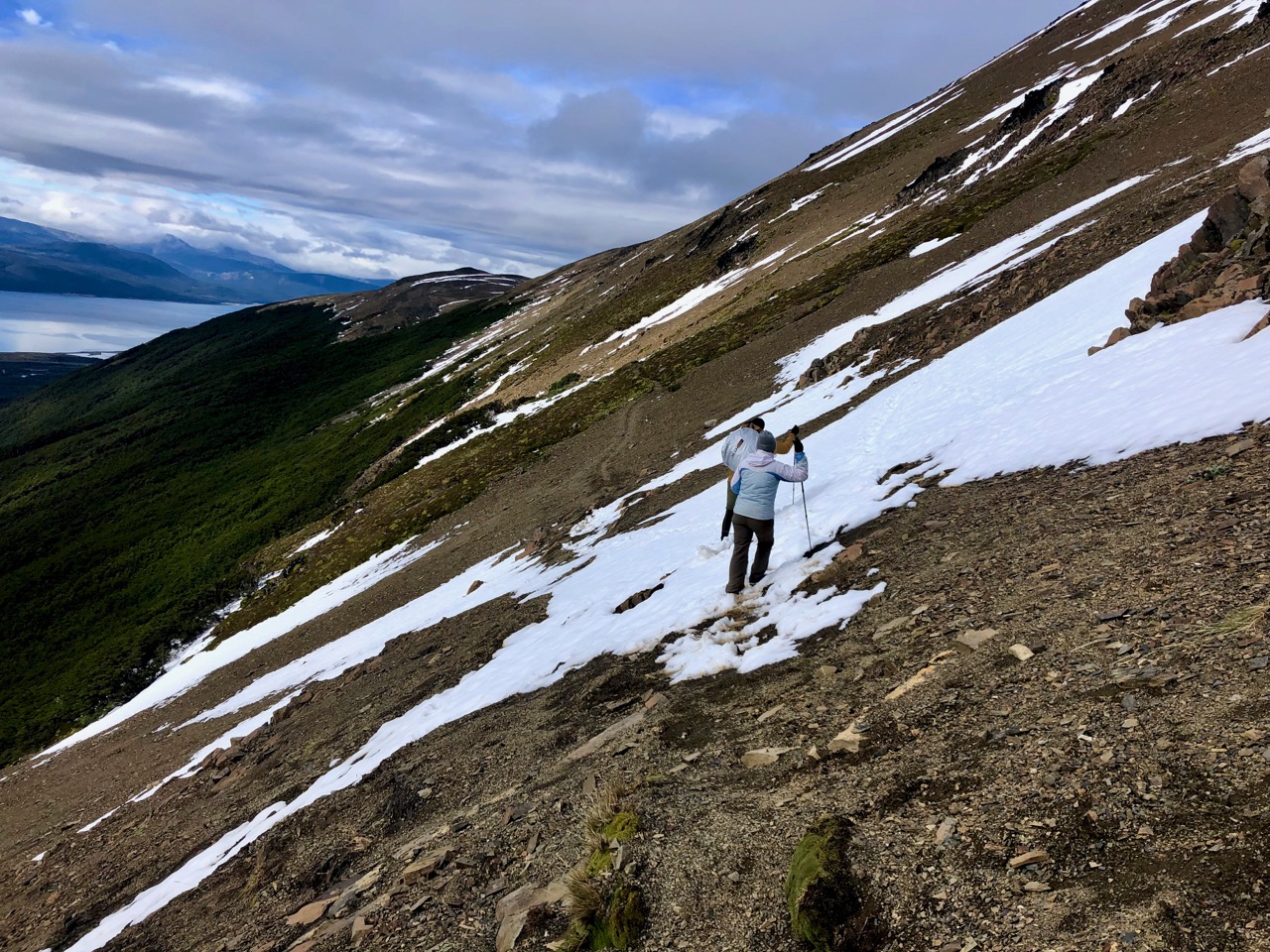
The first big snowfall of the year was the previous week — the end of February.
Almost everyone that week had turned back after post-holing deep snow. Most trail markers were hidden.
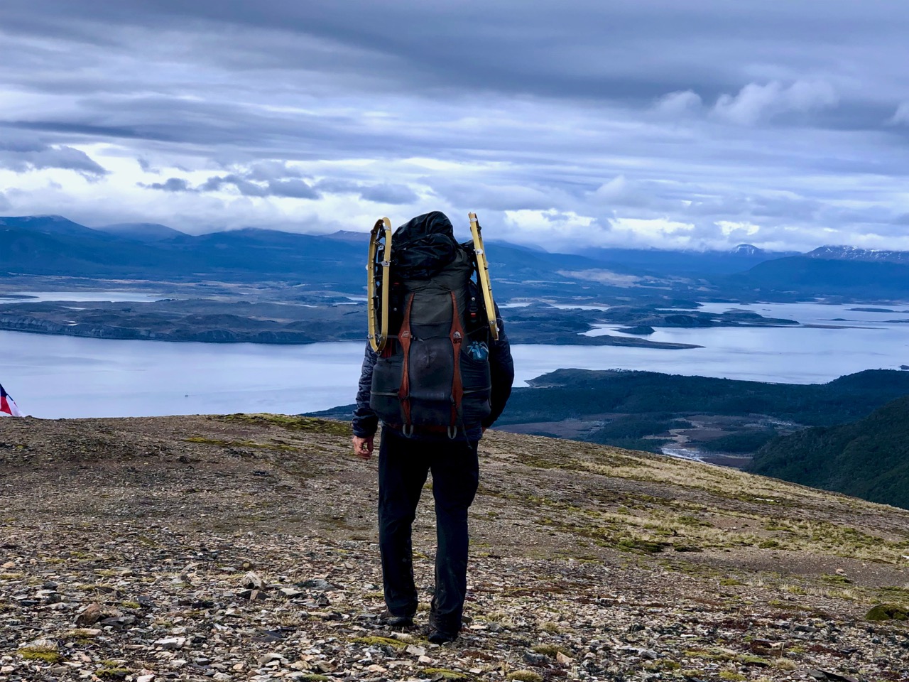
Weather was improving for my departure March 1st. But everyone had rented snowshoes over the past couple of days … just in case.
I’d decided NOT to rent snowshoes hoping enough people were gone ahead of me to put down a trail in the snow.
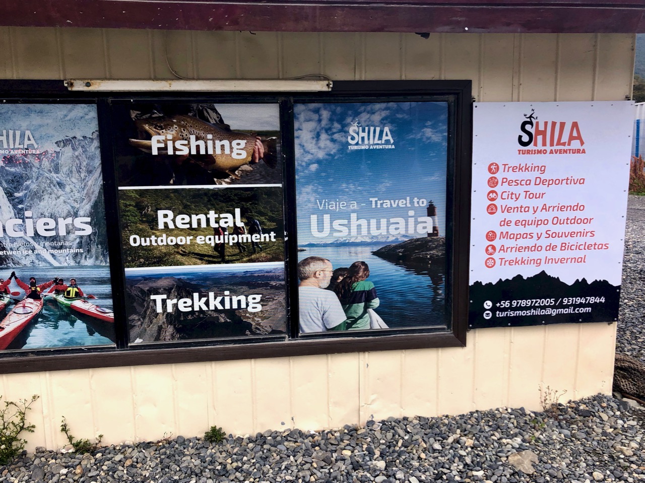
But Shila — the main gear store in town‚ happened to be open (for the first time) as I walked past on the way to the trailhead. I grabbed their last pair. ($3 / day)
Even if I didn’t use them, they would make me look more macho. 😀
It’s a couple of kilometres to the start. Most people walk from town.
Summer on Navarino island is lovely. I can’t imagine how it must be during the very long, dark, cold, wet winter months.
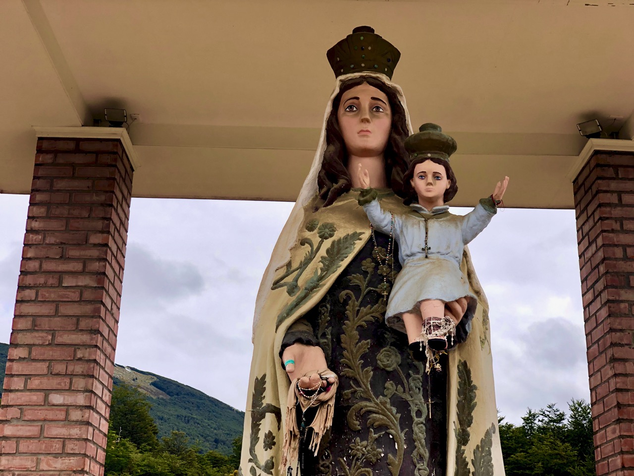
Everyone stops by to give their respects to the Virgin. It couldn’t hurt.
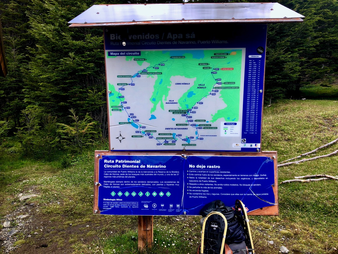
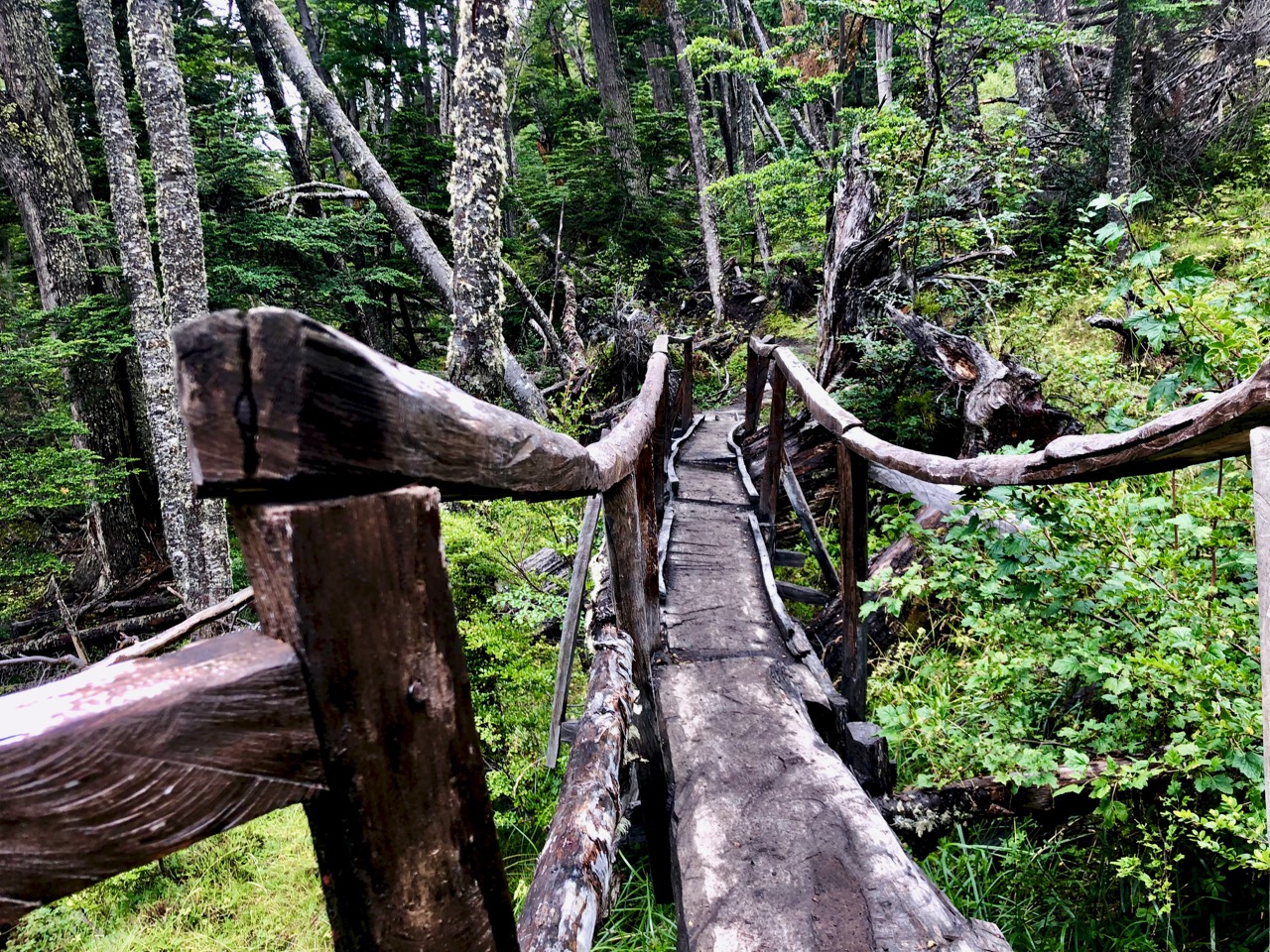
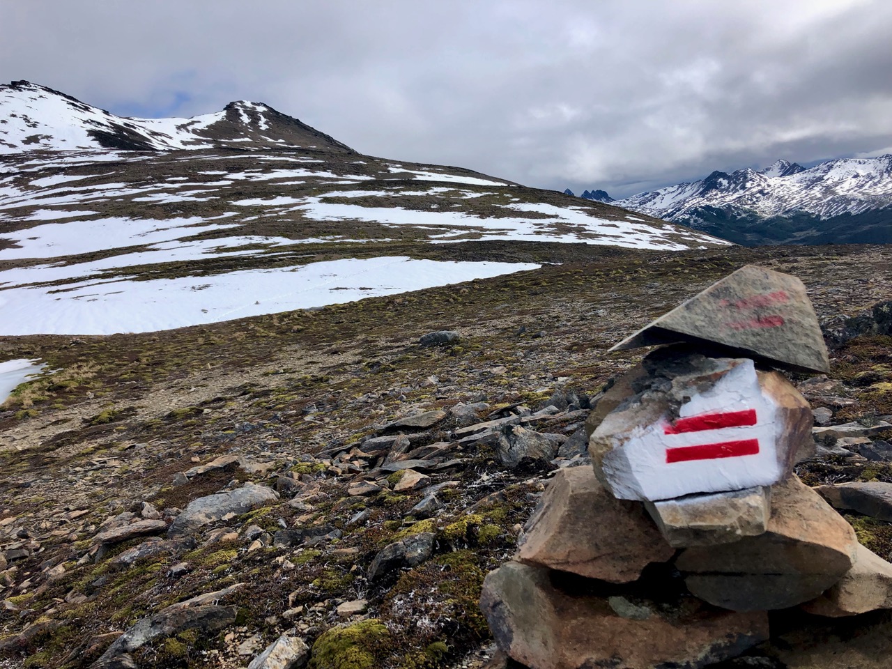
This trail is really well managed. RESPECT to whomever got this organized.
Trailhead
Actually, it was Lonely Planet’s Clem Lindenmayer who popularized it in his 1992 Lonely Planet guidebook Trekking the Patagonian Andes.
Clem died age-47 while hiking in China’s Sichuan Province, I’m sad to recall. I loved his book. It was part of the inspiration that had me start this site.
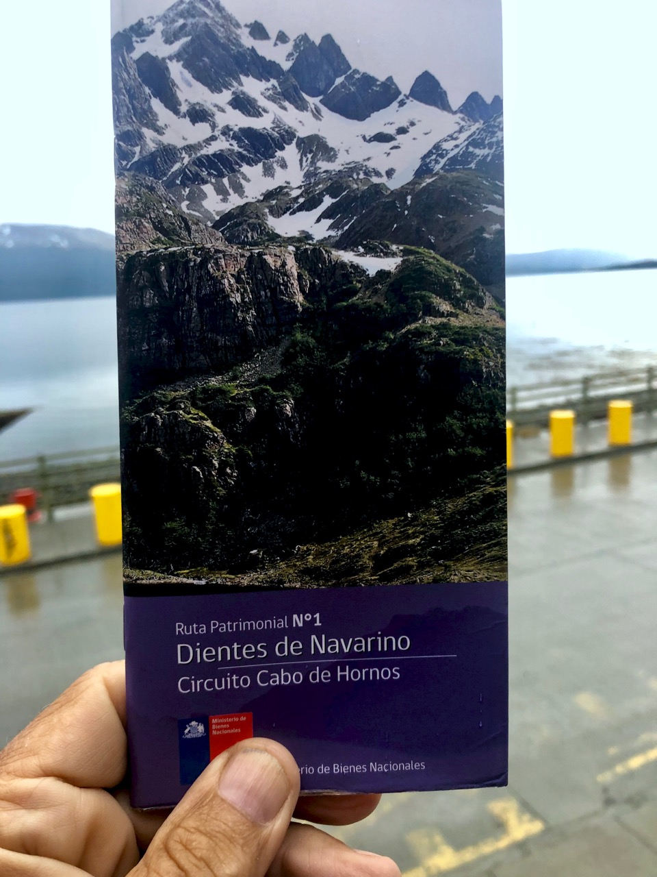
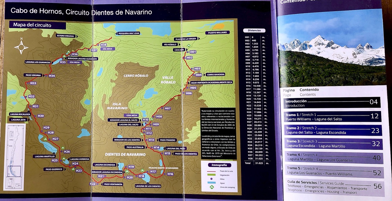
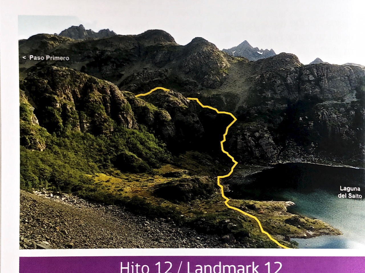
The BEST thing about the Dientes Circuit is this free pamphlet. I can’t recall a better one hiking brochure anywhere else in the world.
In Spanish with English translation, it’s crystal clear. All you need for navigation.
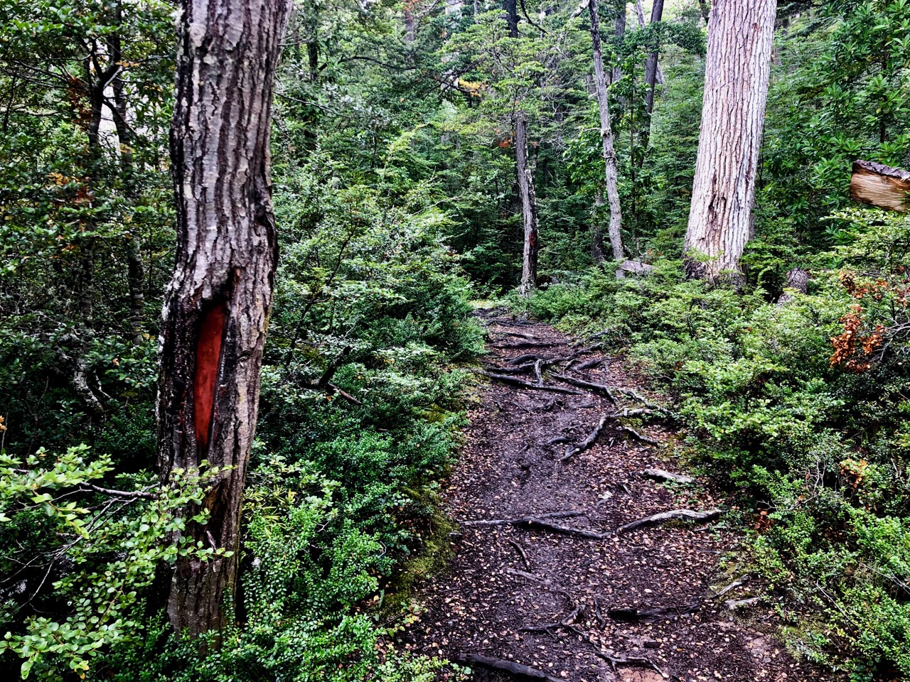
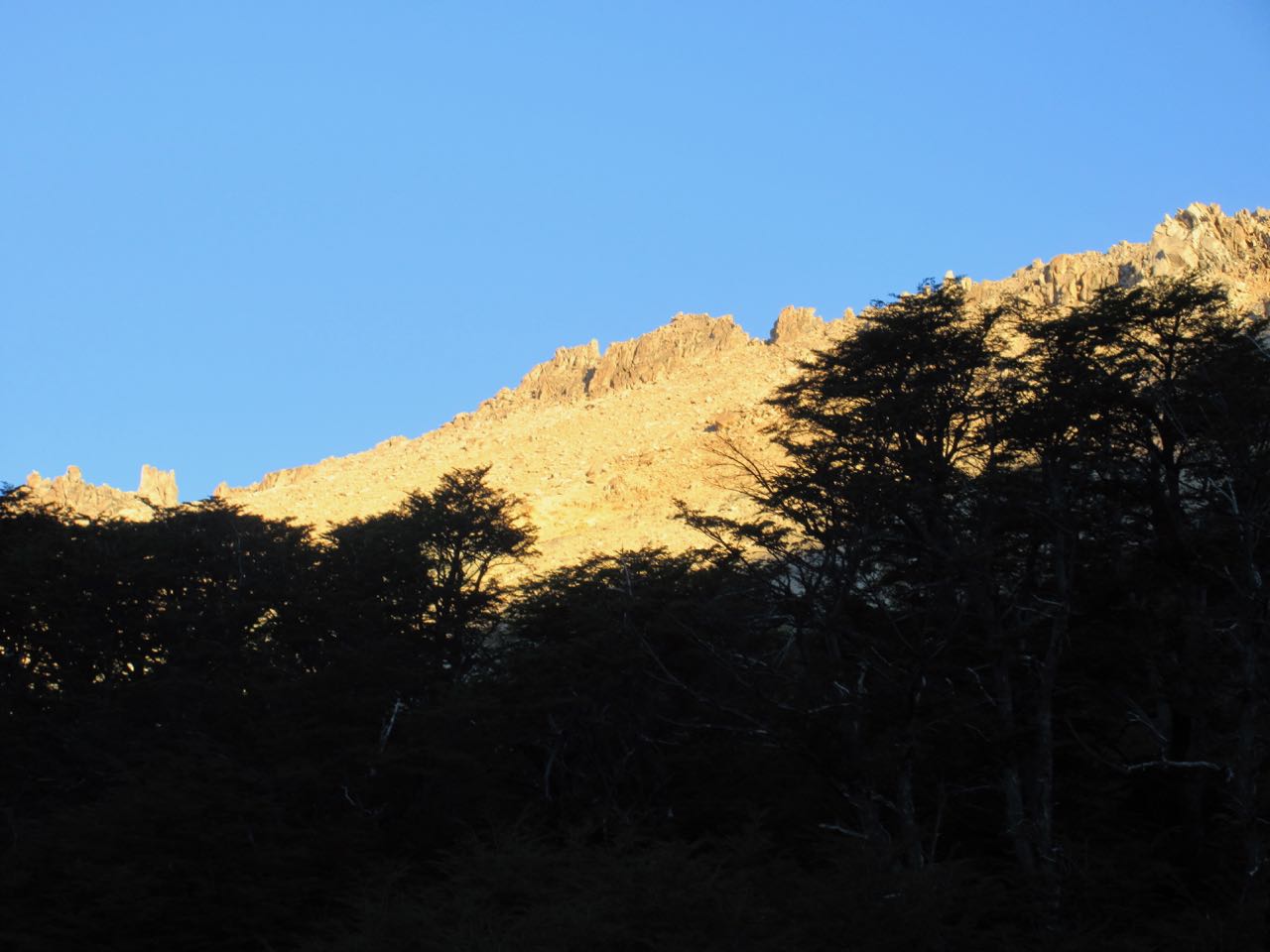
The start is up, up, up through the trees.
Quite a bit of trail maintenance has been done in this section.
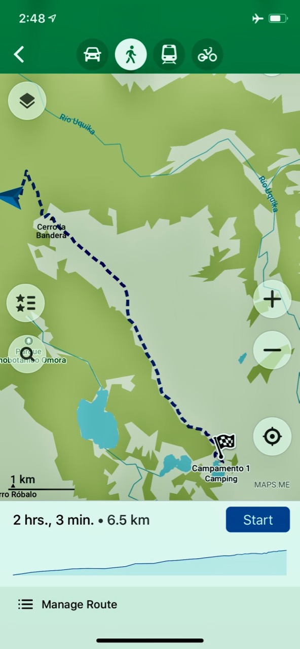
I used Maps.me as a back-up to the pamphlet description.
The start is the most popular dayhike out of Puerto Williams. Up to some viewpoints.
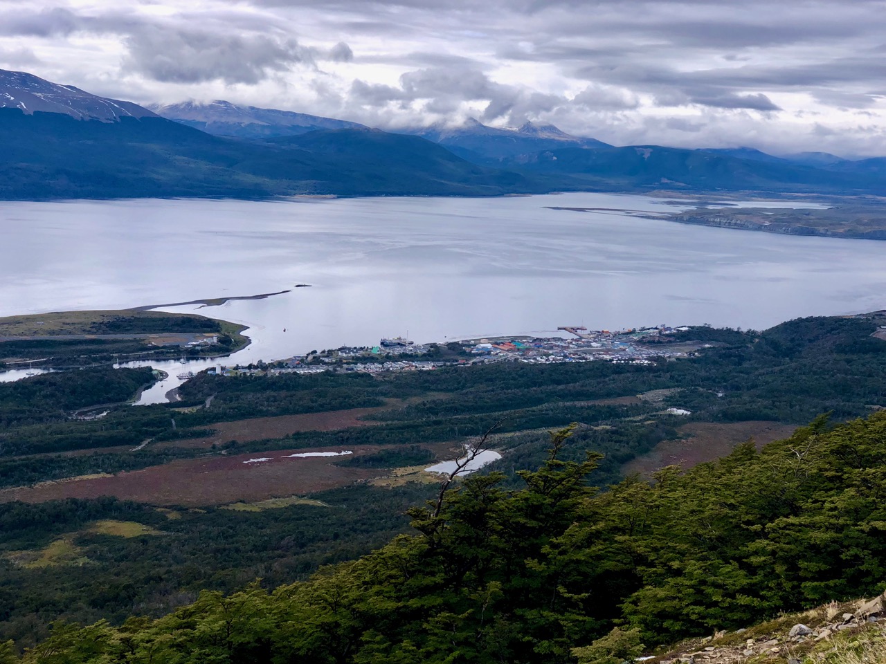
Puerto Williams
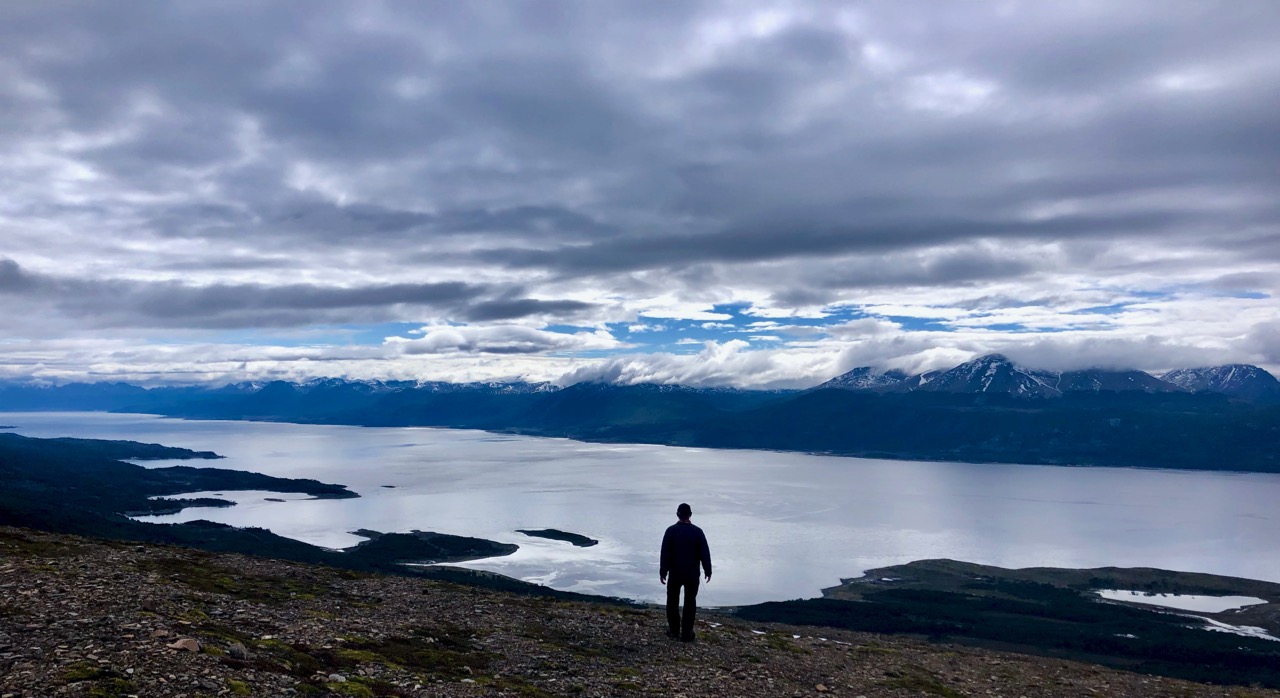
Beagle channel
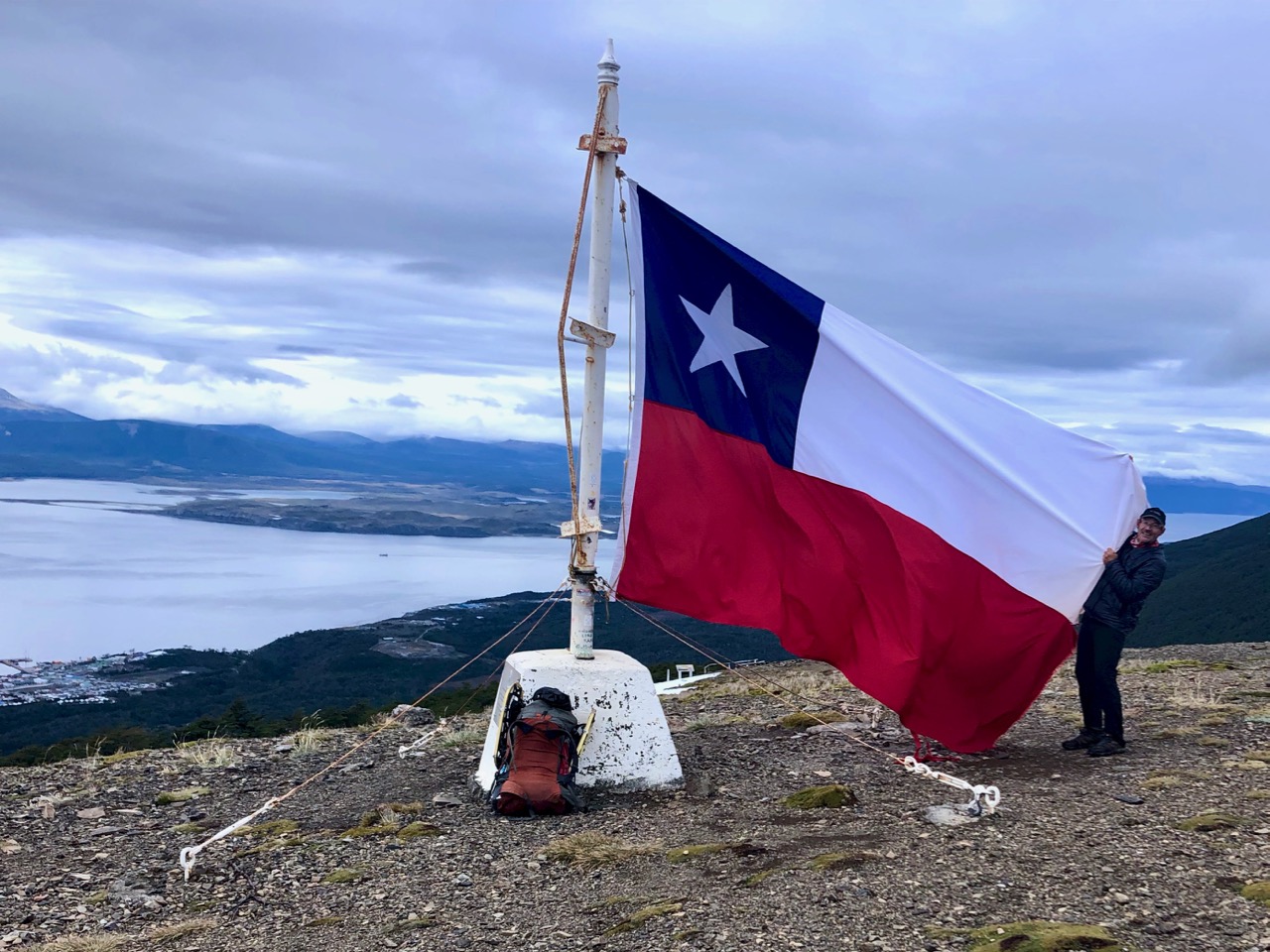
Most day hikers finish at the giant Chilean flag.
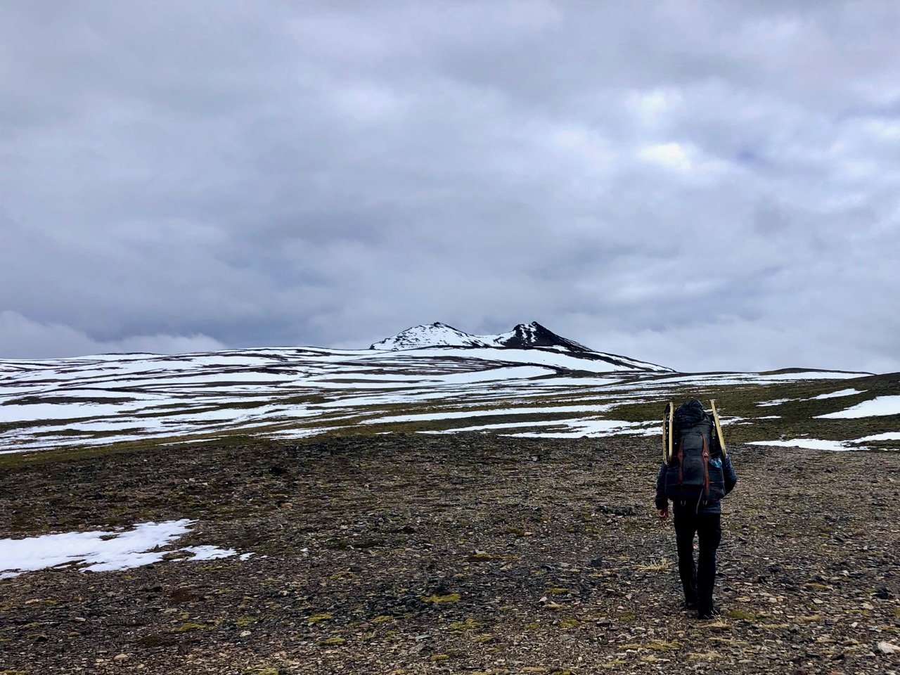
I continued up on the rocky plateau.
It’s fairly well marked here, as well, though you do have to keep your eyes peeled for cairns. In spots there are multiple trails to get to the same place.
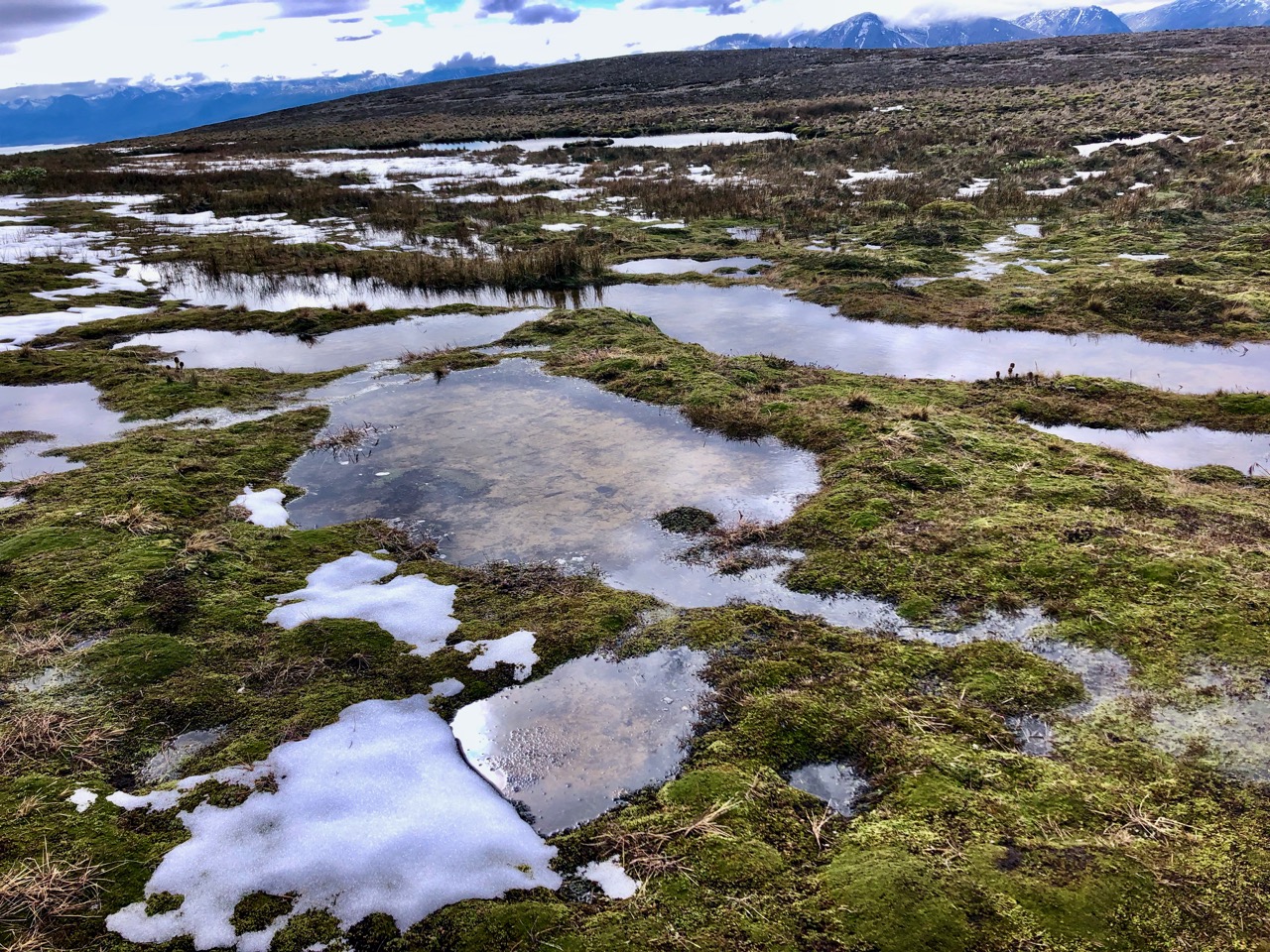
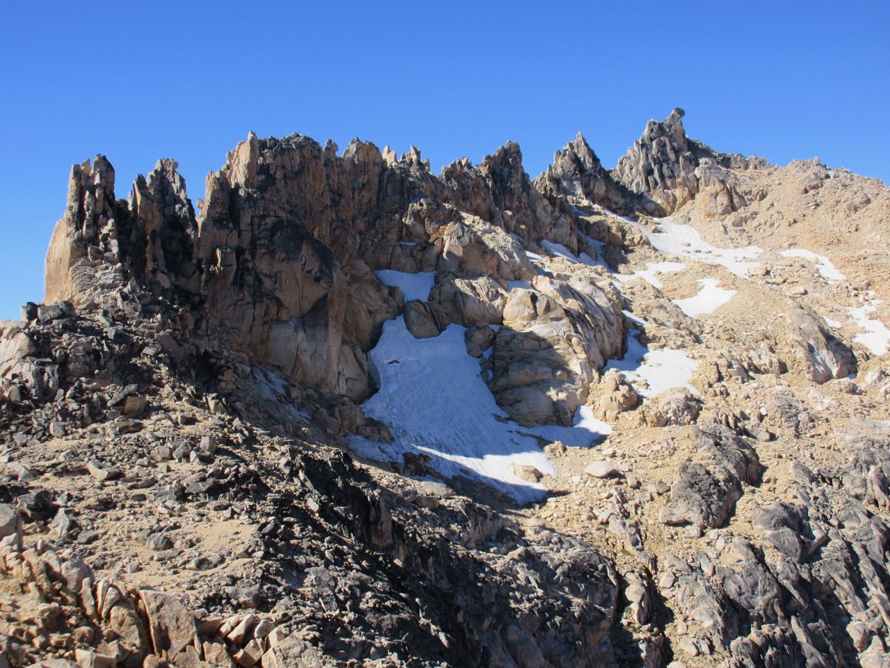
The only real problem is punching through snow or ice and getting your feet wet.
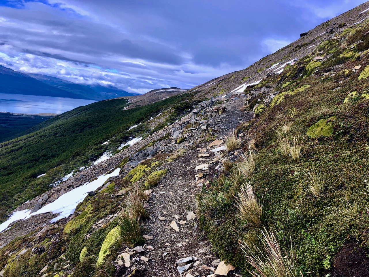
A difficult section is a long traverse along the side of a mountain.
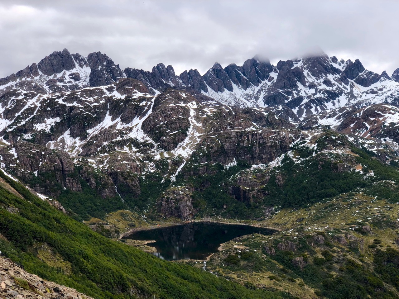
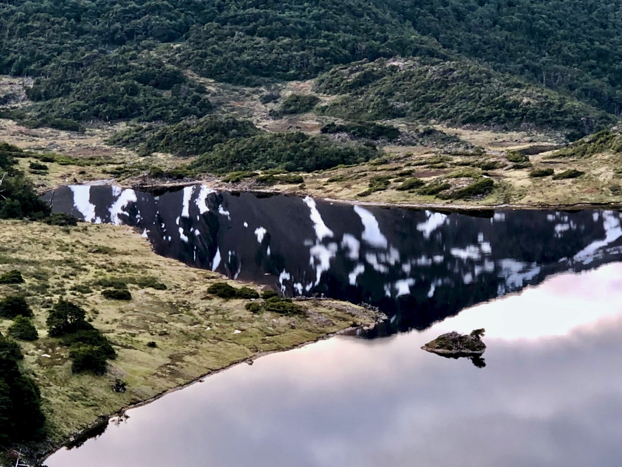
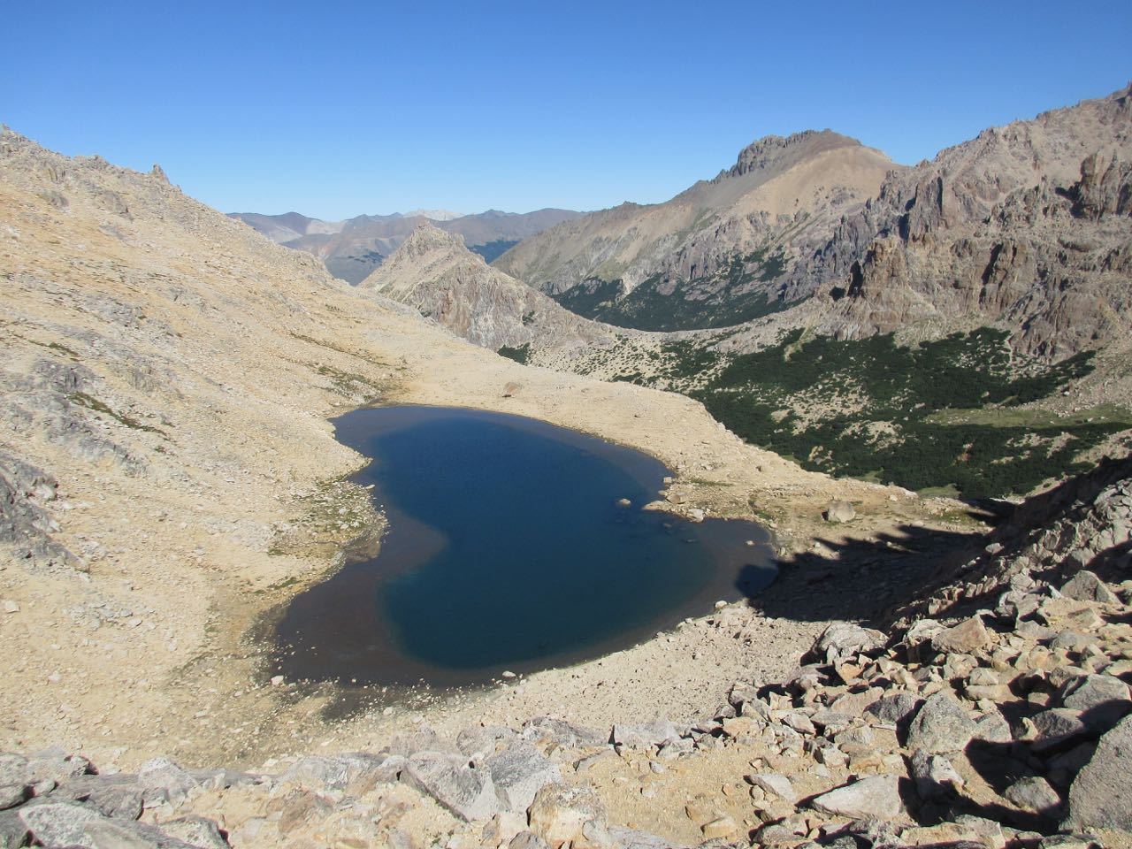
You pass a chain of pretty alpine lakes.
This is the kind of snow I faced on the first day. Easy — but with some exposure. If you slip it would be a long, painful fall.
There’s my destination. Under the teeth of Navarino. It’s a steep scramble down.
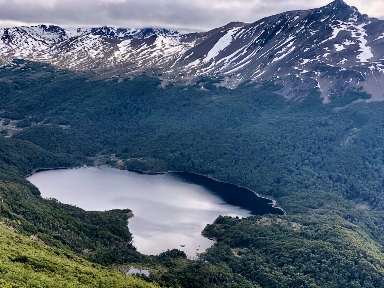
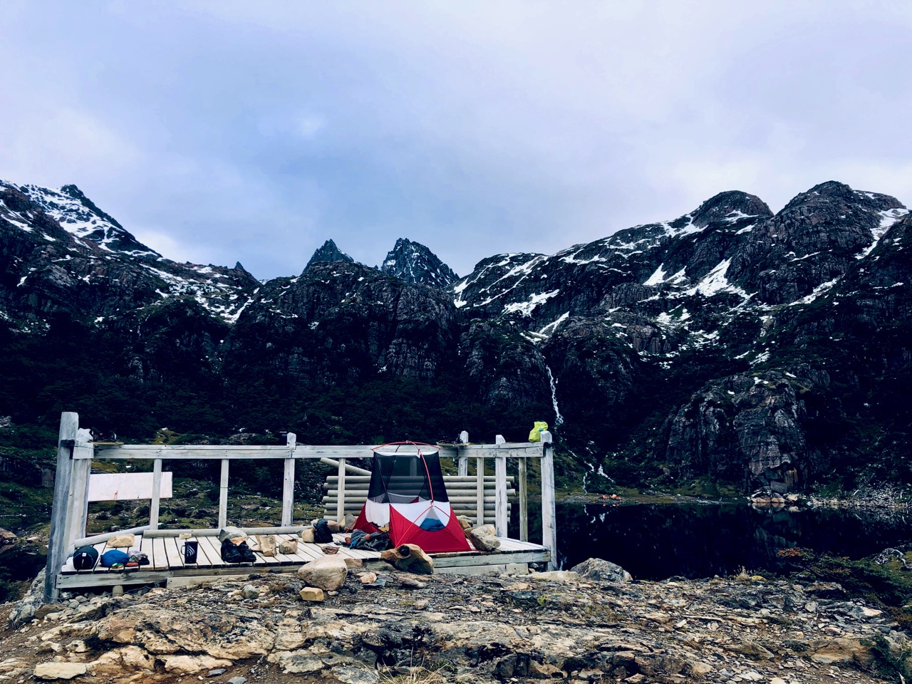
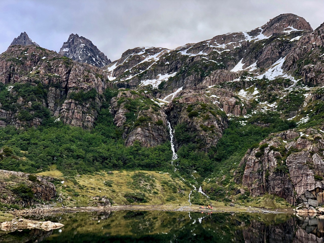
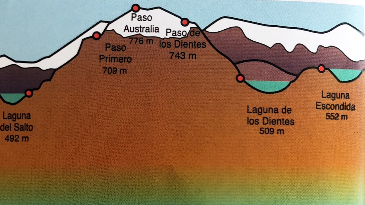
Laguna del Salto
I set up late in the day on the observation platform. Serious hikers sometimes day hike here and back. That would take at least 8 hours.
Most people tent over by the waterfall.
It was a gorgeous evening and night. I was optimistic for the weather next day.
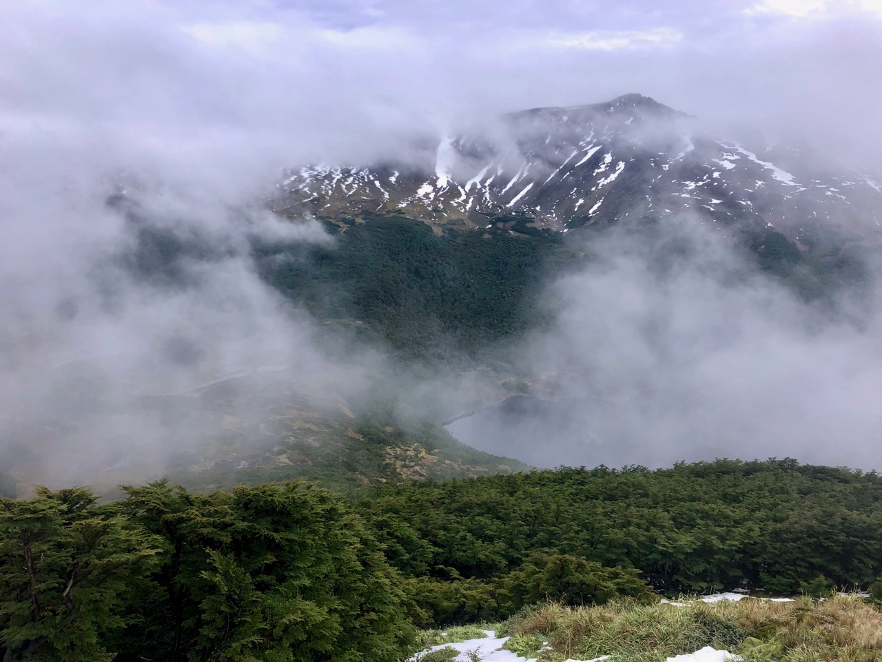
Unfortunately clouds were getting denser when I awoke.
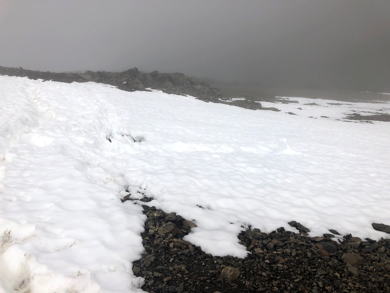
Here’s what I would face day 2 trying to get to Laguna Escondida. Lots of snow.
Potentially no vistas. Potentially a slog in the fog.
I also awoke with a bad stomach ache.
What to do? I had mixed feelings.
In the end I decided to hustle back to Puerto Williams and catch the 4pm ferry. It only runs twice a week in summer.
Back in town it looked to me like the highest peaks were clearing. My odds of getting through the circuit MIGHT have been 70% or more, I believe now.
In South America early 2018 I quickly learned that most every tourist was using the free maps.me app every day.
I was using Google Maps offline.
Google has the best map data in the world.
Maps.me uses Open Street Map data.
Soon I was using both apps and comparing the results. Google Maps offline might be better but it’s far more complicated. You must define the exact square area you want to download. Files sizes are huge.
Maps.me does only one thing.And it does it well.
Opening the app in a new geographical area while on wifi results in one prompt asking if you want to download the maps for your current area. It’s dead easy.
Offline it uses GPS to pinpoint your location.
Surprisingly some hiking trails are included in the Open Street Map data.
I couldrent a car and do this loop. Vehicle and fuel would be expensive, but I’d camp most nights.
That gets me to Skjeggedal, Preikestolen (Pulpit Rock), Rondane National Park, Hardangervidda National Park … as well as the scenic Atlantic Road driving tour.
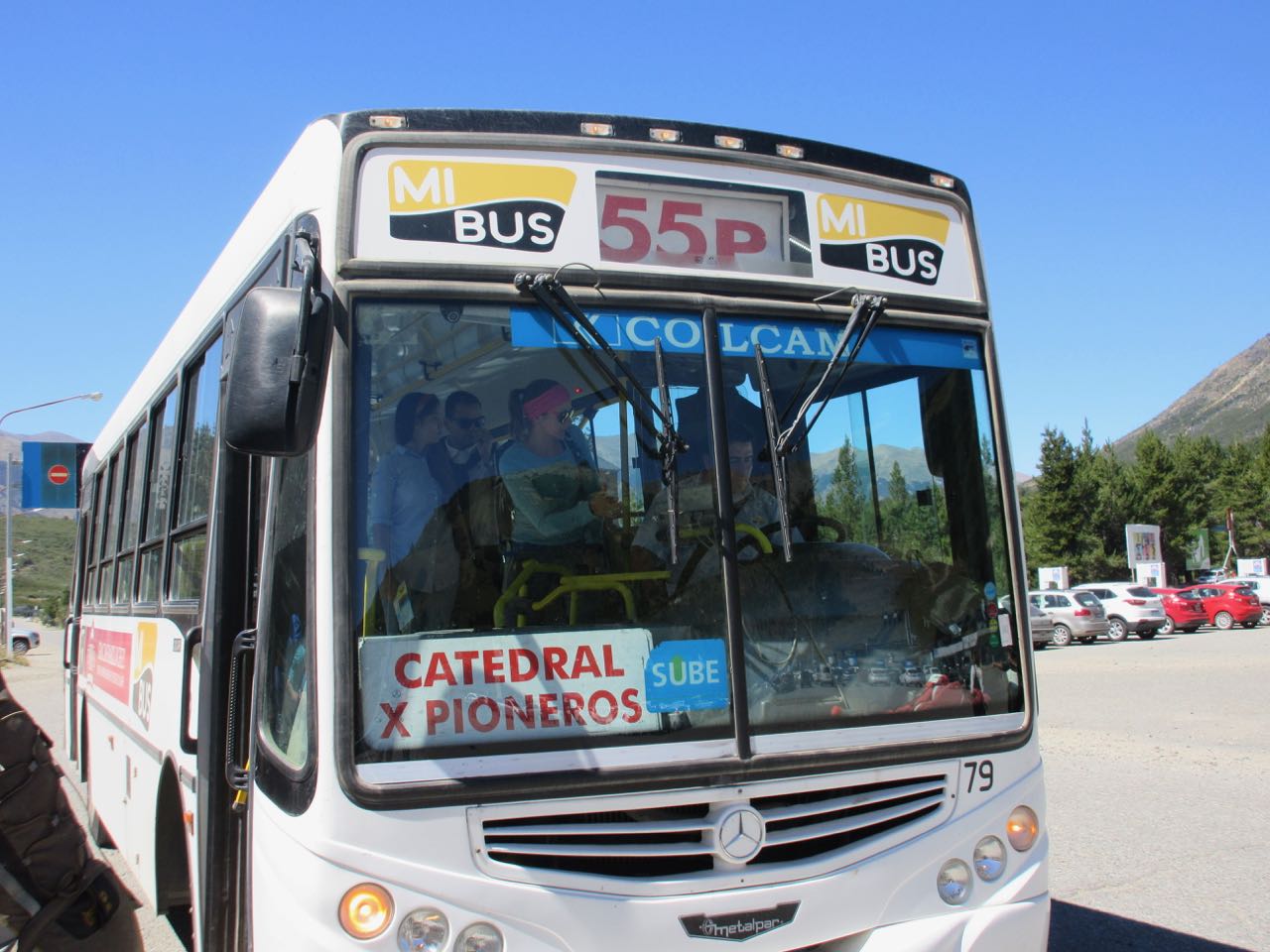
From Bariloche there are two #55 buses taking two different routes to the ski resort. Check with locals to see where to catch the correct bus.
You need to purchase a SUBE bus card. Local buses do not take cash in Bariloche.
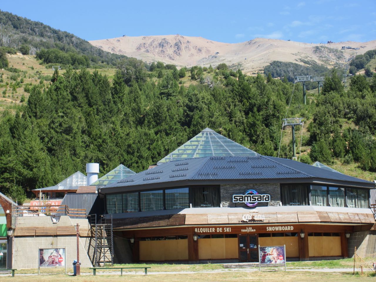
Cerro Catedral Alta Patagonia Ski Resort
Two choices to start your trek:
1. Ski lift – Amancay to Dientes de Caballo ($24 in 2018)
2. Walk Arroyo Van Titter
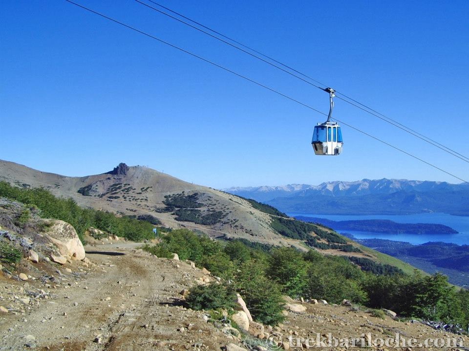
Flush with cash, I took the cable car. Everyone else from my bus walked to save money.
(Early in the season the high route via the ski lift may be impassable due to snow and ice. Check with CAB in Bariloche to confirm.)
The cable car is very popular with day hikers. They come up on clear days to see the amazing vista over to Chile. This is called the Las Nubes trail.
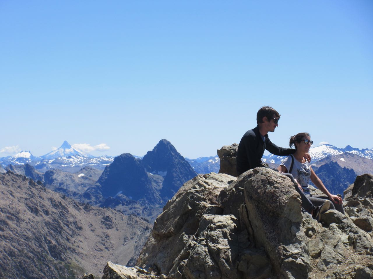
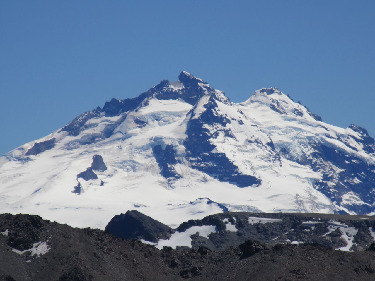
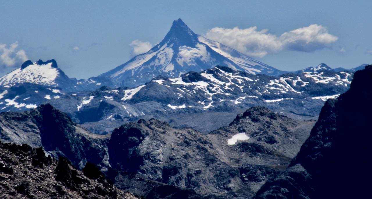
Volcán Puntiagudo
From the top of the lift it’s about 4 hours to Frey or to the most popular alternative, Cascada camp.
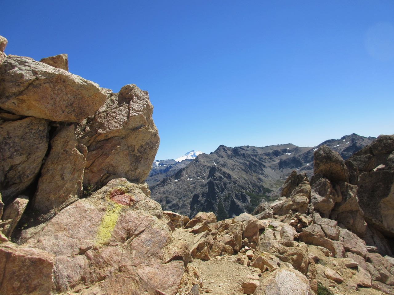
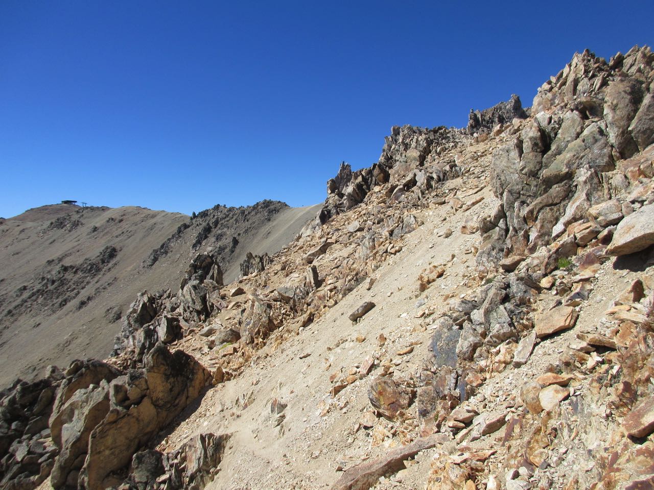
I was surprised at the challenging ridge walk required. It’s difficult right off the bat. Follow the paint splotches.
It’s a high alpine route, not a trail.
I met an American day hiking who planned on descending via Frey and Arroyo Van Titter. Same day. He would be finishing in the dark.
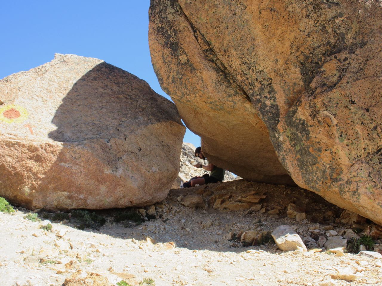
shade
There’s no water up high. It was hot.
At Cancha de Futbol you either turn left and head for Refugio Frey (the only Refugio which requires a reservation for both dormitory and camping) … OR, turn right towards Jacob and psych up for the long, steep scree descent towards the valley.
I planned to camp down in the green at Cascada as I couldn’t get a reservation for Frey.
First I turned left hoping to see Frey from above.
I could see the pond above the refugio, but the hut itself was out of sight below.
For navigation I was using Lonely Planet Trekking in the Patagonian Andes (out of print) — Nahuel Huapi Traverse PDF on my phone. I’d scanned it.
I enjoyed the great views up high on the ridge before starting down.
The descent was long, hot and somewhat dangerous. But I was happier than some British friends I met who were climbing UP to camp at Frey that night (illegally).
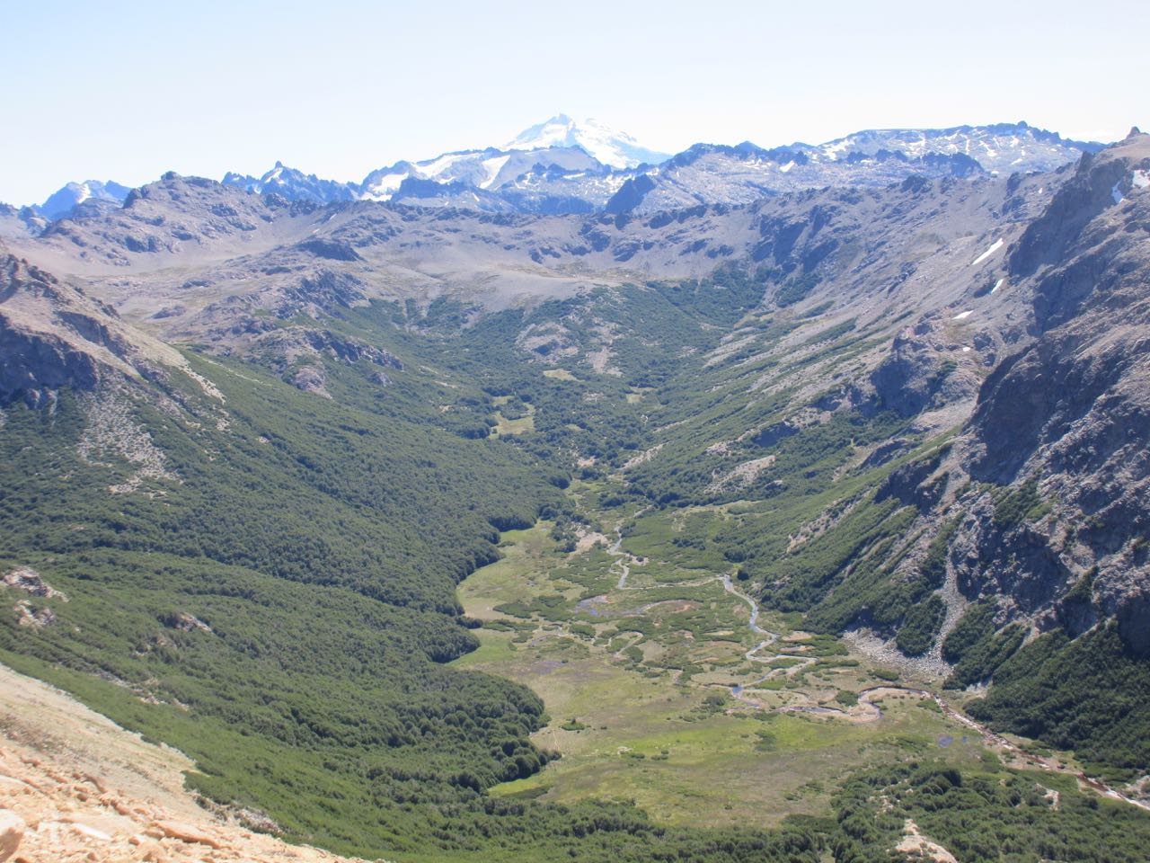
Getting to the tranquil, green, shaded campsite at dusk was wonderful. Plenty of clean water.
Viewranger offers no coverage for Chile and Argentina. Sounds like Gaia GPS is best for those nations.
I can download Patagonian maps and use them offline on the trail.
sample Gaia map
Gaia GPS is free to try for a week. Subscription membership costs $19.99/year while a Premium Membership is $39.99/year.
I joined the lower tier plan hoping the additional maps would help in South America. For Aconcagua Park, Argentina, for example, none of the layers are much good aside from Satellite with Labels. You can see the trails clearly beside water sources, tents, etc.
I’ll try it when I get there in a week or so.
Gaia claims to be superior to AllTrails in most regards, as well. And less expensive.
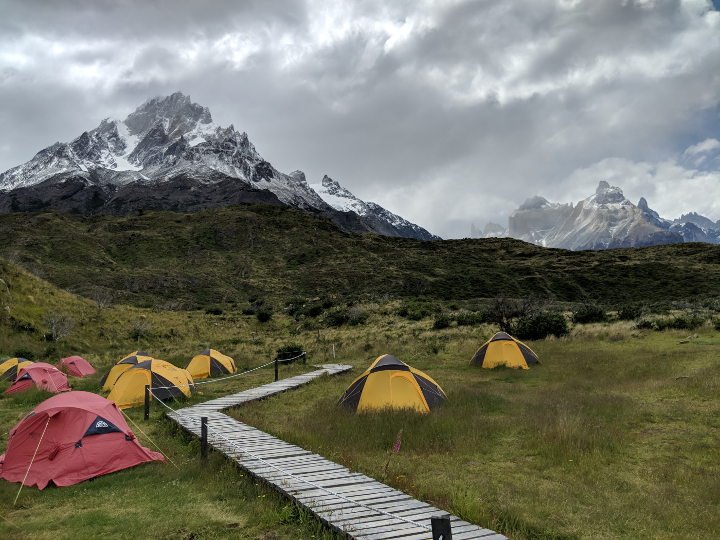
Without question Paine in Patagonian Chile is one of the finest and most memorable treks in the world.
But the logistics of getting everything booked in advance is daunting.
Backpackers Review posted a detailed trip report of their December 2017 circuit. It includes the latest details on getting reservations:
Permits:
It is mandatory to attain all reservations for camping and refugio shelters prior to entering Torres del Paine National Park.
If you do not have reservations for your trek, you will not be able complete the Circuit trek. Reservations fill up fast for the prime season (November-March), so you should book several months in advance (for the Circuit trek, the number of trekkers is limited to 80 per day).
Outside of your camping reservations there is no separate permit needed to hike the Circuit. You simply pay the 21,000 peso (~$35) entrance fee when you arrive at the park and show proof of your camping reservations at several spots along the trek.
Shelter:
If you book your campsites early enough, you will have multiple options for itineraries and can decide to hike the circuit over anywhere from 6-9 days.
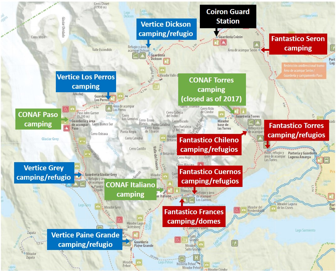
A map with the various campsites and refugios highlighted is shown below.
Note that there are free campsites run by the Chilean government (CONAF) and there are sites run by two different private companies (Fantastico Sur and Vertice Patagonia).
Prices for the accommodations run by the private companies range from ~$10 per person per night for camping to over $75 per person per night for a bed and meals in the refugios.
Some of the refugios are now requiring people to purchase meals, even if you camp (Chileno and Los Cuernos require full board meals in 2017-2018). This adds a lot of cost and is annoying, but the only other option is to not stay at these sites and adjust your itinerary. …
Which camps you decide stay at will largely depend on how many days you have in the park, how much money you want to spend, and whether you prefer to camp or stay in shared bunks. A few example itineraries are as follows (we hiked the 9 day one):
9 days: Seron > Dickson > Los Perros > Paso > Grey > Paine Grande > Frances > Chileno or Las Torres
8 days: Seron > Dickson > Los Perros > Paso > Paine Grande > Frances > Chileno or Las Torres
7 days: Seron > Los Perros > Grey > Paine Grande > Frances > Chileno or Las Torres
6 days: Seron > Los Perros > Paine Grande > Frances > Chileno or Las Torres