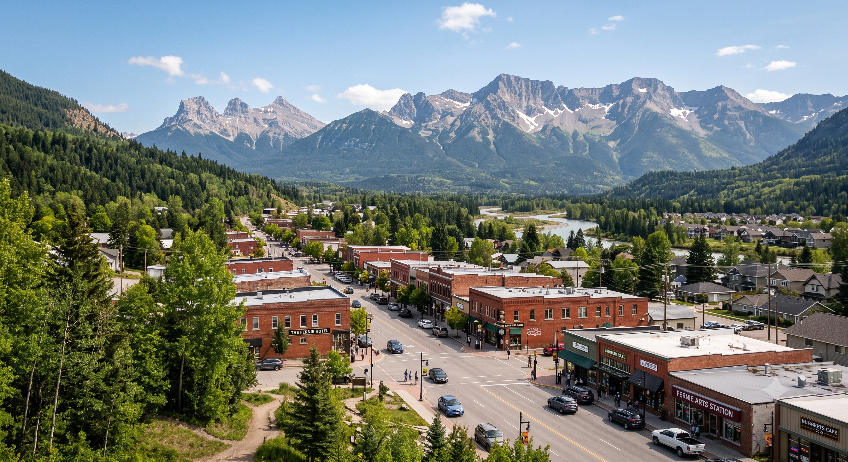
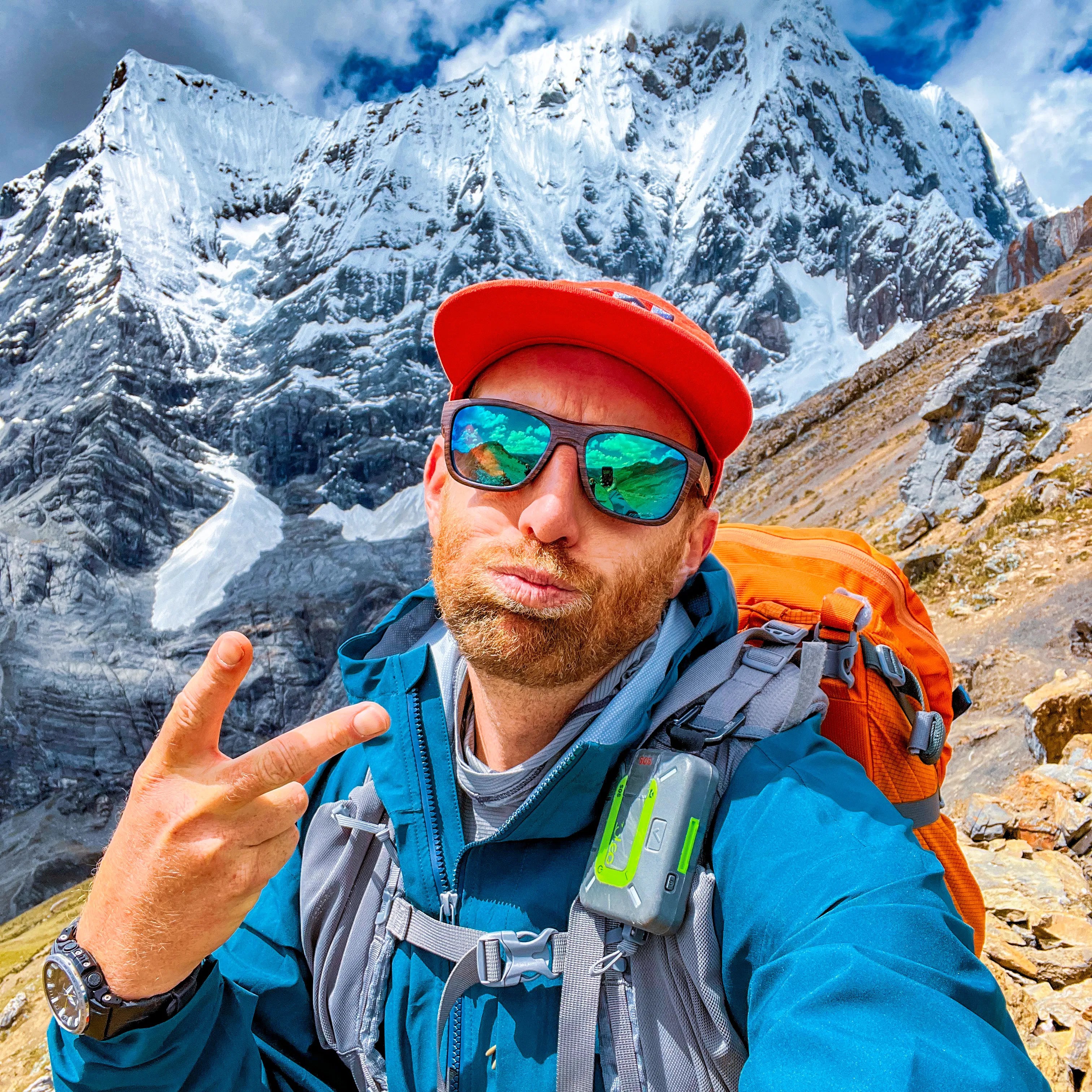
Though I’ve driven through Fernie, British Columbia, at least 100 times, I’d never before stopped as a tourist.
It’s fantastic.
A.I.
A year round outdoor recreation mecca.
Hiking. Mountain biking. Rafting. River tubing.
Not to mention world-class fly fishing on the Elk River for cutthroat and bull trout.
Fernie is most famous for Alpine Skiing and Snowboarding.
There are over 300 kilometers of multi-use recreational trails accessible directly out of town.
The owner of Edge of the World snowboard shop pointed out that he can hike or bike in any direction from town — and be on a fantastic trail in minutes. (He also had to deploy bear spray to dissuade a Black Bear on the day of my arrival. There is plenty of wildlife around Fernie.)
There are 4 dedicated bike and outdoor shops in a town of less than 6500 locals!
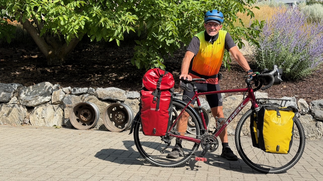
I stopped by Sun Country Cycle in Vernon to have them top up air in the tires and look over the bike for any potential problems.
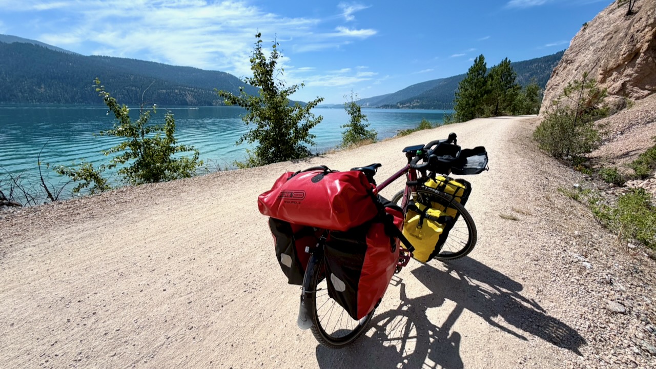
The Okanagan Rail Trail leaving Vernon is fantastic. This is not part of the Trans Canada Trail.
As you get closer to Kelowna, the route is not nearly so good. I was hurting, as well, and could barely walk after only about 60km. I checked into the hostel in Kelowna wondering if I’d be able to continue. My muscles were cramping badly.
BUT I did make it to Penticton. Still hurting, but less and less.
AND was able to cycle up to the Myra Canon trailhead — though the 945-meter elevation gain at never more than 2% grade in the HEAT was tough!
I crashed that night.
Myra Canyon Trestles & Tunnels
The 18 trestles and 2 tunnels are one of the highlights of the entire Trans Canada Trail. This was my 3rd time here and I enjoyed them as much as ever.
Fantastic views — though the surface near Kelowna is very sandy & rocky. Those on eBikes were much happier than me. A good mountain bike would be better, as well, than my gravel bike.
On the other hand, I had the trail to myself most of every mile.
I stopped for coffee at Chute Lake, charging my electronics and filling up about 5 lites of water.
Up high on the trail, this was my brightest fire red sky at night. I was lucky to avoid any worse smokey air.
Columbia and Western Rail Trail
The KVR ends at Midway B.C.
I continued on towards the Columbia and Western Rail Trail. It’s about 162 km connecting Midway, Grand Forks, Christina Lake, and Castlegar.
Great sections, but not nearly as good as the KVR.
Highlights for me were sweeping views of the Granby Valley, Christina Lake, and Lower Arrow Lake.
And it offers ideal wild camping — though there are not all that many water sources.
I enjoyed dinner every night, rehydrating meals frozen by my niece. Much tastier than any commercial camping dinners I’ve ever tried.
NEW for me is using a toy drone automatically following my bicycle.
Also new for me while bikepacking, is carrying a portable camping chair.
I love it!
Though rehydrating meals is ideal …
… I eventually had an urge for solid food.
Here I am saying goodbye to the Columbia and Western Rail Trail.
To Nelson & Crawford Bay
As we had a house in Crawford Bay B.C., I was keen to continue on to Nelson and the old homestead. But I was forced on to highways and rural roadways with … HILLS.
Why didn’t someone warn me there were HILLS in British Columbia? 😀
After flat rail trails, almost every ascent seems daunting. And HOT.
I love Nelson and checked into the hostel for a night. Happily, my friend Tam happened to be in Nelson at the same time and we were able to catch up for coffee.
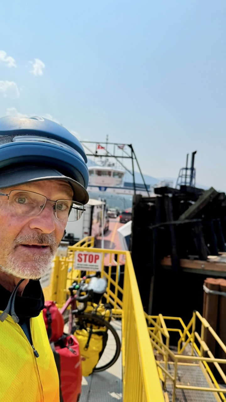
Rather than cycle the dangerous tourist highway out of Nelson, I put my bike on the local bus to the Kootenay Lake ferry.
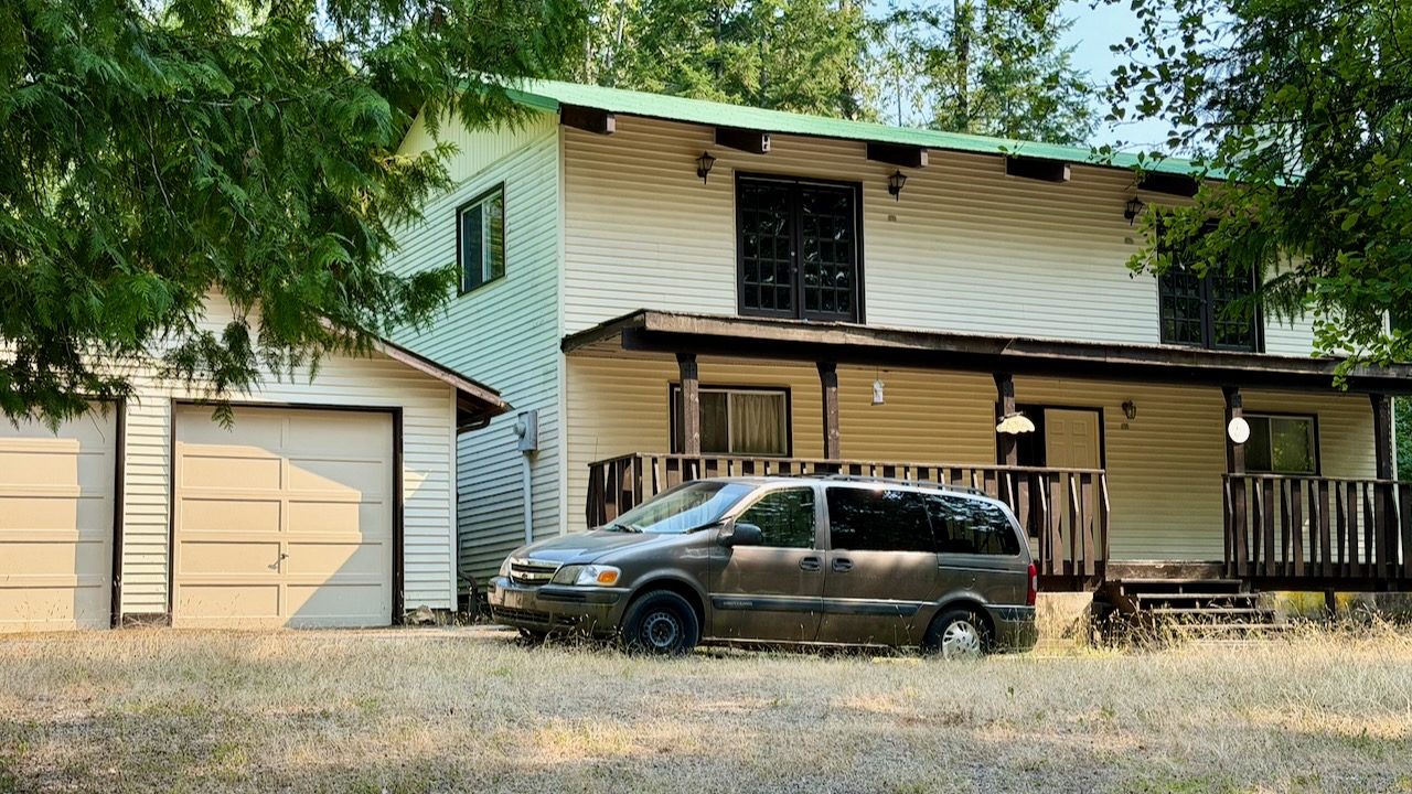
In 2020 the house my Dad built was in rough shape. Six years later it looks even worse.
I’m wondering when anyone actually last lived here.
Like 2020, I stopped for lunch at the fantastic Kokanee Springs Golf Course.
Busy, Dangerous 2-lane Highways
The highway from Crawford Bay to Creston is a favourite of mine. To drive.
On the bicycle it’s dangerous with very narrow shoulders in places.
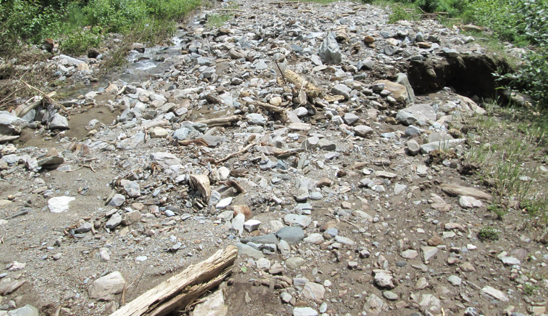
I stopped at the Gray Creek General Store to inquire whether or not cyclists were taking the Trans Canada Trail up and over the Gray Creek Pass — probably the most challenging section across the nation.
Not many, I was told.
Average of nearly 9% grade for 17 km from Kootenay Lake up to Gray Creek Pass
Average of nearly 6% grade for 12 km from Gray Creek Pass down to Parker’s Creek
No service
Rough surface
Not recommended
As I did in 2020, I chickened out and cycled the highway to Creston.
My first flat tire EVER on this bike. After trying to add air with my (crappy) hand pump, I saw there was a bike shop only 4km distant. Rolling my bike there, the street was shut down by police.
This was a crime scene. Stabbing, I was told. Possibly murder.
The bike shop owner happened to drive past, informing me it was still possible to enter the shop from the back. With no customers coming in the front door, they fixed the flat immediately and at low cost. Whew.
Creston to Cranbrook
Mostly highway. No photos.
Crawford Bay to Cranbook was the least interesting section.
Adventure Ends in Fernie
I got coffee in Cranbrook. And then tried to find the trail out of town.
It’s confusing. And I never found even one good navigation app for the Trans Canada Trail.
The end of my trip on day 11. My rear rack broke off completely going over one of those bumpy cattle guards a few hours after leaving Cranbrook.
GMoney, a ski shop owner in Fernie — who’s a punk musician in his spare time — picked me up while I was hitchhiking.
A big time hiker and cyclist, GMoney hosted me at his house and gave me advice on where I might get the bike fixed.
Turns out none of the 4 bike shops in Fernie had the kind of tools to repair the rear rack.
I stayed at the excellent Angry Elk Hostel, as well, for a couple of nights — enjoying Fernie for the 1st time — until my brother & his wife came to my rescue.
(Same day GMoney collected me, he and a girlfriend were 2 yards away from an angry Black Bear with cubs. Had to bear spray to stop her. That’s the closest bear encounter of anyone I’ve ever known. )
In the end, my cycling distance over the 11 days was around 750 km.
I Missed Fernie to Calgary
I broke down at the end of the worst highway sections, and the beginning of one of the best trail & gravel road parts of the entire Trans Canada Trail.
Eric is one of the top hiking YouTubers. One of the reasons I signed up instantly when he posted this trip is for the superb video documentation.
Before you sign up for Kili, watch his 43 minute documentary in 4K.
Sure Kili is one of the easiest trekking peaks close to 6000m — but it ain’t easy.
This guided trek on the highest mountain in Africa is as good as it gets. Eric worked with Zara Tours, the biggest outfitter on the mountain. TrovaTrip handled logistics.
We had 22 hikers. 18 of us made both summits. That’s about typical for the Machame Route. It went well for me. My 3 weeks training & acclimatizing in Ecuador prior to this trip was a good idea.
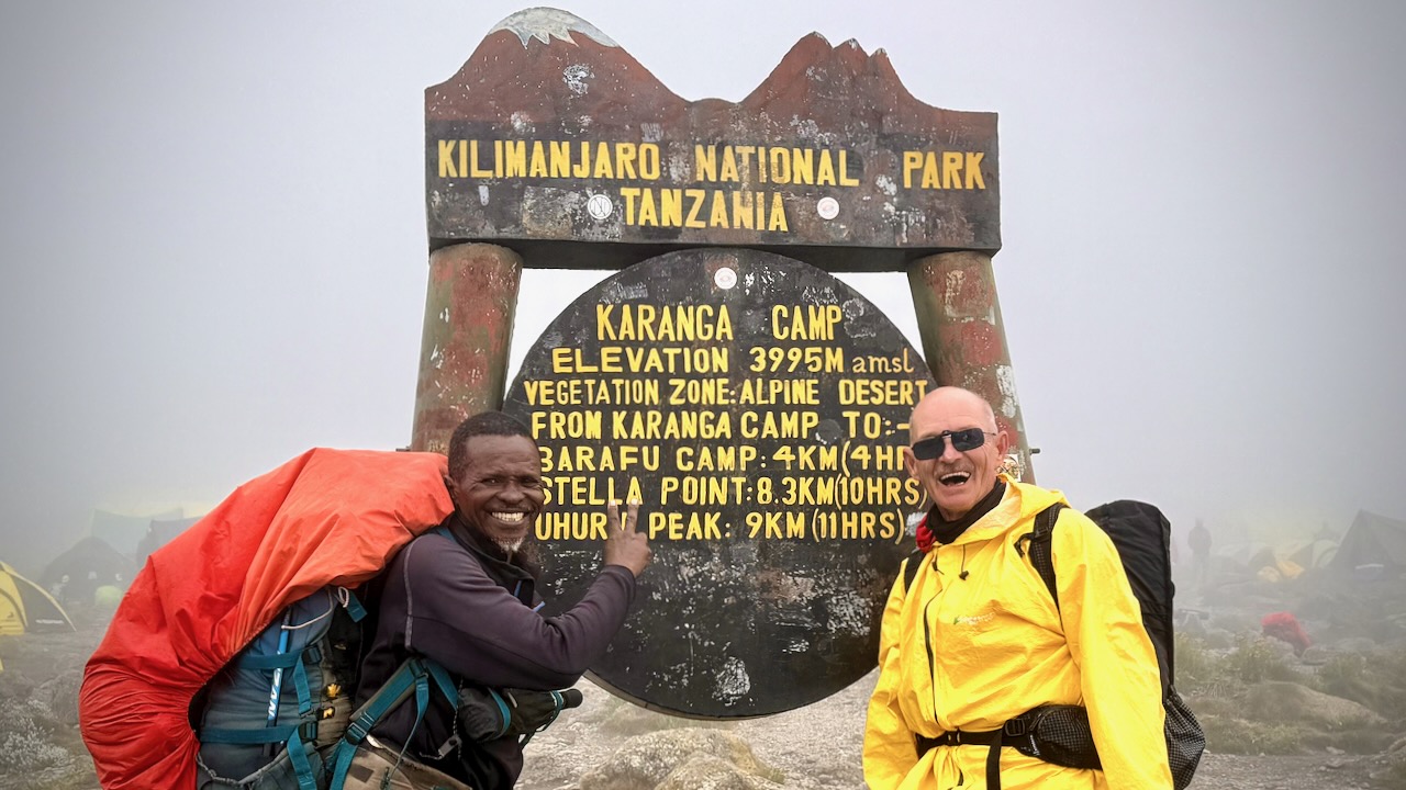
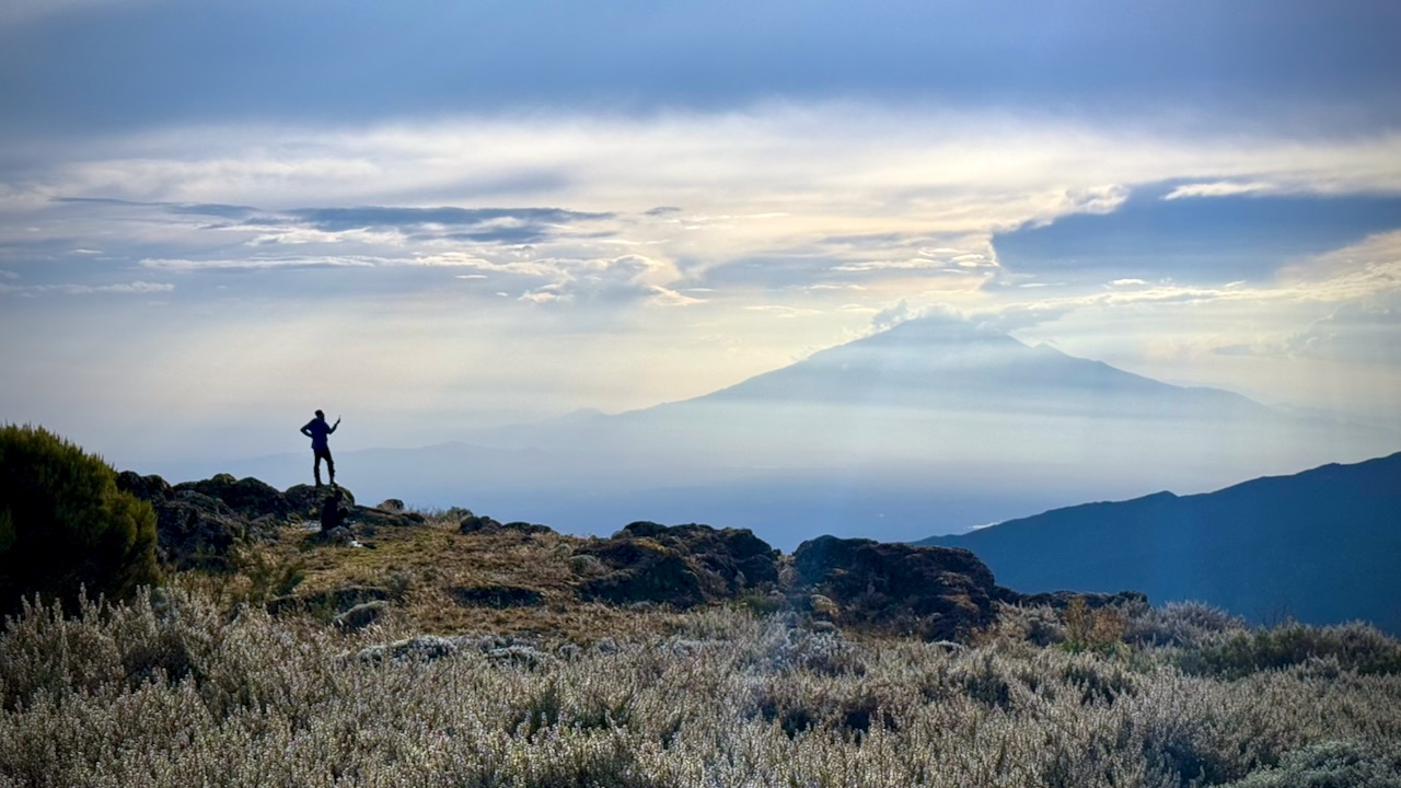
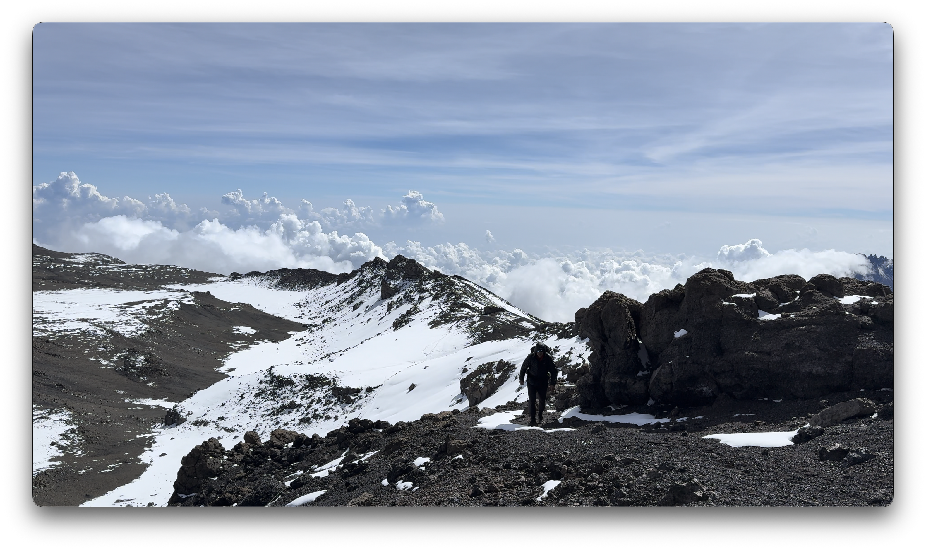
Kili Summit Ridge
Age & fitness matter much less than the ability to acclimatize to altitude.
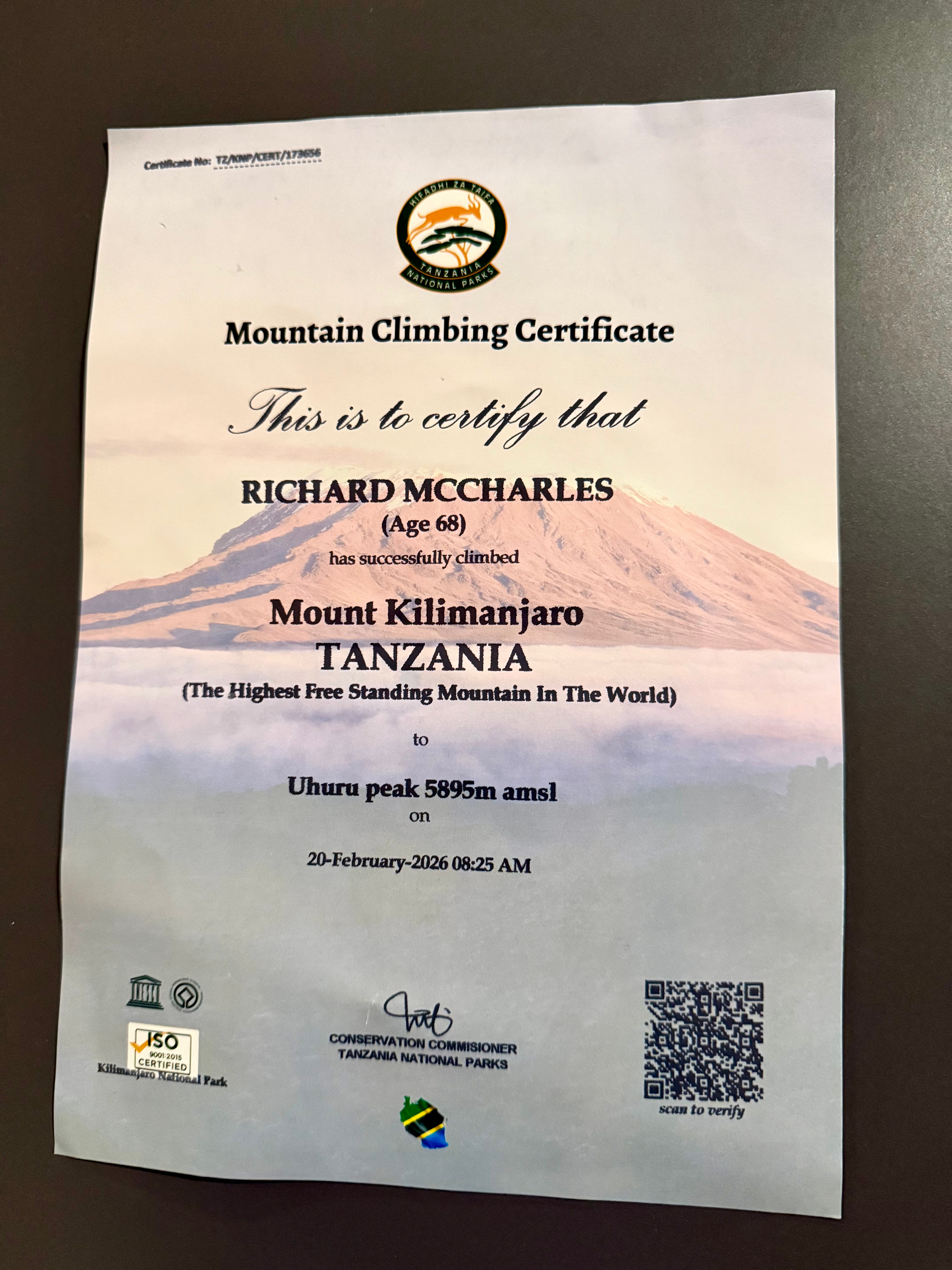
It took me 68-years to finally get to Kilimanjaro. The eldest my African guide got to the summit was 79.
We had another in our group age-66.
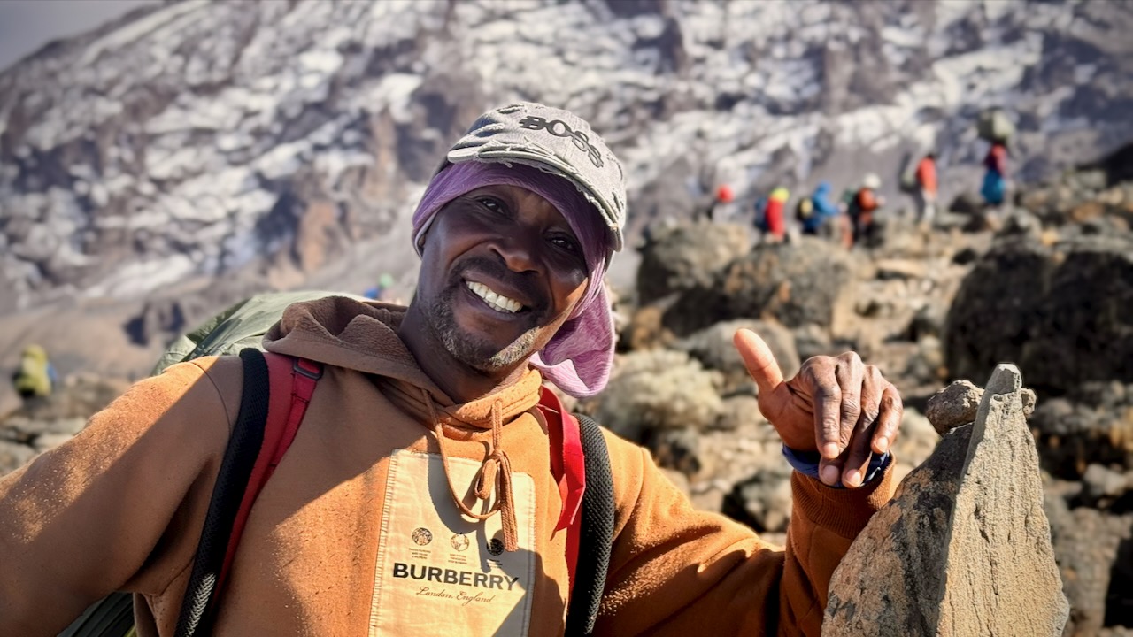
Truly impressive is one of our assistant guides who’s been to the summit over 200 times over 31 years. He’s age 64.
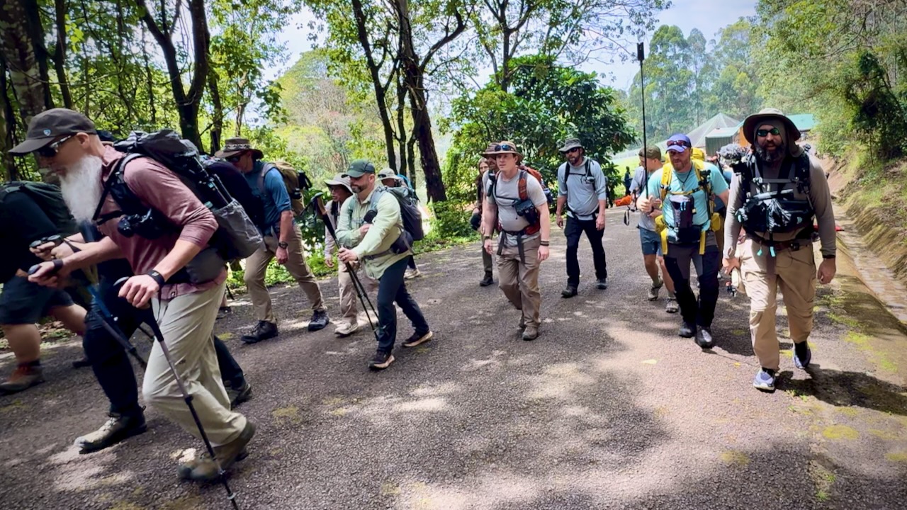
Here we are — clean & keen — at the start of the 7 day adventure.
In fact, it was a party from the start as many who had hiked with Eric in the past joined for Kili. I was simply an addition to a large group, many who knew one another. This is a very social adventure ➙ shared suffering.
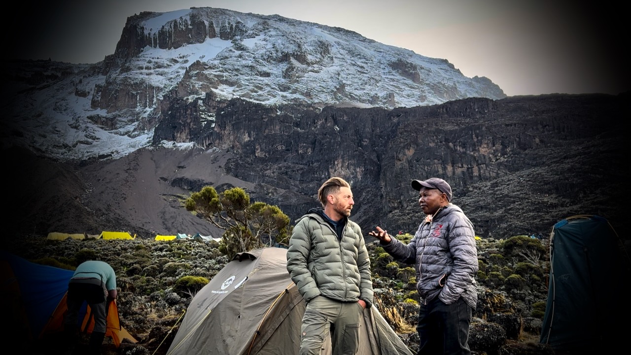
Eric was our American guide. Freddy our African guide. Both responsible for keeping us safe. It was these two who’d make the decision whether or not you were healthy enough to keep climbing.
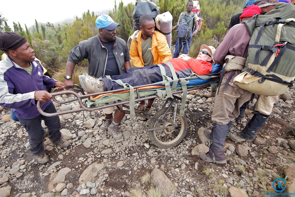
Those who decided to go down were unable to acclimatize quickly enough. We had daily blood oxygen tests.
Three decided to walk out. One took a helicopter, hoping she will recoup the $4100 cost through insurance.
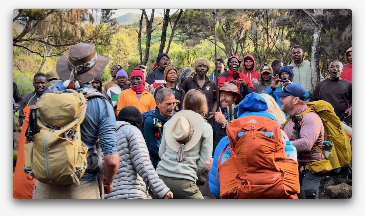
New to me on a trail was the singing and dancing. Non-stop. To the top.
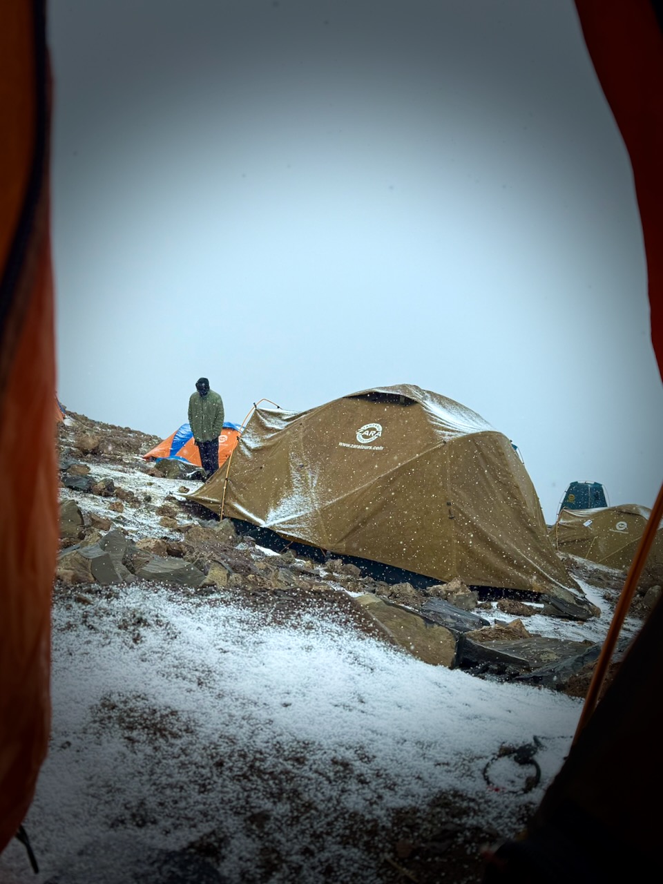
Oddly, all 7 days we had the same weather. Some sort of micro-climate.
Morning clear. Sunny to start the hiking day. Snow, sleet, and hail in the early afternoon. Clearing by dinner time. Clear skies at night. Kili summit clear at dawn.
We added and removed layers non-stop during the day.
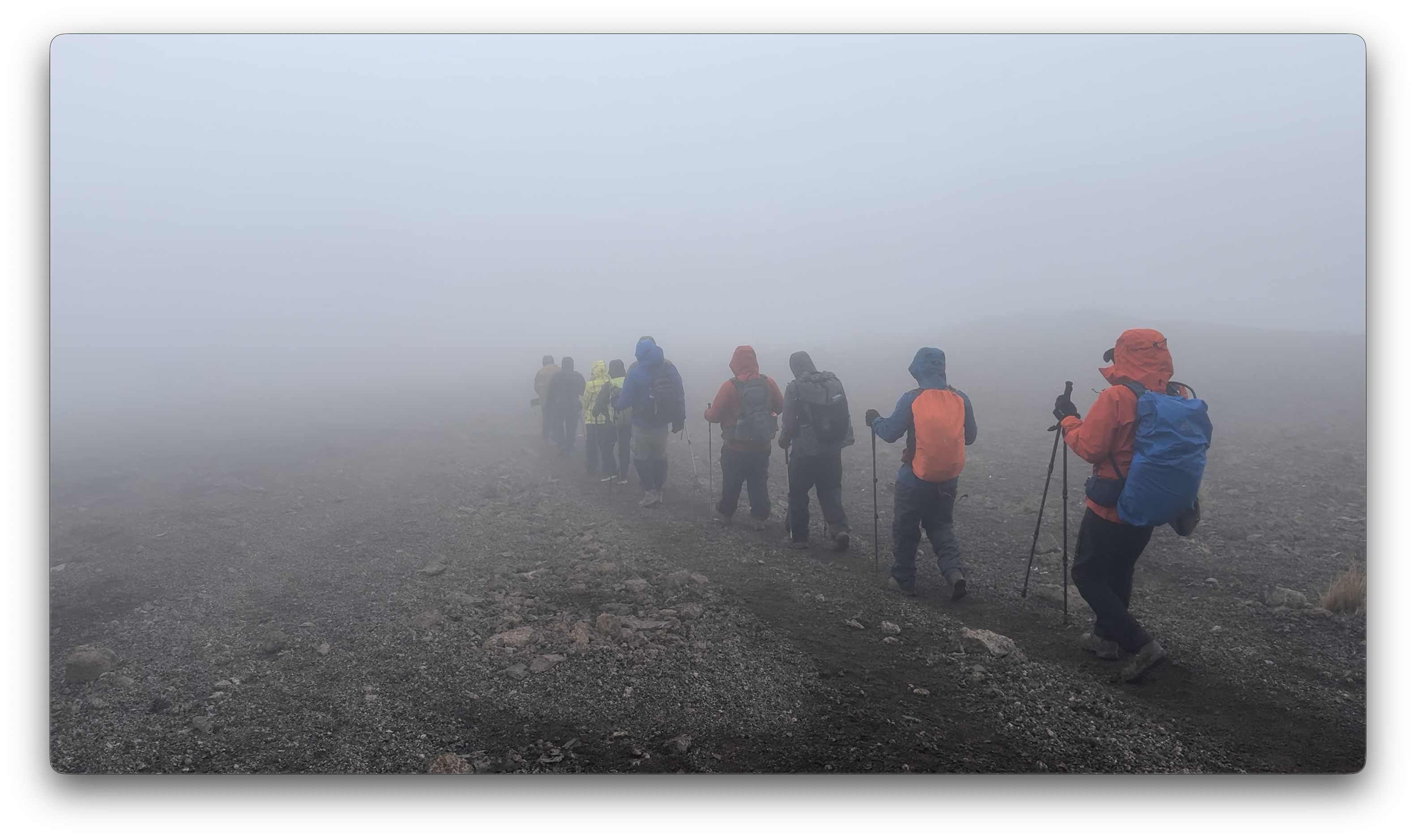
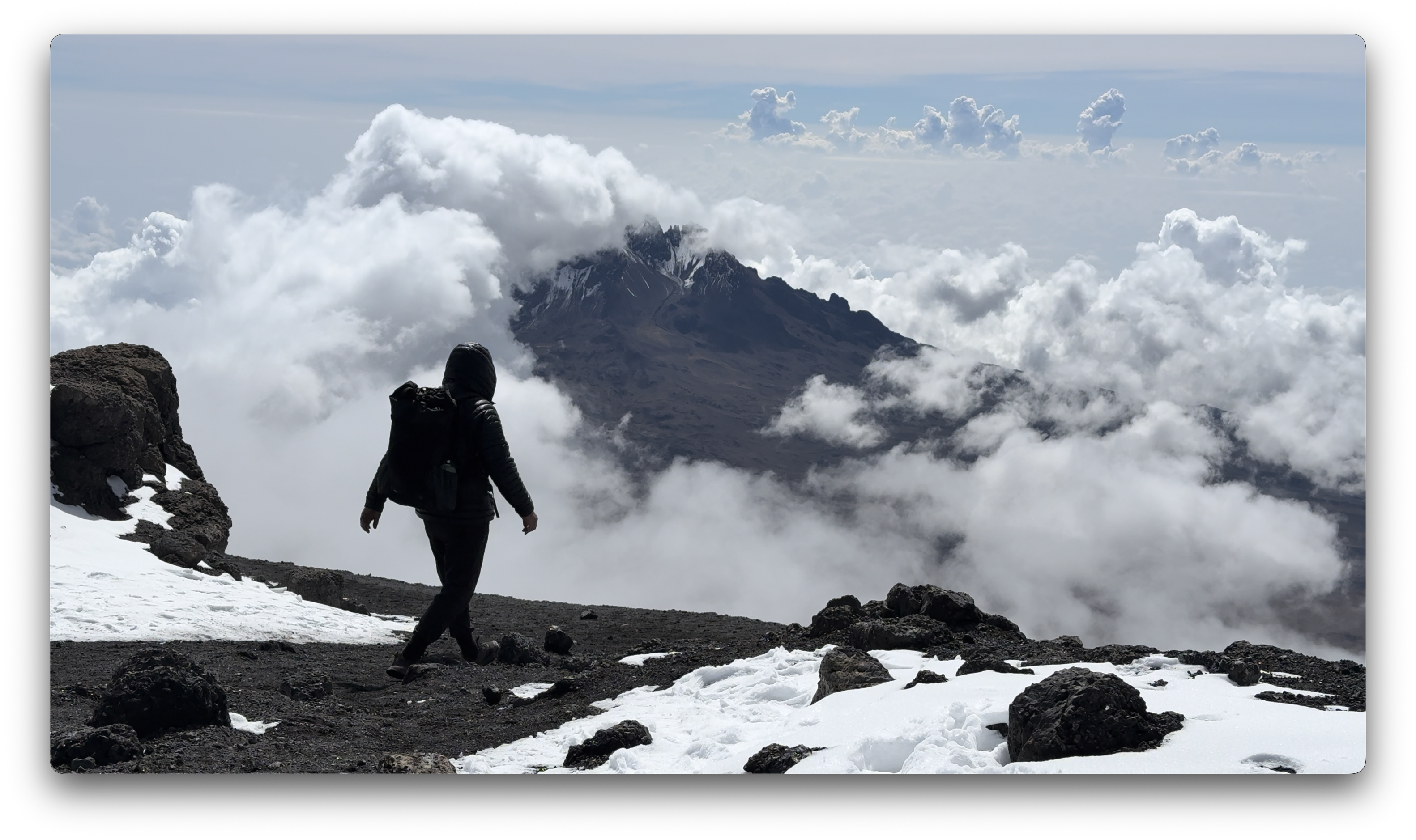
Each day we spent some time hiking through clouds.
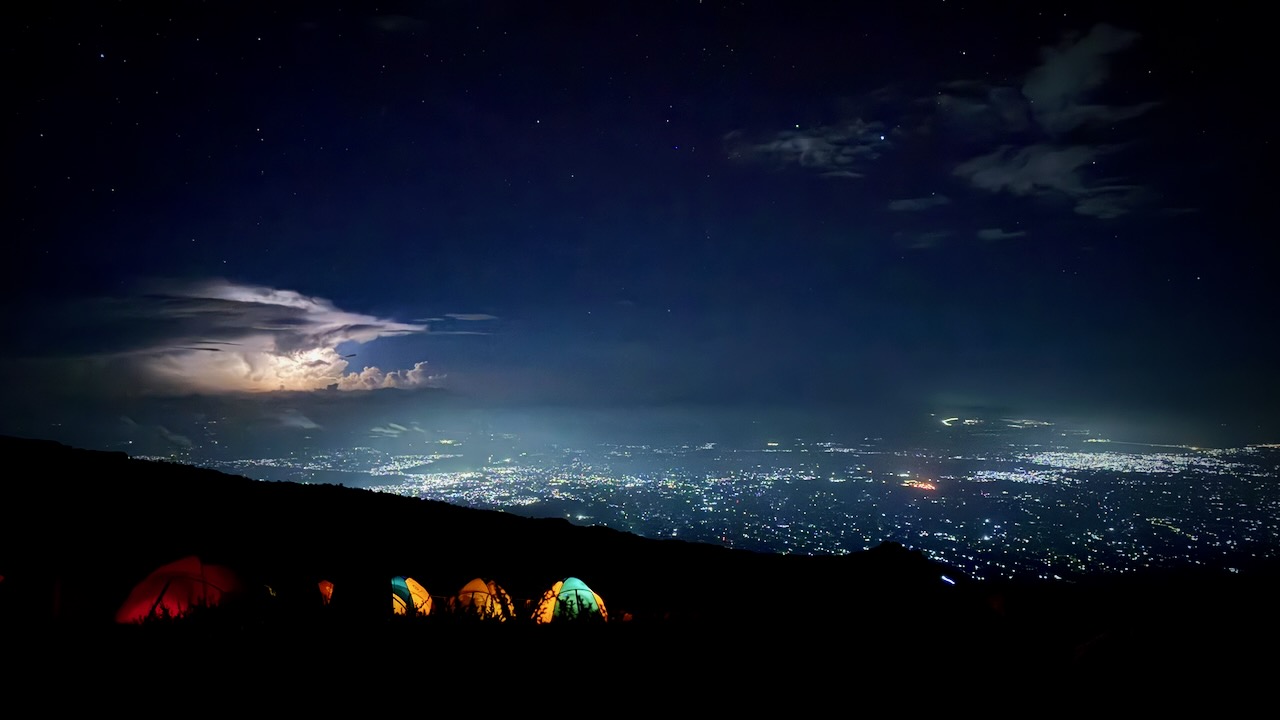
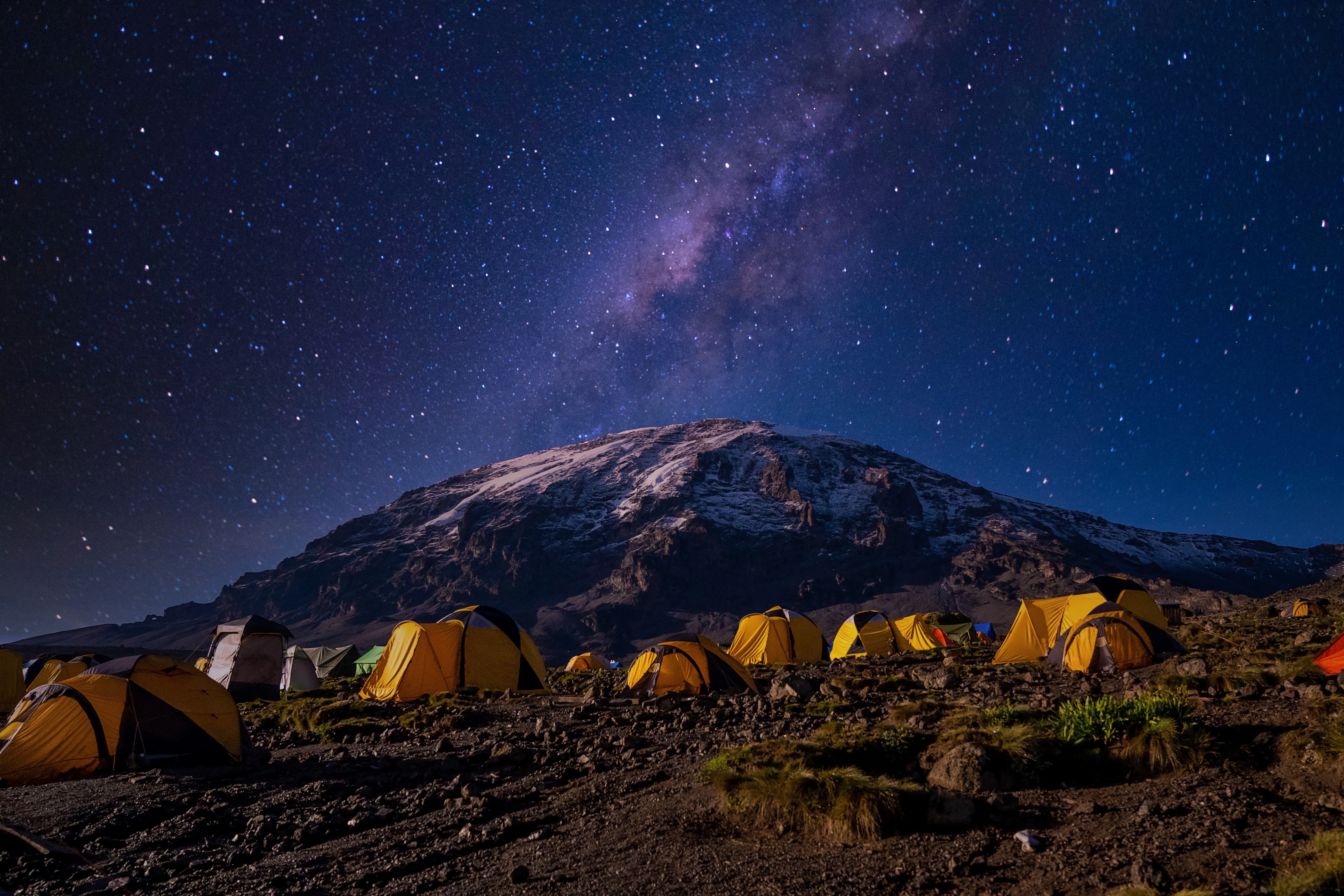
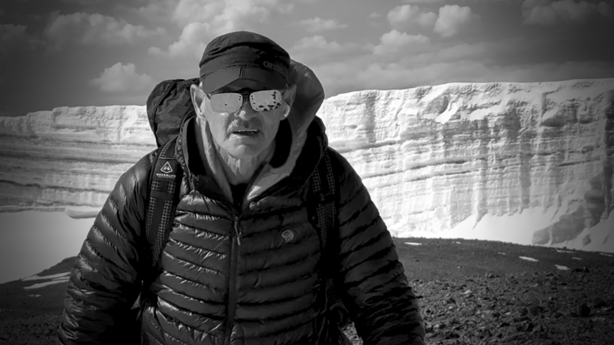
We mostly had clear skies at night. The iPhone 16 Pro is terrific at night photography on a tripod.
I’d paid a little extra to have a tent to myself. It was fairly comfortable — though many of our tent sites were far from level. 😀
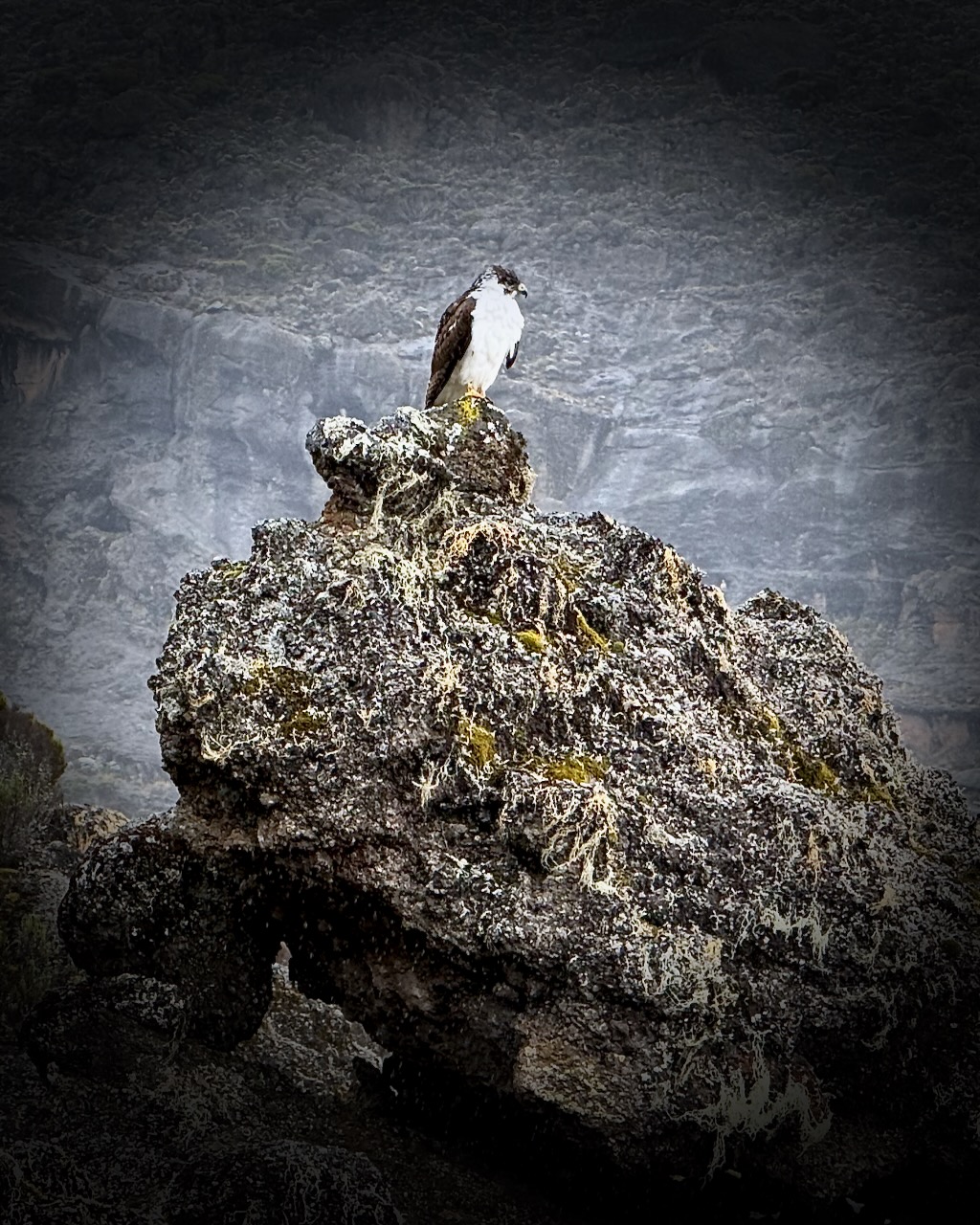
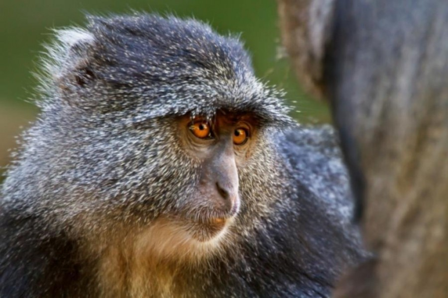
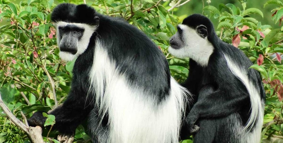
We were happy to see two kinds of monkeys. But both were at lower slopes, close to the start and finishing gates.
Blue Monkey.Black-and-white Colobus.
Baboons and velvet monkeys have been spotted, but rarely.
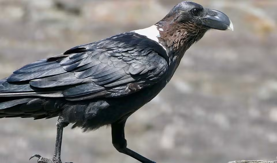
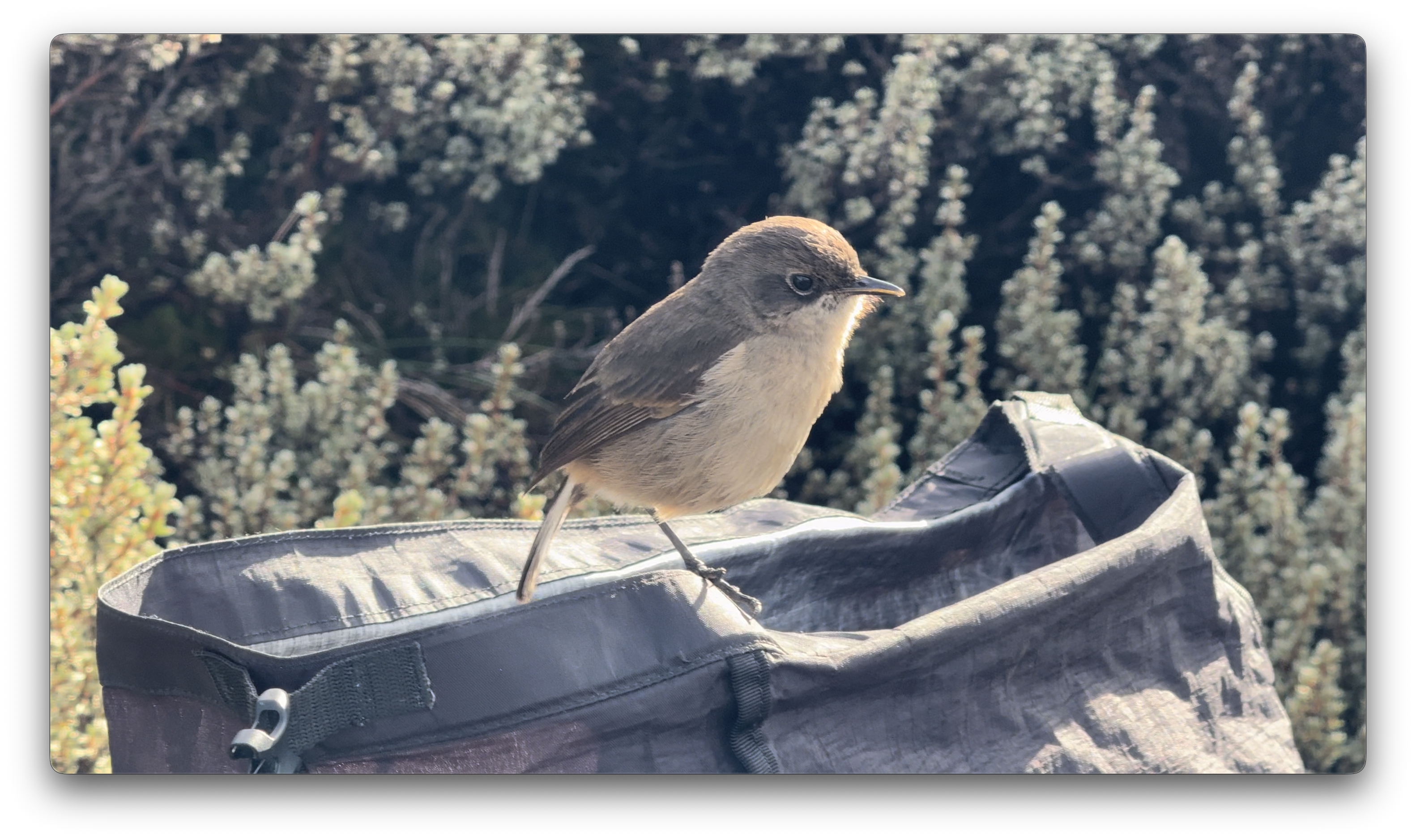
This bird took a dump in my backpack. 😀
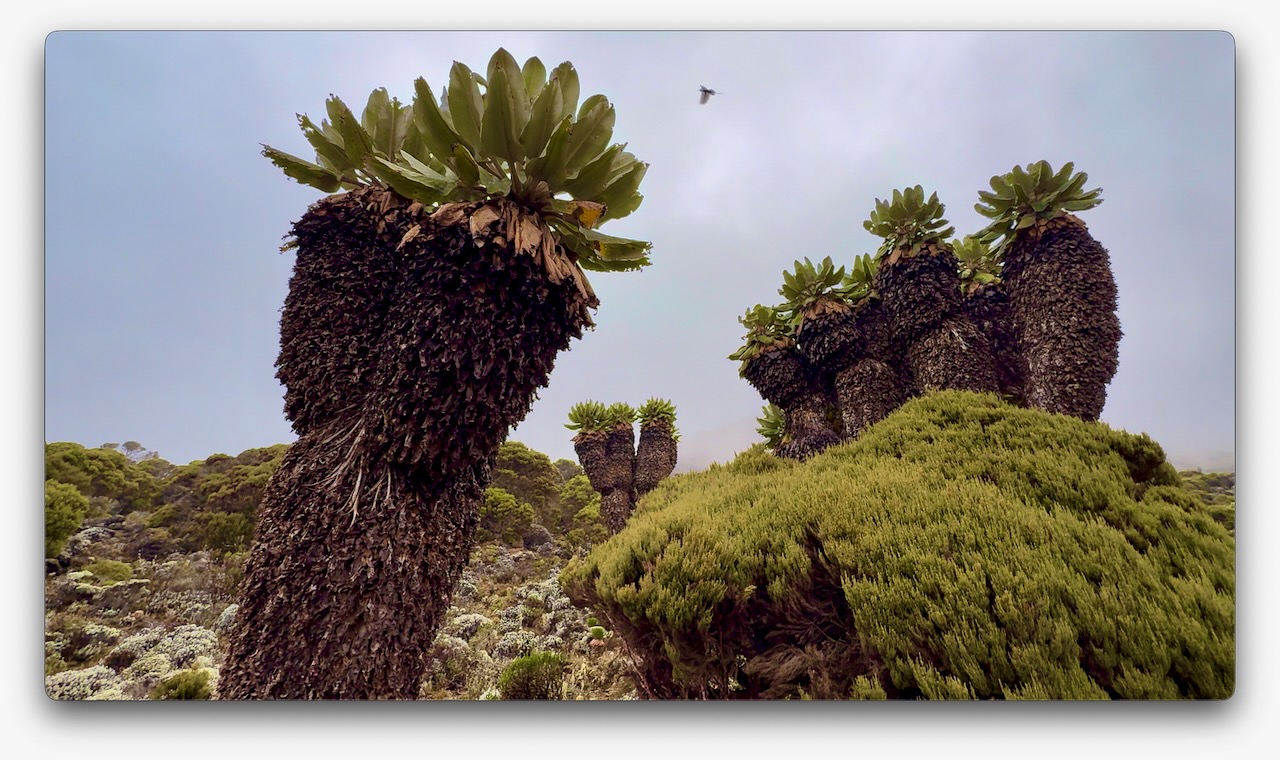
Vegetation was much more interesting as we climbed through so many different ecological zones.
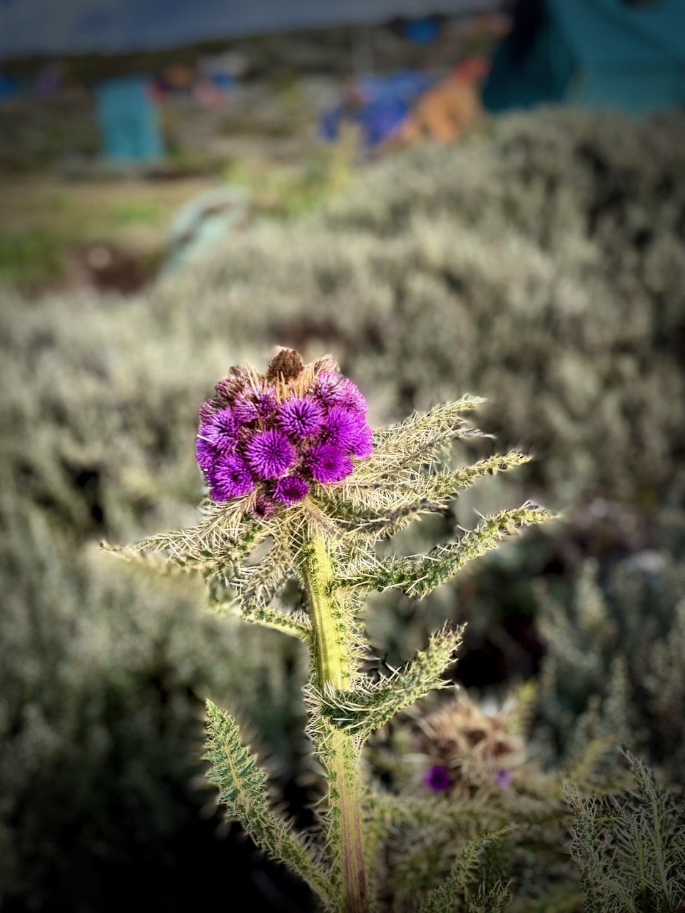
I do love thistles.
We had great views over to nearby Meru volcano. When you see hikers posed like this, you know they are searching for line-of-sight mobile phone reception. 😀
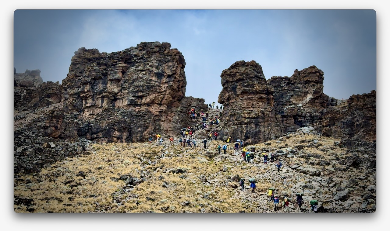
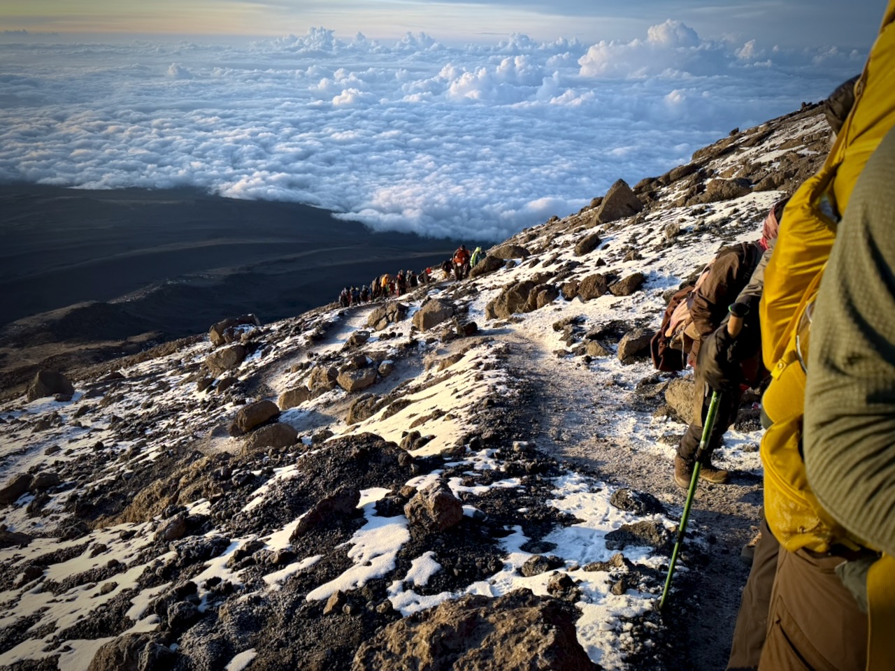
The Machame Route was crowded when I was there. We often had long lines of hikers & porters.
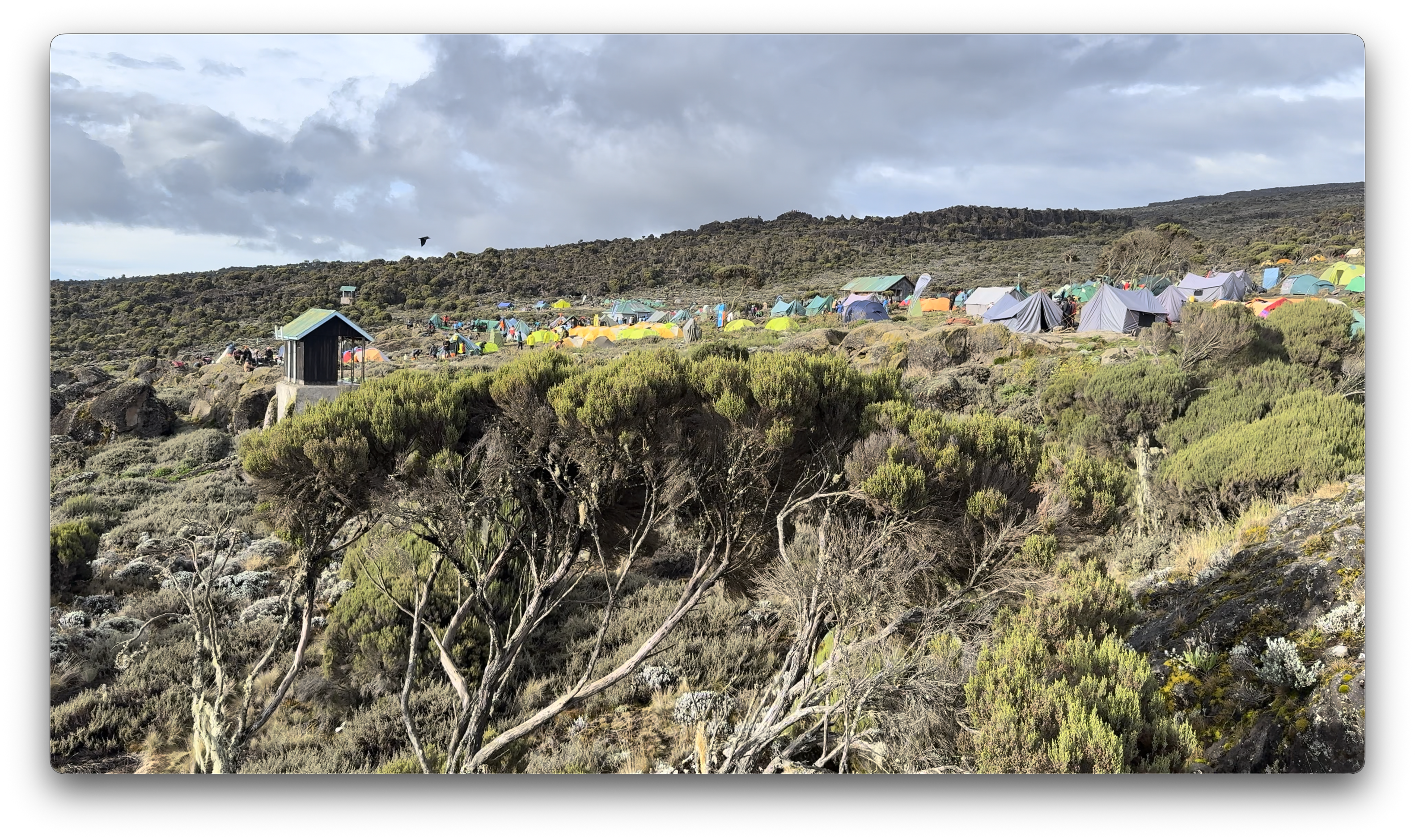
Camps are crowded and littered.
Personally, I felt the portable toilets provided weren’t great. I preferred squatting over a hole in the concrete in the permanent toilet buildings.
Hygiene is not top of mind for any of the guiding companies. In particular, I was surprised alcohol gel was not constantly provided.
That said, nobody in my group got sick from water or food.
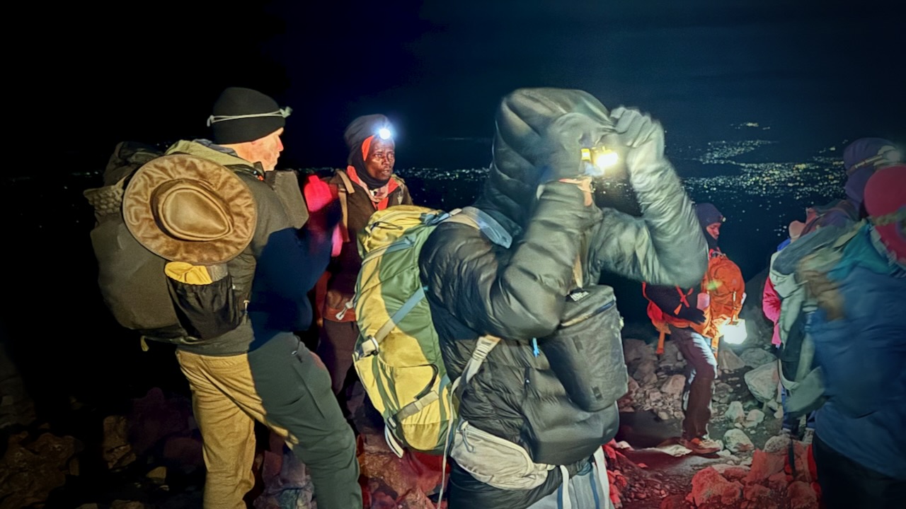
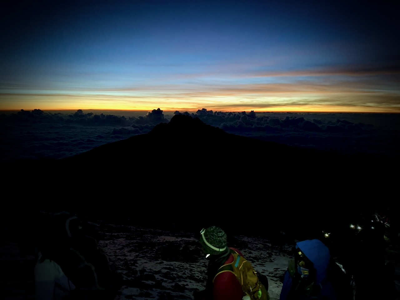
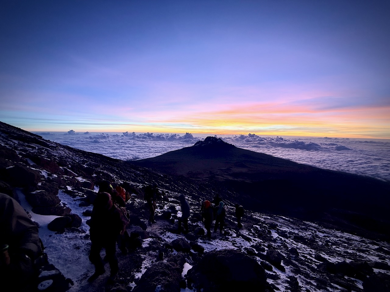
CRUX of Kilimanjaro is summit night. One of the toughest hiking days any of us could recall. I felt perfect. No pain. No problems … when starting.
Wake at midnight. Hot drinks 12:30pm. Start up at 1am.
It was a slow, cold trudge until dawn.
We had an ideal view of the changing light.
Way above the clouds.
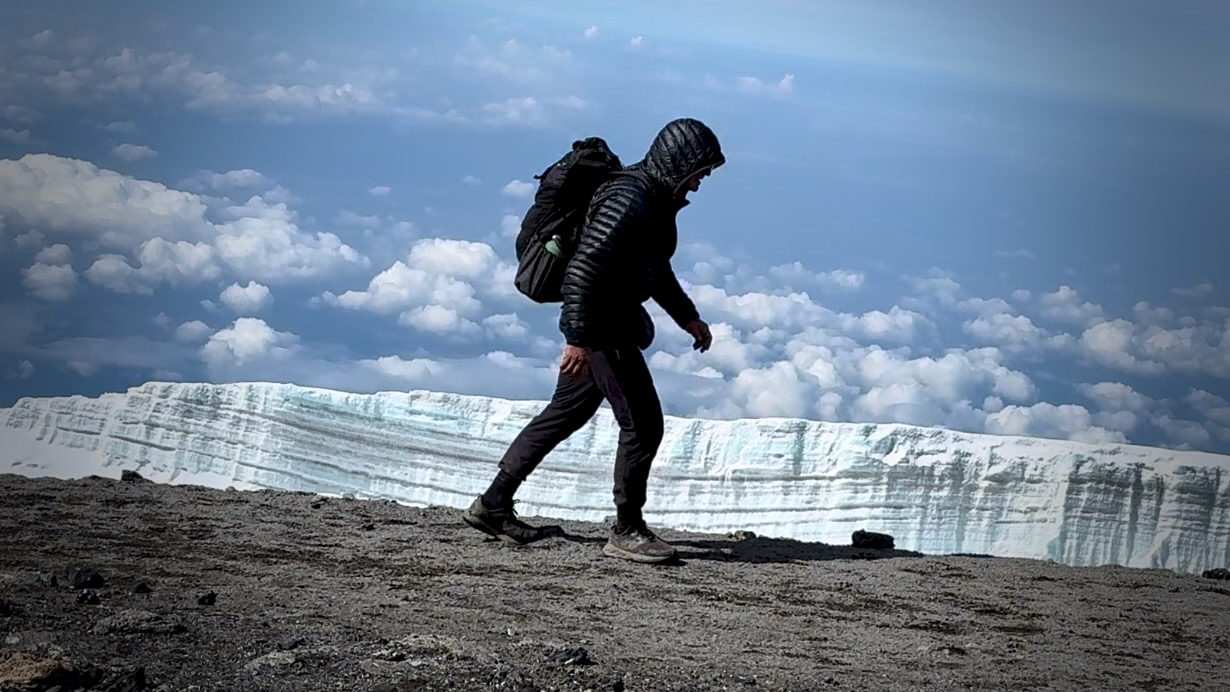
We finally reached the first summit peak. And on perhaps another 35 minutes to the highest peak.
I took a LOT of photos and video up there. Most impressive were the odd, receding glaciers.
That was the FUN part.
Guides hustled us down as quickly as possible to avoid altitude sickness. We climbed down 8000 feet, not getting into low camp until 6pm or so. I ascended & descended for 16 hours, grabbing 1 hour sleep around noon.
Sore knees. Sore toes. And cramping quads.
Highlight?
Most would agree that the porters, guides, and staff were the most impressive takeaway from this adventure. We probably had over 100 staff taking care of us over the week. And these folks will do positively anything you request.
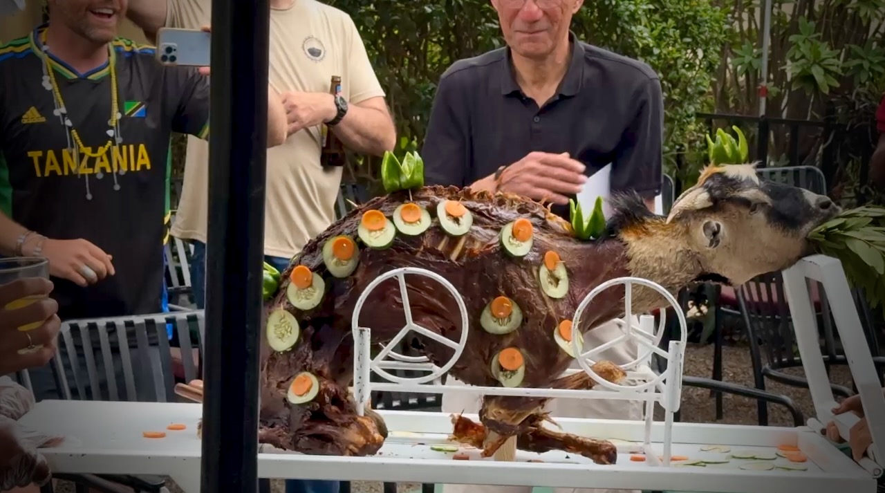
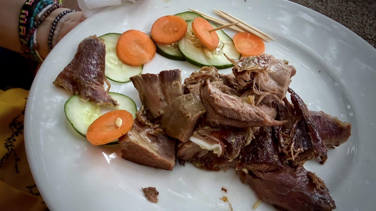
Back at the hotel, we celebrated with alcohol and devoured a full roast goat. Delicious.
A hiker died on Kilimanjaro while I was there. Reported heart attack.
On December 24, 2025, a rescue helicopter crashed, killing all 5 people on board. Two were hikers being evacuated.
10–20 deaths annually out of 30,000+ climbers.
I wrongly thought Kilimanjaro would be easy for me. It wasn’t.
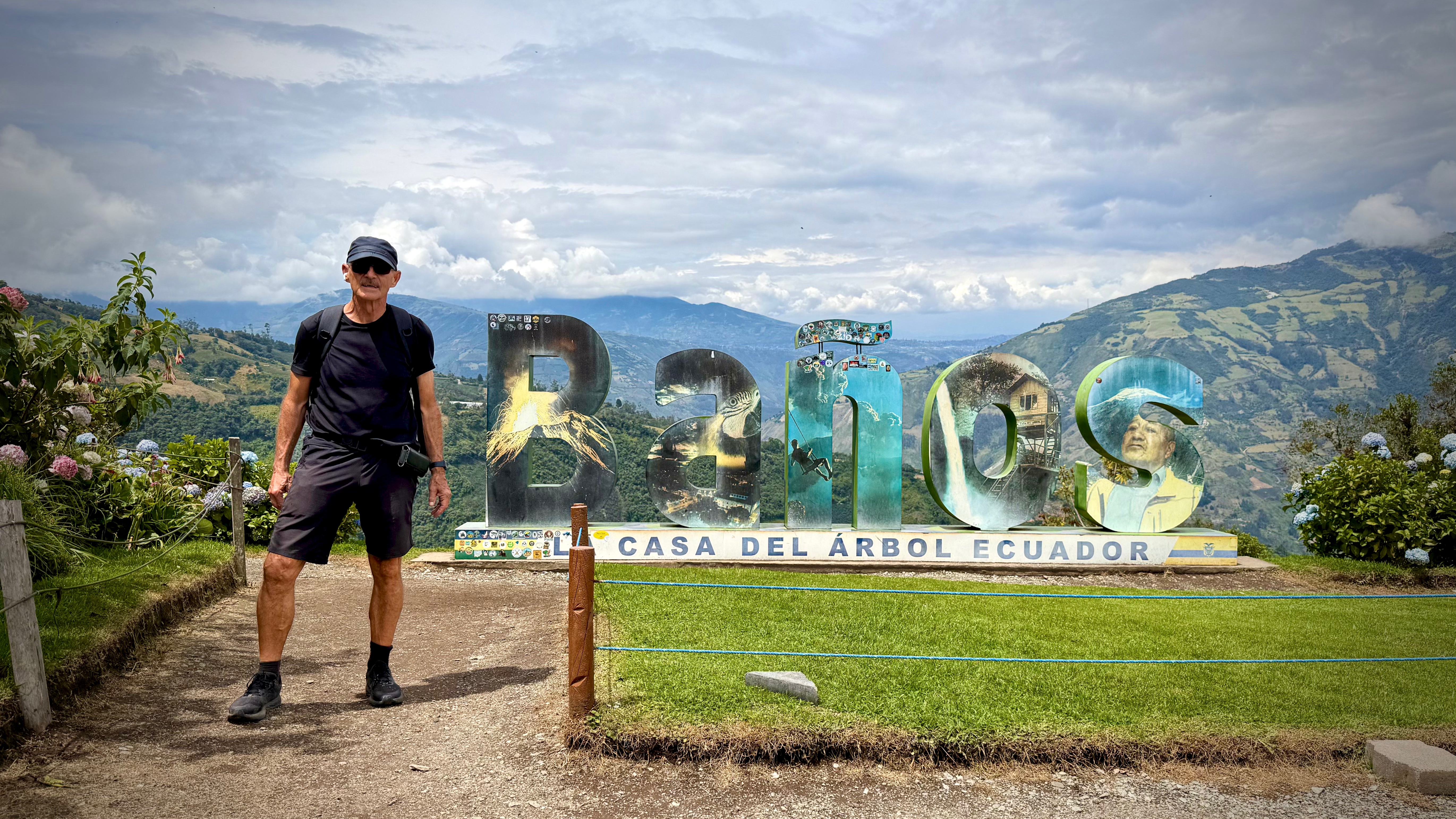
Baños de Agua Santa (Baños) is a small mountain town, the nation’s gateway to the Amazon. And legitimately touted the Adventure Capital of Ecuador.
Activities similar to what you are offered in New Zealand, but for 10% of the cost. There MIGHT be some compromises on safety and liability, however. 😀
I came for the hiking and cycling. And for altitude acclimatization. It’s at 1,820 metres (5,971 feet). Three weeks at altitude conditioning in preparation for Kilimanjaro up next.
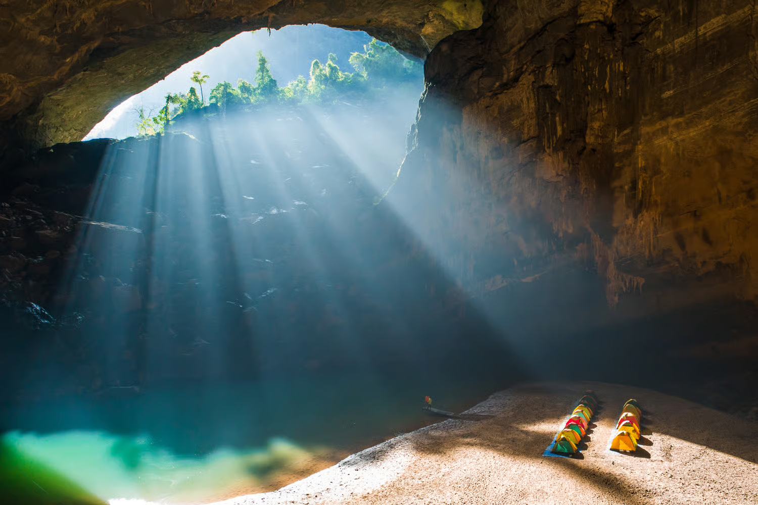
First explored in 1994, Hang En is now known to be the world’s third-biggest cave. …
First, you have to hike for a half day through the stunning Phong Nha Ke Bang national park. Then, you get to camp in tents set up inside the cave.
When you wake up, you’ll see the first sunlight beaming through the cave entrance.
Making it feel even more special is that the tours to Hang En are kept wonderfully small-scale; only one company is licensed to run expeditions there and they will only take one group of up to 12 people at a time. …
An excellent book. Even if you have no interest in hiking or pipelines. 😀
In fact, you won’t learn much about hiking. A thru hiker would not be impressed. Ken’s gear was too heavy. And he hiked the wrong months of the year.
Ken Ilgunas has a Masters in English from Duke. He’s a terrific writer.
This book has given me the best insight into how poor North American rural people think. An insight into why they vote for political Parties that make the rich richer, the poor poorer. Worse education and health care.
Children and grandchildren leave for big cities. Life is tough for those remaining.
Ken mostly sought out small town religious leaders, asking them for advice on where he could tent safely. He was astonished by the generosity of those spiritual leaders.
Ken worked as a backcountry ranger in Alaska. And was forced to take a job as dishwasher in a high Arctic oil camp.
Jobs there were high pay — very low quality of life.
Those arguing for the Petrotoxin industries usually shout JOBS, JOBS, JOBS. Ken came away thinking these were actually lousy jobs. High rates of alcoholism and drug abuse.
In September 2012, I stuck out my thumb in Denver, Colorado, and hitchhiked 1,500 miles north to the Alberta tar sands. After being duly appalled, I commenced my 1,700-mile hike south following the route of the proposed Keystone XL pipeline, from Alberta to the Texas Gulf Coast. It would become a 4.5 month journey across the Great Plains. To follow the pipe, I couldn’t take roads. I’d have to walk across fields, grasslands, and private property. I’d have to trespass across America.
The book is about my journey–fleeing from cows, taking cover from gunfire, and keeping warm on a very wintry and questionably-timed hike. But it’s also about coming to terms with climate change and figuring out what our role as individuals should be in confronting something so big and so out of our hands. It’s about taking a few months of your life to look at your country from a new perspective. Ultimately, it’s about embracing the belief that a life lived not half wild is a life only half lived.
Most of the folks he met were supportive of Keystone XL Phase IV— but over the months Ken didn’t come away with even one good argument in support of the project.
Few jobs. Short term jobs. MOST of the money kept by the corporation, not those people who had dirty oil flowing over their property.
Most of the dirty Canadian oil is shipped overseas.
There are plenty of pipelines in North America. If you must ship Petrotoxins, pipelines are likely the least terrible way.
But Keystone XL became symbolic of the debate over how to slow or reverse climate change.