Alexandra penned Kilimanjaro Uncovered in real time while preparing and during her climb on the Northern Circuit, a little-known hiking route away from the crowds to the top of Kilimanjaro.
She provides valuable guidance for those interested in climbing themselves and tells a broader story of a truly life-changing experience.
Alex is a rookie mountain climber. She over-prepares. Is cautious and thoughtful about every aspect.
The book is very informative for anyone who has never done a serious multi-night tent trip.
I admire her courage in planning that big adventure on her own. I admire her honesty and vulnerability sharing fears and problems on the trek, big and small.
Alexandra Tanbai made the summit. In fact everyone in her guided party made the top though one had a serious ankle injury. No helicopter was available for evacuation.
Less than a year after publishing Kilimanjaro Uncovered, Alexandra founded KiliGATE.com—the first and only online Kilimanjaro tour booking platform committed to responsible tourism.
Her goal—make it easy for tourists to book their climb with a responsible tour operator and promote fair porter treatment.
He hopes to publish February 2019 to get the information out for next season.
As Skurka has envisioned it, the YHR forms a figure-eight from Dorothy Lake Pass in the north, pinching in the middle at Tuolomne Meadows, and extending as far south as the area surrounding Rodgers Peak, not far from Mt. Lyell. …
What are your favorite sections?
The “good stuff” on the Yosemite High Route runs south from Grace Meadow in upper Falls Creek and ends at Quartzite Peak at the northern end of the Clark Range. All the miles between these two points are world-class. You can’t go wrong. …
Louis-Phillipe Loncke …. This was an epic journey that left him exhausted, pushed to his limits, and 15 kg (33 pounds) lighter than when he set off.
The video below is from a new report aired in Australia that caught up with the Belgian adventurer just as he was crossing the finish line, providing some insights into what this journey was like. …
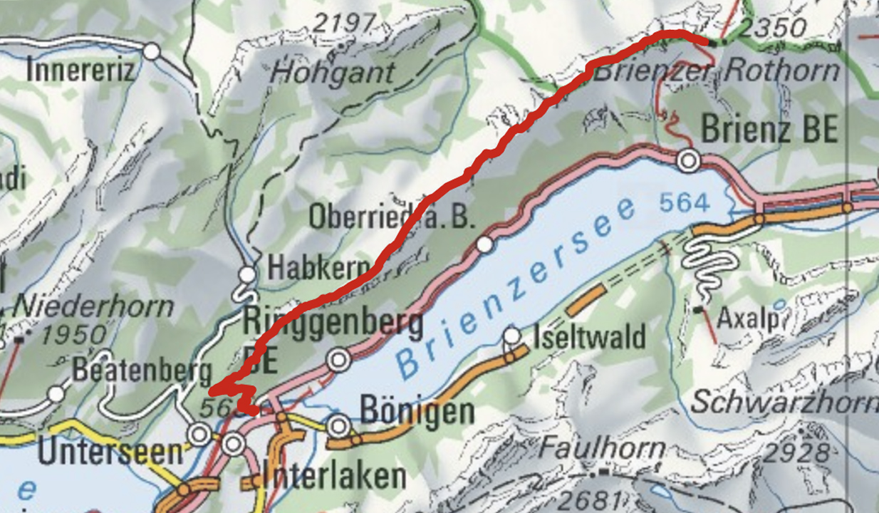
Brienz to Interlaken with rail assistance getting up to and descending from the ridge
Don’t hike the other direction. Logistics are easier starting in Brienz. And it’s safer as the last 2 hours (when your legs are tired) is on easier trails.
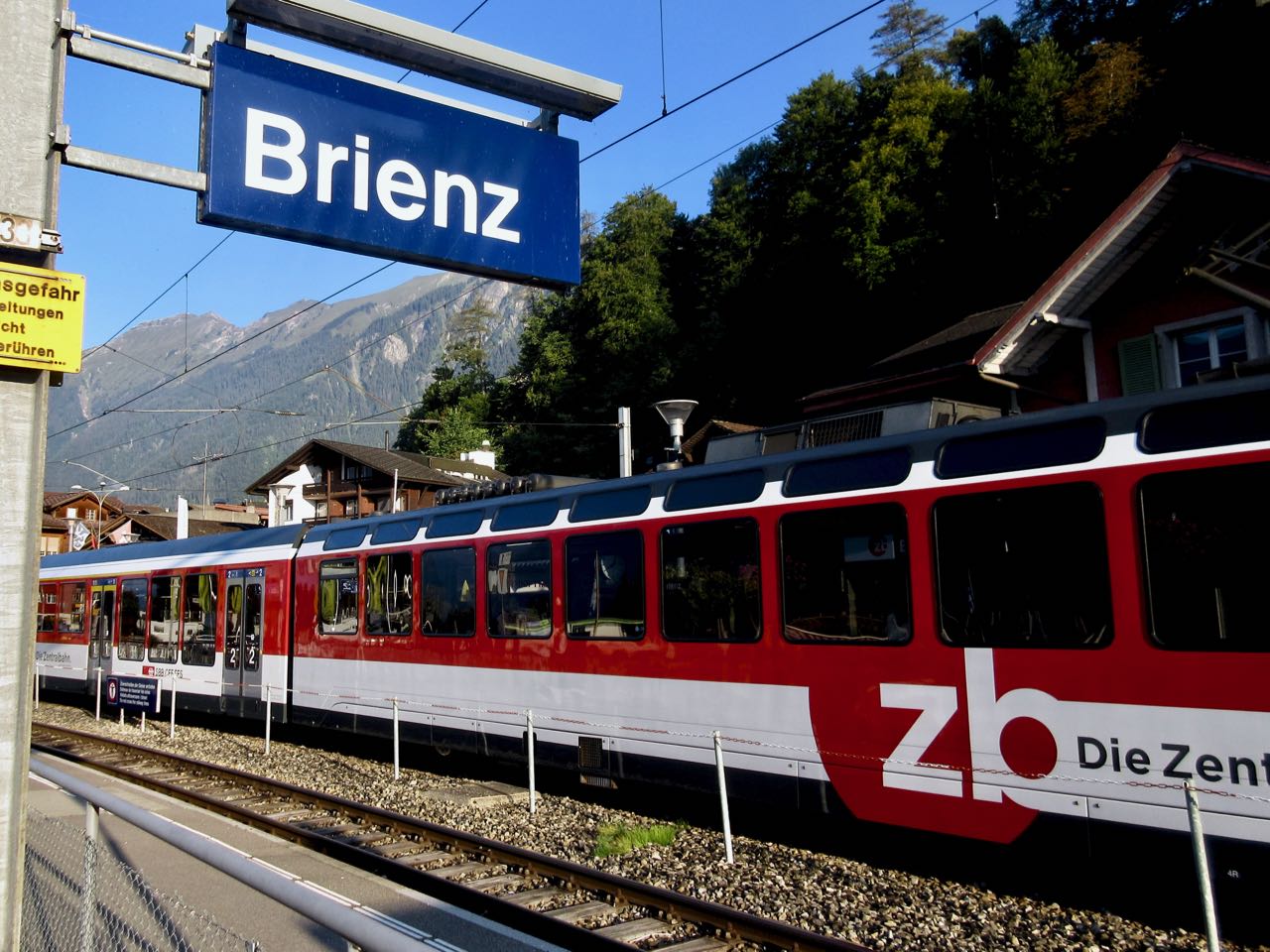
I got up early in Interlaken, ready for my free hostel breakfast starting 7am.
Every half hour a train runs from Interlaken to Brienz for 8.20 francs (2018).
Happily I made the first steam train — 8:36am — from Brienz to Brienzer Rothorn Station. It’s been making this run since 1891.
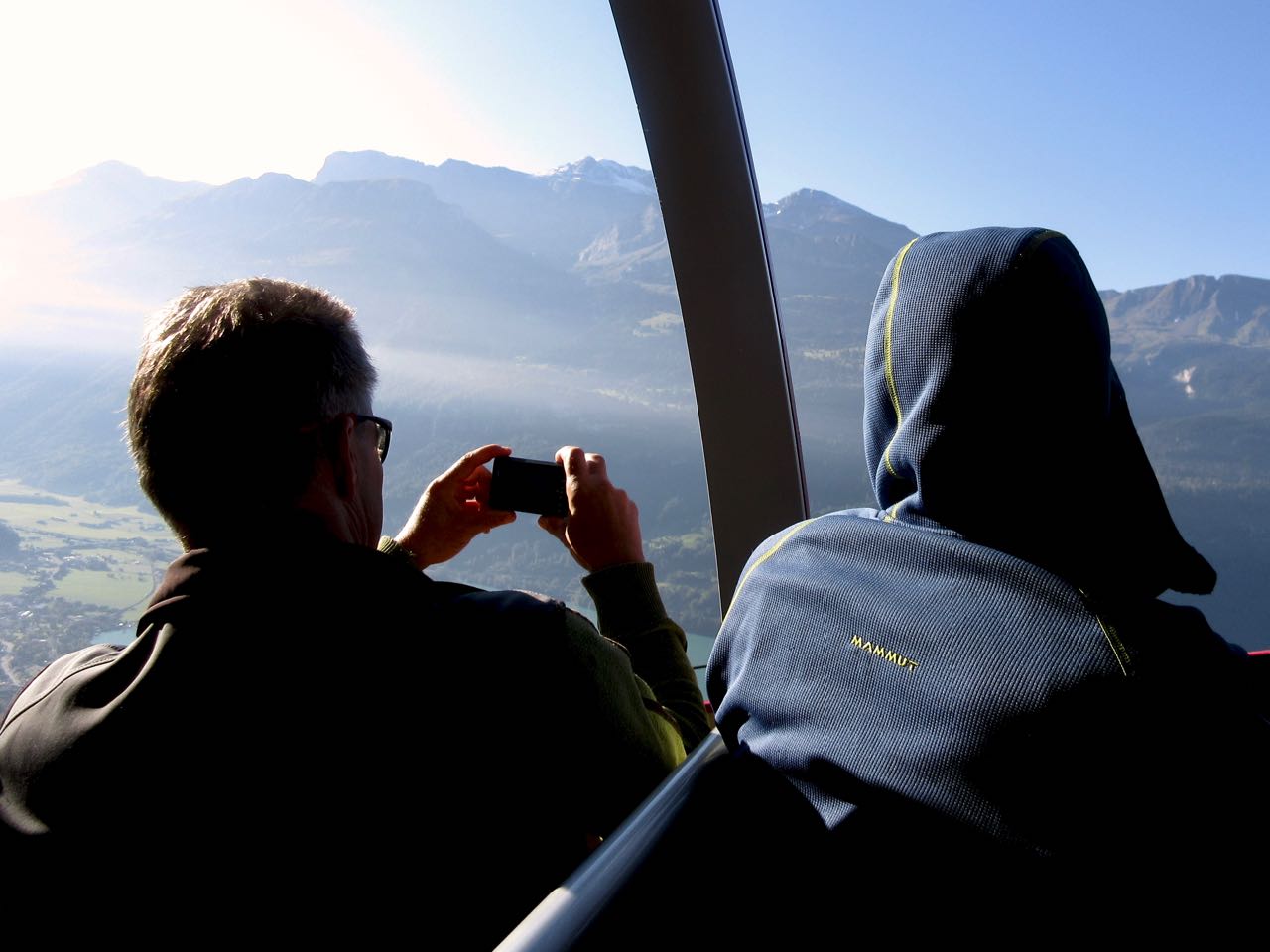
Price is reduced to 28 francs for the first train (2018) to encourage folks to get as early a start as possible on their hike.
At 9km / hour it takes an hour to get to the top of the ridge 2351m.
If clear, you can enjoy distant views over to Jungfrau highest peaks; the Eiger, Mönch, Jungfrau, Schreckhorn, Finsteraarhorn.
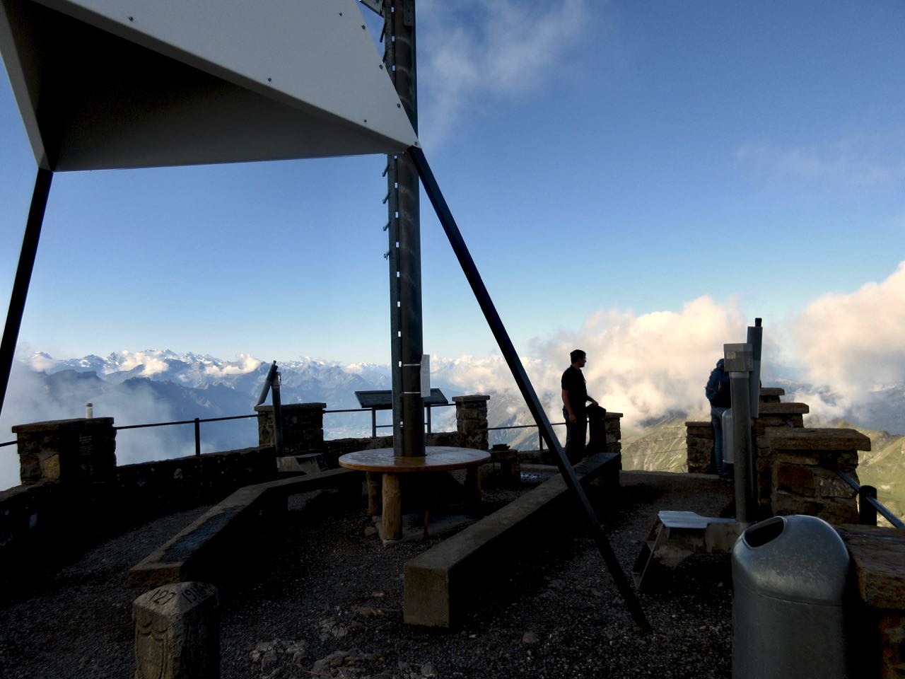
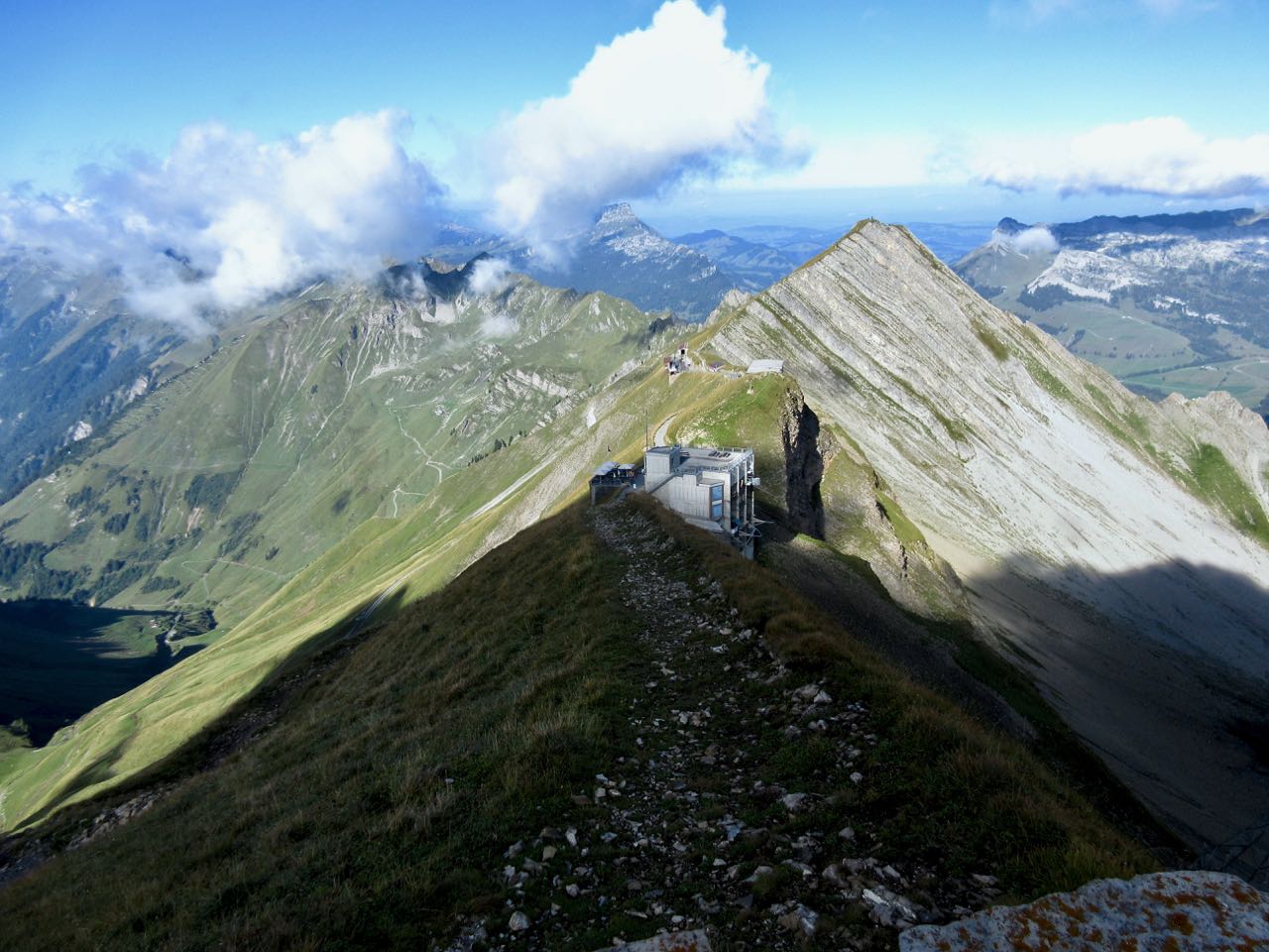
I climbed up to the viewpoint. This is as far as most tourists hike.
Looking down on Brienzer Rothorn Station.
At 10am I started to walk back to Interlaken. I would have about 11.5 hours to make the last teleferico down from Harder Kulm Restaurant. Otherwise I’d have to walk down in the dark.
You can’t really get lost. Follow the ridge no matter what.
The weather was perfect.
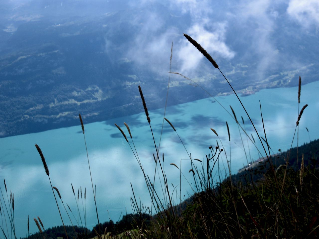
You have Brienz lake on one side …
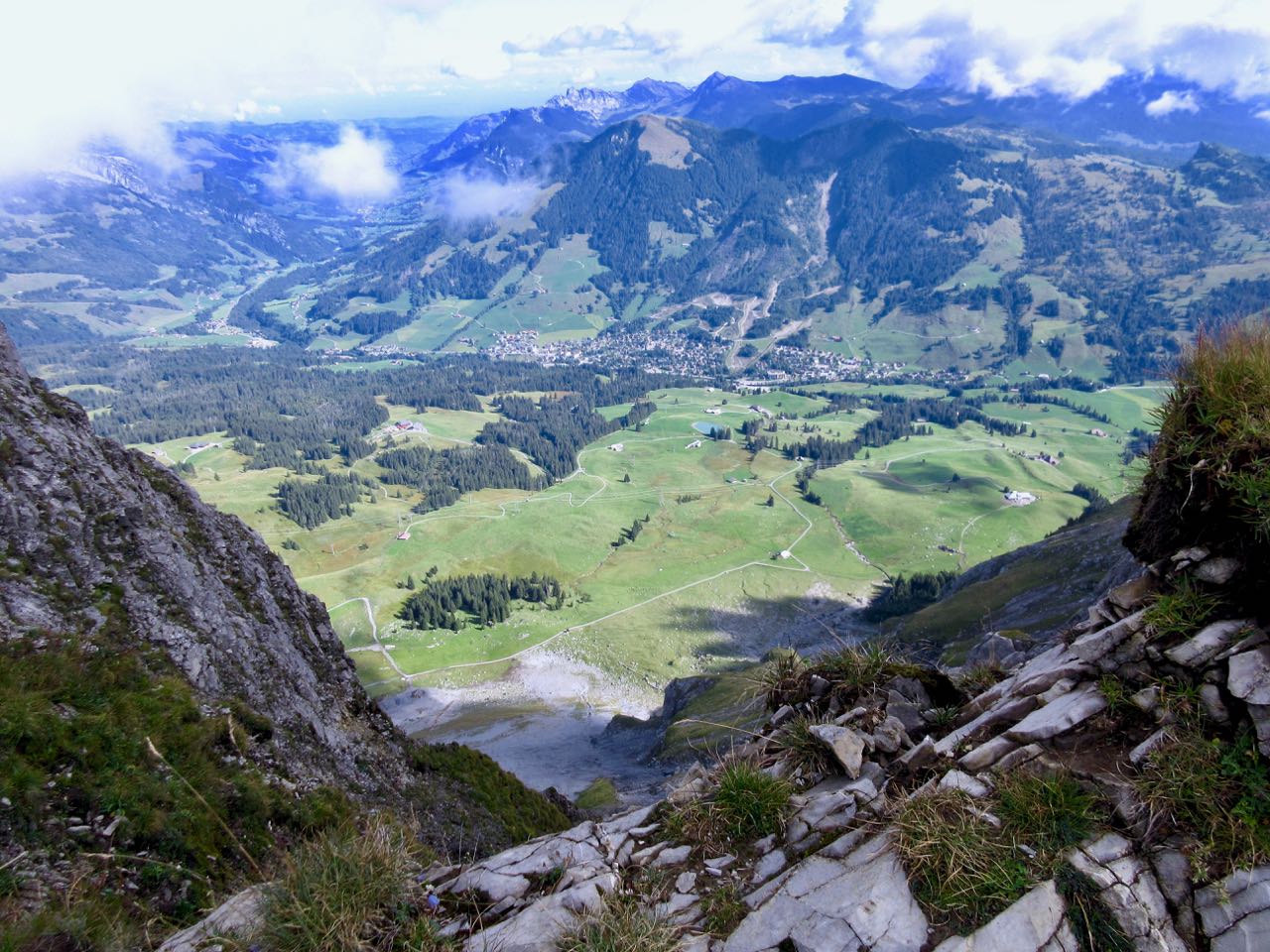
… and Swiss foothills on the other.
I loved it instantly.
Most of the time the ridge is not all that intimidating.
It often looks worse than it turns out to be.
I’d heard everyone who comes up here sees ibex. … Are these ibex?
This adventure is more popular with trail runners than with hikers as they can easily make it in less than 10 hours.
I took very few breaks. Other than checking the GPS on my phone, I had no idea whether I was moving quickly enough to finish in time.
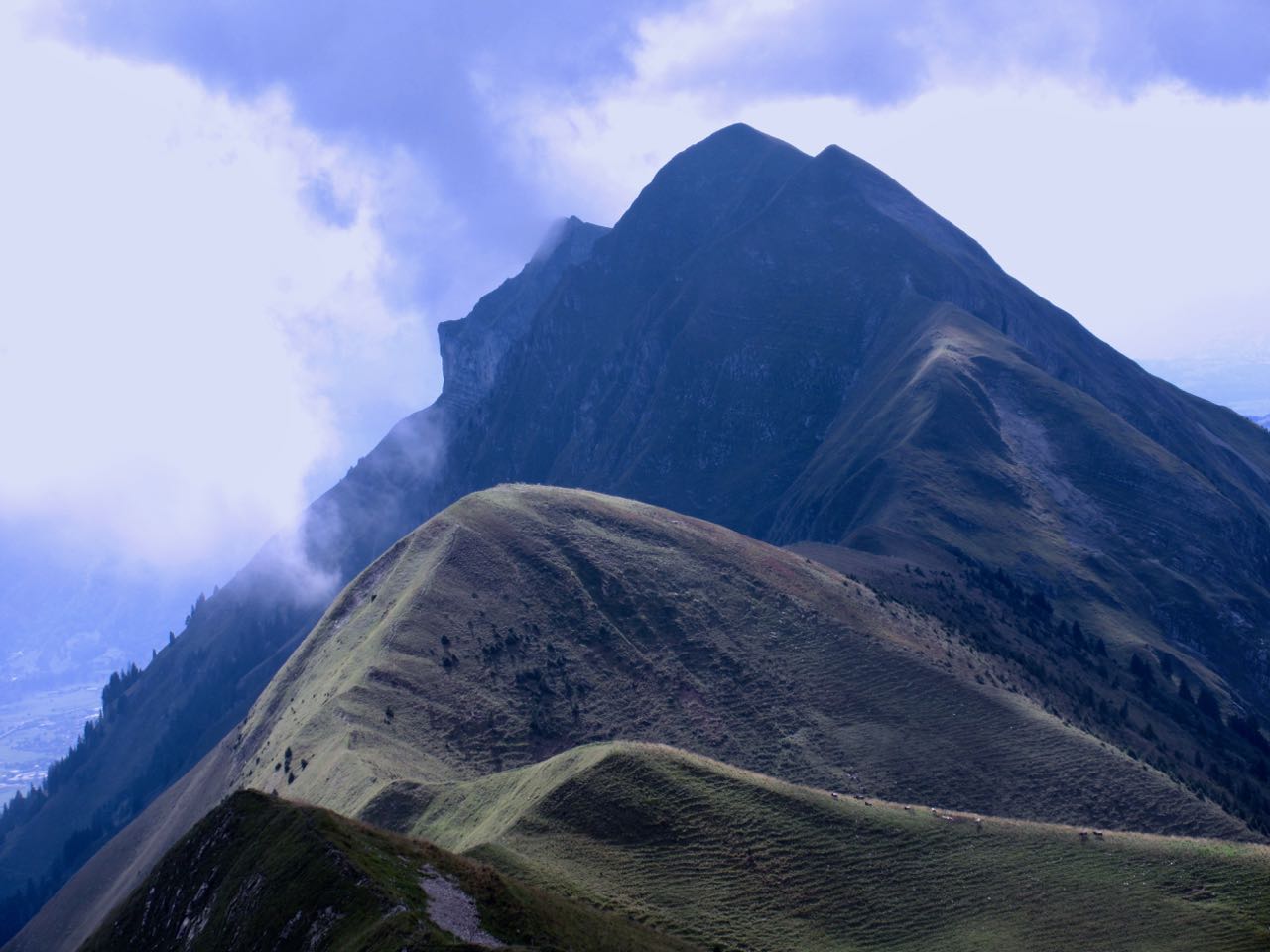
Each time I’d climb a high point on the ridge, even higher points would come into view.
I don’t think I saw another person over the first 5 hours.
Sadly I seemed to be a lot closer to Brienz than Interlaken.
There are sections with stairs, cable and chain assistance. These would be most useful when down climbing in wet conditions.
Hmm … I might finally be past half way.
I tried to quicken my pace on the easiest sections.
There are many more day hikers on the Interlaken end of the ridge. They assured me I’d make it on time.
Interlaken
The last 2 hours stays on the ridge, but you are mostly in the trees. It was the least interesting section … but I was pleased to have less exposure as my legs got tired.
Here it is at last. Harder Kulm Restaurant.
The last funicular descends at 9:10pm. If it’s busy they may run until 9:40pm.
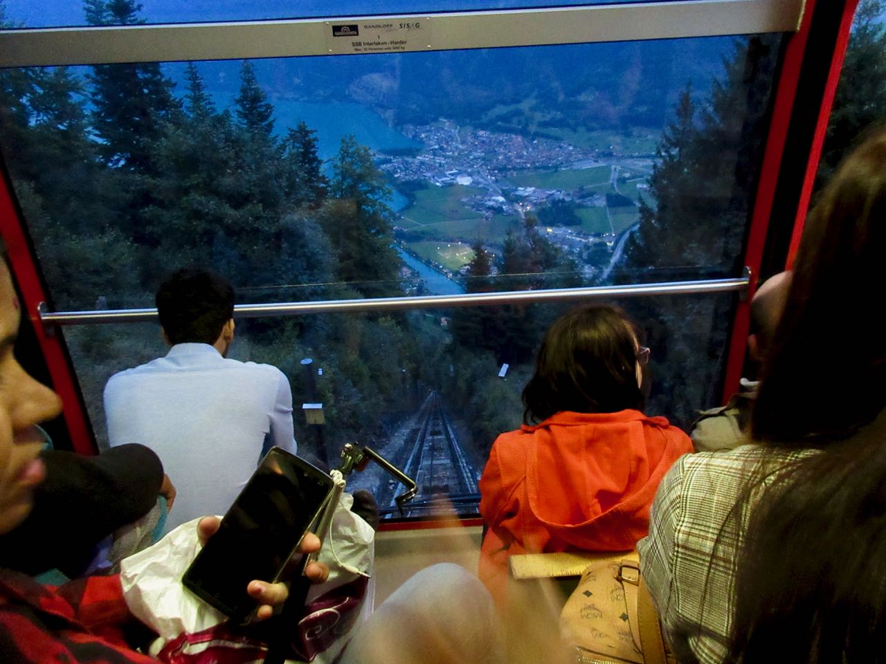
I gladly paid 16 francs and found the short trip down very interesting.
It was dark by the time we arrived Interlaken.
And I was quite dehydrated. I’d brought only 1.5 litres with me. I could have used about 3 litres.
When I got back to the hostel I announced it was the best day hike of my life.
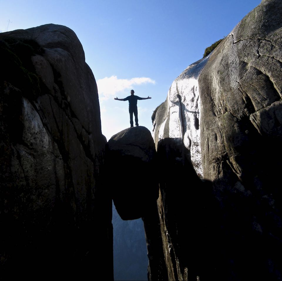
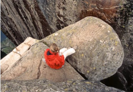
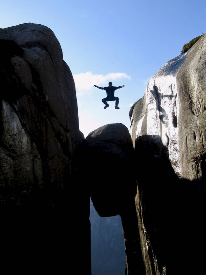
Every hiker has seen photos of the boulderwedged into a Kjerag mountain crevasse above a Norwegian fjord.
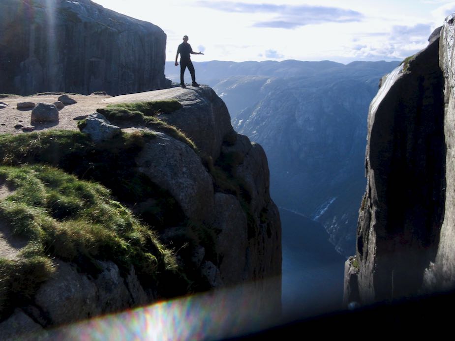
That’s 984m (3,228ft) high. It’s a popular site for BASE jumping.
A Russian BASE jumper was walking up at the same time as myself — some like to jump close to sunset — but he kept climbing past this spot to something more exciting.
I’d never heard it was a tough hike to get there.
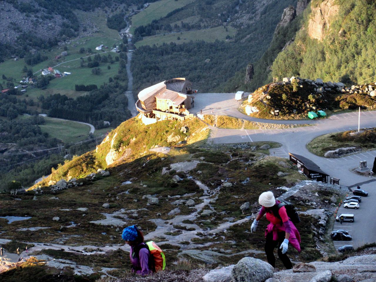
Here’s the start of the easiest ascent from Øygardsstølen visitors center.
It’s 4-6 hour return over beautiful rocky terrain. Some scrambling. Very slippery. There are plenty of chain assists. I used many of them even in dry weather.
By comparison I would say this is much more challenging than Half Dome in Yosemite. And there are all kinds of inexperienced tourists with poor footwear.
… is a platform that allows you to connect with others, raise money as you go, and tell your story as it unfolds. It’s a new way to share fieldwork, projects, and expeditions of all sizes …
It’s for everyone: university researchers to citizen scientists, students to professional explorers …
Each entry on Open Explorer is a geotagged timeline that documents a given expedition in text, photos and video.
There are over 460 Adventures as I post.
You can sort by POPULARITY, ACTIVITY, or MOST RECENT.
One example – New England Explorers:
… search for lost Historic location buried in the forests and waters of New England.
Currently we are focusing on the shipwreck graveyards in Narragansett Bay. Narragansett Bay has more shipwrecks per square mile than any other state.
Over 2,000 wrecks, including colonial trading ships, ships of war, and luxury passenger vessels from the 19th century, can be found in its waters. …