Kraig Adams – September 2025 – 75 miles hut to hut alone on the Alta Via 1 in the Dolomites of Italy.
In and out of Venice airport.
Click PLAY or watch it on YouTube.


Best hikes, treks, tramps in the world.
Kraig Adams – September 2025 – 75 miles hut to hut alone on the Alta Via 1 in the Dolomites of Italy.
In and out of Venice airport.
Click PLAY or watch it on YouTube.
Also known as the Karnischer Höhenweg, (KHW 403) or Via della Pace, the Carnic Peace Trail is is a historic 150-kilometer (93-mile) long-distance hiking route following the former World War I frontline along the Austrian-Italian border.
It’s one of those European hut-to-hut only hikes, so buy the guidebook and book months in advance.
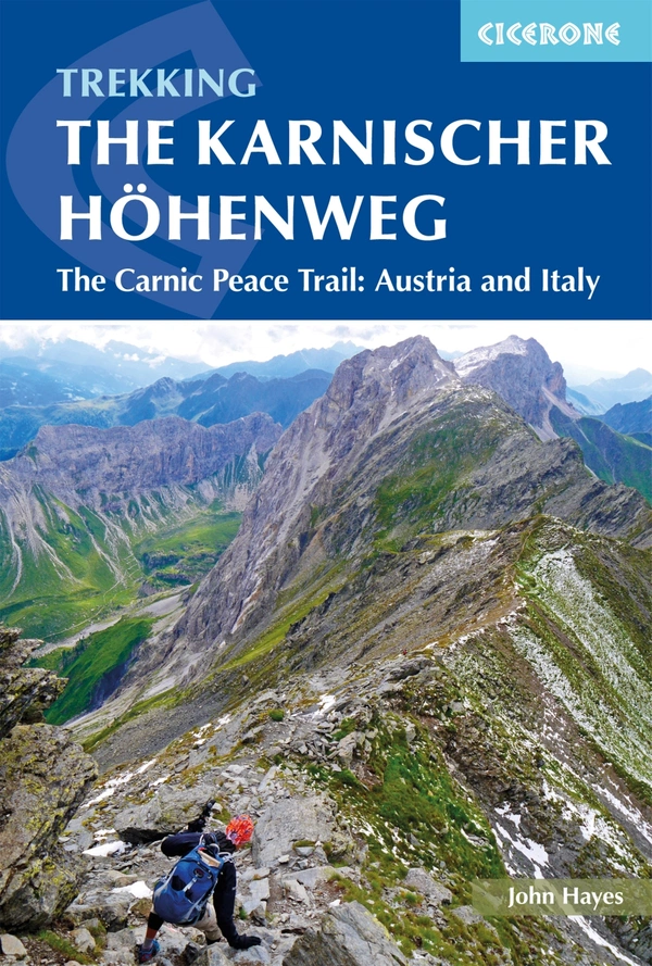
If you opt to do the entire thing, it 170km (106 miles) along the crest of the Carnic Alps, this dramatic high-level trail combines panoramic summits, wartime history and classic alpine hut-to-hut trekking across a landscape shaped by geology and conflict.
There are some challenging sections.
Click PLAY or watch it on YouTube.
BestHike editor Rick McCharles
I’m finally booked for Peaks of the Balkans starting Sept. 5, 2026.
In the Accursed Mountains, crossing between Albania, Kosovo, and Montenegro.
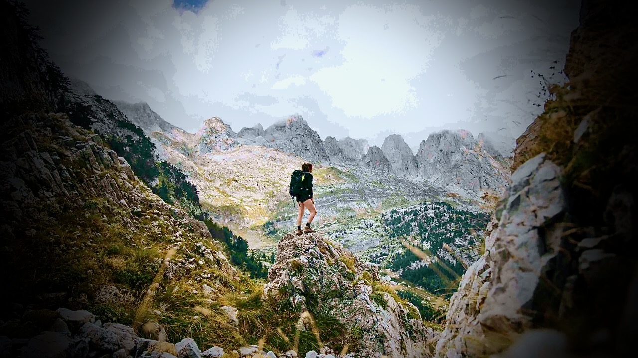
Originally I wanted to do it independently, like my hero Cam Honan.
A Quick & Dirty Guide to the Peaks of the Balkans Trail
The most traveled hiker in the world, even Cam had to hire local tour operator, Albanian-based Zbulo.org, to arrange their cross-border permits.
It sounded too complicated to me.
SO I signed on with a guided tour with TRAVELBASE.
5-day highlights of the longer circuit. Still crossing between Albania, Kosovo, and Montenegro. They call it Balkans Trail, a section of the Peaks of the Balkans.
I’ll carry my own pack. Sleep in my own tent. But enjoy meals provided by my Dutch guides.
Click PLAY or watch highlights on YouTube.
A popular day hike is around Morskie Oko, the largest lake in the Polish Tatra Mountains. It is an easy trail, abundant in beautiful views and extremely varied.

AllTrails – Morskie Oko Loop
Getting to the lake is easy via a paved pathway. It’s about 9km return to the lake.
You don’t need your own vehicle as there are frequent private minibuses from the town of Zakopane. Getting to Zakopane from Kraków is 2-3 hours by bus or train.
Once at the lake, it’s another 3.9 km to add the shoreline loop walk. Unlike the smooth, paved access road you take to get to the lake, this loop is a proper mountain trail made of large, irregular stone blocks, boulders, and tree roots.
Click PLAY or watch it on YouTube.
Guest post by Mohan Raj Bhandari of North Nepal Travel & Trek
I have guided treks in Nepal since 2015, and the two questions I hear most from first-time visitors are “where is Mount Everest, exactly?” and “should I trek to Everest Base Camp or somewhere else?”
The first has a short answer.
The second one deserves an honest comparison, because every year I meet trekkers on the wrong trail: fit hikers bored on gentle routes, and office workers gasping their way toward passes they had no business attempting on a nine-day holiday.
So here is both answers, from someone who walks these trails for a living.
Mount Everest sits on the border between Nepal and Tibet (China), in the Mahalangur section of the Himalayas, at 27.9881° N, 86.9250° E. The summit ridge itself is the border: the south side is Nepal’s Sagarmatha National Park, the north side is Tibet.
Nepalis call the mountain Sagarmatha; Tibetans call it Chomolungma.
Almost everyone who treks to Everest goes via Nepal. You fly from Kathmandu to Lukla, a 20-minute flight onto a runway built on a slope, then walk for about eight days to reach base camp. There is no road. Everything you eat above Lukla arrived on the back of a porter, a mule, or a yak, which explains why a bottle of Coke costs five times more at 5,000 metres than in Kathmandu.
One fact that surprises people: you cannot see Everest’s summit from Everest Base Camp. Nuptse’s wall blocks the view. For the classic photograph you climb Kala Patthar, a brown hill above Gorak Shep, at 5,545 metres, usually at 5 a.m. in a wind that goes through every layer you own.

Everest Base Camp sits at 5,364 metres (17,598 feet) on the Khumbu Glacier. The standard trek takes 12 days round trip from Lukla, sleeping in teahouses: plywood rooms, thick blankets, a stove in the dining room burning yak dung, and dal bhat twice a day.

The trail is not technical. The difficulty is entirely the altitude: at base camp the air carries roughly half the oxygen of sea level. Most people who fail on this trek fail because they climbed too fast, not because they were unfit. I have watched marathon runners turn back at Dingboche while retirees walked in comfortably, simply because the retirees followed the acclimatization schedule and the runners treated it as a race. If you are considering this trek, read up on how the altitude actually works before you book anything; we published a detailed Everest Base Camp altitude and acclimatization guide that covers the schedules and warning signs.
Who it suits: people who want the name, the Khumbu’s Sherpa villages and monasteries, and don’t mind sharing the trail. In October you will queue at the suspension bridges.
If the crowds put you off, the Gokyo Lakes route branches west from the main EBC trail into a valley of six glacial lakes between 4,700 and 5,000 metres. The water is a blue that looks fake in photographs. From Gokyo Ri at 5,357 metres you see four 8,000-metre peaks in one turn of the head: Everest, Lhotse, Makalu, Cho Oyu. I think it is a better viewpoint than Kala Patthar, and you will share it with a tenth of the people.
The Three Passes trek connects Gokyo, base camp and the Chhukhung valley over Renjo La, Cho La and Kongma La, all above 5,300 metres. It takes 17 to 18 days and it is the hardest teahouse trek in the Everest region. Do not make it your first Himalayan trek.
Annapurna Base Camp (locals just say ABC) sits at 4,130 metres, a full 1,200 metres lower than EBC, which changes everything: shorter itinerary, warmer nights, gentler acclimatization. From Pokhara you can walk to ABC and back in 5 to 7 days through rhododendron forest and the stone-staircase villages of Chhomrong and Sinuwa. The camp itself sits inside a ring of peaks, with Annapurna I (8,091 m) and Machhapuchhre standing over your breakfast.
Most people don’t know there is a second base camp on the mountain’s north side, the historic route of the 1950 French expedition. The North Annapurna Base Camp route takes about five days, sees a fraction of ABC’s traffic, and passes hot springs at the trail’s start. We guide both; I send people north when they tell me they want mountains without a queue.
The Annapurna Circuit is a different kind of trek: instead of walking to a point and back, you walk around the entire Annapurna massif, crossing Thorong La pass at 5,416 metres, higher than Everest Base Camp. The classic route takes 10 to 12 days now that roads have shortened both ends.
The reason the Circuit endures is variety. You start in rice terraces, climb through pine forest, and end in a high desert that looks like Ladakh. The village of Manang, at 3,519 metres, is where everyone takes an acclimatization day: bakeries selling sea-buckthorn juice and apple pie, a small clinic run by the Himalayan Rescue Association giving free altitude talks at 3 p.m., and day hikes to Ice Lake that prepare your body for the pass. Crossing Thorong La starts around 4 a.m. and hurts. Then you descend to Muktinath temple and the windblown Kali Gandaki valley, and it’s done.
Not everyone has two weeks. The Mardi Himal trek climbs a forested ridge directly above Pokhara to a high camp at 3,580 metres and a viewpoint at 4,500, staring straight into Machhapuchhre’s fishtail summit. Five to seven days, quiet trails, and in spring the entire ridge flowers red with rhododendron. It has become my standard recommendation for first-time trekkers.
Ghorepani Poon Hill is shorter still, 3 to 4 days, topping out at 3,210 metres. The price of admission is the stone staircase at Ulleri, roughly 3,300 steps that will introduce you to muscles you forgot. The reward is the sunrise from Poon Hill, when Dhaulagiri and the Annapurnas turn orange in sequence. Yes, there will be a crowd at the top with camera phones. It is still worth it.
The Manaslu Circuit is what the Annapurna Circuit was thirty years ago. It loops around Manaslu, the world’s eighth-highest mountain, crossing Larkya La at 5,106 metres, through villages where Tibetan Buddhism is not a decoration but the daily schedule. It is a restricted area: you need a special permit and a licensed guide, and you must be a group of at least two trekkers. That paperwork keeps the numbers low. On a November morning below Samagaon I have walked two hours without meeting another foreigner.
Add the Tsum Valley and you get a side trip into a hidden Buddhist valley that only opened to outsiders in 2008, with nunneries, mani walls, and a customary ban on animal slaughter. The full Manaslu Circuit itinerary runs about 11 days; with Tsum it stretches to 18.
Upper Mustang is the odd one out: a high-altitude desert in the Himalayan rain shadow, so you can trek it in monsoon season when every other trail drips. The route follows the old salt-trade corridor up the Kali Gandaki to Lo Manthang, a walled city of whitewashed houses and 15th-century monasteries near the Tibetan border. The landscape is eroded red and grey cliffs pocked with cave dwellings. The permit costs US$500 for ten days, which filters the crowds better than any distance could.
| Trek | Days | Max elevation | Difficulty | Best for |
| Everest Base Camp | 12–14 | 5,545 m (Kala Patthar) | Hard (altitude) | The classic; Sherpa culture |
| Gokyo Lakes | 11–12 | 5,357 m (Gokyo Ri) | Hard | EBC views, fewer people |
| Three Passes | 17–18 | 5,535 m (Kongma La) | Very hard | Experienced trekkers |
| Annapurna Base Camp | 5–7 | 4,130 m | Moderate | Big mountains, short leave |
| Annapurna Circuit | 10–12 | 5,416 m (Thorong La) | Hard | Variety, teahouse culture |
| Mardi Himal | 5–7 | 4,500 m | Moderate | First Himalayan trek |
| Ghorepani Poon Hill | 3–4 | 3,210 m | Easy–moderate | Families, tight schedules |
| Manaslu Circuit (+Tsum) | 11–18 | 5,106 m (Larkya La) | Hard | Solitude, Tibetan culture |
| Upper Mustang | 10–12 | 3,840 m | Moderate | Monsoon season, desert landscapes |
Ask yourself three questions. How many days do you really have, counting the two buffer days every Himalayan itinerary needs for weather? Have you slept above 4,000 metres before, and how did it go? And do you want the famous trail or the quiet one?
If you have two weeks and want the name: Everest Base Camp, done slowly. Ten days and you want variety: the Annapurna Circuit. A week: ABC or Mardi Himal. If you have trekked before and want Nepal as it used to be: Manaslu. And if someone tells you a trek is “easy,” check what altitude they sleep at before believing them. The mountain does not care about anyone’s marketing.
Mohan Raj Bhandari is the founder and lead guide of North Nepal Travel & Trek, a guide-owned trekking company in Pokhara, Nepal. His team has guided the Annapurna, Everest and Manaslu regions since 2015 and publishes weekly trail-condition updates from its own treks.
It’s only 6 km into Gwillim Lakes in small Valhalla Provincial Park — if you can get to the trailhead.
The nearest towns of note are Nelson and Castlegar.
… there are three separate camping spots Drinnon Lake, Drinnon Pass, and the most beautiful one of all – Gwillim Lakes (free, 1st come, 1st served).
At Gwillim Lakes I counted at least 13 tent pads …
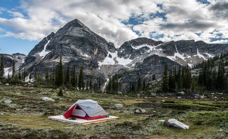
In many ways the crux of the hike is getting to the Drinnon Pass – Gwillim Lakes trailhead. I was ready to give up on account of the road in – though John was definitely not. The rough road is both a blessing and a curse. …
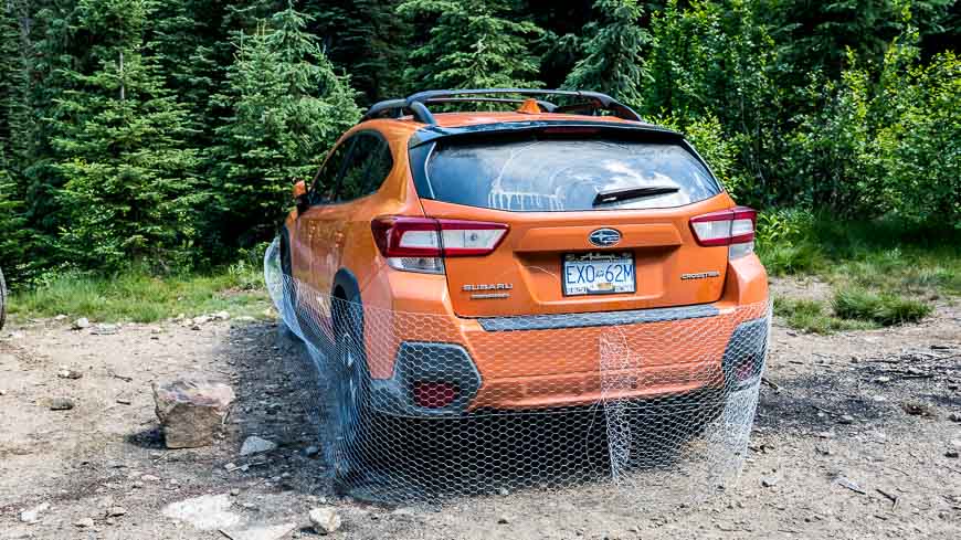
Plan to buy a roll of chicken wire before you head into Valhalla Provincial Park.
Wherever you park, be it at the trailhead or at some point along the final 2 – 3 kilometre section of road, wrap your car in chicken wire like they did in the car pictured below.
This will prevent the pesky porcupine from gnawing away on your car’s brake lines and causing untold misery getting back to civilization.
read more – Hike Bike Travel – Gwillim Lakes Hike, Valhalla Provincial Park
Though I’ve driven through Fernie, British Columbia, at least 100 times, I’d never before stopped as a tourist.
It’s fantastic.
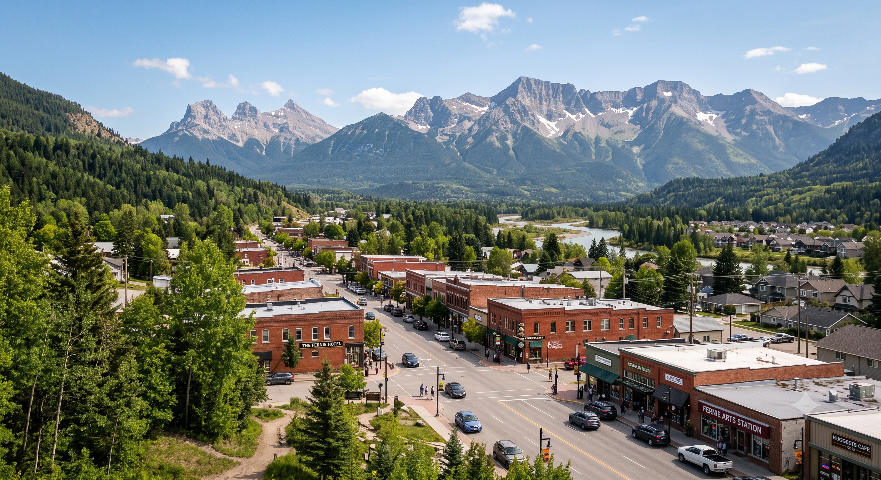
A year round outdoor recreation mecca.
Hiking. Mountain biking. Rafting. River tubing.
Not to mention world-class fly fishing on the Elk River for cutthroat and bull trout.
Fernie is most famous for Alpine Skiing and Snowboarding.
There are over 300 kilometers of multi-use recreational trails accessible directly out of town.
The owner of Edge of the World snowboard shop pointed out that he can hike or bike in any direction from town — and be on a fantastic trail in minutes. (He also had to deploy bear spray to dissuade a Black Bear on the day of my arrival. There is plenty of wildlife around Fernie.)
There are 4 dedicated bike and outdoor shops in a town of less than 6500 locals!
I only ended up exploring Fernie because I broke down my Bikepacking trip nearby.
I’ll be back for sure.
Dientes Circuit, Chile
Chinese Wall, Montana
Laugavegur Trail, Iceland
Rockwall, British Columbia
Jomolhari Loop, Bhutan
John Muir Trail, California
Pinhoti Trail, Alabama & Georgia
Outside
I’m planning on the Chinese Wall in Bob Marshall Wilderness, Montana myself. July 2026.
Start about 85 miles west of Great Falls, at the South Fork Sun River Trailhead, and hike 23 miles northwest. You’ll climb along the Continental Divide and spot elks, moose, and mountain goats along the way. Once you reach White River Pass, at the southern end of the wall, you’ll find a choice of multiple routes, including an eight-mile trail along the wall that ends at a lookout called Larch Hill Pass.
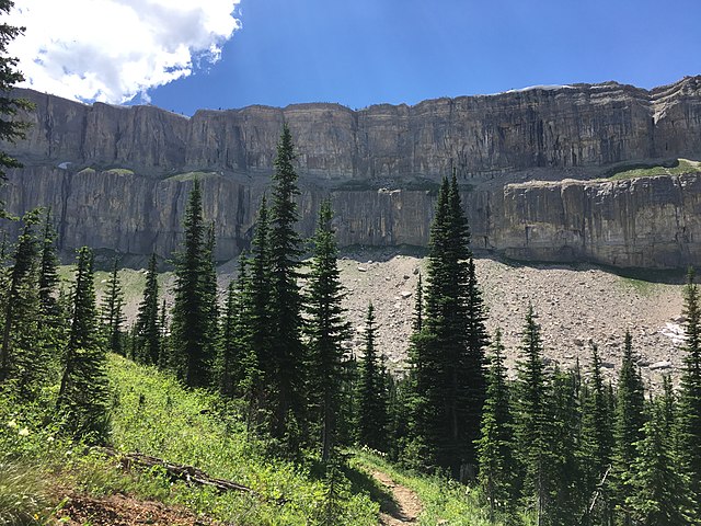
Looks fantastic.
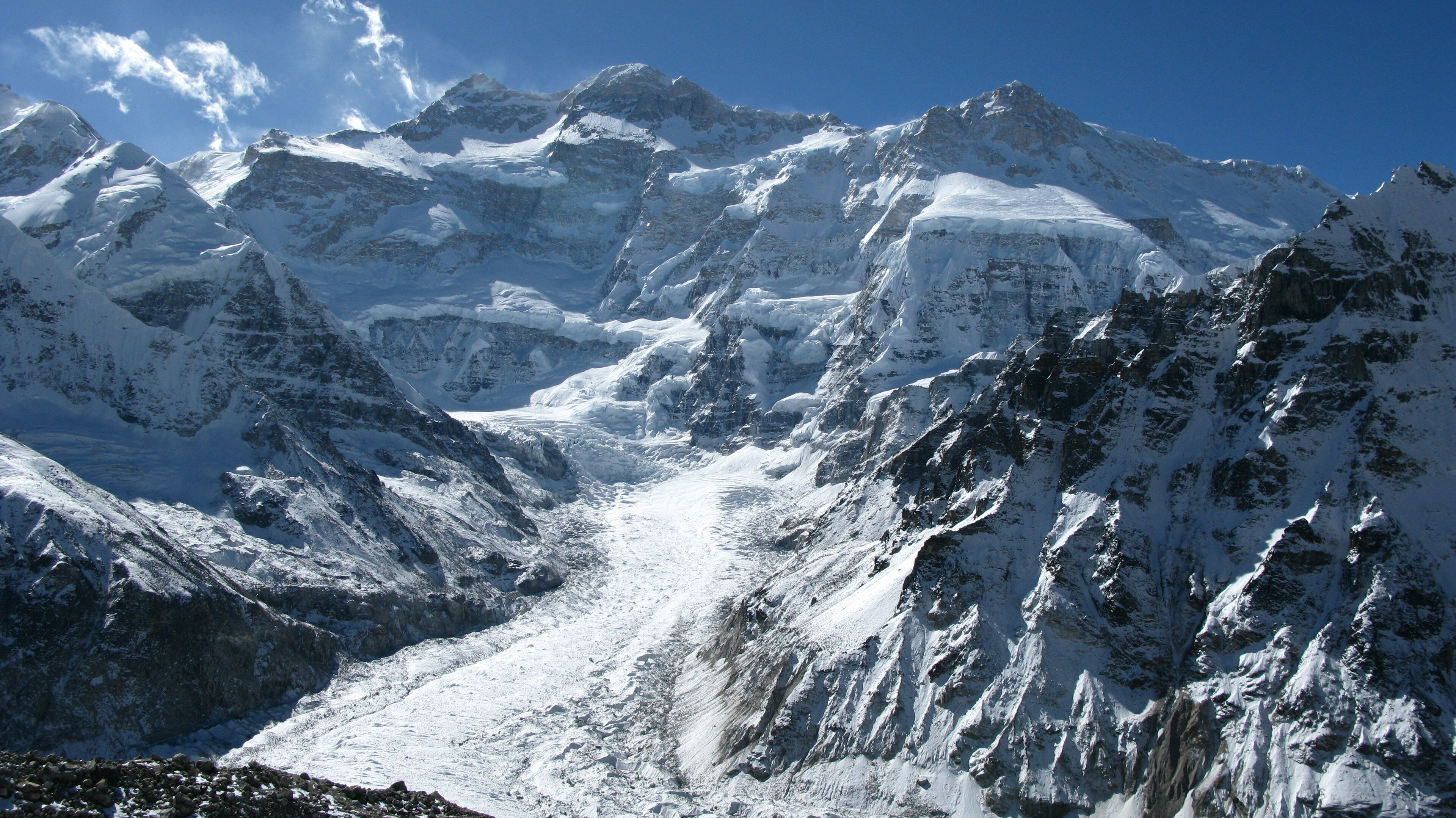
I watched Flora Gonning’s video of her Kanchenjunga adventure guided by Himalayan Masters. That’s the 3rd highest mountain in the world.
They had a lot of snow, changing their itinerary.
Click PLAY or watch it on YouTube.
I’m interested. But it’s a big commitment.
Here’s what Himalayan Masters offered in 2026 starting at USD $1900.
By BestHike editor Rick McCharles
I hiked Kilimanjaro February 2026 on the Machame Route organized by Eric Hanson.
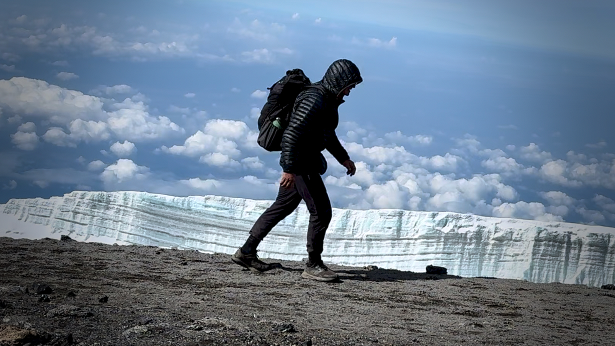
Eric is one of the top hiking YouTubers. One of the reasons I signed up instantly when he posted this trip is for the superb video documentation.
Before you sign up for Kili, watch his 43 minute documentary in 4K.
Sure Kili is one of the easiest trekking peaks close to 6000m — but it ain’t easy.
This guided trek on the highest mountain in Africa is as good as it gets. Eric worked with Zara Tours, the biggest outfitter on the mountain. TrovaTrip handled logistics.
Click PLAY or watch it on YouTube.
I put together a rough draft of my own video — before realizing that it would look bad in comparison with Eric’s epic edit.
Click PLAY or watch it on YouTube.
IF you are considering signing up for Kili yourself, be sure to watch Eric’s TIPS video first.
Click PLAY or watch it on YouTube.

