Kraig Becker linked to this inspiring edit. I’ve hiked Iceland once. But need to go again. SOON.
A new low cost airline might help flight costs go down. 🙂
Click PLAY or watch it on Vimeo.

Best hikes, treks, tramps in the world.
Kraig Becker linked to this inspiring edit. I’ve hiked Iceland once. But need to go again. SOON.
A new low cost airline might help flight costs go down. 🙂
Click PLAY or watch it on Vimeo.
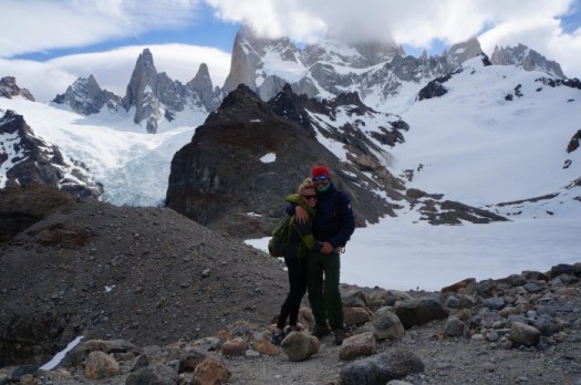
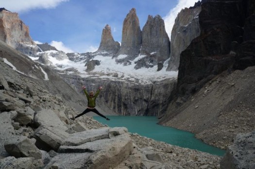
Of the two best hikes in Patagonia, which should you trek?
… you can’t decide between El Chalten (Argentina) and Torres del Paine (Chile), the self-proclaimed “trekking capitals” of their respective countries …
The good news is you can’t go wrong. Both options provide incredible access to some of the most spectacular mountain scenery you’ll ever see.
We can’t really recommend one over the other purely based on natural beauty as they are both equally stunning national parks. However, there are definitely distinct differences between the two trekking meccas that may push you toward one or the other. Here are some things to think about based on our experience in both locations that will help you decide (although the best decision is to do both!)
The Best Trekking in Patagonia – El Chalten vs. Torres del Paine
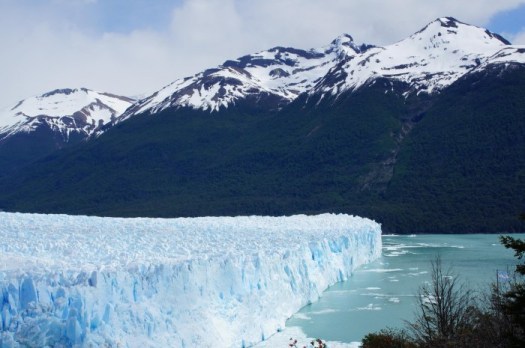
Do both. With a sidetrip to the Perito Moreno Glacier.
Trip report by site editor Rick McCharles
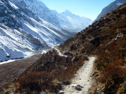
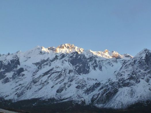
My toughest day in the Himalaya 2014. Up and over the Lauribina Pass 4,610m.
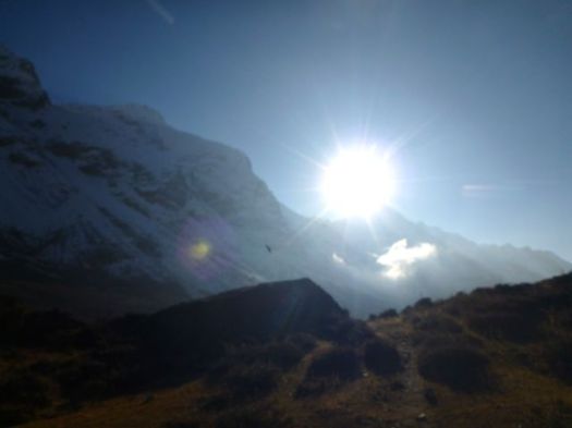
I’d not slept well, getting out of bed 4 times during the night to check the auspicious full moon over sacred Gossankund lake.

In fact, myself and an Israeli guy had hoped to (early morning) follow a guided group up the popular trekking peak called Surya (Sun) 5145m.

He was worried that no guided groups were scheduled. And he was right. Later we learned that there is too much snow and ice at the top. Guides were not going up right now.
First light a chopper landed.


They were evacuating a lady, altitude sick. She looked in rough shape. Could barely walk.
Cost would be something under $10,000. Hopefully paid by insurance.
The chopper crew all rushed to Gosainkund to collect holy water and take selfies. It was this water that Shiva once drank to quench his thirst after having been poisoned.


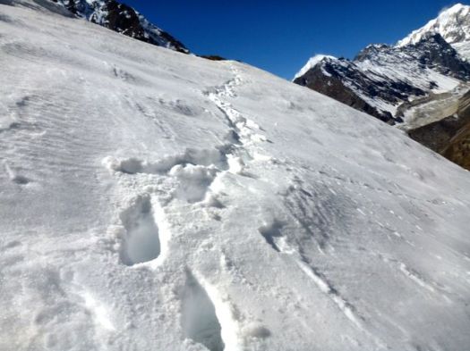
So … instead of an extra day scrambling Surya, I headed towards the Pass with everyone else.
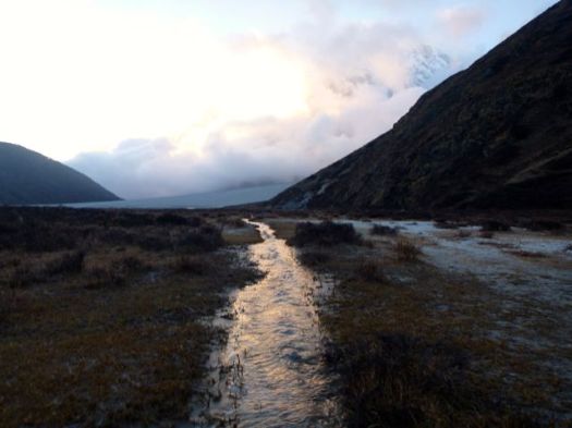
There are 108 lakes in this area, actually. You pass a series of them on the trail. They should be frozen by now, but are not.


For some reason I found this day very, very tough. The Pass was fine. But the long descent to Gopte was taxing.


On the bright side, I saw a rarely spotted Red Panda en route. Surprising him on the trail itself, he jumped uphill instantly. Then, happily for me, dashed back across the trail downhill. It’s a tiny beast with a huge, unmistakable tail. Two distinct colours.

But I was a bit of a wreck arriving Gopte 3439m, early in the afternoon.

I went straight to bed in order to prevent chills.
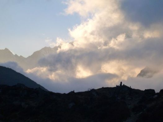
Happily, I awoke just in time for one of the best and strangest sunsets. People compared this sunset with the best they’d ever seen.


My preference is to eat as late as possible. This evening, however, chatting with an adventurous couple from Rocky Mountain House, I waited too long. The kitchen shut down about 8pm.

I begged a chance to join in the Dal Baht feed with the porters and guides, only the second time I’ve ever got the chance to eat with them. It’s not done in the Himalaya. 🙂
see all my high resolution photos from this day
day 1 | day 2 | day 3 | day 4 | day 5 | day 6 | info | … Langtang
Trip report by site editor Rick McCharles
Dawn broke clear and cold.

Up to pee and walk down to the river (my water bottle had frozen), plan was to return to my sleeping bag until the sun hit the tent at 7:19am.
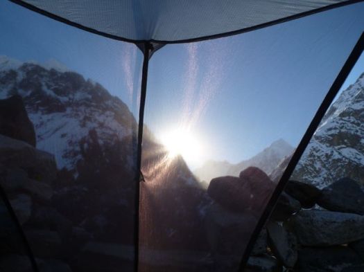
I’d not been cold wearing all my clothing layers, including down parka, in a -3C sleeping bag.
A few minutes later, the sun reached the nearby Japanese group.

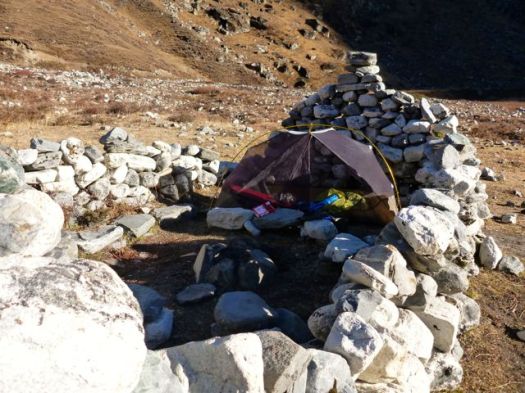
The green number is their toilet tent.
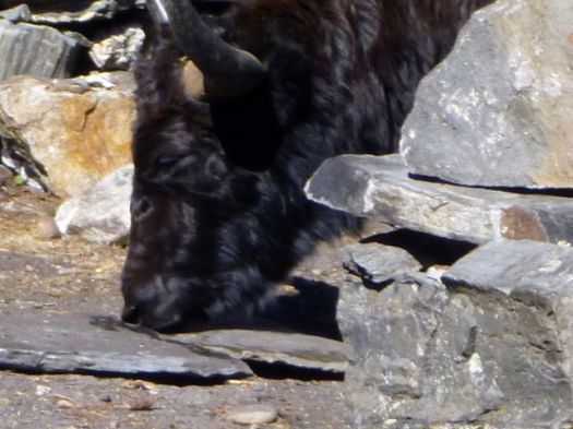
Tenting groups are up and gone quickly in the morning. Yaks move in immediately for urine. Like other mountain mammals, they are salt deprived.


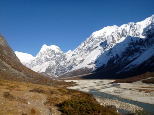
I took an hour before finding a way to cross the icy Langtang without getting my feet wet. Some large expedition had built 3 sections of temporary bridge.
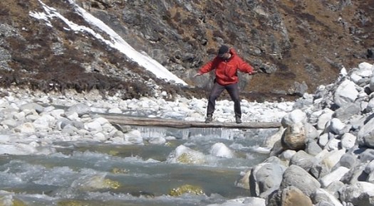
Luckily I’m a gymnast. 🙂
Very few each year scramble up this gap in the high mountains towards Tilman’s Pass, the Langshisha Glacier.
Major Harold William “Bill” Tilman … (14 February 1898–1977) was an English mountaineer and explorer, renowned for his Himalayan climbs and sailing voyages. …
During his extensive exploration of the areas of Langtang, Ganesh and Manang in Nepal in 1949, Tilman was the first to ascend Paldor, 5896 metres, and found the pass named after him …
He penetrated the Nanda Devi sanctuary with Eric Shipton in 1934 …
In my wildest dreams I’d hoped to join a mountaineering expedition crossing Tilman’s Pass to make a loop of the Langtang. Finishing at the luxurious Last Resort.

It’s much tougher than I’d imagined. If interested, click through:
• trip report – Across Tilman’s Pass to Naya Kanga 2010
• trip report – Trekking and climbing in the Langtang, Nepal 2009
Even better are Bob’s notes. A Spring crossing.
Instead, I scrambled up the easy way. As high as I could go.
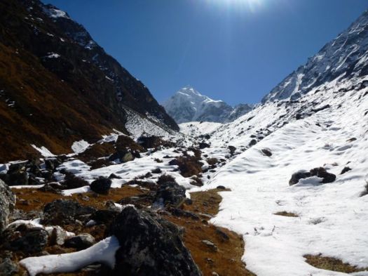
About 2hrs up I came across these instruments.
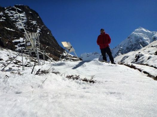
Utrecht University and other researchers are measuring snow and rainfall here.
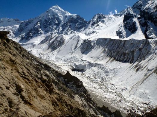
This is as distant on the Langtang as I would get. I believe the lowest notch to the right of the peak is Tilman Pass.
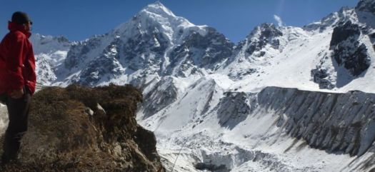
To get there you’d descend to the glacier then climb to the notch. Ugly.
This day hike was fairly straight forward. I did need to work my way through snow at one point.
I drank melt water on the way down having brought no food nor water with me.
Psychologically I was ready to turn back. Down is easier. Right?
Unfortunately “Nepali flat” means endless ups and downs. “Nepali down” means endless ups and downs.
You do not see many wild animals on the Langtang trek, but the birdlife is plentiful and interesting.
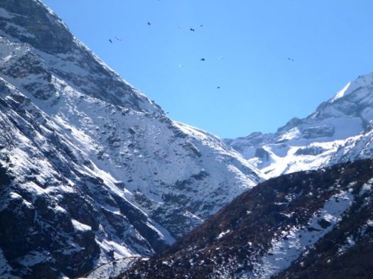
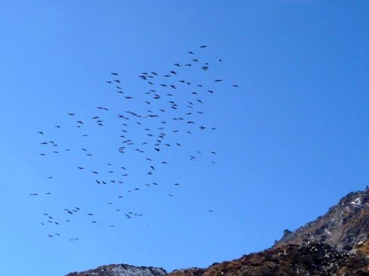
These are swarms of red-billed and yellow-billed choughs. Similar to crows.
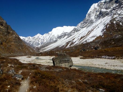
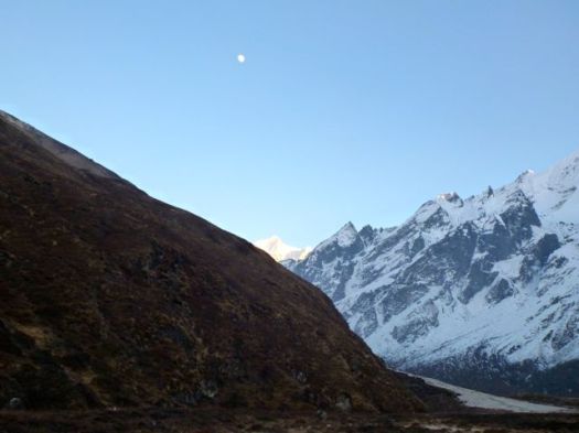
By far the last hiker walking back towards Kyanjin Gompa this afternoon, I had – aside from grazing beasts – the valley to myself.
Whew.
I was extremely relieved to have made it back before nightfall. Just.
Instead of checking in to the Holyland, where I’d already spent 2 nights, I tried Dorje Bakery, instead. Turns out Dorje is not attached to a tea house. But the chef had his brother take me over to one in the family.
I slept well that night. 🙂
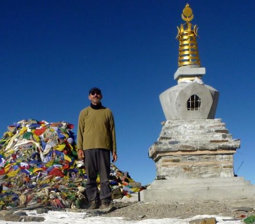
day 0 | day 1 | day 2 | day 3 | day 4 | day 5 | day 6 | day 7 | day 8 | info | … Gosainkund
see all my high res photos from this day
Rescuers in Nepal are trying to reach more than 20 trekkers trapped below a high Himalayan pass by heavy snowfalls and avalanches as the death toll from the unfolding tragedy was reported to be as high as 32.
High winds and blizzards hit much of central Nepal this week as the tail end of a cyclone travelling west across northern India reached the Himalayan mountain chain. The head of the Trekking Agencies Association Nepal said there had never been a disaster like it. …
Local officials said 24 bodies had been found on the Annapurna circuit, which circles the Annapurna mountain and attracts thousands of walkers every year.
I was there last year. In perfect weather. 😦
There was a similar disaster some years ago. Many killed. Many hikers trapped at the Annapurna Sanctuary.
Misti at 5822m (19,101ft) is one of the easiest, most visible, most popular, most accessible high summits in the world. It is recommended for all self-sufficient hikers. If you tolerate cold & altitude symptoms, the ascent is little trouble in good weather.

Misti is one of the best trekking peaks in the world — no mountaineering skills nor gear needed if the weather is good
3 days, 25km circuit plus the climb is recommended. Most do it in 2 days, 1 night, however.
Easy access from Arequipa, our favourite city in Peru.
Click PLAY or watch a short Yeti Adventure trip report on YouTube.
Unfortunately, the freezing temperatures, high winds and an incoming storm forced us to turn back without reaching the summit.
We’ve recently moved and updated our Misti information page.
This looks great. I’ll try to find a copy in Kathmandu.
When Jono Lineen‘s brother died in tragic circumstances, he gave up a comfortable life, moved to the Himalayas and over eight years immersed himself in the cultures of the world’s highest mountains.
The experience culminates in his book Into the Heart of the Himalayas, a fascinating memoir that traces his solo trekking odyssey from Pakistan to Nepal across thousands of kilometres of mountain terrain. No-one has ever before attempted to walk the length of the Western Himalayas alone, but Jono’s intentions were more psychological than physical. It was about integrating the Himalayan culture he had grown to love, assimilating the wisdom of the place and coming to terms with his loss.
Jono’s openness with everyone he meets on the trail – from Pakistani military officers to Tibetan lamas and naked Hindu Saddhus – lies at the heart of one of the most complete portraits of the Himalayas ever written. Jono Lineen – a lone, disarming man – crosses borders, religions, castes, languages and philosophical boundaries to find the way to embrace his future.
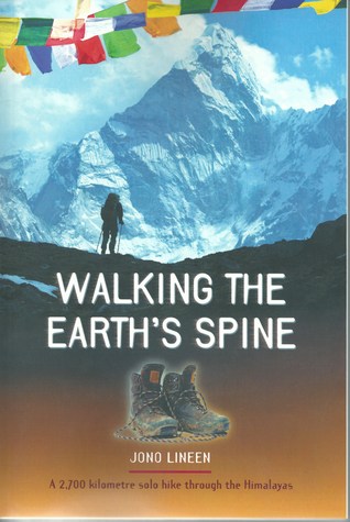
He explains why an adventure from 1995 was not published until April 2014.
Heart Mountain is west of Calgary, Alberta …
The 2,149 m (6,020 ft) mountain is easily distinguishable by its heart-shaped summit …

At the base of the mountain a left turn onto the flat, good quality, Quaite Creek trail delivers us past a pristine swamp with mirror surface water and back to the car. The 11 KM (7 mile) loop …
Barry makes it sound easy. 🙂
Local hiking Guru Kelly Mock recommended that loop, due to an early winter snowfall, but in reverse. Finishing coming down the Hart Mountain trail. We parked at the the Heart Creek trailhead.


Steve had done the loop before, but in the normal direction. We set off looking to ascend on the Quaite Creek trail.


Only Sept 13th, there was much more snow than we anticipated. But we hoped the snow would have been blown off the ridges, once we got up there.

We tried bushwhacking through deep snow between trees to get up on the windswept ridge.
We tried.
If was tough going, postholing non-stop. For hours. Off trail. 😦
Here’s the highpoint reached.

Sadly slipping on that snowfield up to the ridge was a death drop. We turned back, the sun warm, the sky blue, the wet snow … turning to slush.

Yes. It was steep.

We scrambled off trail down a different route, eventually getting back to the regulation track after 8 hours.

Phoning Kelly Mock to curse his bad advice, it turned out Kelly had started the Horseshoe in the normal direction, hoping to surprise us half way round.
After a half hour Kelly quit. You’d have to be an idiot to try Heart in these snow conditions. 🙂
Oh well. It was a terrific quad workout.
more of Steve’s and my photos
In September, serial adventurer Mike Horn, 48, will weigh anchor on one of the world’s last undone firsts: a motorless circumnavigation of the earth via the two poles. …

Yeesh.
I thought I knew much about the history of Antarctic exploration. Yet I learned much, much more after reading this book.
The incredible story of Australia’s most famous polar explorer and the giants from the heroic age of polar exploration.
Douglas Mawson, born in 1882 and knighted in 1914, was Australia’s greatest Antarctic explorer. This is the incredible account of an expedition he led on December 2, 1911, from Hobart, to explore the virgin frozen coastline below, 2000 miles of which had never felt the tread of a human foot.
… he headed east on an extraordinary sledging trek with his companions, Belgrave Ninnis and Dr Xavier Mertz. After five weeks, tragedy struck—Ninnis was swallowed whole by a snow-covered crevasse, and Mawson and Mertz realized it was too dangerous to go on. Dwindling supplies forced them to kill their dogs to feed the other dogs, at first, and then themselves. Hunger, sickness, and despair eventually got the better of Ninnis, and he succumbed to madness and then to death.
Mawson found himself all alone, 160 miles from safety, with next to no food. This staggering tale of his survival, against all odds, also masterfully interweaves the stories of the other giants from the heroic age of polar exploration, to bring the jaw-dropping events of this bygone era dazzlingly back to life. …

Mawson: And the Ice Men of the Heroic Age: Scott, Shackleton and Amundsen. (2012)
