Simien Trek Ethiopia – day 4

trip report by site editor Rick McCharles

day 1 | day 2 | day 3 | day 4 | info

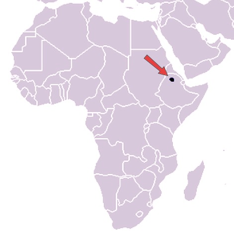
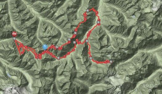
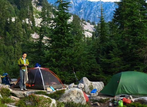
Day 4: Chenek-Buwahit, 4-6 hrs walking

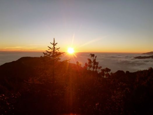
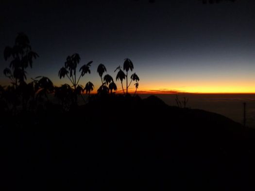
We were up before the dawn, wanting our best chance of success climbing Mt Bwahit.

P1330997

Our guards had slept outside beside the tents, despite the cold.

P1340002

The day before our arrival a young Swiss couple had had their daypack stolen. Cameras, money … passports. 😦

It happens all over the world. It happens here, but not very often. Best guess was that one of the mule drivers had grabbed it. Might have been a young shepard boy, though they are chased out of Camp right quick.

I had my valuables strapped to my waist in a passport case, as always.

P1340001

Our guide had said that our best chance to see Walia Ibex would be this morning. We weren’t disappointed. We saw a number up on a ridge. And later down by the road. They are not shy.

P1340083

… only about 500 individuals survived in the mountains of Ethiopia, concentrated in the Semien Mountains, largely due to past poaching and habitat depletion. If the population were to increase, the surrounding mountain habitat would be sufficient enough to sustain only 2,000 ibex. The adult walia ibex’s only known wild predator is the hyena. …

I was still feeling weak though I had not lost my dinner from the previous evening.

I’d not slept much. Happily, as we climbed, I seemed to get stronger.

Though we ascended about 800m in less than 3 hours, it wasn’t all that cold. The sun helps for sure. We added and removed layers frequently.

P1340013

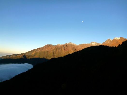
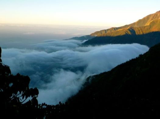
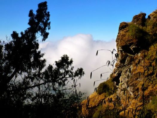
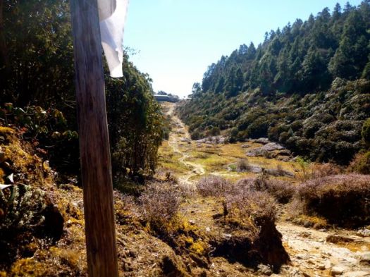
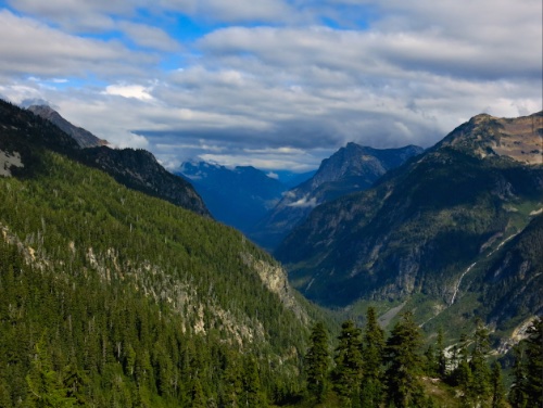
Disappointingly, the road winds up close to the top of the mountain. At times we walked it.

There’s not much traffic, of course. Clouds rolled up the escarpment early. We’d need to reach the top before the clouds did.

P1340029

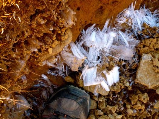
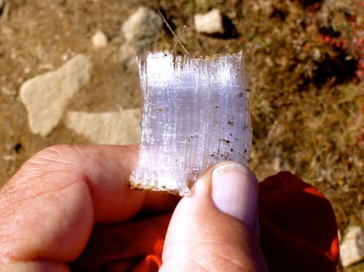
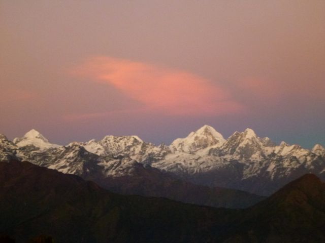
We were very surprised to see snow on the top.

P1340033


P1340038

This is one of the few spots in Africa where snow falls regularly.

Nadine found snow in Africa

P1340046

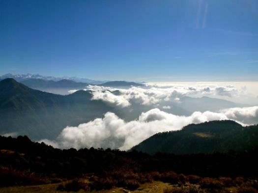
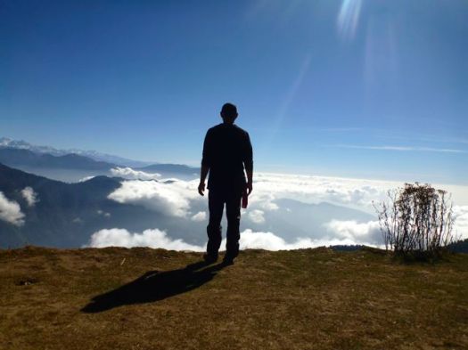
Mt Bwahit (4430m) is the third highest mountain in Ethiopia and the 13th or 14th highest in Africa.

This is as far as we got following the escarpment. But the road continues to Mekane Berhan, 10km past the Park.

P1340045

In fact you can keep going 17 days all the way to Lalibela, if you like.

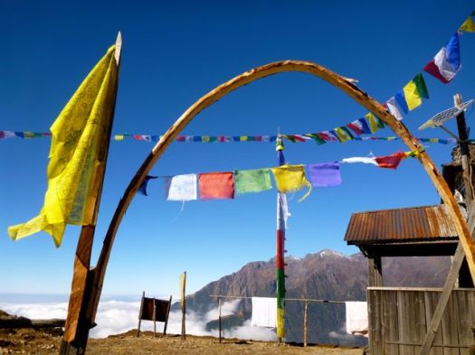
We celebrated with summit photos.

Simien - Josh and Nadine-2

Simien - Josh and Nadine-3

Simien - Josh and Nadine

I left a Summit Stone in the cairn.

Nadine turns back. She’ll be reunited with her husband later in the afternoon.

P1340064

Neither Nadine or I felt many altitude symptoms. Lucky. She gave some medication, on the trail, to one of the other hikers who was feeling rotten.

Obama is wildly popular in Africa though most distrust the American government.

P1340067

We saw many more baboons on the descent. We’d left too early to see them on the way up.

P1340070

The decent was quick. Psychologically, I was ready to go. The Simien a success.

P1340075

In most high mountains lammergeier (bearded vulture) stay far away from me. But here they float right over your tent. After many attempts, this was the best photo I got. They have up to nearly 10ft (2.83 m) wingspan.

P1340091

Here’s Josh’s best photo.

lammergeier - Josh and Nadine

In Ethiopia, they’ve become more tolerant of people, now common near trash piles on the outskirts of small villages and towns.

We saw wild chickens on the way down, too. Nur told us that when he was a shepard, age-5 to age-10, he loved to try to catch one for dinner.

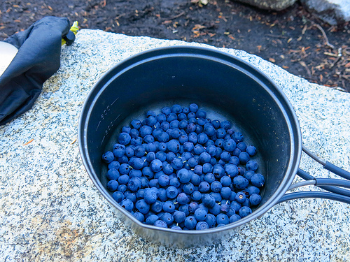
Heading out, I risked eating lunch.

P1340093

Nadine was the one of the few hikers who completed ALL the original planned itinerary. But she was ready to head back to Gondor.

P1340094

It’s a long, bumpy ride back to the Park gates. The roads are bad even in a Toyota Landcruiser.

The closest good hospital is in Dabark. If you crash like this 😦 … they have an ambulance. Another ambulance, I mean.

P1340107

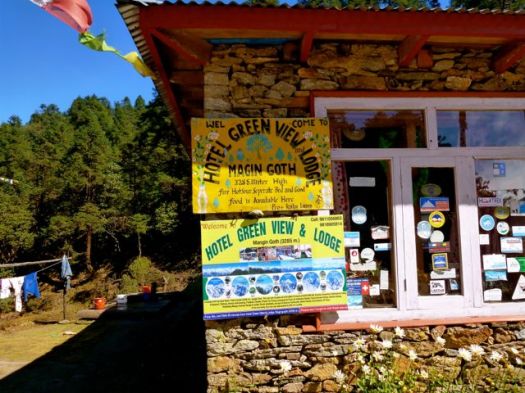
Rich tourists from the highest lodge in Africa take a short day hike to see baboons. Or do a tourist ride. Meh.

P1340103

We tipped around 10% of our tour cost, aside for the cooks who got almost nothing. If the clients get sick, the cooks didn’t do the job.

I suggested to Mohammad, a super guy, that he and the other cooks put a big bottle of alcohol gel on the dining tables. Every time. And to ask cooks and assistants to use it non-stop while preparing food for foreigners.

About half of the hikers I spoke with had stomach problems. Clearly the cook house is not sanitary enough. Cooks work together. If one has dirty hands, it’s possible that all the food will be infected.

When we arrived at the Four Sisters restaurant in Gondar that evening, to celebrate, there was a large bottle of alcohol gel on the table. But don’t expect to see one on a Simien trek any time soon. Inertia is great in Africa.

Four Sisters

I’ll suggest to future hikers that they consider bringing their own stove, cook their own food.

Nur and Hailie

Thanks to Nur and Halie, childhood buddies, who are still working together. Nur Hassan is Coordinator for SimienMountainsTour.com. I’ll be recommending them.

Our cost was $1000 for 3 people for 4 days, all inclusive. The lowest price I heard quoted was $250 each for 7 people in one group.

more photos

day 1 | day 2 | day 3 | day 4 | info

Simien Trek Ethiopia – day 1

trip report by site editor Rick McCharles

day 1 | day 2 | day 3 | day 4 | info

Day 1: Gondar-Sankaber (3250 m), 3-4 hours walking

6:30am Ethiopian coffee

7am pick-up at the (recommended) L-Shape Hotel in the tourist town Gondar. Room about $13 in 2014.

P1330497

It was an easy 2hr drive to Debarq, the jumping off point for Simien Mountains National Park. Quick stop at the National Park office.

P1330499

P1330501

We had breakfast at the Great Work Hotel. Excellent Mango juice.

Our car returned with gear, guide, cook and … personal armed Park Ranger. They call themselves Scouts. A guard is still required for each trekking group in 2014, though these days it’s more of a make work project for the Rangers.

We drove through the Park gates and continued about another hour.

P1330508

This road is rough. Though it was being improved while we were there.

P1330507

We’re HERE. Trekking the Simien mountains. What a thrill.

Simien Ethiopia Map

P1330514

I’d joined Josh and Nadine, a couple from Edmonton, Canada who have been volunteering in Burundi for the past 2 years.

P1330737

Here’s our excellent Guide, Adoo.

P1330753

And our Scout, Adim.

P1330739

Immediately we headed for the great escarpment.

P1330521

It’s a long, long way down. About 800m here.

P1330523

Simien - Josh and Nadine horse

Local people are everywhere. This is a shared use National Park.

P1330531

P1330525

We heard that road and power lines being moved further away from the trekking route. I hope that’s true.

P1330542

Adoo detoured from the cliff when he spotted a group of 200-400 Gelada baboons. (more photos)

P1330543

Geladas are found only in the high grassland of the deep gorges of the central Ethiopian plateau. They live in elevations 1,800–4,400 m above sea level, using the cliffs for sleeping and montane grasslands for foraging. …

Geladas are the only primates that are primarily graminivores and grazers – grass blades make up to 90% of their diet. They eat both the blades and the seeds of grasses. …

P1330567

They mate in May, have babies in November. Females were very protective of their youngest. Some looked like newborns.

P1330667

We sat down and let the group graze past us. Some of the toddlers were curious enough to TRY to touch us.

Simien - Rick baboons 600

What a fantastic 2 hours. This might be the best wildlife encounter anywhere in the world. It was my best wildlife encounter ever. 🙂

Simien was one of the first sites to be made a World Heritage Site by UNESCO (1978). Due to serious population declines of some of its characteristic native species, in 1996 it was also added to the List of World Heritage in Danger.

The word Semien means north in Amharic. But the name Simien and the word simian do make a good mnemonic for this hike. Geladas are the highilght. 🙂

Elated, we shuffled another hour or so to Camp 1. Talking about the baboons.

P1330687

poison tomatoes
poison tomatoes

It’s a very easy half day, yet everyone was huffing and puffing due to altitude.

Popcorn and hot drinks on arrival were much appreciated.

P1330699

I rested an hour. (I opted to use my own tent. Not the one supplied.)

P1330703

We headed over to the ridge for the sunset, surprised how cold it was in Africa at night.

P1330706

Josh got some great pics.

IMG_5955

IMG_5970

IMG_5976

Dinner was impressive: soup, bread, fish, salad, spinach, deep fried banana. I skipped the salad (worried about my health) but tried some of everything else.

P1330715

We checked the full moon, then retreated to our tents. There was no campfire. I climbed into 2 sleeping bags. The one provided. And my own. Everyone was surprised how cold it was at night in Simien.

Simien - Josh and Nadine

more photos

day 1 | day 2 | day 3 | day 4 | info

hiking Portugal’s vineyards

If you love Port and Portuguese wine, consider a week long guided hiking tour through famed Douro valley.

The pitch:

This fantastic program will get you to one of the most beautiful places in Portugal, de Douro region. From Porto to the Douro slopes you’ll take train journeys who lead you to amazing vineyard terraces scenery, today UNESCO heritage site.

While hiking thru the vineyards, you’ll have the chance to taste some of these wines, world class wine!!! Return in a cruise descending to the river mouth at Porto and, finish the trip at the famous cellars of the port Wine.

» UNESCO World Heritage Sites

» One very good time to taste wines from the Douro region.

PortugalPortugal Nature Tours

___

I’ve hiked nearby Peneda-Gerês National Park. Combining a wine walk with this National park on one trip would be idea. Click through for more information.

Gosainkund & Helambu – day 4

Trip report by site editor Rick McCharles

Gopte 3439m – Mangengoth 3420m

Good morning Gopte.

P1320555

P1320556

Nepali toilets are as unsanitary as any in the world. I walked past down the mountain past this one to do my business.

P1320562

P1320564

There’s a strange and popular instrument here, called the sarangi, with a carved dragon? head. Something like a fiddle. But with only 4 strings. Nepali Bluegrass. 🙂

P1320561

Starting out today late, I’m happy to be still above the clouds. 🙂

P1320576

Have you ever seen frost like this? Like hair?

P1320571

P1320572

Nobody talks about distance in the Himalaya, only elevation change. Today I dropped only 19m, my easiest day yet. I wanted a rest after the exhausting day over the Pass.

I stopped for lunch at Thatepati, the only hiker to do so that day. It’s a little off the beaten track.

P1320579

P1320580

Egg Veg Noodle soup, my usual.

P1320581

High on a ridge, the owner had to make several trips down a day carrying up barrels of water. The Helambu trail is mostly on a ridge. And there’s not much water available on ridges.

Hotel Green View, Mangengoth came highly recommended. And it was worth the stopover.

P1320592

P1320593

One of the best viewpoints in Nepal is a 25min climb from the guest house. My first thought was to tent up there, to see both sunset and sunrise. The Green View owner (who looked ex-military) and another guide both felt that was a bad idea. I deferred to their judgement. Even hiking independently you get a lot of smothering advise in Nepal.

P1320599

P1320604

I walked down in the dark.

P1320612

see all my high resolution photos from this day

day 1 | day 2 | day 3 | day 4 | day 5 | day 6 | info | … Langtang

treking Iceland north to south

A short video showing some of the highlights of our traverse of Iceland during the summer of 2014. It took us 21 days to cross about 500km from the northern shore at Hraunhafnartangi to the southern coast at Skogar. …

We had 2 food parcels on the route – one in myvatn and another in landmannnalaugar. This meant the maximum amount of food we had to carry was 12 days giving a backpack weight of between 15 and 25kgs. We also got caught in a storm in the highlands midway through and had to use our SPOT device to get picked up by Iceland’s amazing Search and Rescue volunteers …

http://vimeo.com/101096882

(via Hiking in Finland)

2014 Ursack S29 AllWhite

Though the Ursack is not allowed in many American National Parks, I often use mine on other hikes.

Ursack

The 2014 Ursack S29 AllWhite has been given IGBC (Interagency Grizzly Bear Committee) certification number 3738. It may take a bit of time before that information shows up on the IGBC website. 2013 and earlier models of the AllWhite are not certified. …

… we baited an Ursack S29 AllWhite, knotted it securely and placed it on the ground with no aluminum liner and not tied to a tree. The first two grizzlies went at it for an active 57 minutes. One of the bears was nick-named “The Destroyer,” but neither he nor his sister were able to compromise the Ursack. …

Ursack

Namibia camping – Brandburg – day 1

My hosts in Swakopmund, Namibia run  Ondjamba Safaris.

For the independence day long weekend, we loaded kids into one of their desert vehicles and headed north into the desert.

P1280379

P1280386

P1280388

Our destination was Brandburg (Fire Mountain), Namibia’s highest massif at 2573m.

P1280392

The temperature was about 40C when we arrived White Lady Lodge.

P1280395

I love the Namibian campsites, sprawling under shade trees.

P1280403

P1280399

This technology was a first for me — showers are heated by wood fire. Campground employees light up the showers every morning.

P1280400

Just before sunset we headed off to climb a mound of boulders.

P1280422

P1280430

P1280438

P1280434

P1280426

P1280424

The real attraction of Namibian camping is the Brai — a magnificent barbecue.

P1280439

P1280412

I slumped into my tent early. Too much wine.

see ALL my photos from this long weekend trip

Community Inca Trail Trek

guest post by Helene Cooper:

Last month I embarked on one of the most amazing experiences of my life, Peru’s Inca Trail. I took part in a five day “Community Trek”, which goes a little more off the beaten track, combining an exhilarating trek along the Peruvian Andes, with an opportunity to camp with local villagers and help with farming and community work.

En-route I enjoyed some of the most beautiful mountainous terrain I’ve ever seen, stopping at amazing ancient ruins and pushing my body to new extremes. The Community Trek gives you the opportunity to give something back to the local people, with a proportion of your fees helping with their schooling and farming activities. While you see less of the ruins than on the Classic Trek, you still see the best, while enjoying a completely different experience, too.

The trek was amazingly hard work, with high altitudes making the long hikes exhausting at times, but with the end reward of Machu Picchu just hours away, it was well worth it. The trails are less preserved than on the Classic Trek, which makes it harder work, but what’s life without a little challenge? The opportunity to spend time in local communities gave the trip an added attraction; I really recommend you try it.

Day 0:

We begin our five-day journey with a pre-trek meeting with our guides from Andina Travel. Everyone takes the opportunity to ask any questions and psyche themselves up for the next four days of walking. We’re told to prepare for the high altitudes, which can reach up to 13,900ft.

Day 1:

We’re picked up early by a minibus; it’s a beautiful clear day and the mountains are simply awe-inspiring – I can’t wait to crack on with the trek.

First stop is Saksaywaman, an incredible old ancient fortress overlooking Cusco; giant boulders are stacked as if they fell from the sky – it’s a great photo opportunity! Our guide tells us this was once a historic, religious and ceremonial place, which you certainly get a feel for.

Next we move to the Sacred Valley, a huge gorge between two steep mountains and home to hundreds of maize fields and numerous tributaries, what an amazing sight!

We trek on to the Pisac ruins and its fantastic terraces and walkways, where we get to put our feet up and give our lungs a rest. We purchase walking sticks, coca leaves and colourful plastic ponchos, the last supplies for our mammoth trek.

After lunch it’s time to start walking! We tentatively start climbing our way up the hills and slowly the scenery starts to change. The higher we climb the colder it gets, and the air starts to thin out, which is a strange feeling.

Our tents are already set up when we arrive to our first camp in the amazing Andes. We’re greeted by hot popcorn and cold drinks in the kitchen tent – very civilised! A pack of cards come out and we play and talk about today’s sights until dinner is served.

I’m starving and it was a pleasure to be served a delicious three course meal including ‘Cuy’, roasted Guinea Pig on a spit, which is really succulent and tasty, followed by a hot cup of Peruvian tea to warm us up, as its now getting pretty cold – I put socks on my hands to keep warm.

Day 2:

The morning starts with a soft knock on our tent and the voice of our guide calling: “coca tea!”

We poke our sleepy heads out to find mugs of steaming tea and a hot basin of washing water waiting for us. What luxury! The coca tea is a greenish yellow colour and has a mild bitter flavour, similar to green tea, but gives you a wake-up kick like a good cup of coffee.

Our cooks continue to spoil us with a breakfast of porridge, toast and eggs, which feels like a real treat. We pick up our snack bags, which include some local fruit and biscuits, and set off for a full day’s walking. Small steps and deep breaths is definitely the recipe for success.

En-route we meet some little old ladies running up the mountain paths without shoes, carrying heavy loads on their backs. Kids hike their way to school down the valley and we all feel a bit sheepish in our Gore-Tex hiking gear.

I feel a real respect for the people living in these harsh conditions, it’s bitterly cold and arid in places, but absolutely stunning nonetheless. We advance towards the highest point of the trek, which is surrounded by clouds and looks incredible.

The air is so thin it’s really hard to fill your lungs with oxygen and my body is getting really tired. As we reach the summit we reward ourselves with a shot of Pisco, which is quite the livener; each of us pouring a drop on the ground as a sacrifice to Pachamama (Mother Earth).

Finally we venture downhill and race towards our lunch stop. The porters and cooks overtook us a long time ago and have served up some delicious hot food, including local rice and beans.

Day 3:

More trekking, I can feel myself getting fitter as we progress, but it’s still a strain on the limbs. There are herds of alpacas and llamas on the mountain sides, which I feed with some of my biscuits; the llama is like a cross between a camel and a sheep and laps up my snacks.

We conquer another high pass and stop for a few photos of the stunning green mountain lakes on show, which shimmer in the sunlight, it’s great to be alive!

We cruise downhill for lunch at our second campsite. I have an afternoon nap while some of the guys play football. At night the stars are shining and we admire the silent stillness of the Andes; it feels like we’re the only ones in the world that are enjoying this moment.

Day 4:

We visit a local school where we work with the local children, helping with break activities, singing and poetry lessons, it’s really good fun. None of the children can speak English but they enjoy learning some useful phrases, like llama and Guinea pig!

We get Quechua lessons, the local dialect, from a teacher, who teaches me “sulpayki wayki” (thank you friend)! We then move on to a local farm and help them with planting and weeding and I buy a nice colourful hat from a local weaver.

Our last day of trekking is short and fortunately it’s all downhill, unsurprisingly nobody complains! We’re sad to say goodbye to our team of porters and cooks as we hop on a bus to Ollantaytambo.

On arrival at our lodge in Ollantaytambo we have glorious hot showers and a short rest before a guided tour of the Ollantaytambo ruins, the royal estate of Emperor Pachacuti. The town is home to a large settlement, so we have dinner in a local restaurant which serves some delicious soups and stews with ‘pan de papa’, a bread made with mashed potatoes.

No sooner have we finished eating we are eager to get back to the lodge to try out those lovely looking beds, which do their job very well indeed.

Day 5:

Today we embark on the final part of our journey, towards the epic Machu Picchu; I am so excited! We have an early breakfast and jump on the train to Aguas Calientes, which has some really picturesque views on route. Unfortunately we don’t arrive at Machu Picchu until late morning, so miss the sunrise, but we still arrive earlier than the masses of tourists, which I’m pleased about.

We take a shuttle bus to Machu Picchu, which suddenly appears on the horizon, lying on a steep sunlit mountain side. We meet up with the other trekkers, who took the more traditional, “Classic” Inca Trail route; they are yet to shower and are pretty envious of our fresh smells!

We have a couple of hours of free time to look around the Machu Picchu complex, so we hike up to the Sun Gate, which offers an amazing view on what is a beautifully clear day; the others take the opportunity to have a closer look around the city’s ruins.

Machu Picchu

Soon it’s time to head back; we board the bus and train to Ollantaytambo and our transfer takes us to back to Cusco, where we tell stories about our experiences of the last five days.

We all have aching muscles, blisters and the odd tummy ache, but the amazing scenery and ancient ruins were well worth it. I can’t recommend the Inca Trail highly enough.

Helene Cooper currently writes for Dragoman, the overland adventure operator

related – our Best Hikes South America list

West Coast Trail day 0

wctmaTrip report by site editor Rick McCharles.

day 0 | day 1 | day 2 | day 3 | day 4 | day 5 | day 6 | info page

The West Coast Trail on Vancouver Island in Canada is our #1 hike in the World.

This was my 4th WCT. 🙂

My Dad dropped me at the ferry in Port Alberni. Riding the Francis Barkley is my favourite way to start the WCT.

IMG_1319

P1210737

The weather was perfect as it had been for most of the summer of 2013.

P1210758

arriving Bamfield
arriving Bamfield

Scheduled to rendezvous with the rest of my group next day, I could have taken a trail shuttle out toPachena Bay Campground at the trailhead.

Instead, I stayed at small Centennial Park Campground ($23) in Bamfield.

P1210788

Having no place to store my food overnight, I ended up leaving it in this shed. Storage for a communal fenced garden.

P1210787

My new lighter failed. They truly are an unreliable technology. 😦

It was nice to have a final few hours with phone / free internet access (Bamfield Community School Library). And there were OTHER good reasons to spend my last night in Bamfield. 🙂

P1210786

P1210789

I enjoyed both meals at Tides and Trails Restaurant.

more photos from this day

day 0 | day 1 | day 2 | day 3 | day 4 | day 5 | day 6 | info page

North Cascades Copper Ridge Chilliwack River loop

Washington State

… the sight of Mt. Shuksan‘s tumultuous, glaciated north face will have you groping for adjectives to replace “awwwe-some” or “un-bee-lievable.” Even from a distance you have to crane your neck to take in all of the massive peak.

This remote, unroaded section of North Cascades National Park brims with private pleasures for anyone willing to strap on a pack and exert themselves: thick forests, wildflower-filled avalanche chutes, alpine tarns, and streams that look like milk, thanks to the glacial runoff. …

Backpacker

Ilya posted a trip report starting Sept 1, 2013.

click to see photo map

trail

tents

berries

valley

See more on flickr.