This Week’s Top Instagram Posts from the #PCT

Best hikes, treks, tramps in the world.
trip report by besthike editor Rick McCharles
day 0 | day 1 | day 2 | day 3 | not recommended
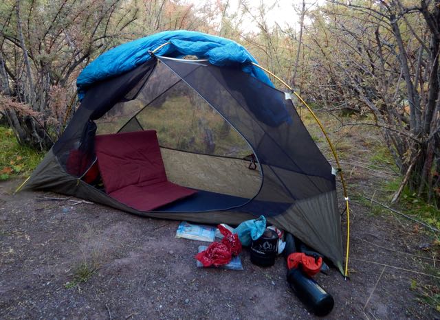
When you sleep under the net and stars, you wake at first light.
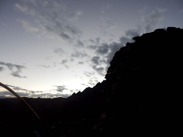
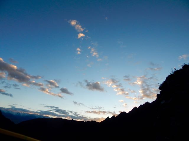
In no rush, I enjoyed 3 pots of coffee while waiting for the sun to reach my tent.
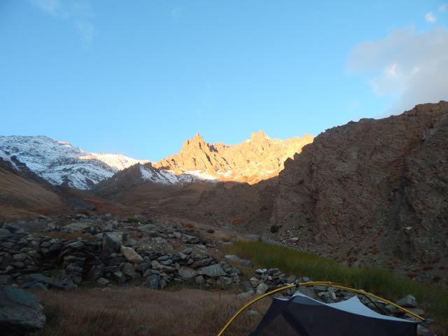
Time to GO.
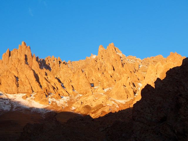
Up. Up. Up.
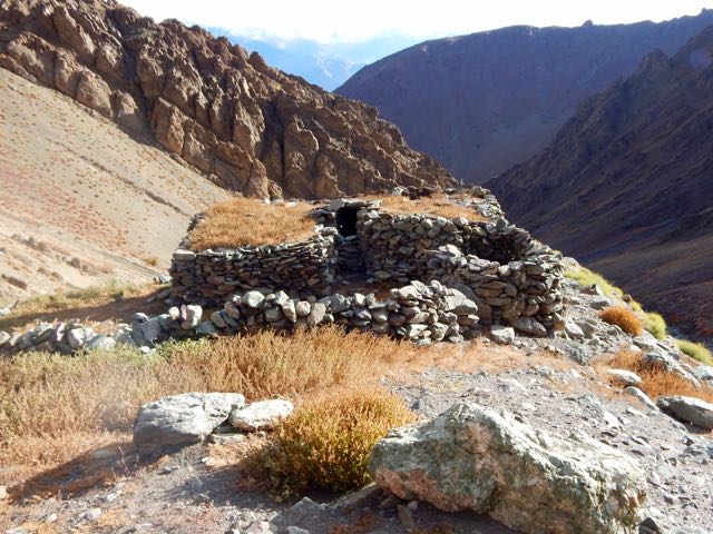
As I drew closer the crossing got increasingly more serious looking.
Entering this valley, the trail disappeared beneath the snow.
I was at the same altitude as the snow line on the other side of the Indus.
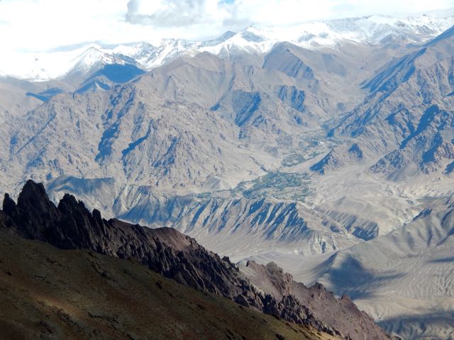
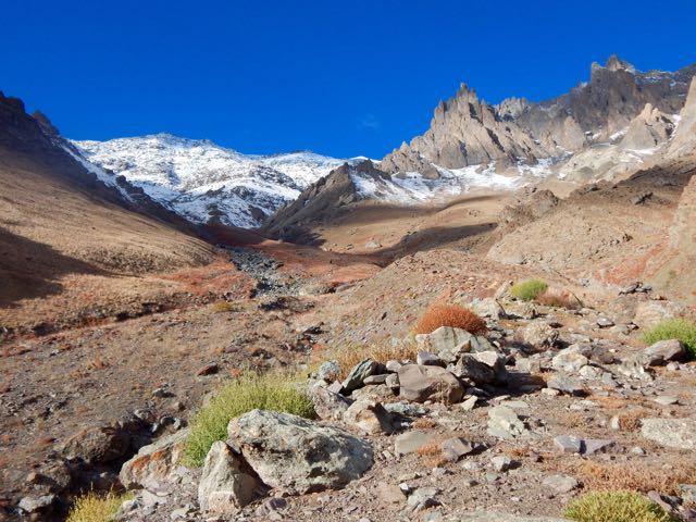
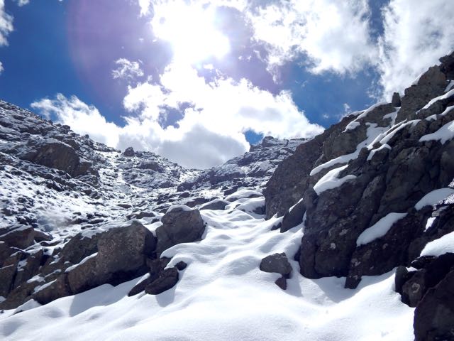
Luckily, the weather was perfect.
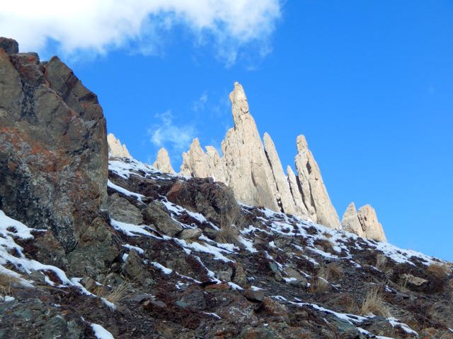
Which notch on the skyline is the pass?
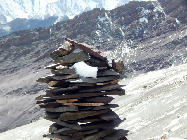
Normally I’d be able to find the route by following cairns.
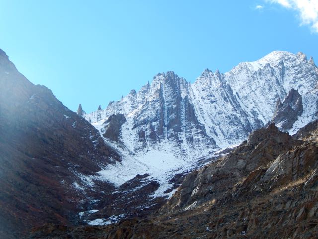
Sadly, there were very, very few cairns. Mostly I made up my own route. The new snow got thicker and thicker.
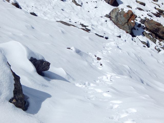
I was the second visitor here since the snow fell.
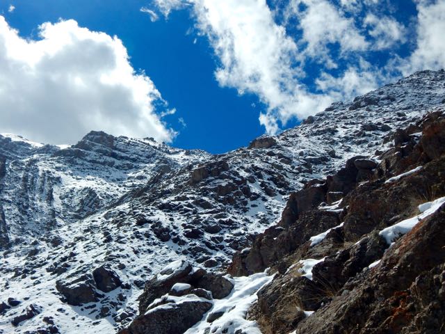
As the morning warmed-up, snow got softer. At the top there were sections of exposure.
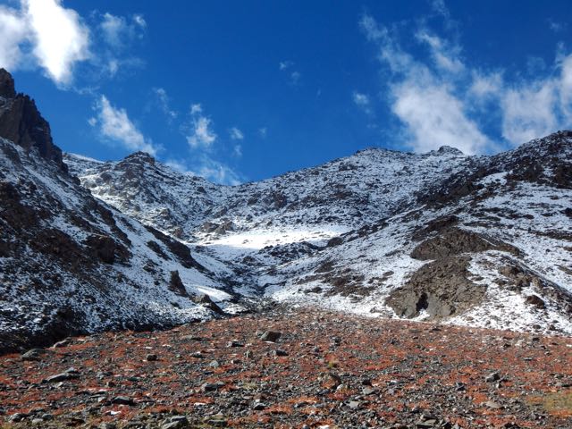
The slope got steeper. Finally – pissed off – I dropped my pack and climbed up the slippery, frustrating slope without it.
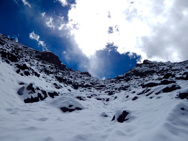
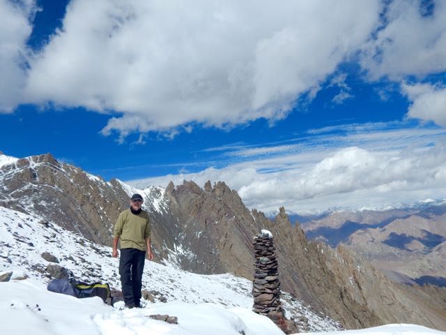
Happy. Happy. I finally saw the prayer flags of Stakspi La 5177m (16985ft).
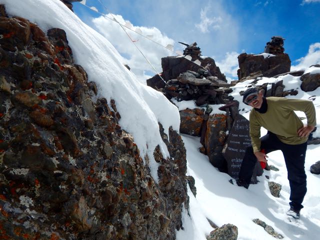
Thanks the Gods. The other side was an easy descent, in comparison. I’d feared it would be as snowy and slippery as the ascent side.
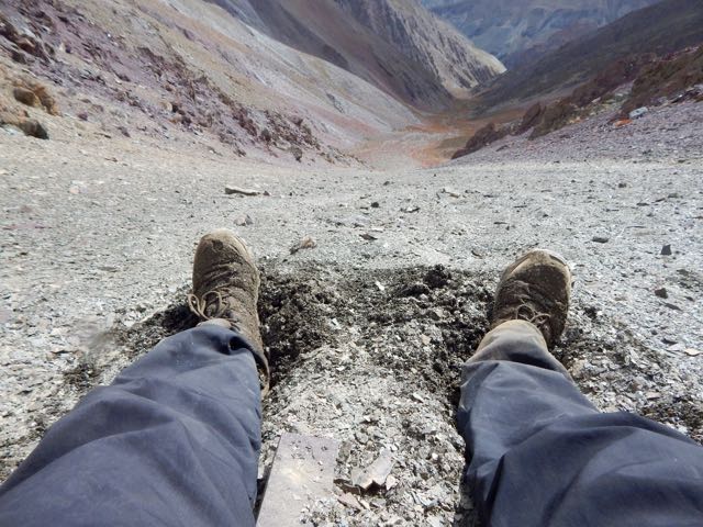
It was an 15 excited minutes down. 35 very motivated minutes back up with the pack. (The alternative – having to retreat on that soft snow could have been disastrous.)
Even better, the downhill was a soft scree slope. Fun. And very easy on the knees and feet.

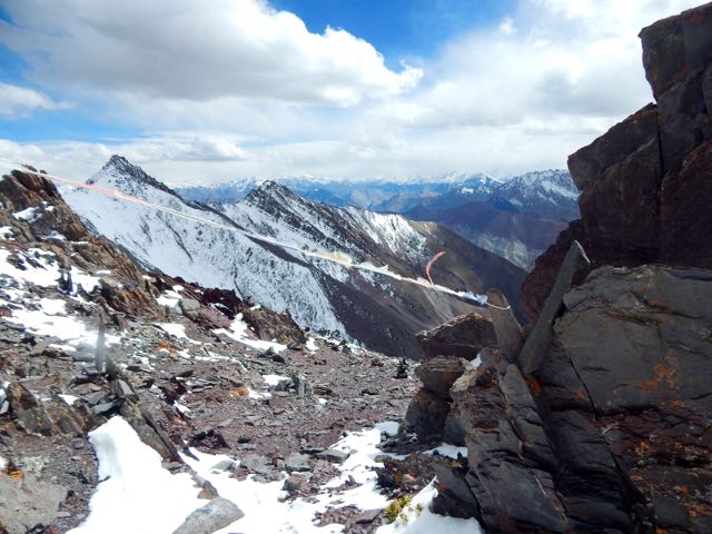
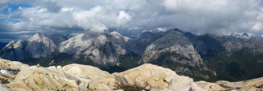
Very quickly I was at the valley bottom looking back at the Pass.
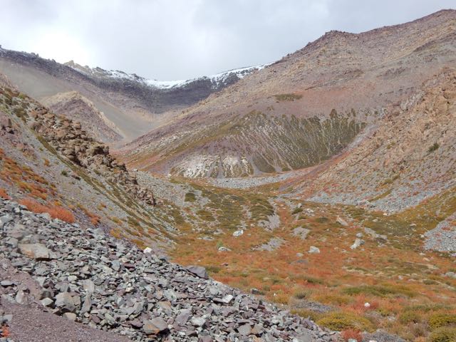
Already I’d concluded to NOT recommend this route on my hiking site. It’s far too dangerous. And it was obvious that very few people ever cross it.
I’d not taken the time to melt snow so had very little water left at this point.
I could see small springs up high on the slopes, but was watching closely for the start of water in the main valley. And for good camp spots. I was exhausted.
I spotted one possibility.
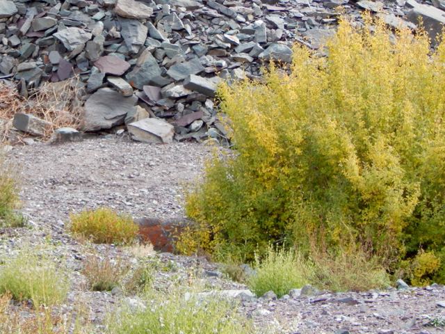
Then 2 snow leopards resting next door! There may be as few as 7000 left in the wild.
One took flight instantly. And was gone.
The other stayed. And stared me down. I franticly fired up my camera into video mode.
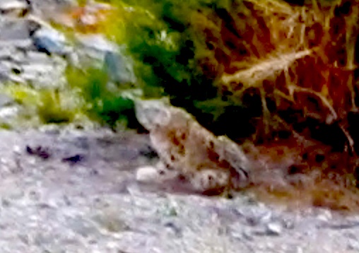
Eventually the second took off after the first, both disappearing into some scrub trees on the mountain slope.
Click PLAY or watch the video on YouTube.
I hung around for another 30 minutes, hoping to see them again. But I believe both stayed in the trees motionless. Watching me.
Needless to say, I didn’t camp there. I moved on down the valley.
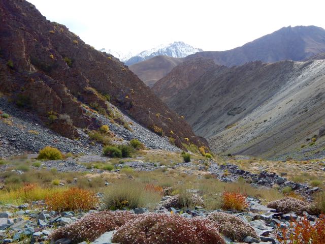
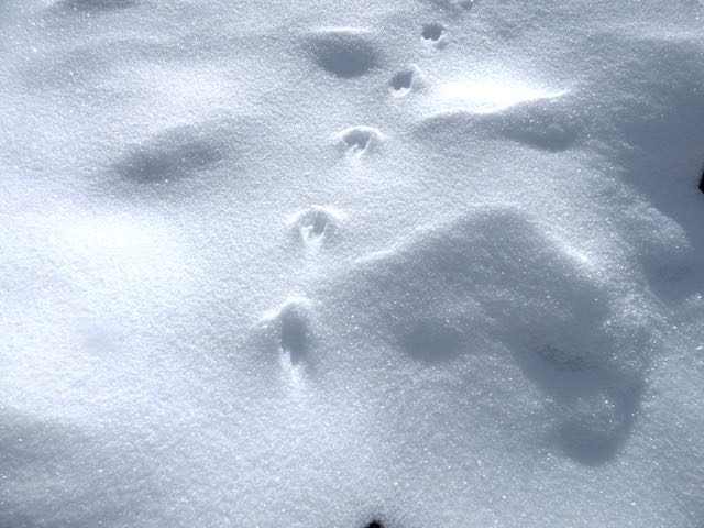
About 15 minutes later I found out why the snow leopards were so close to a human trail. They were on the hunt. This is their favourite prey – Blue Sheep.
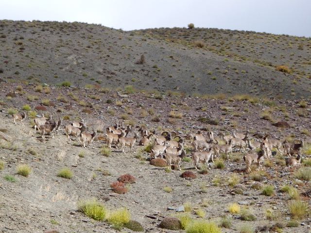
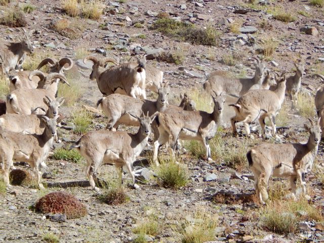
Why were these sheep so far from the protection of a rocky wall? I could only guess they’d come down for an evening drink of water.
Not much further down I found a protected, hidden spot by the finally running water. And crashed early.
It had been a rough day.
But seeing snow leopards definitely made up for my suffering on the ascent. The Snow Leopard (1978) by Peter Matthiessen is one of my favourite books. In it George Schaller and Matthiessen search for Himalayan blue sheep and Snow Leopard. Schaller eventually spots a snow leopard, but Matthiessen does not.
See all the high resolution photos from this day.
day 0 | day 1 | day 2 | day 3 | not recommended
trip report by site editor Rick McCharles
day 1 | 2 | 3 | 4 | Sunshine Coast Trail information page
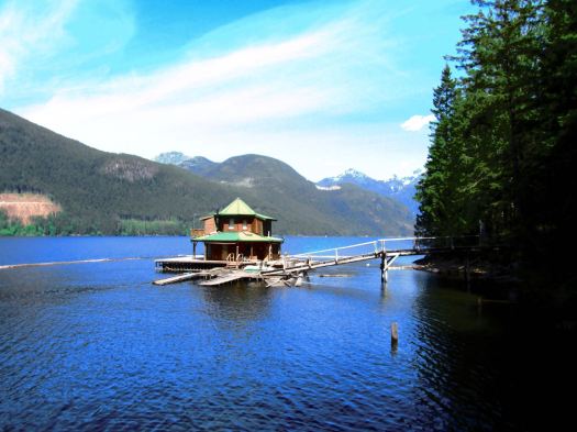
This was my toughest day. A steep scramble up to Confederation Hut on the same-named lake. Then a long descent down to Fiddlehead Landing Hut. And finally a steep slog up to the top of Tin Hat Mountain.

This is not Fiddlehead Landing Hut. Rather a floating holiday home next door.
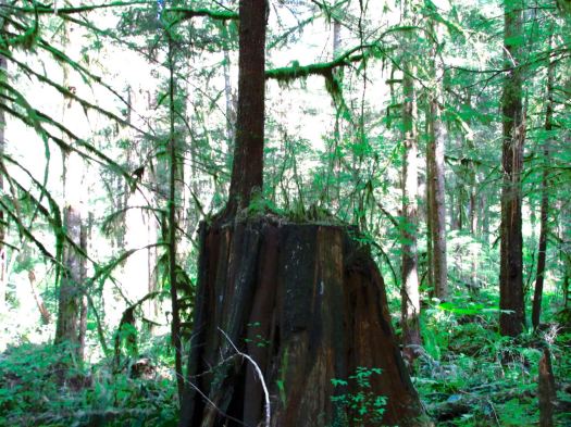
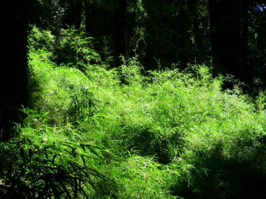
Hiking temperate rain forest can be lovely. Soft mulch underfoot. Plenty of variety. Nurse logs. Good visibility even in the trees.

I didn’t see much wildlife. Other than garter snakes.
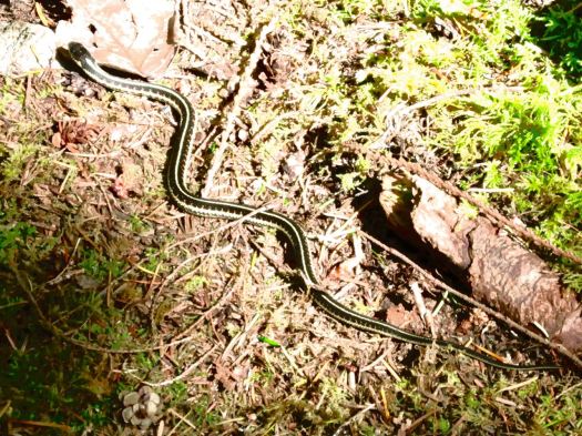
One snake was eating a banana slug. I’d believed NOTHING could eat a banana slug. 🙂
Lisa from Ontario had seen a bear near the start of SCT. But – in general – you don’t see much aside from birds.
… Fact is, I never made it to the top of the mountain. About an hour short of Tin Hat Hut I dropped my pack on the trail and set-up on the trail.
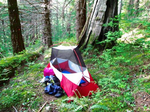
Could barely keep my eyes open. That was 7pm. I’d been almost all of 12 hours on my feet. Mostly climbing up or down.
day 1 | 2 | 3 | 4 | Sunshine Coast Trail information page
Cam Honan:
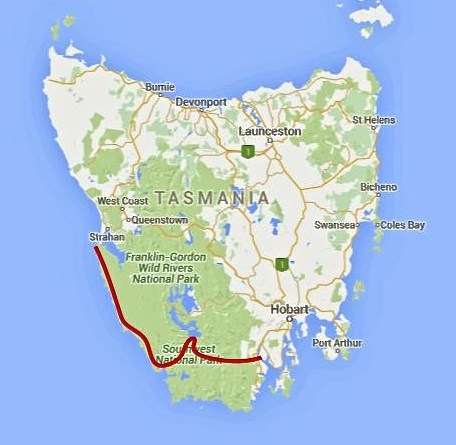
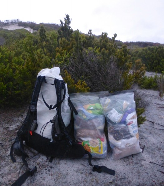
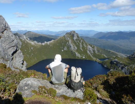
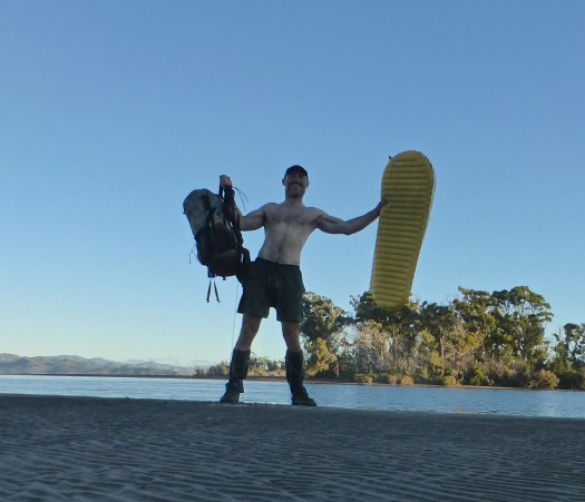
Between February 27 and March 22 of this year, I completed a traverse of the southwestern region of the state. One of the wildest, most pristine backcountry areas on the planet, it was a hike I had dreamed of doing for almost two decades. …
200 miles (322 km) approx. …
Time: 24 days
Daily Average: 8 miles (13 km) approx. This included one rest/resupply day. Hiking, scrambling, bushwhacking, climbing, paddling, crawling, swimming, rock hopping…………yep……..the terrain really was that challenging …
trip report by besthike editor Rick McCharles
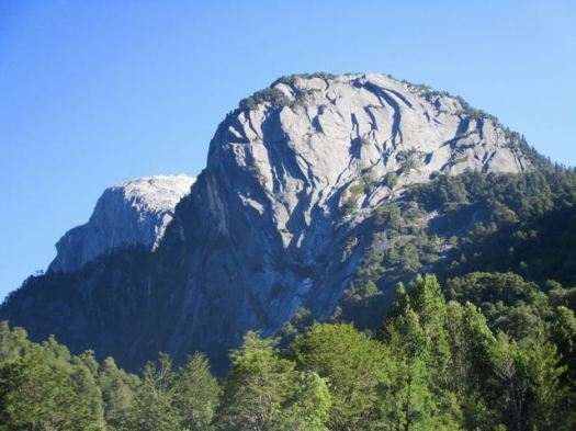
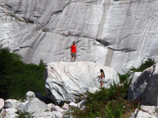
Not being a rock climber, I’d never heard of Cochamó before this trip. But the photos were intriguing.

… The valley has a striking similarity to Yosemite Valley, due to its granite domes and old-growth forests. Like Yosemite, rock climbers from around the world come to climb the valley’s several 1,000 meters (3,300 ft) granite walls. However, it is also an unexplored paradise for serious and hikers – with trails ranging from easy to challenging, a myriad of rare bird and plant life, and a stunning landscape. …
The trail’s most famous users were Butch Cassidy and the Sundance Kid, who, while hiding out for a couple of years at their ranch in Argentina, actually drove their own cattle down to sell in Cochamó. …
Almost the entire valley is privately owned …
International tourism was pioneered by German adventurer and maverick, Clark Stede, who brought the trail to the attention of mainly European visitors, and established two lodges – one at the mouth of the River Cochamó, and an “outback” lodge in the upper La Junta Valley (the ‘Yosemite’ of Chile). These evolved into Campo Aventura. (currently closed) This was in the early 1990s …
Getting to the Cochamó valley was more complicated that expected. The bus we awaited in Puerto Varas did not bother stopping as it was already full.
Myself and 2 other Canadians from Alberta decided to take a 30 min bus to Puerto Montt – the start – in order to get seats on the next bus to Cochamó.
In fact, many buses that Saturday were leaving Puerto Montt full. Cochamó is very popular with Chileans during the summer.
The bus drops you at Cochamó town or the turnoff to the trailhead, just past the town.
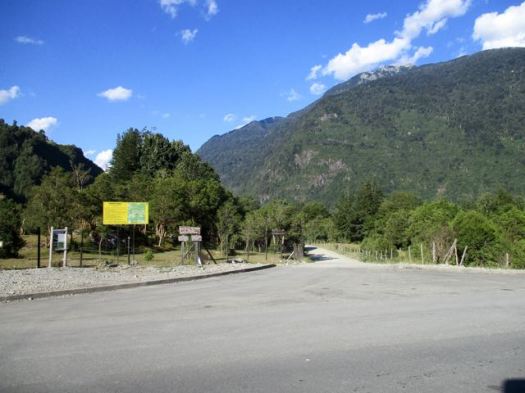
From there I paid an additional couple of dollars for a shuttle to the trailhead itself.
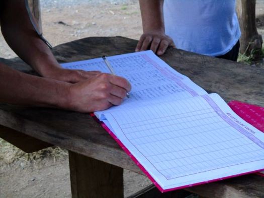
You are required to register but there’s no cost for the hike.
You head into the trees. For 13kms.

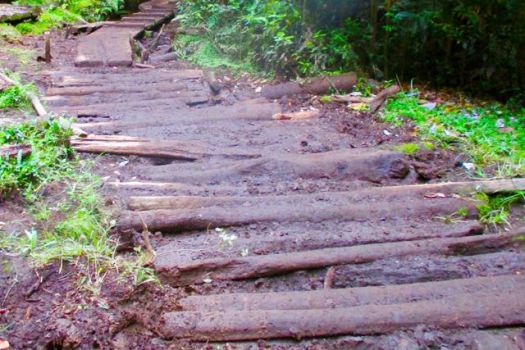
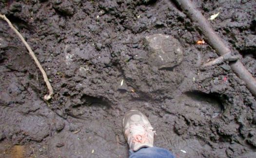
13kms of muddy, horse churned muck.
Luckily, it had been sunny for weeks prior to my visit. I could almost get through without getting my feet wet.
About the only highlight was catching glimpses of the crystal clear, pretty river.

I ran out of daylight putting up my tent near the trail about 10pm.
Very early next morning I hiked on another hour or so to La Junta.

Of several campgrounds available, I was most impressed with Camping Trawen.
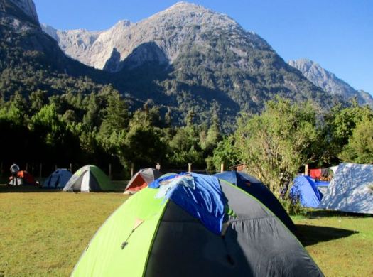


But a petty tyrant lady terrorizing campers there motivated me to cross the river by cable car to stay at the next campground.


For hikers it’s recommended to camp in the valley. Day hike up, up, up on 3 different trails:
• Trinidad (13km return)
• Amphitheatre (8km return)
• Arco Iris (13km return)
I planned to do Trinidad & Amphitheatre day 1. Arco Iris day 2. Then hike out in time for the bus.
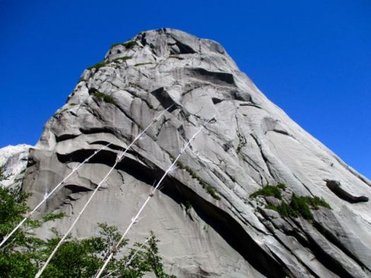
Views from La Junta were enticing. It did not look all that far to the walls.
I started up quickly passing the famous water slide.

I was the first person to start up Trinidad that day. It took a couple of hours of scrambling (hands & feet) to get to granite. In the trees without all that many views.

A couple of young guys caught me and we traversed together for another hour.

Route finding is tricky. These are not park trails but rather bushwhacking routes – the fastest ways climbers have found to get to the lines they want.
When I got to this vista I sat down to enjoy lunch.
A condor was checking us out.

The boys sat too. They couldn’t find the route to the end-of-the-line laguna.
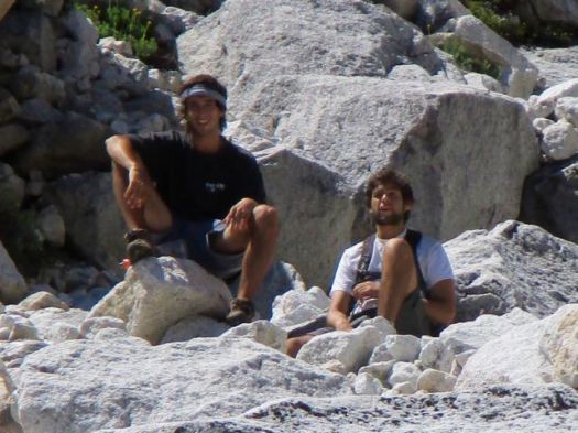
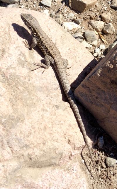
It was us and the lizards.

I turned back, still wanting to get to Amphitheatre in the afternoon.


Back into the trees.
It seems Amphitheatre is far less popular. I saw very few people on this “trail”. There was some rope assistance for scrambling over this rock. It would be very, very slippery when wet.

Orchids, I assume.

Amphitheatre is impressive. 🙂


This was about 4:30pm, however. I didn’t stay long.
Sadly I left my camera at Amphitheatre. It was embarrassing to tell other hikers descending why I was going back up. Two hours back up. 😦
… It wasn’t there. Merde.
Happily, this guy had found my camera somewhere on the trail. Then hung it on a branch across the trail so I couldn’t miss it on my second descent. 🙂
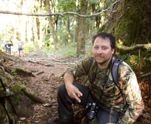
That was about 7pm.
I hustled down as quickly as possible but it was still near dark before I reached my tent. I was exhausted from 15 hours or more on my feet. And fed up with narrow, dangerous scrambles.
Next morning was cloudy.
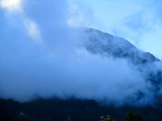

But I’d already decided to skip Arco Iris. That’s a shame.
Arco Iris is probably the best “hike” in the valley. A relentless, steep hike involving fixed hand lines and good exposure takes you to treeline and a spectacular view point on the north side of the valley. From here, you can continue to scramble up to the summit and be rewarded with some of the best views you will probably ever see. Although this is certainly a serious scramble, trekkers comfortable with exposure and handlines should be able to make it. If big drop-offs scare you or you haven’t done any very steep trails requiring use of your hands extensively, then consider passing on this route.
I walked out. Very tired.
If this all appeals to you, go for it. But I’m not recommending this destination for hikers. 95% of the time you are tree locked. The 26kms return in muddy ruts is not worth the time when there are so many better hikes in Chile nearby.
Hopefully it will be made a National Park one day. Trails, access and navigation improved.
trip report by site editor Rick McCharles
day 0 | 1 | 2 | 3 | 4 | 5 | Traverse info page
Estero Nilfe > Camping Chinay picnic area
Good morning. 🙂


I went for a wander in my crocs.

We could see steam venting from Villarrica.

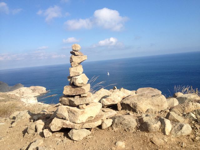
I left a Summit Stone in the Valley of Fire.

Starting up again we soon got our first view of the biggest volcano, Lanin.

The 3 Amigos were loving this.

Interesting mixed terrain today.


Pedro is a big guy – about 100kg. But he was still heavily loaded.

This was the first overnight hike for the two Brazilian guys.

I love weird volcanic geology.

More Monkey Puzzle.


One of my favourite photos from the trip.

These are the most impressive flowers up here.

Once again we saw no wildlife aside from hares. The lizards are entertaining, however.

When we finally reached the first bigger creek on our trip, I decided to soak my feet.

Pedro took the plunge.


Big trees. Good water. We considered camping here.

Instead we walked on to a mostly disused road eventually catching a short ride.

In the end we set up at an old picnic site at (currently closed) Camping Chinay.

A hiker from France joined us in trying to finish our 3 litres of wine. 🙂

trip report by besthike editor Rick McCharles
day 0 | 1 | 2 | 3 | 4 | 5 | info Condor Circuit
I had a long way to go today. But it was mostly downhill.

Back past Laguna Ánimas, busier than when I had camped here.

Two large water birds seem to spend their nights here.

The easy way to descend snow fields.


Though I’m afraid of riding horses, Chile is ideal country for cowboys.

Back to the green. And some shade.

Impressive Bolsón was packed. This great weather had inspired more folks from Santiago to takes some time off work.


This day I did see two large hares, the only indigenous mammals I found.
Surprisingly I saw no sign of snakes or scorpions. Or rodents. My principle companions were tens of thousands of these guys.
On the trail the only language I heard was Spanish. Foreign hikers do not seem to get here much. It’s another Chilean secret. 🙂
Catching the Parque Inglés bus back to Molina, a tranquil town of about 40,000. I (eventually) found an inexpensive and interesting place to stay in the small town. With a BIG swimming pool.
Hostería Suichi (Suisse + Chile) run by Robert, a (now jaded) Swiss expat.
Robert gave me good information. And cooked up a beef soup typical of the region for me.
In the evening I ate ice cream and hung out in the plaza. As everyone does.
On the street late night I bumped into a Chilean couple on holiday who ended up staying at the Hostería. Next morning we had breakfast together in the popular restaurant. 🙂
Meeting new people is one of the great highlights of travel.

“… Arguably the best hike in all of middle Chile, the full-day Sendero Enladrillado takes you to the top of a unique 2300m basaltic plateau with stunning views. …”
– Lonely Planet

How could I resist? 🙂
I reached Reserva Nacional Altos de Lircay from Talca bus station, 65km west of the Park. A sunny summer Friday afternoon, my Buses Vilches contraption headed to the mountains was packed. I was lucky to get a seat, one of the few perks of having grey hair.
From where the bus drops you off after 90min it’s around a 2km walk uphill to the Conaf administration building. Open even though it was after opening hours.
An older gentleman checked me in but – for some reason – charged me double for Park entrance. 10,000 rather than foreigner’s rate of 5000 pesos. I assumed the extra 5000 was for camping. At the time.
I was given a simple map and instructions on the best hike. A counterclockwise loop seeing all the highlights over about 8 hours.
It was dusk by the time I walked uphill another 2km (in crocs) to Camping Antahuara, also run by Conaf. The boys at the campground – after seeing my two Park entrance receipts, did not charge me for camping. Gracias.

Conaf’s Camping Antahuara is an excellent campsite. And I actually had electricity!

I listened to audio books, Spanish lessons. And got to sleep early.
Morning dawned bright and sunny. Again. It was a summer heat wave in Chile.
By 8am I was started up to Enladrillado carrying only a day pack. It felt easy.


This is a popular hike. I saw nearly as many people as lizards.

It’s steep in places. I recommend you hike right to left, climbing more gradually to the Enladrillado, descending from the Laguna viewpoint.

Enladrillado is great. But if you’d climbed all the way up here without seeing Descabezado (“decapitated”), you’d be disappointed. This is a hike for good weather. Phone the Ranger station (71) 220 9517 to check on he visibility before heading up.

It was getting hot.

I hid out in the shade dreaming of hiking all the way to Descabezado base camp. And climbing. Some day.

Starting here and continuing to Parque inglés is called the Circuito de los Condores. (Condor Circuit)
That’s what I should have done this trip. 😦
Next I started looping back towards Camp across the dry plateau.


Up high I saw only 3 small water sources. It’s not easy for flora or fauna to live up here.


Some cloud was rolling in down in the valley. Rangers had warned that a “little rain” was in the forecast for the weekend.

Here’s the viewpoint overlooking the laguna.

It’s a lot further down than it looks.

Though all kinds of signage makes clear that camping is not allowed, it appears the rule is not enforced. Many hikers up here were carrying sleeping bags.
This large group did not get to the top of the plateau until 1:30pm. Sadly the clouds were climbing higher. They’d likely miss the views.

I was back in camp before 4pm. The only highlight on my return this fox. In Spanish you can call him “El Zorro”.

I’d seen his cousins in Patagonia (10yrs ago) brazenly rob tents. I resolved to be more careful hiding away my camping food in Chile.

Enjoying the campground, I decided to stay another night rather than bus back to the city. It rained all night. 😦 I missed the morning bus by 2 minutes 😦 delaying my exit by about 5 hours.
Still, I highly recommend Sendero Enladrillado in good weather. I’ve added it to our list of best hikes in South America.
The best guidebook I’ve seen is Trekking por Chile 40 Rutas 2015 (Spanish). It’s available in larger bookstores in Chile.
related wiki – Altos de Lircay circuit, Enladrillado
Guest post by mountain guide Roberto Calcagno:
I have been hiking Gran Paradiso National Park since I was 3yrs-old. My parents brought me there 3 months each season, my favourite time of the year. In Gran Paradiso I discovered my passion for the mountains and for nature in general.
After 30 years traveling around the world, exploring many other amazing destinations – including the Himalayas, Andes, Pamir, Andaman Sea – I had to conclude there is no place like home. Gran Paradiso National Park is my favourite place in the world.
Gran Paradiso was the first National Park in Italy and is today the largest. Cogne village is near the heart of this magnificent region. From Cogne there are hundreds of hikes and climbs. The mountains are rugged. Though there are many trails, most of the mountain valley crossings are challenging. Hikers need alpine experience.
Gran Paradiso National Park is two hours far from Turin and 3 hours from Milan, in the top north west corner of Italy.

The mountain environment is stunning with glaciers, alpine lakes and plenty of wildlife including ibexes, chamois, marmot and golden eagles.


Accommodation of all kinds are available: campsites to 4 star hotels. Food here is heavy but amazing with mountain cheese and typical rice and polenta dishes. Delicious food is just one of hundreds of reasons to come to visit this gorgeous park.


___
Roberto Calcagno was born in Turin, Italy. He is 30 years old, formerly a Telecommunication Engineer who studied and lived in both Chile and Thailand. He’s always loved Nature, especially the Alps. Roberto switched jobs some years ago to follow his passion and become a hiking guide. Today he’s the owner of trekking-alps.com. Contact Roberto via that link if you are interested in hiking these mountains.
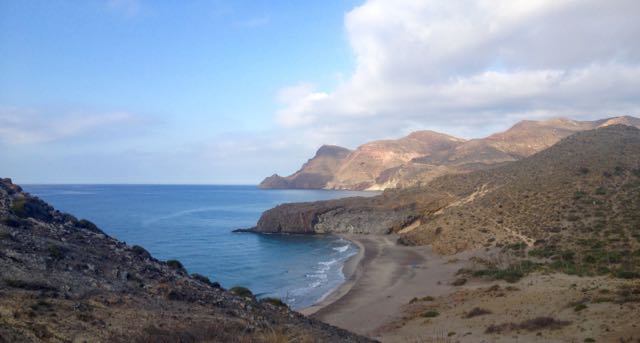
After freezing for 3 nights on the Sierra Nevada Traverse, the nearby Mediterranean coast of Spain appealed.

Cabo de Gata-Níjar Natural Park is Andalucia‘s largest coastal protected area, a wild and isolated landscape with some of Europe’s most original geological features. It is the only region in Europe with a true hot desert climate.
The eponymous mountain range of the Sierra del Cabo de Gata with its highest peak El Fraile is Spain’s largest volcanic rock formation with sharp peaks and crags in red/ochre-hues. It falls steeply to the Mediterranean Sea creating jagged 100-metre (330 ft) high cliffs, which are riven by gullies leading to hidden coves with white sandy beaches, some of the most beautiful in Andalucia. …
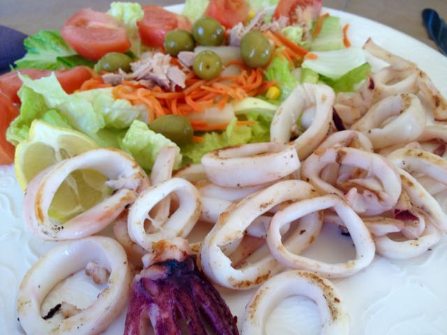
I departed Granada by bus at noon. And was sitting down in Cabo de Gata town for Calamari by 4pm.
Cabo de Gata is a popular beach town in “summer”. But by mid-October it looks like this.

Mine was the only open restaurant. I need to wait for siesta to finish so I could buy 6 litres of liquid (mostly Coke Zero) to start the walk. Happily, the tiny supermarket opened at 5pm.

Lonely Planet Hiking in Spain describes a 52km coastal walk from Cabo de Gata to Aqua Amarga. I planned to start. And continue as long as I wanted. Bus transport back from Aqua Amarga is a problem. 😦

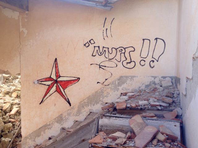
Passing retirees enjoying the sun, first stop is the Cabo de Gata tower.

Turns out there is a series of these ruins up and down the coast.
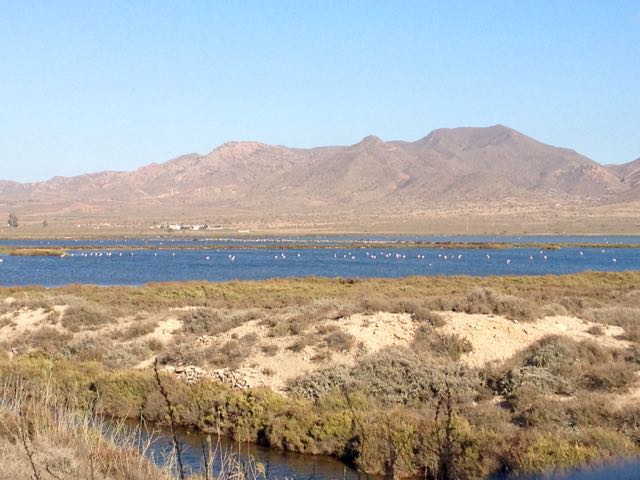
Between the village of San Miguel and the Cabo de Gata point are salt flats. This is an important stopping point for migrating flamingoes and other birds.

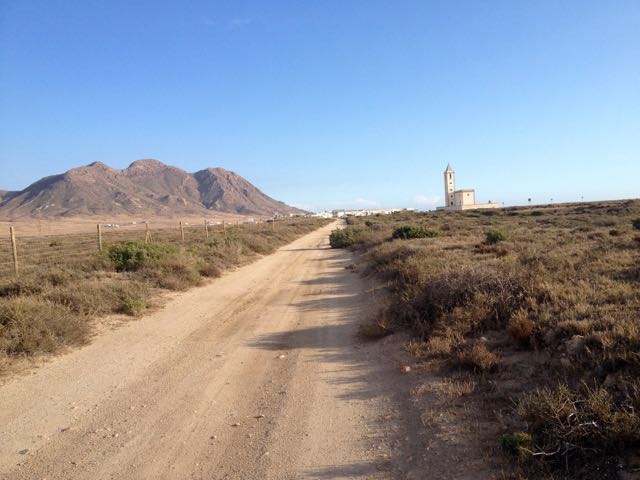
In the distance loomed this impressive church.
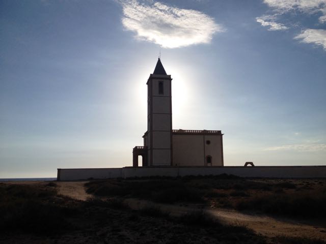
The beaches were near empty. Only one fisherman on this one.

It was a steep climb up and over to reach the Cabo de Gata light station.

The rugged geology is impressive.

Many tourists drive out to enjoy the views at dusk.

The only other person left standing in the dark with me was a young German who had rented an apartment in San José for a week. We walked together past the road block, back towards his place.
Together we found this tent spot. Quiet. Peaceful. And much warmer than 3000m in the Sierra Nevada.

___
Here’s a glimpse looking back to where I’d come from. Next morning.

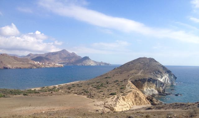
I’d been looking forward to tramping a series of pocket beaches.

If the tides are right, you can scramble between most of them. This was a highlight of the trip.

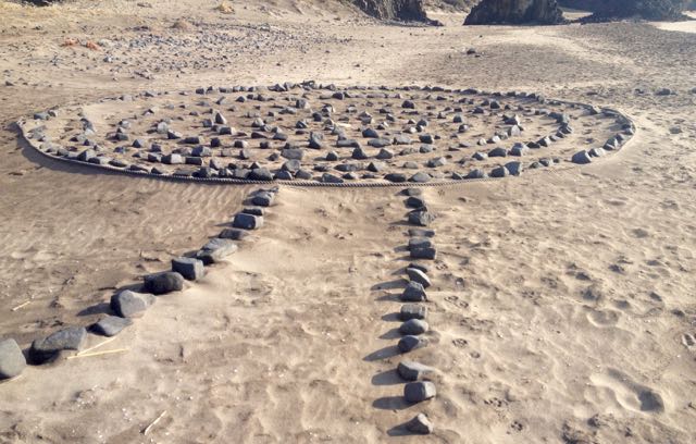
This time of year you’ll see nude and topless sunbathers at pretty much every near deserted beach.
And artists. 🙂

There’s San José (Almeria) in the distance. The centre of Parque Natural de Cabo de Gata.
I’ve seen cows (Sri Lanka), kangaroos (Australia) and goats (Spain) on beaches. Never once understanding why they would want to be there.

This is a desert. There’s very little water.
This windmill marks the start of town.

I could spend a week or two in San José. It’s lovely. Population about 1000. Plus tourists. And there are very few tourists in October despite daily highs around 28C.
An ideal idyl for cyclists, hikers, artists and photographers, I’d say. Lawrence of Arabia and the Clint Eastwood spaghetti Westerns used this location.
The campground was (surprisingly) closed. On a whim I checked the Aloha Hotel, recommended by Lonely Planet. When they offered me a pool view room for only 40EU, I couldn’t resist. After all … “recovery is an important component of every successful hike”. Plus wine. 🙂
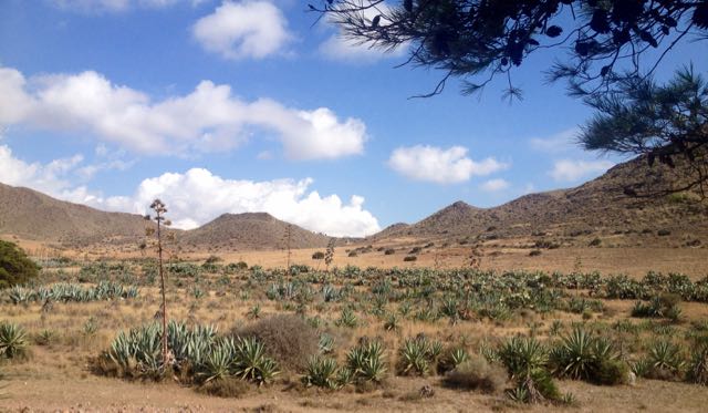
In the afternoon I continued my hike – without backpack – up into the hills beyond San José. Here’s a glimpse back to town.
It’s rough and arid.
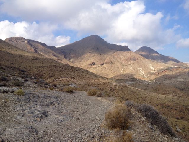
But with gorgeous coastal views.
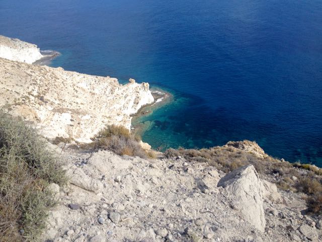
I enjoyed chatting with a very tan elderly couple from GBR before finally stopping at this ruin.


This vista was the end of my Cabo de Gata hike.
I turned back to civilization.
