Check out some of these. I probably link most to The Hiking Life.
The top sites that made this list are ranked according to Alexa (33.3%), Domain Authority (33.3%), Page Authority (33.3%) indicators. …


Best hikes, treks, tramps in the world.
Check out some of these. I probably link most to The Hiking Life.
The top sites that made this list are ranked according to Alexa (33.3%), Domain Authority (33.3%), Page Authority (33.3%) indicators. …
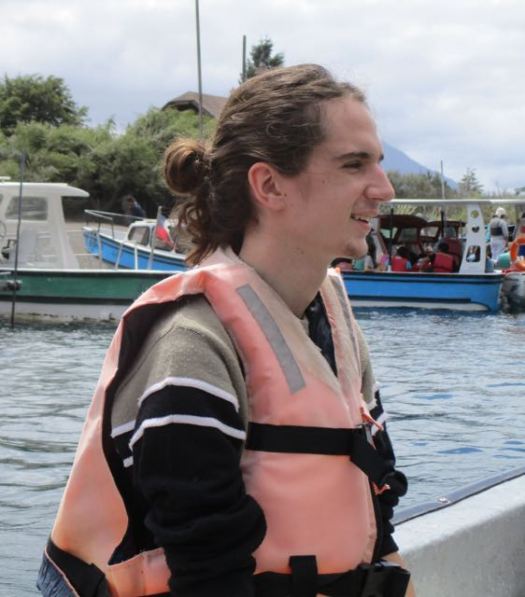
My last day in Chile I was lucky enough to meet up with Jan Dudeck and his partner at the Santiago bus station.
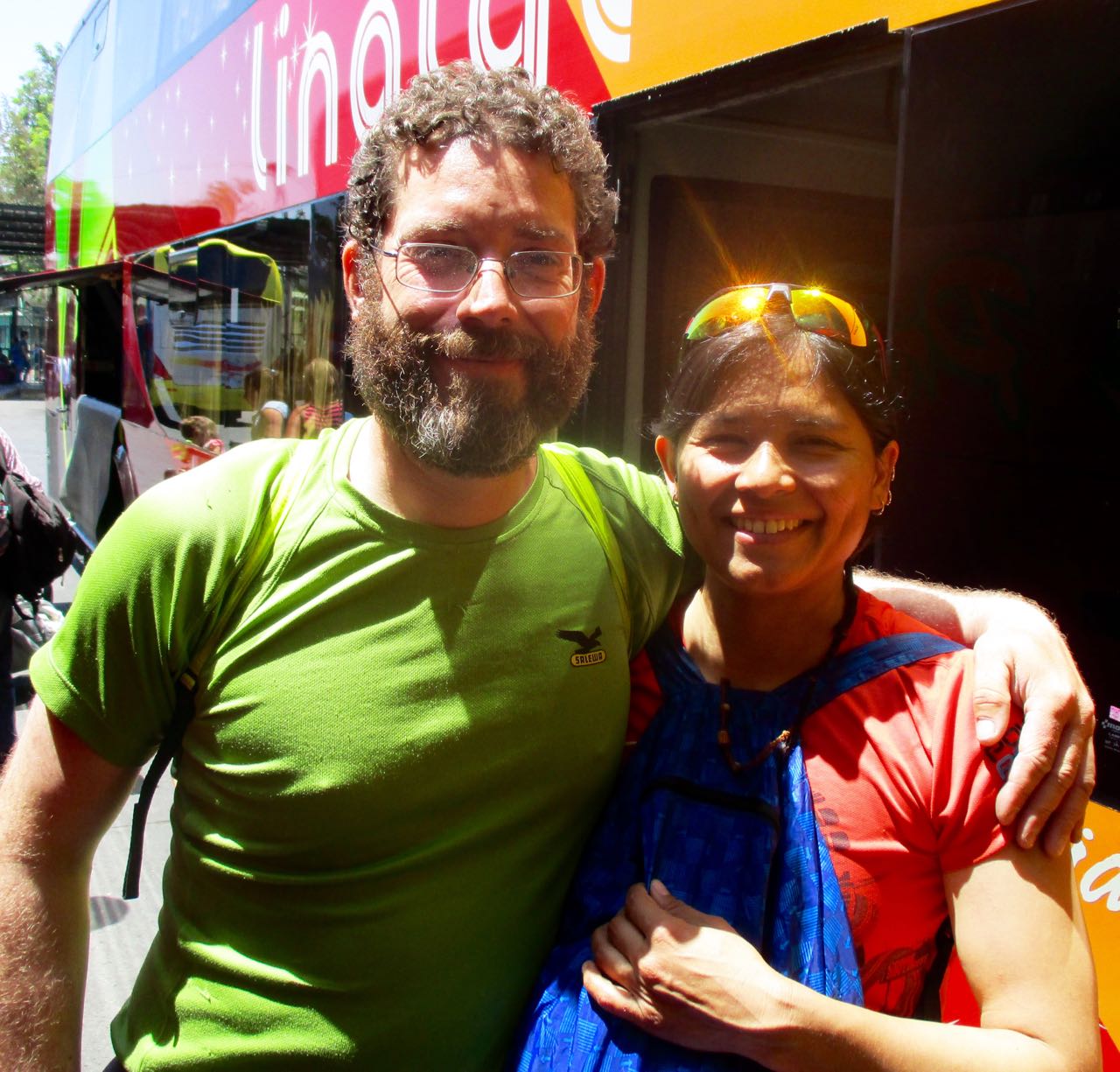
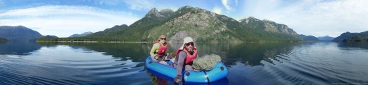
We carbo-loaded on ice cream while I got a personal update on what happened on this their 3rd season on the long distance hike. Carrying an Alpacka packraft on sections.
Once back in Europe, Jan will be updating the wikiexplora page with new data. New alternative routes.
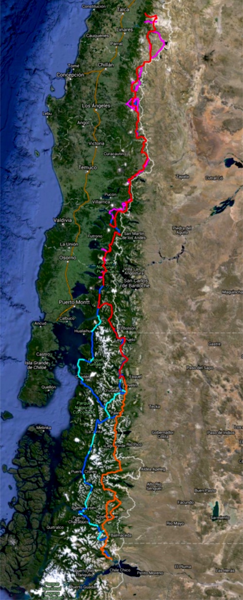
The Greater Patagonian is not an official trail but rather 1500km or more of connected best routes in Chile and Argentina. You’ll be lost for sure unless you have KMZ and GPX files downloaded from wikiexplora.
As they research possible new options Jan actually starts with cached Google Earth images. Then looks for the faint trails he sees there to mark waypoints on their GPS. They don’t bother carrying heavy topo maps.
I tried and failed on section 1 of the Greater Patagonian in January. But am very tempted to go back next Jan/Feb to try other sections.
trip report by site editor Rick McCharles
day 0 | 1 | 2 | 3 | 4 | 5 | Traverse info page
Laguna Avutardas > Pucón
We set the alarm for first light. Planned to get out as quickly as possible to avoid horseflies. Happily we didn’t suffer many this day.

A shaded and green exit.

Civilization. Of sorts.

You walk the final few kms on another disused road.
On reaching the highway we managed within minutes to hitchhike to the next town. The driver asked a few dollars which I was happy to pay.

On arrival in Curarrehue we again had to wait just a few minutes before departing on the local bus for Pucón.

Back at the hostel I dried my gear. Repacked for the next hike.

It was a hot and fabulous day in town, most tourists getting sunburned at the beach.


I wandered town on this our last day taking photos.

The last eruption was 1971, lava almost reaching the town.


We ate bread and cheese. Chatted with the Banff Mountain Film Festival organizer for South American in the evening. Talked past and future travel.
Farewell Pucón. 🙂
trip report by site editor Rick McCharles
day 0 | 1 | 2 | 3 | 4 | 5 | Traverse info page
Upper Estero Mocho > Laguna Avutardas
Lonely Planet recommended Upper Estero Mocho for camping … but it isn’t a particularly good site. The water source was standing pools.

We would have been better to camp higher for better water.
Weather continued perfect.

50km of 81 total. We hoped for BIG mileage today as the going was easier.

Laguna Azul, out first big lake of the trip.

The Brazilians had never seen snow in person until this trip.


Lunch vista.

We stopped at the lake, as well.

Victor – somehow – lost one of his sandals there. By this point both the guys had switched over from their hiking boots (too small) for sandals.
Victor was forced to put his boots back on despite blisters.

… Or was he?
Instead Victor tried hiking in several pairs of socks with the boot inserts.

I can’t recall ever hiking with anyone using that system. 🙂
The next section was intensely beautiful.


I hoped this lizard would ride along and help me chase away horseflies.

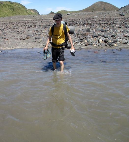
Our only river crossing.
We bypassed Laguna Blanca.

WOW!


This was my favourite section of all. The sky amazing.

Finally we began dropping back down into the trees.


We camped at Laguna Avutardas making this day 25km or more, double the recommended Lonely Planet distance.

There were too many cows crapping in the lake for my liking.

Again I walked back for better water.
This curious calf came to visit. We again were again hiding out in our tents to frustrate horseflies.

trip report by site editor Rick McCharles
day 0 | 1 | 2 | 3 | 4 | 5 | Traverse info page
Camping Chinay picnic area > Upper Estero Mocho

We debated whether or not to sidetrip to the Palguín hotsprings. Lonely Planet claimed it was 3.5km by road one way. That would mean 7km total IF we couldn’t find a ride with a vehicle.

The walk was actually about 8km one way. AND the one hotspring we paid for was not particularly hot. I did enjoy the menu of the day, however.

A first for me – burnt sugar cubes.

Happily we were able to get a ride back from the hotsprings to the trail, paying a staff person a few dollars for the lift.
Our first hassle on this trip. Burrs. 😦 It’s difficult to avoid them at lower altitude.

In fact, the Traverse is two hikes separated by the road walk we took yesterday. Theres no real reason to walk them connected. The start of the second half is here.
It was a steep climb to get back up to the Traverse.

The Monkey Puzzles kept me moving.

We were steadily leaving Villarrica behind.

Here’s one of the highlights – Mirador los Volcanes. We could see at least 6 from one spot.


What you don’t see in the photos are hordes of horseflies (called tabanos here) even up at that high altitude in the wind. Later we learned that south central Chile doesn’t have many mosquitos, but they do have horseflies in January. I’ve never seen them so aggressive.
From the Mirador it’s a long, interesting ridge walk.

We walked quickly, swatting flies.

When we finally reached the Lonely Planet recommended camp all we could do was jump into our tents to hide out until dark. The flies were that bad.

trip report by site editor Rick McCharles
day 0 | 1 | 2 | 3 | 4 | 5 | Traverse info page
Estero Nilfe > Camping Chinay picnic area
Good morning. 🙂


I went for a wander in my crocs.

We could see steam venting from Villarrica.

I left a Summit Stone in the Valley of Fire.

Starting up again we soon got our first view of the biggest volcano, Lanin.

The 3 Amigos were loving this.

Interesting mixed terrain today.


Pedro is a big guy – about 100kg. But he was still heavily loaded.

This was the first overnight hike for the two Brazilian guys.

I love weird volcanic geology.

More Monkey Puzzle.


One of my favourite photos from the trip.

These are the most impressive flowers up here.

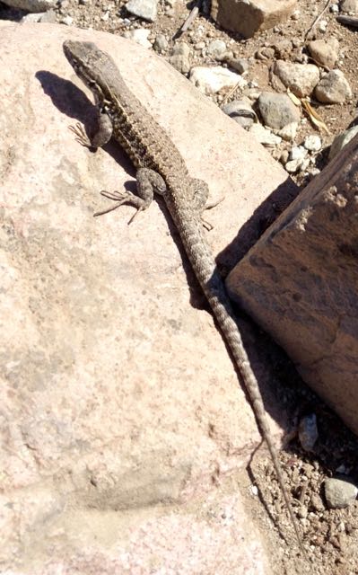
Once again we saw no wildlife aside from hares. The lizards are entertaining, however.

When we finally reached the first bigger creek on our trip, I decided to soak my feet.

Pedro took the plunge.


Big trees. Good water. We considered camping here.

Instead we walked on to a mostly disused road eventually catching a short ride.

In the end we set up at an old picnic site at (currently closed) Camping Chinay.

A hiker from France joined us in trying to finish our 3 litres of wine. 🙂

trip report by site editor Rick McCharles
day 0 | 1 | 2 | 3 | 4 | 5 | Traverse info page
Pucón > Ski Centro > Estero Nilfe
From Pucón we decided to take a taxi up to the Park gates. Much easier than hitchhiking.
The Ranger opened the Villarrica National Park office for us. He’d formerly worked in a Canadian National Park. I chatted with his wife who’s from my hometown, Calgary.

CONAF charges an entrance fee of Ch$5000 to Chileans or Ch$7000 ($10) to foreigners (2016) for using the “Villarrica Traverse”.
Happily we were able to hitchhike the final 17km up to the (ugly in summer) ski resort, the official start of the Traverse.

Slightly overcast (as it often is in the morning in Chile) we quickly headed off into the great blue yonder.

At this point we were literally traversing the volcano. The landscape bleak and blasted. I’d met Victor and Pedro, 2 Brazilian music students, while hiking further north. They decided to join up with me for this BIG and HIGH walk.

My lunch for the first few days was cheddar and buns.

Navigation is very easy on this adventure. Follow the stakes. 🙂

Sadly I still managed to get us lost for perhaps 90 minutes. 😦 When we finally found our way back to the correct route we moved and replaced stakes so nobody else would make my mistake.
Finally the clouds blew off and we got our first good close-up look at Villarrica 2847m. It’s the most climbed volcano in Chile.

Water is a concern. Anything close to the volcano is dirty with ash.

Whenever you find clean water, load up.
Still, water is life. Vegetation regrows only with water.

The Monkey Puzzle trees are a great highlight of this hike. They are the national tree of Chile.


Footing is often difficult in volcanic scoria. Don’t fall.

With so much exposure to the sun, it was always a relief to reach shade.

We camped at the spot recommended by Lonely Planet. Can’t complain about the view. 🙂

I didn’t like the water, however, so walked back to a tarn for perhaps 30 minutes. We did treat a lot of water on this hike.

Good night. It was a great start.

trip report by site editor Rick McCharles
day 0 | 1 | 2 | 3 | 4 | 5 | Traverse info page
Santiago > Pucón
The goal was The Traverse, one of Chile’s best hikes. In fact I now rate it second best after Paine in the far south.
81km
demandingA classic longer trek along the rugged volcanic spine of Parque National Villarrica.
I took a night bus semi-cama. That’s almost a bed, but not quite. About 9 hours. I’ll take FULL cama next time. 🙂

Arrived Pucón early morning. Groggy and disoriented.

My hostel – ¡École! – restaurant was not even open as yet for coffee. But I dropped my bags.

I recommend this excellent low cost accommodation. Folks from the Banff Mountain Film festival were there at the same time.
Pucón is one of the great mountain tourist traps of the world. Picture Banff, Canada with volcanos rather than Rocky Mountains.

If you hate tourists, you might hate Pucón. Young people come mostly for the party.


Personally I loved Pucón. The infrastructure for foreign tourists is superb. And as a jumping off point for wilderness, it’s ideal.
We shopped for groceries. Packed for the trail.
trip report by besthike editor Rick McCharles
What’s the best hike on or around Osorno? (11 eruptions recorded between 1575 and 1869)

I wanted to ask Charles Darwin who had glimpsed the peak in January 1835.
We headed first out to the Petrohue camping area in Vicente Pérez Rosales National Park. A short bus ride out of Puerto Varas.


At the end-of-the-bus-line marina, you need pay a couple of dollars for a boat to get you across the river.

This woman runs one of the dirty, crowded unofficial Petrohue camping areas. The toilets are awful. 😦

Cats, chickens and dogs run (and crap) everywhere.


This kayaker stayed two nights here as the wind was too high on the lake to continue.

We’d met Molly from London on the bus. She and I immediately scrambled up the steep slope above camp.

The river mouth empties into lake Todos Las Santos.

Here’s why Petrohue camping is so popular. The view of Osorno.

I crashed early.

Next morning we packed up as quickly as possible so we could to go do something on the volcano.

Unfortunately the big mountain was cloudy.

At Conef across the river I was convinced to do a relatively easy hike called Desolation, part way up the mountain.

The rest of the group – 6 others – wanted instead to climb as high as possible from the ski resort. So we started walking the road.
After about 6km we managed to hitch a ride (all 7 of us) to the junction. Then we caught another ride to the top of the ski hill.

First stop was the restaurant for coffee.

From here we had the option of riding an expensive cable car. Or ascending on foot.

We walked.

These guys were walking their bikes up. Riding down.


A zip line is in operation. But we didn’t see many people using it.

Up into the clouds.


It was clearer below.

Most visitors hike only to this crater.

We were having fun.


What are these women doing? 🙂


Pedro and Molly were keenest to climb as high as possible, despite cloud.

The ski lift stopped for some reason. A guy climbed up to fix it.

The snow line. This is where I stopped.


The vista was great from there.

Some kept climbing.


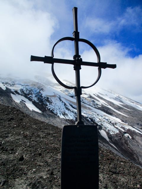
An 18yr-old swiss hiker was lost and died here. I left a Summit Stone at his memorial.

There were several other memorials.
The rest of us started to descend, assuming the peak would not get any clearer. We were wrong.

Back down to the restaurant, we celebrated. Then checked the parking lot for a ride down the mountain.


It turned out to be a great day. 🙂

In minutes we caught a ride for 7 people down to the crossroad.

After walking 2km we (eventually) determined that the bus was no longer running that late in the day. So, instead, hitched a ride for 9 people with the patriarch of our campground.
Back across the river, we ate and celebrated until dark. 10pm. 🙂

From Petrohue camping you can see Volcán Puntiagudo (“Sharp-pointed volcano”). There’s no end to intriguing hiking possibilities in Chile.

trip report by besthike editor Rick McCharles
day 0 | 1 | 2 | 3 | 4 | 5 | info Condor Circuit
I had a long way to go today. But it was mostly downhill.

Back past Laguna Ánimas, busier than when I had camped here.

Two large water birds seem to spend their nights here.

The easy way to descend snow fields.


Though I’m afraid of riding horses, Chile is ideal country for cowboys.

Back to the green. And some shade.

Impressive Bolsón was packed. This great weather had inspired more folks from Santiago to takes some time off work.


This day I did see two large hares, the only indigenous mammals I found.
Surprisingly I saw no sign of snakes or scorpions. Or rodents. My principle companions were tens of thousands of these guys.
On the trail the only language I heard was Spanish. Foreign hikers do not seem to get here much. It’s another Chilean secret. 🙂
Catching the Parque Inglés bus back to Molina, a tranquil town of about 40,000. I (eventually) found an inexpensive and interesting place to stay in the small town. With a BIG swimming pool.
Hostería Suichi (Suisse + Chile) run by Robert, a (now jaded) Swiss expat.
Robert gave me good information. And cooked up a beef soup typical of the region for me.
In the evening I ate ice cream and hung out in the plaza. As everyone does.
On the street late night I bumped into a Chilean couple on holiday who ended up staying at the Hostería. Next morning we had breakfast together in the popular restaurant. 🙂
Meeting new people is one of the great highlights of travel.

