
trip report by besthike editor Rick McCharles
What’s the best hike on or around Osorno? (11 eruptions recorded between 1575 and 1869)

I wanted to ask Charles Darwin who had glimpsed the peak in January 1835.
We headed first out to the Petrohue camping area in Vicente Pérez Rosales National Park. A short bus ride out of Puerto Varas.


At the end-of-the-bus-line marina, you need pay a couple of dollars for a boat to get you across the river.

This woman runs one of the dirty, crowded unofficial Petrohue camping areas. The toilets are awful. 😦

Cats, chickens and dogs run (and crap) everywhere.


This kayaker stayed two nights here as the wind was too high on the lake to continue.

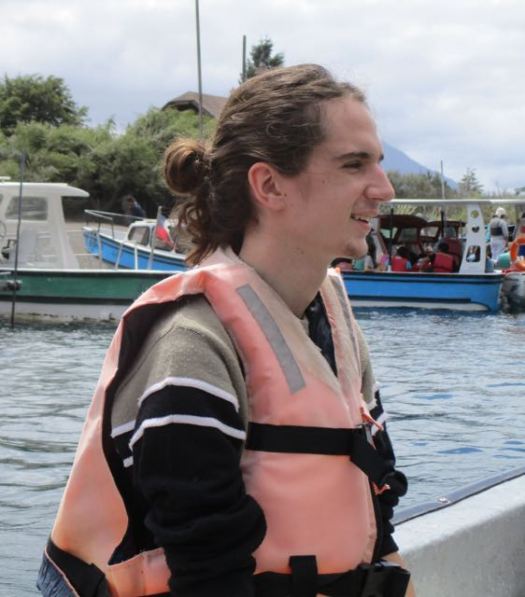
We’d met Molly from London on the bus. She and I immediately scrambled up the steep slope above camp.

The river mouth empties into lake Todos Las Santos.

Here’s why Petrohue camping is so popular. The view of Osorno.

I crashed early.

Next morning we packed up as quickly as possible so we could to go do something on the volcano.

Unfortunately the big mountain was cloudy.

At Conef across the river I was convinced to do a relatively easy hike called Desolation, part way up the mountain.

The rest of the group – 6 others – wanted instead to climb as high as possible from the ski resort. So we started walking the road.
After about 6km we managed to hitch a ride (all 7 of us) to the junction. Then we caught another ride to the top of the ski hill.

First stop was the restaurant for coffee.

From here we had the option of riding an expensive cable car. Or ascending on foot.

We walked.

These guys were walking their bikes up. Riding down.


A zip line is in operation. But we didn’t see many people using it.

Up into the clouds.


It was clearer below.

Most visitors hike only to this crater.

We were having fun.


What are these women doing? 🙂


Pedro and Molly were keenest to climb as high as possible, despite cloud.

The ski lift stopped for some reason. A guy climbed up to fix it.

The snow line. This is where I stopped.


The vista was great from there.

Some kept climbing.


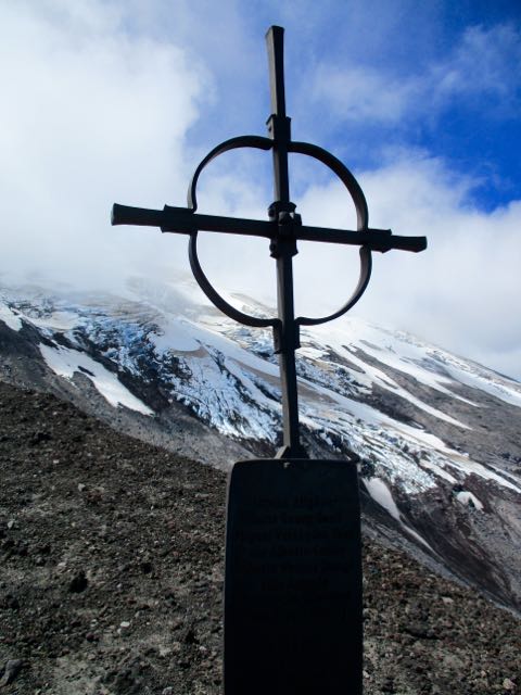
An 18yr-old swiss hiker was lost and died here. I left a Summit Stone at his memorial.

There were several other memorials.
The rest of us started to descend, assuming the peak would not get any clearer. We were wrong.

Back down to the restaurant, we celebrated. Then checked the parking lot for a ride down the mountain.


It turned out to be a great day. 🙂

In minutes we caught a ride for 7 people down to the crossroad.

After walking 2km we (eventually) determined that the bus was no longer running that late in the day. So, instead, hitched a ride for 9 people with the patriarch of our campground.
Back across the river, we ate and celebrated until dark. 10pm. 🙂

From Petrohue camping you can see Volcán Puntiagudo (“Sharp-pointed volcano”). There’s no end to intriguing hiking possibilities in Chile.


2 Replies to “Osorno volcano hiking, Chile”