One of my favourite hikers, Hank Leukart, posted his favourites.
Click PLAY or watch it on YouTube.
I was inspired to update and better organize my own hiking folder.
Thanks Hank.

Best hikes, treks, tramps in the world.
One of my favourite hikers, Hank Leukart, posted his favourites.
Click PLAY or watch it on YouTube.
I was inspired to update and better organize my own hiking folder.
Thanks Hank.
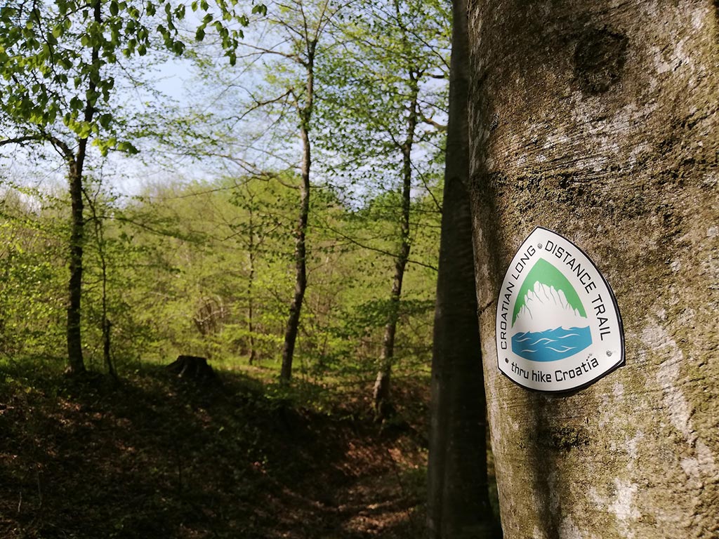
The Croatian Long Distance Trail (CLDT) was pretty much invented by Nikola (Tesla) Horvat.
Croatia shares a maritime border with Italy. The capital city is Zagreb.
As I post the trail is not recommended due to COVID-19 restrictions. Hopefully it will be possible again starting 2021.
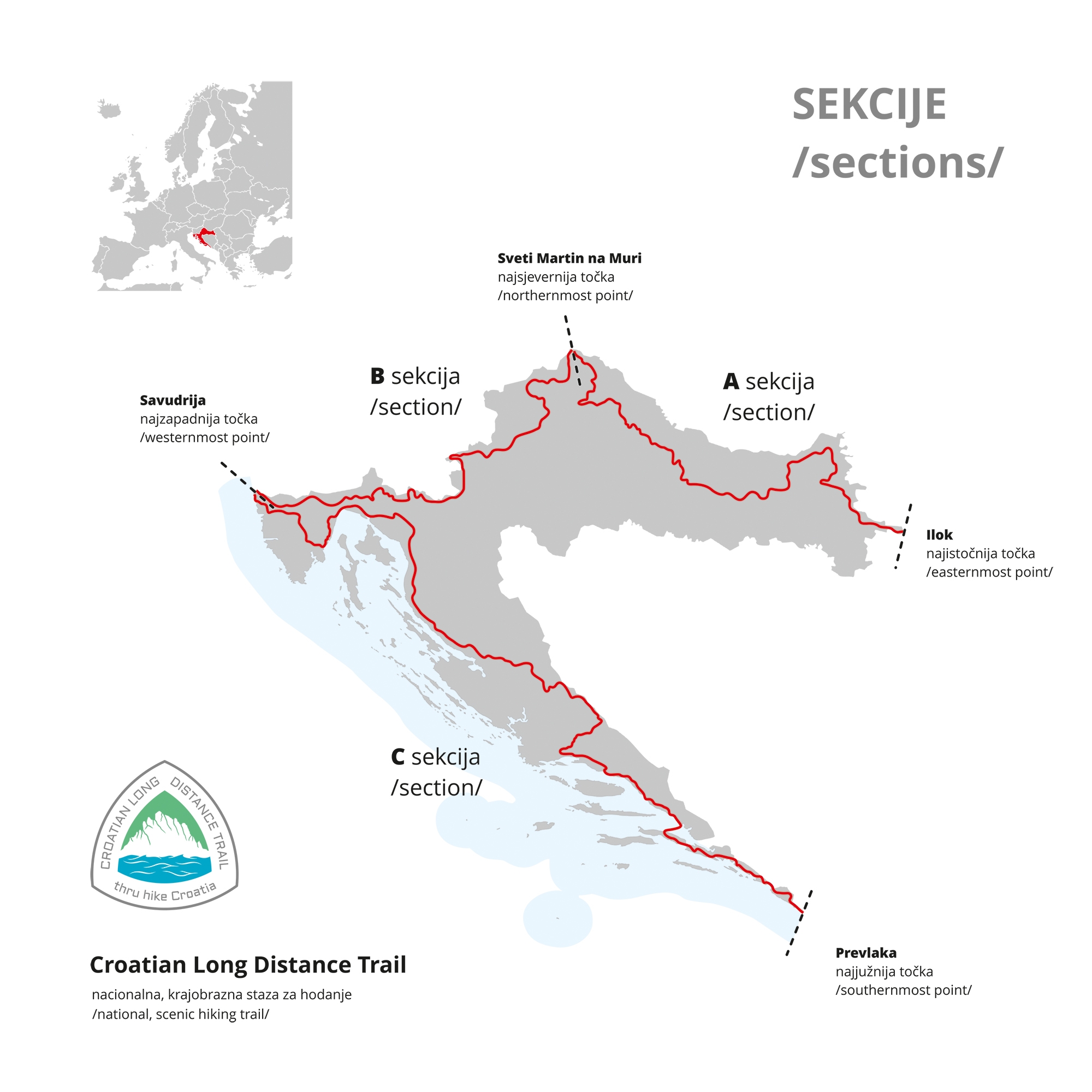
As very few have hiked it yet, you’ll be pleased to hear there is a Guthook Guide. There are some blazes and emblems, as well..
Details on the official website
It’s easy to hike Nepal independently.
Not so India.
I did Markha Valley independently. But for Kuari Pass I finally signed on with a guided trek.
The hiking infrastructure in India is not well developed. Getting to and from trailheads often a headache. Next time I go to India I’ll likely sign on for trips guided by IndiaHikes.
One bit of good news.
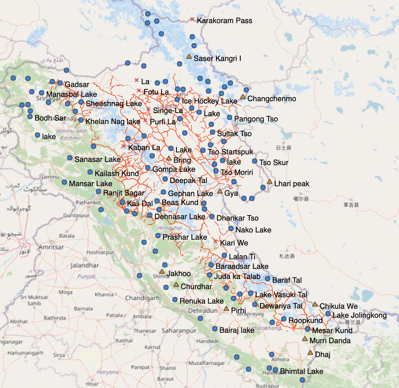
Peter Van Geit has been creating detailed hiking maps of the Indian Himalaya.
So far, he has pulled together over 1,000 trails across Uttarakhand, Himachal Pradesh, Ladakh and Jammu and Kashmir.
It shows 600 passes, 700 high-altitude lakes and more than 10,000 reference points. …
It allows hikers to see elevation profiles and download GPS logs onto their phones rather than having to carry multiple, less detailed paper maps.
“The map has more trails than anyone could ever cover in a lifetime,” he says.
“It took me months to plan a long traverse across the Himalaya. With this new digital map, you have all the information in a single place.” …
Everything is open sourced, so can be accessed with any Open Street Maps viewer or mobile app (for free). Other hikers can add information to it and help the resource grow. …
Andrew Skurka is without question one of the most accomplished hikers in history. A legend.
He’s run a 2:28 marathon, as well.
The Ultimate Hiker’s Gear Guide: Tools & Tips to Hit the Trail, was published by National Geographic – over 125,000 copies sold.
Today he and his team lead people to exciting destinations, teaching skills along the way: planning, gear, fitness, food, navigation, responding to emergencies, etc.
In a recent podcast interview Andrew explains why he still prefers map and compass, using electronics as a back-up. And you have to believe him since it was sponsored by the Gaia GPS app.
Click PLAY or listen to it clicking through via Twitter.
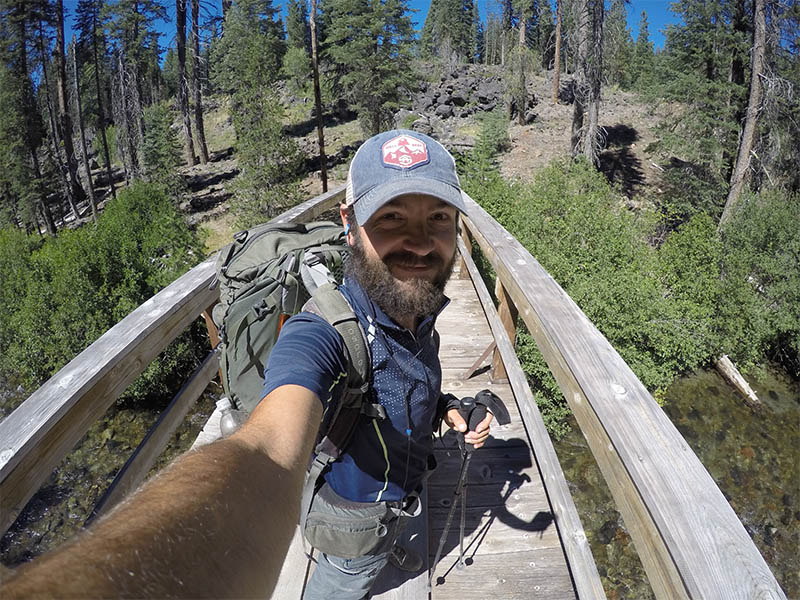
Trip report by BestHike editor Rick McCharles.
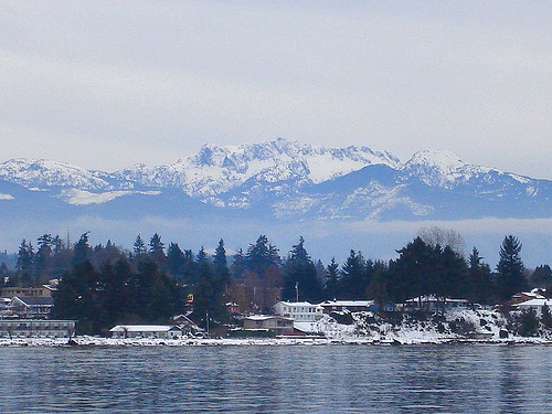
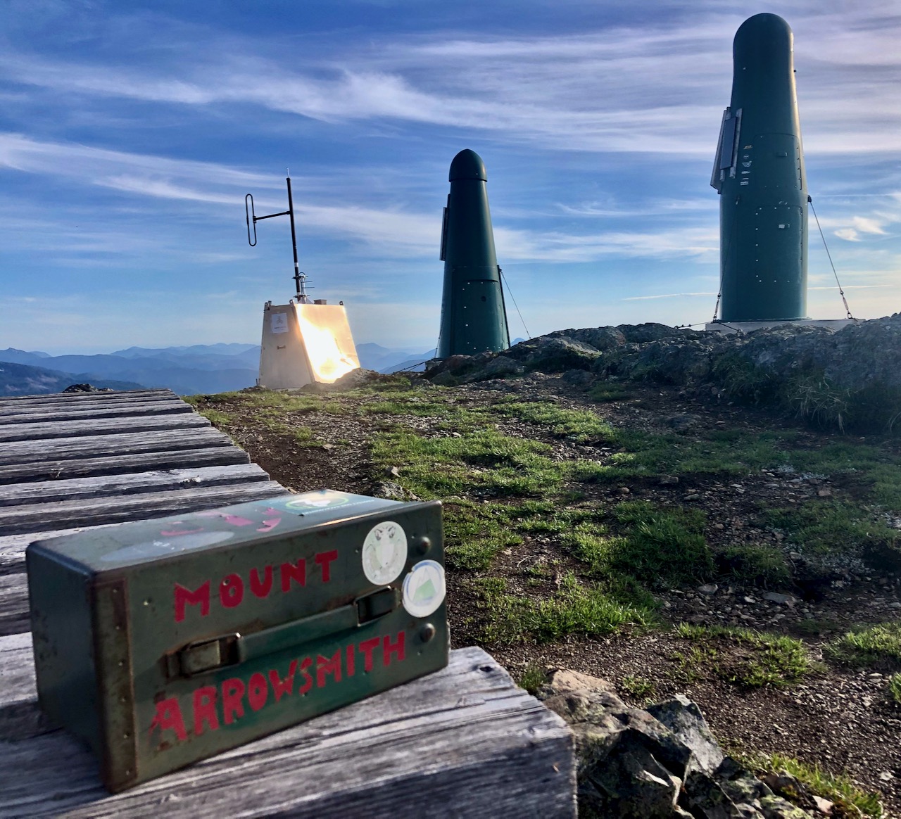
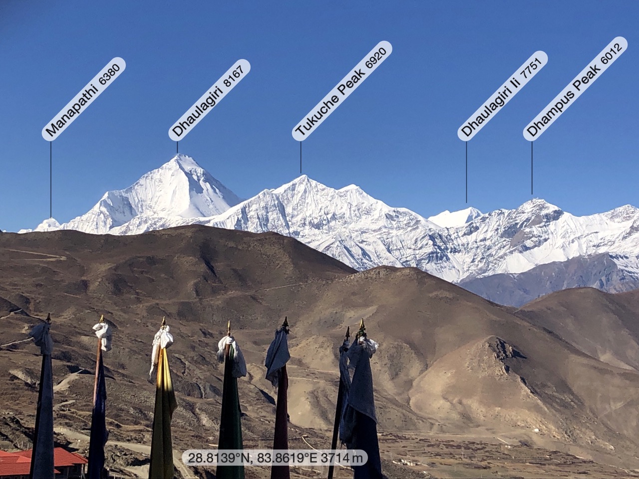
Mount Arrowsmith 1,819 m (5,968 ft) is the most prominent peak seen from my parents home in Vancouver Island.
It’s close to Port Alberni, B.C.
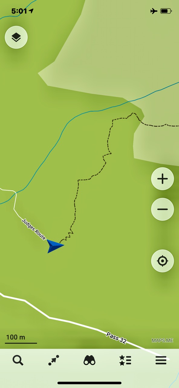
The most popular hike to the top is called Judges Route. Details.
Finding the trailhead can be confusing. Google Maps has it wrong, for example.
I used the free Maps.me app — that worked.
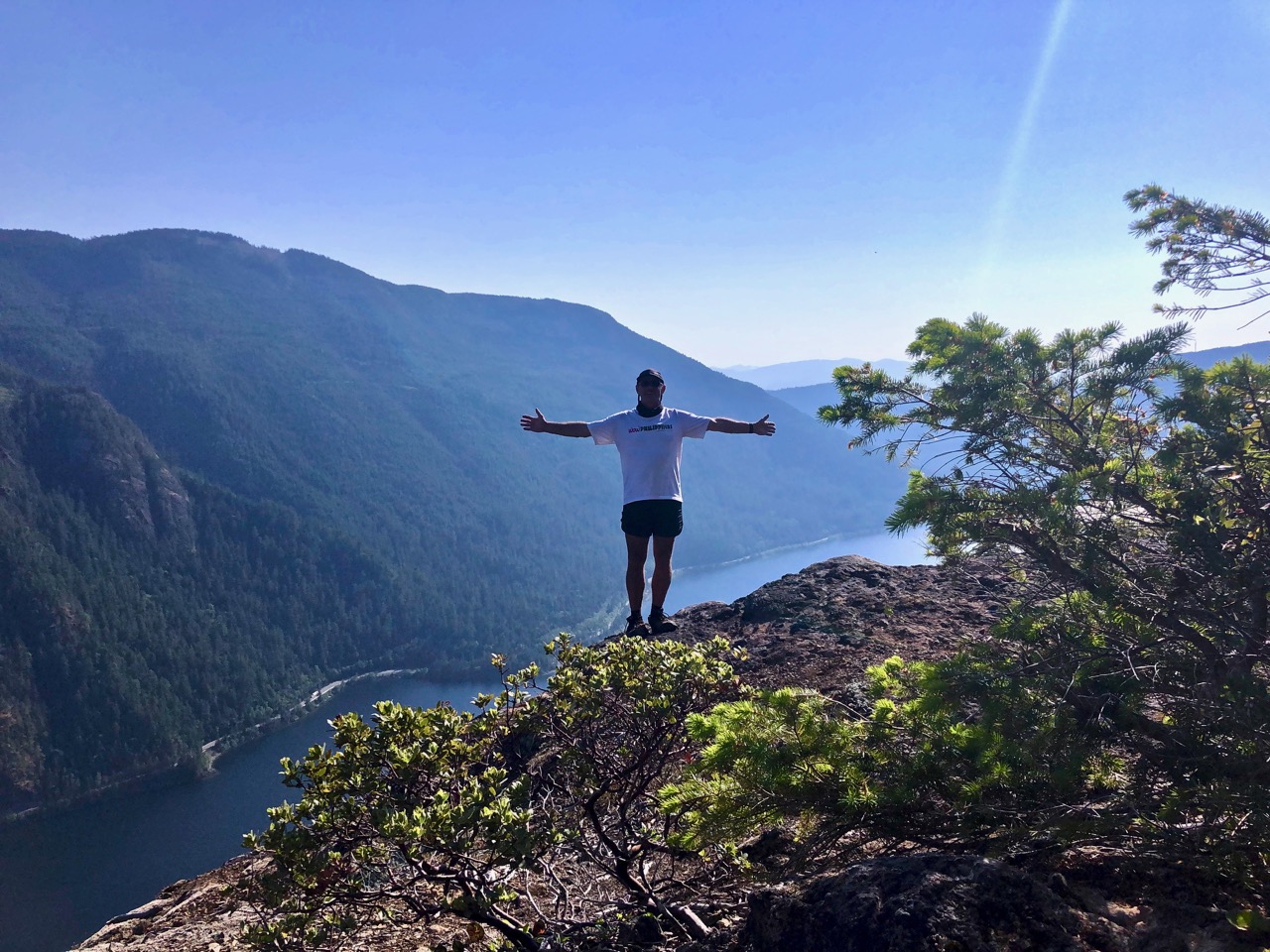
It’s 4-6 hours return. Challenging. Some exposure. A bit of scrambling. Some route finding. I was briefly lost 3 times.
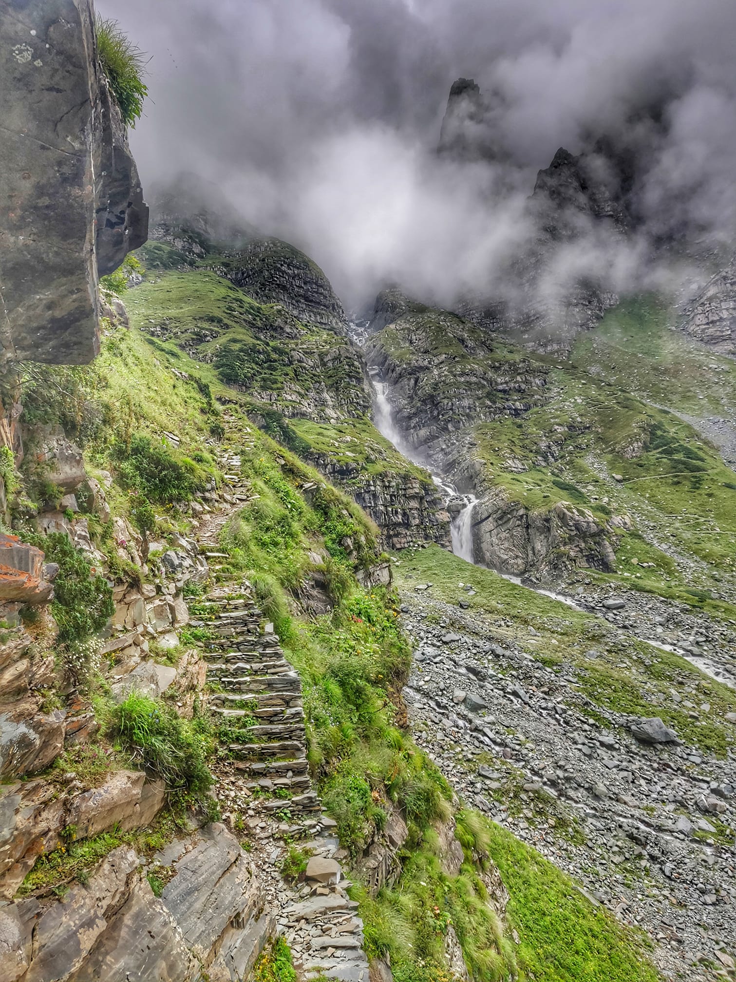
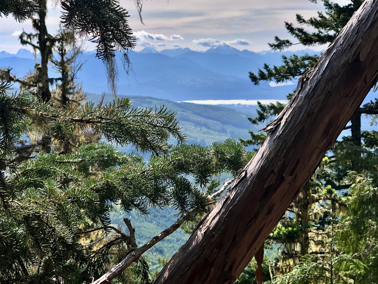
There are some views on the way up.

On June 25th, 2020 I didn’t have much snow.
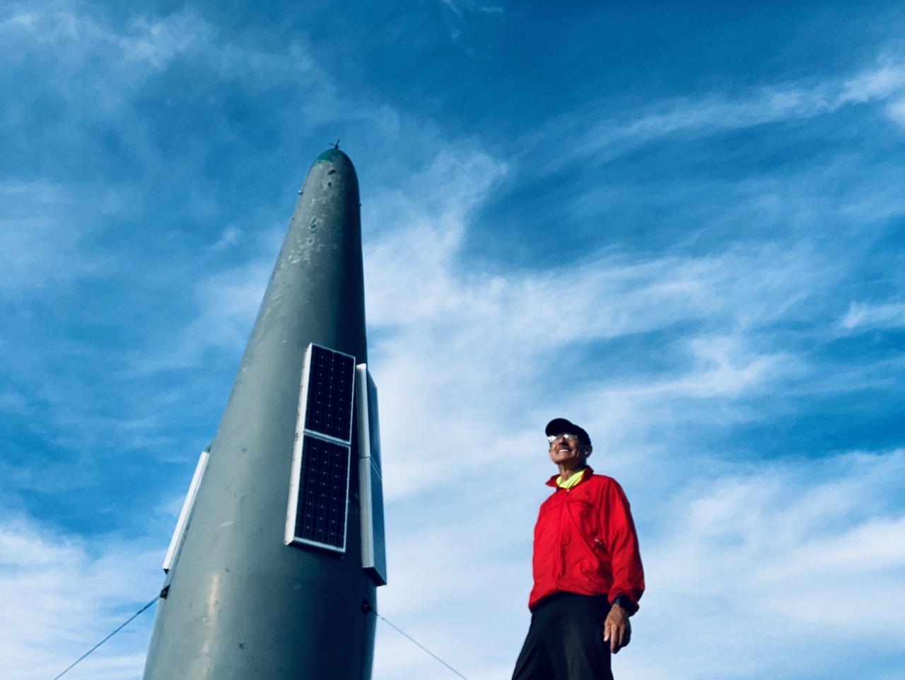
The summit is interesting.
From the top you can see from Port Alberni to Mt. Baker in Washington State.
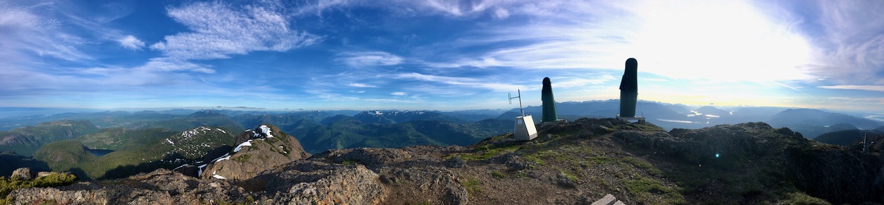
I was inspired to try one of my rare panoramas.
Great day.
Starting up at 4pm I was last hiker on the mountain.
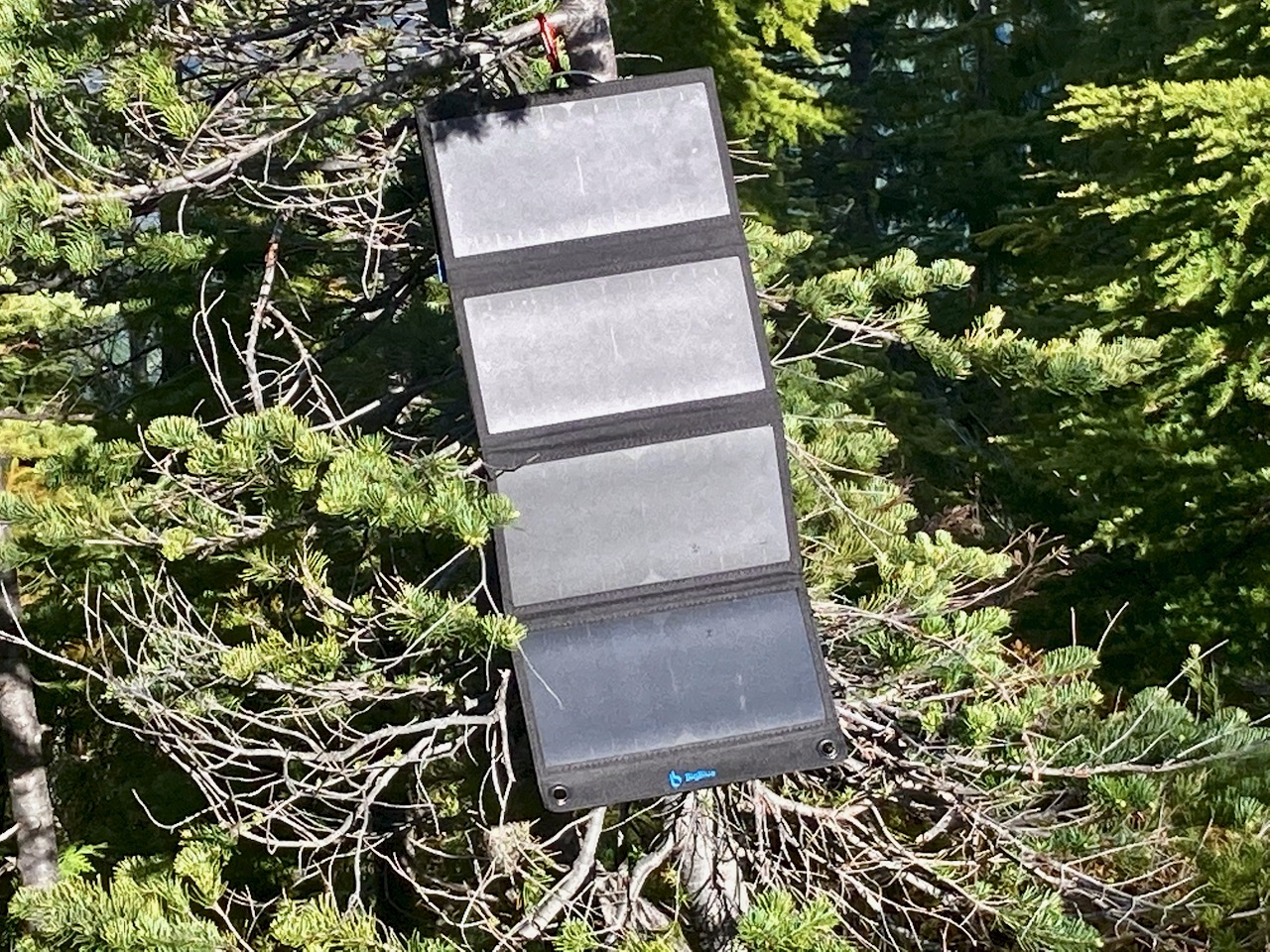
UPDATE: Love the solar charger. But on the last trip it stopped charging my Apple watch. Not sure why. But it would charge my Anker PowerCore Fussion 5000 battery which does charge the watch.
My first solar power charger. No built-in lithium ion battery.
I chose BigBlue 28W USB Solar Charger over similar products based on the positive Wirecutter review. AND this one is quite inexpensive.
I plan to use it mostly for bikepacking where weight is less a concern. But I carried it on a few hikes as well.
1.2 pounds.
On the bike, it can get bumpy.
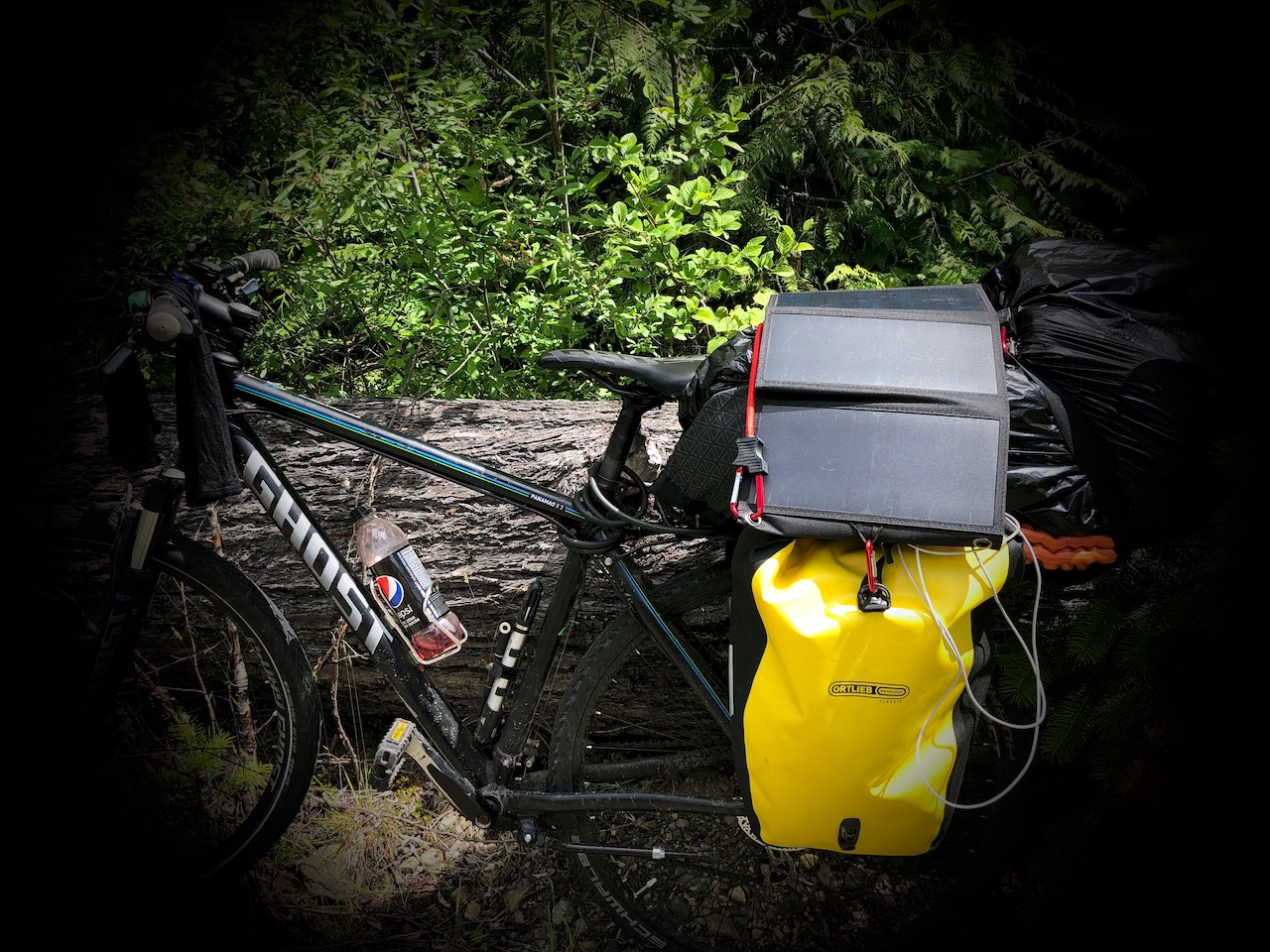
Mostly I’m wanting to keep charged:
It works well in direct sunlight. Slowly when overcast.
Click PLAY or watch it on YouTube.
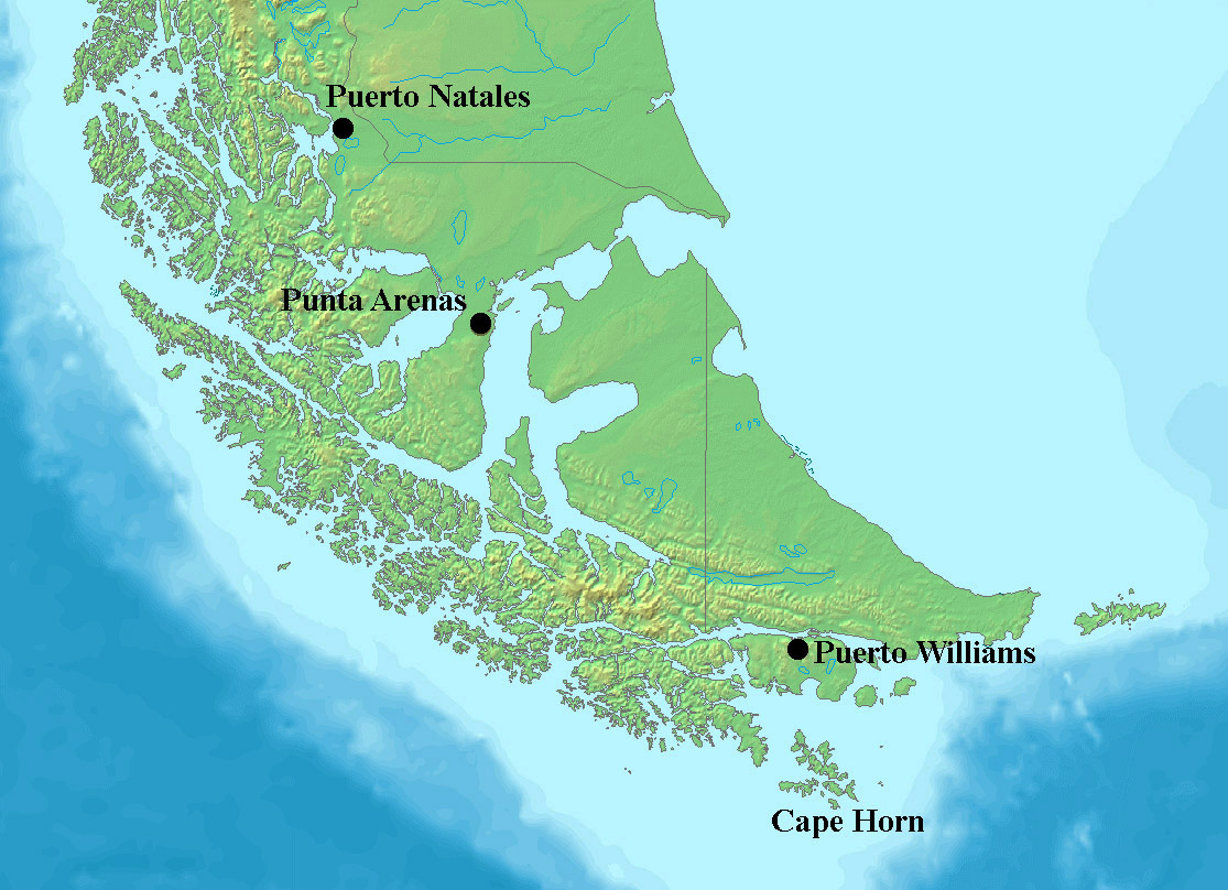
Last year I tried and failed to complete the Dientes Circuit on Isla Navarino, Chile.
The trail was covered over with snow, and I had no guide to lead the way. I only tented one night. Then turned back.
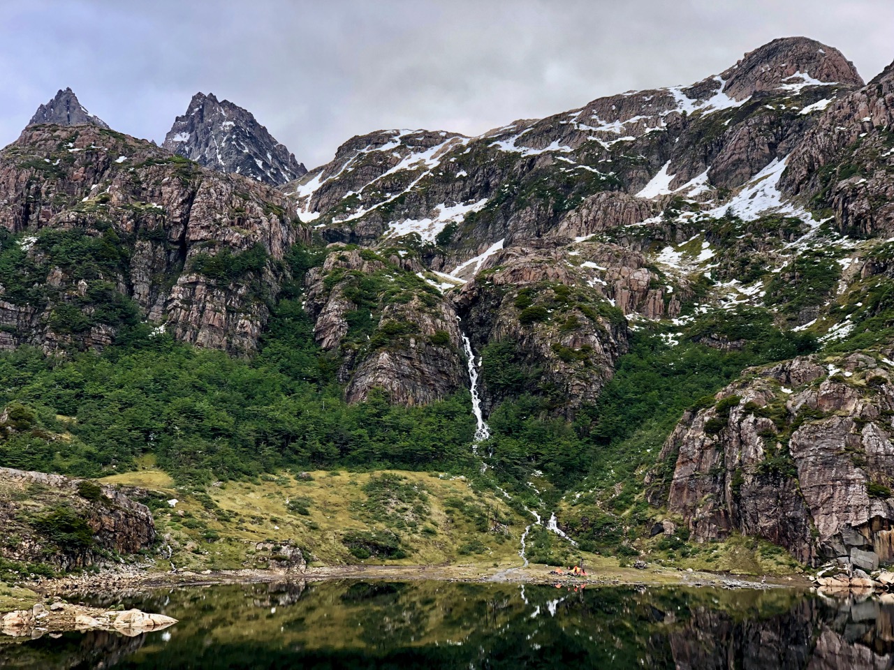
This guided group had far worse weather than me. And still made it.
Click PLAY or watch it on Vimeo.
To find out how to do this trip yourself, click over to our Dientes Circuit information page.
Michael Atkinson places himself in the historic predicament of two stranded German aviators in 1932 to see if the his skills as a survival instructor, pilot and adventurer will allow him to escape to the nearest civilization.
It is a gripping film.
I learned a lot about surviving in the harsh Australian coastal wilderness.
The most remarkable feature of this documentary is its mode of filming. It is not performed by any film crew that follows his journey. It is single-handedly managed by Mike through drones and cameras so it preserves the natural element. The breathtaking pictures of the ocean, varied shades of the waters, flora and fauna of marine sea and the natural cliffs along the coast paint an excellent landscape for the viewers. It manages to take one to an unexplored world …
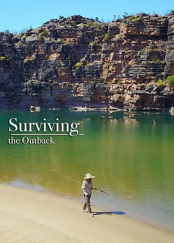
Watch the hour long documentary FREE on TubiTV.
On my recent trip to Nepal I really enjoyed the FREE PeakFinder app.
Click PLAY or watch it on YouTube.
ViewRanger Skyline is similar.
Trip report by BestHike editor Rick McCharles
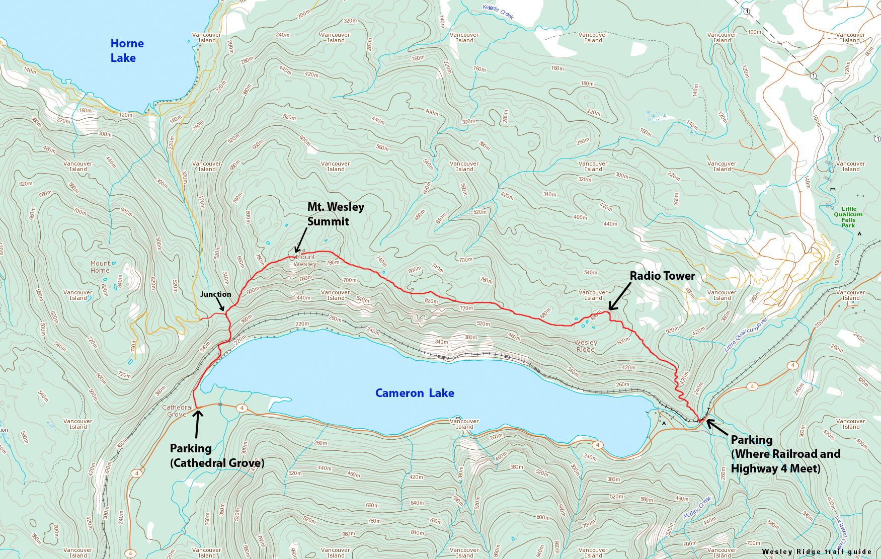
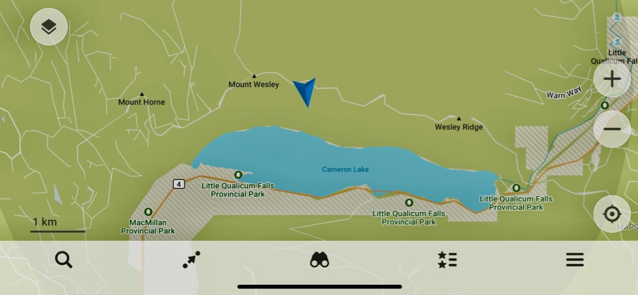
I tried and failed to do the Wesley Ridge traverse:
I started at the end closest to Parksville assuming it would be less busy than the Cathedral Grove trailhead.
I made a video of the BikePacking trip. Cycling to and from my parent’s place in Parksville qualifies this as a #MicroAdventure.
Click PLAY or watch it on YouTube.
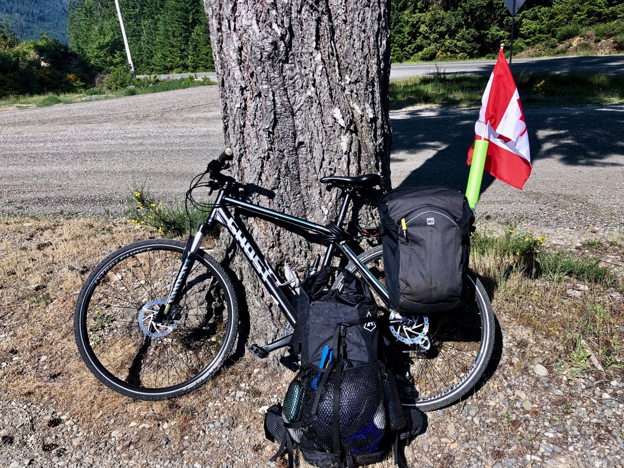
I hid and locked my bike close to the trailhead. Transferred what I needed to my hiking pack — and headed up the railway tracks.
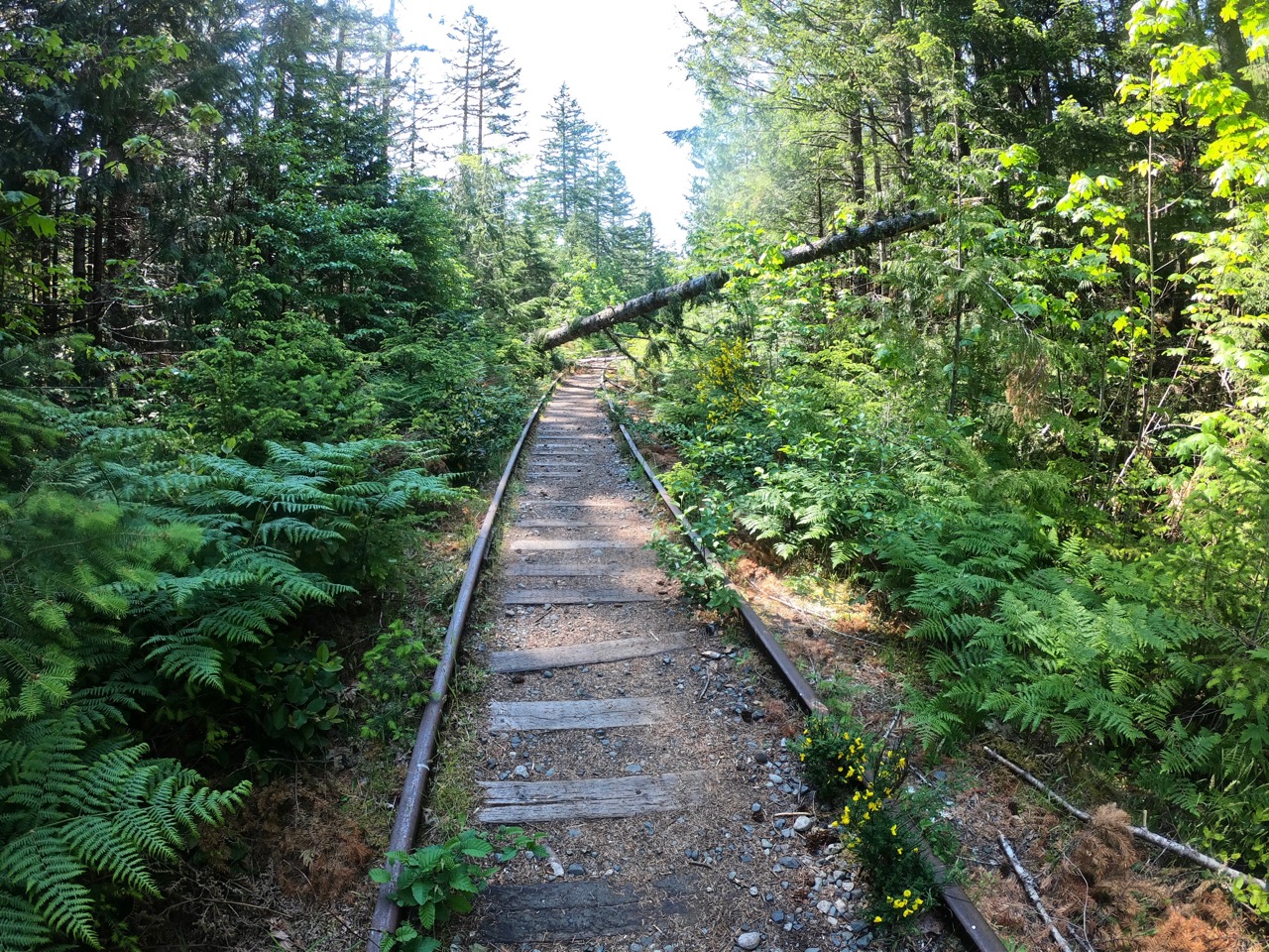
I missed the turn-off up mountain. It’s not obvious. On my return I flagged the start to make it more conspicuous.
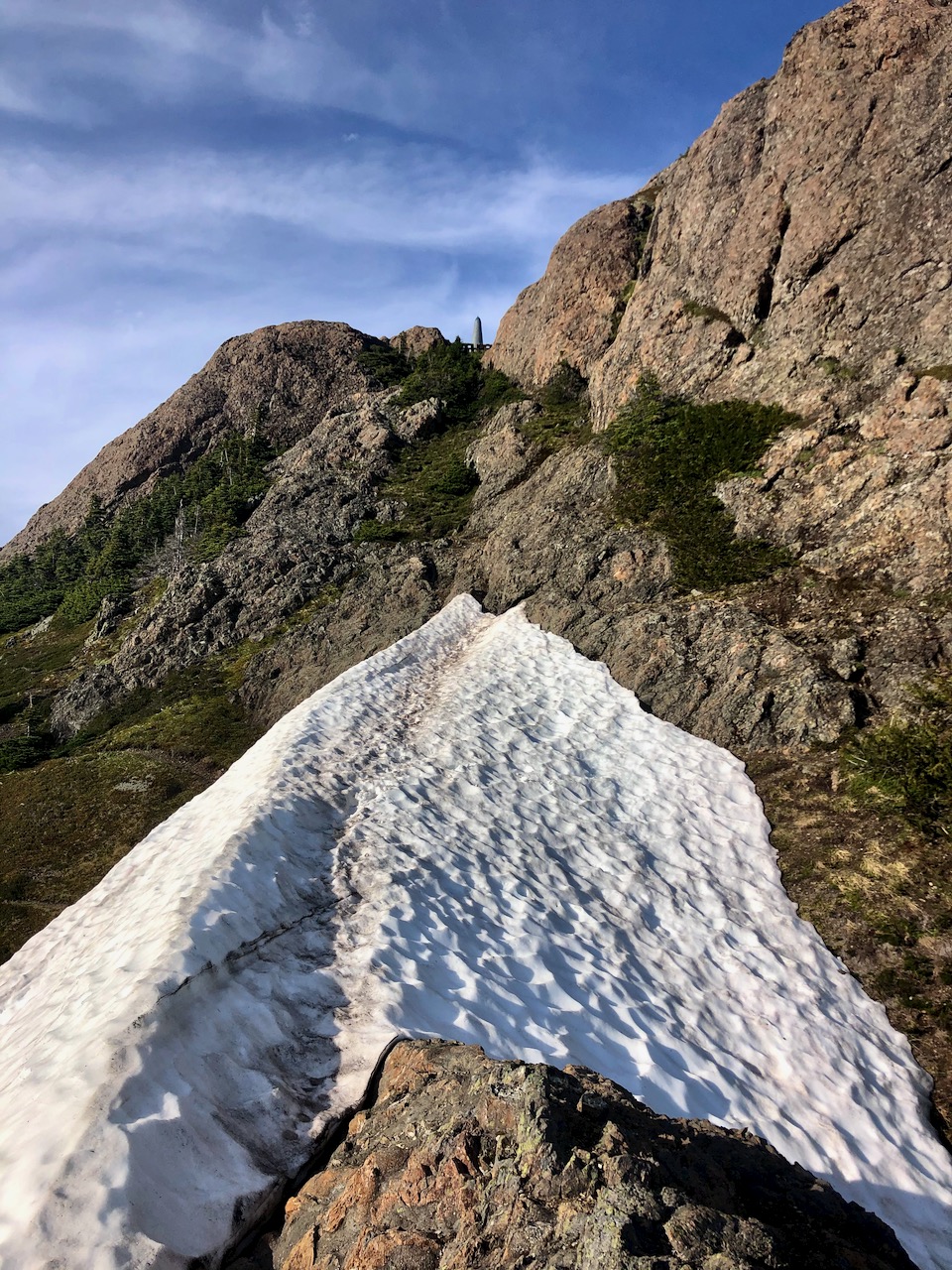
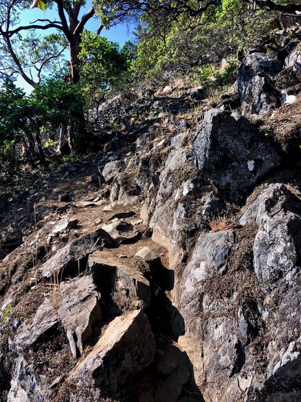
Steep.
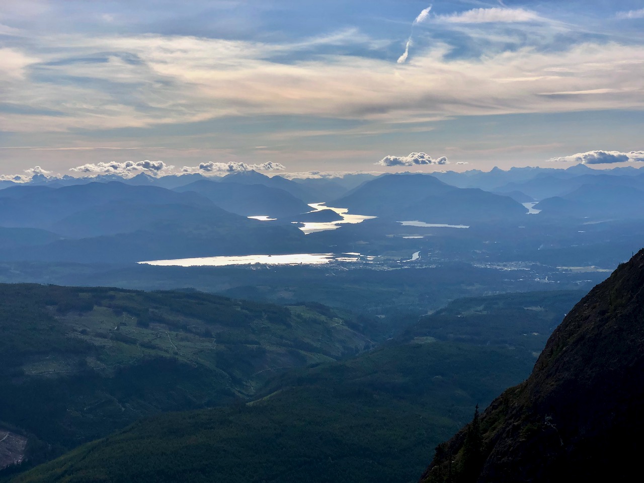
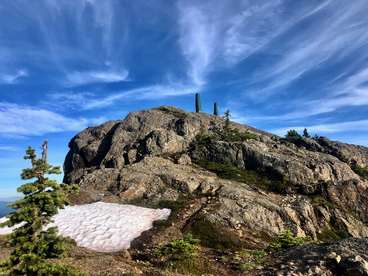
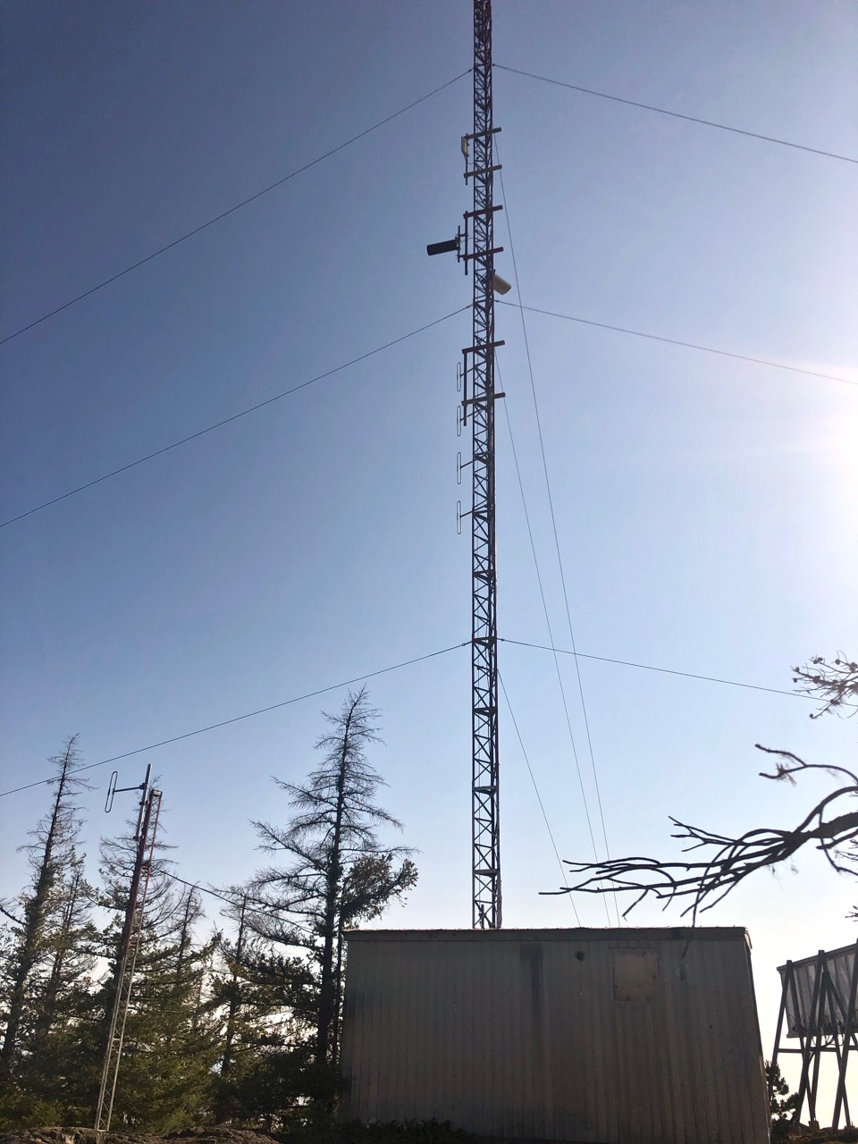
The strenuous 2km climb up to the telecommunications tower is called Wesley Tower Trail.
Many continue on to the first lake vista. It took me about 2 hours to get here. There are two benches, one named Forever Tuesday after the Tuesday Walkers Club in nearby Port Alberni.
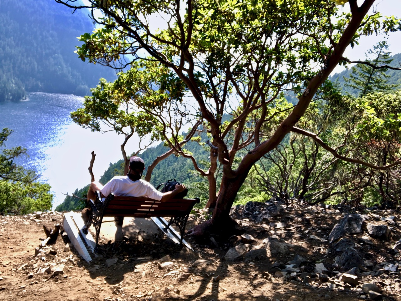
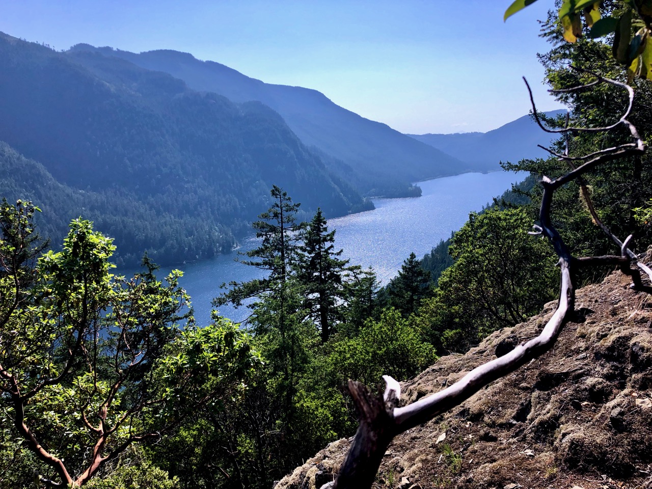
Most turn back at this point. There’s no one path across the ridge from here.
I gave it a good try. You follow different (competing) sets of orange tape flags. Some lead to dead ends.
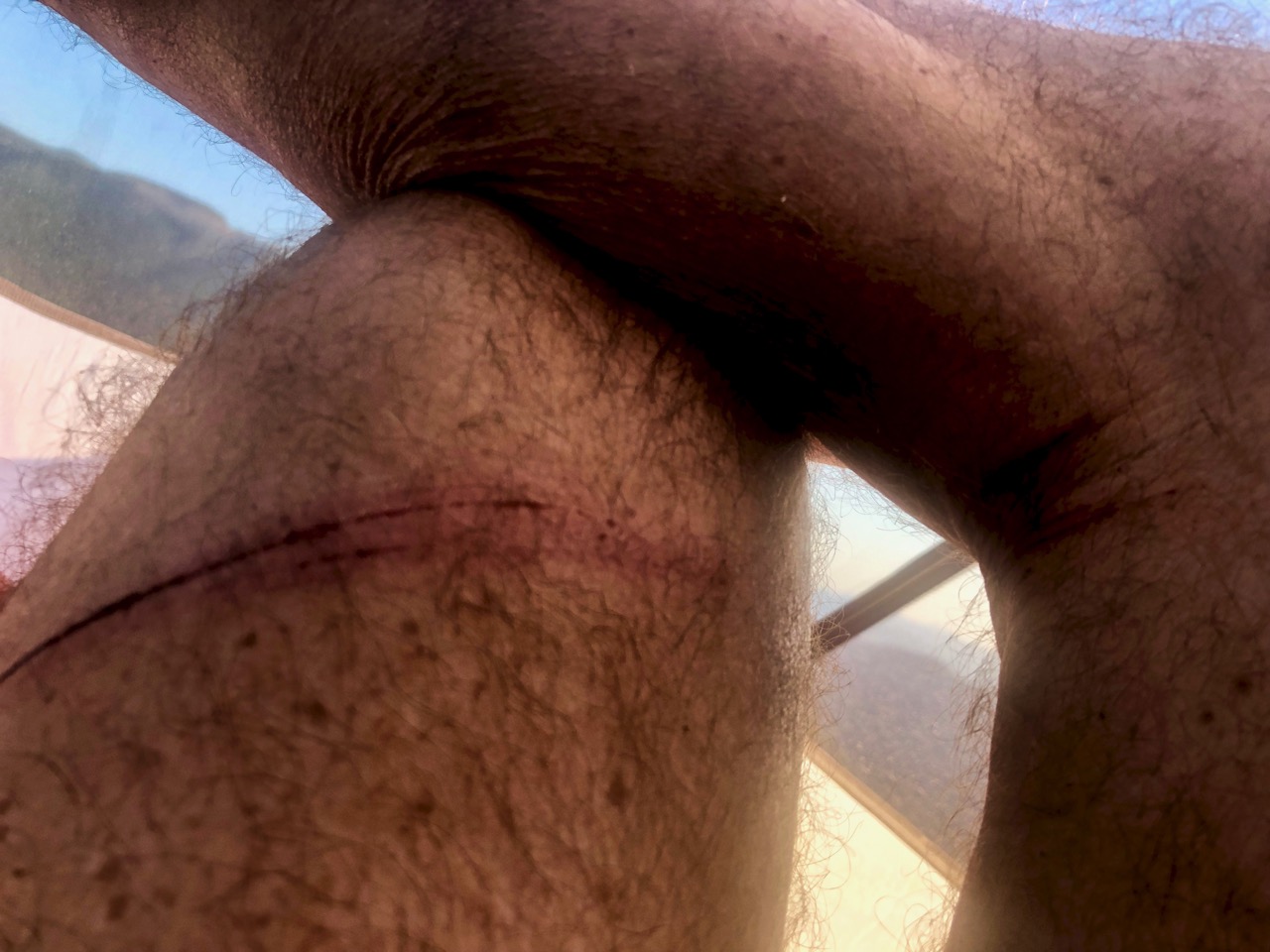
A bigger problem was scrambling hundreds of fallen trees. Not bringing long pants, I got quite scratched up. It was bushwhacking.
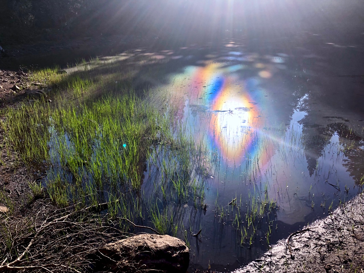
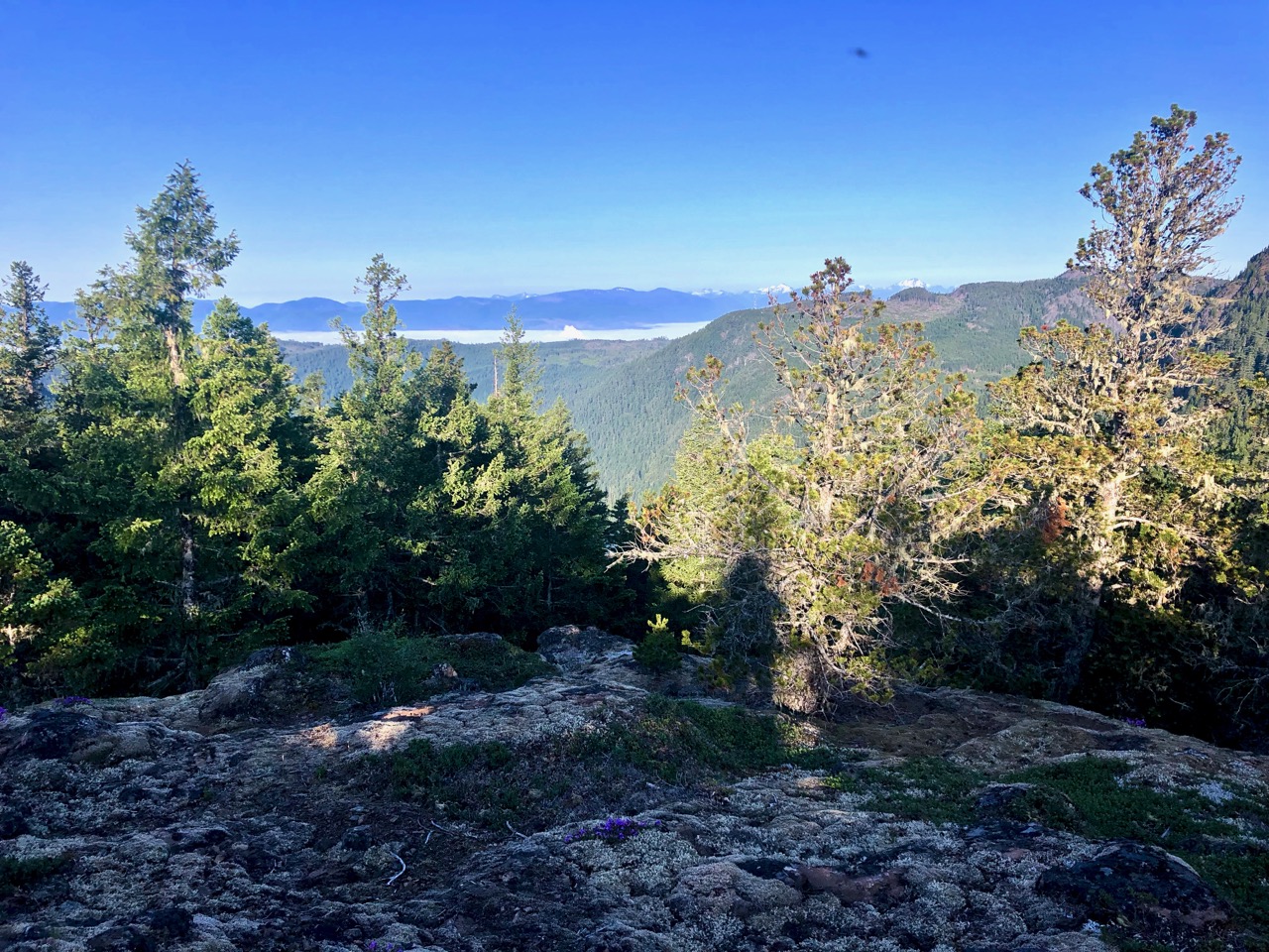
Another problem is water. I saw no flowing water — only remnant snow melt tarns.
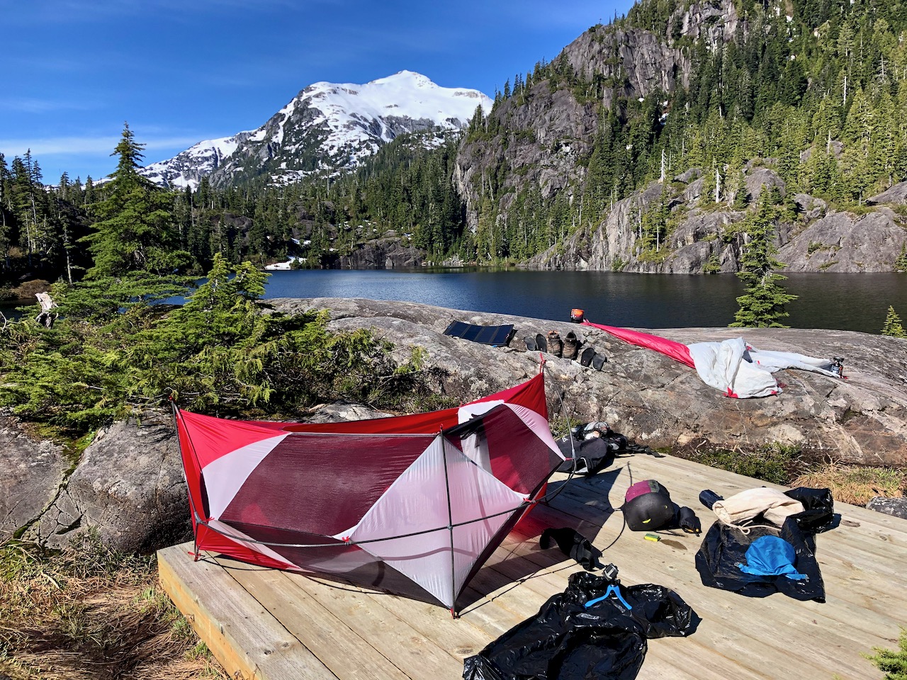
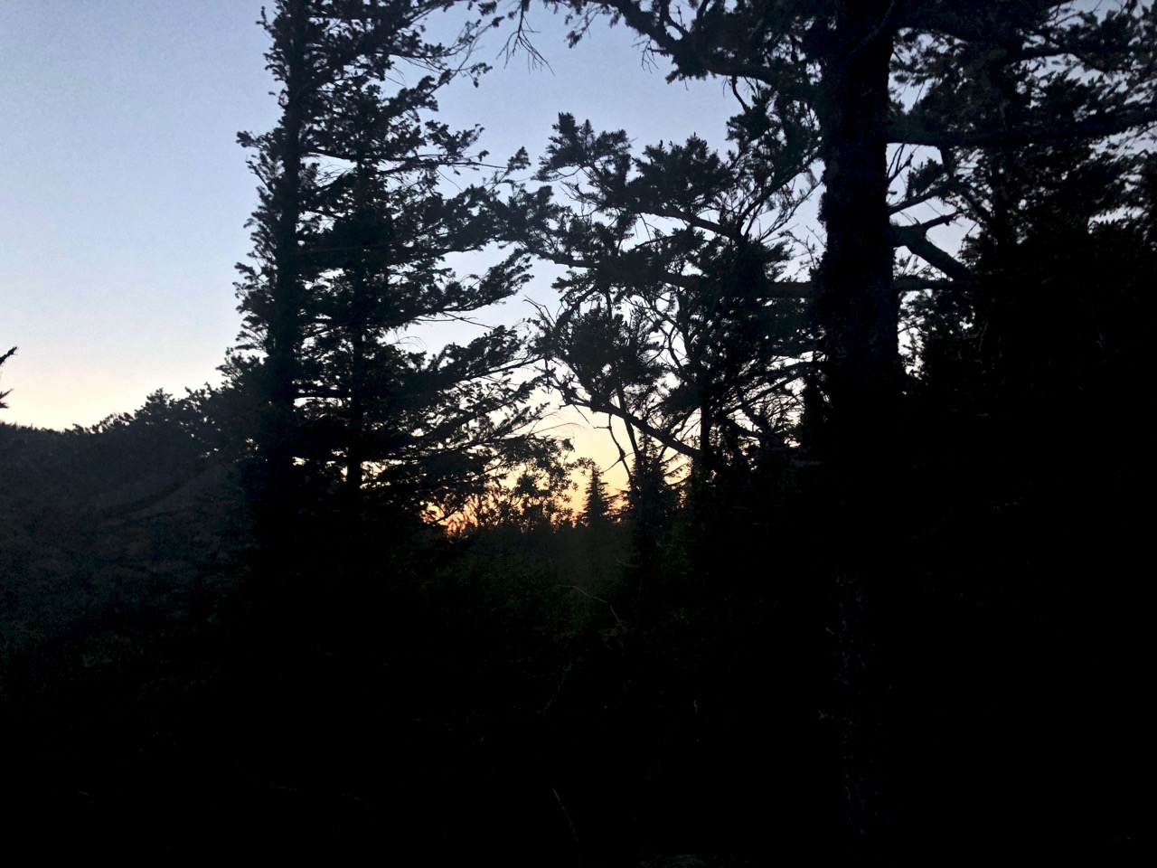
With daylight failing, I finally decided to find myself a great tent site.
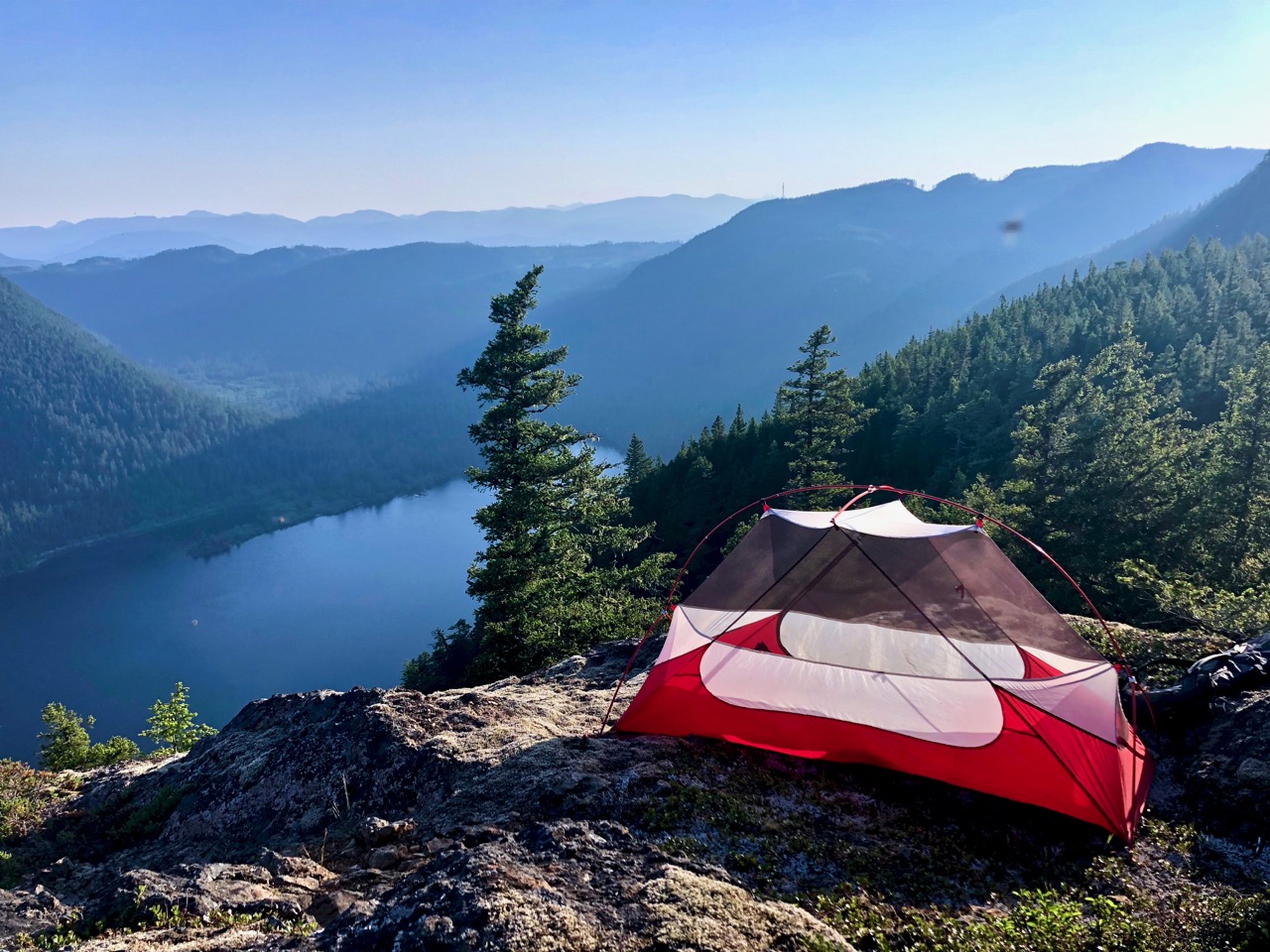
It doesn’t get much better than this. I had to HIDE in the tent at dusk, however, pestered by small non-biting flies.
From here I could see steam rising from Port Alberni.
Here’s where I stopped.
Good night.
Next morning, nearly out of water, I decided to hustle back the way I’d come. I’ll try the Ridge from the other end on some future trip.
related – Lonny Barr – Wesley Ridge Trail
