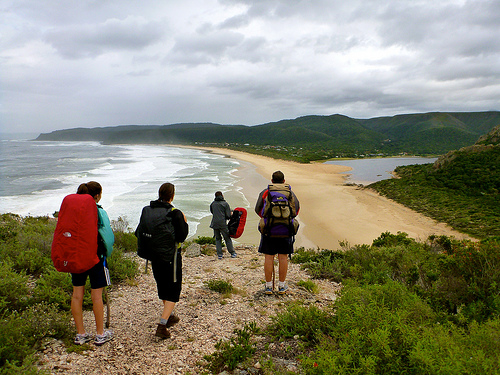
The plan is simple – to be a part of the world’s first group to walk across the northern part of the island from east to west, entirely on foot, a distance of almost 400 km, in the seemingly impossible timeframe of three weeks. …
Days pass by as we trek west. We camp in rural villages – usually on patchy football fields where, night after night, hundreds of curious children and adults alike surround us, amazed at the presence of a ‘Vaza’, a white ghost – the Malagasy term for westerners. They haven’t seen many before. In fact, in this part of Madagascar, away from the tourist trail in the south, the last foreigners that have entered the foothills of the Tsaratanana were the French army in the late 1940s and occasional mineral prospectors in the 1970s. …
At exactly the half way point of the journey, after almost two hundred kilometers of uphill slogging, we reach the summit of Maromokotro, Madagascar’s highest mountain. …
Eric Leifer of National Geographic Young Explorers :
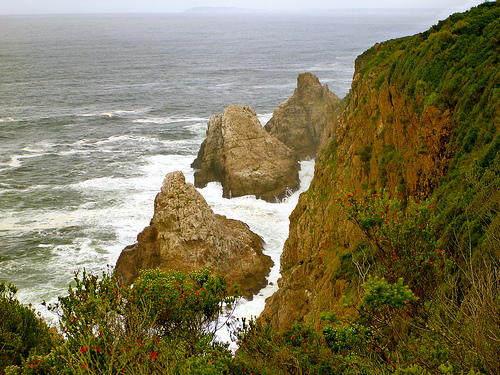
Fiordland National Park, tucked away far within New Zealand’s South Island, has the notorious claim to fame as one of the wettest locations in the southern hemisphere; and with a mean annual rainfall of 268 inches …
Throw yourself off the deep end by accepting the challenge of the country’s hardest trail, the infamous Dusky Track, an 84-kilometer route that impossibly forces its way through this impermeable landscape. …
… a good 4 to 5 day hike. We had great weather with no rain, which meant hot afternoons. In the mornings, we were up around 5am to be on the trail by 6am. This was to avoid the heat and catch the sun rise. Although hiking in the heat was hard work, the waterfall swimming pools at the end of every day (except the last) were a magnificent reward. Amazing water and then catch some rays in the sun. …
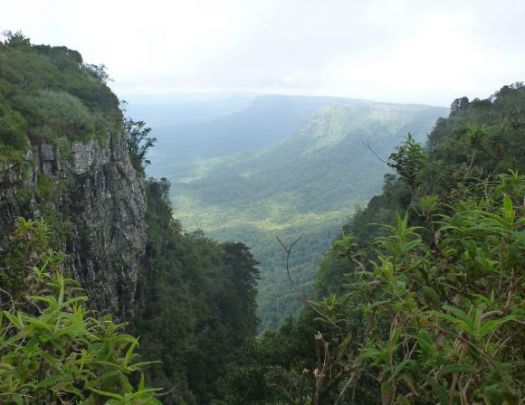
Many drive the Blyde River Canyon Panorama Route en route to or from Kruger National Park in South Africa.
God’s Window … is a popular vantage point along the Drakensberg escarpment, at the southern extremity of the Nature Reserve.
Here, sheer cliffs plunge over 700 metres to the lowveld. From this escarpment—a mostly unbroken rampart of cliffs—opens a vista into the lowvelt expanse and escarpment forests, the Eden-like aesthetic appearance of which prompted the name. On a clear day it is possible to see over the Kruger National Park towards the Lebombo Mountains on the border with Mozambique.
God’s Window features prominently in the plot of the 1980 cult film The Gods Must Be Crazy. Near the end of the movie, the Bushman character Xi (played by Namibian bush farmer N!xau) travels to God’s Window, and due to some low-lying cloud cover believes it to be the end of the Earth. …
I was lucky and got some views of the big vista.
Most who stop here see nothing but cloud. Hot air rising from the veld below turns to mist. Many are disappointed.
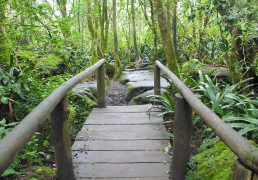
Even in misty weather, it’s worth hiking the adjacent Rain Forest Trail.
But have you heard of the new alternative, the 6-day Black Cat Track?
The Black Cat Track is closed, and no one—not Koyu up in Kaisinik or anyone in Lagui—thinks it will open anytime soon. The region remains tense. …
Last September, a trekking company’s guided trip through the wilds of Papua New Guinea was shattered when machete-wielding men attacked the native porters, killing two on the spot and injuring many more. The motive appeared to be robbery, but Carl Hoffman knew something else was at work—ancient tribal patterns of violence that, he knew, would inevitably be avenged.
Ed Stafford (born 26 December 1975) is an English explorer and former British Army captain. He holds the Guinness World Record for being the first human ever to walk the length of the Amazon River. …
Stafford was announced as one of National Geographic Adventurers of the Year 2010 and then in March 2011 he was awarded European Adventurer of the Year in a ceremony in Stockholm, Sweden. …
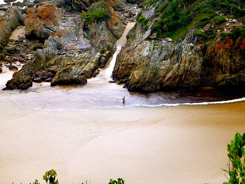
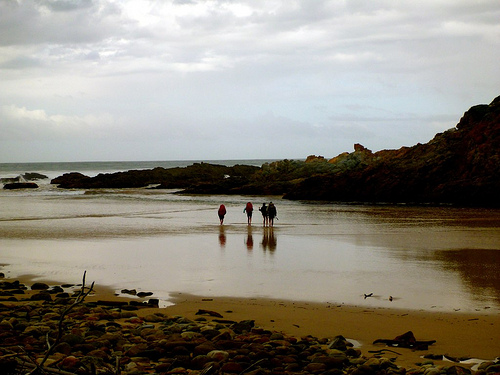
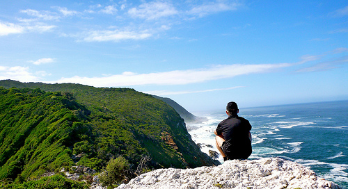
Last day, early morning, climbing out of the tent, I glanced up to see the Marques family high up on the cliff.
A few minutes later, there they were up on a further viewpoint.
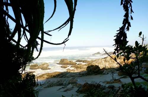
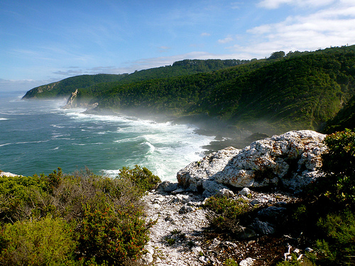
… I’m not all that ready to leave the Otter Trail. 😦
I caught up with the Marques just before dropping down to the Groot River and Nature’s Valley.
Instead of bright sunshine, we had a few drops of rain. The first significant rain in 5 days.
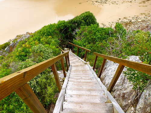
The longest 2km were on pavement to the only restaurant in Nature’s Valley.
Otter Trail certificates are available there. And you’ll be offered a traditional ‘shot’ to celebrate.
There are hostels in Pleasant Valley, served by the Baz Bus. But I caught a ride back to the start, Storms River. Scott and family had decided to stay there one more night.
Cost for that shuttle was about 150 Rand / person. ($16)
I collected my stored luggage at the National Parks office. And shared a hot shower with this mantis.
We saw friendly vervet monkeys there, as well.
I’ll never forget the Otter Trail, one of the best hikes in the world. A life changer.
If you’re interested in hiking the Otter Trail yourself, check our information page.
Day 4 = 13.8km (± 6 hours) – Oakhurst huts – Bloukrans crossing – Andre huts
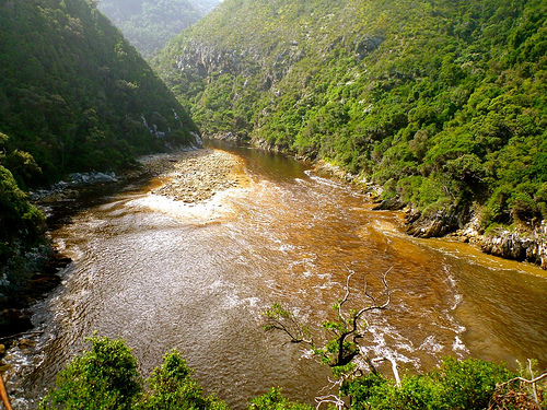
Crossing the Bloukrans River is the crux of the trip. It’s extremely important to arrive there before low tide.
At low tide in good weather, you might barely get your shorts wet. But people have drowned here. 😦
Low tide was 9:19am on our day. It takes 4-6 hours to get there.
Therefore, Rod and Jess left at 03am.
The Marques family at 05:30am.
It was 6:45am, in day light, as I walked away from camp.
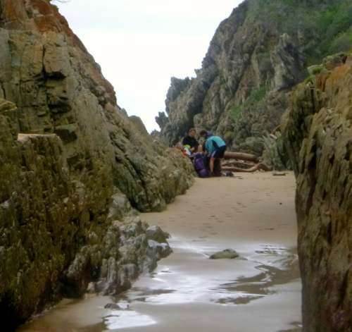
A mad rush to get to the river crossing in time, I didn’t take many photos that morning. But had to stop for this picture.
We all managed our time well, arriving at the infamous Bloukrans river crossing right at low tide, 09:19am.
From above, I saw Scott checking route A, by far the BEST way to cross the river.
Conditions were perfect.
Low tide. Low river. No wind. 🙂
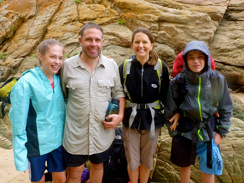
This family had crossed the Bloukrans the year before in far worse conditions.
They found it EASY this time.
Route A has you wade out via this sandy surge channel.
By contrast, the swim and exit via Route B (mid-tide) looked horrorshow.
You are supposed to haul yourself up out of the freezing Indian Ocean on one of two ropes.
This one gets you to the low traverse.
The other rope leads you to climb up the cliff, instead.
… I wouldn’t want to try either.
There are Routes C and D for very high water. 😦 … Don’t contemplate either.
Best wait up to 12 hours for the next low tide. Take Route A.
If you are too late in the day, be aware that there is a land route up and over the river known by Rangers. Telephone if you want information on that.
Once across the Bloukrans, you are much relieved. Guaranteed to finish the Otter. It’s easy from there.
Studying the near useless map given you at the start. And the look of the coast, … I gambled that it might be possible to stay low and make it to Andre huts along the coast.
After all, it was low tide. Very early morning.
Why not give it a try?
Sadly, the very last headland is impassable. I made it this far — then had to either backtrack. Or scramble up the cliff to regain the trail.
I scrambled.
Some exposure. Not recommended.
Arriving at the Andre huts early, we had plenty of time to explore.
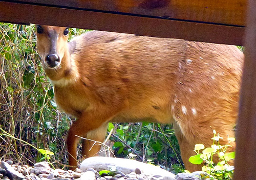
Over 5 days we saw no big marine life. But plenty of birds.
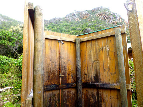
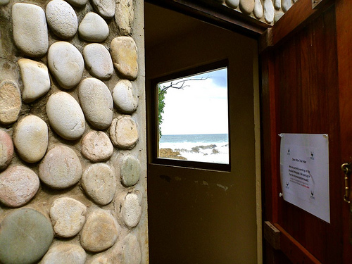
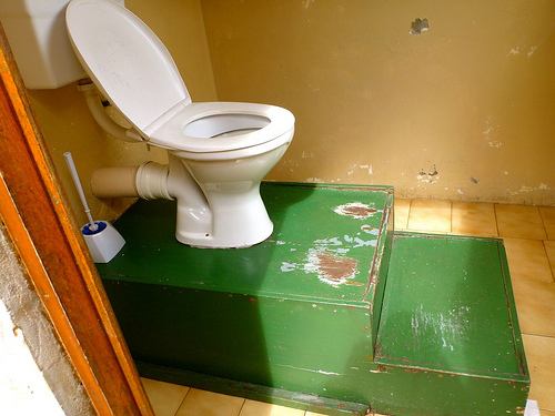
Check the standard facilities.
cold showerloo with a view
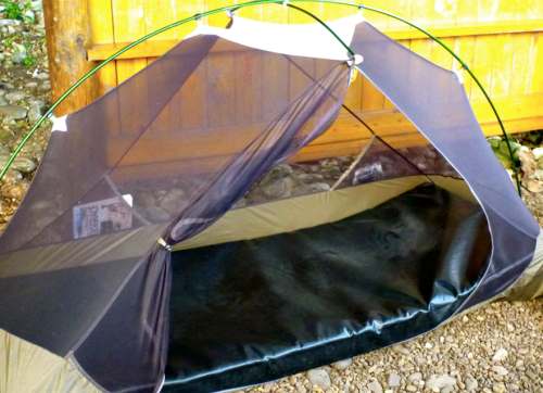
My last night. Luxury mattress.
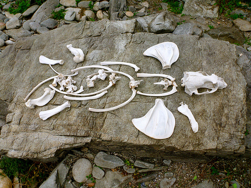
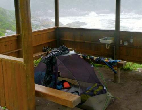
This was the only local visitor to my tent over 5 days.
Trip report by site editor Rick McCharles
day 0 | 1 | 2 | 3 | 4 | 5 | info page
Day 3 = 7.7km (± 4 hours) – Scott huts – Lottering crossing – Oakhurst huts
Crossing the Lottering River at low tide, or close to low tide, decides your day. Time of departure from camp depends on the time of low tide. It’s almost at the end of your hiking day.
Here’s where you need the tide tables handed out at Storms River reception.
Since low tide was 8:46am this day, everyone was up and departed early.
… Aside from me, that was. I took time for 2 more cups of coffee.
The weather was gorgeous. No wind.
I was further delayed, enjoying the beach, at the easy Elandsbos River crossing.
There are at least 2 ways up the other side. An old eroded scramble. And a newer, safer route more upriver.
What a gorgeous day. My favourite of the 5.
I was much late for low tide by the time I got to Lottering.
That’s Oakhurst, my destination, just the other side of the river.
If you are going to miss the tide, at least arrive when the tide is going out. … Not coming in, as it was when I got there.
Happily, I made it across only just barely getting my shorts wet. 🙂
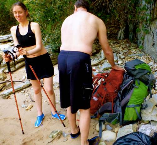
Rod and Jess were late, too. But super organized.
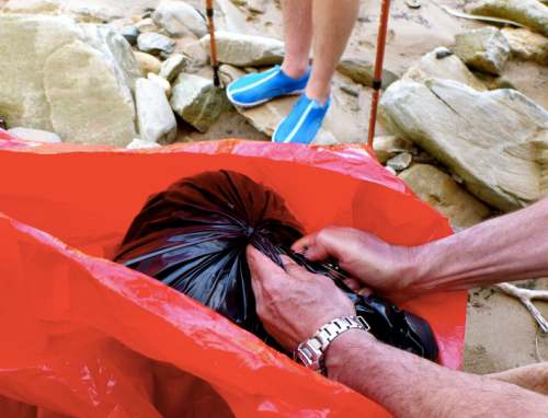
They had individual dry bags for each pack. And a second gigantic (red) dry bag that swallowed both packs.
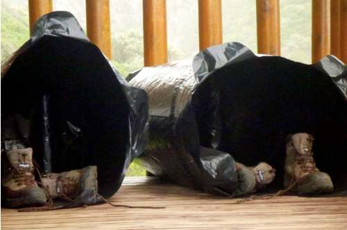
Those are the individual bags airing out after the crossing.
My own system was simpler. Every item in my pack was in waterproof or water resistant bags.
Don’t underestimate the Lottering. You could drown crossing this river in bad weather. The current is stronger than it looks.
The waves bigger at Oakhurst camp than anywhere else on the Otter.
In 2012 wardens offered to hike in meat and drinks for your last night. A menu with prices and a telephone was available in Day 3’s hut. A small service fee was charged.
By 2013 that service had been cancelled. We heard there was some abuse of the customers. Not all the beer ordered was making it to the last huts.
At one time, the trail was much better signed for distance.
Many of those have gone missing over the years.
I’ve got this trip tagged jungle.
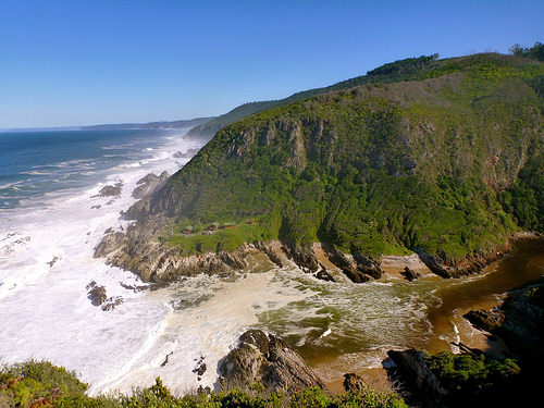
In many parts it’s impassable without following human or game trails. Dense fynbos is the natural shrubland or heathland vegetation unique to this part of the world.
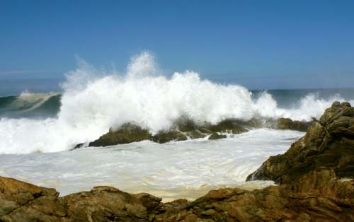
This ocean is cold and choppy. That didn’t stop Scott.
The family had barbecue once again. I shared some of their chicken. And ate my usual meal — smashed potatoes.