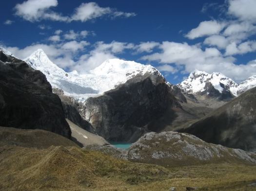
I’m hoping to do the famed Simien Traverse in early December 2014. I’ll be in country Dec 1-14th. It’s the best hike in Ethiopia, one of the best in the world.
Click PLAY or watch a some highlights from a 2014 trek on YouTube. It looks spectacular. Scenery and wildlife. Especially the Gelada Baboons.
I’m using the most recent Lonely Planet Ethiopia to start my research.
I plan to fly Addis Ababa to Gondor, buying my ticket when I get to Ethiopia. Spend at least one night in Gondor, acclimatizing, before traveling about 2hrs north to Debark.
The Simien Park Hotel in Debark is reputed to have hot water showers. One night there while I organize my adventure at the National Park Office.
I’m hoping to either join a group headed up or to hire the minimum for a solo trek. That’s one ‘Scout’ (armed park ranger) and one English speaking guide.
No mules. No cook.
The most popular route is 4-5 days to Geech or Chenek and back. I’ll not summit Ras Dashen, the highest peak in Ethiopia.
A cable car will open September 2015 or sooner, degrading the hiking experience. The Sapa area is great, but trek elsewhere in the region. This summit will soon be flooded with suitcase tourists. 😦
Below is our old information page, no longer being updated.
Update (this is an exception 🙂) from patriciaoprea March 2017:
I paid about 60 USD the night before (I’m so last minute) for a tour from Sa Pa
It was 2 days,1 night.
The good thing about this? We arrived at the summit at 7:00 in the morning.
The cable car is built, but NOBODY is there at that hour, because it hasn’t opened yet!
I loved this hike, go for it 🙂
AT A GLANCE
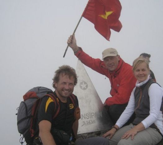
3,143 meters (10,312ft), it’s the highest in Indochina
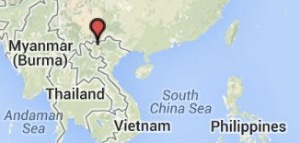
Northwest region of Vietnam, near the Chinese border
9km southwest of Sapa (Sa Pa), a gorgeous hill station developed by the French
1-3 days hiking
pine forests, bamboo thickets and jungle
best months October through April. Some say April and May are best as it’s warmer. And the flowers are in bloom.
avoid the wet season from June to September, with heaviest rainfall occurring in July and August
record for scaling Fansipan is one hour and thirty-five minutes, in case you want to better that time. 🙂
Panoramic views of the mountain ranges of northwest Vietnam, if you get any views at all. The summit is famously shrouded in cloud.:-(
Why We Like This Hike
about 2,024 floral varieties and 327 fauna species (sadly many of the larger animals have been hunted out)
no ropes or technical climbing skills are needed
plaque at the peak placed February 2007
colourful minority ethnic people, especially on market days
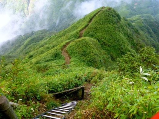
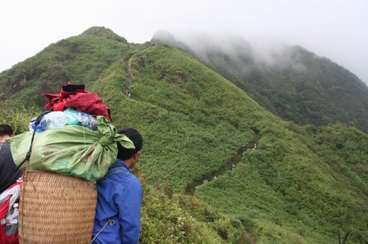
ridge walk sections were our favourite
Considerations
malarial mosquitoes can be a danger some months of the year
bring warm clothes. Temperatures below freezing are frequent.
snow is possible
climb is rough, wet, muddy and cold. Some bring rubber boots.
gloves with good grips recommended for ladders and rock scramble
scramble ladders and tree roots
you may be clutching bamboo at points
we’ve seen warnings about poisonous snakes, leeches, rodents, perhaps exaggerated
dogs are a worry, both in Sapa and on the trail. Even if you don’t carry a trekking pole, you might want to carry a stick
Sapa is a tourist trap. Touts are a pest.
Cost
Guided trips are no longer asinexpensive as they once were. Seems the government got stricter with guide requirements.
We paid $95 for a one day, up-and-down for 1 person October 2014.
A two day trek costs $180 for 1 person October 2014. You can negotiate on price with some agencies.
Shop around. The official government tourist information office quoted $120 for the $95 tour. Assume the difference is commission.
Routes
There are a number of options, including a 1 day guided up-and-down.
It’s possible to do independently. But we wouldn’t recommend it unless you are familiar with the route.
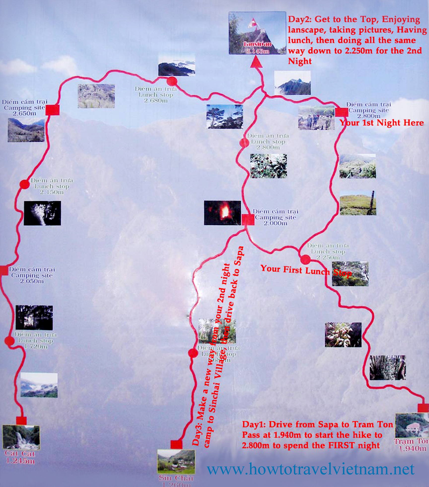
click for larger version
There are three routes to the mountain. One is from Tram Ton, the others from the villages of Sin Chai and Cat Cat.
The first route is a more gradual climb because it has been selected for tourists. The trip can be made in a day.
The route from Sin Chai is shorter but more adventurous, requiring climbers to sometimes use ropes or other special facilities for climbing.
The route from Cat Cat is the longest, but mixes some challenging climbs with great scenery. After one day of climbing, there’s a break at 2,200m above sea level. Climbers can have a meal cooked by a Mong porter and camp, followed by a second camp at 2,700m before reaching the peak on the third day.
Most climbers chose a tour from Sa Pa at a cost of about VND1.5 million excluding train fare from Ha Noi, and tours should be booked a month in advance.
many hikers arrive by overnight train from Hanoi to Lao Cai, then bus from Lao Cai to Sapa. Those tickets sell out during high season, especially during holidays, as Sapa is super popular with Vietnamese.
even better, some feel, is the night sleep bus direct from Hanoi
we stayed at the Sapa Unique Hotel for about $35 / night. It gets rave reviews.
We recommend you hire a guide. Let them do the logistics. You simply enjoy the journey.
on the most popular route up from the Ranger Station Camp 1 is located at around 1,500m (4,920ft). Simple accommodation and food are offered.
at 2,800m (9,190ft) is Camp 2. Sleeping is communal in a very poorly maintained ‘hut’. Might have rodents. Have your agency bring tents, instead. Camp 2 is trashed and unsanitary.
Once you’ve been up on the Roof of Africa in the Ethiopian Highlands, you won’t want to come down
Jemima Sissons:
… I spent my first few days in Ethiopia exploring the capital, Addis Ababa, then caught a flight to Gondar in the north, where I met Mulat and our driver, Melsie Nuru, and started preparing for our four-day, 50-kilometer trek across the Simien Mountains.
The Chinese-built roads make the three-hour drive to the base camp at Sankaber an easy whiz through lush pastures and past goat herds weaving their way across the road, oblivious to traffic. Soon the roads give way to dirt tracks, and after leaving the final village, the real adventure begins. It is unimaginable to contemplate this stretch without an SUV, as we lurch from side to side through unfathomably deep mud, on a number of occasions jolting within a hair’s breadth of the precipitous edge.
When the car finally stops, the cook and driver go off to set up camp, while my guide and I begin our trek. …
Fansipan is a mountain in Vietnam, the highest in Indochina (comprising Vietnam, Laos, and Cambodia), at 3,143 metres (10,312 ft). …
Update. I’m just about to book my flight. I hope to climb Fancy Pan end of October.
“the Roof of Indochina”
AT A GLANCE
3,143 meters (10,312ft), it’s the highest in Indochina
Northwest region of Vietnam, near the Chinese border
9km southwest of Sapa (Sa Pa) Township
1-3 days hiking
pine forests, bamboo thickets and jungle
I’ll travel to the jumping off tourist town of Sa Pa. Hang out for a day or two looking at guided options. If I feel good, and the weather is reasonable, I’ll try for the one day up-and-down. About 10 hours total.
The best trip report I’ve seen was posted on mymilez:
We did not expect the climb to be so heavy. The trail was very steep and mostly ran in the rain forests and bamboo groves, by wet and slippery roots and rocks. …
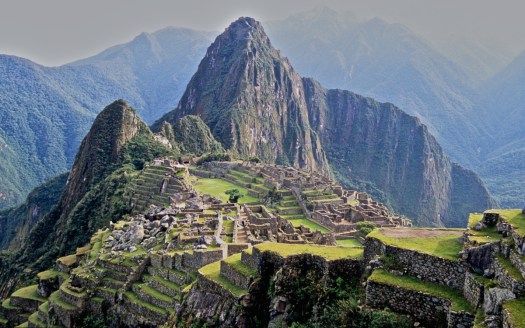
To walk down from the Gateway of the Sun (Inti Punku) to the site of Machu Picchu is one incredible experience. …
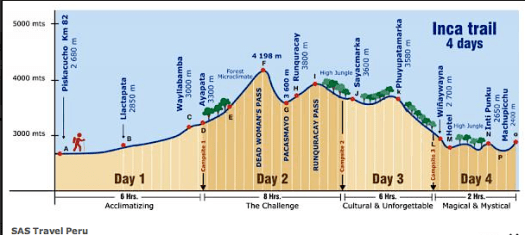
The nice thing about getting to Machu Picchu via the so-called Inca Trail is that walking past a number of other remarkable Inca ruins provides a context as well as a build-up for the ruins of Machu Picchu. Here is a graphic that I’ve “borrowed” from the SAS Travel site because it very neatly and quickly encapsulates the entirety of the trek. …
The plan is simple – to be a part of the world’s first group to walk across the northern part of the island from east to west, entirely on foot, a distance of almost 400 km, in the seemingly impossible timeframe of three weeks. …
Days pass by as we trek west. We camp in rural villages – usually on patchy football fields where, night after night, hundreds of curious children and adults alike surround us, amazed at the presence of a ‘Vaza’, a white ghost – the Malagasy term for westerners. They haven’t seen many before. In fact, in this part of Madagascar, away from the tourist trail in the south, the last foreigners that have entered the foothills of the Tsaratanana were the French army in the late 1940s and occasional mineral prospectors in the 1970s. …
At exactly the half way point of the journey, after almost two hundred kilometers of uphill slogging, we reach the summit of Maromokotro, Madagascar’s highest mountain. …
ramblin’ boy posted the best Huayhuash trip report I’ve yet seen.
15 days
… Most of the 125-km long trek is on trails above 4000m and above the tree line so you have a very stark mountain scenery. It is obviously much more of a commitment than, let’s say, hiking the Monte Fitz Roy area near El Chalten in Argentina’s Patagonia; it is also more demanding physically than the eight-to-ten-day Torres del Paine Circuit in southern Chile.
However, the reward is even more stunning scenery– and nobody is there!
It is not everyone’s cup of tea; but if, like me, you enjoy the idea of “leaving” civilization behind while donkeys carry your gear for a couple of weeks of wandering along incredible mountain trails then look no further! …
At Llamac we met the arrieros (muleteers) and their burros, all ten of them. They would carry the bulk of our stuff for us; we would walk with day packs containing rain gear, cameras, and a water bottle. I cannot imagine doing this particular trek unsupported, weighed down by all the things you’d need to bring. …
… a good 4 to 5 day hike. We had great weather with no rain, which meant hot afternoons. In the mornings, we were up around 5am to be on the trail by 6am. This was to avoid the heat and catch the sun rise. Although hiking in the heat was hard work, the waterfall swimming pools at the end of every day (except the last) were a magnificent reward. Amazing water and then catch some rays in the sun. …
But have you heard of the new alternative, the 6-day Black Cat Track?
The Black Cat Track is closed, and no one—not Koyu up in Kaisinik or anyone in Lagui—thinks it will open anytime soon. The region remains tense. …
Last September, a trekking company’s guided trip through the wilds of Papua New Guinea was shattered when machete-wielding men attacked the native porters, killing two on the spot and injuring many more. The motive appeared to be robbery, but Carl Hoffman knew something else was at work—ancient tribal patterns of violence that, he knew, would inevitably be avenged.