I signed up, raised some money from incredulous friends, some of whom thought it cheaper to give than to have me committed, and started training.
On January 13, 2014, in my 65th year, I joined the group in Amsterdam for the flight to Moshie to start the trek to summit Mount Kilimanjaro. We are 13, 10 women and 3 men, ages varying from mid twenties to mid sixties. We’ve raised almost $100,000 for Outward Bound and have paid our own way here.
Summiting Kilimanjaro is simple but not easy. …
At 5895 meters (19, 340 feet), it is Africa’s tallest peak. It demands a high level of fitness; six to eight hour days of high altitude trekking is demanding. Our well trodden trail, the longer Machame-Mweka route covers 55 kilometers that takes us up a flank of the summit and then traverses slowly across the width of the mountain to the final camp above 4800 meters; from which we strike out for the summit. The longer route allows more time for acclimatization, improving our chances of summiting. …
The landlocked mountain kingdom of Lesotho is an enclave completely surrounded by South Africa.
Population just over two million, about 40% of the population lives below the international poverty line of US $1.25 a day. It’s one of the poorest nations on Earth.
The easiest way to hike Lesotho is by guided day tour ($50) out of Amphitheater Backpackers in the northern Drakensberg.
Our first stop was at Mafika-Lisiu school, the only one for many miles. Amphitheater Backpackers built a classroom.
One of the teachers joined us as an assistant guide. Local information, first hand.
This teacher has been waiting nearly 2yrs for a visa that would allow him to visit South Africa as a tourist.
Lesotho once had the opportunity to join South Africa, but the leaders — considered very corrupt — declined.
Many families here are self-sufficient, not much using currency. Maize is the primary crop. 75% of the population is rural.
No electricity. No formal shops. The school does have a football field.
From the school we hiked up to see some of the famous cave paintings.
Sadly, many had been defaced.
Again we saw plentiful bird life, but no wildlife. This was the wildest creature en route.
From the caves our group had the option to extend the hike up on to a ridge.
Hans loved the tranquility of the valley.
There are “roads” in Lesotho, but most are awful.
Hans signed on for the tour because he wanted to see a traditional African healer.
She’s entirely self-taught. Her healing ability is a “gift” first revealed in dreams.
Here is her home.
I’m a skeptic of natural medicine. But most people in Lesotho do not have the money nor transportation to make the long trip to a clinic or hospital. She is all they’ve got.
Her bedside manner is excellent. Warm and charismatic.
One tidbit we learned is that the traditional round houses with thatched roofs are slowly being phased out. Thatch is expensive in 2014. And must be replaced regularly.
Children here do not have much. The healer married at age-20 and had had 8 children.
Kids seem to roam about unattended by parents. They are raised (and disciplined) by the village.
AIDS infects about ⅓ of the population. But we heard nothing of that on the tour.
Theft of animals is the most worrisome “crime” in Lesotho. Though the kids are ignored, valuable stock animals are watched closely.
One local man was trying to chase down a young cow while we were there. 🙂
Full disclosure: I had been booked on a serious 8hr mountain climb for this day. But opted out, switching to the Lesotho cultural tour instead. After only one day in the summer sun, I was too sunburned to risk a tough climb.
While checking into the hostel, sign up for their most popular guided hike. It’s offered about every 2nd day for about $50 all inclusive.
7:30am departure.
Here’s our guide “Sim” parking one of the hiker shuttle vans at Sentinel car park 2,500m (8,200 ft). This is the only official day hiking trail leading to the top of the Drakensberg escarpment.
Yep. That’s the Sentinel. You cannot climb it without ropes. We’ll skirt the base.
The trail zigzags up towards the big peak. Then traverses right.
Entirely above the treeline, we did not see much in the way of wildlife. Aside from lizards, of course.
It was an easy start with perfect weather.
One short ladder on the ascent.
The crux of the hike is up this gorge.
It’s a 300m scramble. Not too difficult overall.
Atop the Amphitheater cliffs, we stopped for lunch. Our guides were disappointed that clouds obscured the fantastic views.
Note the big birds that stopped for lunch with us.
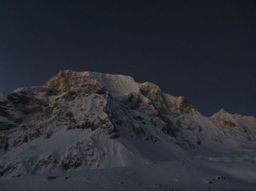
3:00am breakfast … terrible oatmeal, OK pancake, litre of coffee
3:30am intended start
We actually got going nearer to 4am. And it’s plenty cold standing around in the dark.
I was counting on a bright full moon.
Sadly for me, it had set long before 4am.
Finally setting off, we attempted to catch Tasha and Ivan. Breathing was difficult. Vision was worse. I finally had to step out of line to change batteries in my headlamp.
This first 45min was the worst part of the Manaslu Circuit for me, so far. 😦
Whilst moving, you are not cold.
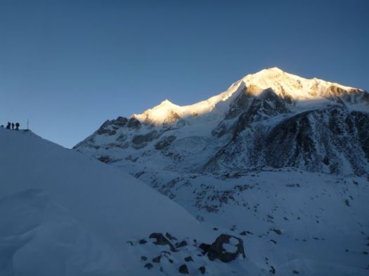
Things got better as the sky lightened.
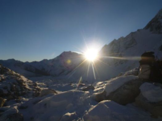
Glorious when the sun finally appeared atop the high peaks.
It was good to be alive when sunshine hits you in the face this high up.
At this point we were completely confident in crossing Larkya. We could relax.
This was like any winter in my Canadian Great White North.
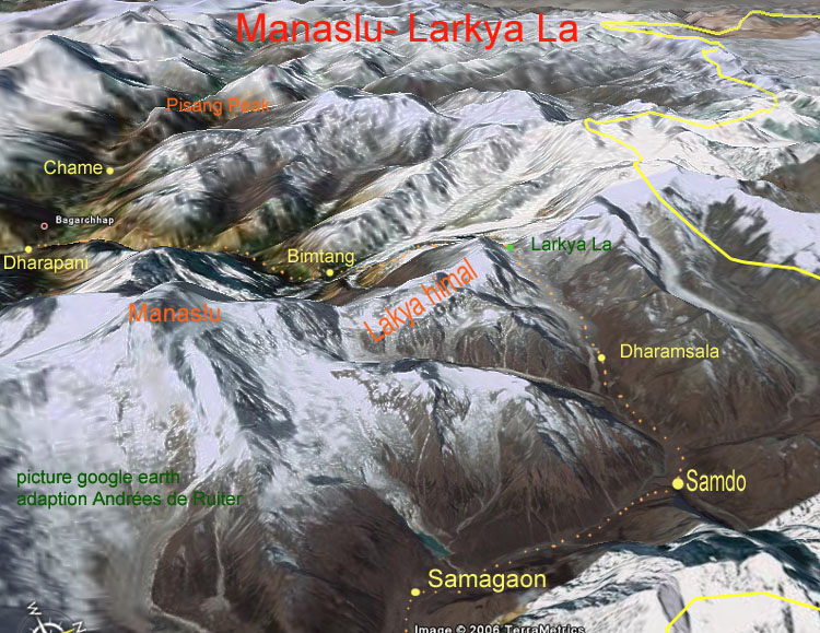
We were surprised how quickly we reached Larkya La5106m (16,751ft).
Ivan and Tasha
We’d started early to avoid severe wind here. Happily, there was very little wind.
Actually, it was quite challenging on one long, steep section.
Porters, in particular, were slipping and falling. I can see why this Pass could be closed after a snow storm.
It’s a little more treacherous than it looks.
You skirt the glacier before getting back to reasonable footing.
Some make a side trip to visit the glacial lake. We skipped it.
Once finally down down, the trail is easy.
Smiles on our faces, we arrived Bimtang 3720m.
Civilization.
That might be the finest guest house we saw on the Circuit. Private cabins. It was booked, of course. By large groups of French trekkers.
It was early in the day. Mike and I were the 3rd & 4th hikers to arrive. Tasha and Ivan were 1st & 2nd.
It takes most hikers 6-10hrs to make the crossing. Much longer, of course, if you start in Samdo rather than Larkya Phedi.
We took the chance to bathe in the sun. The river was flowing, but water taps at our guest house were frozen.
And do some laundry.
I again walked the moraine ridge above Camp at sunset. But it wasn’t nearly as inspiring as the night before. Things are a bit anticlimactic after crossing the Pass.
We chatted through dinner. Went to bed early. I slept 11hrs straight through.
Note: One woman had fallen the day before we crossed the Pass. Hit her head. Though continuing immediately, she had a suspected concussion. She was resting in Bintang. Make sure your travel insurance covers hiking at altitude.
This is why you want to trek in November / early December.
Mike and I were happy to have the weather. Wanted to get up and over the Pass as soon as possible. If he were to have to backtrack to the start, he’d miss his flight back to the U.K.
The arid terrain that high up was very Tibetan.
Not much can live in this climate. Yet Yaks thrive.
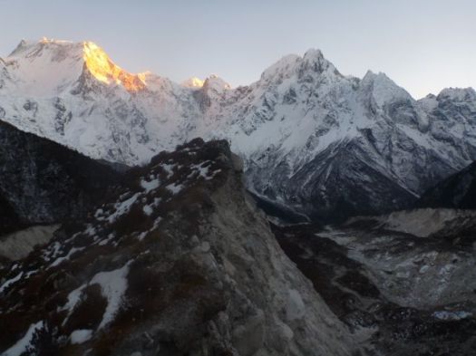
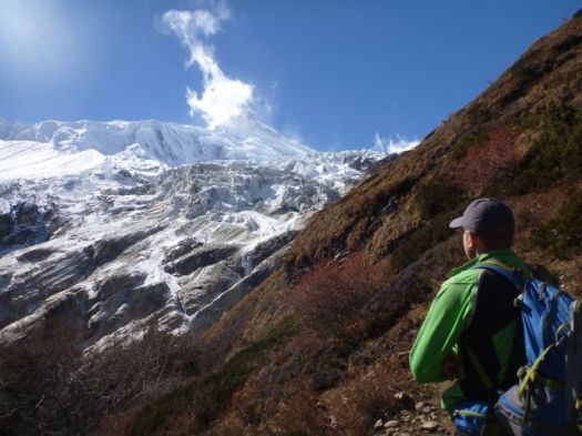
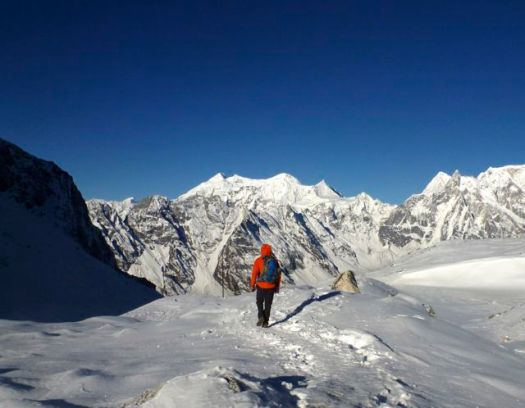
The scenery is fantastic. You hike closer to the big peaks than anywhere else I’ve been in Nepal.
I was one happy hiker.
Some trek from Samo only to Samdo 3690m. Then make a long, long day climbing over the 5106m Larkya Pass.
Sounds crazy to me. But it worked for a German couple we had been hiking with. Their guide doesn’ t like Larkya Phedi 4470m (Dharmsala).
Larkya Phedi is a harsh place. In every way.
It was closed by MCAP in 2011 for being an “illegal structure”. But open since. Open normally until about Dec 15th each season. Food sometimes runs out before that date, however. Some years hikers eat nothing but potatoes before crossing the Pass.
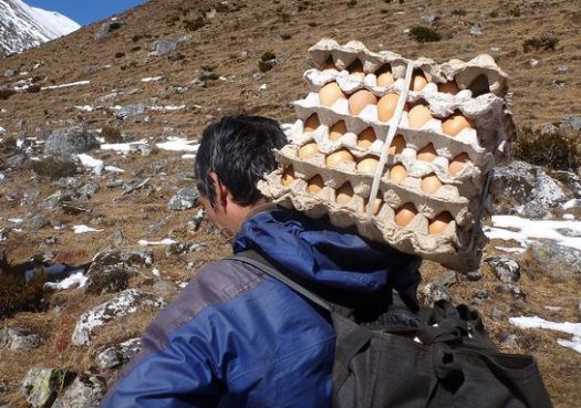
We knew fresh eggs had arrived.
Larkya Phedi is the last place you can sleep with a roof over your head. … On the other hand, there were no beds left when we arrived. When the Pass is closed, it gets very crowded here. 😦
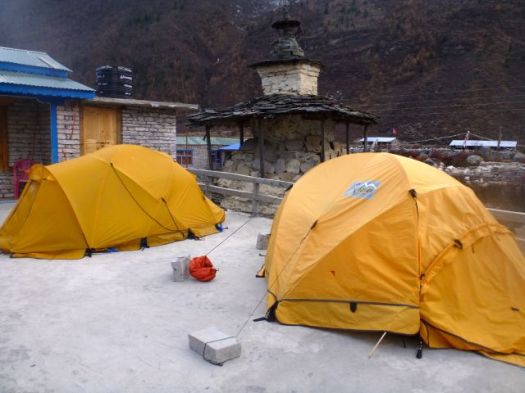
We set up my tent on a snow patch.I wouldn’t be getting much sleep anyway. Wake-up time would be 2am.
Hikers tried to relax in the sun. Nap if they could.
It got very cold as the sun went down.
Toilets are overflowing with feces. They don’t stink. They are frozen.
Ivan saw one Nepali shit into the stream above Camp. The only source of drinking water. That’s how uneducated some of the porters are. That’s why the water is so dangerous in Nepal.
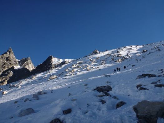
We walked the ridge above Camp for acclimatization. And to stay warm. There were dozens of Blue Sheep up there. Until hikers scared them away.
I practiced various speeds walking both uphill and downhill to maintain an optimal temperature. This in anticipation of the Pass, considered much more difficult than Thorung La on Annapurna.
Wandering alone up there until dark, this was the single highlight of the entire trek for me. 🙂
Wonderful.
Mike and I lingered in the dining hall as late as we possibly could. Staying warm. And avoiding our cold tents. Mike and our guide were forced to share a rent a tent as all beds were taken. Porters slept on these tables and benches starting 10pm.
Last minute I ordered hot water for my Nalgene bottle, using it inside my sleeping bag to warm my feet. Temperature dropped to at least -15C. (5F)
Above 3000m guides are constantly monitoring your health. Head ache? Stomach? Fatigue?
Mike and I felt fine at Sama 3530m, our rest day, so our typically over-cautious guide let us go without him on an acclimatization hike up on to the Manaslu Base Camp trail.
Before departing, we had some excitement in town. A chopper landed to pick up 4 hikers. They all looked healthy to me. Perhaps they’d run out of time waiting for the Pass to open.
Cost for a helicopter evacuation is between $4,000 – $8,000.
Yes. It’s a good idea to have insurance.
The weather was gorgeous for November. Very little wind.
En route to the Base Camp trail we came upon this memorial.
There were 231 climbers and support team on the mountain at the time.
One reason to trek rather than climb the Himalayas.
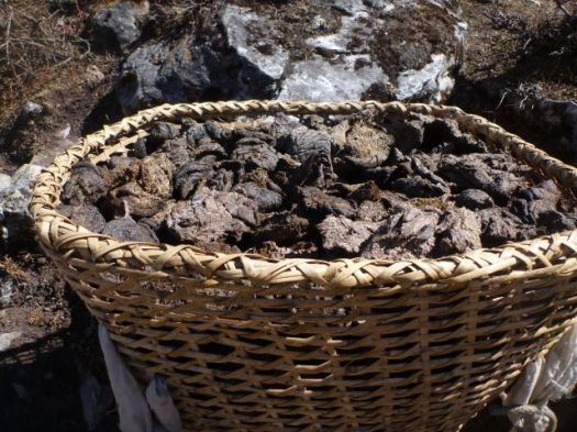
We saw ladies from Samo collecting dried Yak dung as fuel, the only time I saw them collecting anything but dead fall wood.
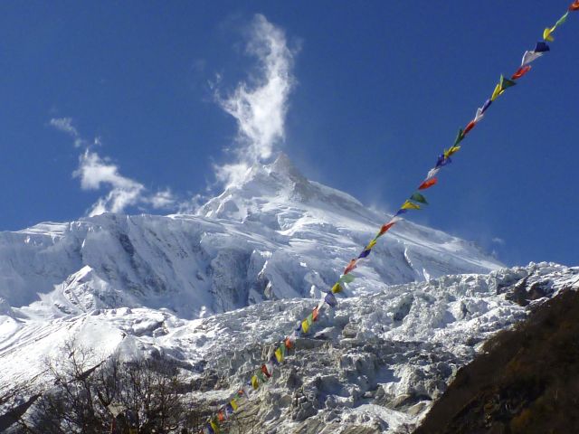
The mountain is awesome.
Mike’s a photographer. And got some great light this day.
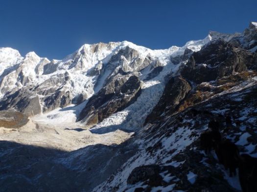
Manaslu Base Camp is at about 4400m. We climbed most of the way, picking out a nice spot for lunch.
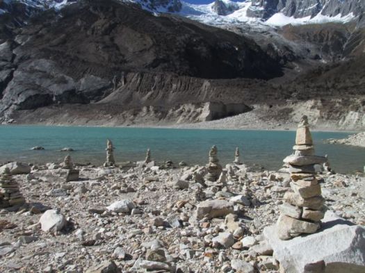
The view down on to the glacial lake. That’s Sama in the distance.
Descending we opted to bushwhack down to the water.
Yaks were relaxing on the shore.
Later we learned that Tasha had swum the icy waters. … She is from Alaska. 🙂
It seemed — from here — logical to bushwhack up the ridge to the monastery.
That didn’t work out so well. We ended up stranded on a knife edge moraine ridge.
It was back to town to recharge our batteries. Literally. And figuratively. We wanted to be sure our cameras were working when we got to the highpoint of the trek.
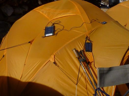
Many seemed to be having trouble with their solar recharging. I’m not sure that technology is worth the trouble, as yet.
Good night.
The crux of the adventure would roll out over the next 36hrs. One way or the other.
This would be the longest day so far. And the most stunning yet.
Permit check first thing in the morning.
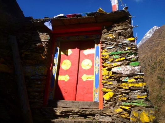
Local people and their landscape grows increasingly Tibetan as you ascend. Each village from here on up had it’s own monastery (Gompa).
It was well below freezing last night.
Still, when the sun comes out, hikers strip off their many layers quickly.
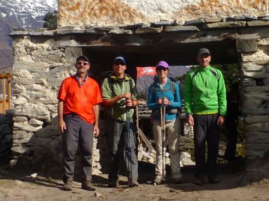
Rick, Brion, Betsy, Mike
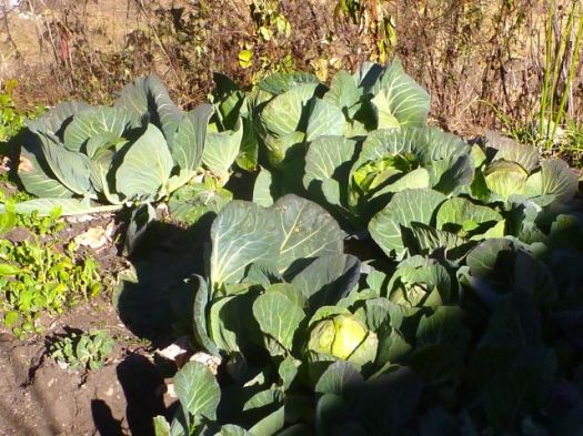
I was astonished at what can still grow at these altitudes.
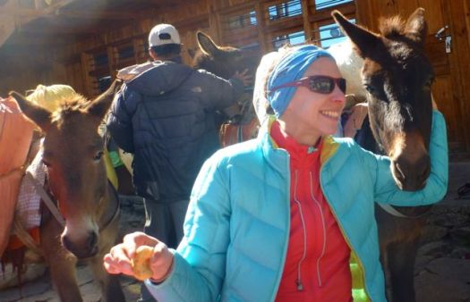
We stopped at Lho 3180m for lunch. The pack animals tried to join us at the table.
Some stayed at Lho for acclimatization. Tempting.
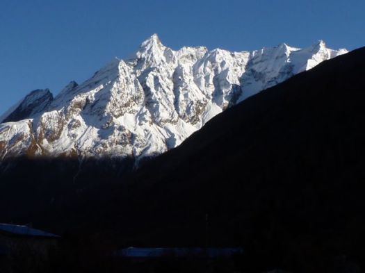
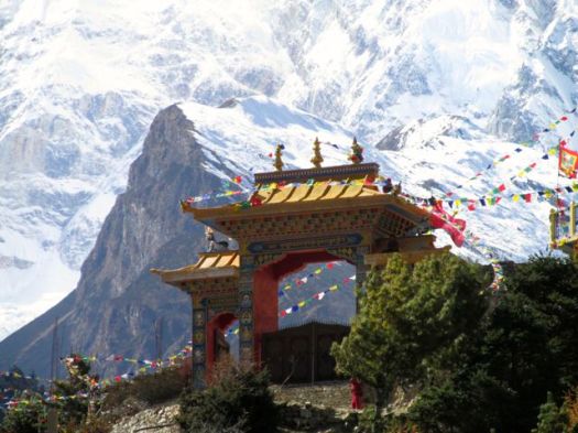
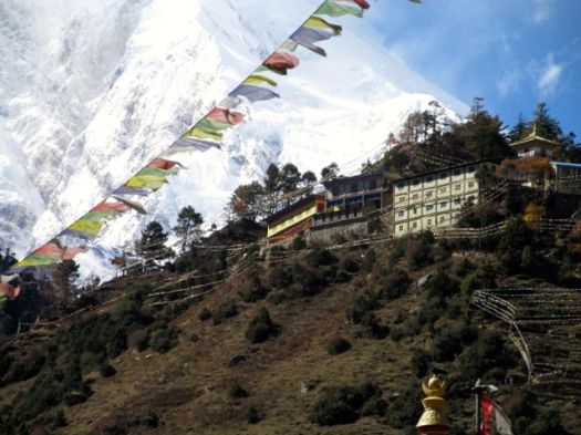
Lho has the very best views of Manaslu!
It’s the cover photo for our hiking guidebook.
This is why you hike the Himalaya. 🙂
We all felt good here at 3180m, so we pushed on to Sama 3530m.
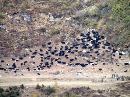
The afternoon was fantastic, too. Grasslands of the Tibetan plateau support grazing animals nearly all year round.
Yak, Yak, Yak
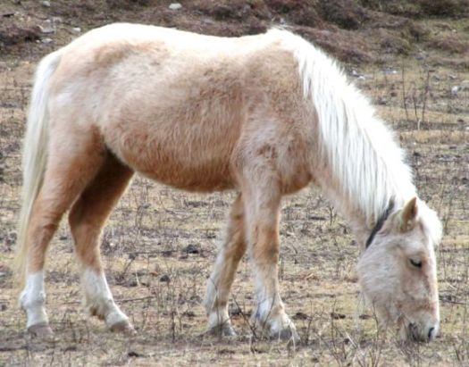
There are plenty of mountain ponies, too. Used for transport.
You can rent a pony to carry you up. Or down, if you are feeling altitude sickness.
A doctor on Annapurna told us of a young Japanese hiker who’s guide put him on a pony to carry him over a high Pass there. He died of HACE or HAPE en route. 😦
We unpacked for two nights in Sama. (Samagaon) 3530m This would be our acclimatization rest day.
Sama is a surprisingly big village of about 1000 residents. Big lodges. Well stocked stores. Good restaurants. We even checked email there, the internet having arrived only 3 months prior. (2013)
Speed of the internet was good. But the computers and notebooks available to rent were atrocious. Almost unusable.
One downside of sleeping indoors rather than in a tent are rodents. In some guest houses you are kept awake by their scurrying. I even saw one in the dining room at 4470m.
On the Manaslu Circuit a tiny room costs about $1.50 / night. Two single beds about $3.
But there’s a shortage of rooms during high season. I had to argue at many guest houses to get my own room, even at double the price.
The previous night I’d not slept well. Coughing. Nose running. I did have my own room — the owners had given me one of theirs.
In my opinion, it would be better to sleep in a tent on this Circuit.
On the other hand, where else are you going to have a view from a $3 room like this?
We were in the high Himalaya. The highest mountains in the world.
We saw helicopters rushing up valley. Word was that the Pass had been closed due to a freak early winter snowstorm. That one porter had been caught out overnight high. And had suffered severe frostbite. He was evacuated by helicopters. All guides and porters should be insured by their trekking agency.
Late in the day we met (unhappy) hikers backtracking from Dharmsala. It was cold, windy and crowded up there. They decided to retreat rather than wait for the Pass to open.
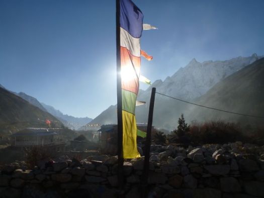
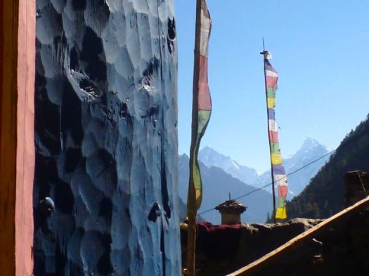
For us it was a lovely sunny day. At higher altitudes we saw more signs of Tibetan Buddhism.
This is no Buddhist relic. It’s a hand-made, water-driven grinding stone.
This was the worst sign of deforestation I saw on the Circuit.
Live trees hacked down. Unnecessarily, I thought.
There are plenty of trees. And buildings are constructed mainly of stone.
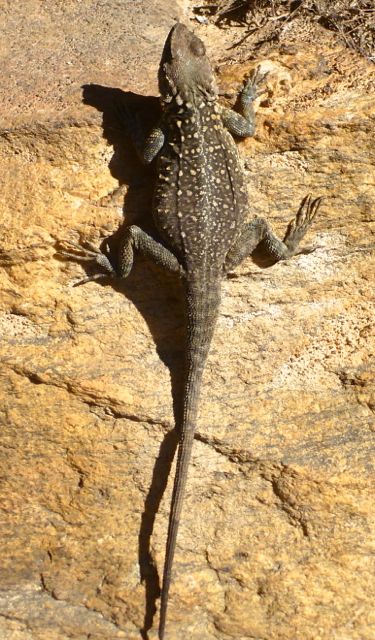
We didn’t see much wildlife on the Circuit. These chubby lizards were a highlight.
I was surprised to see Nepali scarecrows.
There are crows everywhere in the Himalaya. And they are not all that easy to scare.
I was disappointed to see only two giant Himalayan vultures over my entire trip. I’d seen many in the past.
Here we go. Langur monkeys were raiding one farm, taunting the guard dogs. One poor dog fell hard in his excitement to chase monkey.
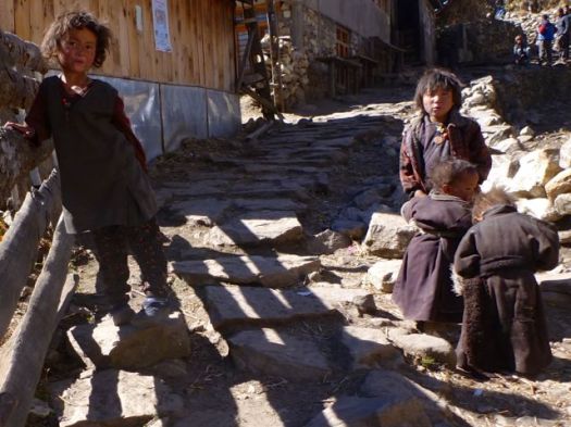
Ladies in the fields paid no attention.
The sun dropped early. The moon rose early.
We slept in Namrung 1660m. From here on and higher we spent most of our evening time keeping warm in multiple layers. 🙂
I awoke early. Went out to get some photos at first light.
I went also to find a good and quiet boulder for a movement. I’d been constipated on this trek so far, my bowels clenched at the smell of every Nepali outhouse.
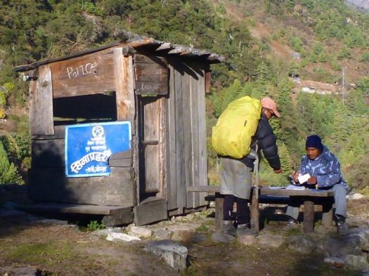
Jagat means “checkpoint” (or something like that) in Nepali. Everyone must have the correct permits. Nobody can sneak past unseen.
Actually, Brion and Betsy were missing one of their 3 required permits. Their trekking company had bungled.
Happily, they were able to pay an additional fee and buy it here.
In Nepal you should be careful to treat all water. I used tablets. New to me was the steriPEN.
Amazing.
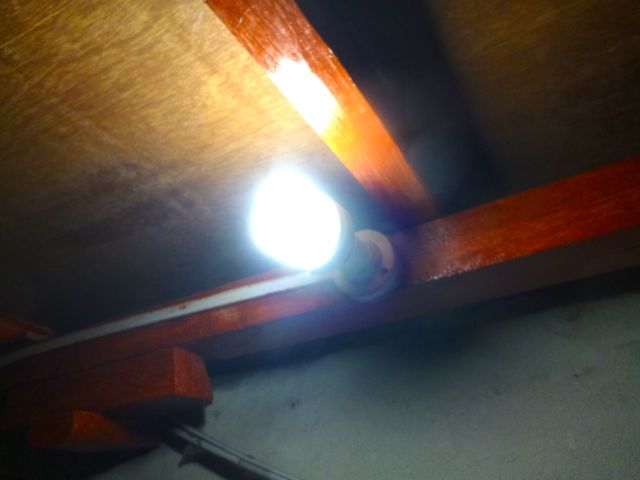
Much improved from my last trip to the Himalaya are LED light bulbs.
I once carried a 100 watt bulb and replaced the one in my guesthouse cell for the night. No more need for that. The LEDs are quite bright.
We got a fairly early start, the valley still in shade. Days are short in November. Sunlight precious.
We stopped along the river to watch a brick maker.
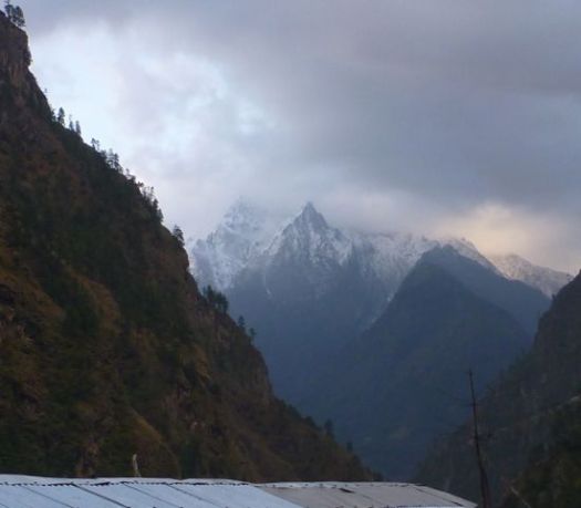
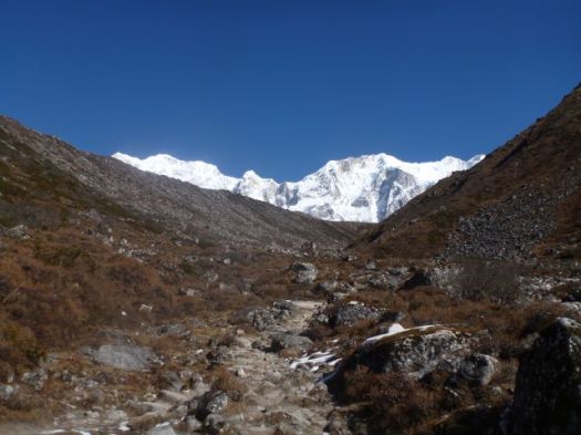
Already loving this trek, it got even better as the BIG mountains came into view.
On the other hand, between 10am and 2pm is rush hour.
If you happen to get behind one of the big French expeditions, it can be slow going.
There are far more French hikers on Manaslu than any other nationality. They mostly tent.
For some reason they mostly eat at guesthouse restaurants rather than at their campsites. That helps the local economies.
Electricity is more available than on Everest or Annapurna. There’s plenty of solar. And a number of micro Hydro stations en route.
Tourism is to credit for that, I believe.
Not all the local people are happy with the increased number of funny looking foreigners walking past.
The young will have grown up with tourists.
No motor vehicle road will ever be blasted here.
My guide figures it will take 15-20yrs.
I love this kind of trekking.
We slept in Dyang 1800m. More snow was falling up high.


 Civilization.