Steve Behaeghel and his wife Katrijn, outdoor adventurers, walked long and difficult sections of Nepal’s GHT.
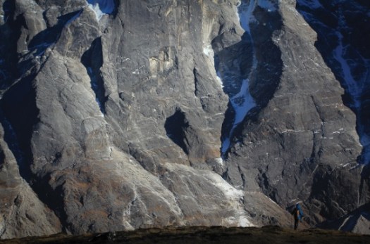
He posted something of a trip report with photos on Sidetracked. A good read.

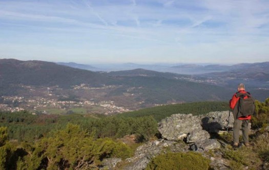
Best hikes, treks, tramps in the world.
Steve Behaeghel and his wife Katrijn, outdoor adventurers, walked long and difficult sections of Nepal’s GHT.
He posted something of a trip report with photos on Sidetracked. A good read.
For my 6th trip to Nepal, where should I hike?
Dolpo? Mustang? Kanchenjunga?
So far I’m leaning towards Makalu. You can fly to the start, avoiding horrendous overland travel. 🙂
Known for its rural farming villages and a diversity of flora and fauna, the area receives few trekkers due to its relative inaccessibility.
OVERVIEW
Starting at 400m in Tumlingtar along the banks of the Arun River, you’ll need strong legs to carry you for an elevation gain of 5120m to reach Makalu Base Camp. A rustic teahouse trek (don’t expect deep-fried snickers bars), you’ll find yourself at the foot of Mt. Makalau (8485m), the world’s 5th highest mountain, with Lhotse (8,516m), Everest (8,850m), Baruntse (7,220m) and Chamlang (7,319m) not far off.
It is a culturally rich perspective on Nepal best suited for people who have been trekking in Nepal before.

related – 2012 trip report by sathya
If you love Port and Portuguese wine, consider a week long guided hiking tour through famed Douro valley.
The pitch:
This fantastic program will get you to one of the most beautiful places in Portugal, de Douro region. From Porto to the Douro slopes you’ll take train journeys who lead you to amazing vineyard terraces scenery, today UNESCO heritage site.
While hiking thru the vineyards, you’ll have the chance to taste some of these wines, world class wine!!! Return in a cruise descending to the river mouth at Porto and, finish the trip at the famous cellars of the port Wine.
» UNESCO World Heritage Sites
» One very good time to taste wines from the Douro region.
___
I’ve hiked nearby Peneda-Gerês National Park. Combining a wine walk with this National park on one trip would be idea. Click through for more information.
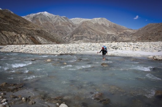
The Great Himalaya Trail is a proposed trail of more than 4500 km stretching the length of the Greater Himalaya range from Nanga Parbat in Jammu & Kashmir to Namche Barwa in Tibet thus passing through Kashmir, India, Nepal, Bhutan and Tibet. When completed, it will be the longest and highest alpine walking track in the world …
It will never be “completed”. There are many GHT routes, higher and lower. They can be hiked continuously or by section.
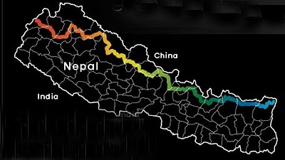
Check out two main websites, both pretty good:
The second mostly covers GHT Nepal.
The guidebook I’m researching is from Trailblazer – Nepal Trekking & the Great Himalaya Trail 2011 by Robin Boustead.
He’s got a coffee table book, as well, that I’ve never seen – The Great Himalaya Trail.
Stuart Bilby solo’d the Nepal GHT Nepal in 127 days in 2014, an incredible accomplishment. No cars, buses, planes, donkeys or yaks for transport. Stuart lost 19kg body weight. Actually, the first half he did with Lisa Lee-Johnson.
Linda Bezemer published a (much more reasonable) GHT Low Route electronic guidebook which you could use with an iPad on the trail. 1550km broken into 11 sections.
Seth, Kathleen and John did a 2014 east-west GHT Nepal traverse.
But my favourite is Gerda Pouler’s account of her 2012 very personal adventure – Great Himalaya Trail: 1,700 Kilometres Across the Roof of the World [Kindle Edition].
… This path is perhaps the ultimate walk.In 2012, Himalaya veteran Gerda Pauler set out to walk the length of the trail to raise awareness of autism in Nepal.
Travelling across the country with open eyes and ears, ascending high passes, visiting isolated villages and drinking tea with the locals allowed her to see and hear things many of us might never hear, never experience — and never know.Beautifully written like many great travel books and with a foreword by Sir Chris Bonington, this is so much more than a travel diary — it is a collection of stories from the very heart of Nepal and its people. From Tibetan tea and local beer to corrupt politicians and child marriage; cold nights and monsoon rain to incredible views and searing heat; and from angry yaks and giant spiders to Mr Bean and Jack Nicholson…

home page – gerdapauler.info
trip report by site editor Rick McCharles
“the Roof of Indochina”
 3,143 meters (10,312ft), Fanispan is the highest mountain in Indochina
Oct 20, 2014

Breakfast at the fantastic Unique Hotel starts 7am. Since I was leaving at 5am, the cook awoke early and put together a takeaway breakfast for me. 🙂
I arrived at Sapa O’Chau travel agency at 5:10am for the 5:30 rendezvous. Guide and driver were there already, so we departed instantly.
By 5:30am we were marching briskly up the trail. In the dark.
“Silver”, my guide, spotted a wounded bird near the Ranger Station. Knowing that some dog would dispatch him in the morning, he carried the bird along with us until finding a safer place in the forest.

We started early because I opted to climb Fanispan in one day US$95, rather than the normal US$180 2-day itinerary.

Silver quickly decided I was strong enough to make it. I hoped he was right.
The trek is wet. And muddy. At the bottom you are often walking in creek beds and runoff streams.

Happily for me, it had been very dry of late. My feet did not get wet over the entire day!
The best sections are ridge walks with misty valley vistas far below.


Surprisingly, long sections of the ridge are protected with concrete railings. They are well built and seem to be enduring the climate very well.

I asked my guide about poisonous snakes. He laughed, saying the snakes this high are very wary. People don’t see them. But in his village, Kat Kat, there are many, many.

Just around the next corner we came across that one, bludgeoned to death. Silver was sorry to tell me that his people eat large snakes and kill small ones.
You’ll only see goats and buffalo on this trek. For anything more exotic check the restaurants of Sapa. Some Asians are happiest eating the most endangered species. 😦

Almost everyone climbs Fanispan with a guide. But I did talk to one guy from Hanoi who did it alone. In a day. Much faster than me. Parts of the trail are marked with collapsed signposts and fading red markers.

It would be easier to follow the trash, however. Only western tourists and guides pack out what they pack in. I’ve always found indigenous peoples to be the very worst litterbugs.
This day we were first to arrive at Camp 1 – 1,500m (4,920 ft). You can buy snacks and drinks here. The guard dog was chained.


Up and up. Into the clouds. Fanispan’s summit is usually clouded over.


Multiday hikers normally stay at Camp 2 – 2,800m (9,190 ft). Either in fairly dirty buildings or in much cleaner tents carried by porters.

We had a meal here on the way up. And on the way down.


Though I set out my alcohol gel, my guide didn’t use it. Other cooks I saw were equally unsanitary.
Camp 2 is atrociously trashed. The main reason I chose to do a one day climb was to avoid staying here. 😦
If you feel I’m exaggerating, click over to a photo of the toilet.
This is a tough trek. There are dozens of sections where you really need to scramble. Many inexperienced hikers must turn back.
Here’s one essential handhold.

Though in a hurry, we got stopped high up for 30min because a work crew was blasting rock.


Turns out a cable car is being built. It will open September 2015 or sooner. There must have been 200 workers living atop this high mountain.


I took perverse pleasure in seeing this mess, but I’m not going to recommend Fanispan to others. The cable car will further degrade the hiking experience.
We did finally stand on the summit, the highest spot in Indochina.

I assumed it would be quick down. But we didn’t get back to the Hoàng Liên National Park Ranger Station until 5pm.
That was 11.5hrs up and down. Including 2 half hour stops for food.
I was awarded a certificate and medal. 🙂

I could barely walk that evening. But seemed to be completely recovered next morning. 🙂
See my high resolution photos from this adventure on flickr.
See our old information page – Fansipan, Vietnam – not recommended
I’m hoping to do the famed Simien Traverse in early December 2014. I’ll be in country Dec 1-14th. It’s the best hike in Ethiopia, one of the best in the world.

Click PLAY or watch a some highlights from a 2014 trek on YouTube. It looks spectacular. Scenery and wildlife. Especially the Gelada Baboons.
I’m using the most recent Lonely Planet Ethiopia to start my research.
I plan to fly Addis Ababa to Gondor, buying my ticket when I get to Ethiopia. Spend at least one night in Gondor, acclimatizing, before traveling about 2hrs north to Debark.

The Simien Park Hotel in Debark is reputed to have hot water showers. One night there while I organize my adventure at the National Park Office.
I’m hoping to either join a group headed up or to hire the minimum for a solo trek. That’s one ‘Scout’ (armed park ranger) and one English speaking guide.
No mules. No cook.
The most popular route is 4-5 days to Geech or Chenek and back. I’ll not summit Ras Dashen, the highest peak in Ethiopia.
Leave a comment if you’ve done this trek.
World → Asia → Vietnam → Fansipan
“the Roof of Indochina”
A cable car will open September 2015 or sooner, degrading the hiking experience. The Sapa area is great, but trek elsewhere in the region. This summit will soon be flooded with suitcase tourists. 😦
Below is our old information page, no longer being updated.
Update (this is an exception 🙂) from patriciaoprea March 2017:
I paid about 60 USD the night before (I’m so last minute) for a tour from Sa Pa
It was 2 days,1 night.The good thing about this? We arrived at the summit at 7:00 in the morning.
The cable car is built, but NOBODY is there at that hour, because it hasn’t opened yet!I loved this hike, go for it 🙂
3,143 meters (10,312ft), it’s the highest in IndochinaPanoramic views of the mountain ranges of northwest Vietnam, if you get any views at all. The summit is famously shrouded in cloud.:-(
Guided trips are no longer as inexpensive as they once were. Seems the government got stricter with guide requirements.
We paid $95 for a one day, up-and-down for 1 person October 2014.
A two day trek costs $180 for 1 person October 2014. You can negotiate on price with some agencies.
Shop around. The official government tourist information office quoted $120 for the $95 tour. Assume the difference is commission.
There are a number of options, including a 1 day guided up-and-down.
It’s possible to do independently. But we wouldn’t recommend it unless you are familiar with the route.
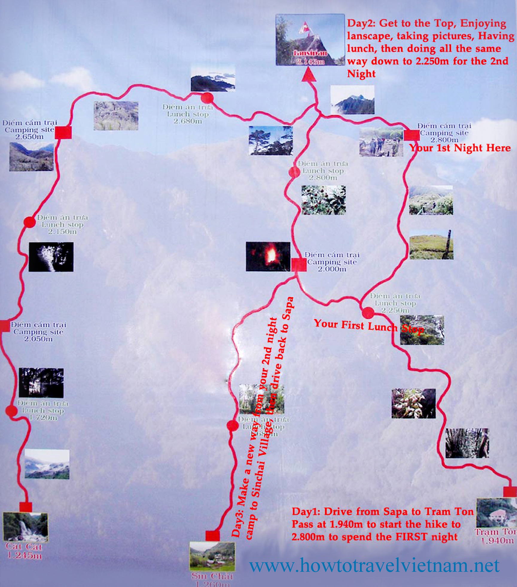
There are three routes to the mountain. One is from Tram Ton, the others from the villages of Sin Chai and Cat Cat.
The first route is a more gradual climb because it has been selected for tourists. The trip can be made in a day.
The route from Sin Chai is shorter but more adventurous, requiring climbers to sometimes use ropes or other special facilities for climbing.
The route from Cat Cat is the longest, but mixes some challenging climbs with great scenery. After one day of climbing, there’s a break at 2,200m above sea level. Climbers can have a meal cooked by a Mong porter and camp, followed by a second camp at 2,700m before reaching the peak on the third day.
Most climbers chose a tour from Sa Pa at a cost of about VND1.5 million excluding train fare from Ha Noi, and tours should be booked a month in advance.
Climb Sipan
We recommend you hire a guide. Let them do the logistics. You simply enjoy the journey.
Click PLAY or watch Leonard Boey’s 2013 trip highlights on YouTube.
Questions? Suggestions? Leave a comment on this page. Our editors will reply.
Once you’ve been up on the Roof of Africa in the Ethiopian Highlands, you won’t want to come down
Jemima Sissons:
… I spent my first few days in Ethiopia exploring the capital, Addis Ababa, then caught a flight to Gondar in the north, where I met Mulat and our driver, Melsie Nuru, and started preparing for our four-day, 50-kilometer trek across the Simien Mountains.
The Chinese-built roads make the three-hour drive to the base camp at Sankaber an easy whiz through lush pastures and past goat herds weaving their way across the road, oblivious to traffic. Soon the roads give way to dirt tracks, and after leaving the final village, the real adventure begins. It is unimaginable to contemplate this stretch without an SUV, as we lurch from side to side through unfathomably deep mud, on a number of occasions jolting within a hair’s breadth of the precipitous edge.
When the car finally stops, the cook and driver go off to set up camp, while my guide and I begin our trek. …

Fansipan is a mountain in Vietnam, the highest in Indochina (comprising Vietnam, Laos, and Cambodia), at 3,143 metres (10,312 ft). …
Update. I’m just about to book my flight. I hope to climb Fancy Pan end of October.
“the Roof of Indochina”
3,143 meters (10,312ft), it’s the highest in IndochinaI’ll travel to the jumping off tourist town of Sa Pa. Hang out for a day or two looking at guided options. If I feel good, and the weather is reasonable, I’ll try for the one day up-and-down. About 10 hours total.
The best trip report I’ve seen was posted on mymilez:
We did not expect the climb to be so heavy. The trail was very steep and mostly ran in the rain forests and bamboo groves, by wet and slippery roots and rocks. …
Fansipan Peak was blocked due to snow fall damage January 2014.
Leave a comment if you have any advice for me. I’ve added Fansipan to our list of the best hikes in Asia.