Everest trek – day 2

Trip report by site editor Rick McCharles.

Is it safe to trek independently in Nepal?

Is it safe to trek solo in Nepal?

Yes. And yes.

On the other hand, while I was there posters were up for a missing Russian trekker. And a missing Chinese trekker.

The majority of hikers in the Everest region hire a guide, porter(s) and/or pack animals.

group tent camp

But there are many, many hiking independently. And solo. I feel Nepal is one of the safest places to hike solo anywhere in the world. I met many women traveling solo.

The trails are packed with people! It’s difficult to ever find yourself alone on a trail.

Certainly independent hikers are experienced. They know what they are doing. Have proper gear. And carry a good guidebook.

… No independent hiker takes a suitcase with wheels to Mt. Everest.

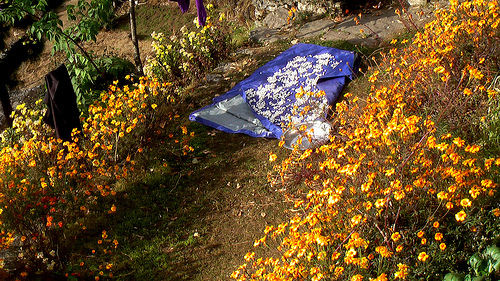
Still feeling fatigued, I didn’t go far day 2. I set up camp early afternoon on a sand bank on a side stream, the Monjo Khola. And enjoyed a day hike up the side valley away from the crowds on the main trail. A rough trail leads to Kusum Kangru base camp, the most difficult of the Nepal trekking peaks.

It was an early night reading the one novel I carried up to the mountains. (And later listening to audio books on my two iPods.)

By late evening my stomach was feeling better. I was getting acclimatized.

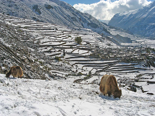
all photos from Everest trek – day 2

… on to day 3
days: 1|2|3|4|5|6|7|8|9|10|11|12-13|14|15|16|17| info page

Everest trek – day 1

Trip report by site editor Rick McCharles.

I’ll post a photo trip report of my superb 17 day trek in the Everest region of Nepal, over the next 17 days.

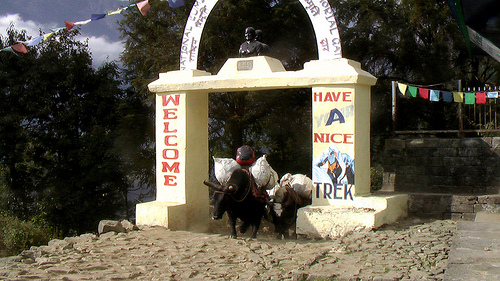
The highlight of the day was flying in to Lukla Airport 9,380ft (2,860m), officially named Tenzing-Hillary Airport since 2008.

That landing is enough to get your heart rate up above 200.

The safety statistics are comparatively good for a short takeoff runway. Comparatively good means planes have only crashed 3 times recently, 1991, 2004 and 2008. Everyone was killed except for the pilot in 2008.

(Actually, the taxi ride from Kathmandu to the Airport is likely statistically more dangerous.)

Immediately the mountain views are stunning. Is that Everest?

The mantra out of Lukla is SLOWLY, SLOWLY. It takes some time to acclimatize to the 2800m elevation. We did not walk far day 1.

This elevation is still surprisingly warm and lush considering the date, Nov. 11th, 2009.

A group of us hiking independently (no guide, no porters) stayed together until the village of Phakding. I checked into a room (less than $1 / night) and crashed for the evening without dinner.

I was altitude sick … complicating my KathmanFlu.

more photos from Everest trek – day 1

… on to day 2

days: 1|2|3|4|5|6|7|8|9|10|11|12-13|14|15|16|17| info page

hiking the mountains of Iran

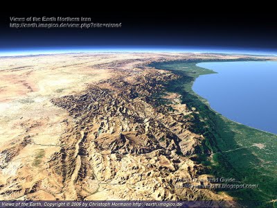
When flying over the country recently I studied for almost an hour the impressive mountains of Iran. Big and mostly empty of people.

Alborz Mountain Range, Caspian Sea

That image by Views of the Earth is posted on an excellent website called Iran Nature.

All useful information you need to visit Iran natural and historical attractions and landscapes. Hiking & trekking Iran nature and ecosystem, Iran mountain, valley, and cave, Iran forest and garden, Iran plain and desert, Iran lake, river, spring, and waterfall, Iran protected and wildlife zone, Iran island.

The most popular adventure in Iran is climbing Mount Damavand, the highest peak 5671m (18,605ft). It’s near Tehran.

Personally I’m more interested in hiking opportunities. But I cannot find much information on the web. Leave a comment if you have any advice about trekking in Iran.

President Mahmoud Ahmadinejad has many problems these days. Too many problems to think much about the 3 American hikers who entered Iran illegally, accidentally, from Iraq.

He did say that he hopes the punishment dealt out by the Iranian judge is not too severe.

Climbing the Mountains of Indonesia

Daniel Patrick Quinn wrote to let us know about a new website called Gunung Bagging – Climbing the Mountains of Indonesia.

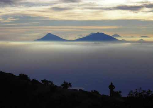
Two English expats have recently compiled a list of all the mountain and volcano peaks in Indonesia with a prominence of 1000 metres or more.

Thanks to huge advancements in mapping technology, this list of peaks, known humorously as “The Ribus”, represents a new development in our understanding of the mountain areas of the Indonesian archipelago. …

It is hoped that the list of peaks and the website will encourage hikers, whether Indonesian, expatriate or backpacker, to explore this amazing country in more detail and visit incredible areas as yet largely unexplored. …

Check out the site – gunungbagging.com

INTERESTING RIBU FACTS

Highest Ribu: Carstensz Pyramid, Puncak Jaya (4,884 metres elevation and prominence) Papua
Lowest Ribu: Tombia (1,022 metres elevation) Sulawesi Tengah
Most western Ribu: Hulumasen (2,310 metres elevation) Aceh
Most eastern Ribu: Cycloop (2,000 metres elevation) Papua Timur
Most northern Ribu: Seulawah Agam (1,810 metres elevation) Aceh
Most southern Ribu: Wanggameti (1,225 metres elevation) Nusa Tenggara Timur
Province with the most Ribus: Nusa Tenggara Timur (East Nusa Tenggara)

Summit Stone in Maui volcano

Want to grab a Summit Stone for yourself?

Look for this unique geological feature in Haleakala National Park, Maui. …

It’s very close to the Kapalaoa cabin. (maps)

Climb the trail up past this landmark. Then scramble right up on to the ridge to find the treasure enclosed in two ziplock bags.

What is a Summit Stone?

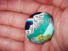
It’s a hand painted rock by DSD of the SUMMIT STONES & ADVENTURE MUSINGS blog.

There are no real rules regarding where Summit Stones are left to be discovered by future hikers. I place the ones given me in locations of singular natural beauty. Or great spiritual or historical importance.

Book that flight to Maui and go collect this one.

Rim of Africa trek

A proposed new long hike in South Africa.

Bookings are now open for a guided hike of the first 11 days of the proposed route, one that will eventually require 48 days, 650km.

4 October – 15 October 2010

11 October – 22 October 2010

18 October – 29 October 2010

Be a trail blazer.

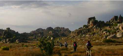
… We have opened the first stage of the hike, consisting of 11 days. You will be hiking through mountain wilderness from Pakhuis Pass in the Cederberg to the remarkable Turret Peak in the Koue Bokkeveld, following the length of the Cederberg and the Skurfteberg. …

In association with the Cape Leopard Trust, the Rim of Africa traverses the territory of the icon of freedom – the Cape Leopard. As the trail’s choice of totem, the Cape Leopard asks us to walk with personal integrity and impeccability. How do we approach our lives with compassion and where do we find within ourselves our individual human potential and act accordingly.

Walk the Rim of Africa.

pack it out? … to where?

So said Sir Edmund Hillary in Nepal.

Any hiker carrying their trash back from the Himalaya to Kathmandu is making a mistake. The capital of Nepal has a worse trash disposal system than either Namche Bazaar or Lukla, in the mountains.

New Road, Kathmandu

Should we carry trash all the back to our home nation? … Think of the carbon footprint.

As far as I’m concerned, in Nepal it’s best to burn paper in the mountains. Shatter glass into a remote waterfall. Bury metal under a pile of stones.

I did the same in the Andes.

This all contradicts the dictates of the Nepali National Parks.

Leave a comment if you have a contrary opinion.

Fundy Footpath, New Brunswick, Canada

Marc Guitard recommends a 41km hike in Fundy National Park, Canada.

Marc writes:

It’s a truly wild coastal area along the Bay of Fundy which has the world’s highest tides. There are 2 river crossings that have to be timed at low tide or else they are otherwise inpassable.

They rate it as 41 kms, but is in fact close to 50km when you include the ‘approach’ Goose River Trail, (8-9km) – part of Fundy National Park, but is necessary to walk to reach the start of the actual Fundy Footpath.

There is a more touristy (driveable) section of the coast called the “Fundy Trail” but it is not the same thing. The Fundy Footpath actually spans from Fundy National Park TO the Fundy Trail.

Recommended 4 days.

details on CanadaTrails.caHiking the Fundy Footpath

is the Annapurna Circuit dead?

Or is this simply a catchy blog post title?

Adventu.re – Yep, The Annapurna Circuit is Dead.

… Newly-built roads now reach nearly all the way around Nepal’s Annapurna Circuit, the most popular long trek in the world. Is the journey is still worth the effort? Probably not, if you’re going with a big tour company that hasn’t updated their itinerary. Yes, if you plan your route carefully. …

I did Annapurna 11yrs ago … and loved it.

I do regret that motor vehicles are degrading one of the world’s best hikes. But I’ve been trekking the Everest region over the past 2wks, … where I spoke to at least a dozen hikers that did Annapurna as well this Fall.

Not one mentioned to me that they were disappointed with the Circuit.

Not one told me that “Annapurna was dead“. They all enjoyed it.

Annapurna is not dead yet.