Annapurna out, Everest in

by site editor Rick McCharles

For years the Annapurna Circuit in Nepal has been one of our top 10 hikes in the world. I loved my own trip there in the 1990s.

But, year after year, road building has degraded the experience.

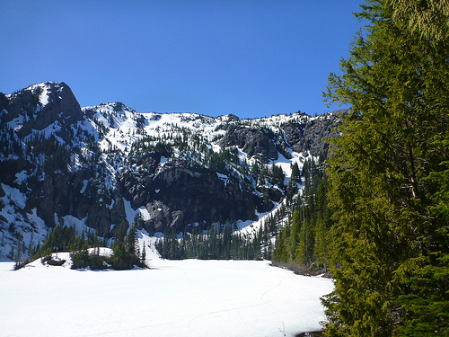
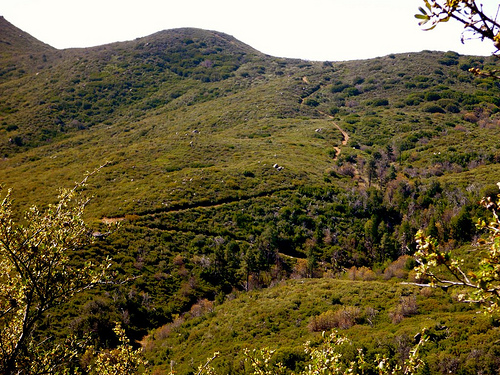
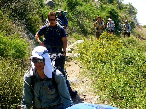
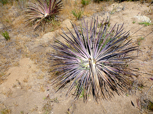
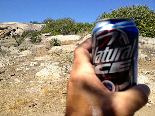
Here’s one of Andrew Ostrowski’s photos from the ‘Circuit’ …

We’ve replaced Annapurna on the top 10 with …

Everest Base Camp / 3 Passes

There’s NO shortage of information on how to hike to Everest Base Camp (5,320m / 17,450ft) in Sagarmatha National Park, Nepal.

But the best route is fairly new, via three high passes:

Kongma La (5,535m)
Cho La (5,380m)
Renjo La (5,388m)

You can do one, two or three of those.

If 3 Passes are not challenging enough, you can opt to side-trip 3 trekking peaks:

Gokyo Ri (5,483m) … similar vista to Renjo La
Kala Pattar (5,545m)
Chukkung Ri (5,550m)

Pokalde Peak 5806m (19,048ft) is an option, too. But requires a Climbing permit as does the much more popular Island Peak 6,189 m (20,305 ft).

The sacred Gokyo Lakes is a superb side-trip. Don’t miss it.

everest-3-passes-mapdetails – Everest Base Camp / 3 Passes

The focus of that page is the difficult 3 Passes route. For independent trekkers.

Pokhalde Base Camp on the Kongma La 5535m

related – our updated top 10 best hikes list.

Borrego Palm Canyon, California

by site editor Rick McCharles

My second visit to Anza-Borrego Desert State Park, I had time for a quick late afternoon day hike.

coyote

Right after I took photos of this coyote, hunting road kill.

AnzaBorregoTrailMap

If you park in the visitor center, you don’t need any kind of State Park permit. That adds a mile or so to the walk.

Borrego Palm Canyon is the most popular trail in California’s largest state park. It leads to the third-largest palm oasis in California, which was the first site sought for a desert state park back in the 1920s.

It’s a beautiful, well-watered oasis, tucked away in a rocky V-shaped gorge. If you’re lucky, you may glimpse a bighorn sheep, in a canyon vegetated by California’s only native species of palm. The park receives many visitors due to its proximity to the metropolises of Southern California, and the trail is relatively easy to access and hike (three miles round trip with 600′ elevation gain). …

EveryTrail

trail

oasis

I got lost on the “alternate” route back.

cactus

more photos

related – official website – Anza-Borrego Desert State Park

Lake Angeles, Olympic National Park

by site editor Rick McCharles

The North Olympic Peninsula, Washington State, enjoyed some high-temperature records for early May.

Not the Vampires of Forks, Washington, of course. Instead of rain and overcast it was a blistering 88 degrees on May 5th, 2013.

Diana

My friend Diana and I drove out that day to talk to Park Rangers. The usual question:

What’s the best hike this early in the season?

First best was Lake Angeles Trail.

Lake Angeles

As promised, the trail was dry.

bridge

Moving steady, we reached the lake in 1hr 37min.

The only delay was getting lost confused on the hard packed snow just at the lake campground.

Angeles

Above the lake is Klahhane Ridge where a hiker died after being gored by a 370lb mountain goat.

One day (later in the season) I’m going to get a ride to Hurricane Ridge, hike down the 9.9mi to the Lake Angeles trailhead at the Park gates.

After leaving a Summit Stone close to the lake, we dashed back down and instead drove up to Hurricane Ridge.

Hurrican Ridge

I was told the rest of that road would not be plowed this season. Budget cuts. 😦

We finished this fine day with a soak and dinner at Sol Duc Hot Springs, first opened 1912.

see more photos of this perfect hiking day

fatal mountain goat attack 2010

A federal judge has dismissed most of a widow’s claims against the federal government after her husband was killed by a mountain goat while hiking in Olympic National Park

Robert Boardman, 63, of Port Angeles was trying to protect his wife and other hikers when the 370-pound male mountain goat fatally gored him in the thigh on a trail at Klahhane Ridge on Oct. 16, 2010.

Robert

The goat is believed to have been one that harassed hikers in the park for years …

The mountain goat then stood over Boardman for about 30 minutes, staring and pawing at the ground, making it impossible for … hikers to reach him, according to park ranger reports of the incident.

Boardman died from blood loss in about five minutes, the reports said. The goat was later shot and killed by a ranger. …

A necropsy on the animal showed it was healthy and in rut for the mating season …

After Boardman’s death, park rangers warned hikers to keep at least 50 yards away from goats and not to urinate on trails.

The park said the urine creates a long salt lick, attracting the animals. …

Federal judge dismisses most lawsuit claims in fatal mountain goat attack in Olympic National Park

Lake Angeles trailhead

Park Rangers have shot aggressive Elk in the past. But this is not typical of mountain goats.

I’m content the law suit was not successful.

This death has changed regulations, however.

… an Olympic National Park ranger operating under new mountain goat management rules shot and killed a mountain goat that had refused to leave a campsite near the park’s Upper Royal Basin for three days. …

related – What should you do if you’re attacked by a mountain goat?

guided trekking in Ireland

What are the best hikes in Ireland? Guide Ian Taylor:
In Ireland, we have numerous trekking opportunities on offer. Maybe you are looking to climb Carrantuohill, Ireland’s highest peak, or Croagh Patrick, Ireland’s Holy Mountain, or maybe Lugnaquilla, the highest peak in Wicklow, Lugnaquilla, we offer each of these unique and stunning Irish mountains. We can also organize treks in the Wicklow mountains or Glendalough, a beautiful sanctuary just an hour from Dublin. Whatever you are looking for in the Irish countryside, we can help you organize your dream holiday to this spectacular country. Some of the options:
Glendalough Trekking Trek Lugnaquilla Carrantoohill climb Trek Wicklow Climb Croagh Patrick
Carrantoohill details
related – Why choose Ian Taylor? (VIDEO)

South Lykken Trail, Palm Springs

Just behind my cheap motel (Desert Inn $40) in downtown Palm Springs was the South Lykken trailhead.

One afternoon I hiked. The next I did a trail run.

trail run

Palm Springs

elevation gain

more of my photos from those day hikes

… the North and South Lykken Trails are named in honor of Carl Lykken, Palm Springs’ first postmaster. …

related – Hiking in Palm Springs

Kolby Kirk – trail journaling

I’ve been a fan of Kolby Kirk for years. He’s certainly one of the most entertaining and creative hiking bloggers.

TheHikeGuy.com

100hikes.com

In person, he’s even better. 🙂

Likable. Personable. Self-effacing.

I grabbed a front row seat for Kolby’s ADZPCTKO 2013 presentation on JOURNALING a hike.

Rather than try to explain what I got out of his talk, here’s Kolby himself explaining the journaling he did for a hiking documentary, MILE… MILE & A HALF.

Click PLAY or watch it on Vimeo.

And I was convinced. I’ll be carrying a hard cover Moleskine journal on future long hikes. A mechanical pencil. And carrying the journal some place easy to reach on a whim.

related – The fools ( Mahe Drysdale, Tamati Coffey, Cate Helm, James Gibson) selecting hikers for an Air New Zealand contest — 9 Great Walks in 9 weeks — did NOT choose Kolby Kirk.

The criteria: “… personality, creativity and skills that may be useful on the trip …”

Do as I do. Boycott Air New Zealand, if you can.

I’m planning to travel to New Zealand next year. I’ll choose a different airline.

I HIKED THE PCT


43 miles … or 1.6% 😦

pct

day 120 miles Mexican border to Lake Morena County Park in southern California.

day 223 miles Mount Laguna back to Lake Morena County Park.

… I’d caught a ride up the mountain with a Trail Angel so I could hike downhill. 🙂

day 3 – ZERO day

zero day

My feet had small blisters after the first two days, MUCH TOUGHER than I’d expected. So I’d planned a modest day 3 – only 10 miles onward from Mount Laguna.

After an hour I gave up trying to hitchhike up the Sunrise Highway. And ended my PCT. For now.

After all, I’d attended ADZPCTKO 2013 for information and inspiration.

Mission accomplished.

PLAN FOR 2014.

The week prior to ADZPCTKO 2014 I’ll travel directly to Warner Springs at the 110 mile mark. Hike south to Mount Laguna.

Catch a ride to the Kick Off party at Lake Morena.

Gear up.

Then catch a ride back to Warner Springs. Continue north from there as far as time and feet will allow.

Hopefully a resupply at Anza. (152 miles)

Finish perhaps at lovely Idyllwild. (179 miles)

… That would get me up to a slightly more respectable 6.7% of the PCT. 🙂

Meantime, I may catch a section in the Sierras this summer.

Wish me luck.

PCT day 2 – Mount Laguna back to Lake Morena

trip report by editor Rick McCharles

I knew next to nothing about PCT hiking strategy.

But it seemed a no brainer to catch one of the many available Angel rides up to Mt Laguna at mile 43. And hike downhill to Lake Morena at mile 20 … rather than uphill.

A_elev

Yet very few hikers did so.

Rick

Beautiful country.

trails

PCT

cactus

flowers

I passed hundreds of sweaty, hot thru hikers climbing. It was interesting to check their gear. And their hiking systems.

hikers

No mountain bikes are allowed. But trail riders and beasts of burden are welcome.

beasts

Several hikers had seen Rattlesnakes. I saw 3 of these guys. A gopher snake, I believe.

click for larger version

It seemed to take FOREVER to get back to the Kick Off campground. Yeesh.

campground

I grabbed a shower. Then enjoyed free chile provided by Trail Angels.

Feet sore. Some blisters. Confidence shaken. … I wasn’t at all sure I’d be able to hike day 3. 😦

more photos

PCT day 1 – Mexican border to Lake Morena

trip report by editor Rick McCharles

Everyone was excited to get to the Mexican border, the start of the Pacific Crest Trail.

hikers Mexico

Trail angels drove clean hikers here the 20 miles from ADZPCTKO 2013. (Annual Day Zero Pacific Crest Trail Kick Off)

Rick Mexico

The infamous fence between Mexico and the USA was less impressive than I expected.

fence Mexico

A savvy coyote would dress his illegals in hiking clothing. And tell them to march north on the PCT.

Lovely scenery to start. Much greener than you’d think.

landscape

Interesting and colourful desert vegetation.

cactus

I dropped a Summit Stone conspicuously on this rock. This trail will be super busy only for about 3 days.

Summit Stone

The first 15 miles seemed easy, the heat not a problem this day.

… Then we got a look at these switchbacks.

switchbacks

I cooled my feet and psyched for the climb.

cool feet

A second wind got me up there. But well meaning angels had left BEER at mile 18.

beer

Smarter hikers than me resisted.

I had to drag myself the last 2 miles to camp. Where free and delicious dinner welcomed.

free dinner

The hot shower was much appreciated. I slept early.

more photos