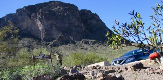
I had a half day free to hike. Not sure where to go, I drove up to Peralta trailhead close to Mesa, AZ. Of the many options from the trailhead, this looked best to me.
Level: Easy/ Moderate
Length: 5 miles
Elevation: approx 1300 ft. gain
Type: Out and Back
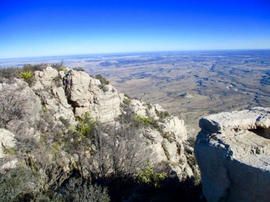
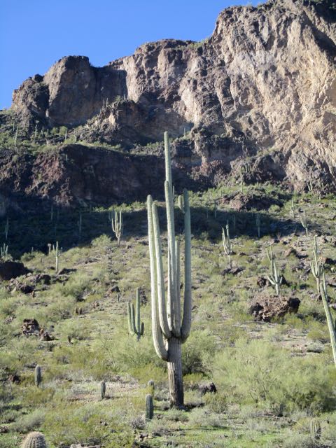
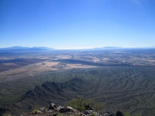
It was a beautiful day climbing up and along a creek. Here’s the vista on one side.
And the other side.
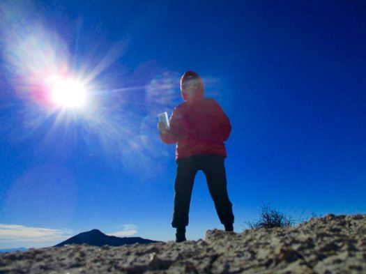
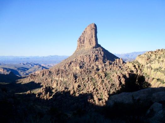
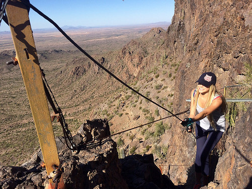
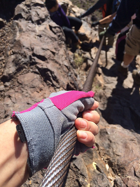
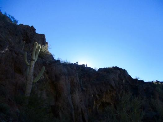
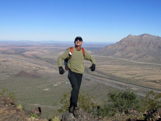
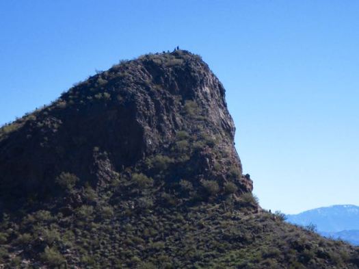
At the Fremont Saddle kids were scrambling the boulders. Moms tried to avert their eyes.
The consensus was not good: bad roads, snow into July, forest fire recovery sections, hunters. It will not go on our list of the best hikes in North America.
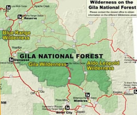
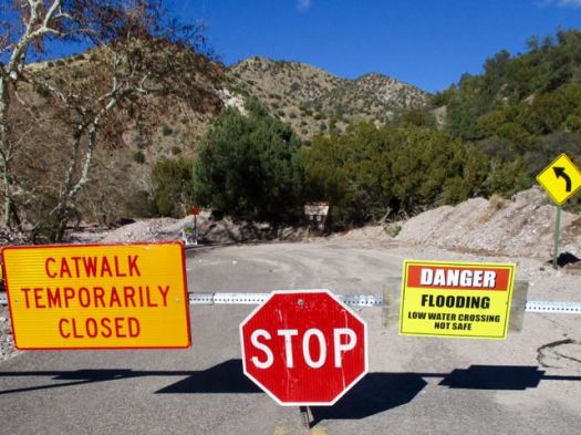
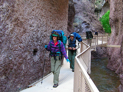
The most popular hike in Gila Wilderness is the Catwalk – “… a one-mile trail suspended above a rushing stream in a gorge only a few feet wide.”
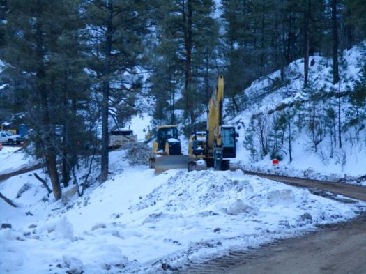
It had been rebuilt over a period of 2 years costing over $4.4 million dollars. And opened again in 2016.
I’d been advised by a Ranger that only the catwalk part of the trail was open. Hikers often continue on to #207. I would have wild camped if it had been open.
Sadly, that Ranger was wrong. It was all closed due to flooding.
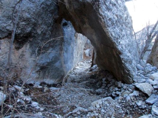
Still, the Catwalk does look very cool.
The 1.1-mile Catwalk National Recreation Trail winds through the canyon’s steep, pink walls of volcanic rock, following the path of a pipeline built in the early 1890s to provide water and electricity for the mining town of Graham. …
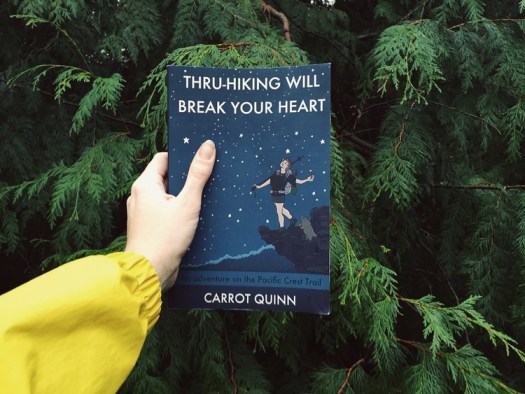
Carrot Quinn was raised in Alaska on welfare by a schizophrenic single mother. A rough life. In fact, she became a hobo riding the rails.
This book reads as a blog. That’s because it started as blog posts from the trail.
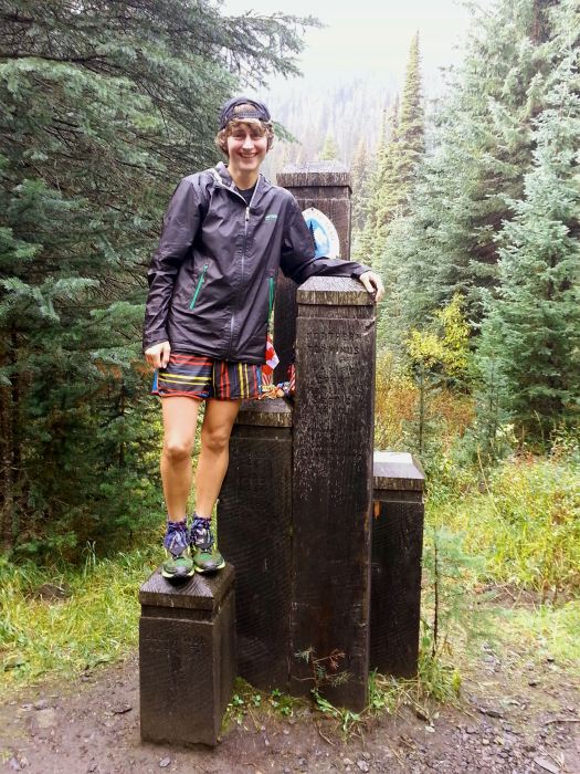
reaching the Canadian border
If you are one of those who disliked Cheryl Strayed’s memoir Wild … because it had too little actual hiking … know that this extended trip report is all about the hiking. 🙂
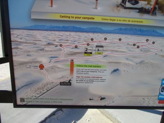
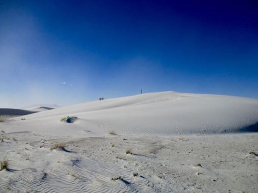
It is the largest gypsum dune field in the world. …
The Monument is completely surrounded by military installations (White Sands Missile Range and Holloman Air Force Base) and has always had an uneasy relationship with the military …
Located on the northernmost boundaries of White Sands Missile Range, the Trinity Site can be found, where the first atom bomb was detonated. …
Backcountry Camping Trail map
There are non-stop warnings about dehydration.
Let’s go.
I wore these lightweight camp shoes. They turned out to be perfect for the soft sand.
Land totaling the size of Connecticut has been targeted in a new bill in the Republican House, uniting hunters and conservationists in opposition
Now that Republicans have quietly drawn a path to give away much of Americans’ public land, US representative Jason Chaffetz of Utah — @jasoninthehouse —has introduced what the Wilderness Society is calling “step two” in the GOP’s plan to offload federal property. …
The bill seems to run in direct opposition to Interior Secretary appointee Ryan Zinke’s (R-Montana) initiatives. In his confirmation hearing earlier this month, Zinke said: “I am absolutely against transfer and sale of public lands. I can’t be more clear.” …
Story goes that ranchers in 1881 got lost in the deserts. Had no water. With their horses failing they spotted the limestone walls of one more canyon. This would be their last chance.
My guidebook author called this “one of my favourite spots in all of New Mexico”.
It has plenty of water year round. A rarity in this part of the world.
I started late in the afternoon as it was only 2.7 miles to the recommended campsites.
The light gorgeous.
Here’s that water that saved the ranchers.
Obviously this canyon floods at times.
I checked out the campsites. Too exposed. It was very, very windy.
Instead I hunkered down in this more sheltered spot.
Having forgotten my bear bag rope, I instead tossed my food bag up into a tree attached to a loose branch. Ingenious improvisation I thought … at the time.
The wind blew it down during the night. Happily my food stayed undisturbed lying on the ground.
Next morning I had the option to try to loop to famed Sitting Bull Falls.
But to save time I opted to backtrack from here, visiting the falls via the front door.
As you probably would guess, the Sioux medicine man Sitting Bull never visited New Mexico.
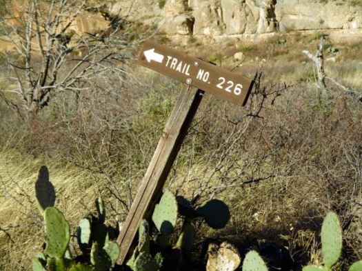
You immediately drop down into a small drainage following cairns. There’s no signage.
Up the other side the trail is well defined.
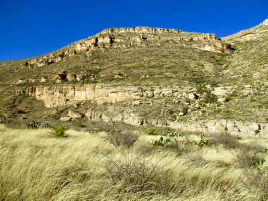
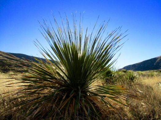
I love the desert. And it was a beautiful day … though very windy.
You can go 3 miles out, 3 miles back. Or try to loop via other canyons. Instead I went out about a mile … enjoyed some solitude … then hustled back to my vehicle.
The “unfriendly vegetation” was too often snagging on my favourite hiking pants. It was difficult to avoid.
In the flat desert it’s easy to get lost. Even here close to Carlsbad Caverns and many roads. In 1999 hikers Raffi Kodikian and David Coughlin were lost in Rattlesnake Canyon. Coughlin died.
The Parks recommends a (strenuous) 6-8 hours. In a rush to finish before dark, I did it in 4.5 hours.
Trailhead is the Pine Springs Visitor Center. I checked in with a Ranger on trail conditions. She neglected to tell me there was a LOT of snow up in the Bowl.
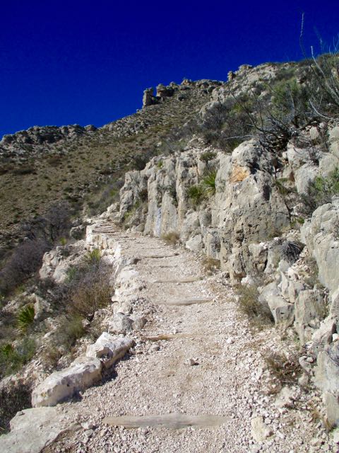
My guidebook recommended to climb up via the Tejas trail.
A very easy way gain all that altitude. Very well maintained.
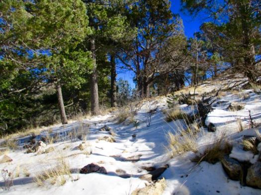
Up top in the bowl it looked like the Canadian winter I’d fled.
I met only one other hiker. She too was surprised with the snow.
It’s a different ecosystem up here.
A beautiful coniferous forest of pine and Douglas fir … awaits those who are willing to hike up 2500 feet from the Chihuahuan desert below.
Close to the turnoff for Hunter’s Peak I saw a herd of mule deer. I’m not sure why they are so high this time of year.
From there I needed to either backtrack. Or finish the loop.
Signage in Guadalupe Mountains National Park is not nearly as good as in Big Bend. The free Parks trail map is not detailed enough to do many of the hikes it recommends. Get a better map.
Happily I did find the sign to Bear Canyon Trail. The descent was much different — and much steeper — than how I got up.
water pipe
I saw some strange wreckage. An airplane crash, I assume.
It was much quicker down than up.
In fact, for most people it’s better to climb on Bear Canyon, descend on Tejas. Easier on the knees. We’ve added The Bowl to our list of best hikes in North America.


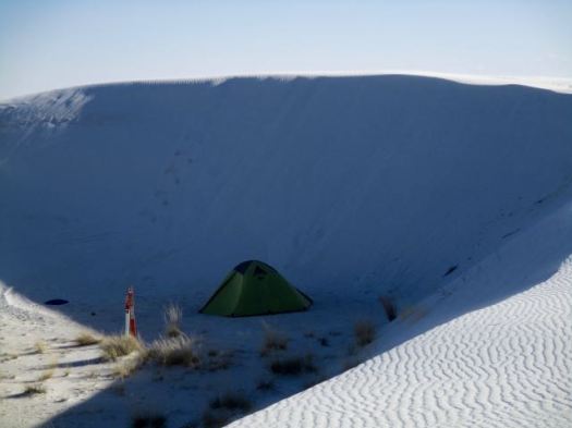


 I checked out the campsites. Too exposed. It was very, very windy.