WHAT!?
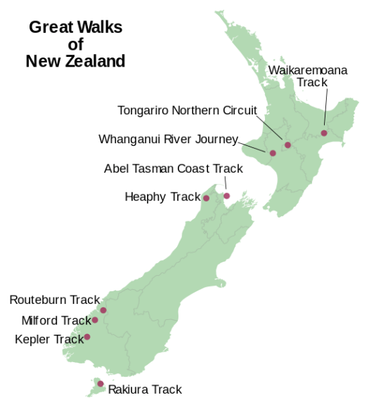
One is a river paddle, the Whanganui Journey, 145 kilometres (90 mi).
Is this even possible?
Click through to see if these guys made it — AND THEN THERE WERE NINE

Best hikes, treks, tramps in the world.
WHAT!?
One is a river paddle, the Whanganui Journey, 145 kilometres (90 mi).
Is this even possible?
Click through to see if these guys made it — AND THEN THERE WERE NINE
“This ain’t about politics. Whether you’re a Democrat, or Republican, or Libertarian, or vegetarian, these lands belong to you,” Montana Governor Steve Bullock pronounced last week. “They’re our heritage. They’re our economy. They’re our quality of life.”
That didn’t fall on deaf ears. Thousands of people marched on state capitals across the American West, protesting Congressman Jason Chaffetz’s (R-Utah) proposed bill to sell off 3.3 million acres of public land. Shortly after, Chaffetz announced via Instagram that he would withdraw the bill. It was the first successful defeat of anti-American policy proposed by the 115th Congress. …
Why Hikers Need Hunters and Vice Versa
Federal lands belong to all of us—it’s time to unite to fight crooked politicians
Click PLAY or watch it on YouTube.
Next time I get to Vegas I plan to cross the Mojave National Reserve south to north.

I’ll start from highway 40 heading towards the Granite Mountains. Refill at Kelso Depot. Hike on to Mid Hills Campground , refilling my water bottles. And exiting at Nipton.
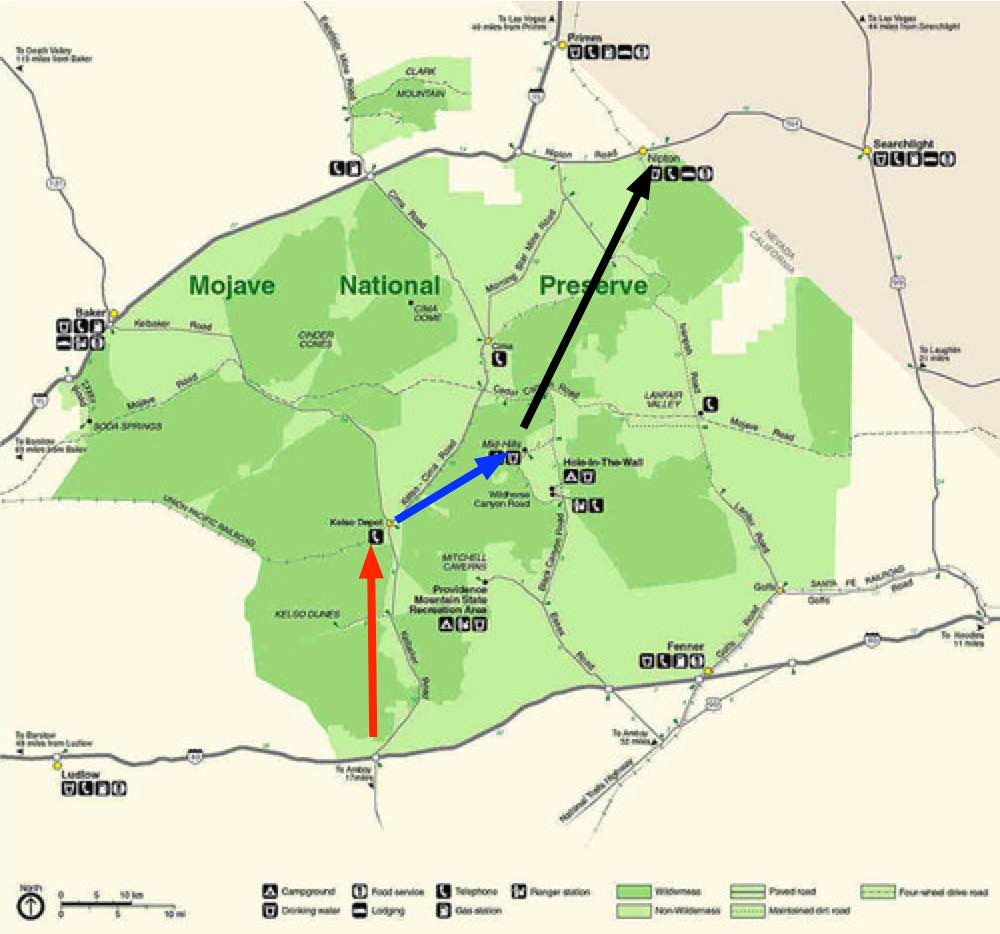
Surprisingly, water will not be a problem.

I won’t count on natural springs, however. Let’s leave that for the wildlife.
I’ll carry the Tom Harrison map. Wish me luck.
trip report by site editor Rick McCharles
Northeastern Arizona.
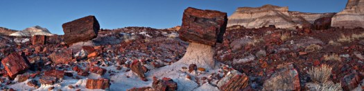
Named for its large deposits of petrified wood, the fee area of the park covers about 230 square miles (600 square kilometers), encompassing semi-desert shrub steppe as well as highly eroded and colorful badlands. …
The site, the northern part of which extends into the Painted Desert, was declared a national monument in 1906 and a national park in 1962. About 800,000 people visit the park each year and take part in activities including sightseeing, photography, hiking, and backpacking. …
The park’s seven maintained hiking trails, some paved, vary in length from less than 0.5 miles (0.8 km) to nearly 3 miles (4.8 km). …
Hikers and backpackers may also visit the park’s wilderness areas. Free permits are required for overnight stays …
I enjoyed the 1 mile hike at Blue Mesa. Reviews.

Entry fee.
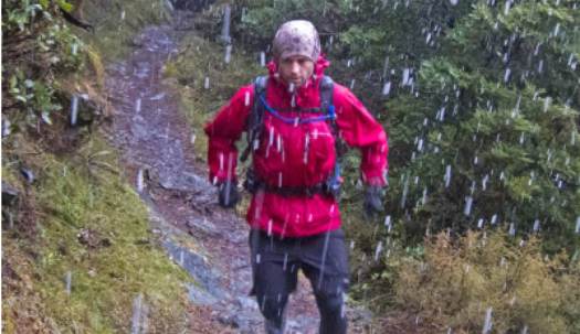
I had a chance to try one on. And was impressed.
But who’d want to hike in a white jacket? A polar bear researcher? Those who HATE PFCs?
21 recycled plastic bottles are used in manufacture.
Click PLAY or watch it on YouTube.
Have you been following Peter McBride & Kevin Fedarko?
Epic Grand Canyon Hike: A 650-Mile Challenge (Part 1)
Epic Grand Canyon Hike: Frozen Shoes and Low on Food (Part 2)
I liked the 3rd and final instalment best.
Click PLAY or watch Thirst and Threats in the Godscape on YouTube.
trip report by site editor Rick McCharles
I love Mojave National Preserve about an hour away from Las Vegas.
But I’d already done most of the popular hikes on previous trips.
Happily this time I discovered the Barber Loop Trail apparently the newest of the established trails.
Ideal for those sleeping at Hole-in-the-Wall Campground.

It’s a loop so you can hike in either direction.

Best is to start off into the desert, return via the Rings Loop Trail
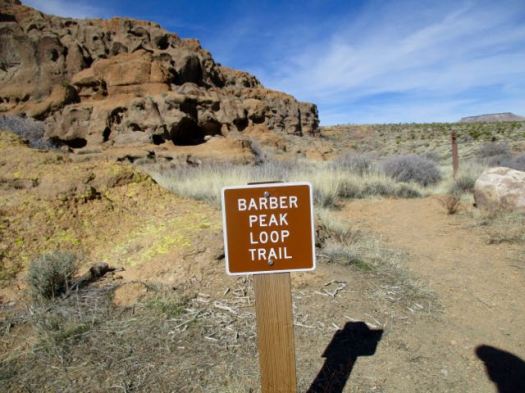
I was a bit disappointed. Standard flat desert.

I’d hoped the trail would loop up on top of Barber Mountain. It doesn’t.

There are a few things to see in the desert, of course.


The best part is the section you could do separately as the Rings Loop Trail.


If you want to know more, Bird and Hike posted an excellent trip report.
trip report by site editor Rick McCharles
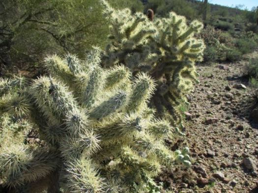
My old friend Francis Tally took me to one of his favourite hikes out of Usery Mountains Regional Park near his winter home in Mesa, AZ.

Huge Saguaro cactus are the highlight. And the brazen chipmunks. 🙂
Francis told me an awful story of a hiker who fell into one of the OTHER types of cactus. It took paramedics 3 hours to remove enough spines just to transport him by ambulance!
We arrived on a Sunday morning to learn that weekend mornings are a zoo on this popular trail. It was difficult to find parking .

The trail itself is not all that difficult. Many children hike it.
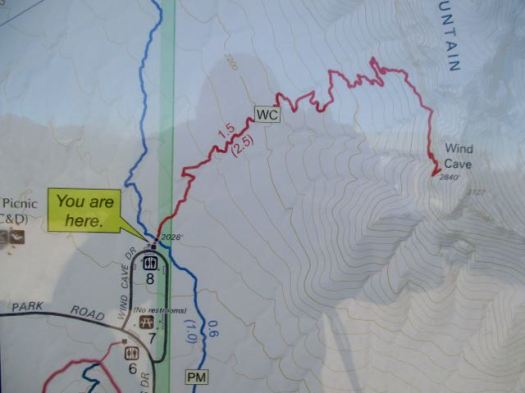
The Wind Cave isn’t really a “cave” but rather an indent to shelter from the wind.

Almost everyone stops here. Francis and I scrambled on to the top of the mountain.
Finding some pink ribbons we decided to follow that off-trail route.

Here we be. The sprawl of greater Phoenix at our feet.

This is a terrific area for day hikes.

Thanks Francis. … I assume the name tag on your hat is to help authorities return you to your retirement park if you get lost. 🙂

Exiting the Park Francis took me over to a nearby gun range just below the Phoenix sign. I’d never seen one before.

They are LOUD.
related – Roads Less Traveled trip report
Patagonia has just become the first retailer to pull out of a big industry trade show in Utah to protest state leaders’ efforts to strip federal protection of public land. …
The company’s announcement Tuesday came after its founder, Yvon Chouinard, wrote an open letter last month urging Utah governor Gary Herbert to stop trying to undo the decision by former president Obama to create the Bears Ears National Monument. …
It’s time for Outdoor Retailer shows to move out of Utah. Utah governor Gary Herbert @HerbertForUtah and most of his Republican colleagues hate Outdoor Recreation.

trip report by site editor Rick McCharles
Flatiron, aka Siphon Draw, is one of the most popular and exhilarating hikes in the Superstition Wilderness. This trail puts you on top of one of the most prominent rock features of the range called Flatiron due to the fact it looks like an upside down iron. …
The Flatiron trail begins at the westernmost side of the Superstition Wilderness at the Lost Dutchman’s State Park.

Lost Dutchman’s is a lovely Park and campground. Up and up.

It doesn’t take long to reach the big cliffs.

The Siphon Draw Trail is not much of a trail. It’s mostly a scramble up the rocky chute.


As you can see, it’s very popular on a nice January day. A number of these folks were challenged by the physical demands. A few had poor footwear.
The crux of the scramble is at the very top. No doubt a few turn back there. 😦
Top of Flatiron. Here’s the view over the Phoenix sprawl.
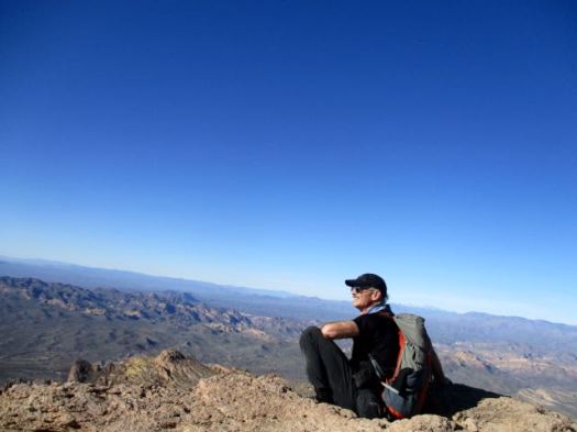

I continued up into these weird eroded towers.


I left a Summit Stone atop a cairn. Then made my way down as rapidly as possible.

The descent is much more dangerous than the climb. I fell once. Most people fall more than once.
The sun was dropping rapidly by the time I reached the trailhead. Beautiful light.


We’ve added Siphon Draw to Flatiron to our list of the best hikes in North America. It’s highly memorable and unique.
