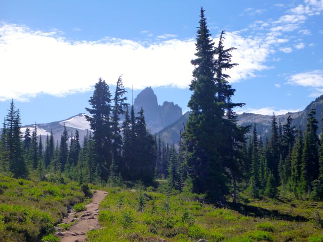
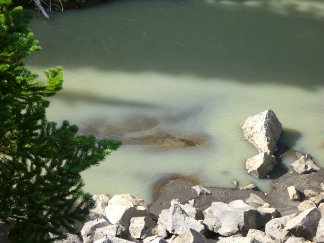
Breathtaking is the only word that can remotely describe the beauty of Hunlen Falls in remote Tweedsmuir Provincial Park in the West Chilcotin area of British Columbia.
But almost no one has ever heard of Hunlen Falls – and nor do they realize that these waterfalls are Canada’s third highest – plunging 1,316 feet (401 meters). In fact they are the highest waterfalls in Canada IF you measure as a continuous unbroken drop. …
The best way to see Hunlen Falls is via floatplane. It’s a twenty minute flight from Nimpo Lake. If you have time, you can land on Turner Lake and take the one kilometer trail to the lookout.
Alternatively you can hike to Hunlen Falls. …
… 16.4 kilometers one way with a vertical raise of 800 meters (2625 feet). It’s a great trail if you like counting switchbacks. There are 78 of them.
Plan to take 6-9 hours one way …
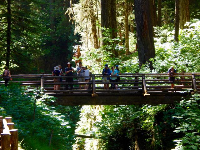
The 75-kilometre West Coast Trail is getting repairs to bridges, ladders and other sections, as part of $33.6 million in funding announced for Parks Canada.
The money is the largest federal infrastructure investment in Parks Canada since its formation 104 years ago, said Vancouver Island North MP John Duncan. …
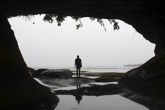
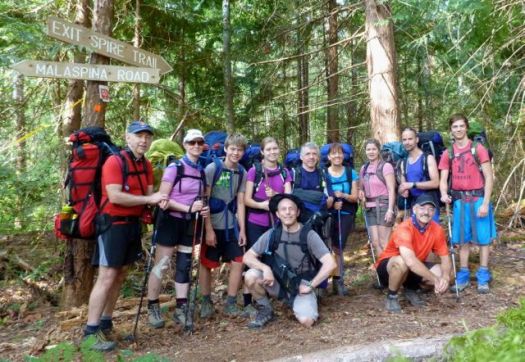
Eleven hikers from flat, dry central Canada – Saskatchewan – met up at Nancy’s bakery in remote Lund, B.C.
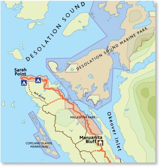
Our plan was to hike from Sarah Point to Powell River in 5 days, 4 nights. The first section of the 180km Sunshine Coast Trail.
We ended up exiting after 2 nights walking out from Manzanita hut right back … to the bakery. 🙂
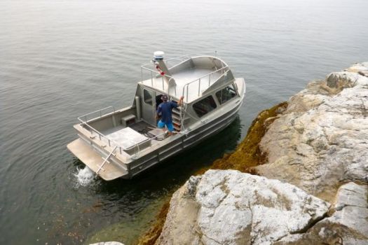
We’d booked a water taxi from Lund to the trailhead at Sarah Point.
Our skipper was excellent. The weather perfect. Yet the scramble up steep, slippery rock to the trailhead was challenging. I’d hate to do it in rough seas.
We were off. 🙂
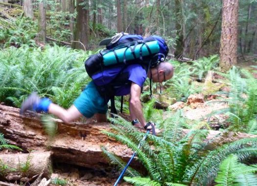
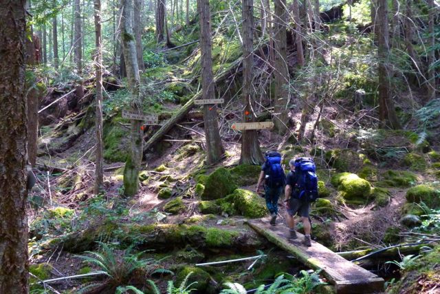
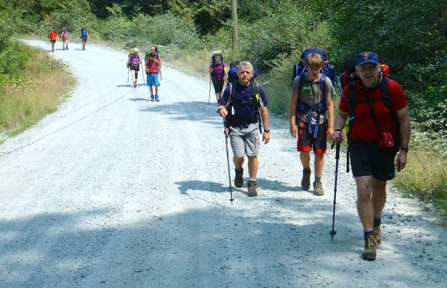
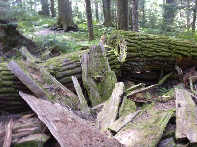
The trail is well flagged but requires frequent scrambles over, under or around fallen trees. Our packs felt very heavy at this point.
Early July 2015 the Pacific N.W. was atypically hot and humid. Forest fire hazy clouded the sky.
Mosquitoes and wasps were a real pest. Four of our group were stung over 3 days.
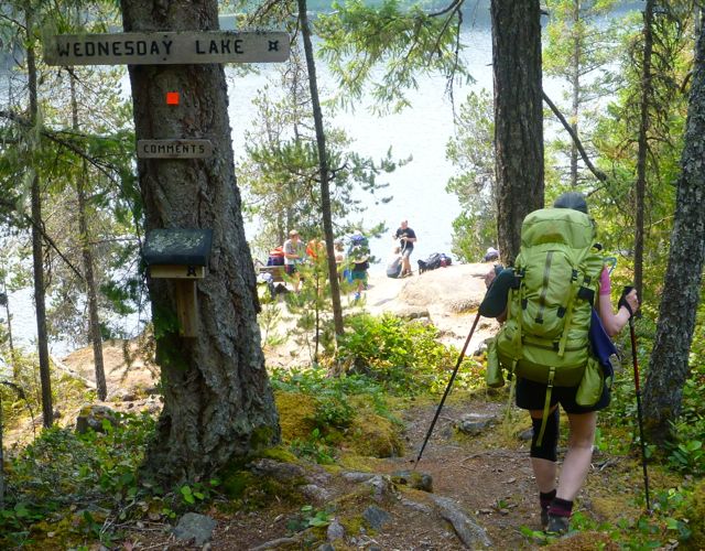
It quickly became evident our large group, starting late in the day, would never make it to our intended destination – camping at Wednesday lake.
Instead we dropped down to a disused campsite at Cochrane Bay. It turned out to be a lovely spot. The pit toilet (which we found the next morning) still in working order.
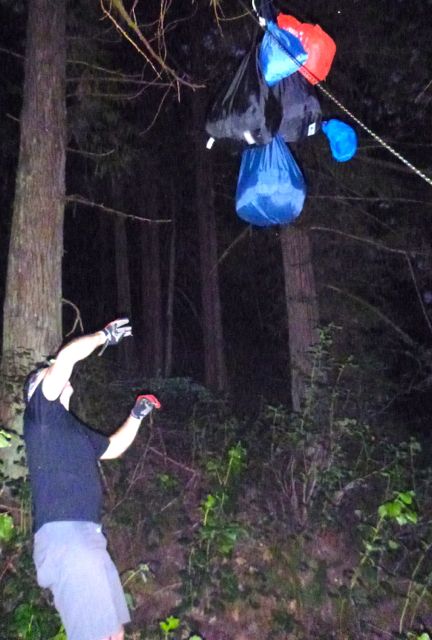
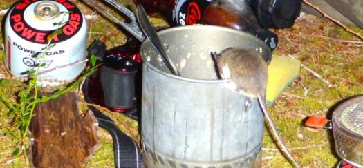
It was dark when we went to hang the food.
Rodents quickly pounced on my dinner pot (salmon) once I set it on the ground.
The sea a glassy lake next morning.
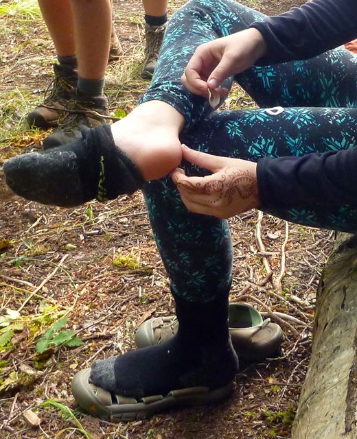
We suffered some foot and knee pain. And morning stiffness, of course.
A steep, sweaty climb up from the sea brought us to Wednesday lake where we refilled all our water bottles. You need at least 3 litres / person on this dry section of the Trail.
We needed this refreshing break as the climb up to the Manzanita bluff was particularly gruelling.
Joan’s last hike?
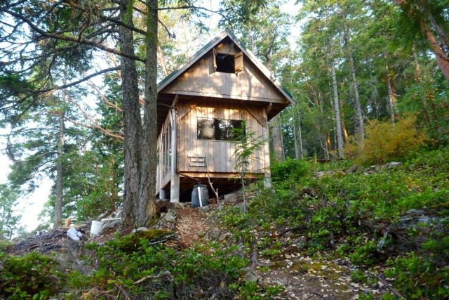
It was with relief that we arrived at Manzanita hut early in the day.
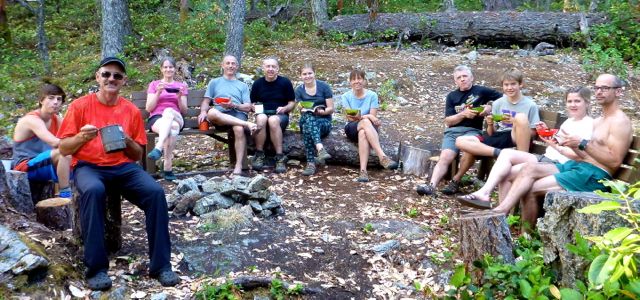
It is a treat to have tables and fire pit after the wilderness camp of the previous night.
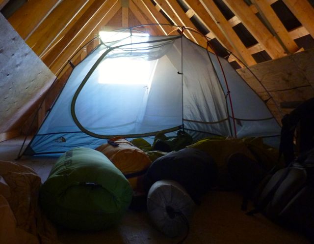
We split up some sleeping in their tents, some in their tents in the loft.
Running low on water, some of the keeners walked about 1.5km down hill to find a stagnant spring. Carried it back up. You need to treat all water on the SCT.
By morning it was decided. We were going to quit the SCT and exit to Lund. Our spiritual leader Bill Wallace and his doppelgänger consulted the guidebook, brochure map and some local day hikers to calculate the best route.
The manly men checked to see if they were strong enough for the escape … by trying to do a chin-up with full pack.
Bill leading the quitters to safety.
Civilization. 🙂
siesta
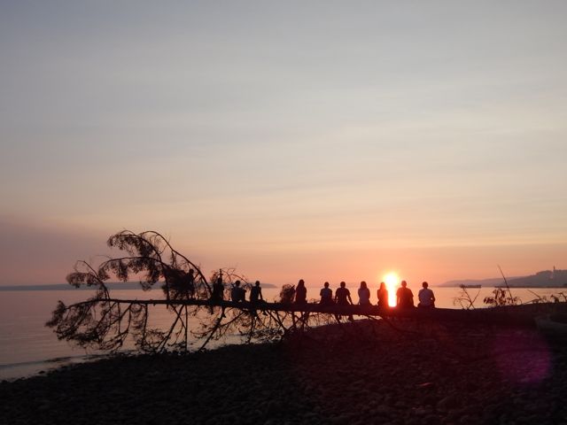
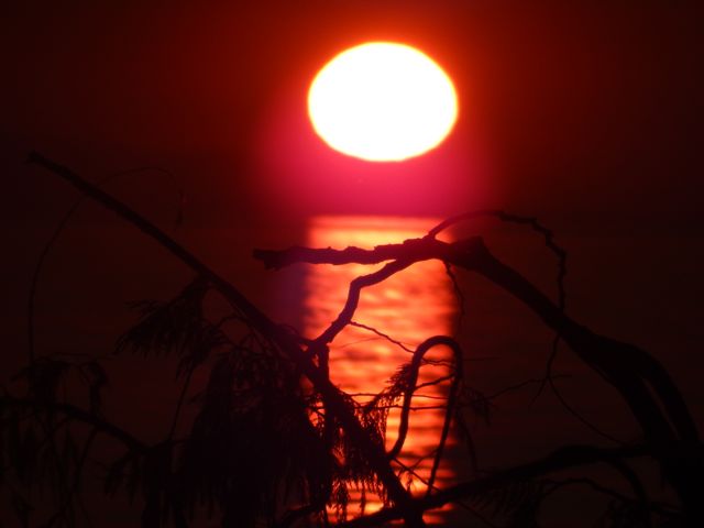
We checked in at the Willingdon Beach campground in Powell River. It’s a good spot, walking distance from the ferry.
The sunset is gorgeous from here. Sandy descended the steep, slippery cliff to shore faster than anyone else. 🙂
With the extra time we decided to kayak Desolation Sound. It turned out to be the best day of the week!
Back to Saskatoon. Back to reality. 🙂
Lessons learned on the Sunshine Coast Trail:
it’s mostly inland
great vistas are infrequent. Many sections are tree-locked.
it’s rarely flat
much more challenging than expected
Two ladies who had done half the Pacific Crest Trail found the long day from Sarah Point to Manzanita hut a serious day. They went straight to bed after dinner and were gone by 6am next morning. Do not underestimate this trail.
I’m hoping to get back in September / October when the bugs are less a problem. Cold doesn’t worry me.
I was en route to hike the Cape Alava to Rialto Beach “Shipwreck Coast” on the Olympic peninsulaend of June.
But when I dropped by the the Wilderness Information Center in Port Angeles on the way to the trailhead, Rangers informed me that famed High Divide Loop (7 Lakes Basin) was open early this year. Winter had dropped very little snow on the high peaks.
I instantly changed my plan. You can hike the Shipwreck Coast almost any time. But the High Divide Loop window is time limited. Late July to mid-October most years.
The High Divide Loop is very weather dependent. I arrived during a heat wave. Blue skies. Quite rare in the high mountains of the rainy coast.
20.3mi (32.6km) including sidetrips to Lunch Lake and Bogachiel Peak
must carry a tent and be completely self-sufficient
cumulative elevation 5200ft
On the advice of a Ranger, I booked 2 campsites:
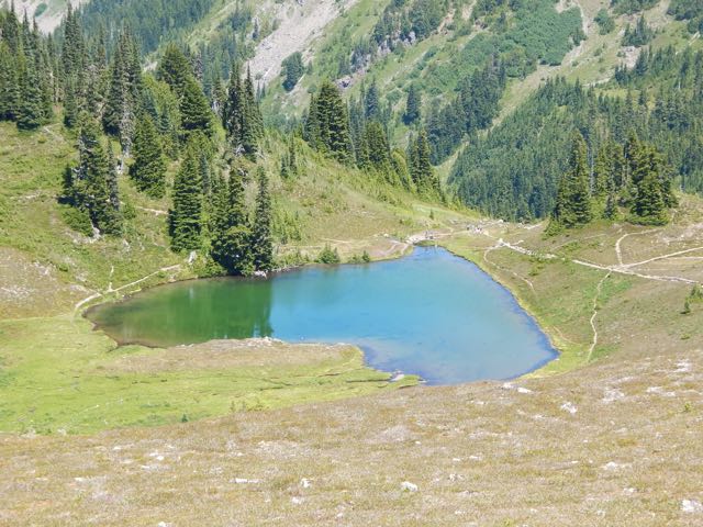
Deer Lake
Sol Duc Park (near Heart Lake)
I started with the day hikers heading up to Sol Duc Falls.
It’s a steep up,up,up from there to Deer lake. Nice campsite. But it did have mosquitos. I was happy to have carried my mesh bug shirt.
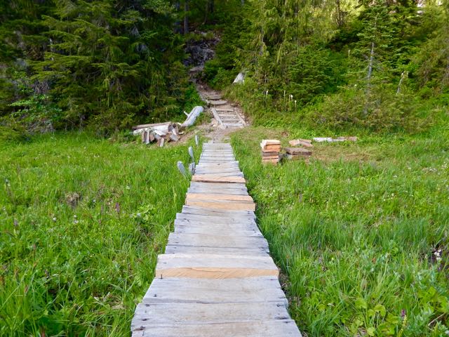
The Park was extremely dry while I was there. Normally you get wet feet on this hike. Boardwalk helps.
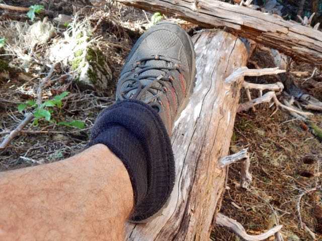
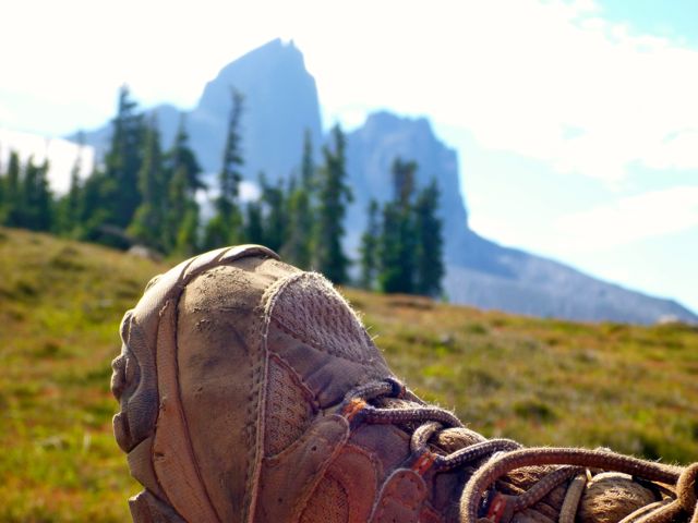
I used the instagator technique to keep pebbles and dust out of my approach shoes.
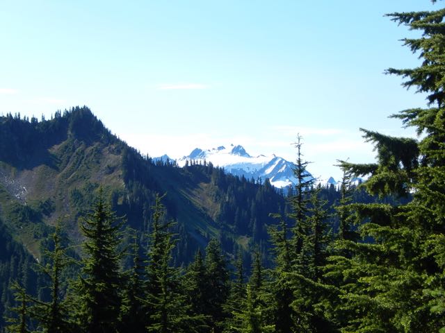
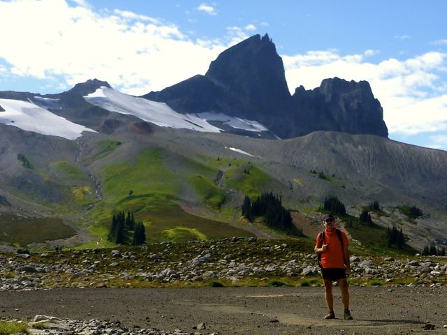
This was my first glimpse of Mt Olympus next morning. I was very pleased the skies stayed clear. This summit is usually cloud shrouded.
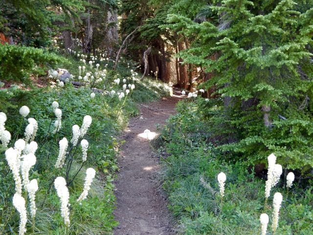
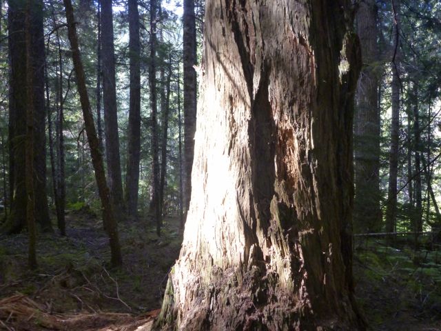
Though the old growth forest trails are tranquil, it was fantastic to get above the tree line.
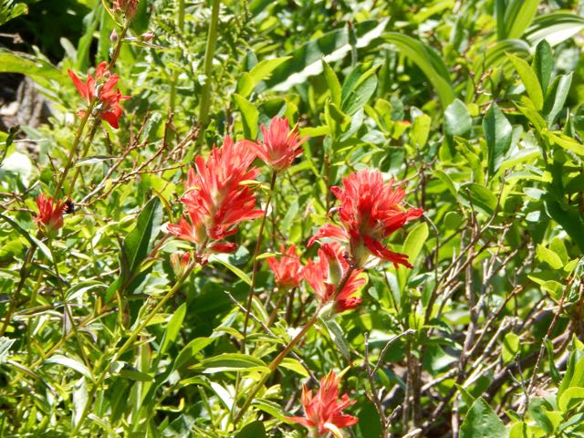
I love the bear grass, but wildflowers were less prolific than expected.
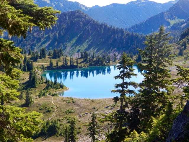
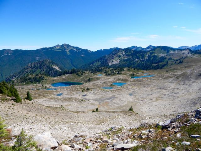
I stashed my pack on the ridge and dropped into into 7 Lakes Basin for some day hiking.
It is marvellous.
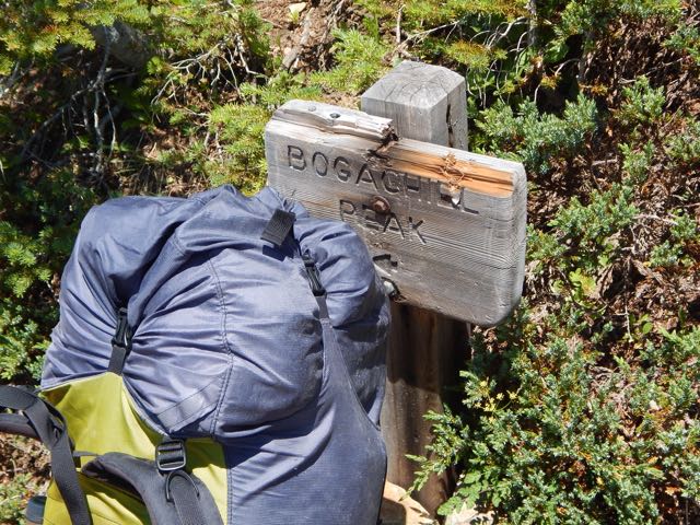
Climbing back up to the ridge I continued to one of the most famous viewpoints in the Olympics, Bogachiel peak.
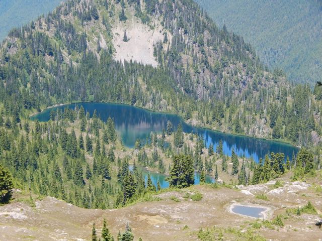
The ridge walk above the basin is fantastic in clear weather. You look down on the many-more-than-7-lakes.
I was exhausted and dehydrated by the time I finally dropped down towards Heart Lake.
Rangers there told me where I could find good water. There was none on the ridge. 😦
I had been counting on melting snow. Unfortunately I found no snow.
With relief I set up my tent at Sol Duc Park campsite. Washed my feet. And took an hour siesta.
In the late afternoon I made a long day hike past Cat Basin campground to see what my guidebook claimed was the best view of Olympus. I wasn’t disappointed. 🙂
Next morning was an easy downhill exit through old growth. Very mellow.
If you’d like to see 7 Lakes Basin and Mt Olympus for yourself, check our new information page.
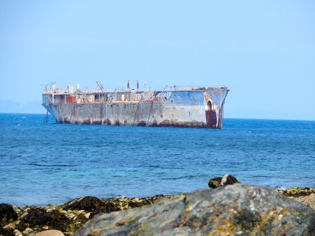
The Elwha Dam was a 108-ft (33 m) high dam located in the United States, in the state of Washington, on the Elwha River approximately 4.9 miles (7.9 km) upstream from the mouth of the river on the Strait of Juan de Fuca.
It was taken out in an effort to restore the original habitat, especially for fish breeding.
Looks pretty good in 2015. I did a short day hike from the viewpoint.
You didn’t want to be downstream when the floodgates were unleashed.
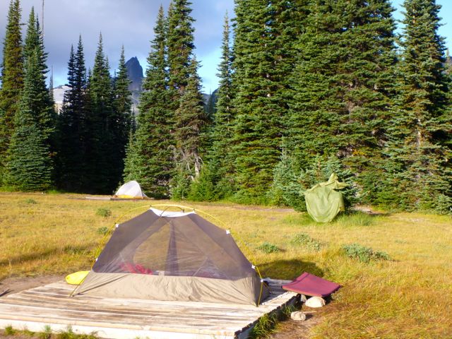
The huts are basic. First come, first served. I’ll carry a tent, just in case.
No fees. No registration. Easy access from multiple trailheads means you can resupply en route. Logistics will be easy. It’s coastal and fairly flat – aside from 3 mountain ascents of about 4000 feet.
The soonest I could do all or part of the SCT is summer 2015. Leave a comment if you are interested. This is a terrific excuse to visit the Sunshine Coast of Canada.
One more thing.
There’s a paddling route roughly in parallel with a large section of the Sunshine Coast Trail. From Shinglemill to Canoe Main. Hikers could switch to canoes or kayaks for a break from the trail, or meet up with paddlers at designated campgrounds. Portage is required.
Most hikers approach from the Taylor Meadows campground to the south near Garibaldi Lake, although there is a second route from the north that travels by way of Helm Lake. …
Locals advised me to avoid the crowded trailhead off the highway, and hike via the Helm Creek Trail instead. That’s the Cheakamus Lake trailhead, closer to Whistler.
I bought my $10 / person / night camping permitonline from BC Parks. You can pay cash at a machine only at the Diamond Head and Garibaldi Lake parking lots, not at the Cheakamus Lake parking lot.
Why doesn’t BC Parks have an office somewhere near Whistler?
Cheakamus Lake to Black Tusk Meadows via Helm Creek:
• Length, 14.5 km; suggested time, 6 to 7 hours one way;
• elevation change, 600 metres.
• 1.5 km along the Cheakamus Lake trail, drop down to a bridge across the Cheakamus River.
On the other side of the river the trail switchbacks upward steeply to the Helm Creek Campground.
I carried on to gorgeous Black Tusk Meadows.
Hikers coming down from the south summit told me it was too late in the day for me to start up.
After weighing my options (I was carrying a head lamp) I finally decided to wander the meadows, instead.
It turned out to be a leisurely night.
Next morning I turned my back on Black Tusk and headed back down to my car.
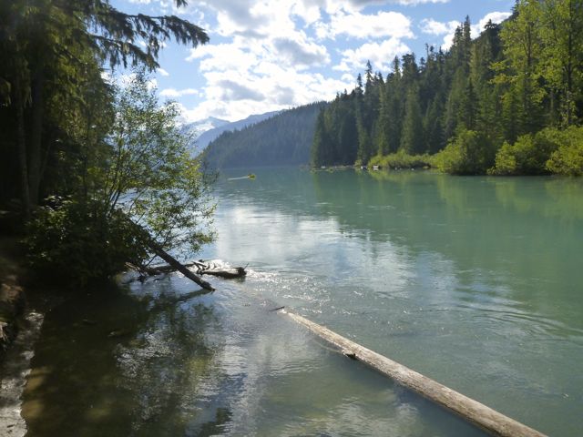
I had time for a sidetrip to pretty Cheakamus Lake via lush temperate rain forest.
Black Tusk is off limits to mountain bikes, but the ride to this lake is superb.
All in all, a wonderful 2-day hike.
If I had one more day I would have done the 34km route Helm Creek, Panorama Ridge and Black Tusk shoulder detailed in this 9min video.
… Parks Canada has officially declared Nitinat Narrows the third access point to the iconic West Coast Trail, a place where broken hikers cannot only exit, but where fresh ones can start, choosing an abbreviated trip of a few days while creating new revenue potential for the Ditidaht. …
Anyone entering from Nitinat Narrows must still receive an orientation from the First Nations, and are recommended to be as experienced and prepared as someone tackling the entire trail …
A last minute change in my transportation itinerary required that I finish the West Coast Trail a day ahead of the rest of my group.
That meant I’d need to finish the last 2 days by 4pm TODAY, in time for the last ferry across the Gordon River.
I packed up in the morning gloom.
Alone and at low tide, however, I made very good time.
sea lions
It was just me and these … smelly guys.
Sea stacks are the iconic image of the West Coast Trail.
I did linger to take some photos at Owen Point.
In my opinion, the most dangerous section of the West Coast Trail is not Adrenaline Surge, rather the boulder section between Owen and Thrasher.
These are hikers coming the other direction. In wet conditions, the footing is treacherous.
Walk balanced atop beached logs instead, at every opportunity.
I stopped for brunch at Thrasher, pleased with my time getting there. A brazen mink was making the trip from the safety of the forest to the shore right beside hikers.
It was trying to tear off chunks of a dead octopus, washed up on the rocks.
Twice a bald eagle swooped in. First time we assumed it was defending the dead octopus. After the second, we realized it was trying to take the mink, instead.
Ahead of me lay the “toughest” day. Supposedly.
In 1999 this short section to the Gordon River had taken us 10hrs.
I’m not sure what’s changed. But it seemed very easy. Very scenic. The footing excellent.
The only real challenge was wasps.
wasp sting
A scrawled paper warned of wasps. I ignored it. And was stung once.
Many others that day and the next were stung, as well. (Some were stung near Chez Monique’s, as well.)
But I had no time to lick my wounds. Here I am happy to have reached the Donkey Engine.
km 75. We made it in time for the 3pm Ferry.
Happy. But dirty and tired. Some injured.
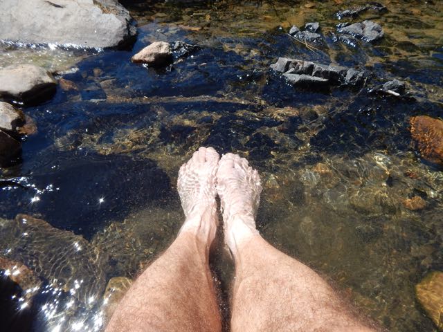
Myself. I felt great. Especially while cooling my feet in the chill Gordon.
If you miss the 4pm boat, there’s a chance you’ll be spending the night here.
On the civilization side you can immediately get a hot shower at the campground.
Transportation clicked. I caught the 5pm WCT shuttle to the downtown Victoria bus station. I was at my parent’s home in Parksville by 10pm.