For multi-day wilderness adventures, Rangers told me the higher, dryer east half Olympic National Park was best. Many options depending on how many days you have.
Just looking at a map, I’m thinking to start at Deer Park trailhead (5400ft) because it’s high. Decide where to exit based on Ranger’s advice, weather and the number of days I’ll have.
Leave a comment if you’ve hiked overnight on the East side of the Park.
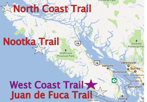
The North Coast Trail is the newest (2008) of the WCT alternatives. An alternative way to spend time in this wild coastal temperate rainforest. It’s billed as “the WCT circa 1970“.
Was the WCT this bad in 1970? … Probably.☹️
STANDARD ROUTE:
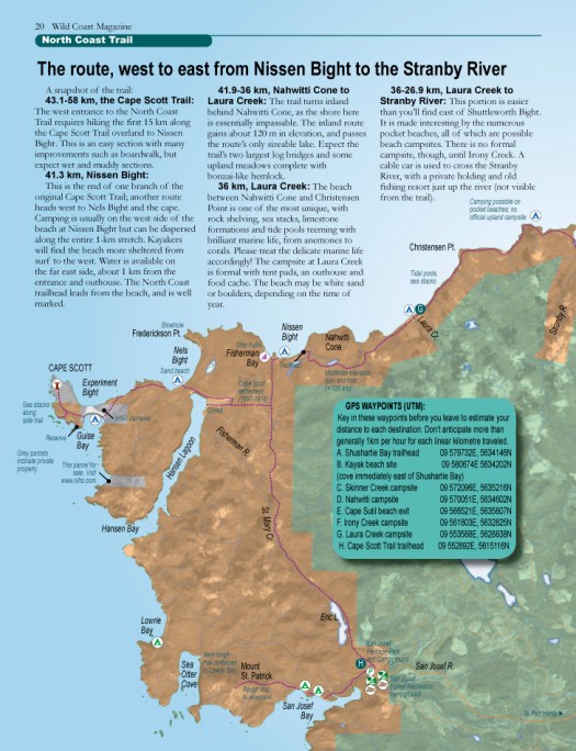
• the North Coast Trail is a 43.1km extension to the original Cape Scott Trail. The total hiking distance Shushartie Bay (from water taxi) to San Josef Bay & Cape Scott Trail parking lot is a minimum of 59.5km (37mi).
• the only ways to get to the NCT are by logging road (64km from Port Hardy), water taxi or float plane.
• actually, a few masochists have bushwhacked in to Shushartie from Port Hardy. Dumb idea.
• best hike is to decide as you go where you want to camp. An “open” itinerary. Base your decisions each day on tides, weather and how you feel.
• many do 7 days, 6 nights on the standard NCT trail but — if you — instead — start at the parking lot, any number of days works. If you have serious problems, walk out.
• often you can choose between an inland path or a coastal route. The coast is almost always better. Certainly more scenic.
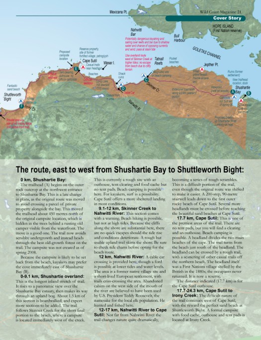
• the most detailed route report of the STANDARD NCT was posted in Wild Coast (2008)Shusartie to Laura Creek:
1. Shusartie overland (Shusartie to Skinner)
2. The Nahwitti Stretch (Skinner to Cape Sutil)
3. The Sutil Scramble (Cape Sutil to Irony)
4. Christensen Coast (Irony to Laura)
5. Nahwitti Cone (Laura to Nissen)
… walk out via the easy Cape Scott Trail
Though I had a challenging, terrific experience Sept 2012 (see trip report) … my recommendation is NOT to do what I did. Don’t hike the STANDARD NCT (minimum 61km). You can do better on Vancouver Island.
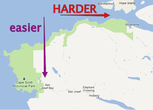
The new trail is extremely difficult where you start in the east. And gets easier as you head west and then south.
The beaches and trails are “better”, too, I felt, in the older western & southern parts of the Park.
Instead of the standard North Coast Trail: water taxi to Shushartie to Cape Scott Trail parking lot, better itineraries are:
• or — best of all — hiking the North Coast Trail, differently:
_____
HIKE DIFFERENT – option 1 of 2:
~ start Cape Scott Trail parking lot (getting there by personal vehicle or Shuttle Van) -> hiking as far into the North Coast Trail as you wish -> then backtracking to the parking lot.
That in-and-out hike gives you many, many options. You can decide what you want to do, as you go. Keeners in your group can go further east, while others in your group relax on a favourite beach.
The very worst section, in our opinion, is Skinner – Shushartie. You can stop when you get to Skinner, if the going is rough.
Downside?
Some hikers hate backtracking. No worry, in this case. The Trail looks completely different walking in different directions. It changes, too, with the tide. Trust me — you won’t be bored.
If you don’t have your own vehicle, you’ll somehow have to arrange the Shuttle to come pick you up.
_____
HIKE DIFFERENT – option 2 of 2:
Start at Skinner. Or even Cape Sutil.
… Why doesn’t everyone do that?
“Park Facility Operators” by email:
Shushartie is by far the safest and most reliable place to drop off hikers. It can be reached at all tides by most boats. I completed a survey of the coastline with the Coast Guard and they also recommended keeping Shushartie Bay as the primary access point strictly from a safety perspective. It is also a hardened area that is not negatively impacted by constant boat landings. …
Though more materials for boardwalk has been airdropped alongside the Trail, I heard money had run out. There has been some controversy regarding the funds expended, too.
_____
If I was going again next year, I’d start at the Parking lot. Not Shushartie.
… Are we being too hard on the Skinner – Shushartie slog?
“Park Facility Operators” by email:
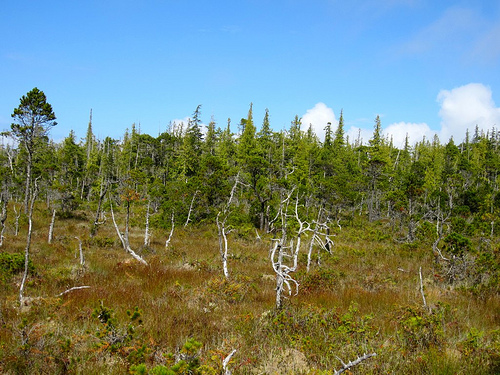
It’s unique due to its rare vegetation and tree species, its endangered (and protected) fish and amphibian species and its ability to positively affect the rest of the park’s functioning ecosystem. All rare and unique. These types of ecosystems are often referred to as the lungs of our environment.
“Park Facility Operators” felt that it was very important to represent this ecosystem as part of the hike. It is very unique and like I say, one of the primary reasons this part of the park was created, from a conservation perspective.
Those upland bogs are interesting.
But visiting them requires one day of your life.
WHY WE LIKE THIS HIKE:
• North Coast Trail is like the West Coast Trail without the hassle of getting a “Trail Use Permit”
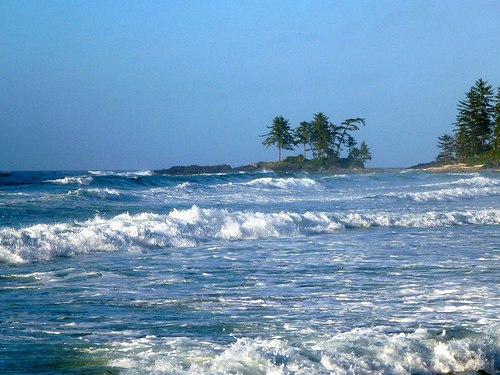
• west coast of Vancouver Island is fantastic. This truly is one trek that could change your life.
photo by Sam Yeaman
• NCT camping is only C$10/person/night. May to Sept. You can buy backcountry permits online, or pay cash at the trailhead. Honour system.
• no quota on number of hikers (WCT allows only 60/day)
• no reservations needed
• you can hike NCT / Cape Scott year round, weather permitting, while the full WCT is only officially open 5 months a year. (However, the Water Taxi stops running around Sept. 15th each season.)
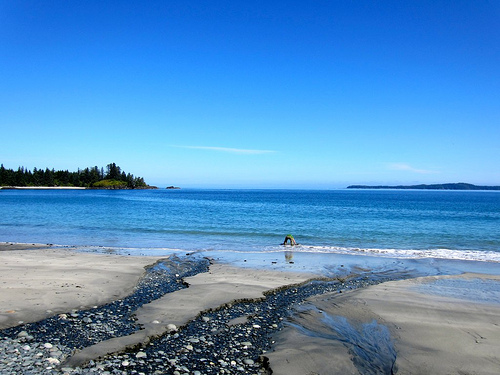
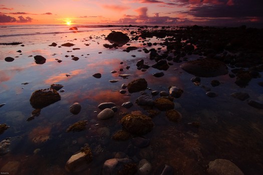
• gorgeous beach campsites with sunset views. Nel’s Bight beach is 2.4km long and 210m wide at low tide. Sweet.
• some old-growth forest including giant Sitka Spruce & Western Red Cedar
• pretty sea stacks and other fascinating coastal geology
• tidal pools, bogs, riparian areas, …
• good tent pads, far better than on the West Coast Trail
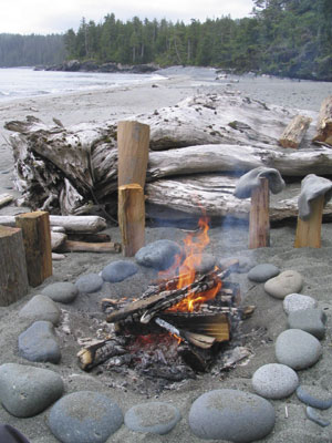
• campfires allowed. Plenty of drift wood.
• chance to see whales & other marine mammals, bald eagles, river and sea otters, mink, deer, elk
photo by Sam Yeaman
• everybody loves Guise Bay & Experiment Bight
• few biting insects on the coast (you will find mosquitoes inland out of the wind)
• possibly a few horseflies inland (not to mention millions of weird, but non-biting, beach hoppers on the coast)
• creek crossings are only an issue when in flood.
• two new cable cars propel you over the only major rivers
• theft and vandalism of parked vehicles is normally no problem at Cape Scott trailhead, San Josef. No parking fee.
• wild (dispersed) camping is allowed
• many set up tents protected within “fortresses” (temporary beach shelters made of drift logs). “Park Facility Operators” asks that you dissemble those, when finished
• beach-combing is fascinating, look for wreakage from Japan
• the Cultural Heritage of this area is fascinating. Signage explains the history of native peoples and the failed Danish colonies
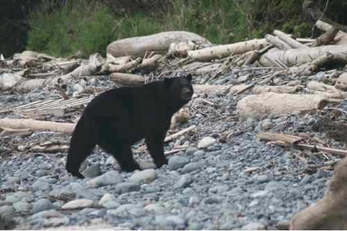
• you’ll see BEARS and WOLVES in the wild 🙂
CONSIDERATIONS:
• you’ll see BEARS and WOLVES in the wild 😦
• bears and hikers both love: berries, low tide, trails
photo by Sam Yeaman
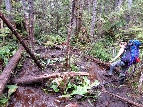
• it’s MUDDY, … really, really MUDDY
• did we mention it’s MUDDY?
• prepare for slippery rocks, roots and logs. Eyes blinded with rain, you’ll need to scramble up, over and between giant stumps. With a full pack.
• most wear waterproof hiking boot with high gaiters. It’s a gamble to wear anything else — 5-10 water shoes, for example.
• most hikers get blisters. Bring moleskin, or whatever works best for you
• most hikers bring a second pair of footwear for camp
• consider bringing one or two hiking poles. There are many wooden walking sticks to be found in the campsites, as a back-up
• you must scramble fallen trees, steep slippery slopes sometimes assisted by muddy rope
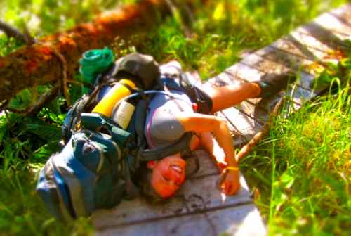
• expect to fall on your face. Most often at a moment when you’re not paying attention to your footing.
• so far “Park Facility Operators” has recorded more injuries on the “cobble beaches” than any other terrain. Slippery boulders can be ankle busters.
• bring a first aid kid. There are 3 Ranger stations, but many parts of the trail are not regularly patrolled. Plan to be self-sufficient in any emergency.
smilewithyourheart – on the road to Cape Scott
• water is a problem in this Park, sources few and far between. By end of season some sources are reduced to a trickle. Or seep. Boil, filter or treat. Collect rain water with a tarp, if you get the chance.
photo by Sam Yeaman
“Park Facility Operators” by email:
Perennial streams on coastal trails, including the NCT, are hard to predict. With such little relief and few lakes to store runoff, it all comes down to recent rain fall. Even the big streams like Nahwitti and Stranby are tidally influenced and are brackish near their mouths. …
• best bring more water carrying capacity / person (perhaps 4 litres / person)
• signage is terrific on the Cape Scott Trail, but minimal on the new NCT. Most hikers are working off the $10 Wild Coast Map
• when the NCT was built, the signage was combined with the Cape Scott Trail for consistency. Makes sense.
• fishing is permitted as per provincial and federal fishing regulations. Nobody was catching anything when we were there.
• leashed dogs allowed — but NOT recommended. There’s a chance they’ll run into wolves. UPDATE – we’ve heard dogs are no longer allowed on the trail.
• no emergency phone. No phone coverage. (Marine radios can be rented from North Coast Trail Shuttle. If you call, evacuation costs about $1000 … IF they can get to you.)
UPDATE from George of North Coast Trail Shuttle:
Only 2 injured hikers picked up in 2012. at no cost, 1 heli 1 coast guard. We picked up 2 on different days that called in to say they were done. 1 pooped 1 mild knee strain. They paid seat price as we were in the area.
We have only had one group pay the charter rate of $1000.00 in 5 years. Most get picked up next morning for discounted rate after we drop off others.
• bring your own satellite phone if you want to maximize safety. VHF radios are going to work. SPOT locators are fairly unreliable, in my opinion.
• sections of the trail are impassable or very difficult at high tide. Check tide tables posted at most official campsites. Get tide tables in advance, as a back-up, in Port Hardy. Jot them down from signs (if posted) in campgrounds, as they may be slightly different
• May to October are the best months
• we like August and early September best of all
• off-season this part of the world is very cold and rainy
• some consider Cape Scott Lighthouse a bit of a letdown. It’s not on the sea.
• rogue waves can knock an inattentive hiker into the sea
• expect torrential rain and wind. You need a good waterproof tent and tie-downs. And clothing for those conditions.
• keep a dry set of clothes in a waterproof bag, for wearing inside the tent
• summer highs around 14C (57F)
• risk of hypothermia
• bring parachute line to hang food from a tree as a back-up, in case you don’t make it to an official campsite, for any reason. There are bears everywhere.
• bear-proof metal food caches are widely available, actually. Near essential in this bear country.
photo by Sam Yeaman
LOGISTICS:
• almost everyone arrives Port Hardy by the only lonely highway. It’s 499km from Victoria, 412km from Vancouver (plus ferry).
• a terrific alternative, would be to arrive or depart by BC Ferry from Prince Rupert. (From Rupert you can catch the Alaska Marine Ferry, something I did once. A superb trip up the Inside Passage.)
• bring stove fuel with you to Port Hardy as stores may be closed
• public transport is convenient
~ one Greyhound bus a day
~ walk a couple of blocks to one of two hostels. There are many hotels, too.
~ walk to the North Coast Trail offices at the Marina, morning of transit
• both the hostel & North Coast Trail Shuttle will store a small bag for you, while you are gone. Your small bag with CLEAN clothes.
• no reservations are needed to hike the North Coast Trail. But you must book both van shuttle (San Josef) and/or water taxi (Shushartie) in advance. To get a good price you need a number of hikers taking that transport at the same time. North Coast Trail Shuttle rents VHF marine radios too ($50+tax).
You can prepay your $10/night/hiker to North Coast Trail Shuttle, as well. Very convenient.
• National Topographic Series Maps, Scale 1:50,000, Index No.102, Sheets 1/9 and 1/16, cover the Cape Scott area. Available at most map retailers in British Columbia.
BEST VIDEOS:
Cape Scott Park has a Flash-based Virtual Tour. Click around to discover highlights.
Here’s one of Jed’s earlier treks, the famed Milford Track. He couldn’t get a spot for an independent hike … so signed on for one a guided adventure. … A guided adventure being the kind where you have hot chocolate waiting at the hut. And hot showers.
It’s a fixed itinerary:
Day 1: Lake Te Anau to Glade House
Day 2: Glade House to Pompolona Lodge
Day 3: Pompolona Lodge to Quintin Lodge
Day 4: Quintin Lodge to Sandfly Point
Back in 2002 Jed was a “rookie” hiker with new untested gear. He writes his impressions at that time:
… It begins with a boat-ride from lake Te Anau to a drop-off point, from which one must traverse wetlands, temperate rainforest, suspension bridges, and an alpine pass, before finishing some 53km later, at Sandfly Point, on the edge of Milford Sound. Because of the delicate nature of the ecosystem and the inherent danger to the hikers (for some portions of the trail are routinely submersed under the very heavy rain and others traverse avalanche fields … 56 in all!) …
After arriving at Sandfly Point, weary, bitten, yet still elated, we boarded a ferry that took us to Mitre Lodge, where we had rooms, a hot meal, plenty of wine, and a dry pair of clothes waiting for us.
And although the hike was nominally finished for me, I knew that it was just a beginning: an introduction to the world of trekking that had already infected me with a desire to explore other regions of the planet. With this in mind I carefully catalogued the gear that worked well for me, and that which needed to be remedied before my next hike …
Mike does trips I don’t even want to dream of. The thought of fording the Queets River in the Olympics multiple times in a day, to find an elusive waterfall is something I don’t think I will ever be capable of!
Mikes spent 31 days in 2004 crisscrossing rugged, remote wilderness, often solo, often off trail.
He’s put up an excellent new website called Mike’s Rain Forest Treks.
The first of a series of planned photo trip reports is already posted. Detailed and inspiring.
My big-picture plan for the next month will take me on a disjointed spiral around the west side of Olympic National Park’s million-acre wilderness. My route is varied enough to explore all the major ecosystems of the world’s most ecologically and geologically diverse slice of land.
Starting out in typical northwest spruce and fir forests, I will see the park’s high alpine playgrounds, its extensive coastline beaches, its uncannily immense glaciers, and it’s most prized treasure… the finest remnants of old-growth temperate rainforests left in the world.
The route has been split into three manageable “legs,” ending with a 16-day mega-trek through the most remote and untouched off-trail wilderness in the entire park. These first two legs (each a week-long trip) will be a fantastic “warm-up,” a way to strengthen my legs and awaken my soul before testing my limits.