Wales – Pembrokeshire Coast Path – day 4

Trip Report by BestHike editor Rick McCharles

day 1 | 2 | 3 | 4

I made coffee in the vestibule of my tent in the dark. Packed up and was on my feet by 8am. BIG day ahead. The toughest and most physically demanding of any on the Coast Path.

It was about 2 miles to town. Another 14 miles more (at least) to finish.

I finally saw rabbits on one farm. (SLUGS are much more plentiful.)
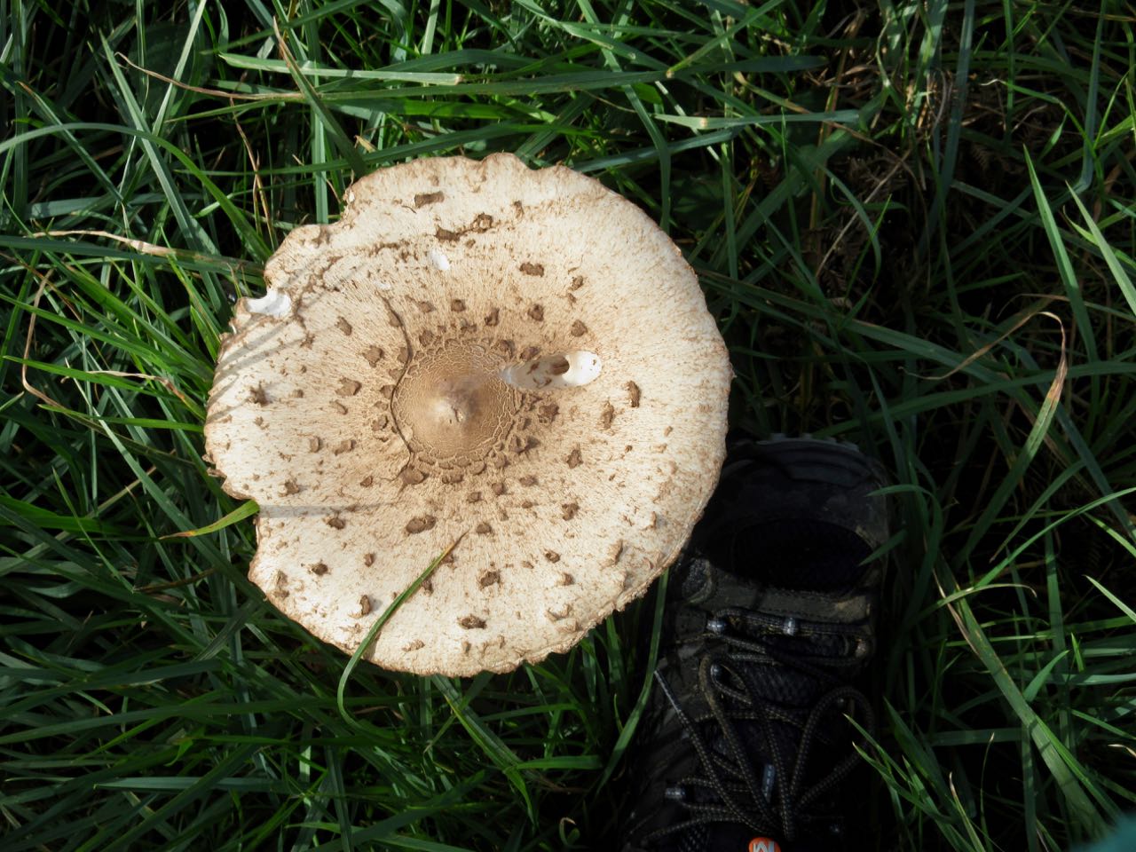
Giant mushrooms.

I detoured to Newport town to pick up provisions. There was some chance I’d need to wild camp again. I had no reservation for the hostel. And it was Saturday.

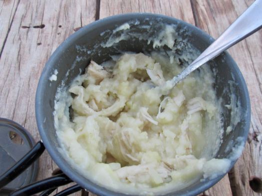
Scones and fruit cake are high calorie. Easy to eat.

For the first time in my hiking career an official trail crossed a golf course. That’s cool.

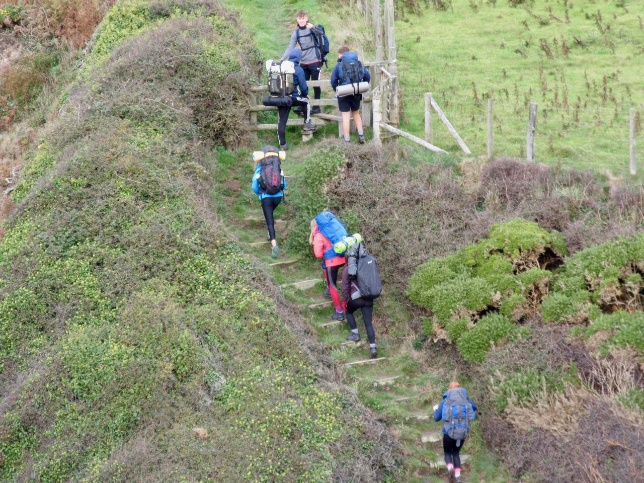
In the parking lot Duke of Edinburgh hikers were unloading. These are students who had to plan and execute an expedition of at least 2 days and 1 night. They looked woefully unprepared to me.

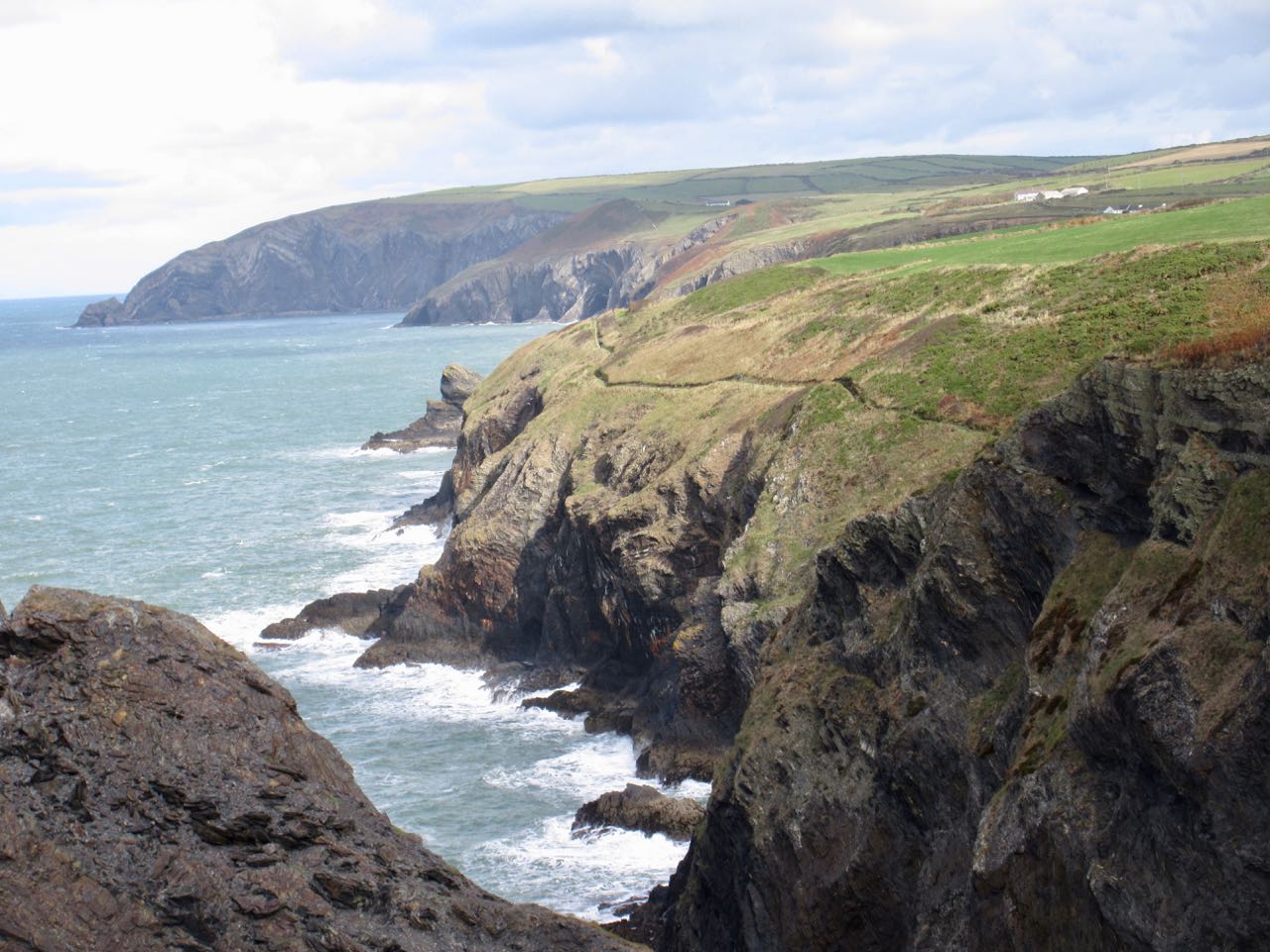
The steep, sheer, non-stop cliffs begin. The highest 575ft (175m). There’s only one emergency exit all day.

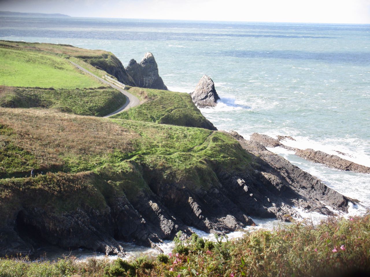
Narrow trails. Far less used than those in the south.

Yes. Muddy.

Most of the coves are inaccessible except from sea.

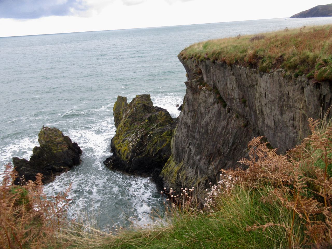
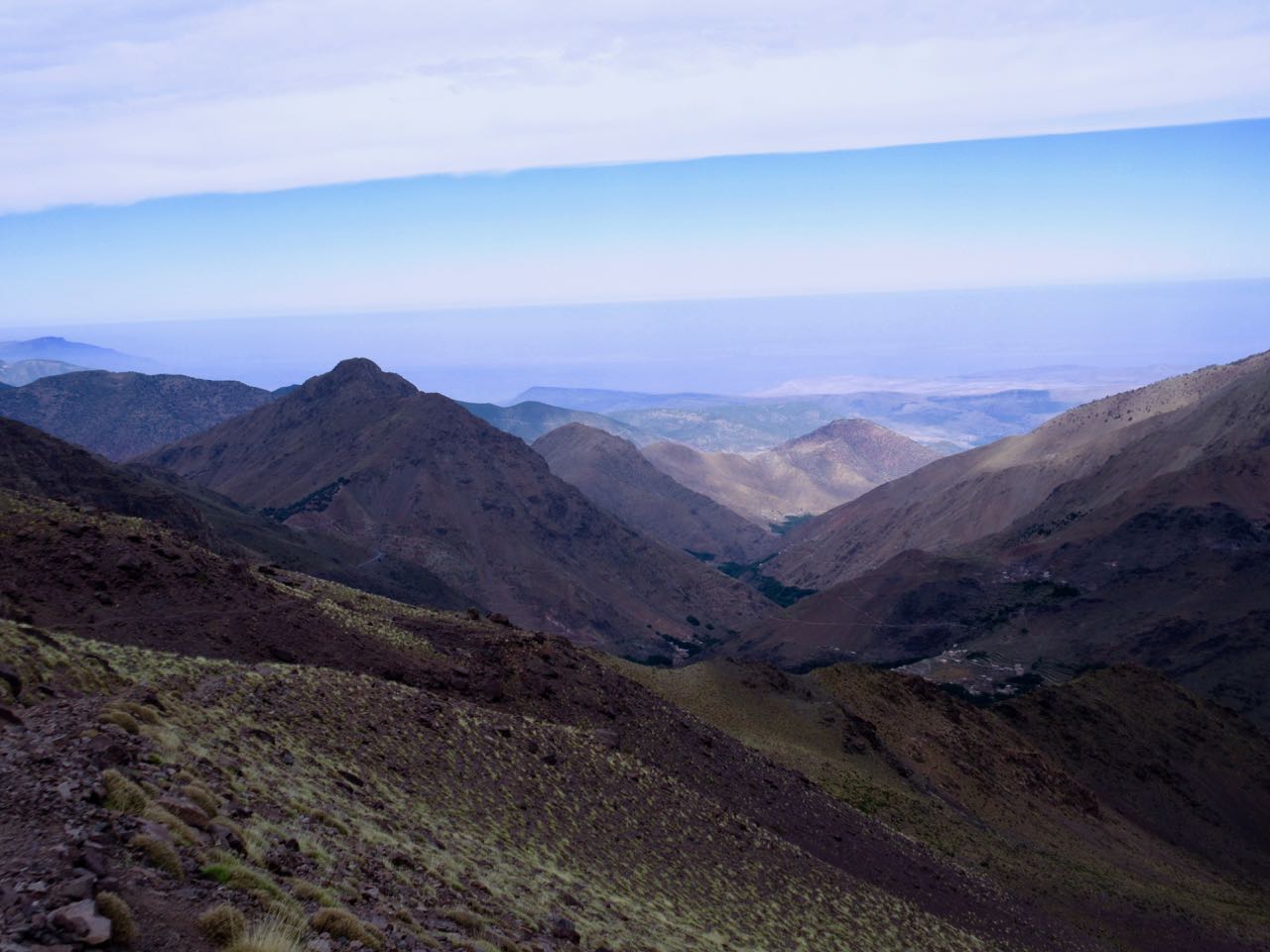
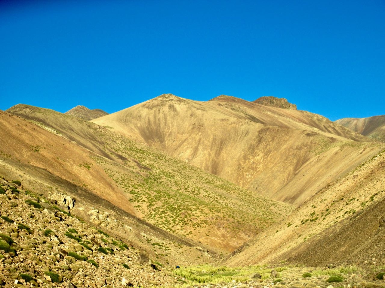
Stunning scenery. The weather improved over the day.

October in Pembrokeshire. You know what that means? 🙂 It’s Atlantic grey seal breeding time!

I did see dozens of seals. (And 5 distant dolphins.)

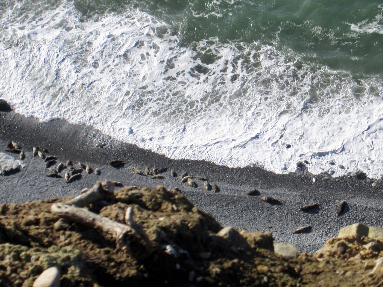
But I saw only one pup. The baby (white) looked nearly as big as Mom.

Pups can’t swim yet. And they are very uncoordinated on land. Helpless as a human baby.

Click PLAY or watch a similar baby on YouTube.

Mom was in the perfect protected spot, however. A collapsed sea cave called Witch’s Calderon.

Weather was great. Aside from the wind.

Click PLAY or watch it on YouTube.

I was quite happy to round the corner and see that cliffs had ended. I’d been walking for nearly 8 hours.

On a weekend, I feared Poppit Sands hostel would be full. I’d need to wild camp again.

Happily there was space at the inn. I spent about 25 minutes in the hot shower! Welsh hostels are excellent.

It was a fun night chatting with an entertaining, informative Irishman. (Are there any other kind?) He was just finishing up a 3 month cycling holiday.

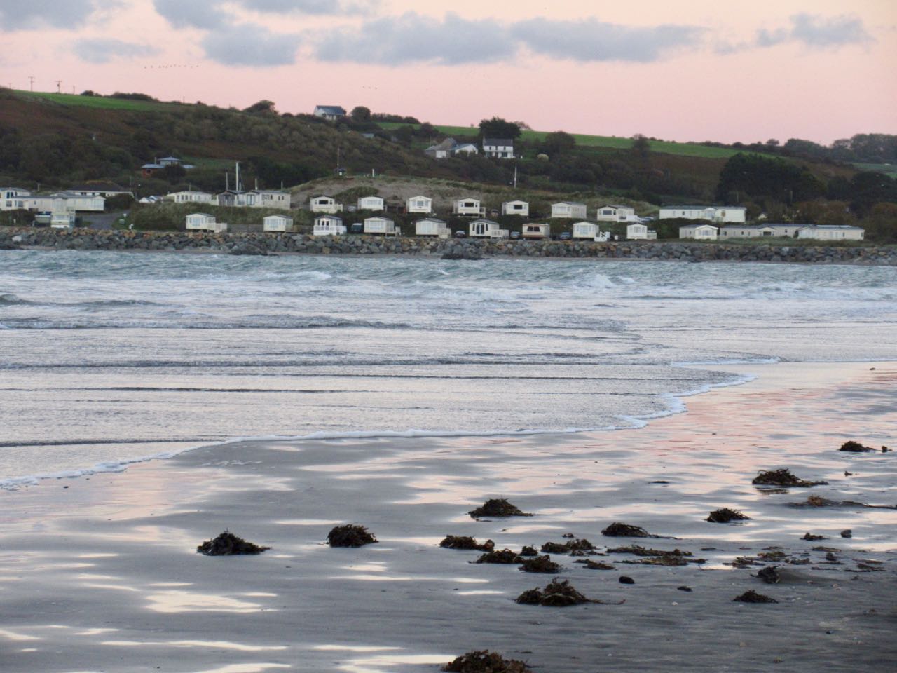
Before dinner I walked Poppit beach. My Coast Path would be ending first thing in the morning.

____

After coffee in the morning I had 2 miles left to trail end in St Dogmaels.

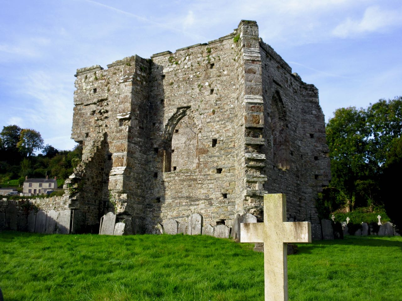
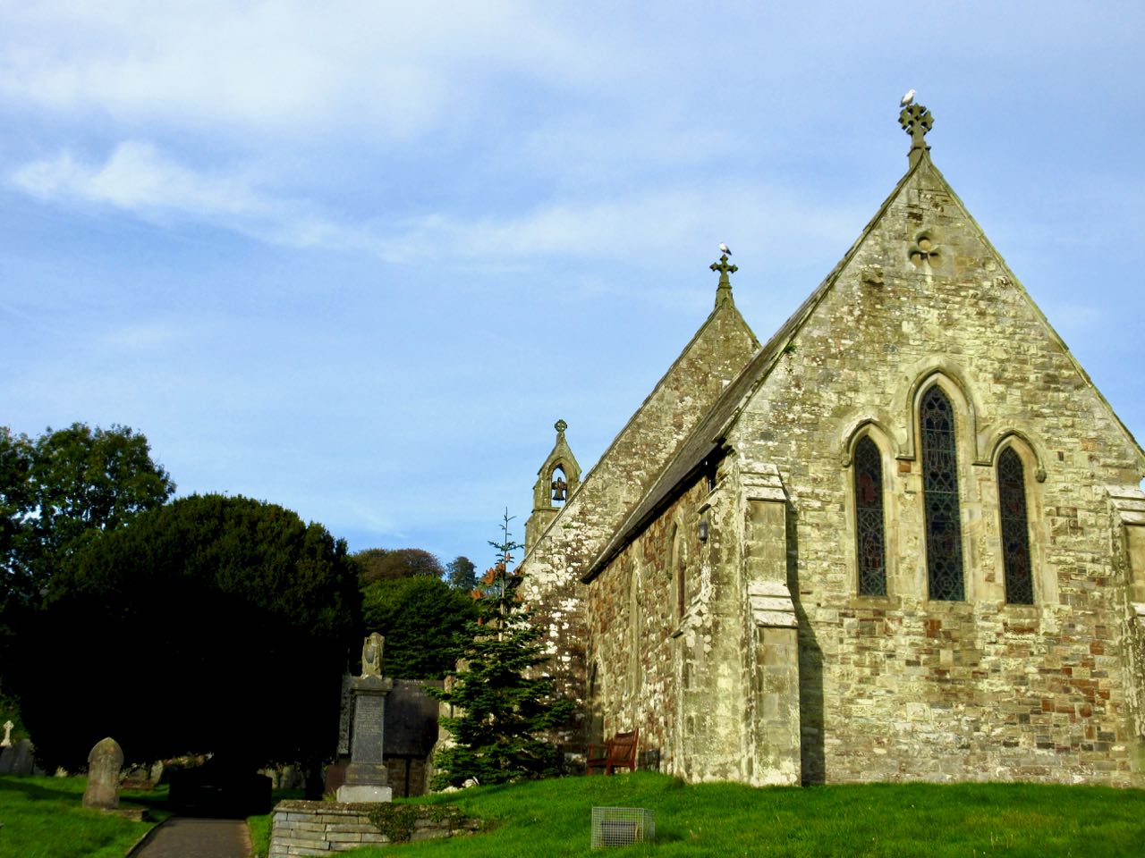
I visited the ancient Abby. And church built 1847 from Abby stones.

Here’s the finish.

Over 4 days I’d walked the first 20 miles. And the last 25 miles. About a quarter of the Coast Path. It was enough.

Then I walked another 2 miles along the Wales Coast Path, an 870-mile (1,400 km) route around the whole coast of Wales, to the bus stop at Cardigan. From there I planned to catch a bus to the train station.

What! What?

In October there are no longer ANY buses to anywhere on a Sunday. Bus service has been shrinking for years for rural towns in Wales. ☹️

The closest train station was 50£ by cab. I hate taxis. So checked into a lovely hotel instead for 45£. A holiday from my hiking vacation.

Pembrokeshire Coast Path is definitely one of the top 10 coastal hikes in the world.

day 1 | 2 | 3 | 4

Cicerone publishes an excellent guidebook with detailed map.

Morocco’s Toubkal Circuit – day 2

Trip report by BestHike editor Rick McCharles.

day 1 | 2 | 3 | 4 | 5 | info | video

I woke at dawn. Shared a couple of cups of coffee with Aziz.

Then told him I might return if I couldn’t find the route.

I climbed back up to the paved road surprised to find this hotel.

If I was to do the circuit again I’d hire a cab in Imlil to deliver me here on the paved road. Begin the hike next morning.

I still had no idea where to start the climb up to Tizi Likemt (3550m), the first high pass.

Happily I saw a brightly coloured people walking down the highway in my direction. It was an Israeli couple who had just finished the circuit the opposite direction.

Waiting on them was the smartest thing I did all week. They told me the entire circuit is available on Maps.me. I had downloaded it in advance. My navigation problems were solved.

Maps.me saves the day again.

I’m sure they thought I looked too energetic. Over-confident.

I was raring to go.

On the other hand, this poor carnivore might have been a bad omen.

The climb was very long. And not all that thrilling.

Looking backward …

There’s a Japanese donated weather station at the pass, but you can’t see it from the side I climbed.

It was hot and sunny. No water.

My Darn Toughs did all 5 days of the hiking. I switched to camp socks / shoes each evening.

It was a long, hot descent as well.

In fact, a pass this high first day is stupid. That’s not smart acclimatization. On the way down I resolve to NOT recommend these first 2 days to future hikers.

Here’s the first water I’d seen in hours. All water sources should be treated in these mountains unless you see it coming out of the mountain with your own eyes.

I was happy to reach the river. A German group had already claimed the best spot.

Further along I enjoyed a couple of pots of coffee.

This is a summer grazing settlement. Animals and their keepers will head down soon when snow threatens.

The next section climbing through a gorge was very entertaining. One of my favourite bits.

I finally camped at an open area on another creek near yet another guided hiking group.

Dinner in the dark was coucous, soup, raisins and peanuts. For Morocco I switched from my usual instant mashed potatoes base to couscous.

day 1 | 2 | 3 | 4 | 5 | info | video 

hiking Yellowstone to the Yukon

This looks good.

Karsten Heuer’s journey was intended to show that such a system of parks and corridors is feasible. He set out in June 1998 from Yellowstone Park, Wyoming, on the beginning of a 3,400 kilometre hike that would end, 18 months later, in Watson Lake, Yukon Territory.

Along the way, he faced personal problems, including the breakup of his relationship with the woman who had planned the journey with him. He came to terms with difficult public relations problems when he spoke to loggers and others with a stake in the economic exploitation of wild lands. And, above all, he overcame extraordinary physical challenges: ferocious storms, avalanches, apparently impassable rivers in full flood, and bears that mistook him for dinner.

Accompanied by occasional human companions and a remarkable border collie named Webster …

walking-the-big-wild-y2y

Y2Y.net

walking-the-big-wild

DRONE in the Drakensberg

A great hiking destination in southern Africa.

Click PLAY or watch it on YouTube.

https://vimeo.com/258940152?ref=fb-share&1

The Drakensberg escarpment stretches for over 1,000 kilometres (600 miles) …

The Afrikaans name Drakensberge comes from the name the earliest Dutch settlers to the region gave it. They called them the Drakensbergen, or “Mountains of Dragons”. …

One of the best hikes there is Giant’s Cup Trail.


Trekking to Aconcagua’s Plaza Francia INDEPENDENTLY – Day 3

trip report by editor Rick McCharles

day 0 | 1 | 2 | 3 | info page | video

Up early again. Coffee as the sun rises.

Rather than doing any more hiking I enjoyed a lazy morning at camp. Toying with my electronics. Listening to my Spanish lessons. The sun was HOT.

There are all sorts of characters coming and going. Some carry huge backpacks.

The craziest of the crazy are trying to summit Aconcagua independently and unsupported. Somehow transporting 70kg of gear or so up the mountain with multiple shuttles.

Around 11am I finally packed up the tent.

I figured it would be an easy walkout. No rush to catch the 5pm bus.

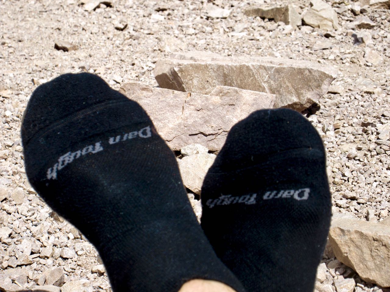
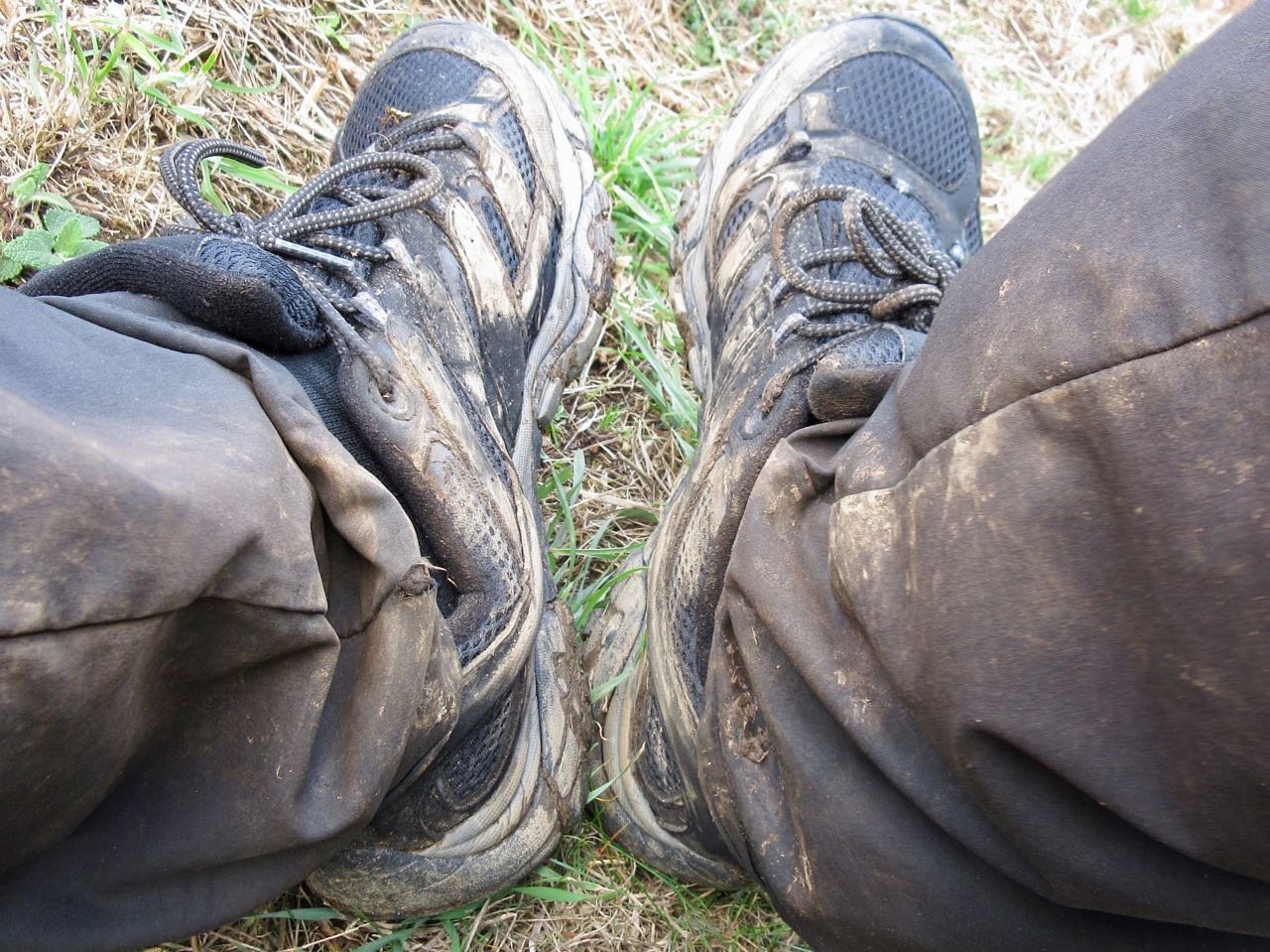
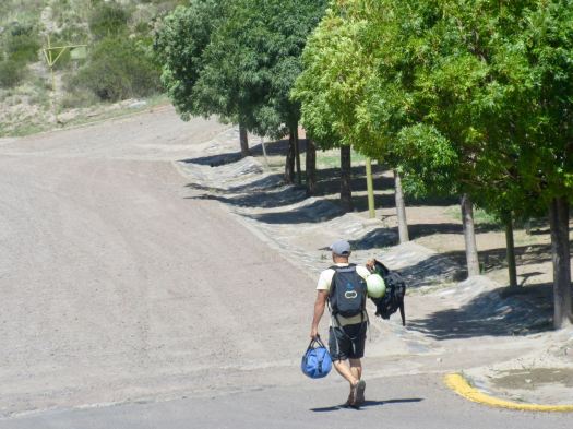
On a rest stop I laid out my basic gear to dry.

I’d expected a quick 2 hour 400m descent, but the walk felt long. Full pack. I was tired.

It was nice to finally reach vegetation.

If there’s something green here, there’s plenty of water.

Laguna de Horcones (2950m)

I checked out at the park entrance. Turned in my permit. Handed over my trash bag.

My Aconcagua trek was a success.

With a couple of hours before the bus arrived, I walked the highway …

… down to Puente del Inca (2740m).

…a natural arch that forms a bridge over the Vacas River, a tributary of the Mendoza River. … 

In March 1835, Charles Darwin visited the site, and made some drawings of the bridge …

In the old days people would walk across the bridge to reach the stone church.
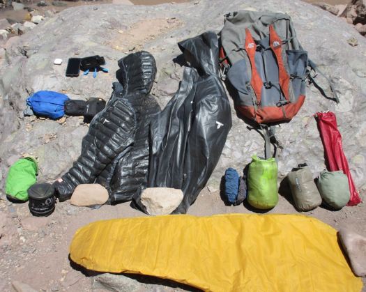
It’s a tourist trap with overpriced junk and yappy dogs.

I decided to wait to eat in Mendoza.

There are a couple of hostels and a campground, however. A good emergency stop. Or hikers could sleep here one night before heading up towards Aconcagua.

I slept well on the bus. Then got myself a big chunk of Argentinian beef to celebrate back at the hostel.

Trekking to Aconcagua’s Plaza Francia INDEPENDENTLY – Day 1

trip report by editor Rick McCharles

day 0 | 1 | 2 | 3 | info page| video

Next morning was sunny. Mendoza enjoys 330 days of sun a year.

With only a 3-4 hour walk in gaining about 400m, I packed heavy.

There are 3 buses a day from Mendoza to the Aconcagua Provincial Park. Go early to the Mendoza bus station and buy a ticket in advance on the Buttini Bus. Seats are assigned. Ask for a window on the right side of the bus. Cost one way in 2018 was AR$130.

Roberto sat down beside me on the bus. He’s a rafting guide from Guatemala who’s worked all over the world. 15 years on the Arkansas river in Colorado, for example.

In 2018 he’s finally guiding the Grand Canyon. Those trips are decided on by a lottery system. He jumped off at Potrerillos where he was visiting a friend, another guide.

I was headed back towards Santiago, Chile on the same scenic highway I’d traveled on an express bus. My local bus stopped everywhere taking 4 hours to get back to close to the border with Chile.

The Parque Provincial Aconcagua office on the highway is quite well organized. We had our permits checked and strictly informed that all trash must be returned in a numbered bag back to this office.

Day hikers can walk a short way up the valley towards the big mountain for $10. (foreigners $25.50)

It’s a popular stop for tourists.

In fact you get quite a good view of Aconcagua from the highway. For free.

You need to walk up a paved road to the parking lot before getting started.
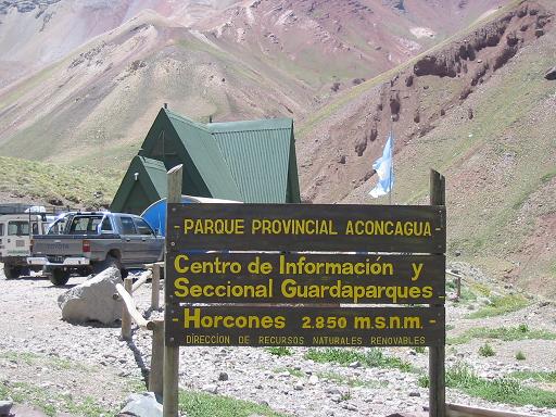
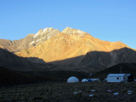
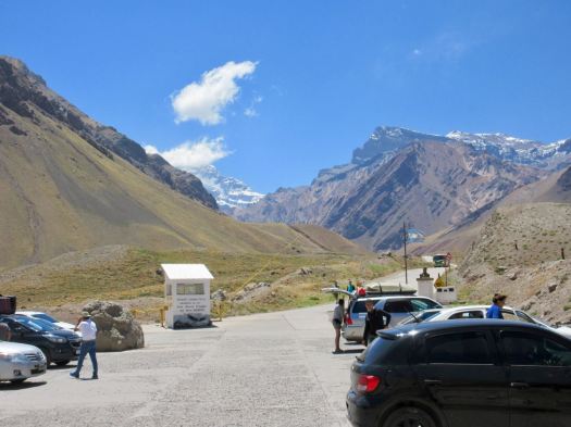
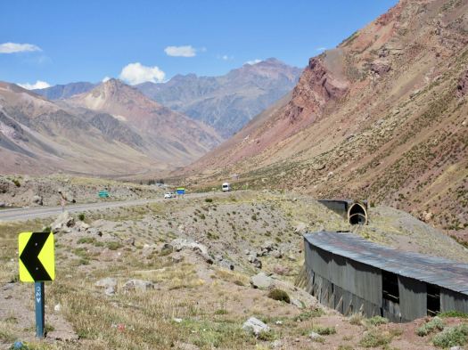
I was to be surprised how many helicopters race up to Aconcagua every day. Two are parked here at the entrance. Ready to go.
Only those with trekking permits can cross the river. I felt I was finally on the Francia trek.
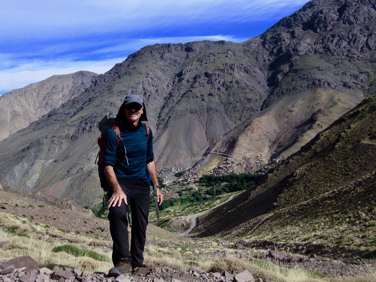
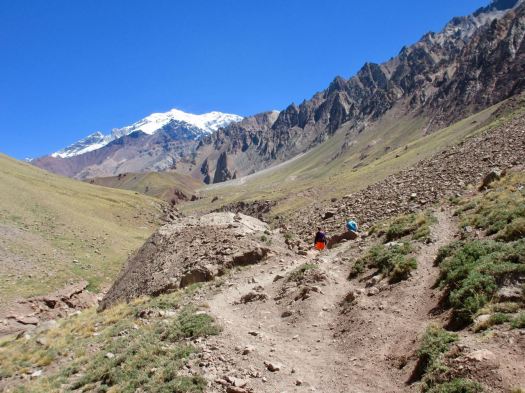
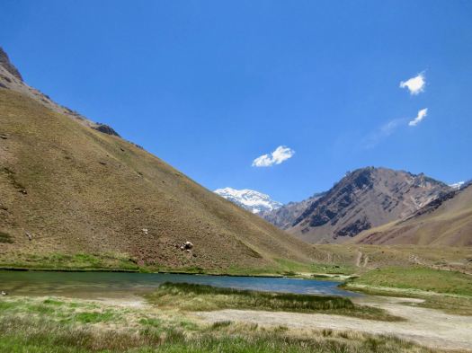
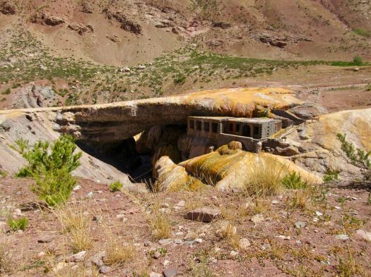
Excited, I rushed up to Confluencia camp (3350m) as quickly as I could.

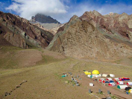
It looks much more impressive from a distance than up close.
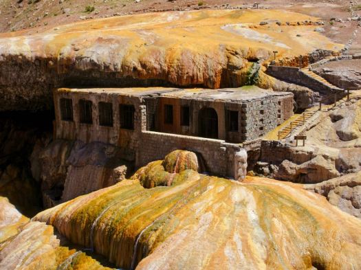
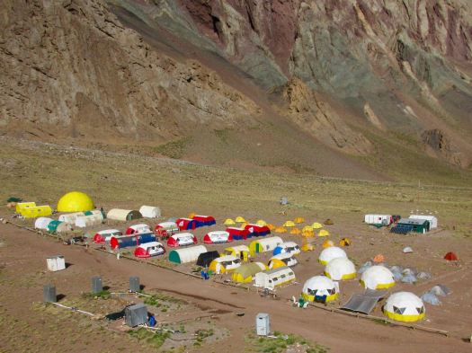
In fact, it’s rather crowded and dirty.

Guided clients sleep in one of the company fixed tents.

When not in use they are protected.
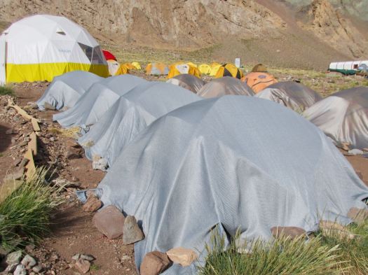
I do like their big bright shared areas.

It was late afternoon, the sun already passed behind the mountains.
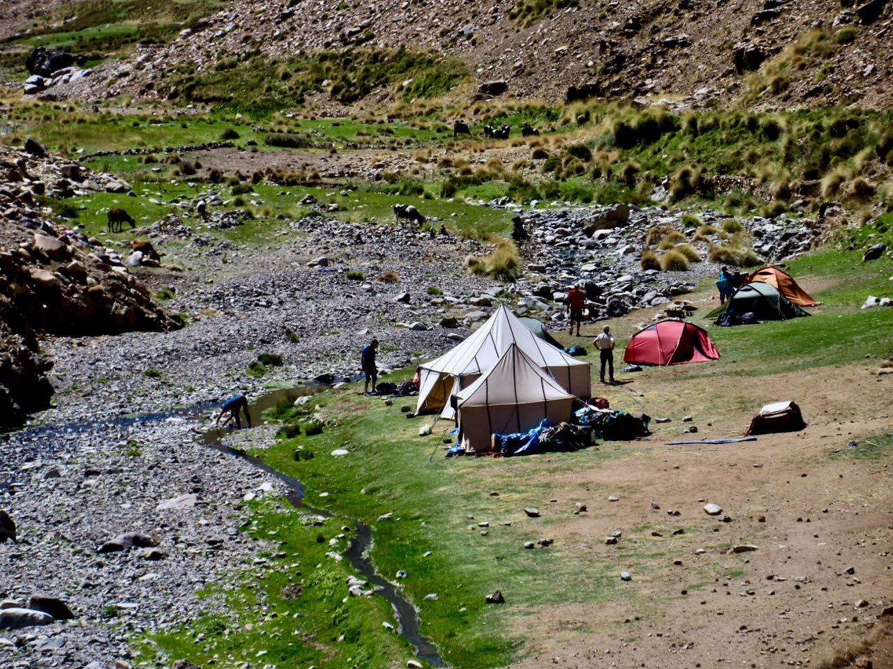
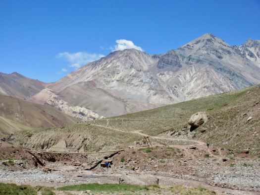
On arrival you check in with the camp guards. They directed me to the tiny area where independent campers are allowed to pitch. We are definitely second class clients here.
Toilets are BAD for guided clients as well as independents.

Chilled and surprisingly tired, I crawled into my sleeping bag and had a nap. I had a slight altitude headache but no other symptoms.

Eventually getting up, II wandered around early evening, enjoying nightfall.

There’s a convenient picnic table with good water supply for independent hikers. I had my standard Knorr soup with instant mashed potatoes. Barbecue chicken mixed in.
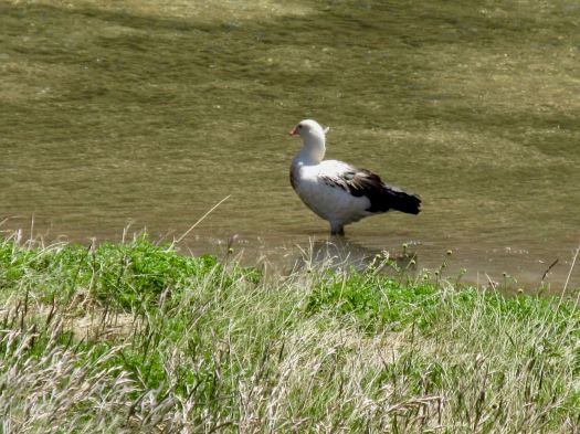
Cheeky Andean fox tend to show up at campsites about dusk. I saw this one hanging around at dinner hoping for leftovers. And another two in the early morning.
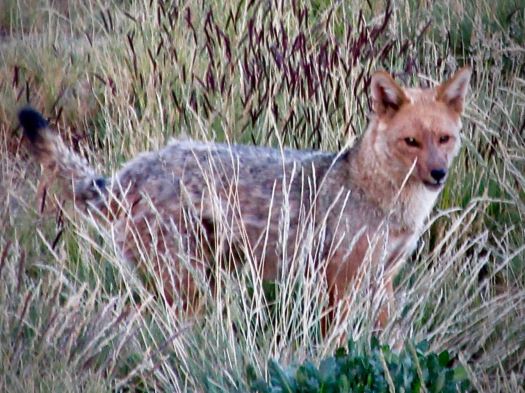
BIG day tomorrow. I tried to get as much sleep as I could at 3350m.

Half the crowded camp wanted to rest. The other half to party. Bring headphones or earplugs.

Big Bend Outer Mountain Loop TX

If I return to Big Bend National Park it will be to hike the Outer Mountain Loop.

Backcountry permits are required for all overnight backpacking trips in the park and can be obtained at the Chisos Basin Visitor Center (or another park visitor center).

outer-mountain-loop-map

Day 1 – Chisos Basin – Boot Canyon – Juniper Canyon (approximately 11 miles)

Begin by caching water near the Homer Wilson (Blue Creek) Ranch. This scenic overlook is located at mile 8.1 along the Ross Maxwell Scenic Drive. Hike down the trail and cache your water in the convenient storage box. Ensure your name and date are written on your bottles. Caching water will make the difference between a dangerous experience and a fun backcountry excursion.

After caching water, head to the Chisos Basin Trailhead to begin the hike. …

Day 2 – Juniper Canyon – Dodson Trail – Blue Creek Canyon (approximately 10-11 miles)

The Dodson Trail is the hottest and most exposed section of the entire trek. Don’t let the relatively short distance fool you. …

Day 3 – Blue Creek Canyon – Laguna Meadows – Chisos Basin (approximately 9 Miles)

National Park Service

Click PLAY or watch a 3 day hike on YouTube. (6 min)

related – trip report – Traveling Ted – Completing the Big Bend Outer Mountain Loop