Located in the Southwest National Park, Tasmania, Australia the 82 km track roughly follows the coast between Cockle Creek and Melaleuca. Most people fly into Melaleuca and walk out to Cockle Creek. This is usually to avoid being trapped at Melaleuca in bad weather without food. There are only three ways to get to Melaleuca, by boat, walk in or fly. …
In 2010 David Murphy created a video of his adventures on the South Coast Track. …
All the good bits (mud, leeches, blood, rivers and rain) are in the second half…..
I’m planning on hiking Acadia first week of July. Leave a comment if you have hiking advice for me.
The park includes mountains, an ocean shoreline, woodlands, and lakes. In addition to Mount Desert Island, the park comprises much of the Isle au Haut, parts of Baker Island, and a portion of the Schoodic Peninsula on the mainland. …
I first heard of the Long Range Traverse, Gros Morne National ParkNewfoundland, Canada, in Classic Hikes of North America by Peter Potterfield.
It’s certainly one of the best hikes of North America.
Distance: 23 miles (35 km)
Time: 4-5 days
Newfoundland’s Long Range Traverse is a unique 35-kilometer backcountry route of growing reputation among wilderness cognoscenti. The storied traverse follows the ridgelines and valleys of Newfoundland’s highest peaks where they rise abruptly 2,500 feet above the island’s west coast along the Gulf of St. Lawrence. The landscape here in Gros Morne Naitonal Park is as dramatic as it is remote, carved by glaciers from massive, uplifted blocks of granite that form the plateau. Land-locked fjord-like bodies of water, locally called “ponds,” dominate the views seaward toward the Gulf. …
The route is often described as a 35 km route, or about 23 miles. But that’s measured as the crow flies, and the actual distance walked will be much longer, the result of detours mandated by terrain and the thick patches of tuckamore. …
Mid May to mid September is considered prime time, but most hikers come in July or August. The advantage of off season travel is fewer bugs, the downside is the greater potential for bad weather. …
Last year Gros Morne National Park was threatened by a proposal to drill and frack for oil metres from the park boundary. After a huge public outcry this specific proposal was stopped. However the park is still vulnerable to future industrial proposals. That’s why CPAWS is working with concerned local community members and businesses to encourage the federal and provincial governments to create a buffer zone around the park to permanently protect it from industrialization
A last minute change in my transportation itinerary required that I finish the West Coast Trail a day ahead of the rest of my group.
That meant I’d need to finish the last 2 days by 4pm TODAY, in time for the last ferry across the Gordon River.
I packed up in the morning gloom.
Alone and at low tide, however, I made very good time.
sea lions
It was just me and these … smelly guys.
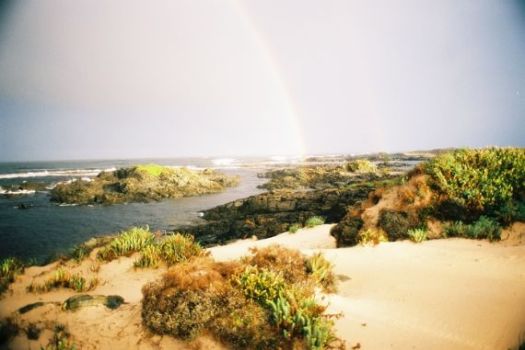
Sea stacks are the iconic image of the West Coast Trail.
I did linger to take some photos at Owen Point.
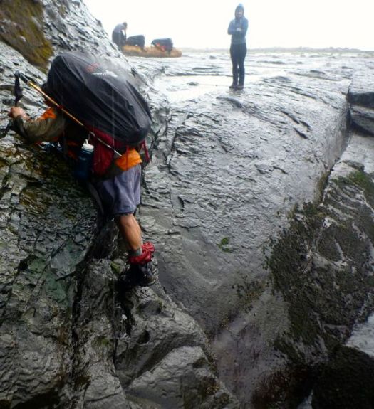
In my opinion, the most dangerous section of the West Coast Trail is not Adrenaline Surge, rather the boulder section between Owen and Thrasher.
These are hikers coming the other direction. In wet conditions, the footing is treacherous.
Walk balanced atop beached logs instead, at every opportunity.
I stopped for brunch at Thrasher, pleased with my time getting there. A brazen mink was making the trip from the safety of the forest to the shore right beside hikers.
It was trying to tear off chunks of a dead octopus, washed up on the rocks.
Twice a bald eagle swooped in. First time we assumed it was defending the dead octopus. After the second, we realized it was trying to take the mink, instead.
Ahead of me lay the “toughest” day. Supposedly.
In 1999 this short section to the Gordon River had taken us 10hrs.
I’m not sure what’s changed. But it seemed very easy. Very scenic. The footing excellent.
The only real challenge was wasps.
wasp sting
A scrawled paper warned of wasps. I ignored it. And was stung once.
Many others that day and the next were stung, as well. (Some were stung near Chez Monique’s, as well.)
But I had no time to lick my wounds. Here I am happy to have reached the Donkey Engine.
km 75. We made it in time for the 3pm Ferry.
Happy. But dirty and tired. Some injured.
Myself. I felt great. Especially while cooling my feet in the chill Gordon.
If you miss the 4pm boat, there’s a chance you’ll be spending the night here.
On the civilization side you can immediately get a hot shower at the campground.
Transportation clicked. I caught the 5pm WCT shuttle to the downtown Victoria bus station. I was at my parent’s home in Parksville by 10pm.
We enjoyed one of the better toilets here, however.
Sawdust does help reduce odour.
Seems the expensive solar composting toilets (used in the past) are no longer “must have” technology.
Hicham dressing for battle.
We faced the most dangerous section of the West Coast Trail — dread Adrenaline Surge.
Our arrival was perfectly timed for low tide.
Two choices. Down and back up? … Or scramble around?
We opted to stay high rather than risk a freak wave flushing us out to sea. That had happened to a friend of ours in the past. (She was washed back into the Surge on the next wave. And pulled to safety.)
All 11 made the traverse safely. But it was very, very slippery.
If not confident in your agility, take the inland route, instead.
On the other hand, in good conditions, at low tide, the coast can be like a sidewalk. Sandy and myself ALWAYS voted to take the coastal route. Vistas are magnificent.
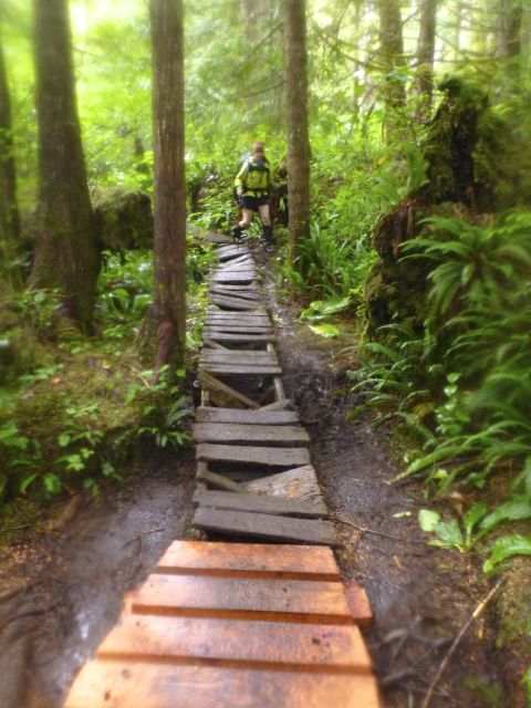
The first word that comes to mind when describing the WCT is … LADDERS.
There are MANY. Some are LONG and STEEP.
This is no adventure for those afraid of heights.
The second word that comes to mind is … RAIN.
The WCT is no place for those afraid of slipping on wet surfaces.
Nor those who don’t like to get dirty.
Actually, we had only a few hours of rain. This was a relatively dry week on the Wet Coast Trail.
Any idiot can hike when it’s dry. It takes experience and expertise to enjoy camping in the rain.
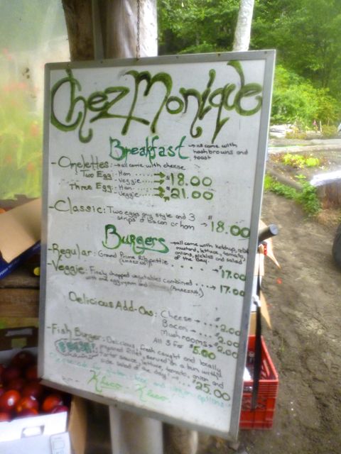
Warren’s happy too. He knows Chez Monique’s is close.
This was the 4th time over the past 14yrs that I’ve enjoyed this Beach restaurant. This time I took the opportunity to hang out with the Quebecois founder. Still feisty after all these years.
I learned of a new service. The restaurant will transfer 40 pounds of your food by boat for $35. You pick up that package when you get to Chez Monique’s. I’m not sure who to contact to arrange that transfer, however.
One of our best moments was hiking through tens of thousands of gulls.
Of our 11 hikers, only 4 were brave enough to scramble the river inland to see the Canada’s tallest tree, the Carmanah Giant, at 95.836 m (314 ft). It’s the tallest Sitka Spruce in the world, too.
A fair bit of boulder hopping was required to keep our feet dry.