We’ve added the Fundy Footpath to our list of best hikes in North America.
Fundy National Park to Big Salmon River, N.B. : 41 kms

Click PLAY or watch a charmingly quaint TV spot on the “new” trail from 2009.
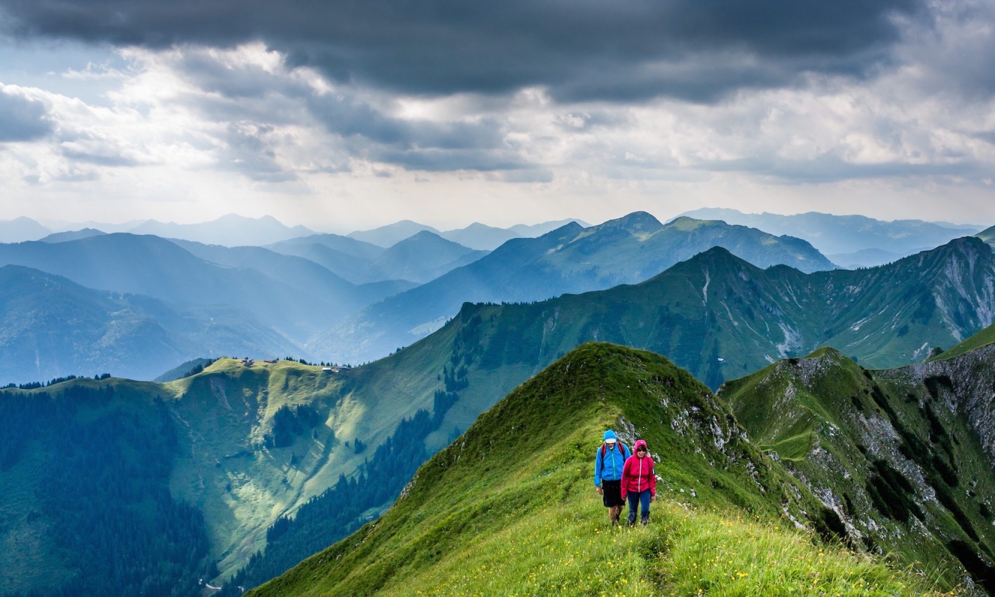

Best hikes, treks, tramps in the world.
We’ve added the Fundy Footpath to our list of best hikes in North America.
Fundy National Park to Big Salmon River, N.B. : 41 kms
Click PLAY or watch a charmingly quaint TV spot on the “new” trail from 2009.
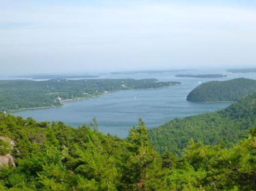
Whether you hike or drive, the #1 highlight of Acadia in Maine is the top of Cadillac Mountain.
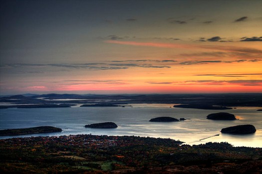 Overlooking Bar Harbor.
more interesting photos
… magnificent views of a glaciated coastal and island landscape. …
… the tallest mountain along the eastern coast of the United States. During certain times of the year, it is the first place in the U.S. to see sunrise.
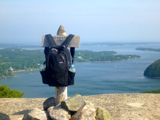
I’d long wanted to hike Acadia National Park in Maine. It wasn’t quite as good as I’d hoped.
In advance, I looked at this post – Five Favorite Hikes in Acadia National Park.
The blogger systematically worked through the local hiking guidebook, A Walk in the Park by Tom St. Germain, arriving at these best hikes:
Acadia Mountain is short and sweet.
Well trod.
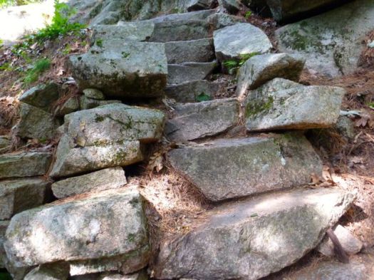
Well blazed.

With terrific vistas from the top.
Guest post by Benjamin Biancini:
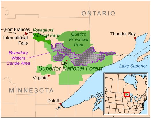
A fusion of hiking and canoeing. The BWCA Wilderness is unique to all other US national parks.
There is nothing that comes close to the uniqueness of the Boundary Waters Canoe Area Wilderness, located in Northern Minnesota.
In the USA mountains are plentiful, oceans and hiking trails are all over the place, then what makes this place so special? In the BWCA there is just as much lake coverage as there is solid ground, this makes trekking it a biathlon of hiking, canoeing, and repeating it again and again.
There are no motorized vehicles allowed in the 1,000,000+ acre wilderness. This means you must park at the edge and paddle onto the first lake with your hiking and trail gear in hand. Once the first body of water is crossed you are expected to jump in the water at the landing (yes, you must get your feet wet) pull the canoe on shore, throw a pack on your shoulders and carry a canoe over your head while hiking long distances to the next lake.
So why is the BWCA so unique? It’s a balance act of paddling, followed by hiking through the forest with 50+ lbs of weight on your shoulders. Watch out for boulders because there’s no easier time to sprain an ankle. The vast differences in area to cover between lakes also make each portage exciting, they can be anywhere from 100 yards across to 10 miles, lakes apply to the same rules. You can canoe across a pond then plan on hiking miles and miles through the woods until you get to the next one.
Here’s a tip that I learned from experience. When it’s windy make sure you stay near the shore, not out in the middle of the lake. You’d think this would be common sense, but it isn’t. Several years ago we tipped our canoes over in the middle of a 7 mile lake and lost some of our gear. We learned from that mistake and certainly won’t repeat it.
So why does anyone engage in such a hiking-canoeing expedition?
The BWCA is home to some of the most deserted lakes in North America. With freshwater fish species booming and ready to be caught and grilled over the fire, there really is nothing like it. Hunting permits are granted during season however no firearms are allowed, only archery. All food must be backpacked in on each trip and of course all trash items have to be taken back out.
The bonus of the BWCA is that you can endlessly paddle and hike into the wilderness. If you want peace and quiet plan on moving in at least eight lakes and eight portages because it will separate you from the Boy Scouts that only scratch the surface. There are survivalists that go into the wilderness during the spring, and don’t come out until fall time. The BWCA is an endless maze of wilderness.
My favorite part of trekking the BWCA is this: after a long day of juggling rocky portages and windy lakes, anything over the campfire tastes good.
Ben Biancini of The Reliable Series – helping outdoor enthusiasts find locally made gear
… Parks Canada has officially declared Nitinat Narrows the third access point to the iconic West Coast Trail, a place where broken hikers cannot only exit, but where fresh ones can start, choosing an abbreviated trip of a few days while creating new revenue potential for the Ditidaht. …
Anyone entering from Nitinat Narrows must still receive an orientation from the First Nations, and are recommended to be as experienced and prepared as someone tackling the entire trail …
Formerly a maximum of 60 hikers could start the WCT each day. An additional 8 / hikers day can now start via boat from Nitinat Narrows.
 related – Self-Evacuation or How to Get Off the West Coast Trail When You’re In the Middle of It
The Narrows have always been an “unofficial” exit point.This makes it official.
We’ve updated our WCT information page.
Located in the Southwest National Park, Tasmania, Australia the 82 km track roughly follows the coast between Cockle Creek and Melaleuca. Most people fly into Melaleuca and walk out to Cockle Creek. This is usually to avoid being trapped at Melaleuca in bad weather without food. There are only three ways to get to Melaleuca, by boat, walk in or fly. …
In 2010 David Murphy created a video of his adventures on the South Coast Track. …
All the good bits (mud, leeches, blood, rivers and rain) are in the second half…..
Our Hiking Blog – South Coast Track – mud, leeches and lots more!
Click PLAY or watch it on YouTube.
The South Coast Tracks is one of the few hikes where I turned back. Partly due to mud.
I’m planning on hiking Acadia first week of July. Leave a comment if you have hiking advice for me.
The park includes mountains, an ocean shoreline, woodlands, and lakes. In addition to Mount Desert Island, the park comprises much of the Isle au Haut, parts of Baker Island, and a portion of the Schoodic Peninsula on the mainland. …
Click PLAY or watch an introduction to the Park on YouTube. (60min)
We’ve updated our Abel Tasman information page. Truly it’s one of the dream hikes of the world.
Click PLAY or watch a promo on YouTube.
I first heard of the Long Range Traverse, Gros Morne National Park Newfoundland, Canada, in Classic Hikes of North America by Peter Potterfield.
It’s certainly one of the best hikes of North America.
Distance: 23 miles (35 km)
Time: 4-5 daysNewfoundland’s Long Range Traverse is a unique 35-kilometer backcountry route of growing reputation among wilderness cognoscenti. The storied traverse follows the ridgelines and valleys of Newfoundland’s highest peaks where they rise abruptly 2,500 feet above the island’s west coast along the Gulf of St. Lawrence. The landscape here in Gros Morne Naitonal Park is as dramatic as it is remote, carved by glaciers from massive, uplifted blocks of granite that form the plateau. Land-locked fjord-like bodies of water, locally called “ponds,” dominate the views seaward toward the Gulf. …
The route is often described as a 35 km route, or about 23 miles. But that’s measured as the crow flies, and the actual distance walked will be much longer, the result of detours mandated by terrain and the thick patches of tuckamore. …
Mid May to mid September is considered prime time, but most hikers come in July or August. The advantage of off season travel is fewer bugs, the downside is the greater potential for bad weather. …
read the full trip report on Great Outdoors

related – Save Gros Morne National Park:
Last year Gros Morne National Park was threatened by a proposal to drill and frack for oil metres from the park boundary. After a huge public outcry this specific proposal was stopped. However the park is still vulnerable to future industrial proposals. That’s why CPAWS is working with concerned local community members and businesses to encourage the federal and provincial governments to create a buffer zone around the park to permanently protect it from industrialization
1. Dog Mountain
2. Stawamus Chief
3. St. Mark’s Summit
4. Mount Cheam
5. Mount Baker Recreation Area
6. Garibaldi Lake
7. Diez Vistas
8. Crown Mountain
9. Mount Seymour
10. The Binkert Lions

Thanks Molly.

