I’ve enjoyed many great hikes on the Olympic Peninsula over the years. Weather is a huge factor. When it’s not raining, the Olympics are paradise. 🙂
Here are a few of my photos from the past.
I’m planning to return June 22nd 2015.
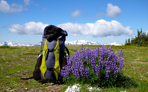
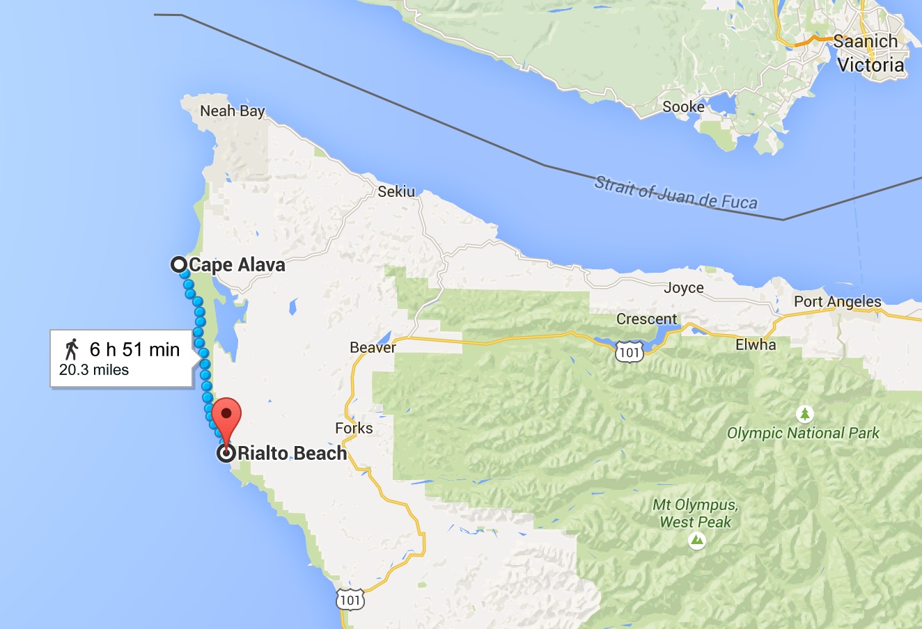
I’ll decide when and where to hike based on the weather forecast. Plan A is to start with Cape Alava – Rialto Beach, the “Shipwreck Coast“. There are many other options, of course. 🙂
I’m planning to do the Shipwreck end of June 2015. 🙂
It’s 20 miles from Rialto Beach to the Lake Ozette Ranger Station. From Lake Ozette, you can tack on another 15 miles from the ranger station to Shi Shi Beach. …
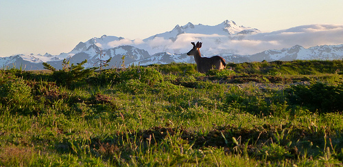
… wind-and-wave-hammered, isolated, and strewn with massive logs and giant strands of kelp. All that makes it one of the most unique backpacking adventures in the lower 48: a wilderness beach hike untrammeled by resort homes and boardwalks. …
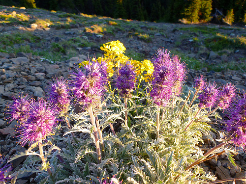
The beachscape, which is part of the 2,408-nautical-square-mile Olympic Coast National Marine Sanctuary, is full of life and always changing: low tides expose tide pools filled with orange and purple stars, urchins, sea anemones, and other intercoastal life. …
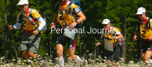
I’m planning to volunteer for Dave Adlard’s NEXT expedition race. Social media. Photos. Video.
June 28th – July 4th, 2015.
Over almost 7 days, teams will undertake a 340 – 600 km (200 – 350 miles) expedition over some of the most beautiful, epic and challenging terrain on Earth.
Racers will use a map, compass and their own wits to navigate their way over a (mostly) unmarked route by mountain biking, rafting, paddling, trekking, canyoneering, coasteering, glacier travel, orienteering, trail running, fixed ropes, and a few other surprises through the amazing expanse of Alaska’s Kenai peninsula!
The High Coast (Swedish: Höga kusten) is a part of the coast of Sweden on the Gulf of Bothnia …
… since the last ice age the land has risen 800m, which accounts for the unusual landscape with tall cliff formations. The High Coast is part of the Swedish/Finnish High Coast/Kvarken Archipelago world heritage site (the High Coast was extended with Finnish Kvarken areas in 2006). …
The Höga Kustenleden is a 128 kilometer long trail along the High Coast. …
Hiking in Finland has a superb trip report of a late Autumn adventure:
The scenic trail passes through villages & towns, along the coast, through the forest and a beautiful National Park and if you have a free week makes for a great walk along the Swedish coastal hills. …
Högakustenleden – the High Coast Trail
Beautiful photos. 🙂
Click PLAY or watch a 3min clip taken during milder weather on YouTube.
Gros Morne is a member of the Long Range Mountains, an outlying range of the Appalachian Mountains, stretching the length of the island’s west coast. …
Hiking the trails is a popular activity at Gros Morne. There are about 20 marked day trip trails, exploring coastal and interior areas of the park. …
The interior of the park can also be accessed, notably through the multi-day Long Range Traverse between Western Brook Pond and Gros Morne Mountain. …
Leigh McAdam:
Before you even get a whiff of the Long Range Traverse, the premier backpacking trail on Canada’s east coast, you must pass a serious navigation test and get a full orientation by staff at the Gros Morne National Park Visitor Center.
The navigation test is nothing to sneeze at. You must understand declination and know how to take a compass bearing from the map. Although you can take along a GPS, and it might help in foggy situations, it’s your map and compass skills that are of utmost importance. It’s the only place in Canada that I am aware of that requires you to pass a navigation test. I guess what happened in the past, is too many backpackers set out, only to get lost – as there is no marked trail – and ended up needing a rescue.
The official website says it will open November 2015.
The Tasmania Parks and Wildlife Service’s largest and most ambitious track project, the Three Capes Track, will be a world class, multi-day walking experience on the Tasman Peninsula along a track up to 82 km in length.
The track will showcase Cape Raoul, Cape Pillar and Cape Hauy as well as stunning natural features and scenery including dolerite cliffs and ocean views. …
Cape Pillar Peninsula from the Blade (Photo courtesy of Stuart Gibson)
You can either walk the route independently or sign up for a fully guided experience provided by a commercial operator.
What will set this track apart from the many multi-day hikes in Australia is the standard of public facilities available. The walk will include huts at up to three sites with mattresses and cooking facilities, reducing the amount of things you’ll need to lug in your rucksack. Bye bye camping stove and fuel, tent and sleeping mattress. After trekking past the tallest sea cliffs in Australia and awe-inspiring ocean views, walkers will be snuggling down on a soft bed.
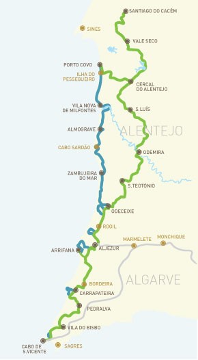
Rota Vicentina is a long distance path along the SW coast of Portugal, between the city of Santiago do Cacém and the Cape of St. Vincent, totalling 350 km to walk along one of the most beautiful and best preserved coast lines of southern Europe. …
It’s easy to section hike. Easy to hike independently. Or sign on with a guide.
Cyprus doesn’t necessarily strike you as the number one hiking destination, but in fact the dramatic scenery, mountains and coastal paths make it a fantastic place for walkers of any experience level. Here are three tried and tested walks you might want to try (though you can definitely find others, and even accidentally stumble on to others whilst finding these!)
photo by Bald Hiker
Aphrodite Trail
Start Point: Baths of Aphrodite
Distance: 8 kilometres. At the utmost peak you’ll reach 370m.
Best for: This hike is for those who are serious about walking; first timers might want to skip this one and head straight into the Baths of Aphrodite or grab some lunch on the terrace. The walk involves some steep uphill climbs, so pack proper walking gear (and don’t even whisper the word ‘flip flops’). Keen photographers will also enjoy this walk as you’ll get some cracking shots over the Akamas Peninsula; there’s definitely satisfaction to come at the end of the struggle with this one.
Time it takes: 3-4 hours depending on how leisurely you’re planning to amble.
Why it’s great: This is renowned as one of the most beautiful trails in the whole of Cyprus.
How to get here: If travelling from Paphos, take bus 645 from Karavella bus station to Polis. This journey takes roughly 50 minutes and leaves on the hour from 8am. From there, change to the 622 to the Baths of Aphrodite. This takes about 30 minutes and again leaves on the hour.
Where to stay: There are loads of stunning hotels – you can check the reviews on TripAdvisor to see which suits!
___
Agros Kato Mylos Nature Trail
Start point: Near the Rodon hotel.
Distance: 6 kilometers.
Best for: Seeing vineyards, orchards, and the rose bushes which the small town is famed for – the annual rose festival takes place in May when thousands of roses are picked to make rosewater. There are also feasts, dances, and ceremonies that attract a lot of tourists during this month. This walk is average in terms of difficulty, but is easier than the other two listed, if a little dangerous and slippy at points.
Time it takes: 2 hours.
Why it’s great: Agros is really tiny, with a population of only around 800. This means you can really escape the tourist clap-trap here and get back to nature without touts trying to sell you knock off souvenirs or overpriced restaurants. The locals are warm and welcoming, and you’ll get a taste of what life is like in rural Cyprus whilst gobbling down some of the most glorious food on the whole of the island. The locals have a lot of traditional syrupy sweets which are also worth a try.
How to get here: 90 minutes from Pathos International Airport – so if you’re not adverse to the idea, rent your own car and drive (there’s not so much in the way of public transport in this area)
Where to stay: Given the size of the place, hotels are few and far between, but you can check out reviews for a few of them here. Rodon is popular with people around Greece who like to get out of the city at the weekends, or for people in the area looking for a great dining experience. The name means ‘rose’ and has added considerably to the economy of the region!
___
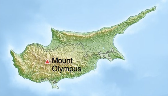
Troodos Trails: Artemis
Starting point: The start is at a small brown hut on the road leading up to Chionistra (Mount Olympus). Take the narrow track immediately to the left of the brown hut (do not follow the signs which suggest it’s the other way – it’s all lies at that point!)
Distance: 7 km. 1850m altitude.
Best for: Great views! This walk is recommended for experienced walkers who are prepared for the rough terrain, or just holidaymakers who fancy a scenic walk and aren’t scared of putting in a little legwork and being careful on the rocks. (Or those with super dodging skills if you decide to go in winter – you might get knocked off the path by passing skiers).
Time it takes: 2-3 hours.
Why it’s great: Goes around Mount Olympus in the Troodos Mountains. This site is often home to weddings, wine lovers coming for tasting sessions and skiers during the winter. You can get some spectacular long distance views when the weather is good(on a really clear day in the winter you can sometimes see out to the coast at Limassol). There are also lots of ruins set into the mountain sides. Best to head out later in the season rather than summer, when the flowers will be in full bloom. (Although don’t go too late, because in winter it won’t be a trail so much as a ski slope).
How to get here: This site is really useful if you’re planning on travelling around by bus. Or rent a car – it’s a 1 hour 15 drive from Pathos International Airport.
Where to stay: You can find a write up of family run hotels and more rural retreats here.
The huts are basic. First come, first served. I’ll carry a tent, just in case.
No fees. No registration. Easy access from multiple trailheads means you can resupply en route. Logistics will be easy. It’s coastal and fairly flat – aside from 3 mountain ascents of about 4000 feet.
The soonest I could do all or part of the SCT is summer 2015. Leave a comment if you are interested. This is a terrific excuse to visit the Sunshine Coast of Canada.
One more thing.
There’s a paddling route roughly in parallel with a large section of the Sunshine Coast Trail. From Shinglemill to Canoe Main. Hikers could switch to canoes or kayaks for a break from the trail, or meet up with paddlers at designated campgrounds. Portage is required.