Crater Lake Rim Trail, Oregon.

Click through to see the rest – 20 Amazing National Park Hikes

Best hikes, treks, tramps in the world.
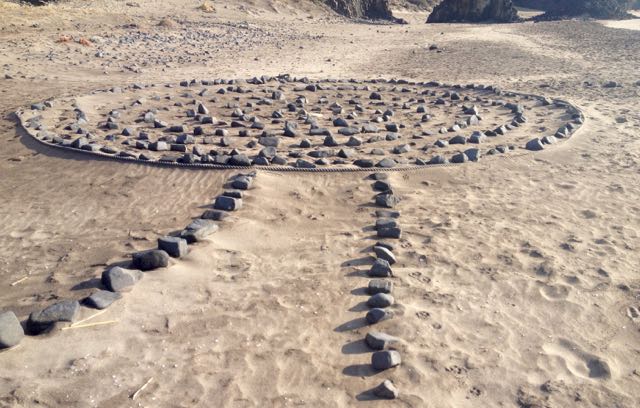
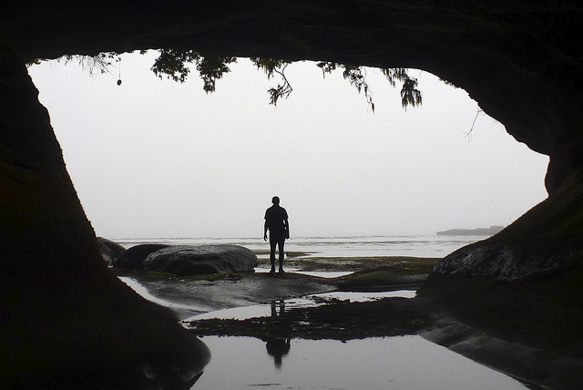
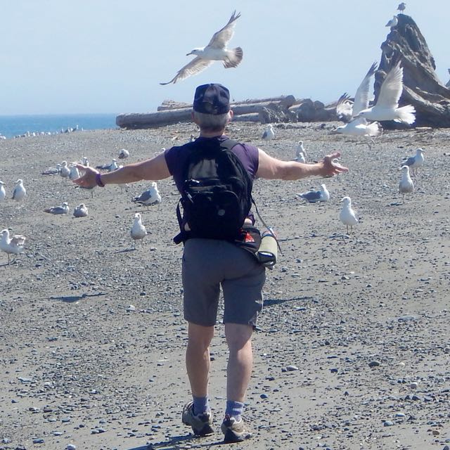
An off trail hike.
Photographer Peter Lam:
… D’Aguilar Peninsula (named after Sir George Charles D’Aguilar, former Lieutenant Governor of Hong Kong) is located on the south-eastern end of Hong Kong Island. The major mount in the area is D’Aguilar Peak, at 325m, where a radio transmission station and numerous terrestrial antennae are installed.
At the southern end of the peninsula, Cape D’Aguilar (also known as Hok Tsui 鶴咀) is the site of a Marine Reserve – The Swire Institute of Marine Science. Here you will also find the Cape D’Aguilar Lighthouse (or the Hok Tsui Beacon), the oldest lighthouse in Hong Kong and a declared historical monument. …


Hong Kong offers some of the best urban hiking in the world. 🙂
A Swiss hiking buddy told me their Army hates sand. It gets in EVERYTHING. Ruins zippers.
Personally, I love sculpting the perfect sand platform and setting up with a water view.

Outbound – 21 Beautiful Beach Campsites
After freezing for 3 nights on the Sierra Nevada Traverse, the nearby Mediterranean coast of Spain appealed.

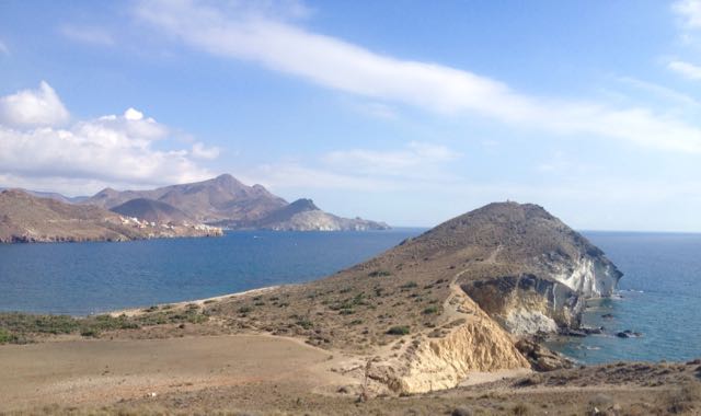
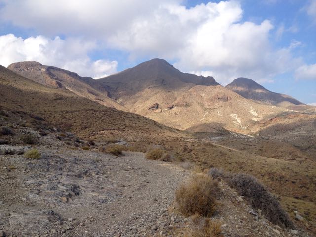
Cabo de Gata-Níjar Natural Park is Andalucia‘s largest coastal protected area, a wild and isolated landscape with some of Europe’s most original geological features. It is the only region in Europe with a true hot desert climate.
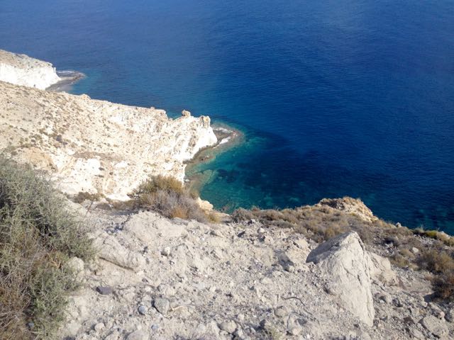
The eponymous mountain range of the Sierra del Cabo de Gata with its highest peak El Fraile is Spain’s largest volcanic rock formation with sharp peaks and crags in red/ochre-hues. It falls steeply to the Mediterranean Sea creating jagged 100-metre (330 ft) high cliffs, which are riven by gullies leading to hidden coves with white sandy beaches, some of the most beautiful in Andalucia. …
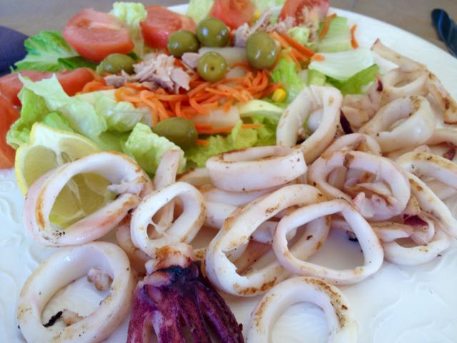
I departed Granada by bus at noon. And was sitting down in Cabo de Gata town for Calamari by 4pm.
Cabo de Gata is a popular beach town in “summer”. But by mid-October it looks like this.

Mine was the only open restaurant. I need to wait for siesta to finish so I could buy 6 litres of liquid (mostly Coke Zero) to start the walk. Happily, the tiny supermarket opened at 5pm.

Lonely Planet Hiking in Spain describes a 52km coastal walk from Cabo de Gata to Aqua Amarga. I planned to start. And continue as long as I wanted. Bus transport back from Aqua Amarga is a problem. 😦

Passing retirees enjoying the sun, first stop is the Cabo de Gata tower.

Turns out there is a series of these ruins up and down the coast.
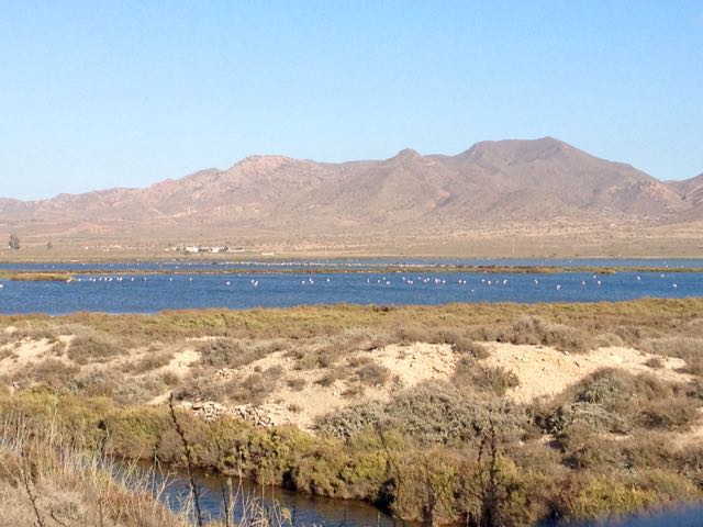
Between the village of San Miguel and the Cabo de Gata point are salt flats. This is an important stopping point for migrating flamingoes and other birds.

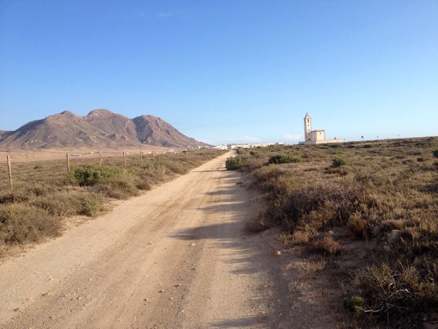
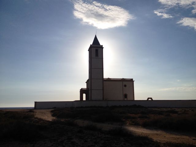
In the distance loomed this impressive church.
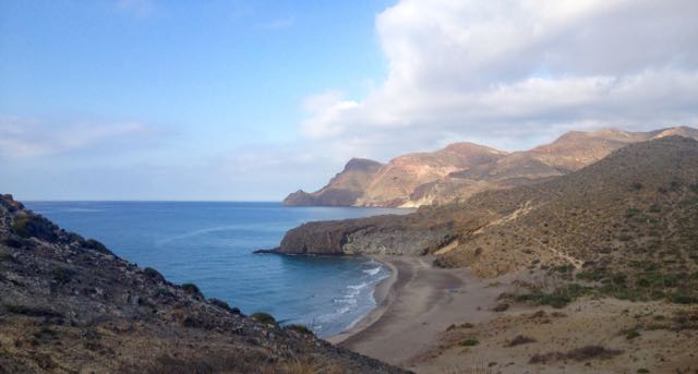
The beaches were near empty. Only one fisherman on this one.

It was a steep climb up and over to reach the Cabo de Gata light station.

The rugged geology is impressive.

Many tourists drive out to enjoy the views at dusk.

The only other person left standing in the dark with me was a young German who had rented an apartment in San José for a week. We walked together past the road block, back towards his place.
Together we found this tent spot. Quiet. Peaceful. And much warmer than 3000m in the Sierra Nevada.

___
Here’s a glimpse looking back to where I’d come from. Next morning.

I’d been looking forward to tramping a series of pocket beaches.

If the tides are right, you can scramble between most of them. This was a highlight of the trip.

This time of year you’ll see nude and topless sunbathers at pretty much every near deserted beach.
And artists. 🙂

There’s San José (Almeria) in the distance. The centre of Parque Natural de Cabo de Gata.
I’ve seen cows (Sri Lanka), kangaroos (Australia) and goats (Spain) on beaches. Never once understanding why they would want to be there.

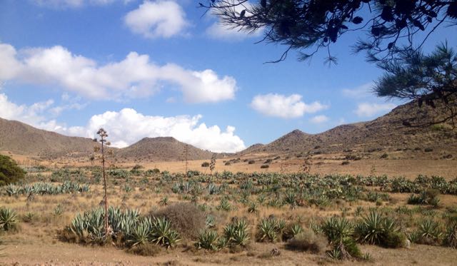
This is a desert. There’s very little water.
This windmill marks the start of town.

I could spend a week or two in San José. It’s lovely. Population about 1000. Plus tourists. And there are very few tourists in October despite daily highs around 28C.
An ideal idyl for cyclists, hikers, artists and photographers, I’d say. Lawrence of Arabia and the Clint Eastwood spaghetti Westerns used this location.
The campground was (surprisingly) closed. On a whim I checked the Aloha Hotel, recommended by Lonely Planet. When they offered me a pool view room for only 40EU, I couldn’t resist. After all … “recovery is an important component of every successful hike”. Plus wine. 🙂
In the afternoon I continued my hike – without backpack – up into the hills beyond San José. Here’s a glimpse back to town.
It’s rough and arid.
But with gorgeous coastal views.
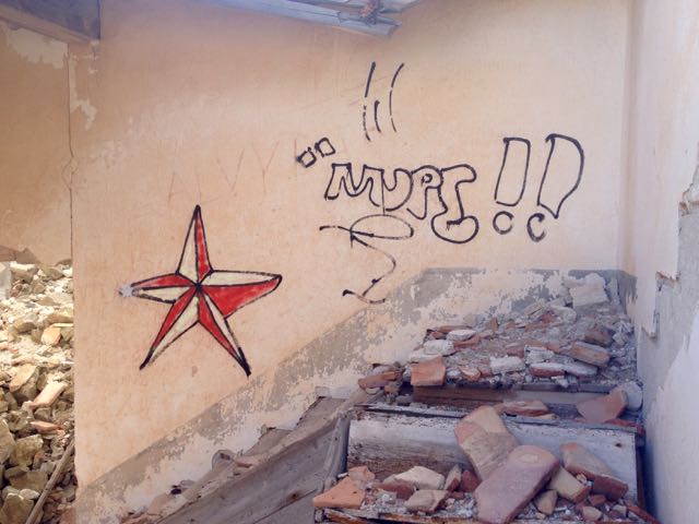
I enjoyed chatting with a very tan elderly couple from GBR before finally stopping at this ruin.


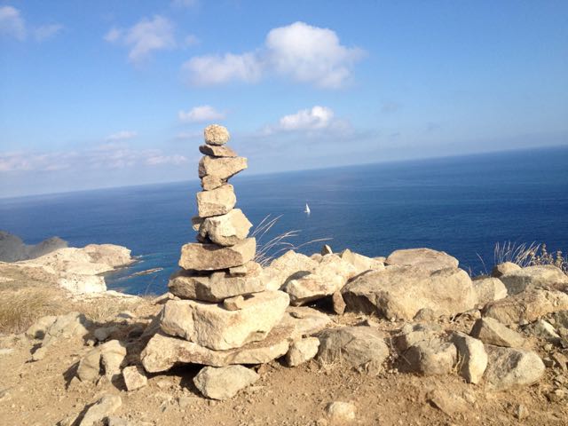
This vista was the end of my Cabo de Gata hike.
I turned back to civilization.
I’m headed for the sunny Spanish Mediterranean coast.
52km. Wish me luck.

Walkopedia recommends Malta Coastal walk (155km) as one of the best hikes in the world:
Outstanding sea views
Unspoiled natural environment
Dramatic cliffs
Azure window and Inland sea
Archaeological remains
Tranquil countryside
Forts, towers and churches
Diversity of habitats and plantsThe best months for walking are in spring (March to June) and autumn (Mid-September to December). …

The WCT is our favourite hike in the world. 🙂
The 75-kilometre West Coast Trail is getting repairs to bridges, ladders and other sections, as part of $33.6 million in funding announced for Parks Canada.
The money is the largest federal infrastructure investment in Parks Canada since its formation 104 years ago, said Vancouver Island North MP John Duncan. …
by site editor Rick McCharles

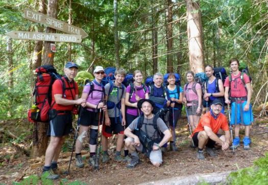
Eleven hikers from flat, dry central Canada – Saskatchewan – met up at Nancy’s bakery in remote Lund, B.C.

Our plan was to hike from Sarah Point to Powell River in 5 days, 4 nights. The first section of the 180km Sunshine Coast Trail.
We ended up exiting after 2 nights walking out from Manzanita hut right back … to the bakery. 🙂
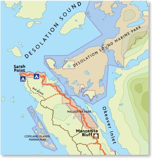
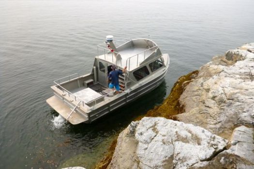
We’d booked a water taxi from Lund to the trailhead at Sarah Point.


Our skipper was excellent. The weather perfect. Yet the scramble up steep, slippery rock to the trailhead was challenging. I’d hate to do it in rough seas.

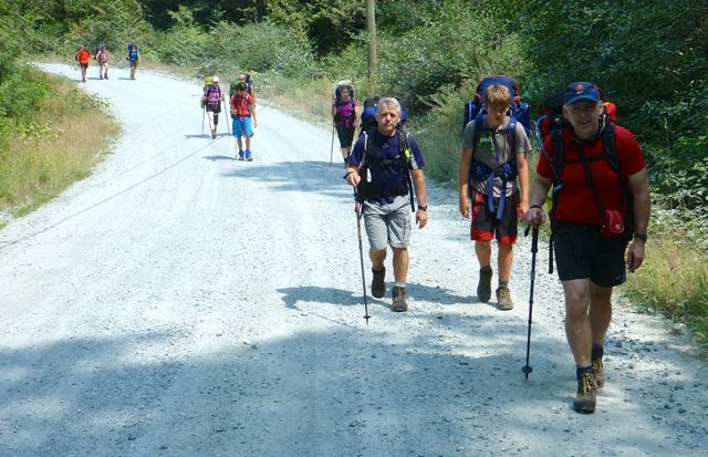
We were off. 🙂

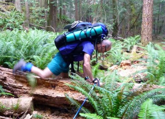
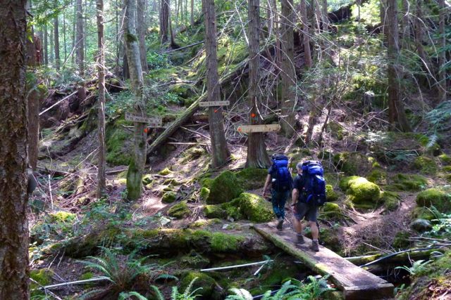
The trail is well flagged but requires frequent scrambles over, under or around fallen trees. Our packs felt very heavy at this point.
Early July 2015 the Pacific N.W. was atypically hot and humid. Forest fire hazy clouded the sky.
Mosquitoes and wasps were a real pest. Four of our group were stung over 3 days.
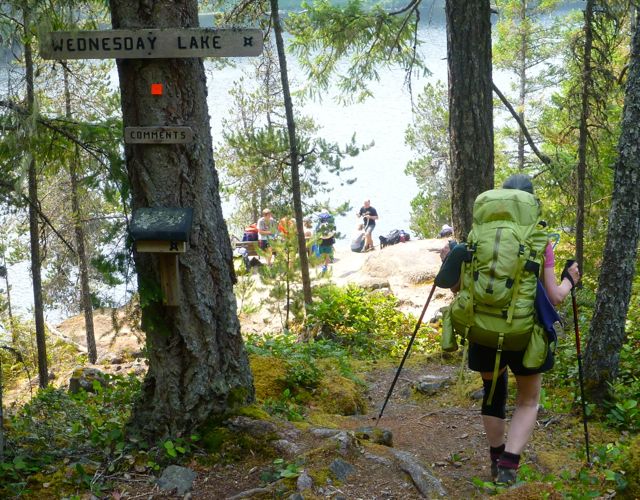
It quickly became evident our large group, starting late in the day, would never make it to our intended destination – camping at Wednesday lake.
Instead we dropped down to a disused campsite at Cochrane Bay. It turned out to be a lovely spot. The pit toilet (which we found the next morning) still in working order.


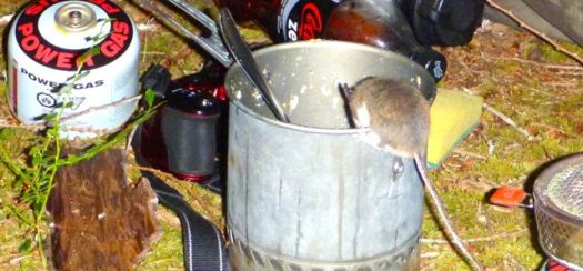
It was dark when we went to hang the food.
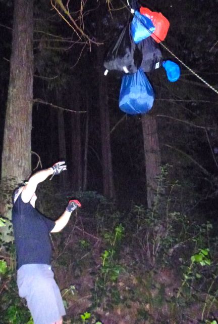
Rodents quickly pounced on my dinner pot (salmon) once I set it on the ground.
The sea a glassy lake next morning.


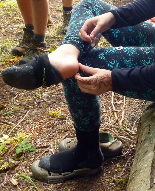
We suffered some foot and knee pain. And morning stiffness, of course.
A steep, sweaty climb up from the sea brought us to Wednesday lake where we refilled all our water bottles. You need at least 3 litres / person on this dry section of the Trail.


We needed this refreshing break as the climb up to the Manzanita bluff was particularly gruelling.

It was with relief that we arrived at Manzanita hut early in the day.
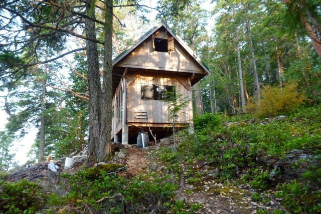
It is a treat to have tables and fire pit after the wilderness camp of the previous night.
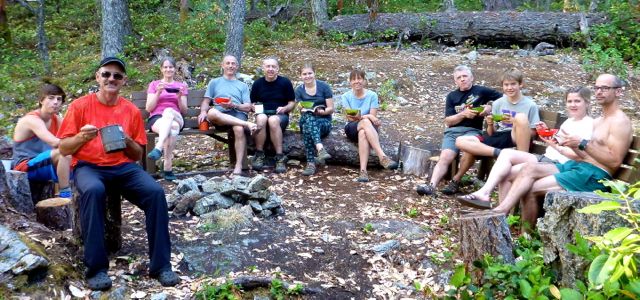
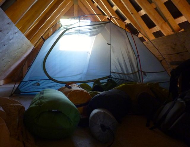
We split up some sleeping in their tents, some in their tents in the loft.
Running low on water, some of the keeners walked about 1.5km down hill to find a stagnant spring. Carried it back up. You need to treat all water on the SCT.

By morning it was decided. We were going to quit the SCT and exit to Lund. Our spiritual leader Bill Wallace and his doppelgänger consulted the guidebook, brochure map and some local day hikers to calculate the best route.

The manly men checked to see if they were strong enough for the escape … by trying to do a chin-up with full pack.


Bill leading the quitters to safety.
Civilization. 🙂


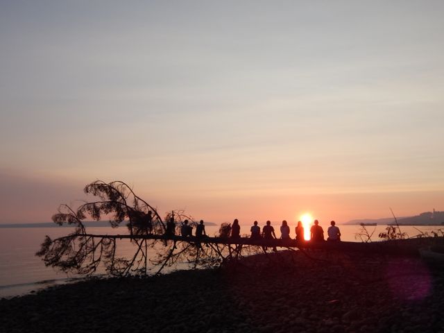
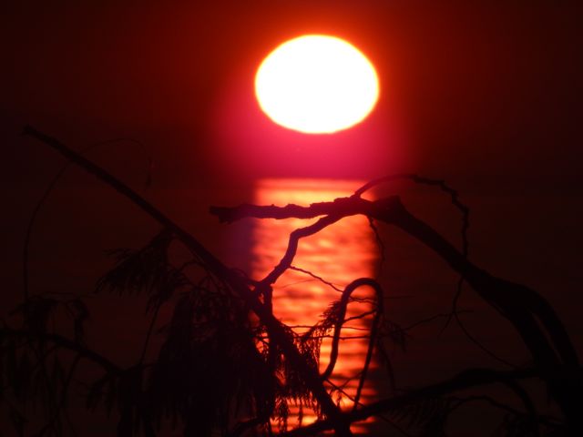
We checked in at the Willingdon Beach campground in Powell River. It’s a good spot, walking distance from the ferry.
The sunset is gorgeous from here. Sandy descended the steep, slippery cliff to shore faster than anyone else. 🙂
Willingdon Beach Trail was a fascinating history lesson. Much enjoyed.


With the extra time we decided to kayak Desolation Sound. It turned out to be the best day of the week!
Back to Saskatoon. Back to reality. 🙂
Lessons learned on the Sunshine Coast Trail:
Two ladies who had done half the Pacific Crest Trail found the long day from Sarah Point to Manzanita hut a serious day. They went straight to bed after dinner and were gone by 6am next morning. Do not underestimate this trail.
I’m hoping to get back in September / October when the bugs are less a problem. Cold doesn’t worry me.

Some of our high resolution photos on flickr. Most of those were taken by Warren Long.
besthike Sunshine Coast Trail information page
We’ve just added an information page on the region.
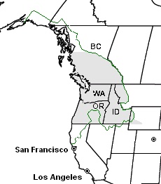
Definitions of the Pacific Northwest region vary and there is no commonly agreed upon boundary, even among Pacific Northwesterners. A common conception of the Pacific Northwest includes … Oregon and Washington as well as British Columbia.
 AT A GLANCE
We’re hiking the Sunshine Coast this week. 🙂
trip report by site editor Rick McCharles
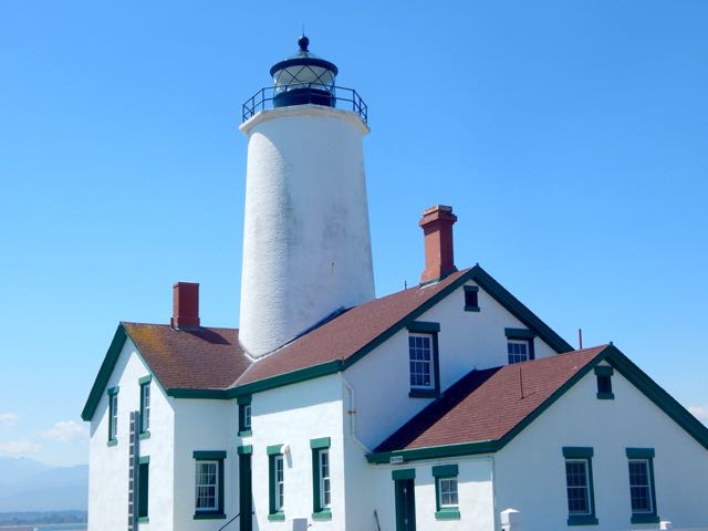
Dungeness Spit is a 5.5-mile (8.9 km) long sand spit jutting out from the northern edge of the Olympic Peninsula in … Washington, USA, into the Strait of Juan de Fuca. It is the longest natural sand spit in the United States. …

Some say it’s the world’s longest naturally occurring sandspit.
Diana and I wanted to visit the New Dungeness Light, in continuous operation since 1857.

It’s fairly easy to find the trailhead from the highway near Sequim.


Here’s the light station at 34x zoom.

It was a long but interesting day hike.

There was a family of volunteers manning the lighthouse. Father had scheduled this week about 6 years ago when his youngest daughter was age-2. Children must be at least age-8 to stay out here.

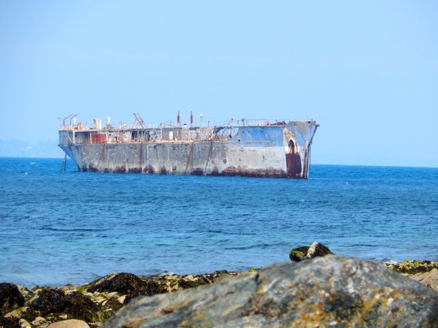
We didn’t catch much sea life. But there were a couple of interesting things out at sea. 🙂


see more of our full resolution photos
related – Washington Trails – Dungeness Spit
