WHAT!?
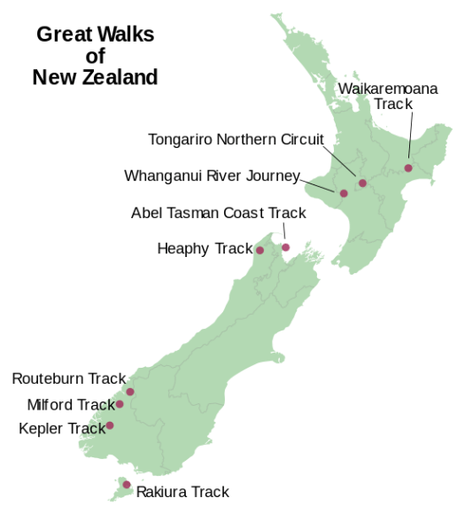
One is a river paddle, the Whanganui Journey, 145 kilometres (90 mi).
Is this even possible?
Click through to see if these guys made it — AND THEN THERE WERE NINE

Best hikes, treks, tramps in the world.
WHAT!?
One is a river paddle, the Whanganui Journey, 145 kilometres (90 mi).
Is this even possible?
Click through to see if these guys made it — AND THEN THERE WERE NINE
trip report by site editor Rick McCharles
Note: We were there Jan 2017. Accessibility may change depending on what happens with Trump’s border wall promise.

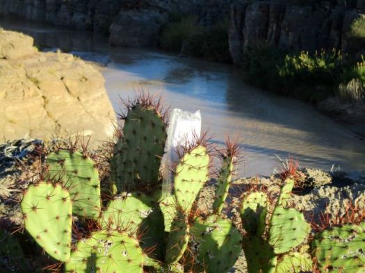
The nature trail crosses Terlingua Creek, climbs several flights of ramps and stairs and then descends into the canyon along the Rio Grande. At this point the canyon walls loom over 1500 feet above the river below. …
In my haste to get over to the Canyon, I took off my shoes and waded Terlingua Creek.

That turned out to be a mistake. Everyone else found a way to cross keeping their feet dry.


Nobody regrets taking this short hike.
And I did finally get a photo of a desert cottontail. Or is it a small jack rabbit?

The best way to see the canyon is by raft or canoe. Local outfitters offer trips from one to three days in length when conditions allow, and river runners of intermediate or better skill level often go on their own. …
Even better for me would be the difficult Mesa de Anguila hike along the canyon rim. Next time. 🙂
related – Texas GOP congressman slams Trump plan for border wall
“Building a wall is the most expensive and least effective way to secure the border,” Rep. Will Hurd (R-Tex.) said in a statement …
trip report by site editor Rick McCharles
Note: We were there Jan 2017. Accessibility may change depending on what happens with Trump’s border wall promise.
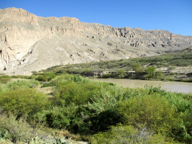
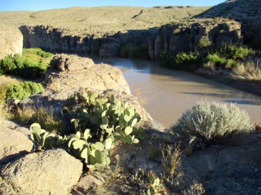
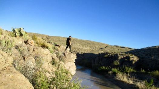
Boquillas town is actually the small village in Mexico that sits on the eastern side of Big Bend National Park. It’s where many tourists cross to hike in Mexico.
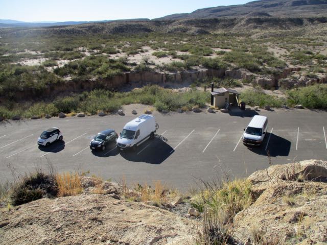
A guy I met in the hotsprings recommended the Boquillas Canyon day hike. It’s about 1.5 miles return on the American side.
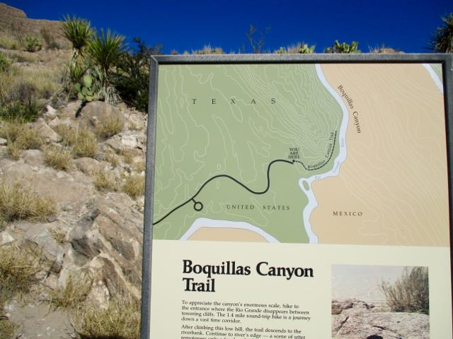
From the parking lot you climb up and over a bluff to walk alongside the muddy Rio Grande.
Supposedly these souvenirs on the beach ($6 each) were a fundraiser for the Boquillas school.
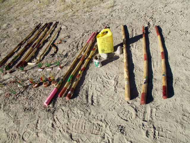
There was a donation box too for the Mexican fishermen who SING for tourists.
The cliff walls loom.

It is an interesting short hike.


Boquillas canyon is not as steep or sheer as Santa Elena. But it is impressive.
trip report by site editor Rick McCharles
Note: We were there Jan 2017. Accessibility may change depending on what happens with Trump’s border wall promise.
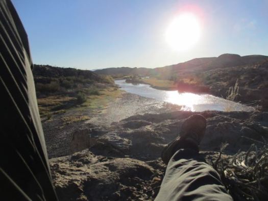
One highlight of Big Bend National Park you should not miss are the Hot Springs.
A reminder of the park’s past volcanic turmoil, the Langford Hot Springs (or just “hot springs”; everyone will know what you’re talking about) is a small, jacuzzi-sized pool of naturally occurring 105°F (41°C) water from deep below the earth. …
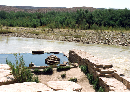
It’s a short walk from the parking lot. Bring a flashlight at night.
Even better is to hike the Hot Springs Rim trail first. Finishing with a dip.
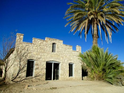
The trailhead features the amazingly well preserved buildings from the Livingston family days.
I started up the Hot Springs Trail.
Continued on to the Hot Springs Rim Trail high above the Rio Grande.
I left a Summit Stone at a nice viewpoint.
Relaxed there looking over the river into Mexico. Very tranquil.
I backtracked to the Hot Springs just in time for dusk. 🙂
This is the life.
Our #1 hike in the world is the West Coast Trail.
![]()
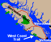 75 km (47 mi), 5-7 days traditional route
Close to the airport and St. George, I quite enjoyed wandering these trails.
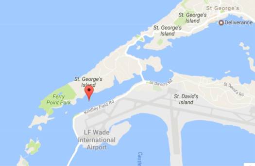
This 64 acres park area is the second largest in Bermuda and has wonderful walking trails, forest areas with endemic plantation, a nice lake, a bay with a lovely beach, and a few historic forts. Other than the sounds of airplanes flying overhead at times, this place has remained as a serene and peaceful parkland over the years. …
Bermuda Railway Trail passes through the park and goes along the western coast line. …
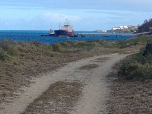
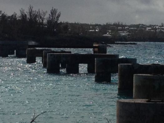
At the western most tip … Ferry Island which can be accessed from the park on a small wooden bridge. It was in Ferry Island where the ferry dock was built way back in 1600s. Ferries transported people across to the other side known as Coney Island which connects to the main island of Bermuda. For over 250 years, ferry was the only transport that connected St. George with the main island.
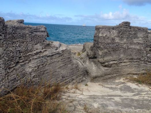
It ceased to operate once the Causeway was built in 1871. …In 1823, Martello Tower came up on the high ground behind the two forts where soldiers could survey the surrounding coastline and the land area. …
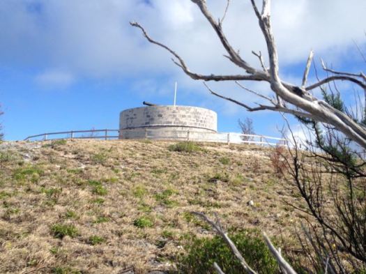
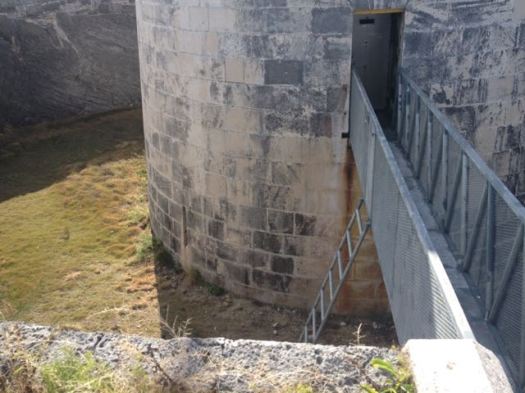
A friend told me they had some terrific drinking parties at Martello Tower back in his misspent youth. It’s all locked up now.
Mike and Lara are MB Guiding.
They’ll organize your hike to many different destinations in B.C.
For example they’ll guide you on the West Coast Trail for C$1650 in 2017.

The West Coast Trail is our #1 hike in the world. A life changing adventure.
Experienced hikers can easily do it independently, however. The MB WCT information page is an excellent resource for everyone.
Thanks Hendrik.
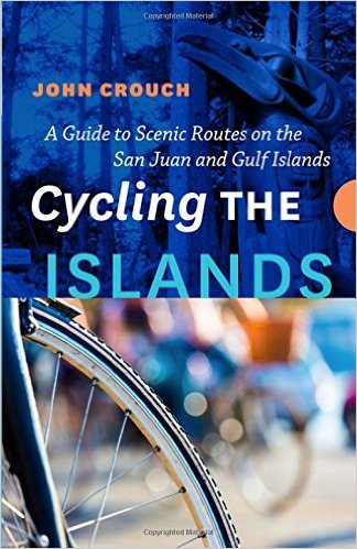
This cycling book includes a pretty good overview of hiking trails on each island. I recommend it.
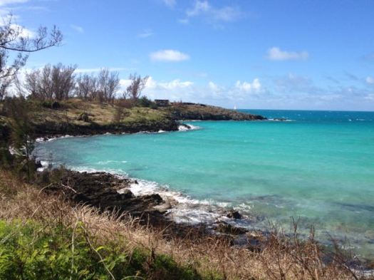
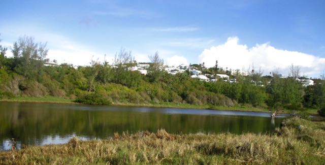
Spittal Pond Nature Reserve is the largest wildlife sanctuary in Bermuda …
It is one of 13 parks or reserves managed by the Bermuda Department of Conservation Services which protects and conserves environmentally critical areas and habitats. …
…unique characteristics such as its lagoon which is permanently brackish, ecology featuring wet grassland and mangrove forests, seasonal shorebirds, other waterbirds and European eels. …
The winter season provides one of the best vistas for visitors walking along the many small trails in the park.
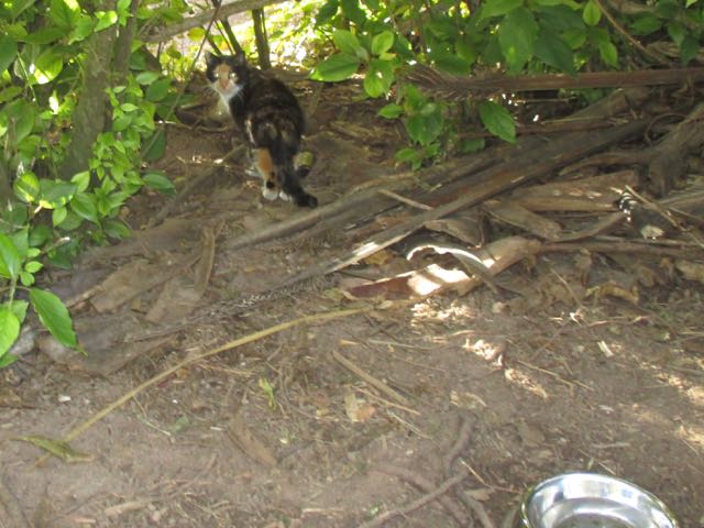
I was there in November. The only visitor on the trail.
I did see feral cats.
Though short, I would say it’s the best hike in Bermuda.
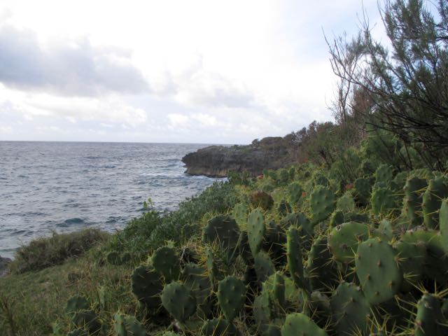
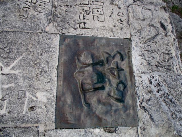
“Spanish Rock”, (also known as “Portuguese Rock”) a rocky cliff overlooking the ocean with inscriptions of the year 1543 AD … This rock piece has been taken out and replaced by a bronze plaque. …

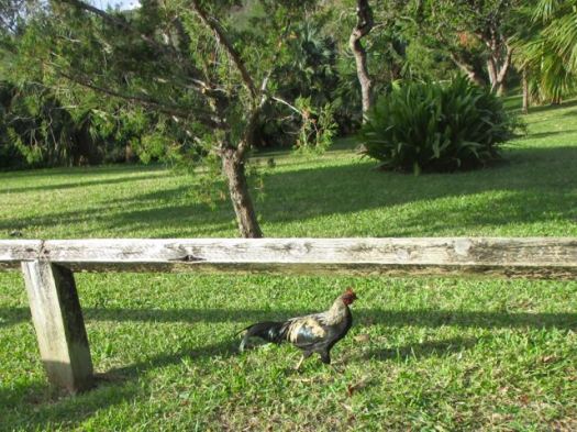
The only other wildlife I spotted were wild chickens.
Click PLAY or watch it on YouTube.
