Climbing Holandsmelen Hill, Loftofen, Norway

Trip report by BestHike editor Rick McCharles

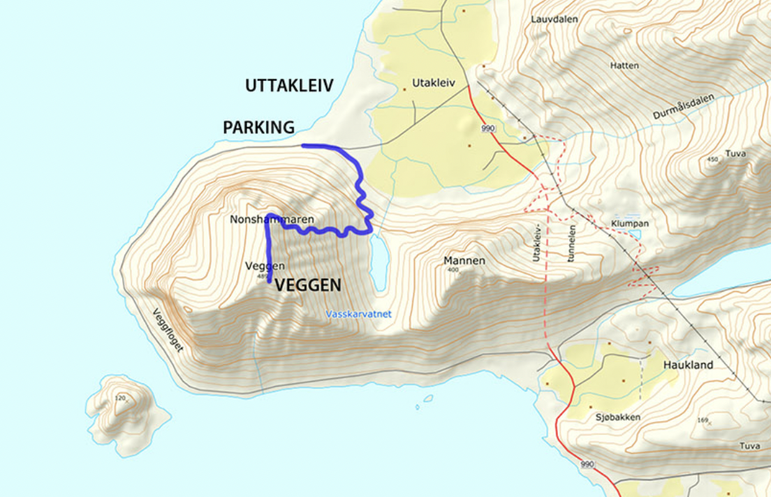
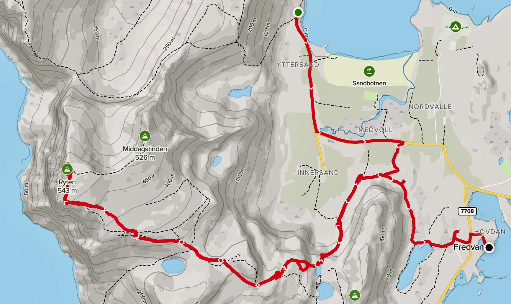
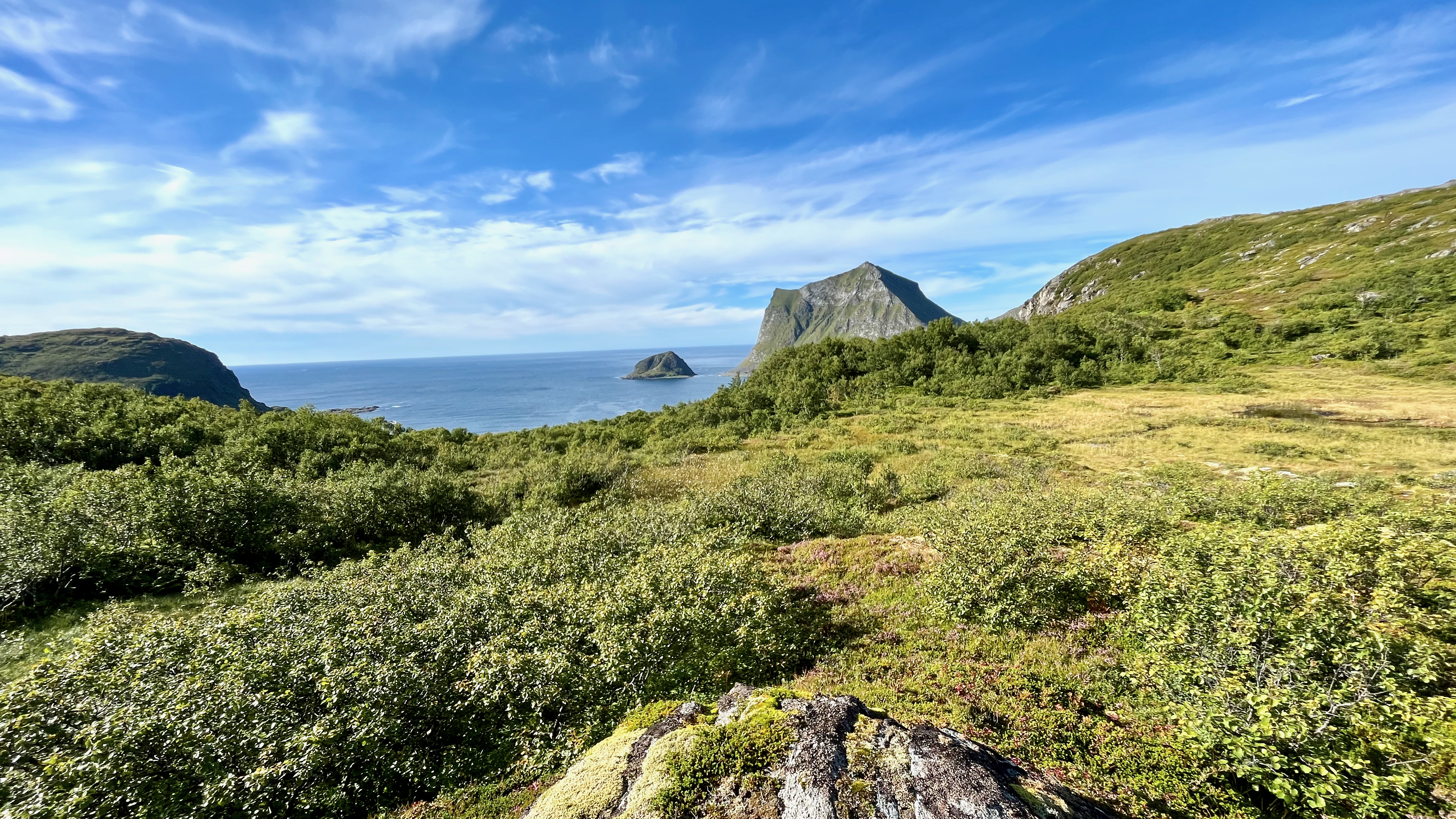
On leaving the famed Haukland beach, I walked to the nearby trailhead of Holandsmelen.

The unmarked, but well worn trail is easy to follow and relatively bog-free by Lofoten standards. That means it takes 20 minutes before your shoes are soaked rather than the usual 10 minutes. 😀

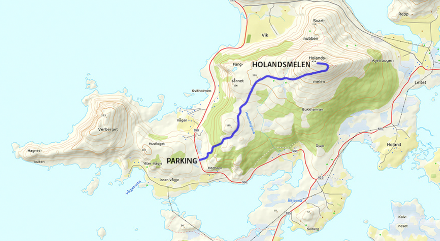
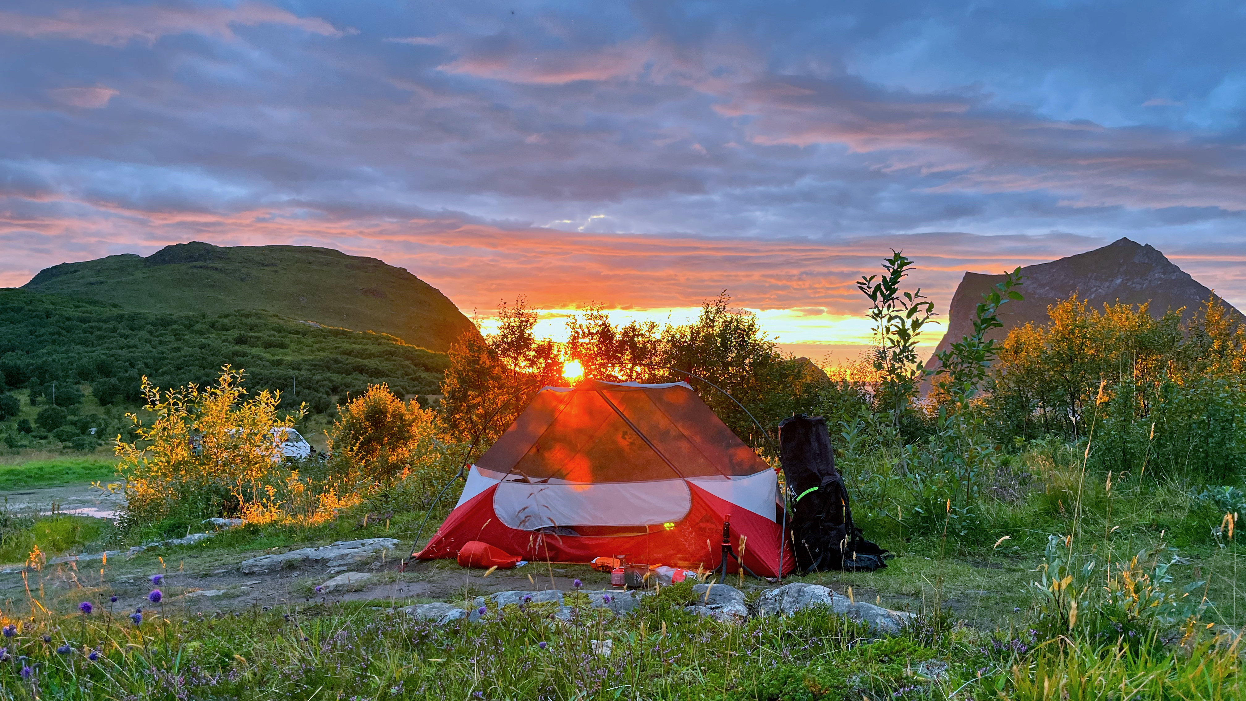
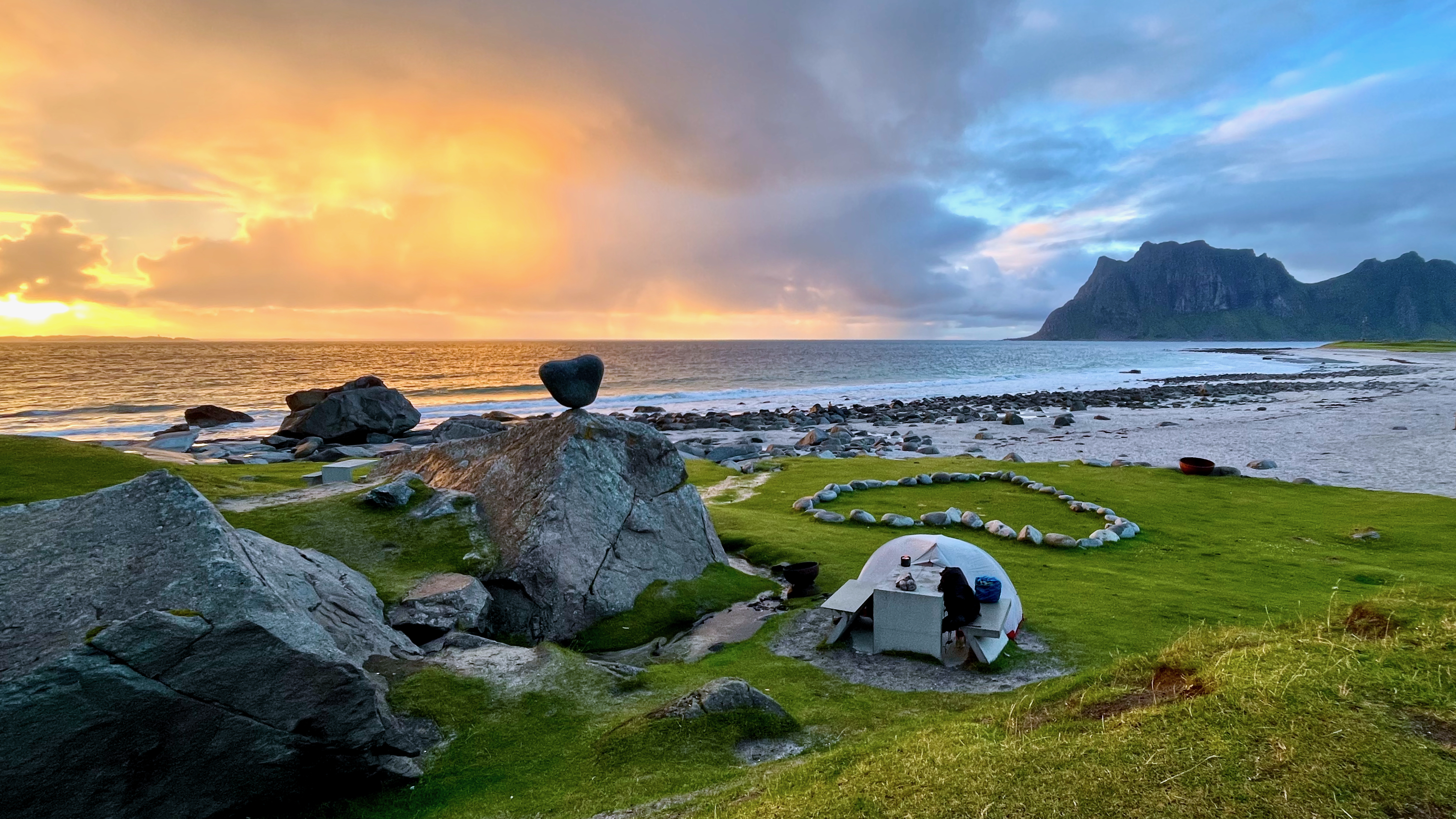
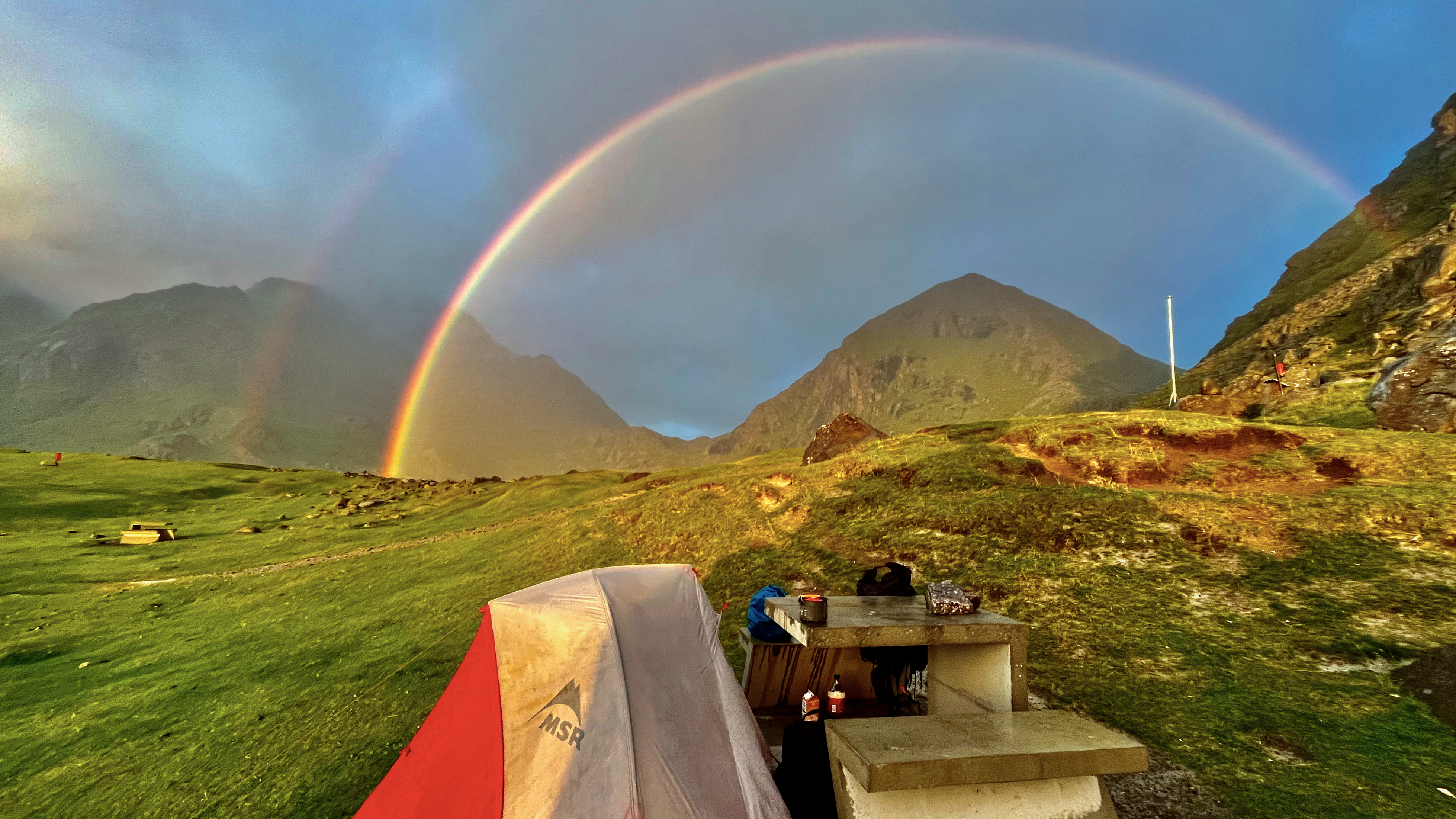
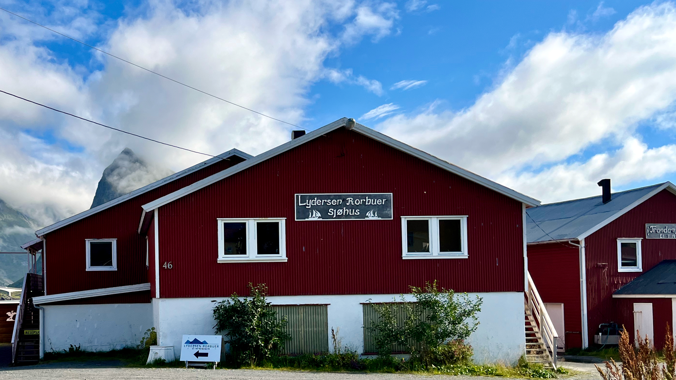
I found a possible campsite close to the trailhead parking lot — then hid my gear in a waterproof bag in the trees.

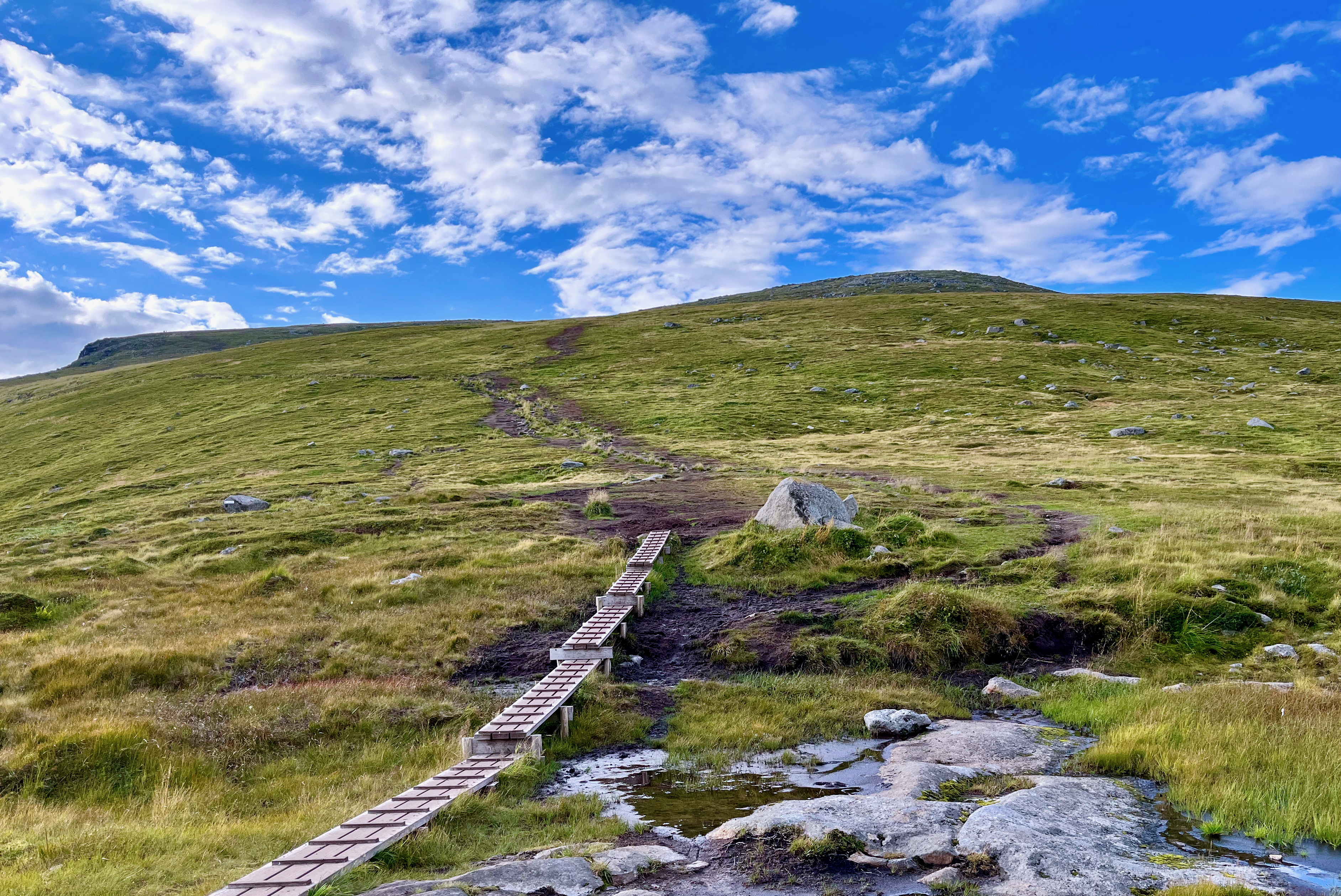
What I liked about Holandsmelen, relative to other Lofoten peaks, is that the going is not an unrelenting climb. There are flat sections on this half dayhike.

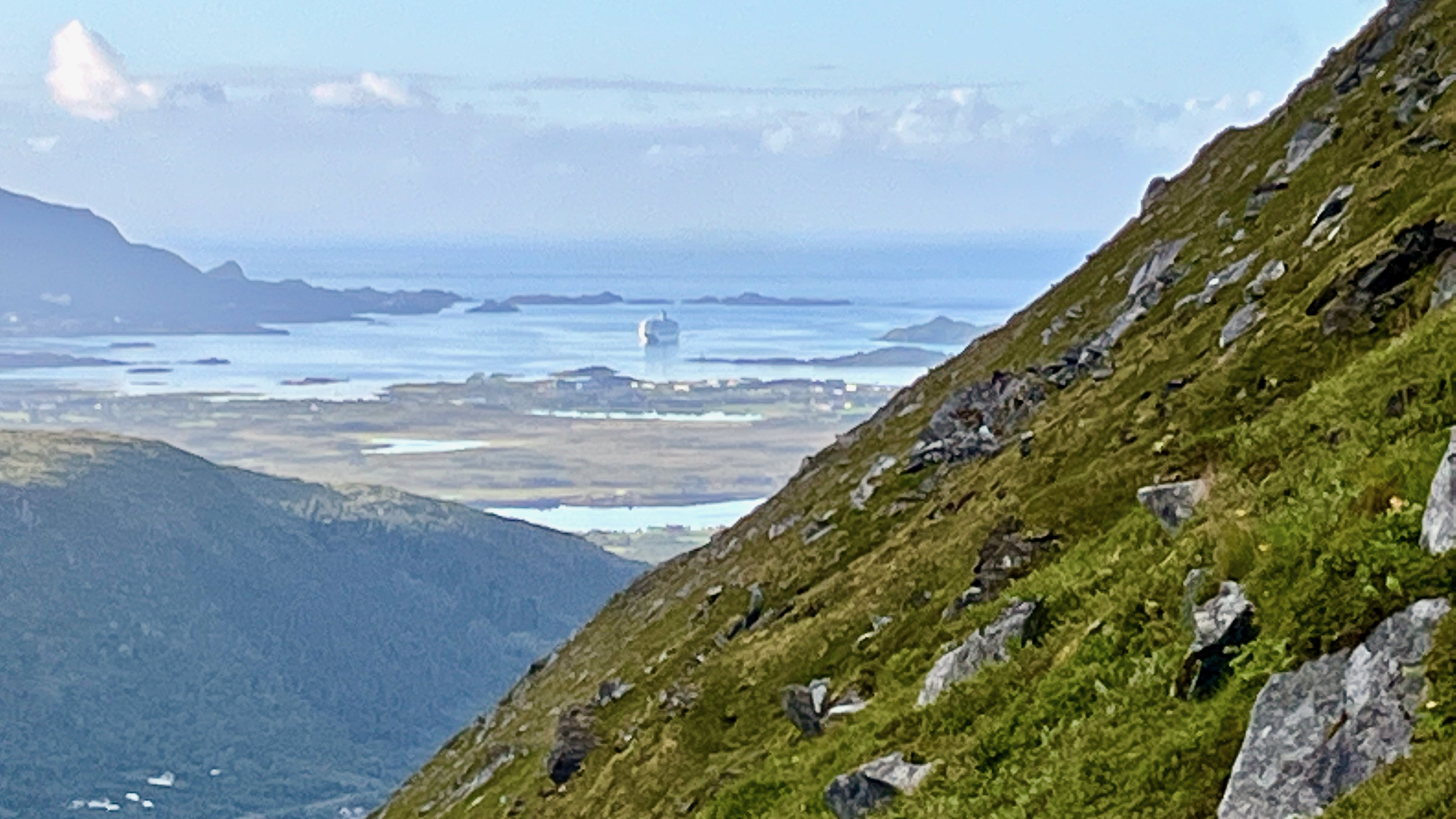
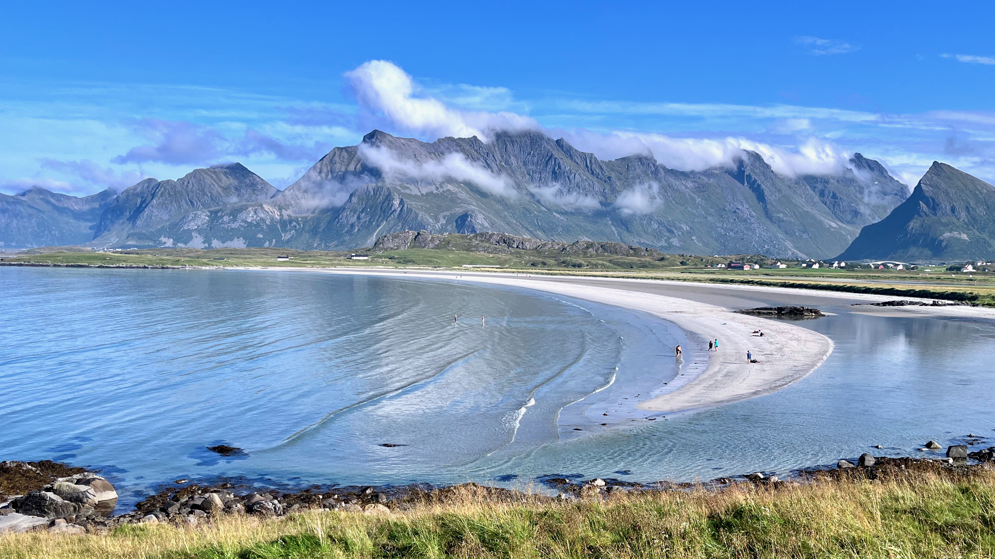
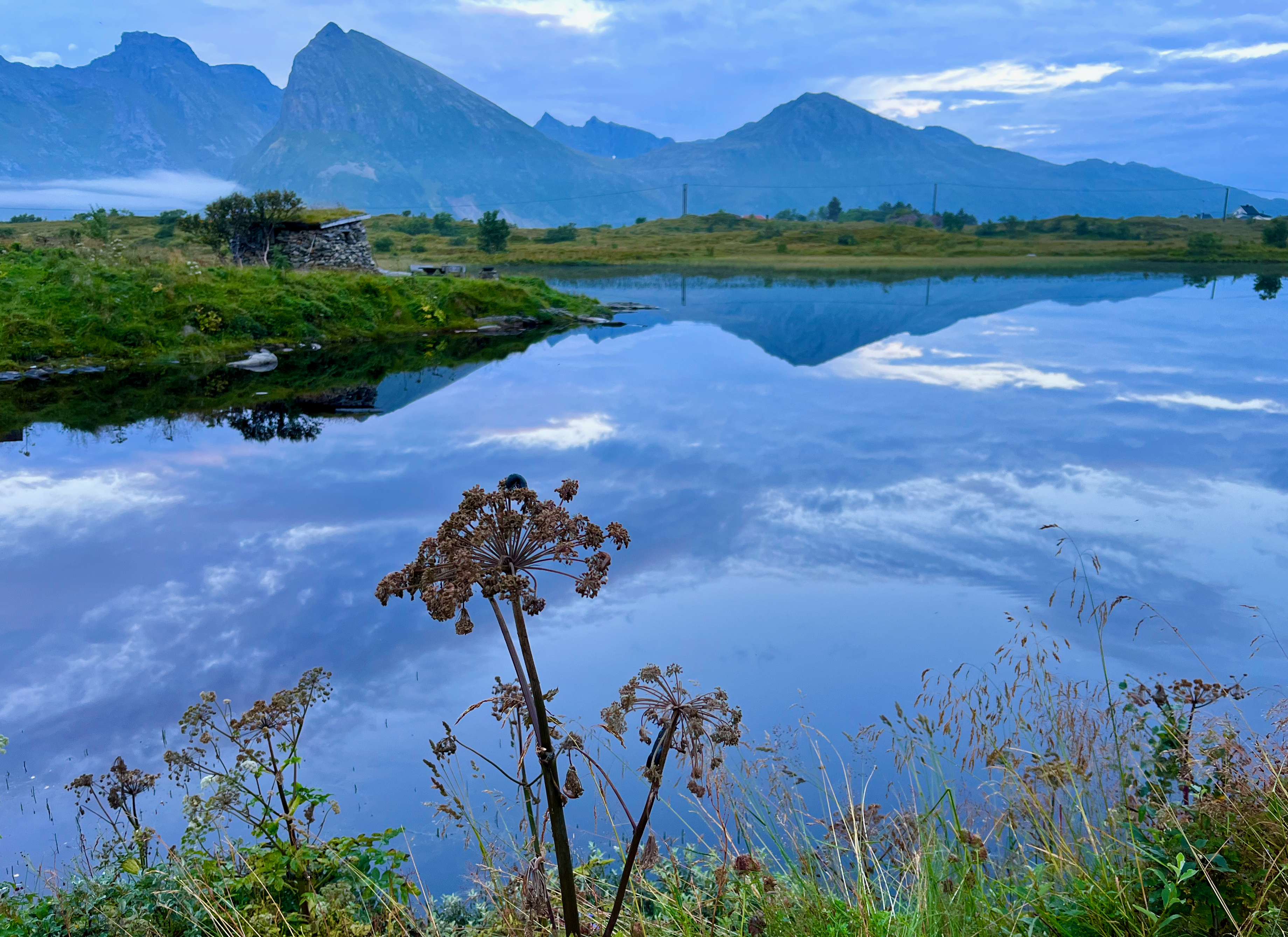
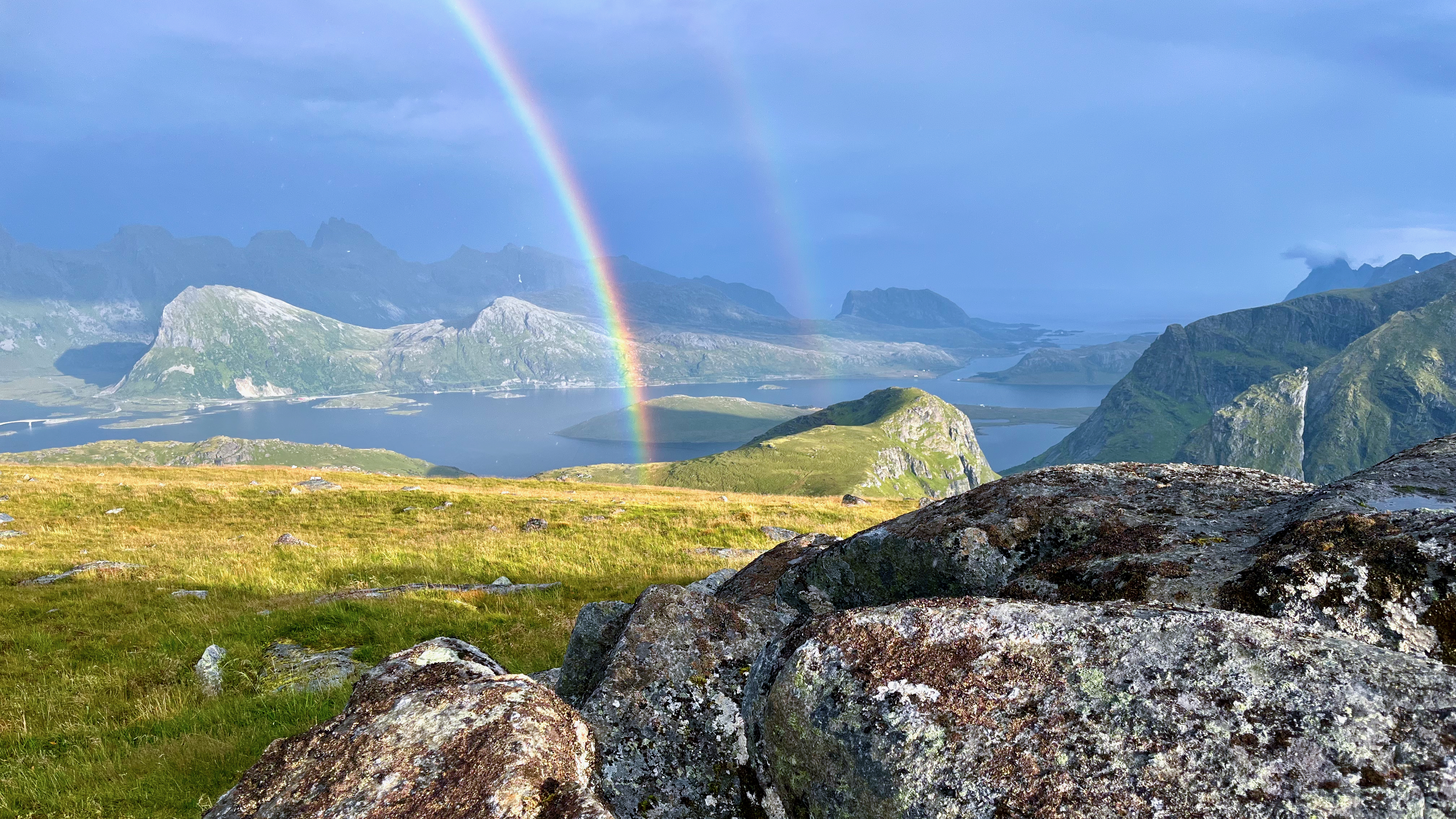
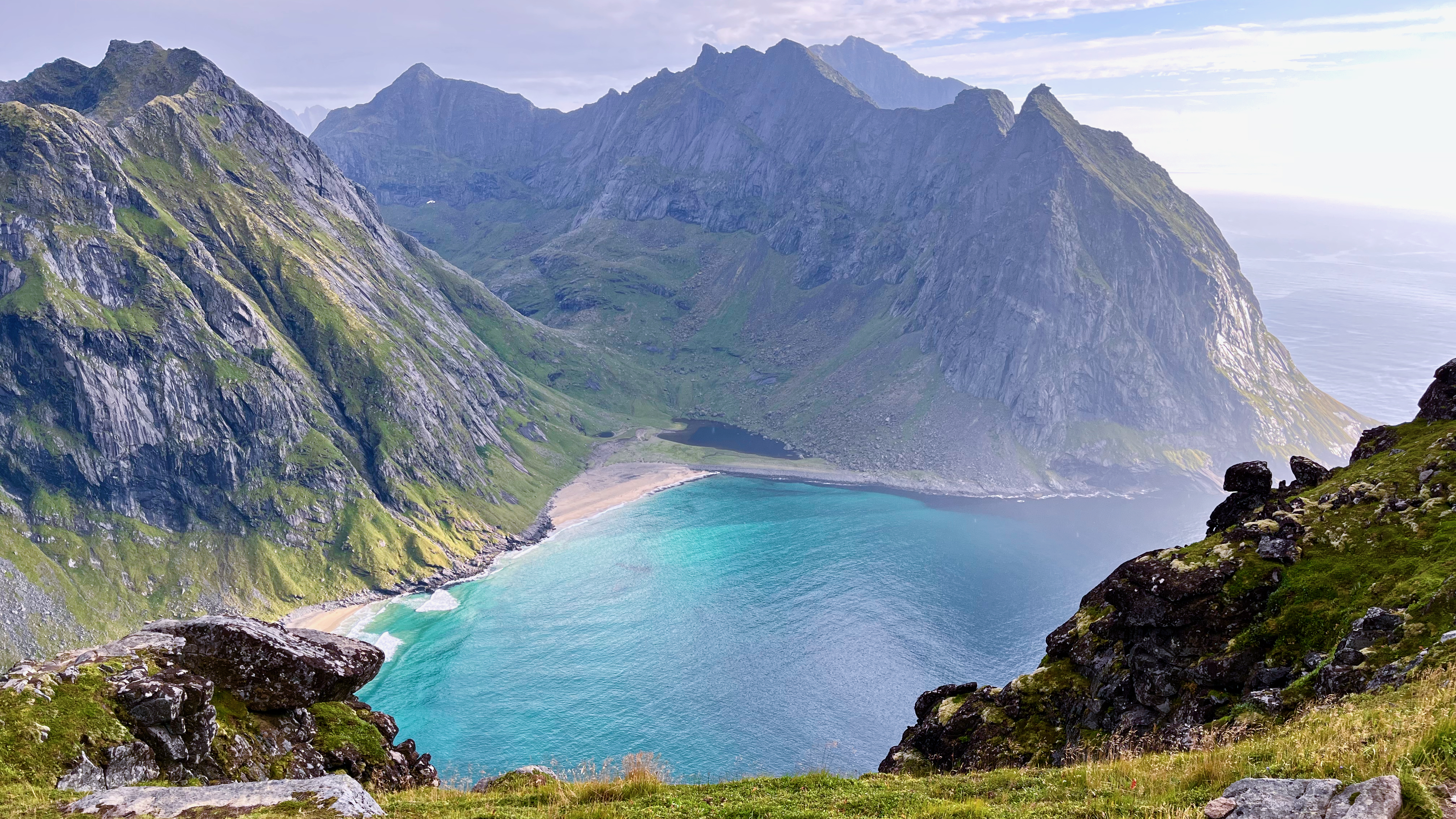
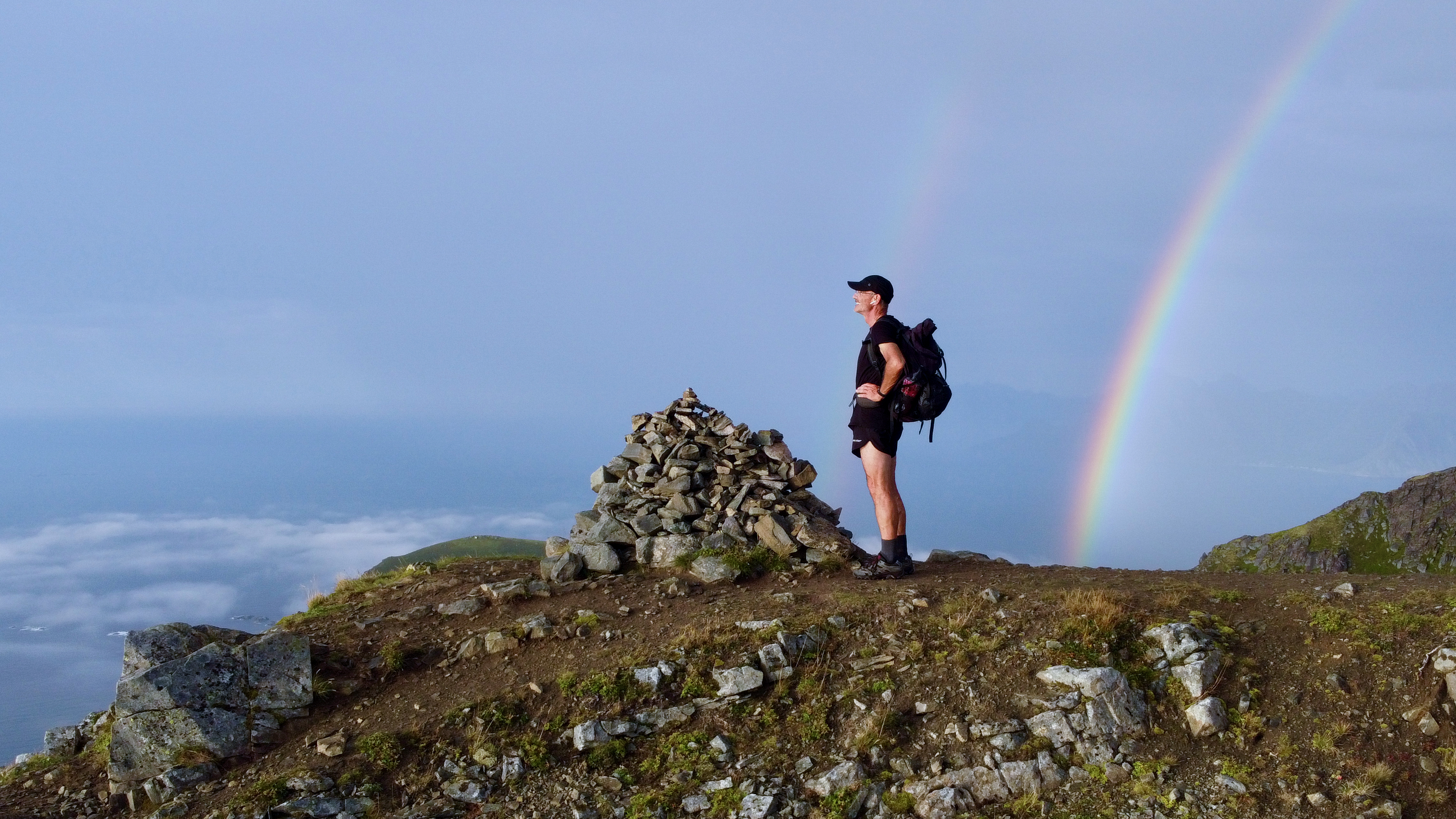
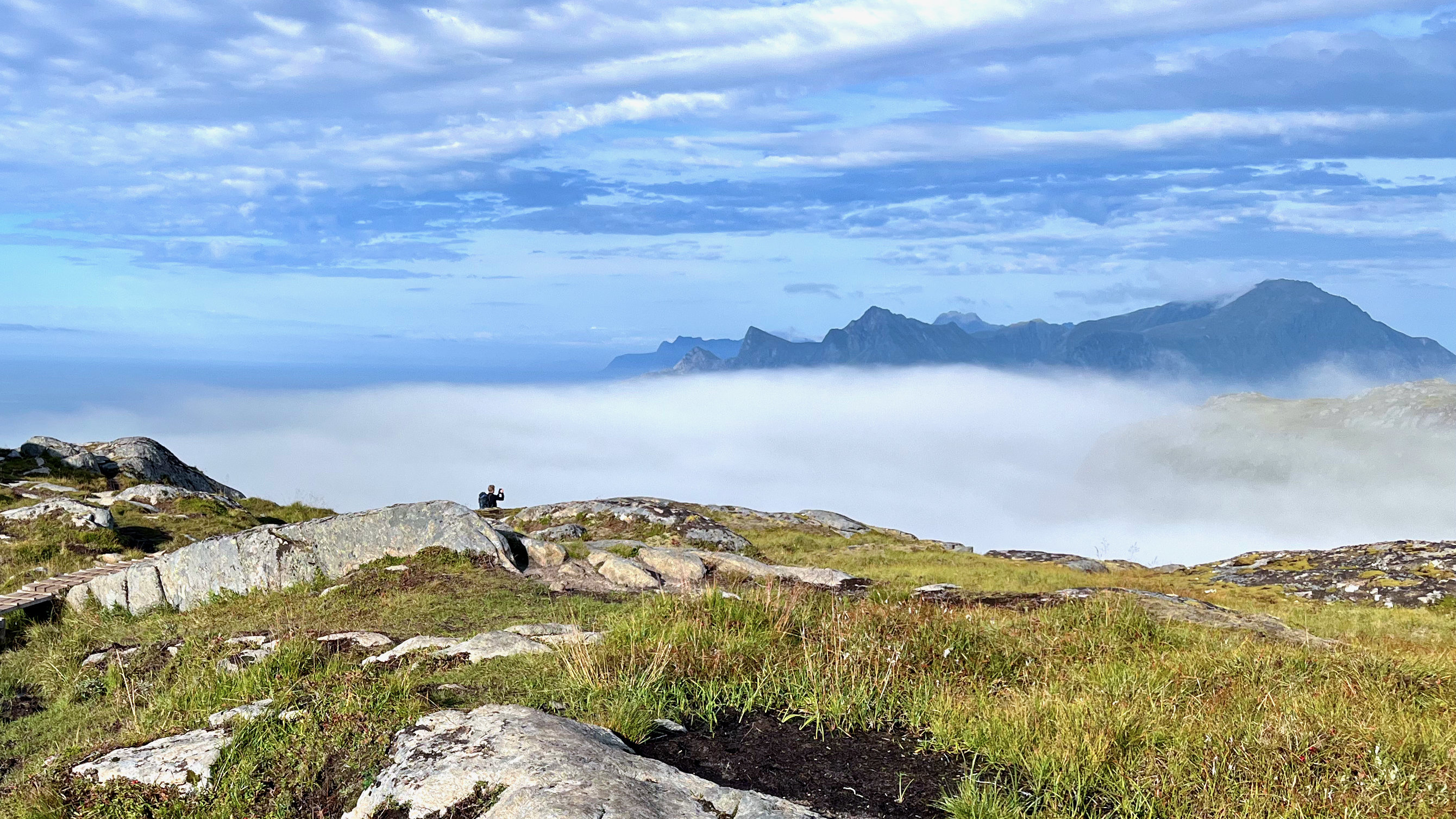
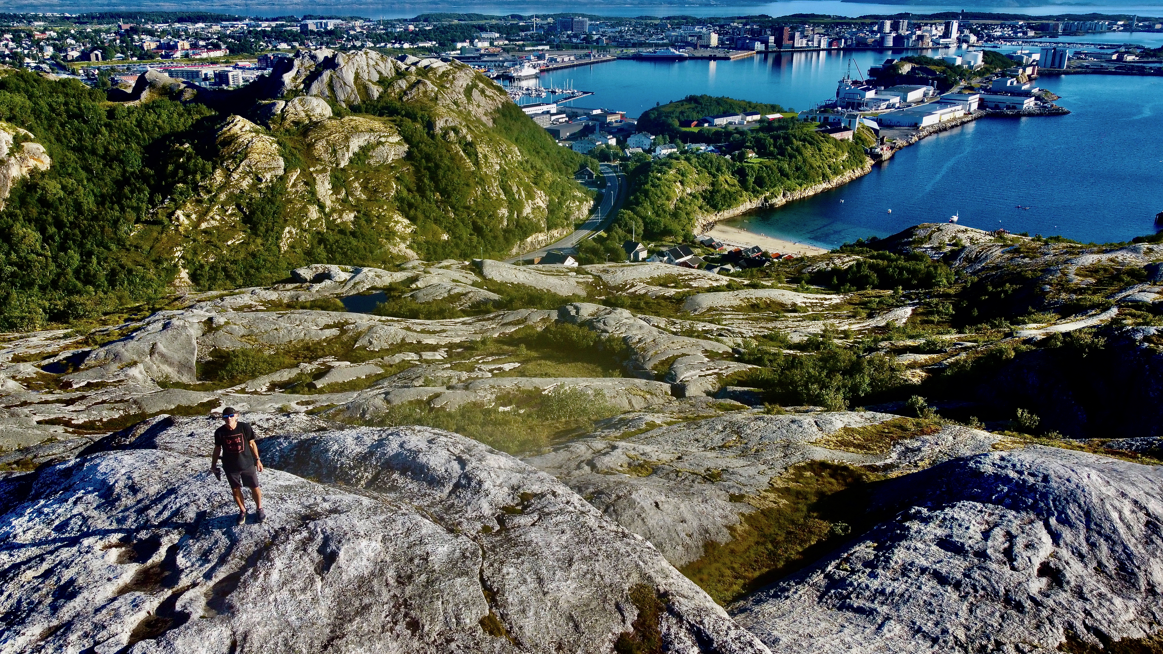
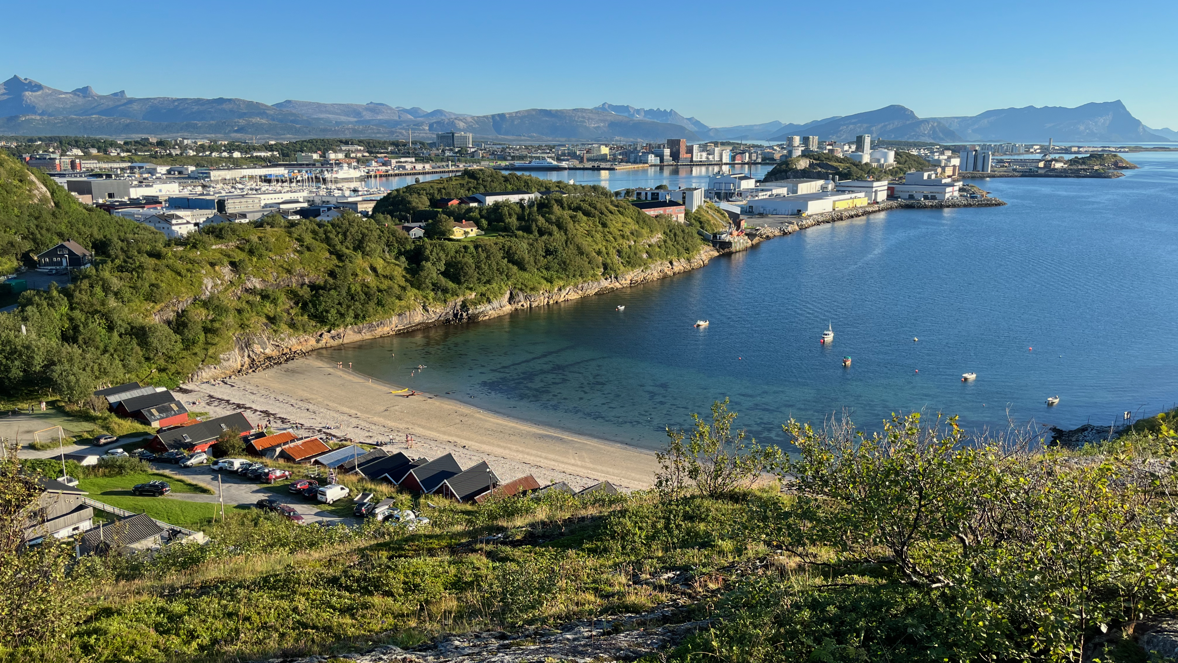
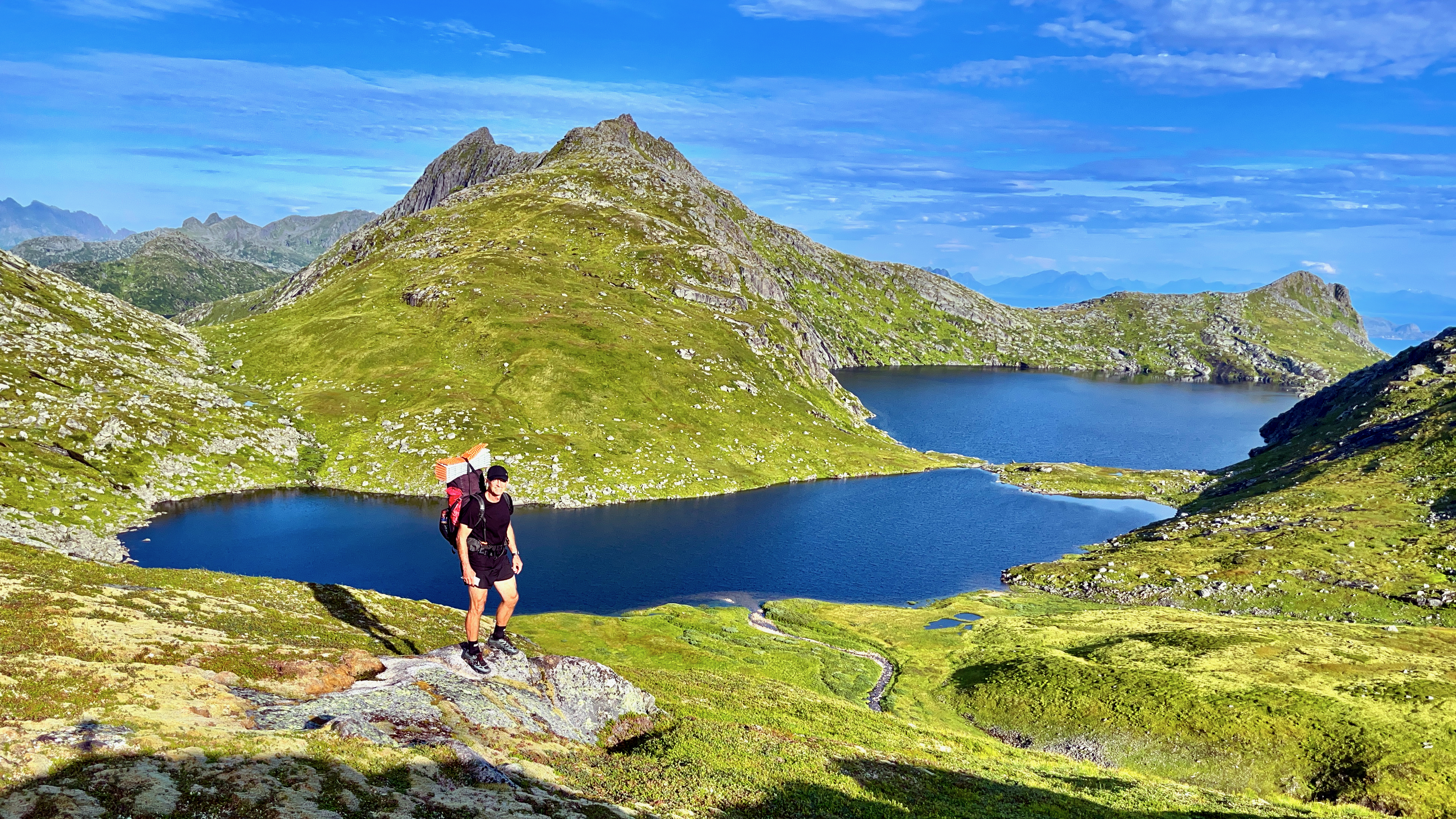
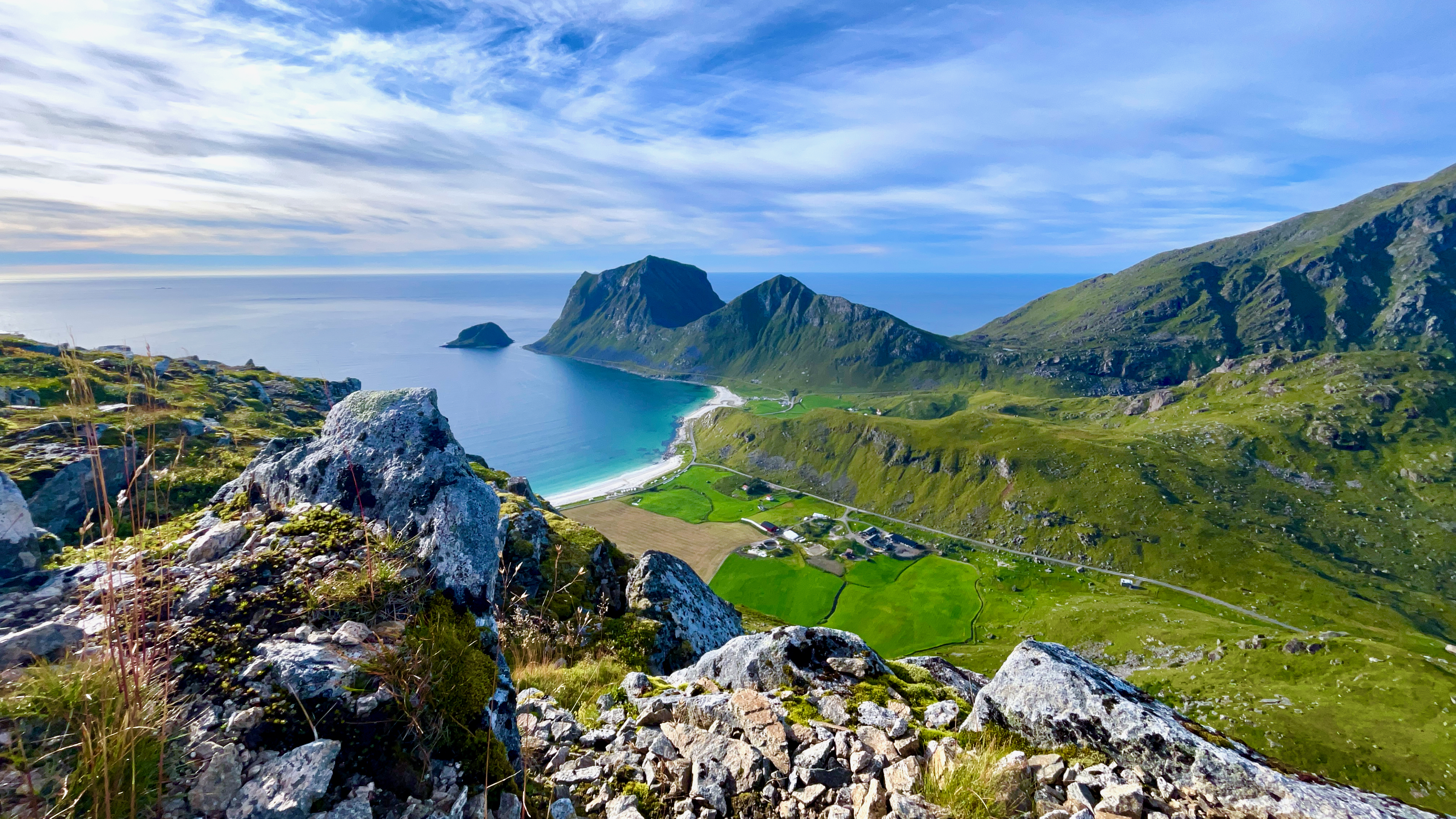
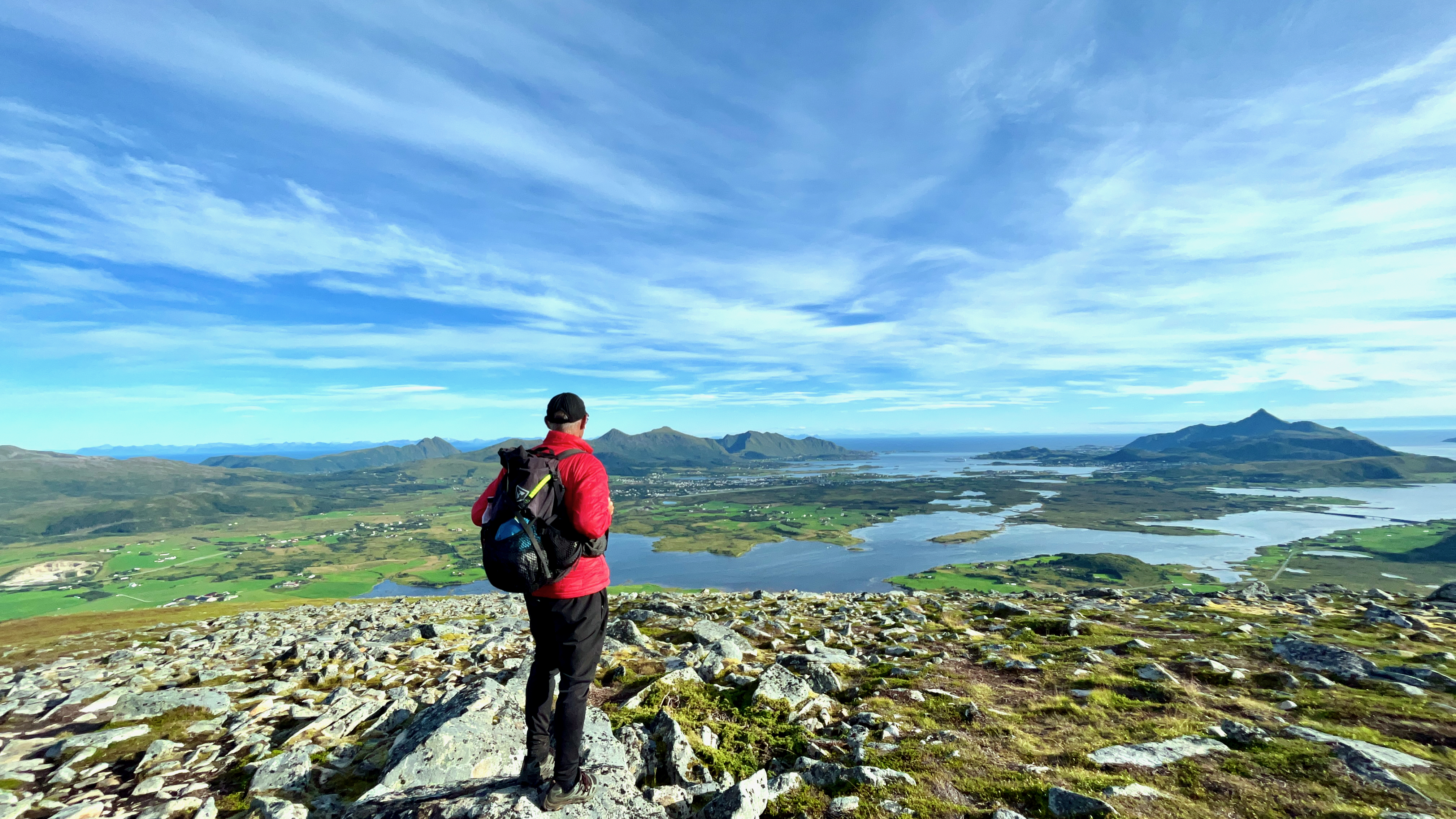
As usual, the views from the top are Lofoten breathtaking.

Looking over to Leknes

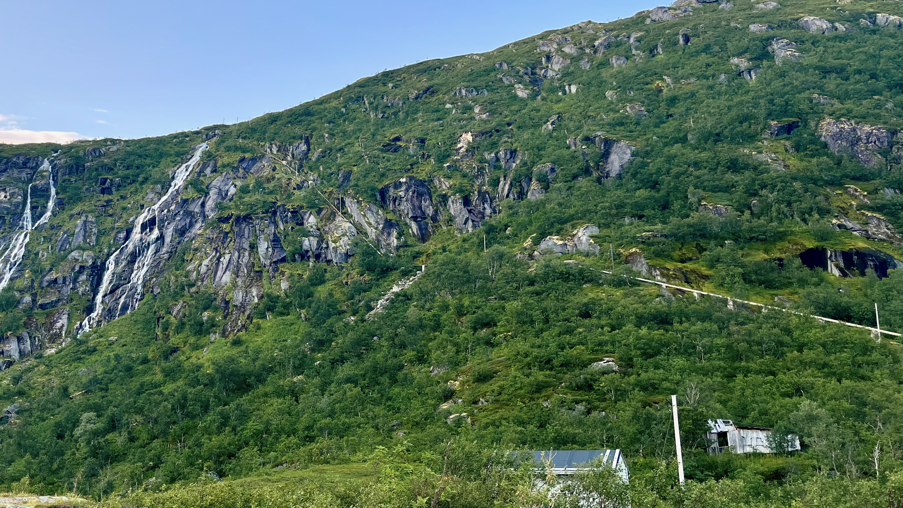
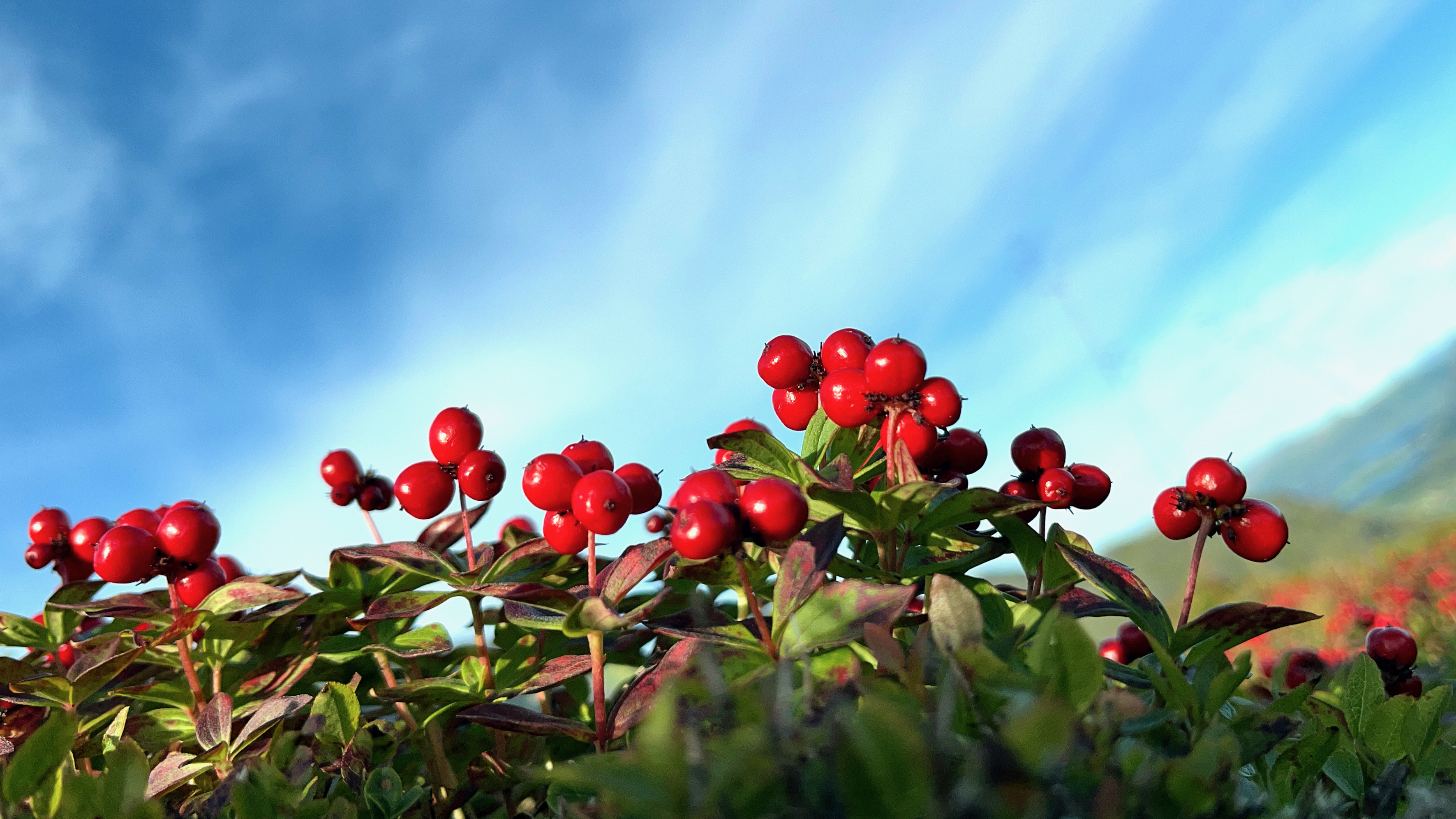
Here’s my favourite photo from the hike. I believe these tiny berries are edible.

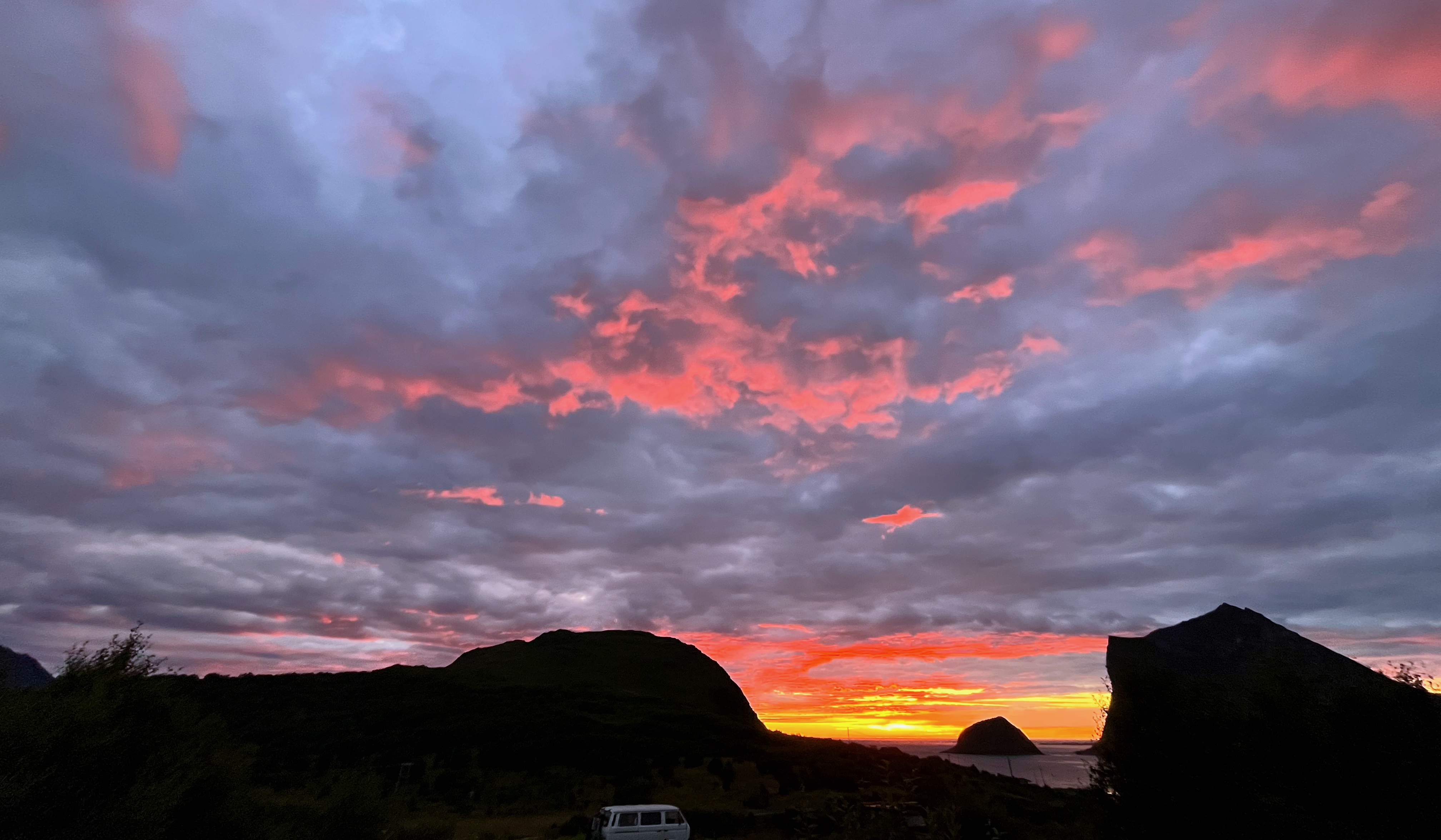
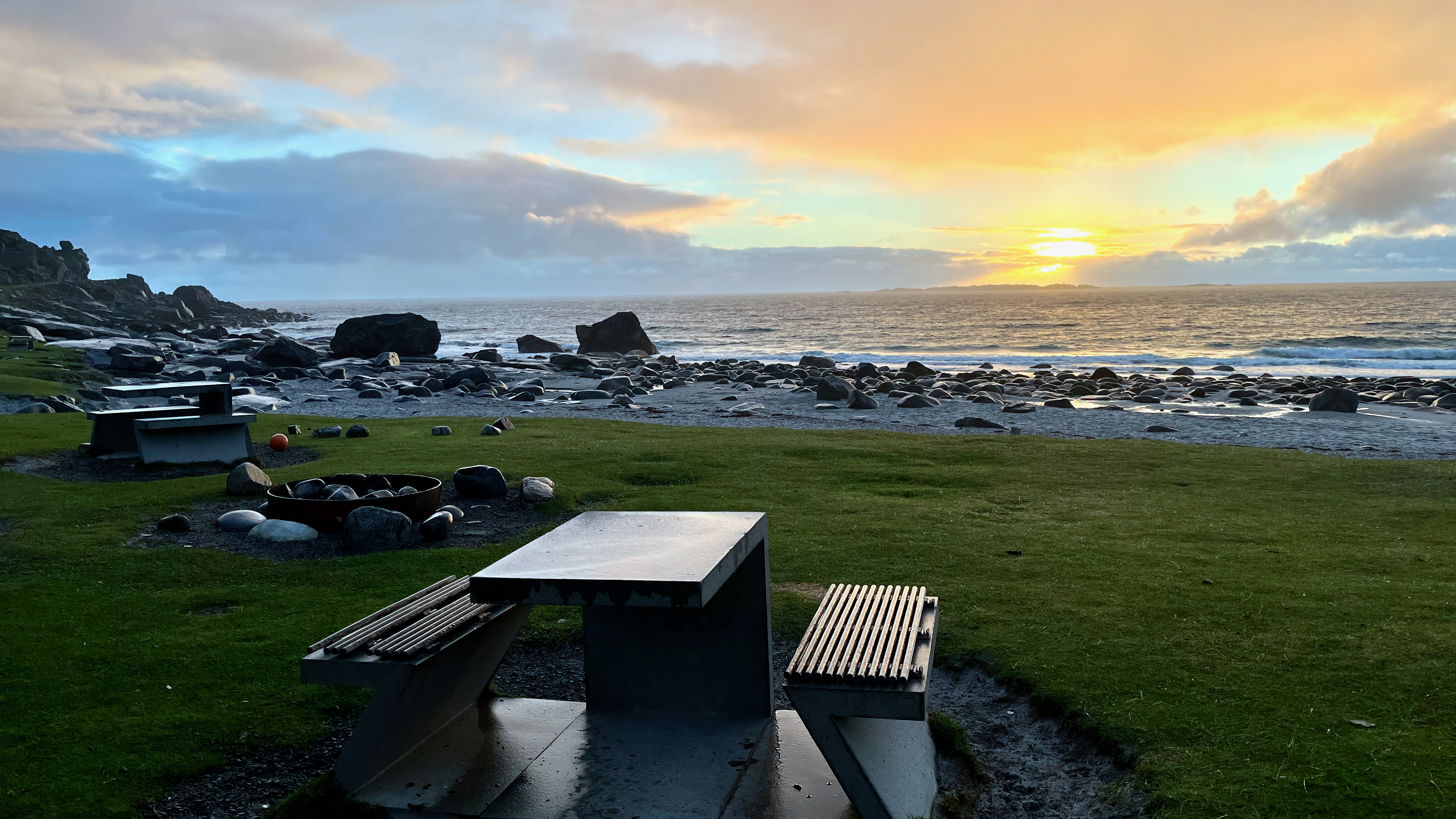
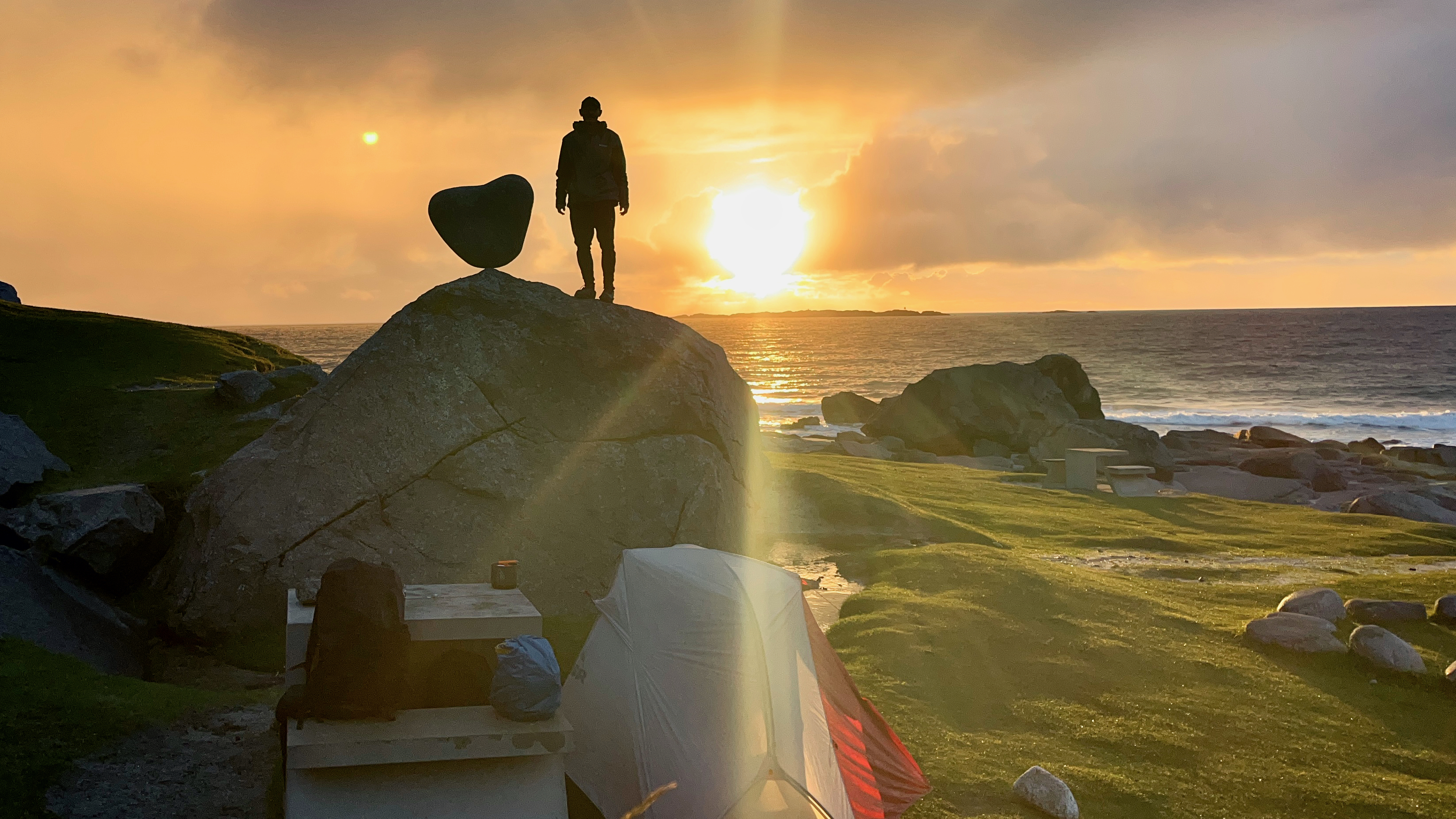
Once again, sunset was long and astonishing.

AllTrails

Climbing Veggan from Uttakleiv Beach, Lofoten, Norway

Trip report by BestHike editor Rick McCharles

Click PLAY or watch it on YouTube.

My best campsite in Norway was at Uttakleiv beach. $20. The only time I paid for camping in a nation where you can camp almost everywhere free.

Early next morning I had to decide whether to climb Veggen or the more popular Mannen.

For no particular reason, I decided on Veggan (“the wall”) which is a bit higher at 489m. Starting early morning, I had the summit to myself.

Like many day hikes in Norway, it’s an unrelenting climb with one good photo stop at lake Vasskarvatnet.

On departing Uttakleiv, I enjoyed the walk along the coast to Haukland beach rather than try to walk through the automobile tunnel.

BONUS ➙ more footage of the beach. Click PLAY or watch it on YouTube.

Hiking 226 km on the ROTA VICENTINA, Portugal

Click PLAY or watch it on YouTube.

If interested in planing for Portugal yourself, check Roberto’s TIPS:

Click PLAY or watch it on YouTube.

The BEST section is the 4 days from Porto Covo to Zambujeira do Mar.

Click PLAY or watch my highlights from those 4 days on YouTube.

related – Fisherman’s Trail, Portugal – Detailed Guide

Hiking Sandbotnen beach to Ryten Summit, Lofoten, Norway

Trip report by BestHike editor Rick McCharles

There are a few options for climbing Ryten. And connecting other summits and beaches.

A beautiful day, I opted to start on Sandbotnen Beach, messing around for an hour before finally starting up the super popular Ryten hike.

With side trips that ended up about 12km and 673m elevation gain.

Click PLAY or get a glimpse on YouTube.

I stayed at the excellent nearby Lydersen Rorbuer hostel.

It is amazing to see beautiful sand beaches well above the Arctic Circle.

Sandbotnen beach, Lofoten

It’s muddy to start, though — for a welcome change in Norway — there are some helpful boardwalks.

Part way up there are some pretty lakes.

Sheep near the top of the mountain.

The weather was typical: sunny, rainy, windy, calm … with threatening lightning. 😀

That’s Kvalvika Beach way down below. I didn’t make the detour but wished I had done so.

Kvalvika Beach

Great views from the top.

Ryten summit cairn

On the way down, clouds formed in the cooler valleys.

There’s a mountain hut on Ryten.

Of the many famous day hikes I’ve done in the Lofoten archipelago, Ryten is one of my favourites.

related – Earth Trekkers Trip Report

Hiking out of Bodø, Norway

The gateway to the wonderful Lofoten archipelago is the town of Bodø, the end of the train line north.

It’s usually cheaper and easier to fly as the train is a 17 hour overnight journey from Oslo. The town is so compact that you can easily walk from the airport to the train station.

On my two trips to the awesome Lofoten hikes, I’ve spent quite a few days in Bodø — supposedly in transit.

It’s worth wandering the streets of Bodø.

ALSO — there is some hiking available walking from the centre of town.

I went first to Bestefarvarden. An interesting scramble among rocky cliffs overlooking the sea.

DCIM101MEDIADJI_0150.JPG

The “hike” starts close to this beach, well above the Arctic Circle.

I left a Summit Stone there.

Click PLAY or get a glimpse on YouTube.

From there, I walked through an industrial zone to reach the city fortress (redoubt). Small, but interesting. With good views over to Bodø centre.

In addition, many tourists visit Saltstraumen, a small strait with one of the strongest tidal currents in the world. 

There’s more to Bodø than only a transit point.

HERO Video – Reinebringen, Lofoten, Norway

The main reason to buy a drone is so you can fly to Norway and get the HERO video atop Reinebringen, likely the most popular photo op above the Arctic Circle. 😀

Click PLAY or watch it on YouTube.

Click over to our Reinebringen information page for details on how YOU can climb this famous peak.

It’s one of our top 10 day hikes in the world.

My Arctic Norway Cycling & Hiking Highlights

BestHike editor Rick McCharles

Though I had to cancel my planned 3000km bikepacking adventure after SAS (Scandinavian Airlines) left my bike box at Heathrow for over a month 🤨, I still enjoyed my 4-5 weeks above the Arctic Circle.

Check my short HIGHLIGHTS VIDEO.

Click PLAY or watch it on YouTube.

Oregon Coast Trail is NOT REALLY a Trail 😀

Forced off the Pacific Crest Trail due to forest fire, Ryan (Kodak) Brown and his partner Ilse Cinnamon Praet decided on Oregon, instead.

The two cofounded Wilderland Media.

It’s more of a ROUTE, not a continuous trail. More than 150 miles (240 km) of the route is on pavement.

Walked in its entirety, linking each trail/beach section, the distance is approximately 425 miles. …

The northern trailhead is at the base of the south jetty of the Columbia River, approximately 4 miles (6 km) north of the campground of Fort Stevens State Park and about 13 miles (21 km) from the city of Astoria.

The trail runs north-south along the entire Oregon Coast, following the shore as closely as practical.

For many portions of the route, it is beach walking, mostly on sand. In populated areas it often follows the nearest street to the shore.

Many parts of the trail leave the beach and take an inland path, usually where land formations make the shoreline impassable, such as at Cape Kiwanda.  …

Wikipedia

Click PLAY or watch it on YouTube.

Hiking in Svalbard. … Also, WHERE is Svalbard? 😀

Svalbard is a Norwegian archipelago in the Arctic Ocean. North of mainland Europe, it is about midway between the northern coast of Norway and the North Pole. …

The largest island is Spitsbergen

The largest settlement is Longyearbyen. …

Click PLAY or get a glimpse on YouTube.

I QUIT the Long Crossing of Lofoten Archipelago, Norway

BestHike editor Rick McCharles

Inspired by Cam Honan’s 2018 adventure, I set out for the Long Crossing – a 160 km (99 mi) hiking route through the spectacular heart of the island chain. 

It’s not all that popular yet. In fact, AllTrails doesn’t have it. And it has every trail everywhere.

After one day — 9 hours in perfect weather — I’ve decided to QUIT. That day was too difficult and too dangerous for me carrying a heavy pack.

Olderfjorden pass

It LOOKS easy in the photo. But it’s mostly route finding through marshy terrain. Worst was a risky descent clutching a water pipe and safety ropes. Starting up near the top of the waterfall.

This was the Kleppstad to Svolvær leg.

I’d already visited Lofoten on another trip, doing most of the popular day hikes.

I’ll follow the general path of the Long Crossing. But camp low. And climb high with a day pack. Weather will dictate which established day hikes I choose.

I’ll be following recommendations set out in the Rando-Lofoten guidebook by Souyris & Brede:

Hiking the Lofoten islands

Wish me luck. Things tend to #fail in Arctic Norway — usually due to weather.