Though I had to cancel my planned 3000km bikepacking adventure after SAS (Scandinavian Airlines) left my bike box at Heathrow for over a month 🤨, I still enjoyed my 4-5 weeks above the Arctic Circle.
It’s more of a ROUTE, not a continuous trail. More than 150 miles (240 km) of the route is on pavement.
Walked in its entirety, linking each trail/beach section, the distance is approximately 425 miles. …
The northern trailhead is at the base of the south jetty of the Columbia River, approximately 4 miles (6 km) north of the campground of Fort Stevens State Park and about 13 miles (21 km) from the city of Astoria.
The trail runs north-south along the entire Oregon Coast, following the shore as closely as practical.
For many portions of the route, it is beach walking, mostly on sand. In populated areas it often follows the nearest street to the shore.
Many parts of the trail leave the beach and take an inland path, usually where land formations make the shoreline impassable, such as at Cape Kiwanda. …
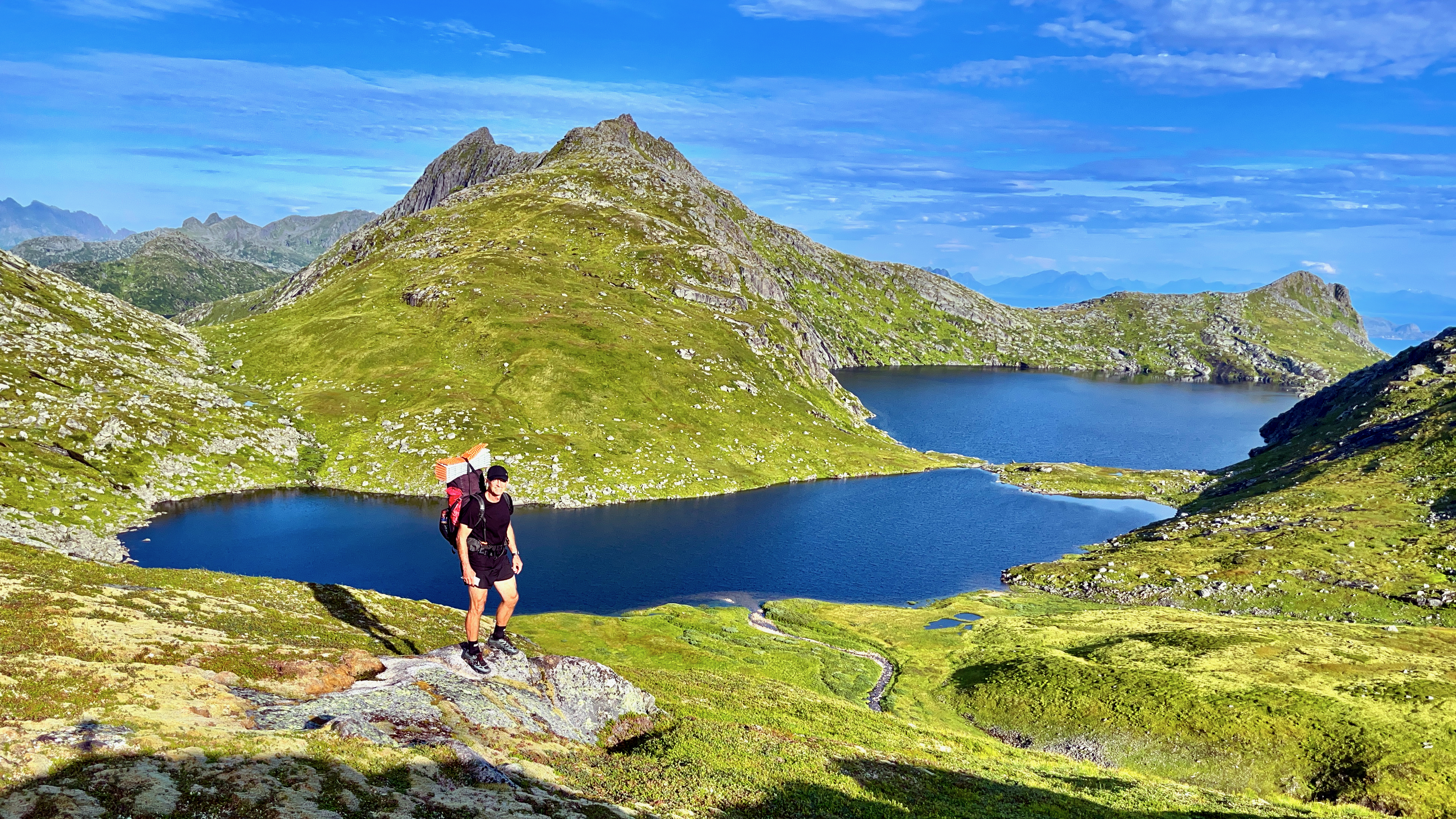
Inspired by Cam Honan’s 2018 adventure, I set out for the Long Crossing – a 160 km (99 mi) hiking route through the spectacular heart of the island chain.
It’s not all that popular yet. In fact, AllTrails doesn’t have it. And it has every trail everywhere.
After one day — 9 hours in perfect weather — I’ve decided to QUIT. That day was too difficult and too dangerous for me carrying a heavy pack.
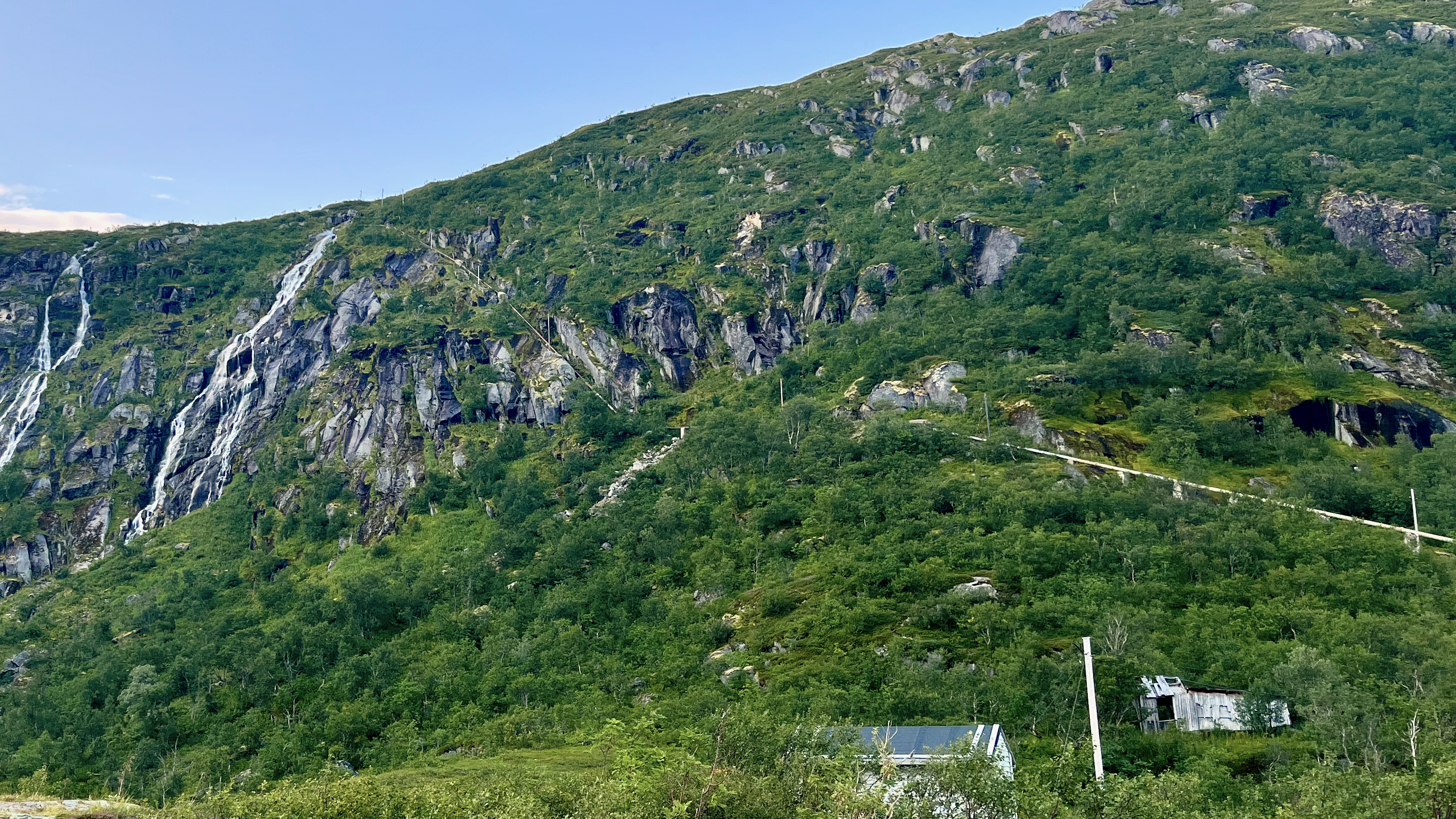
Olderfjorden pass
It LOOKS easy in the photo. But it’s mostly route finding through marshy terrain. Worst was a risky descent clutching a water pipe and safety ropes. Starting up near the top of the waterfall.
I’ll follow the general path of the Long Crossing. But camp low. And climb high with a day pack. Weather will dictate which established day hikes I choose.
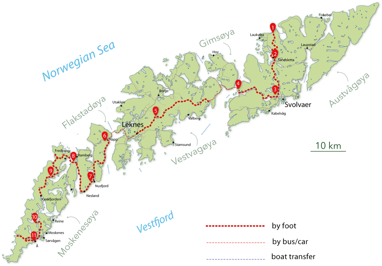
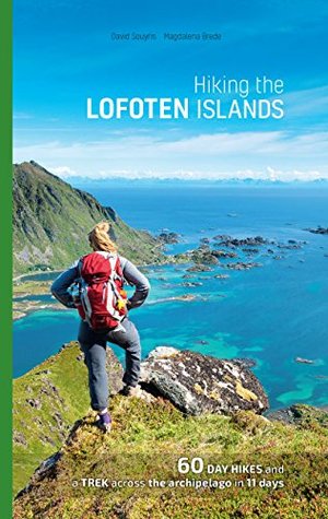
I’ll be following recommendations set out in the Rando-Lofoten guidebook by Souyris & Brede:
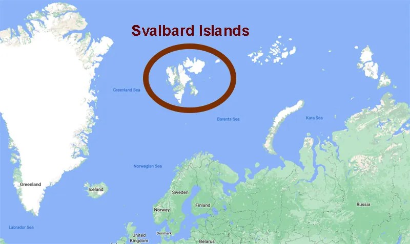
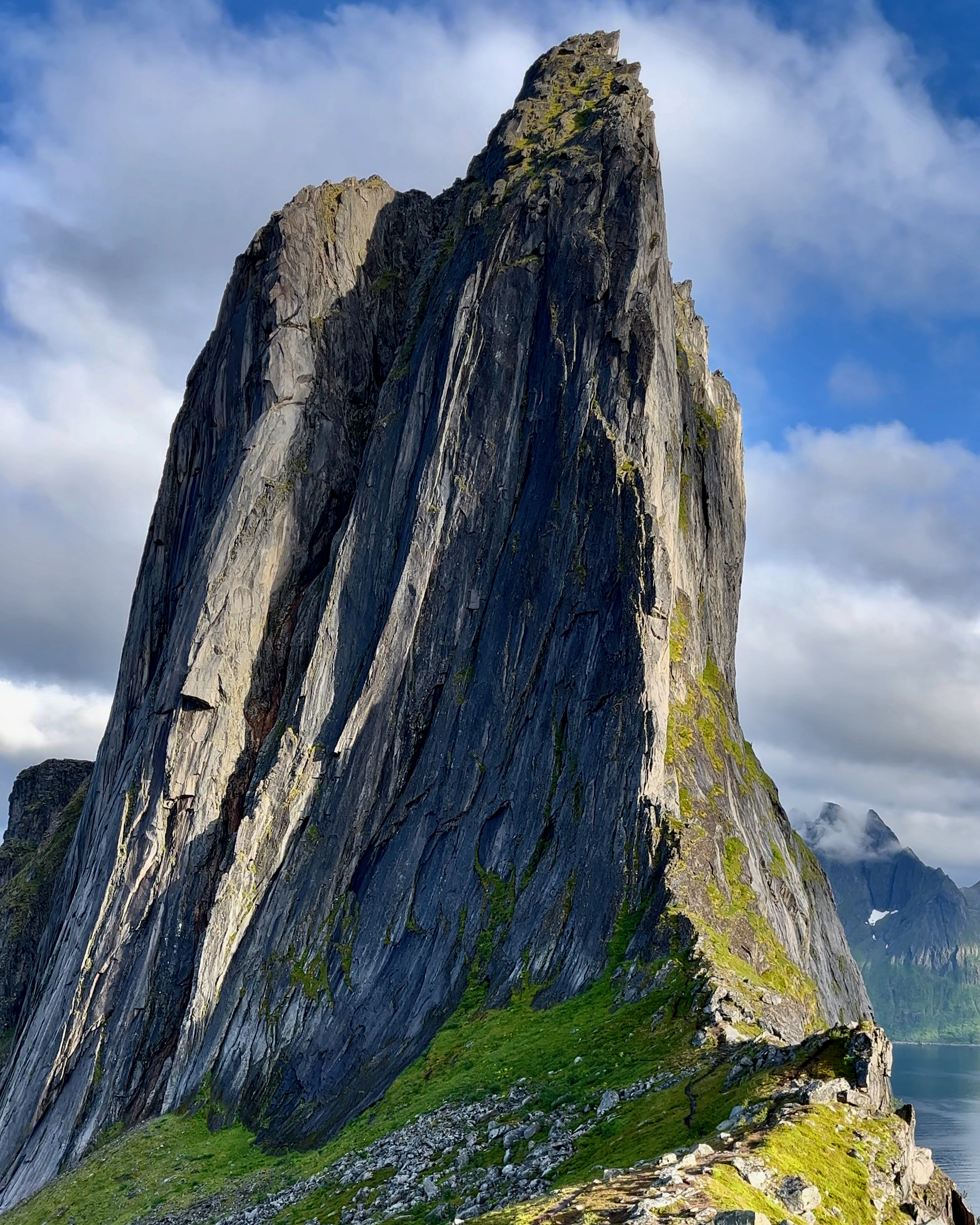
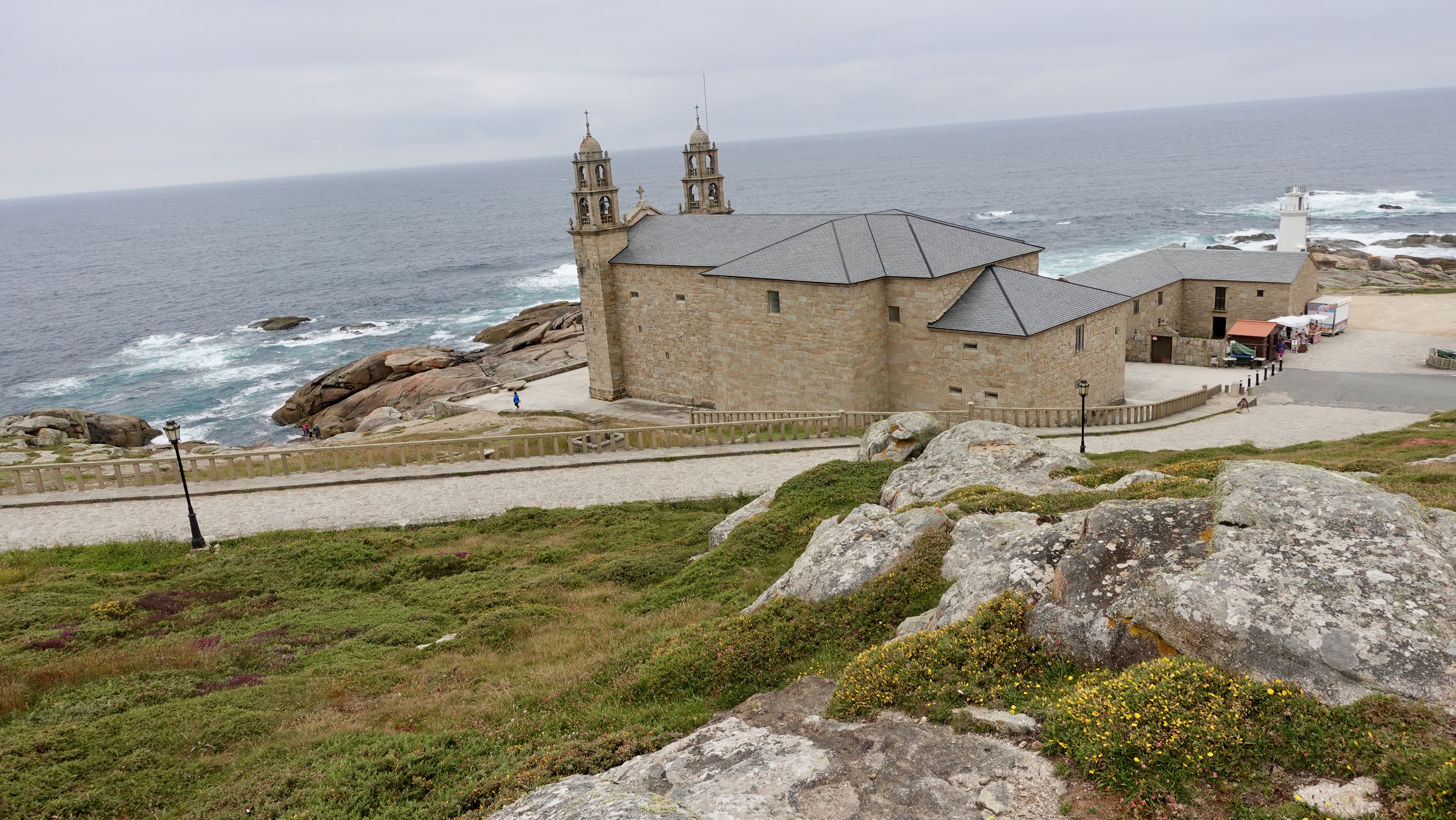
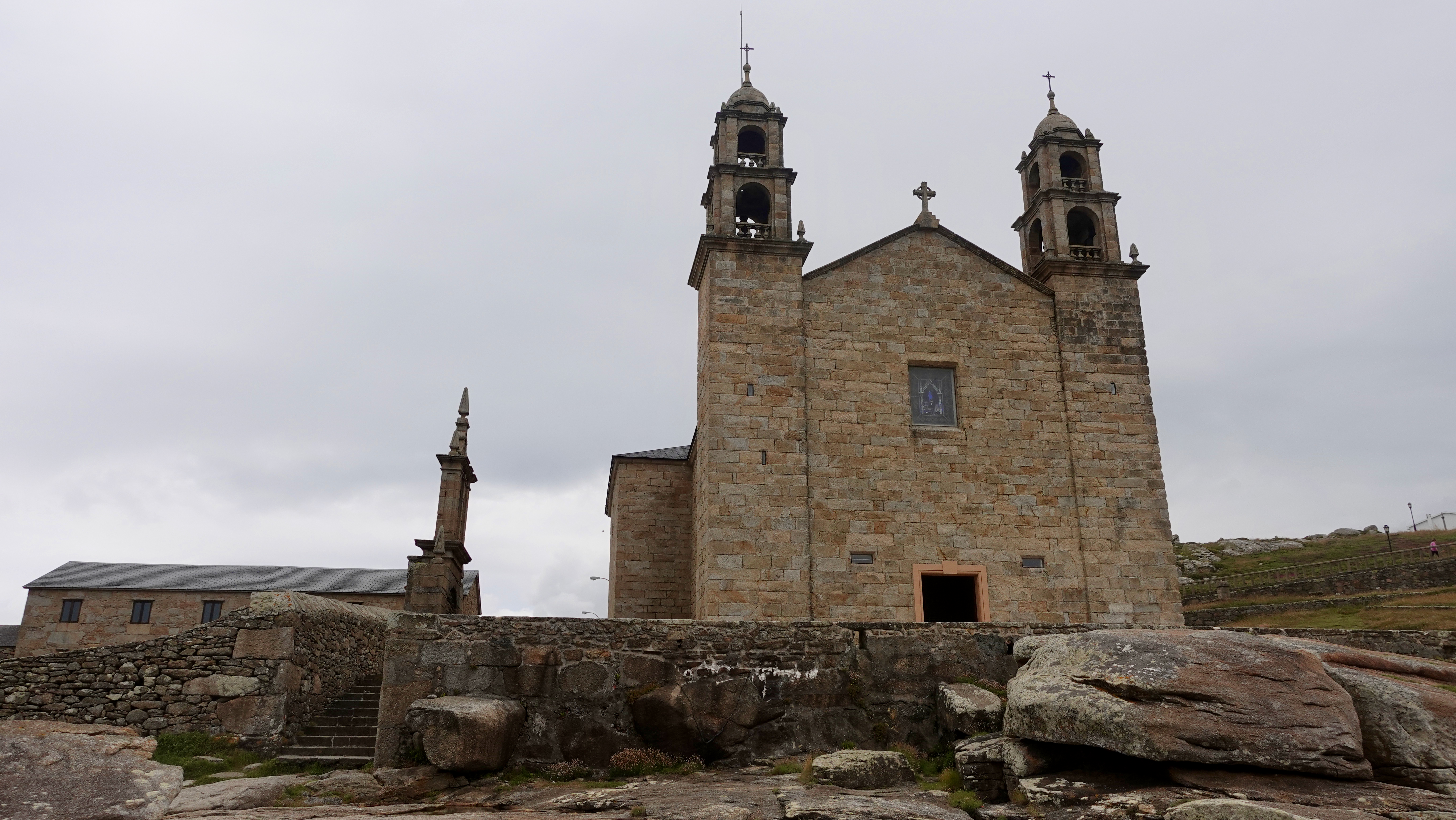
Senja is even further north than famed Lofoten archipelago , but is equally spectacular in places.
The jumping off point is remote Fjordgård, not easy to reach by bicycle.
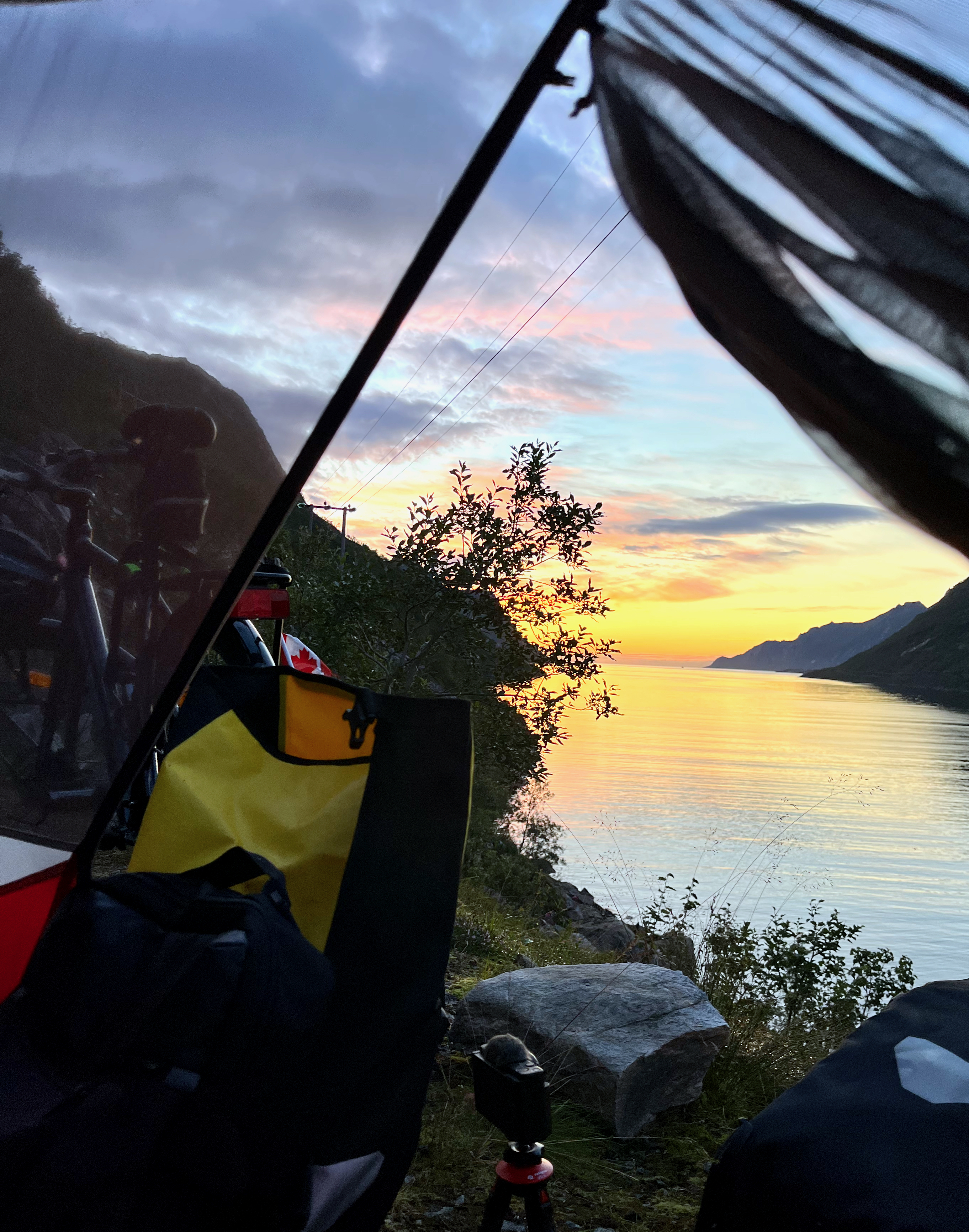
I camped for free along the ocean. A very windy night.
The east side of Segla starts rising gently, whereas the steep cliffs on the west side drop directly into the fjord. The EASY route is still challenging near the top. You’ll be using your hands.
BUT first it’s recommended to do the Hesten hike, rewarding you with the most impressive looks at the peak. 3.7 km return. Hesten is 556m.
Next climb Segla itself, if you have the energy.
Around 4km return. Perhaps 2 hours up, 1 hour down — IF you move steadily. Weather is the main factor. It can switch from sun to rain storm in just a few minutes.
Barheia is not one of the famous hikes. In fact, I only learned of it from a hiking guidebook I found at a nearby hostel.
MOST day hikes here required a lot of vertical before getting to the great vistas.
Only 350m? Only 1 hour?
Let’s GO.
It’s about 6.8km return from the trailhead — once you find it well above the highway campground.
AND it’s very conveniently located in Svensby, close to the ferry dock. You can easily walk from the ferry.
Most tourists drive right past on their way to the most popular day hike in the area, Blåisvatnet (the Blue Lake). Personally I enjoyed Barheia much better. AND had the summit to myself. The Blue Lake trail is crowded with hikers high season.
Confusingly, there’s a trailhead sign close to the campground on the highway. But the start is actually higher up the mountain, well above the campers.
Once there, you can’t get lost as it’s blazed red. Useful when the snow falls.
I flew to Tromsø to begin a long bikepacking tour of the west coast.
Sadly, SAS (Scandinavian Airlines) accepted money from me ➙ then didn’t deliver my bicycle and gear to Norway. It sat untouched at Heathrow airport for days. 🤨
Airlines should not offer flights if they don’t have what they need to deliver.
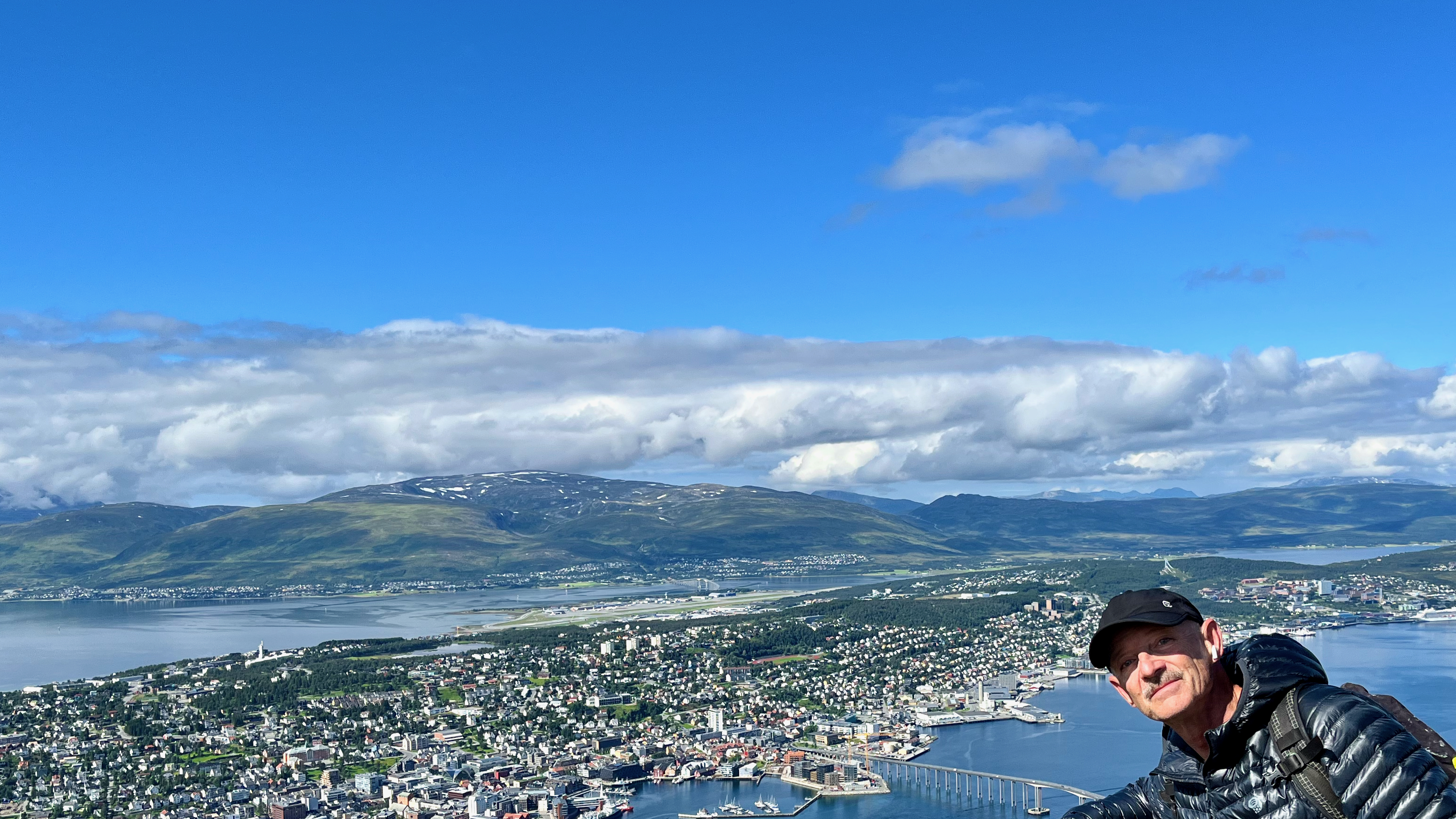
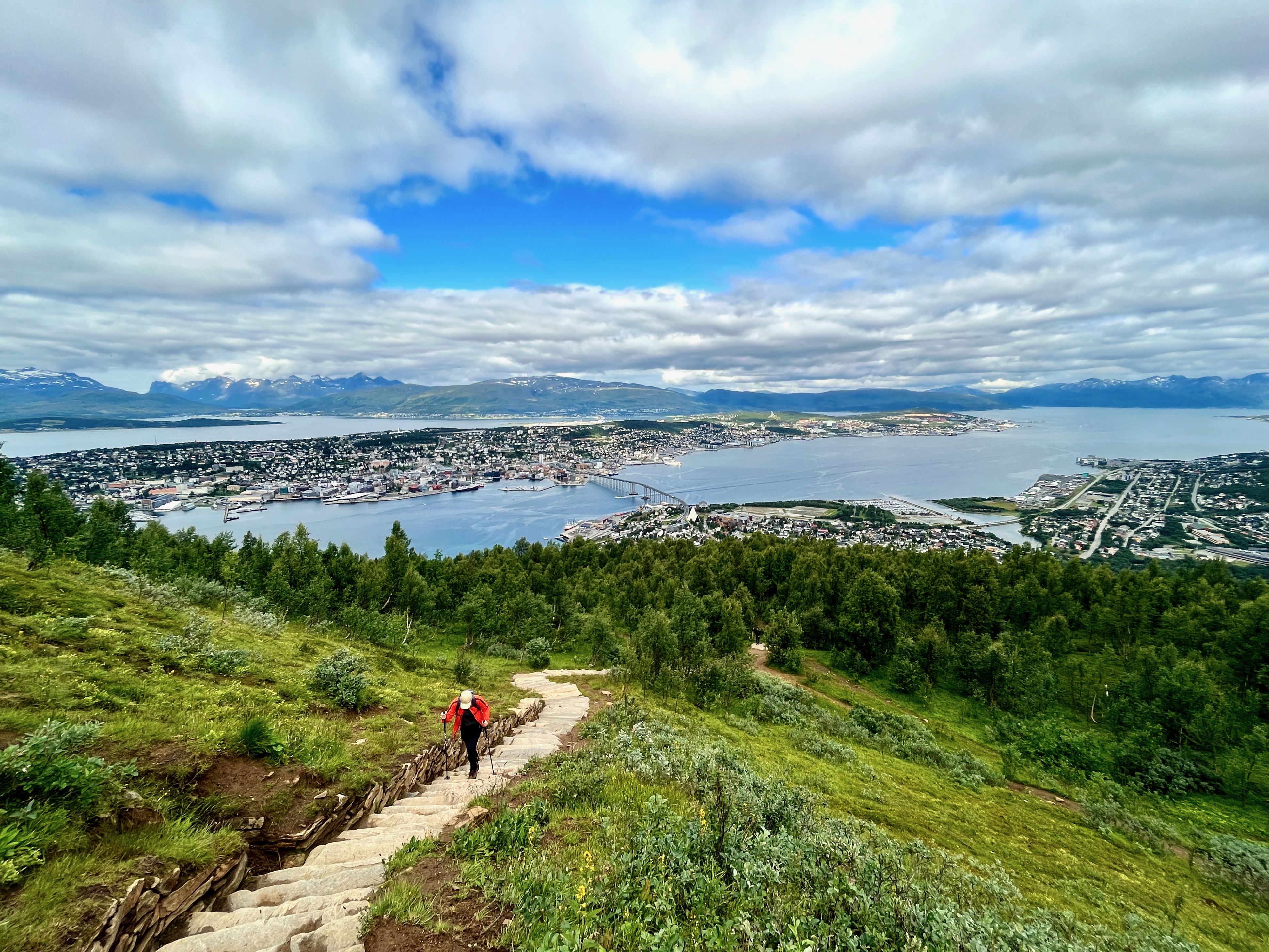
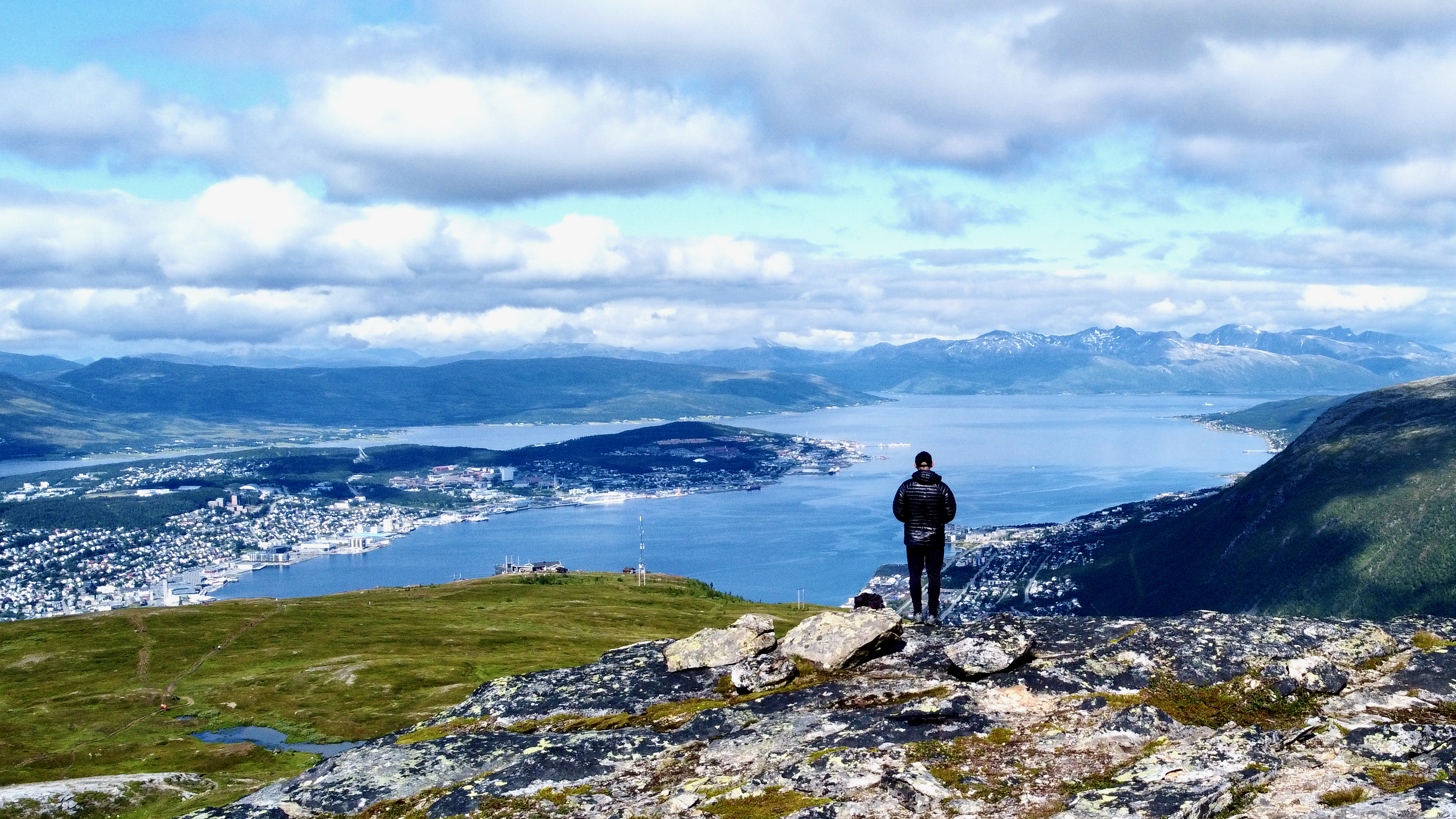
On the upside, there is excellent hiking out of Tromsø.
Most people stop at the restaurant atop the cable car. There’s an excellent view from the deck and atop a nearby rock cliff.
But if you continue UP look for a climbing hut known as Steinbøhytta. You can sleep there for free.
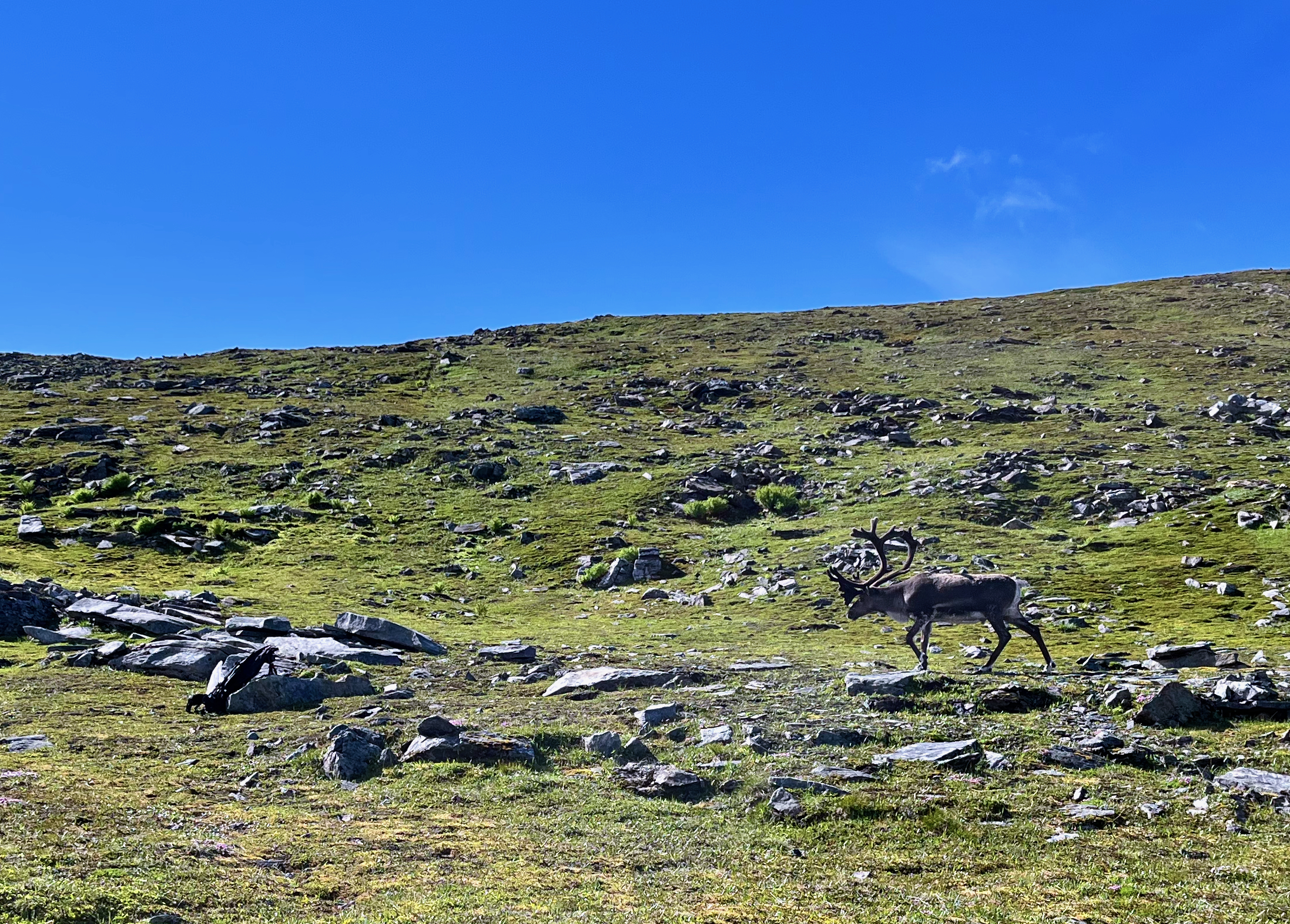
This day there were a number of reindeer grazing. They seemed unperturbed by hikers — but this big male reacted badly when encountering my backpack unexpectedly. Perhaps it looked something like a carnivore in the rocks.
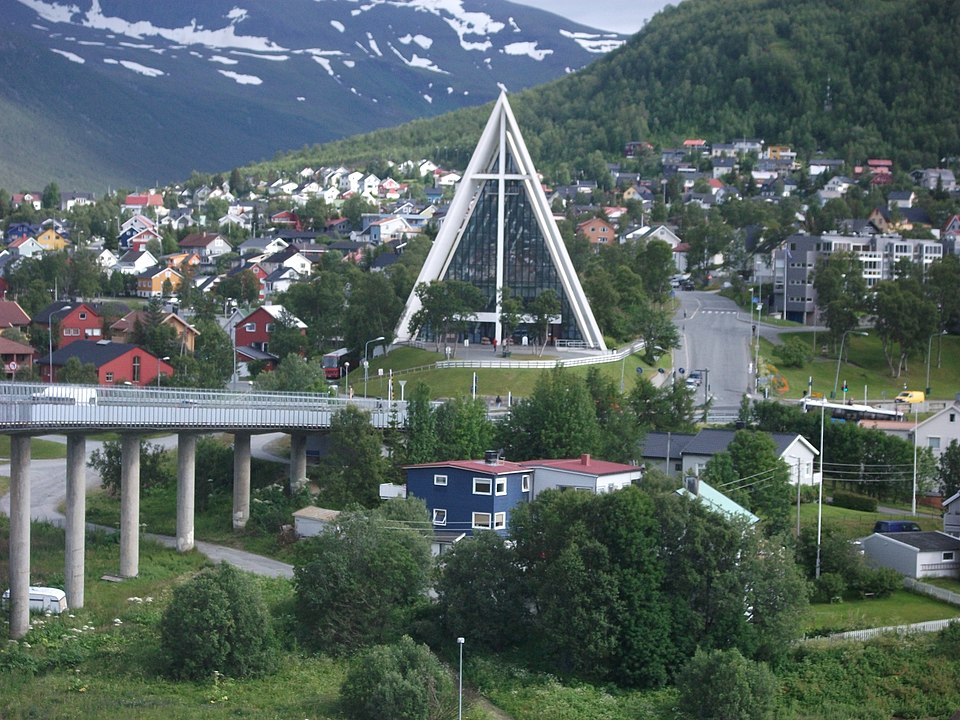
You can drive or take a bus to the start. But many simply walk across the bridge from town, visiting the Arctic Cathedral on the way.
By Oursinbenjamin
If you get to remote Tromsø, don’t miss this vista.
I took the Sherpa stairs back down. But there are alternative trails descending.
A former youth camp, it was purchased 2011 from the BC Conference of the United Church of Canada and is now managed by the Nature Conservancy of Canada.
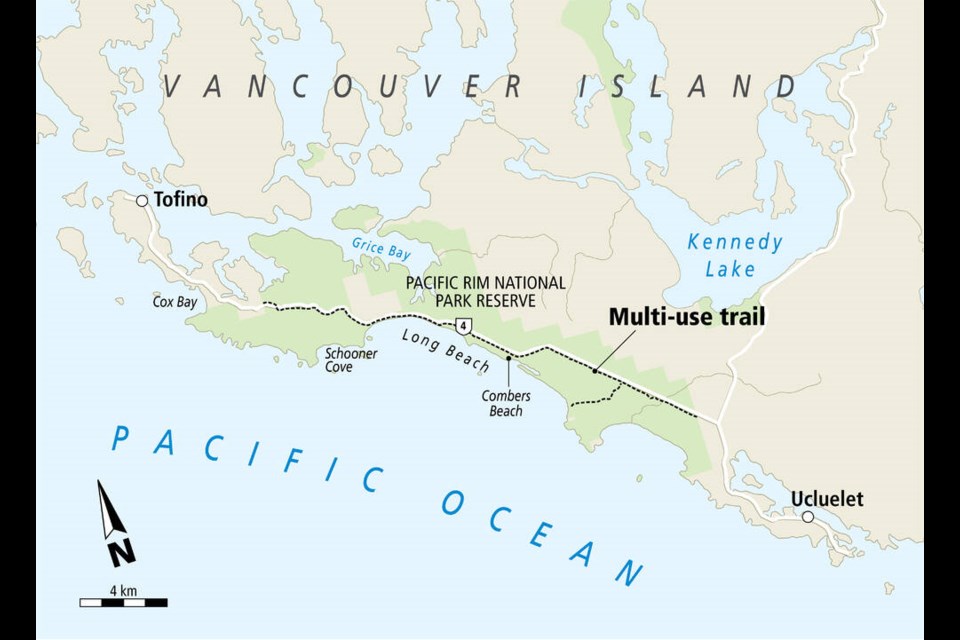
ʔapsčiik t̓ašii means “going the right direction on the path.”
It can also be translated to “do the right thing and speak truthfully“.
TOFINO — Tla-o-qui-aht First Nation, the Yuułuʔiłʔatḥ Government and Parks Canada joined this week in welcoming visitors to use a new multi-use pathway at the Combers Beach trailhead in the Pacific Rim National Parks Reserve.
The path, which extends around 25 kilometres, traverses through the traditional territories of Tla-o-qui-aht First Nation and Yuułuʔiłʔatḥ, on the west coast of Vancouver Island.
It is the result of nearly $51 million in federal funding and offers visitors and locals an opportunity to explore the region’s lush rainforests by bike or foot. …