
Click PLAY or watch it on YouTube.
Converting VIDEO from Landscape to Vertical
Our eyes are side-by-side. Our world view is landscape.
YET vertical (portrait) video is getting increasingly popular on mobile phones.
The reason?
A phone fits more comfortably in the hand in portrait position.
Videos on the BestHike YouTube channel are mostly landscape. But it’s fairly easy to convert a landscape to portrait in your software editing app.
For example, the vertical video below was edited from this landscape original.
Click PLAY or watch it on YouTube.
Here’s the Instagram version.
Here’s the TWITTER version.
I also uploaded it to the BestHike Facebook page.
10 Multi-Day Hikes in Africa
10 Adventures put together a good list.
Click through for details.
- Mount Kilimanjaro, Tanzania
- Mount Mulanje, Malawi
- Mount Toubkal, Morocco
- Fish River Canyon, Namibia
- Otter Trail, South Africa
- Amatola Trail, South Africa
- Outeniqua Trail, South Africa
- Mount Meru, Tanzania
- Naukluft Hiking Trail, Namibia
- Drakensberg Grand Traverse, South Africa
10 Spectacular Multi-Day Hikes in Africa: Explore the Preserved Wilderness

We’d agree that South Africa and Namibia are the best destinations for the hiker.
Otter Trail is one of our top 10 hikes in the world.
Vancouver Island @ LOW Tide
BestHike editor Rick McCharles
I was born in the Rocky Mountain foothills, 1km above sea level.
Lived 10 years on the high prairies of Saskatchewan.
So when I get to my parents place on VANCOUVER ISLAND, I walk the coast at dawn. With coffee. The scenery is different every day.
BEST is Rathtrevor Beach at dawn.
BEST is when dawn coincides with low tide.
You can wander the ocean bottom nearly a kilometre out into the Straight of Georgia.
Click PLAY or get a glimpse on YouTube.
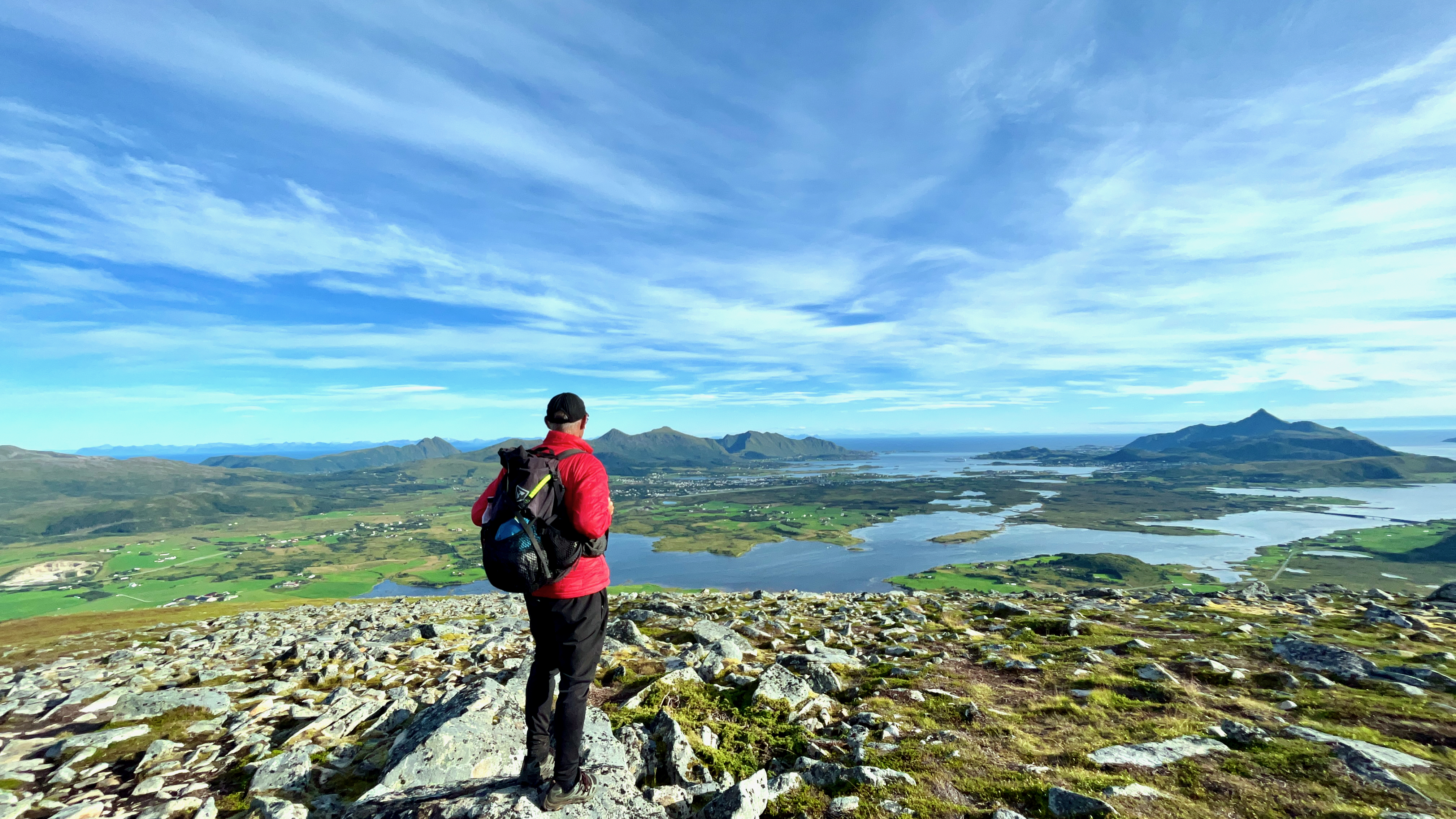
Climbing Holandsmelen Hill, Loftofen, Norway
Trip report by BestHike editor Rick McCharles
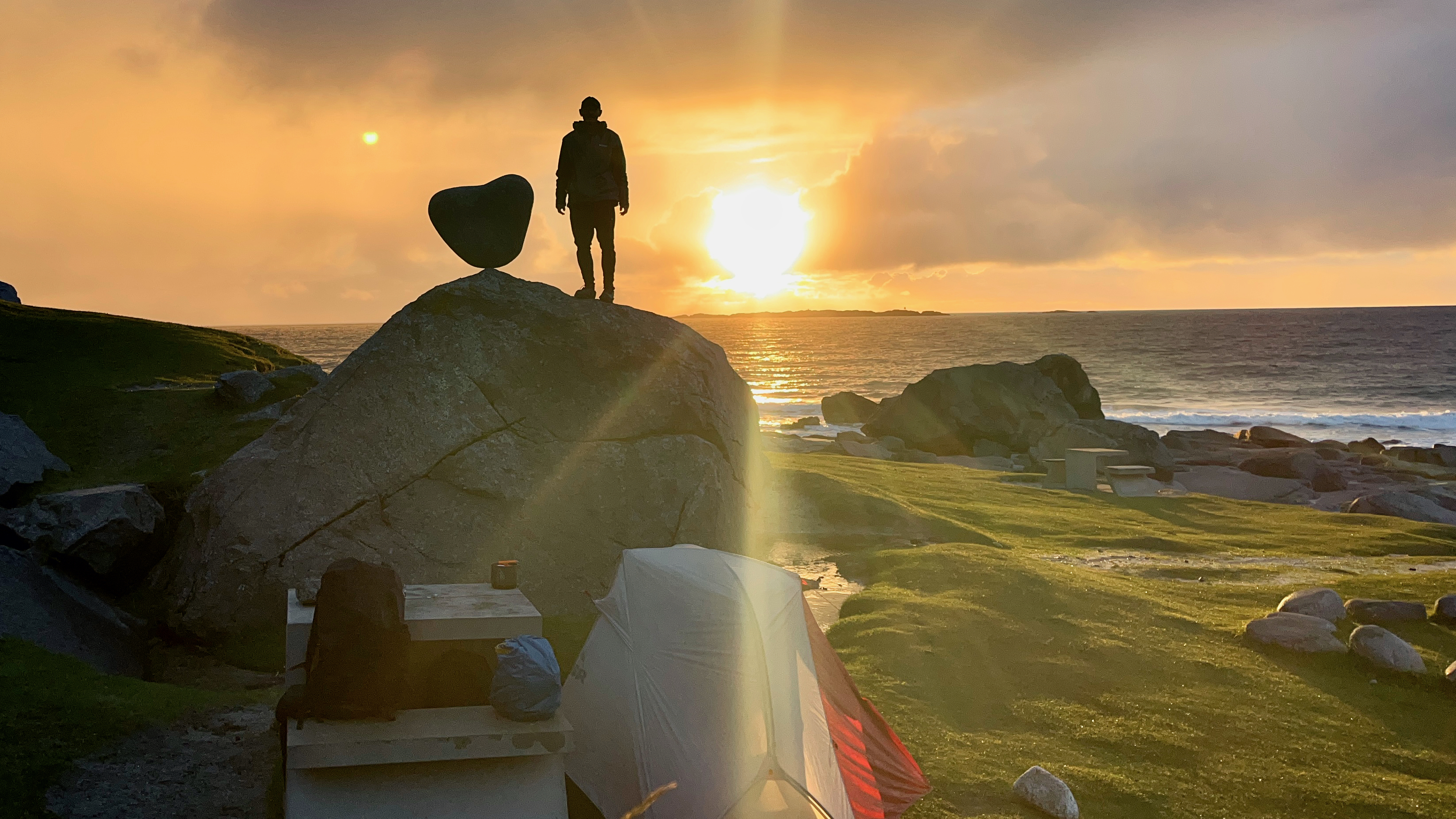
On leaving the famed Haukland beach, I walked to the nearby trailhead of Holandsmelen.
The unmarked, but well worn trail is easy to follow and relatively bog-free by Lofoten standards. That means it takes 20 minutes before your shoes are soaked rather than the usual 10 minutes. 😀
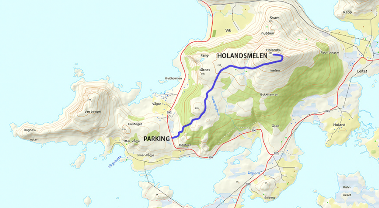
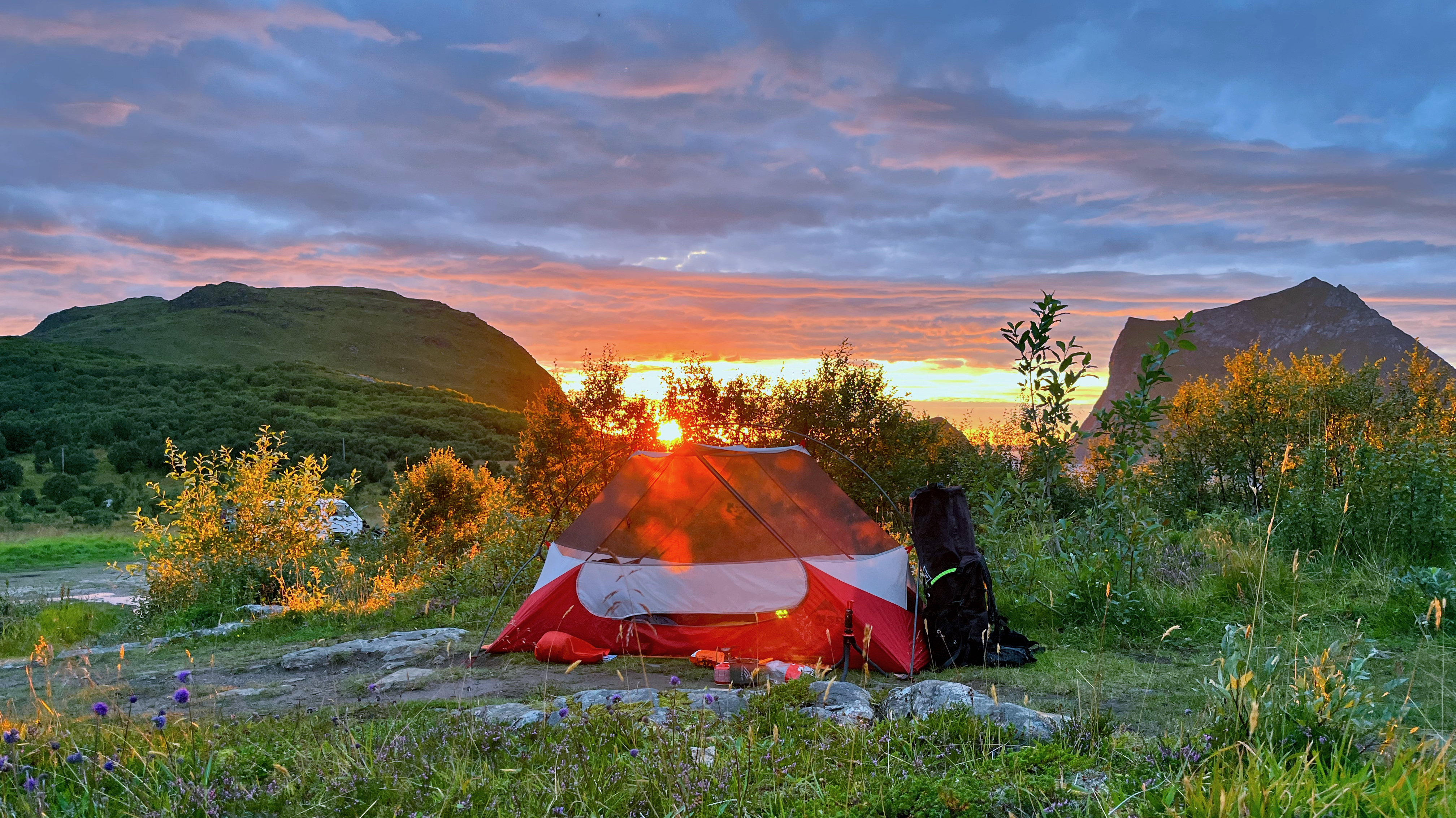
I found a possible campsite close to the trailhead parking lot — then hid my gear in a waterproof bag in the trees.
What I liked about Holandsmelen, relative to other Lofoten peaks, is that the going is not an unrelenting climb. There are flat sections on this half dayhike.
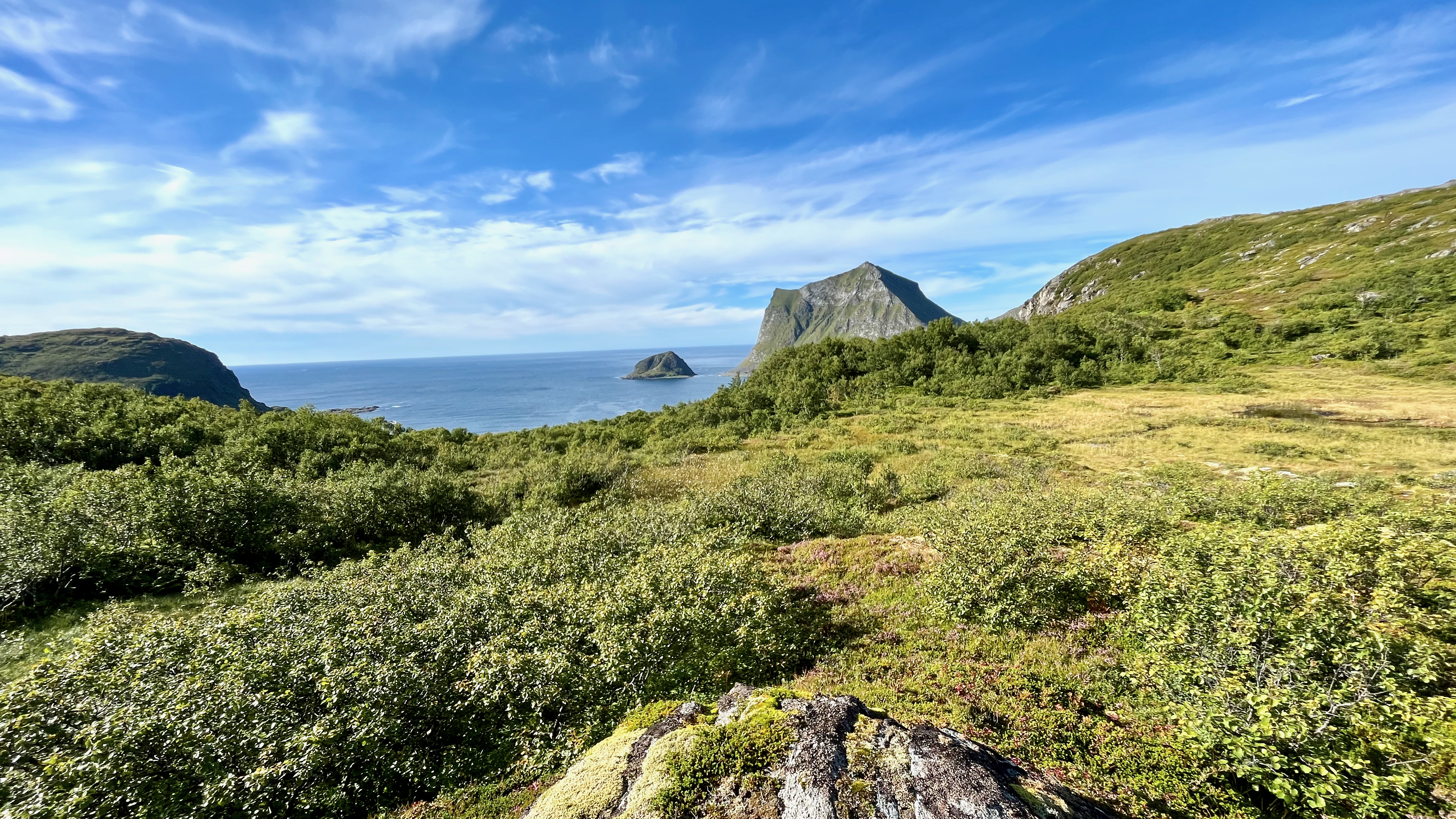
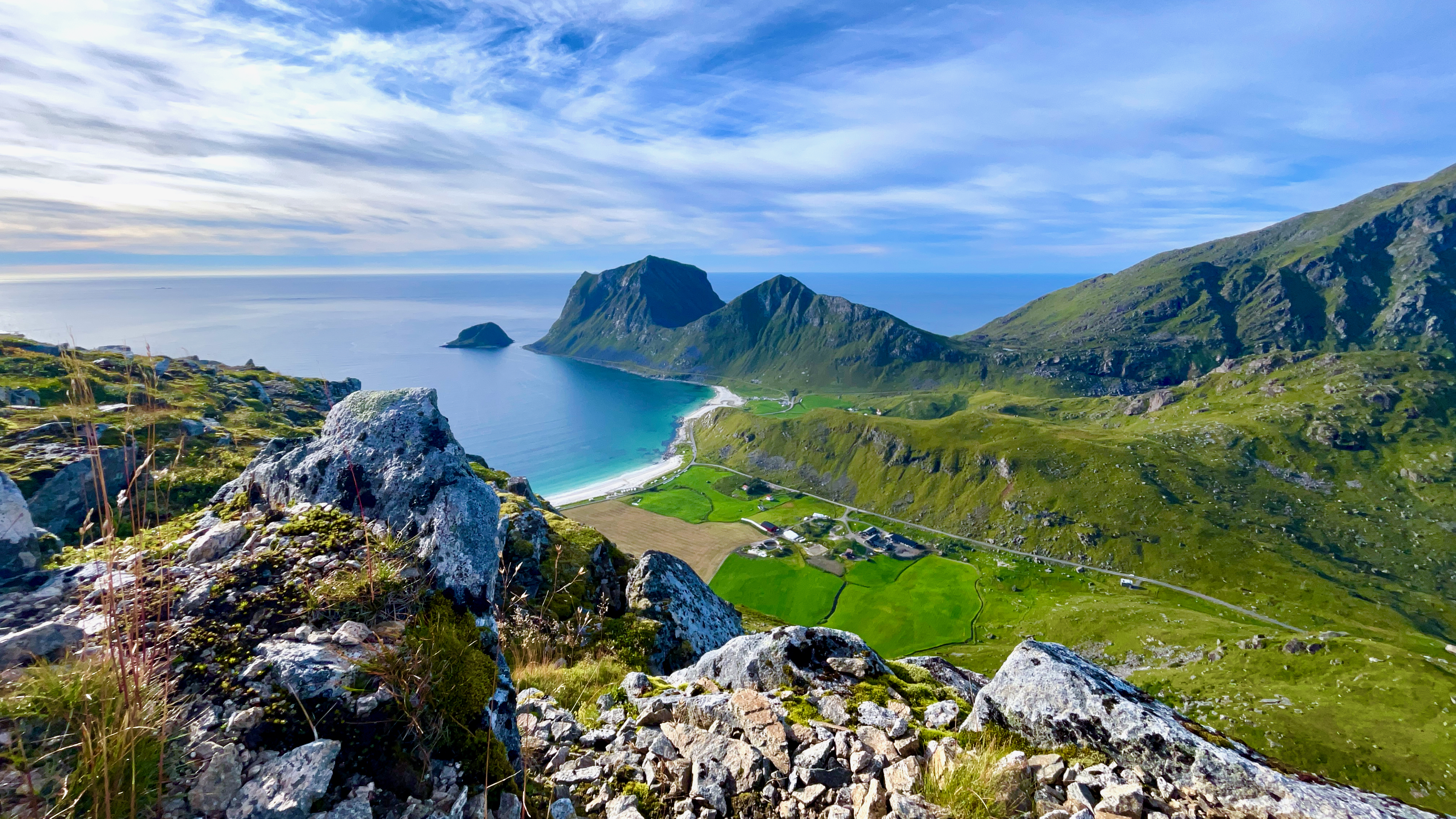
As usual, the views from the top are Lofoten breathtaking.
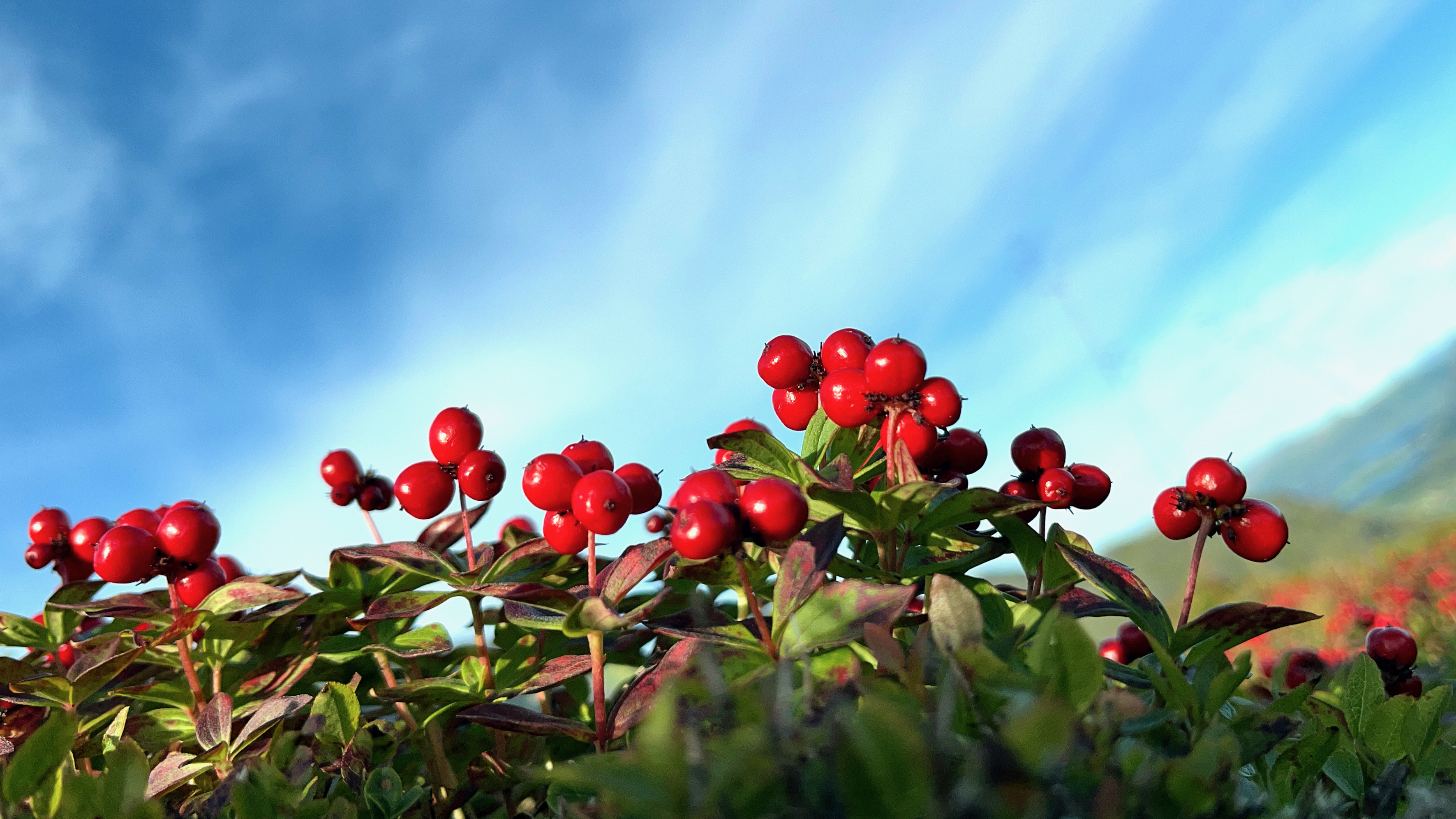
Here’s my favourite photo from the hike. I believe these tiny berries are edible.
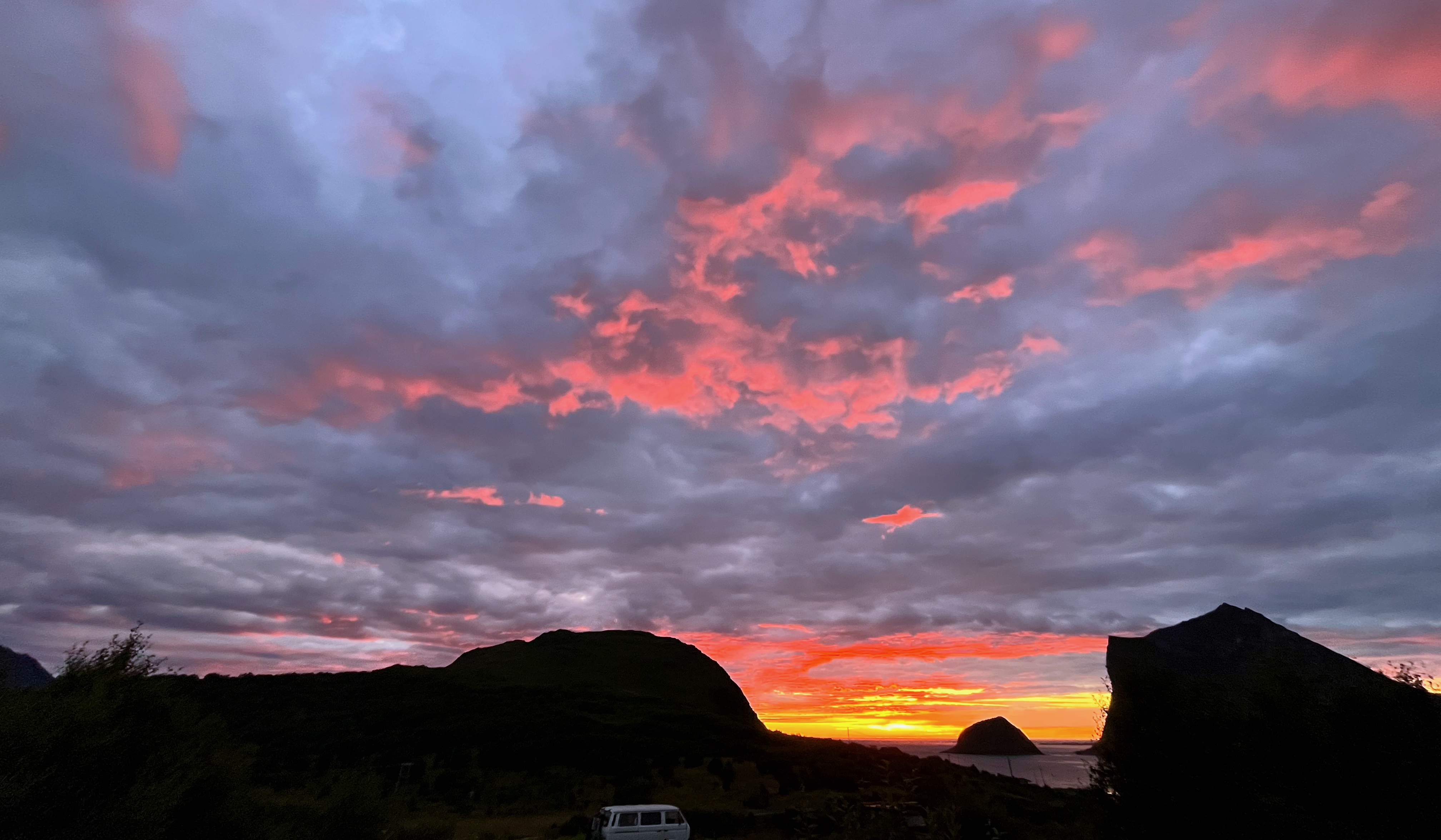
Once again, sunset was long and astonishing.
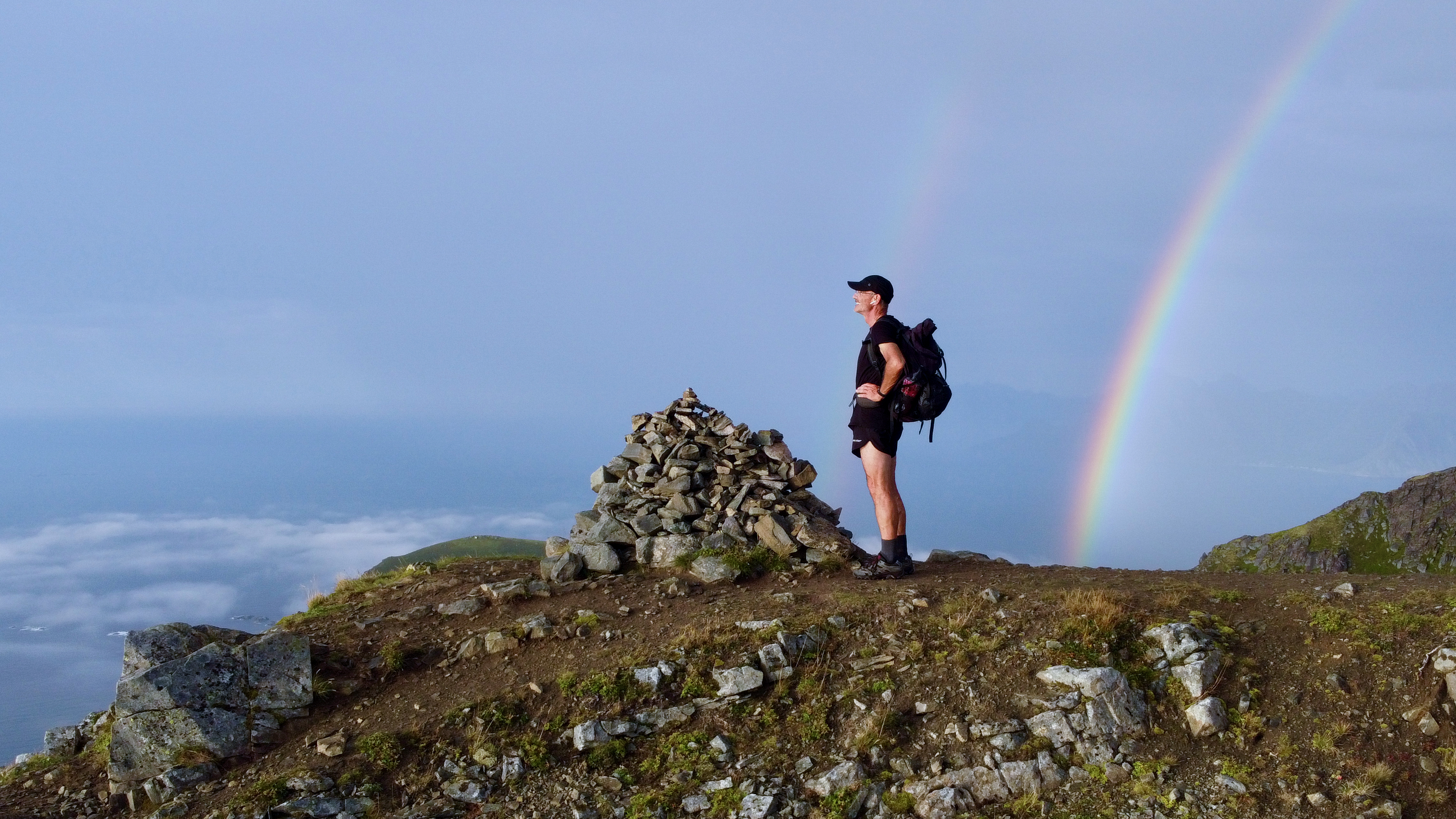
Climbing Veggan from Uttakleiv Beach, Lofoten, Norway
Trip report by BestHike editor Rick McCharles
Click PLAY or watch it on YouTube.
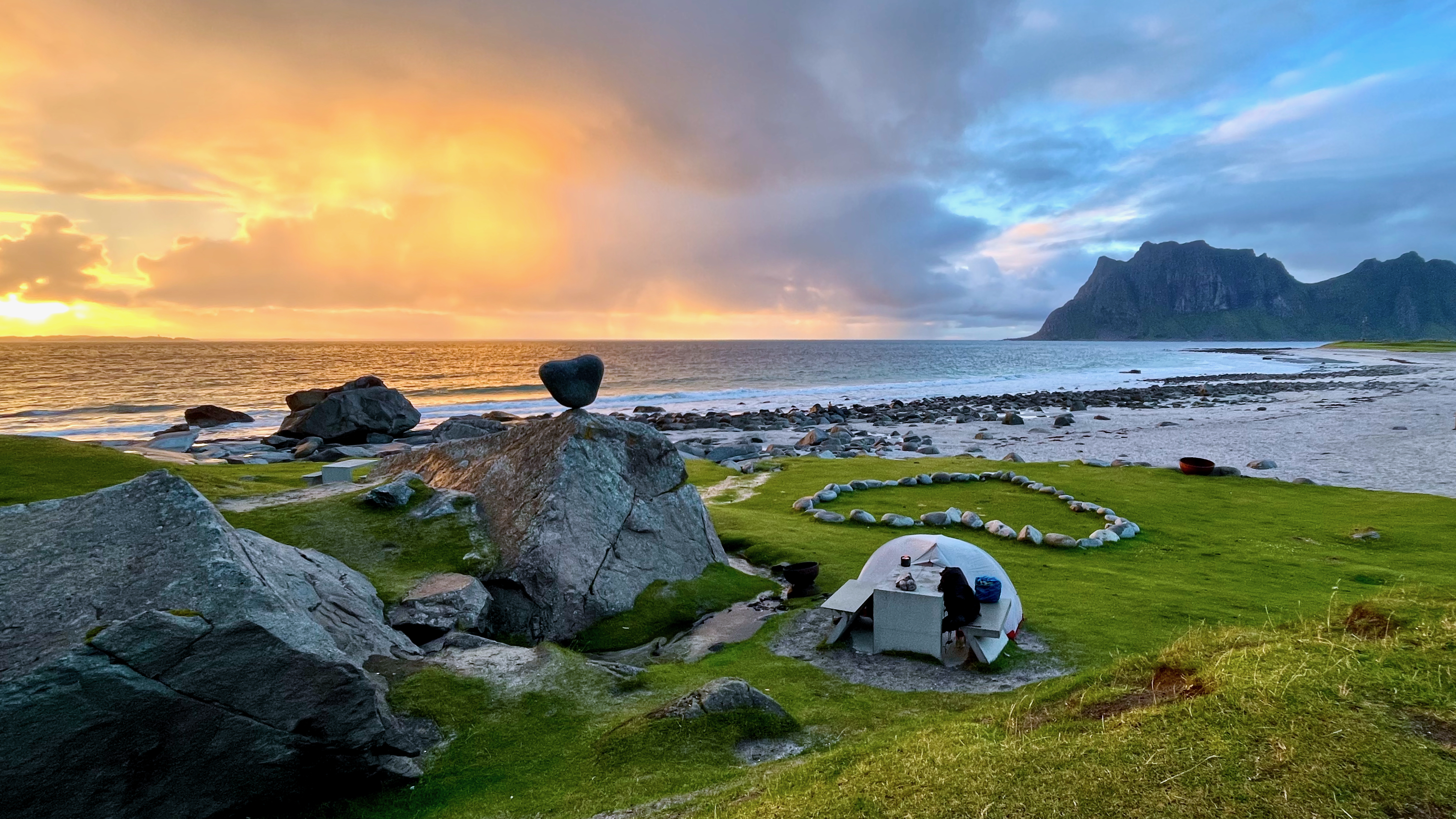
My best campsite in Norway was at Uttakleiv beach. $20. The only time I paid for camping in a nation where you can camp almost everywhere free.
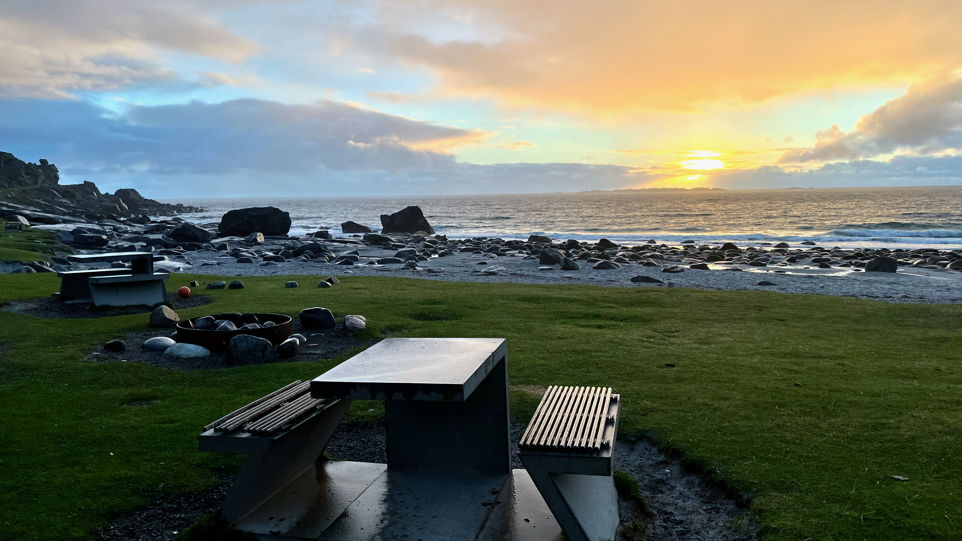
Early next morning I had to decide whether to climb Veggen or the more popular Mannen.
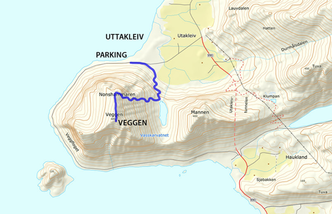
For no particular reason, I decided on Veggan (“the wall”) which is a bit higher at 489m. Starting early morning, I had the summit to myself.
Like many day hikes in Norway, it’s an unrelenting climb with one good photo stop at lake Vasskarvatnet.
On departing Uttakleiv, I enjoyed the walk along the coast to Haukland beach rather than try to walk through the automobile tunnel.
BONUS ➙ more footage of the beach. Click PLAY or watch it on YouTube.
Hiking 226 km on the ROTA VICENTINA, Portugal
Click PLAY or watch it on YouTube.
If interested in planing for Portugal yourself, check Roberto’s TIPS:
Click PLAY or watch it on YouTube.
The BEST section is the 4 days from Porto Covo to Zambujeira do Mar.
Click PLAY or watch my highlights from those 4 days on YouTube.
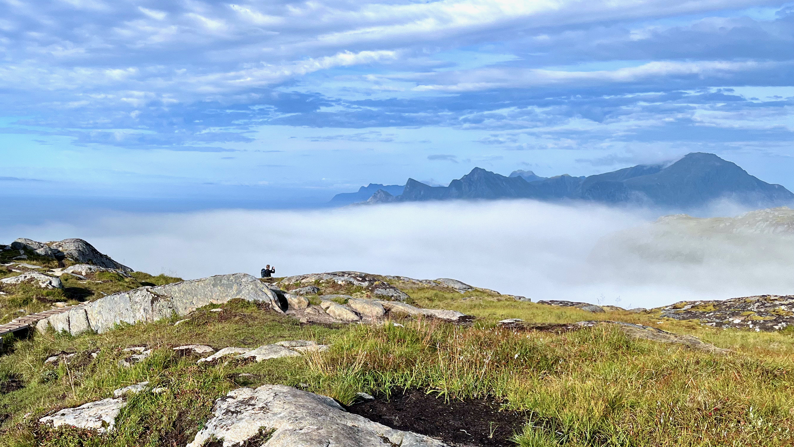
Hiking Sandbotnen beach to Ryten Summit, Lofoten, Norway
Trip report by BestHike editor Rick McCharles
There are a few options for climbing Ryten. And connecting other summits and beaches.
A beautiful day, I opted to start on Sandbotnen Beach, messing around for an hour before finally starting up the super popular Ryten hike.
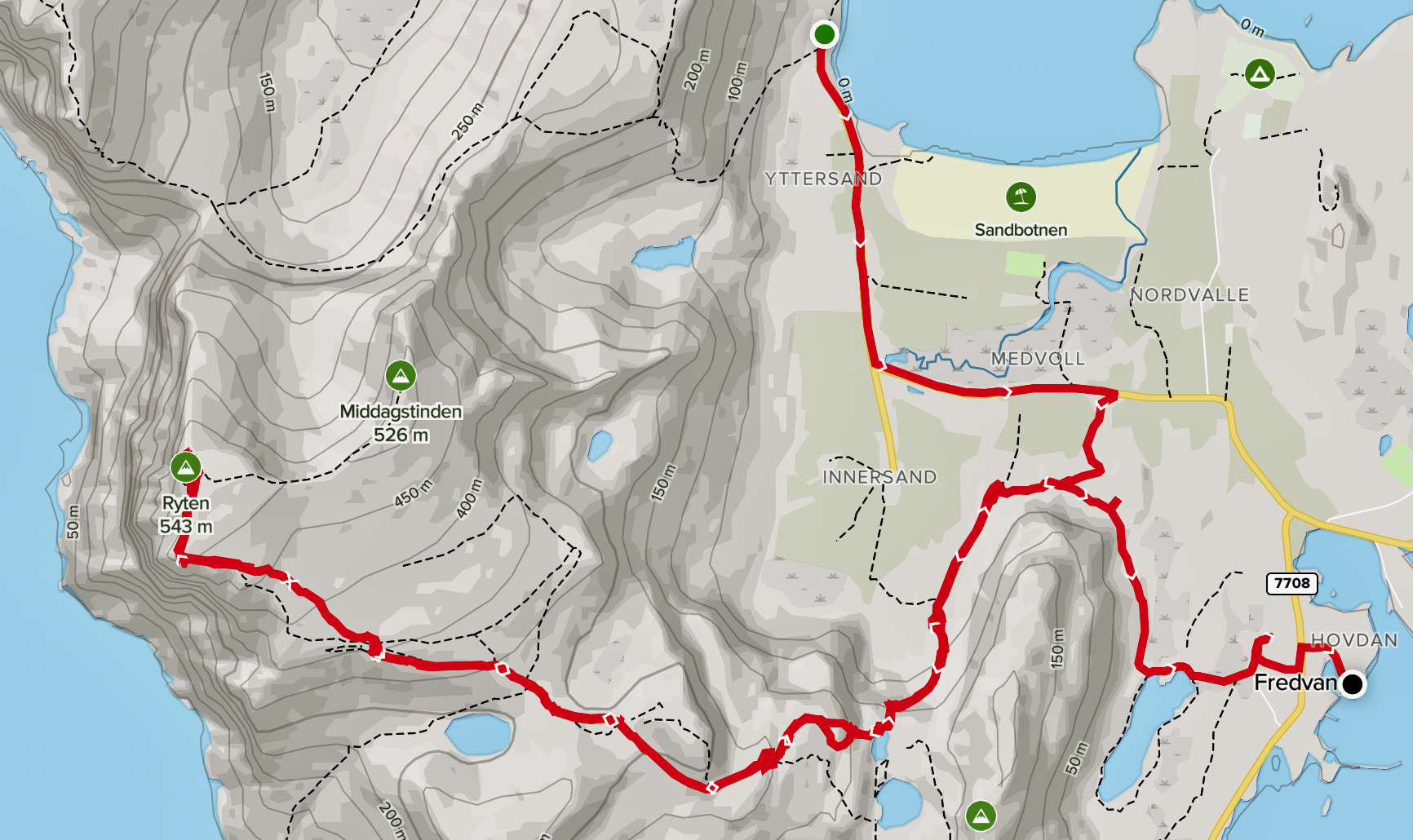
With side trips that ended up about 12km and 673m elevation gain.
Click PLAY or get a glimpse on YouTube.
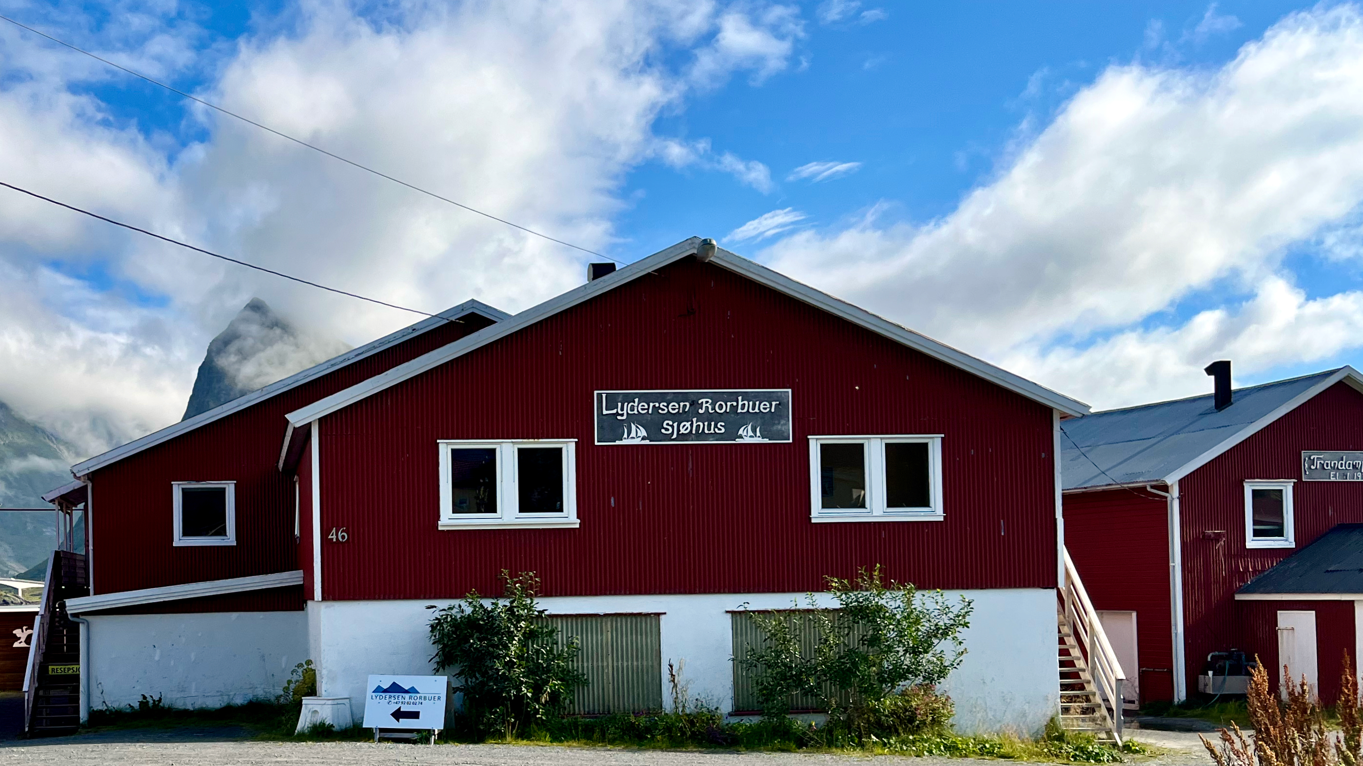
I stayed at the excellent nearby Lydersen Rorbuer hostel.
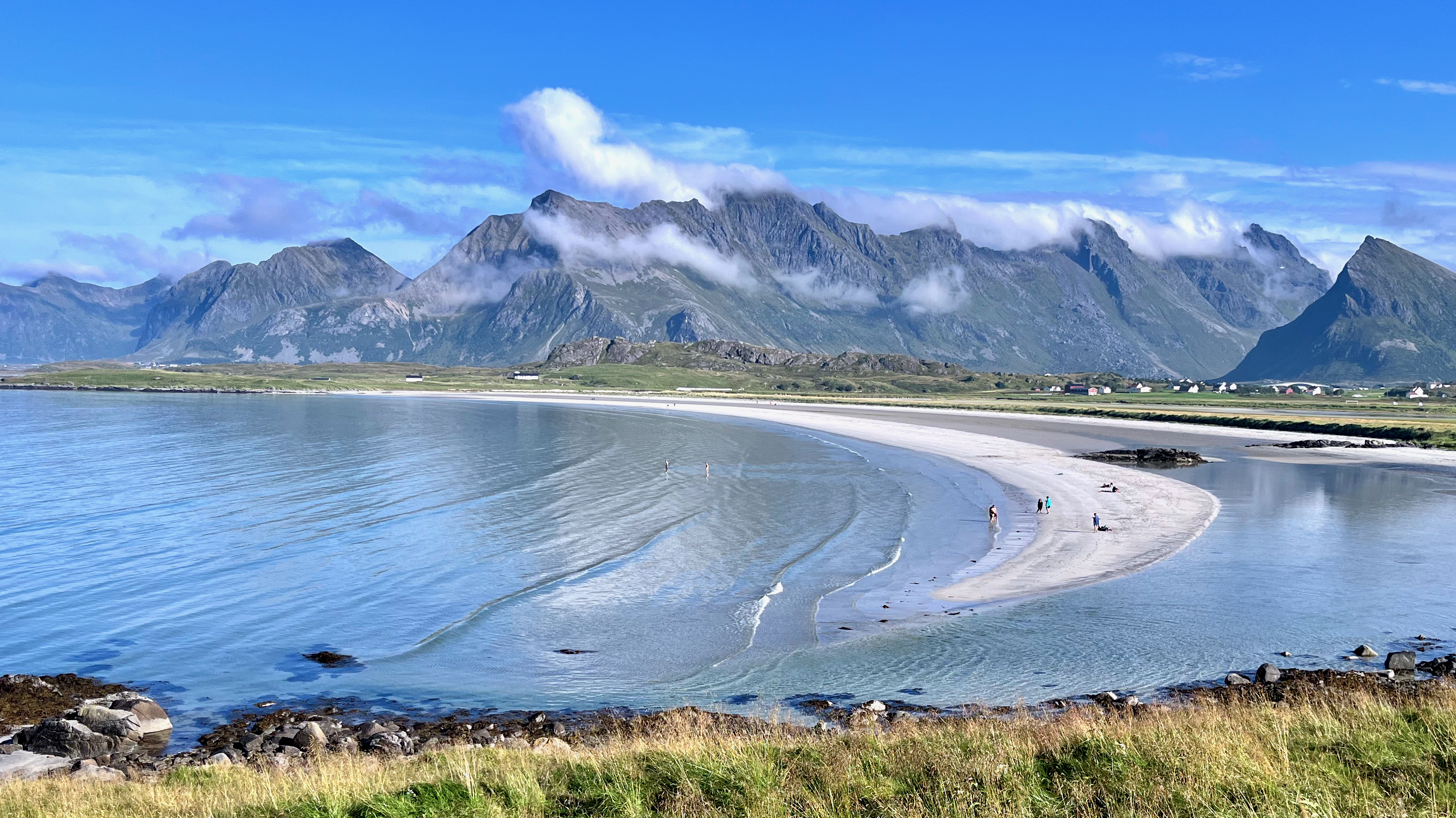
It is amazing to see beautiful sand beaches well above the Arctic Circle.
It’s muddy to start, though — for a welcome change in Norway — there are some helpful boardwalks.
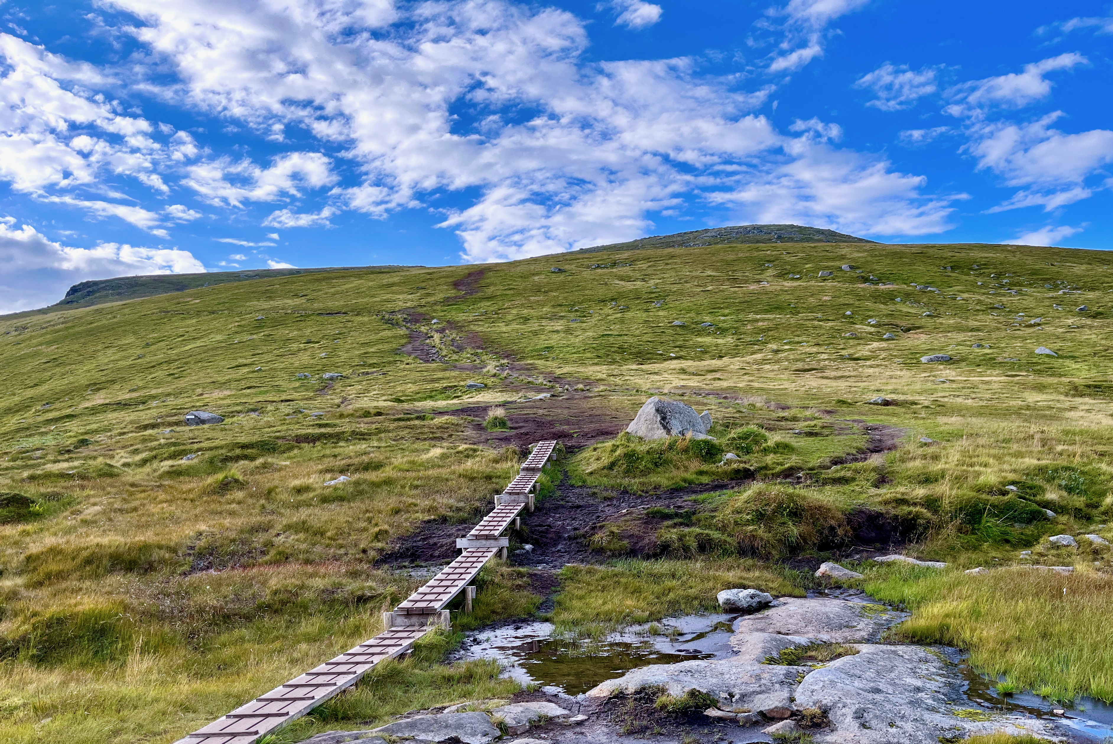
Part way up there are some pretty lakes.
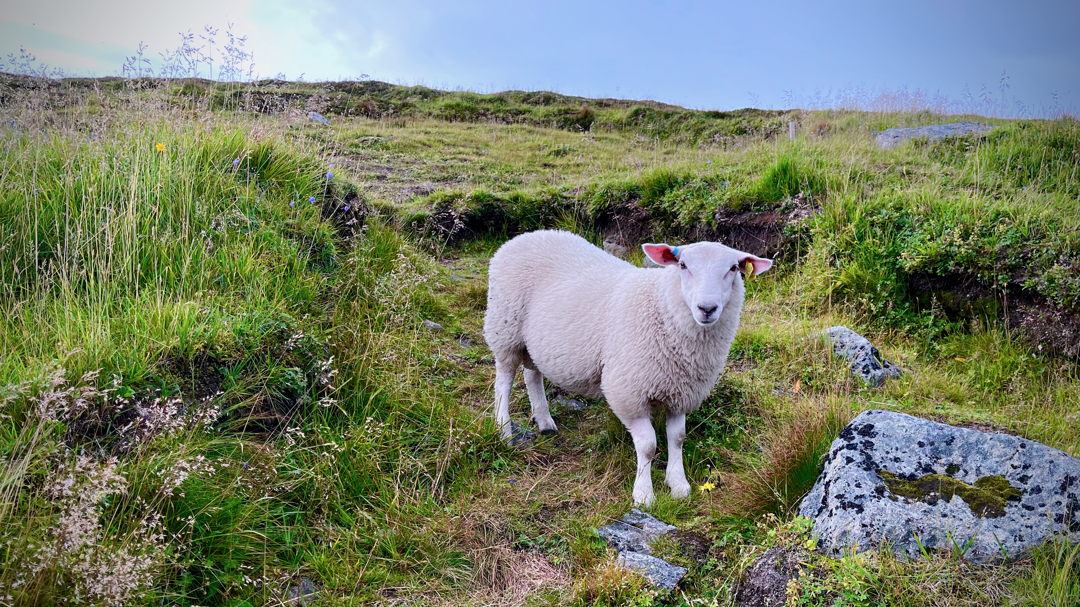
Sheep near the top of the mountain.
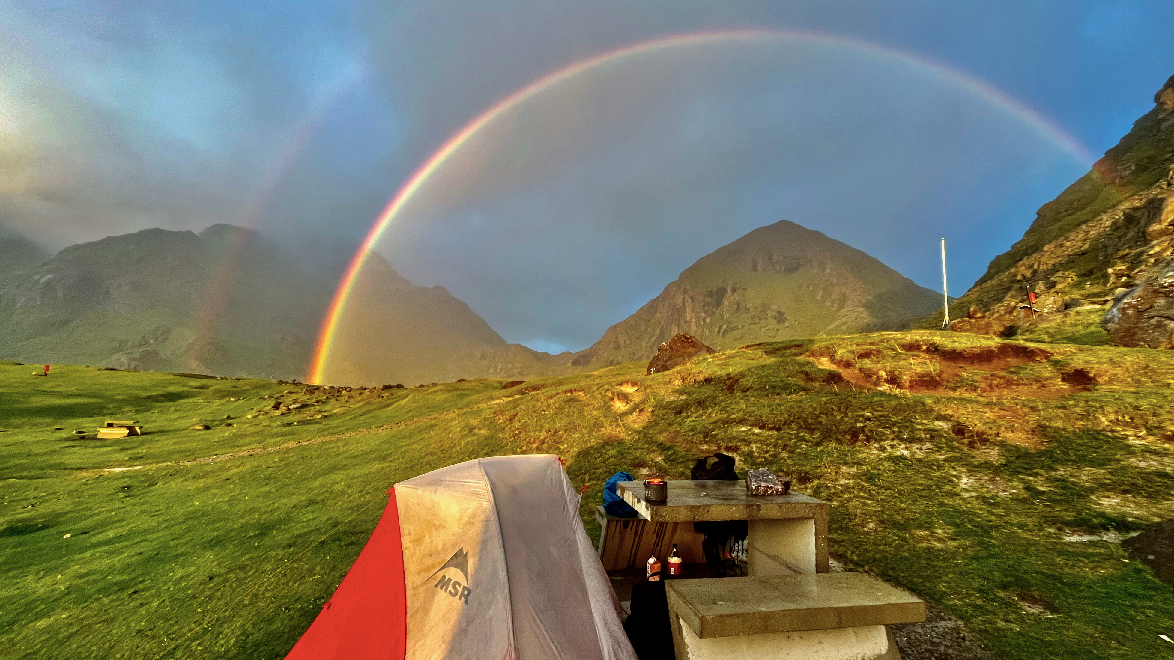
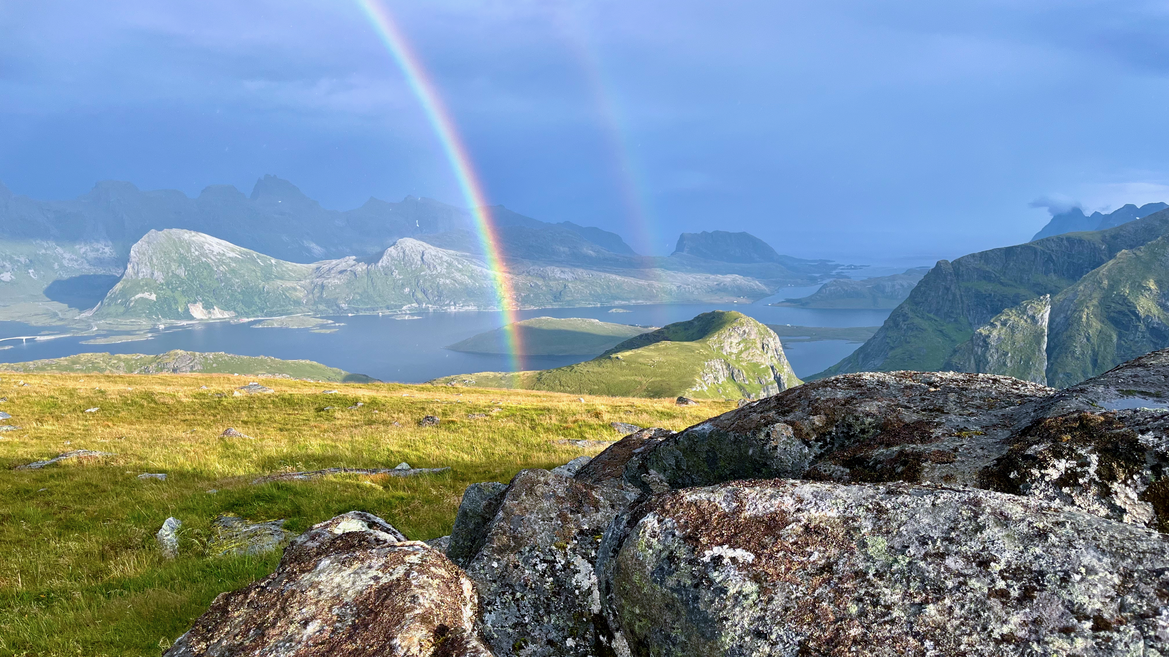
The weather was typical: sunny, rainy, windy, calm … with threatening lightning. 😀
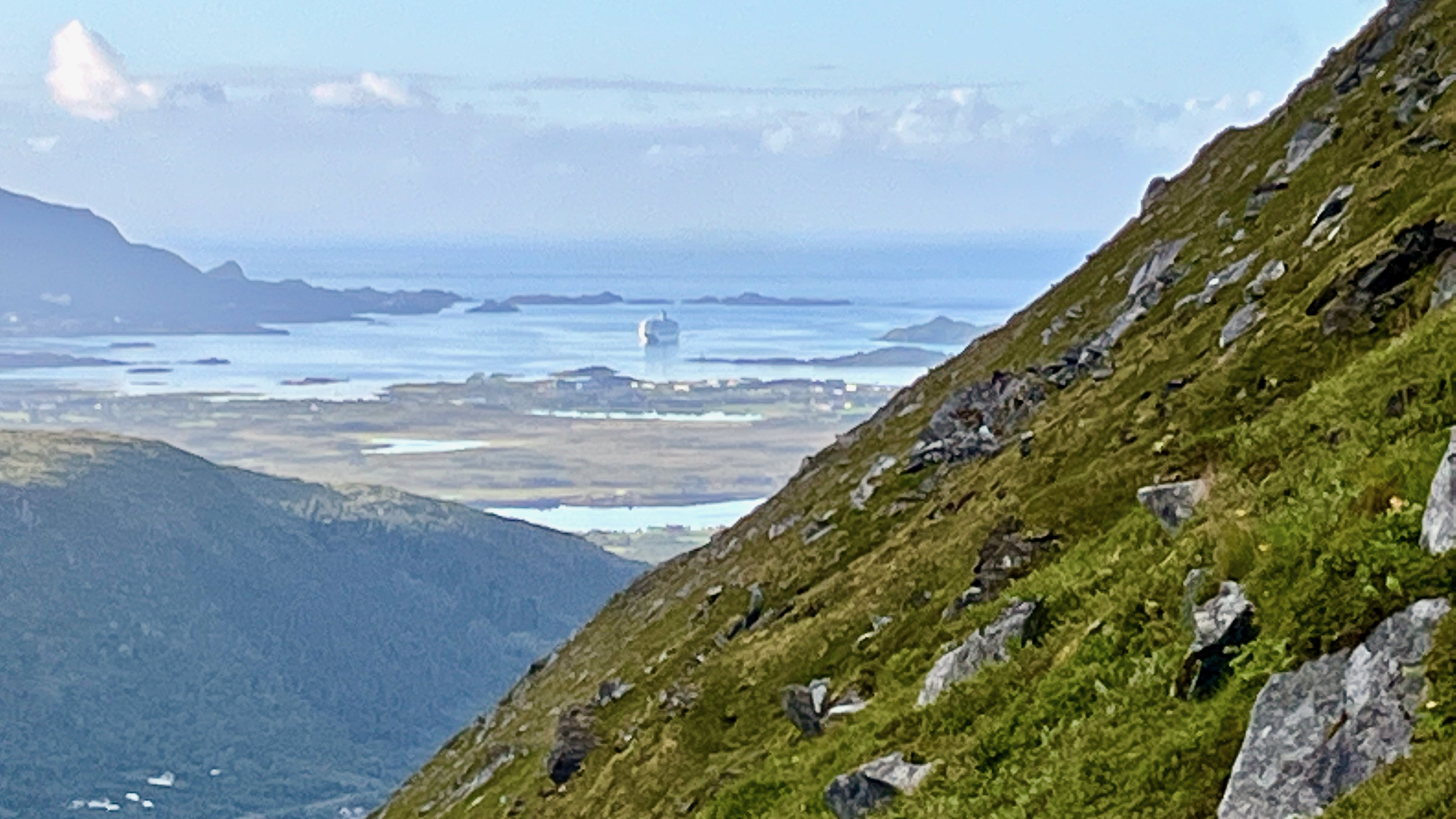
That’s Kvalvika Beach way down below. I didn’t make the detour but wished I had done so.
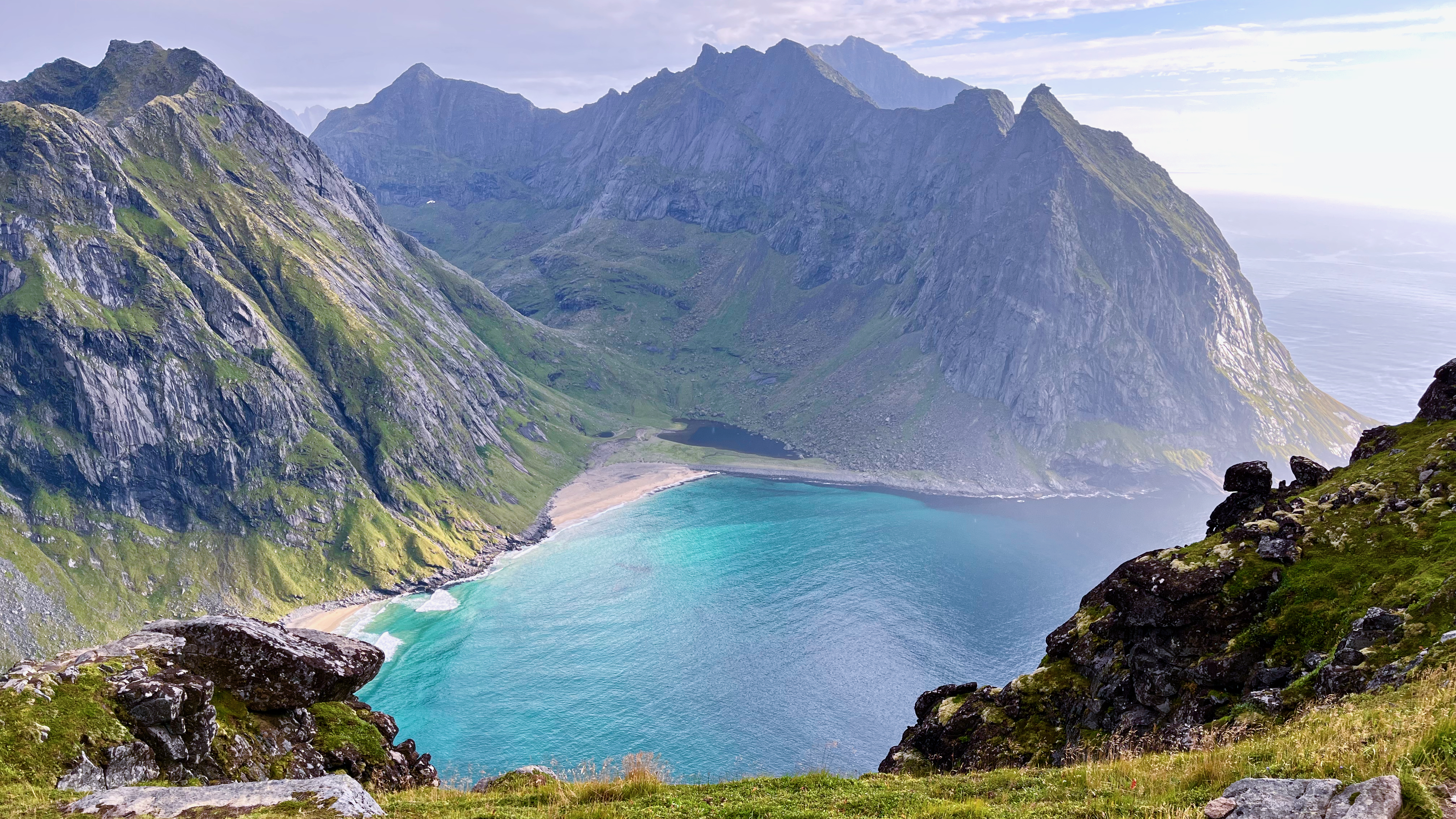
Great views from the top.
On the way down, clouds formed in the cooler valleys.
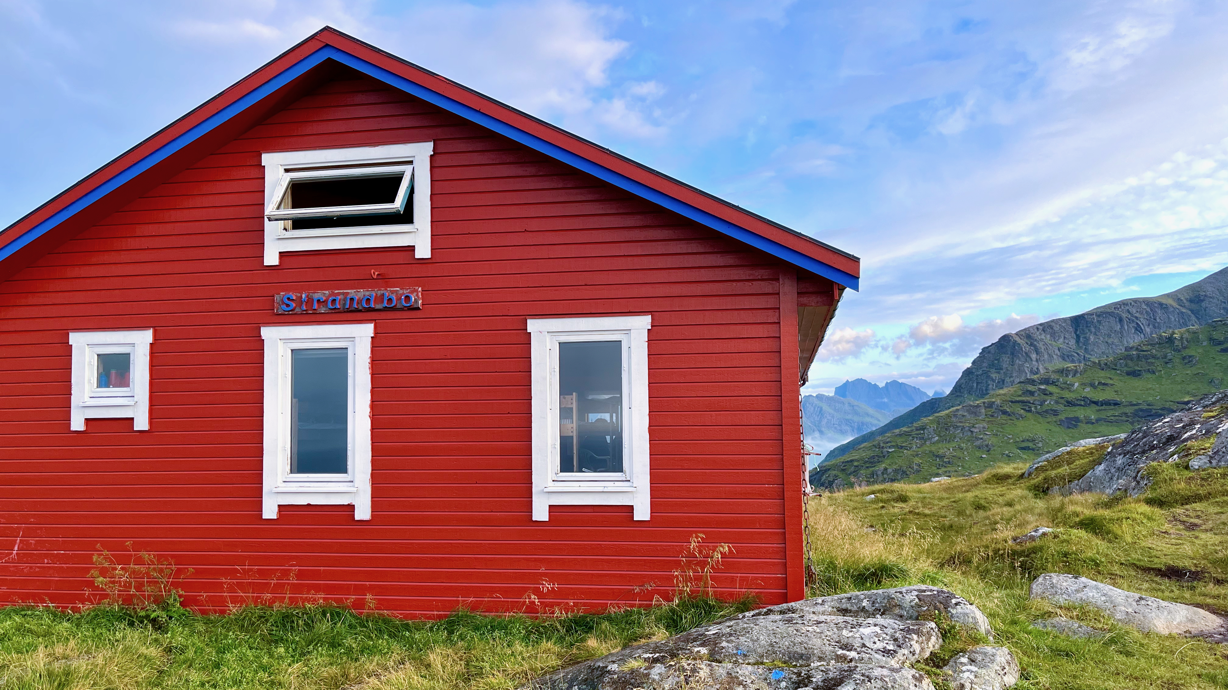
There’s a mountain hut on Ryten.
Of the many famous day hikes I’ve done in the Lofoten archipelago, Ryten is one of my favourites.
related – Earth Trekkers Trip Report
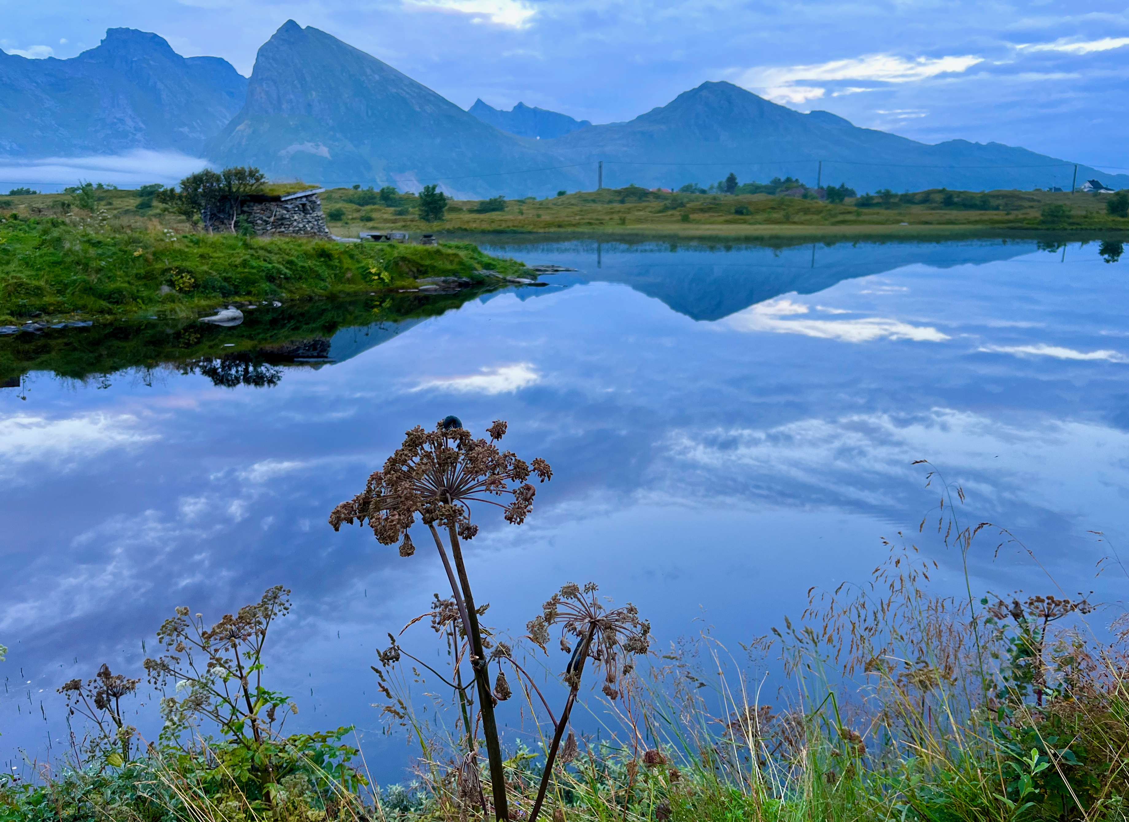
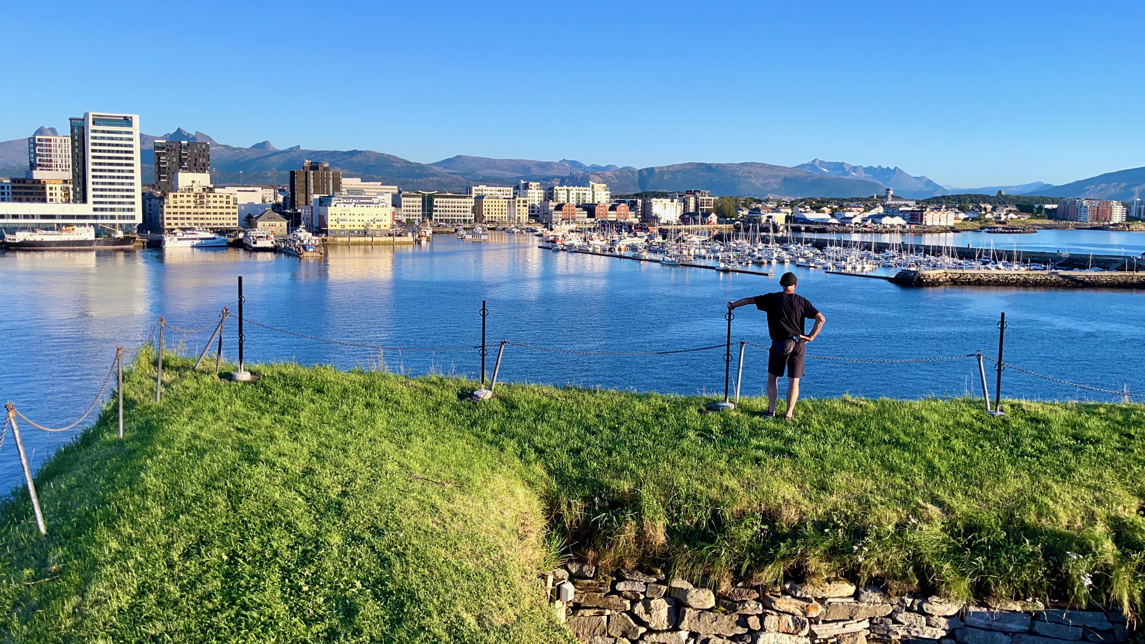
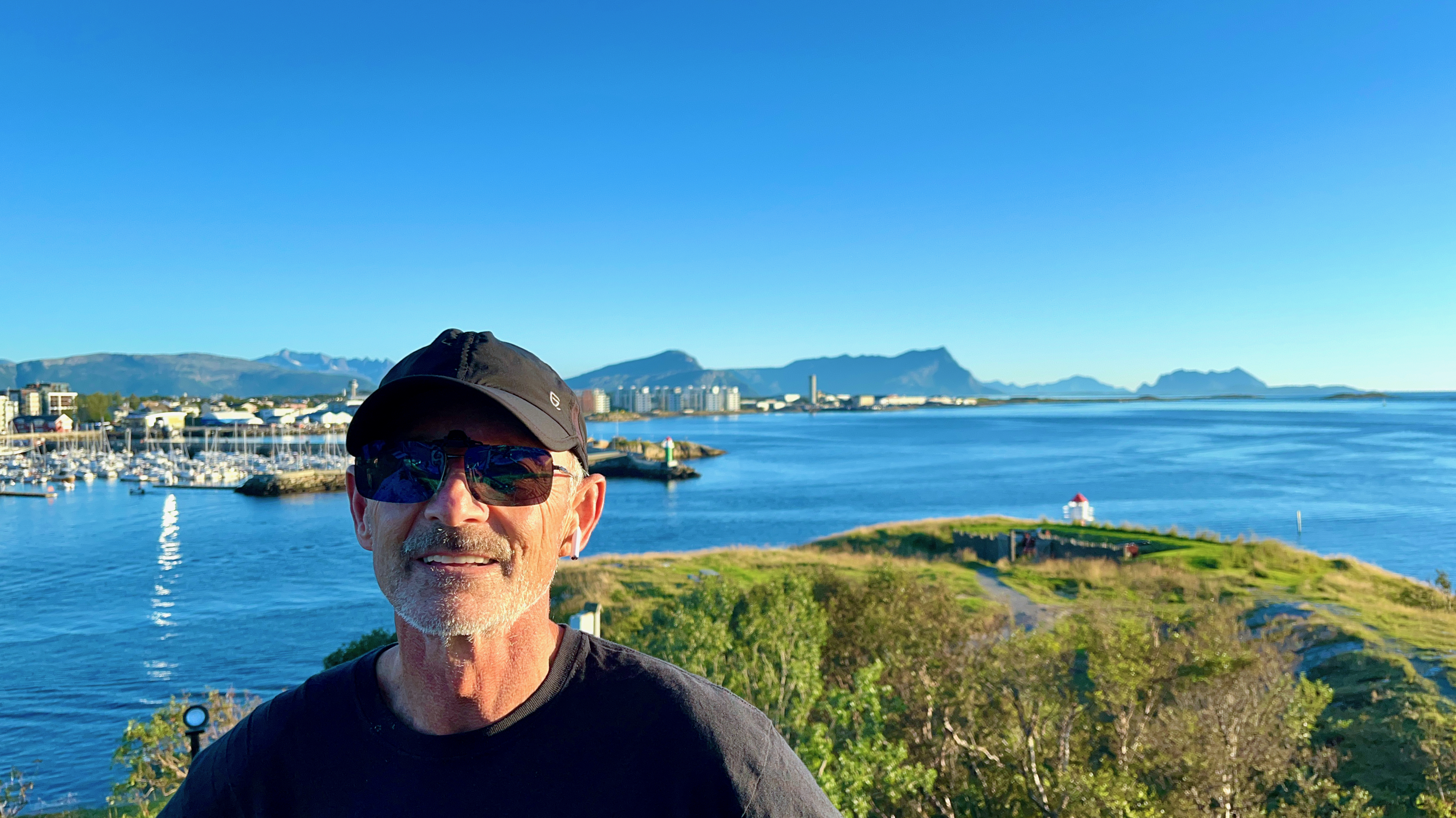
Hiking out of Bodø, Norway
The gateway to the wonderful Lofoten archipelago is the town of Bodø, the end of the train line north.
It’s usually cheaper and easier to fly as the train is a 17 hour overnight journey from Oslo. The town is so compact that you can easily walk from the airport to the train station.
On my two trips to the awesome Lofoten hikes, I’ve spent quite a few days in Bodø — supposedly in transit.
It’s worth wandering the streets of Bodø.
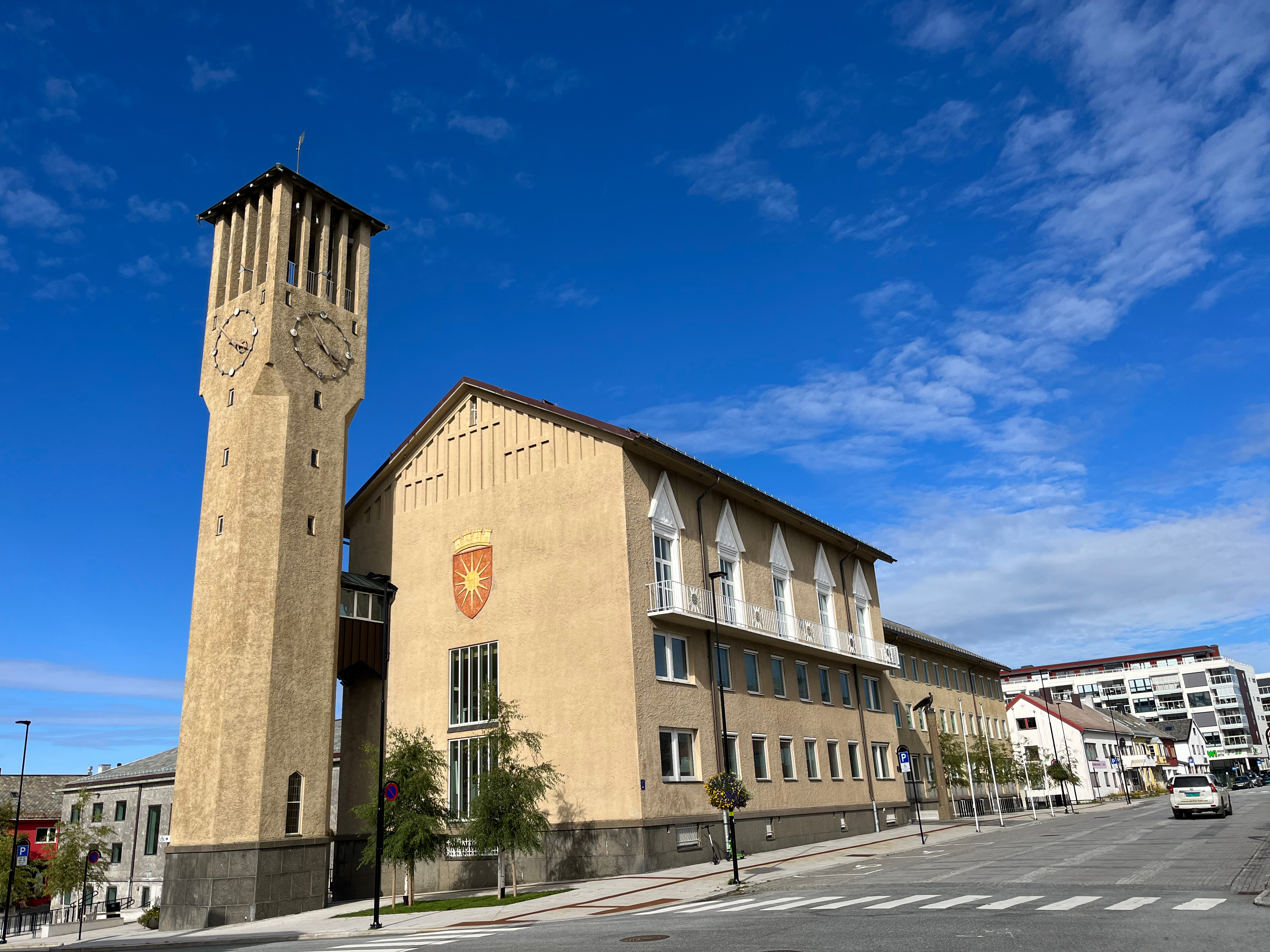
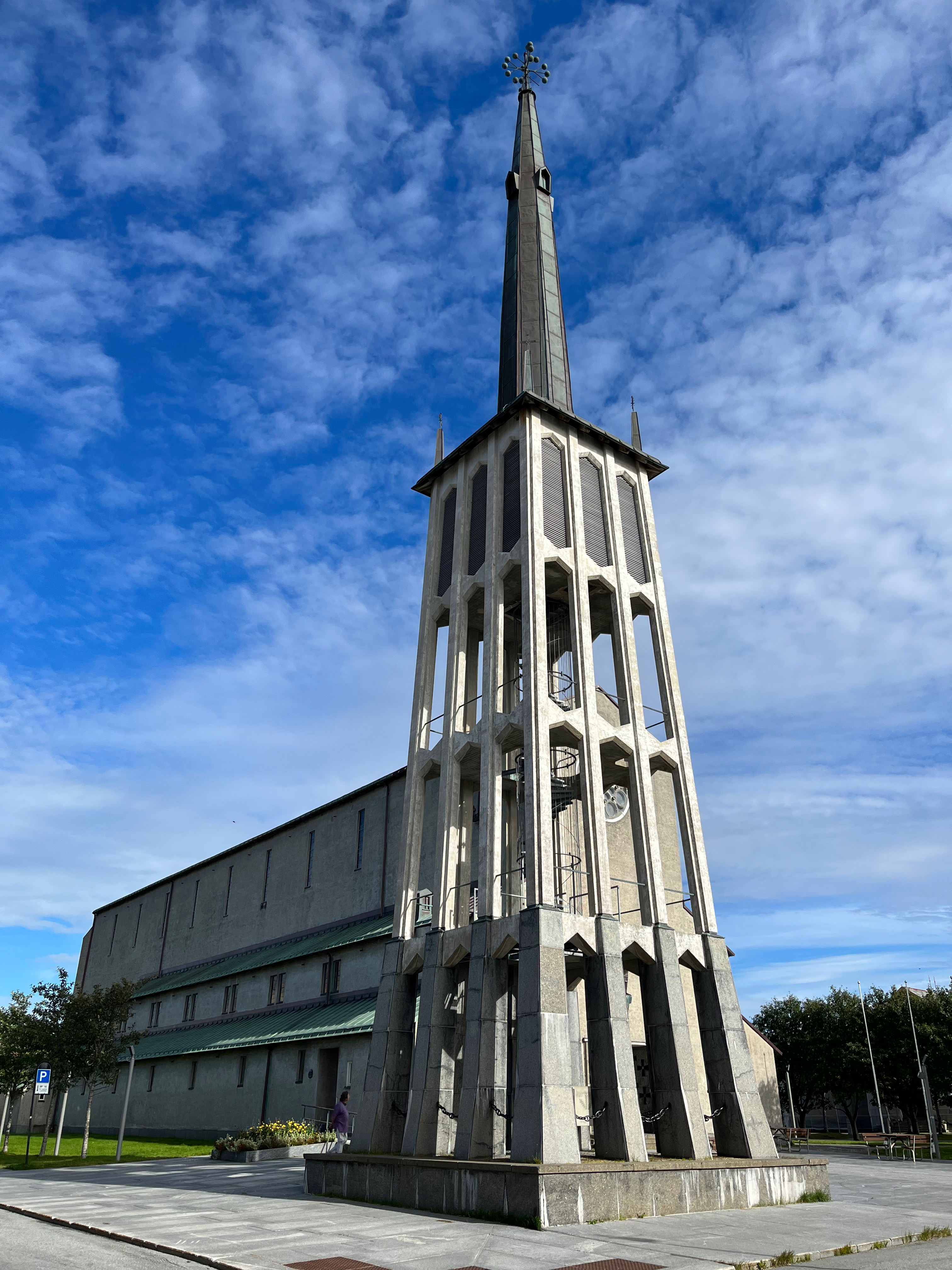
ALSO — there is some hiking available walking from the centre of town.
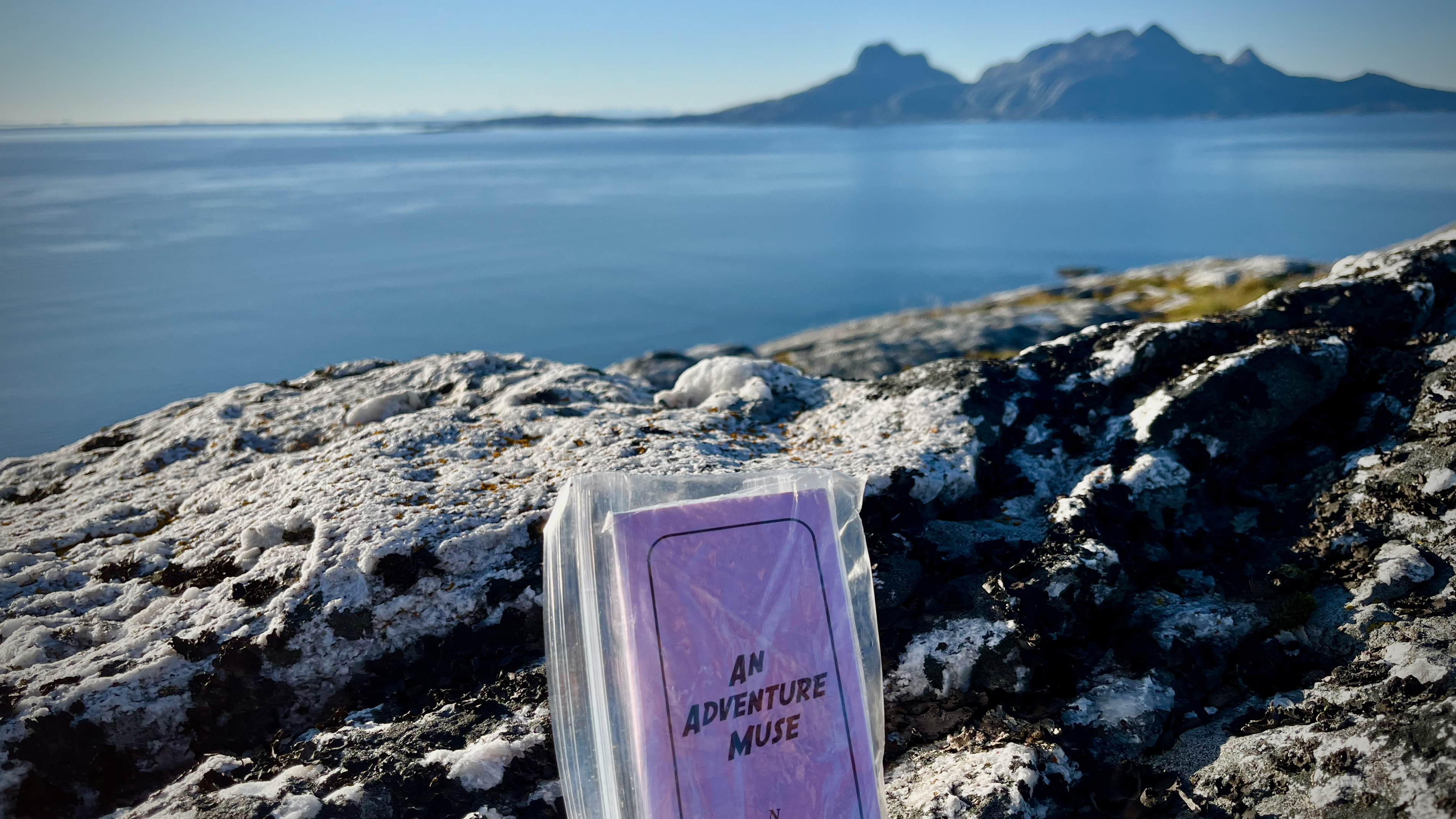
I went first to Bestefarvarden. An interesting scramble among rocky cliffs overlooking the sea.
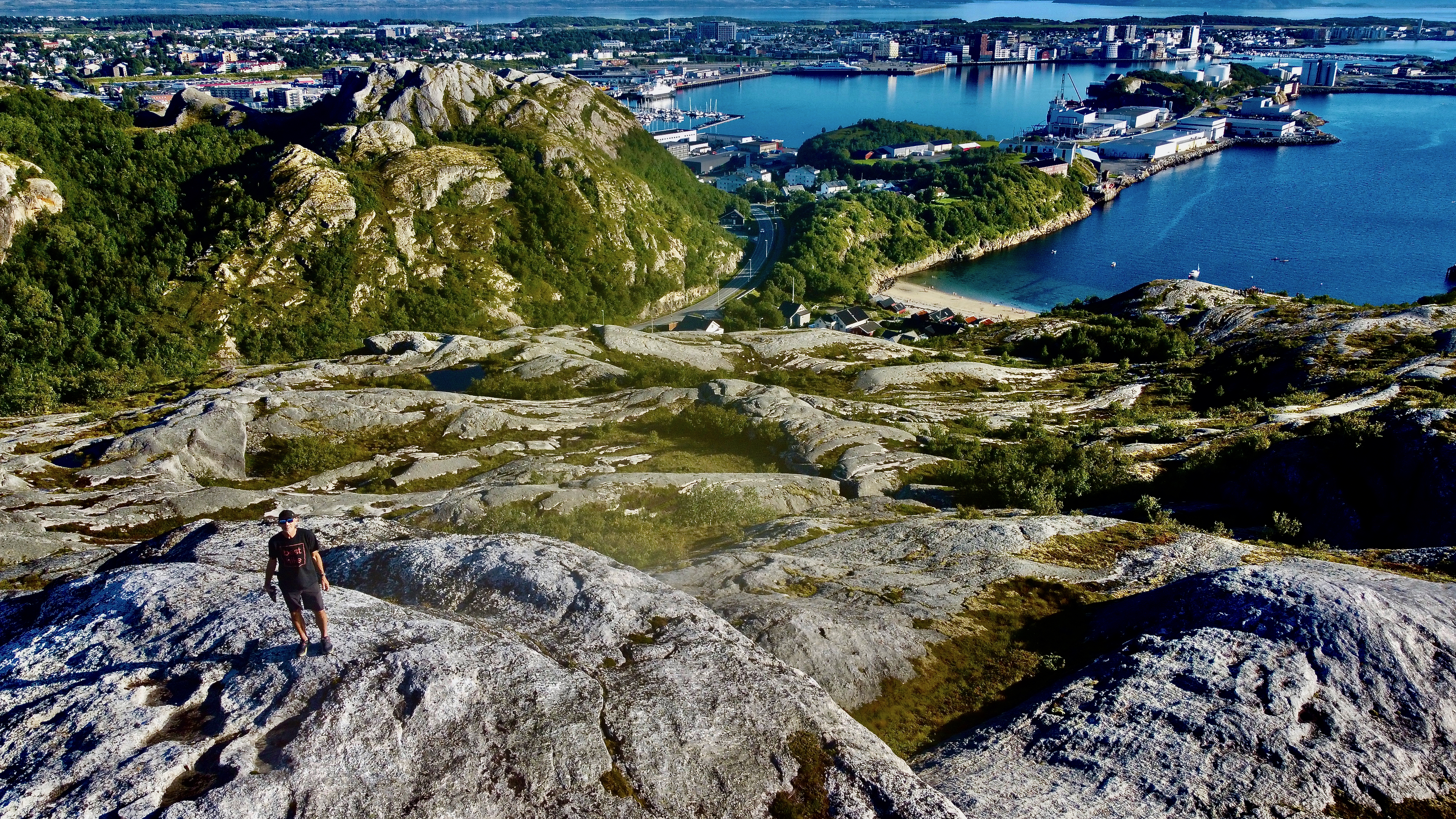
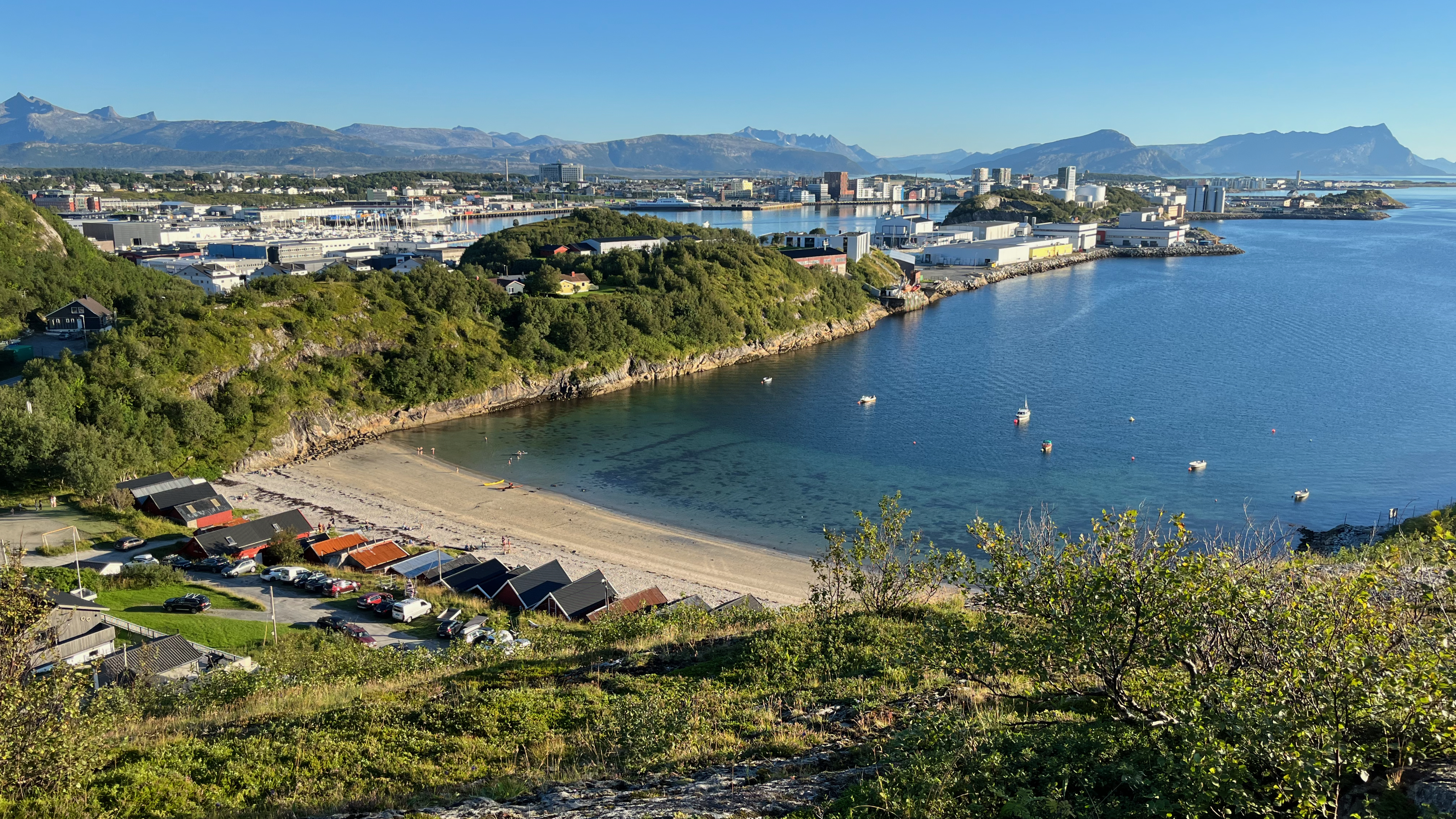
The “hike” starts close to this beach, well above the Arctic Circle.
I left a Summit Stone there.
Click PLAY or get a glimpse on YouTube.
From there, I walked through an industrial zone to reach the city fortress (redoubt). Small, but interesting. With good views over to Bodø centre.
In addition, many tourists visit Saltstraumen, a small strait with one of the strongest tidal currents in the world.
There’s more to Bodø than only a transit point.
HERO Video – Reinebringen, Lofoten, Norway
The main reason to buy a drone is so you can fly to Norway and get the HERO video atop Reinebringen, likely the most popular photo op above the Arctic Circle. 😀
Click PLAY or watch it on YouTube.
Click over to our Reinebringen information page for details on how YOU can climb this famous peak.
It’s one of our top 10 day hikes in the world.
