
Click PLAY or see how it works on Vimeo.
what are trail angels?
Trail Angels on the PCT is a documentary currently in production. It will explore the generosity and kindness administered to hikers along the 2600 mile Pacific Crest Trail.
Click PLAY or watch it on YouTube.
top 10
Updated January 2019.
top 10 hikes
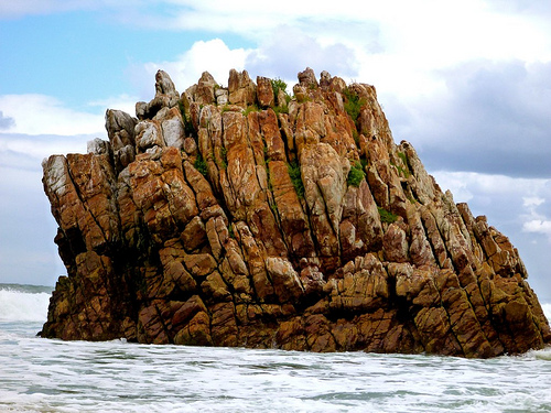
 #1) West Coast Trail, BC, Canada
#2) John Muir Trail, California, USA
#3) Tongariro Northern Circuit, New Zealand
#4) Ausangate Circuit, Peru
#5) Sunshine to Assiniboine, Alberta, Canada
#6) Glacier North Circle, Montana, USA
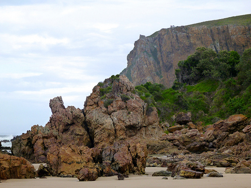
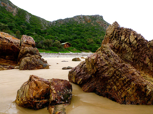
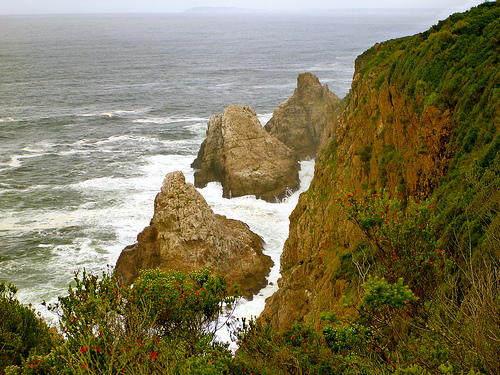
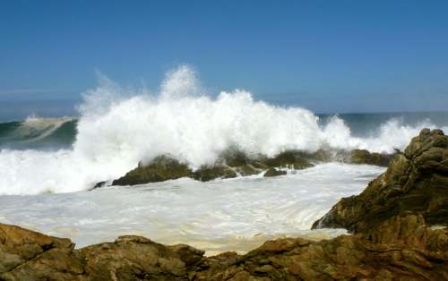
#7) Otter Trail, South Africa
#8) Everest Base Camp / 3 Passes, Nepal
#9) Haute Route (Chamonix-Zermatt), Alps
10) Overland Track, Tasmania
Be the first to hike those 10 in series in 5 months.
top 10 hiking regions
#1 New Zealand
#2 Southwest USA
#3 The Rockies
#4 Sierra Nevada USA
#5 Central Andes
#6 Patagonian Andes
#7 Nepal
#8 Australia
#9 The Alps
T #10 Indian Himalaya
T #10 Dolomites
New Zealand is #1 for us. But the wealth of options in North America make it a more compelling destination for most.
top 10 hiking towns
#1) Queenstown, New Zealand
#2) Huaraz, Peru
#3) Namche Bazaar, Nepal
#4) Cortina, Italy
#5) Chamonix, France
#6) Banff, Canada or Canmore, or Jasper
#7) Grindelwald, Switzerland
#8) El Calafate / El Chaltén Argentina
#9) Zermatt, Switzerland
10) Moab, Utah
More candidate towns.
top 10 coastal hikes NEW
#1) West Coast Trail, BC Canada
#2) Otter Trail, South Africa
#3) Abel Tasman Track, New Zealand
#4) Lost Coast Trail, California
#5) Thorsborne Trail, Australia
#7) Kalalau Trail, Kauai, Hawaii
#8) Pembrokeshire Coast Path, U.K.
#9) South Coast Track, Tasmania
10) Great Ocean Walk, Australia
More candidate coastal hikes.
top 10 trekking peaks NEW
#1) Mt. Kilimanjaro, Tanzania 5895m
#2) Cotopaxi, Ecuador 5897m <wiki><pb><sp>
#3) Imja Tse (Island Peak), Nepal 6189m <wiki><pb><sp>
#4) Mera Peak, Nepal 6476m <wiki><pb><sp>
#5) Chimborazo, Ecuador 6263m <wiki><pb><sp>
#6) Huayna Potosí, Bolivia 6088m <wiki><pb><sp>
#7) Misti Volcano, Peru 5822m
#8) Stok Kangri, India 6153m <wiki><pb<sp><trip><video><info><trip>
#9) Mt. Rainier, USA 4392m <wiki><pb><sp>
#10) Mont Blanc, France 4810m <wiki><pb><sp>
Aconcágua, Argentina 6,960.8m can be a walk-up. But not many would be willing to call it a trekking peak. 🙂
Trekking peaks are mountains under 7,000 metres (22,970 ft) climbable by anyone with a moderate amount of mountaineering experience and minimal gear.
Others considered for the top 10:
- Mt. Toubkal, Morocco 4167m <wiki><pb><sp><trip>
- Mt. Elbrus, Russia 5642m <wiki><pb><sp><info>
- Lhakpa Ri, Tibet 7045m <pb>
Thanks to Kraig Becker, the Adventure Blog, for help on the trekking peak section.
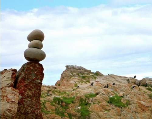
random header images
The images atop every page all come from our 900+ best besthike photos.
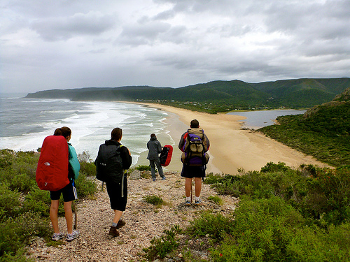
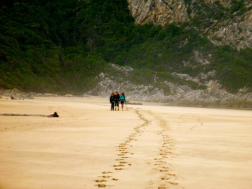
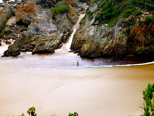
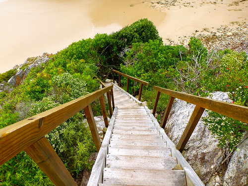
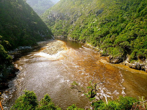
day 5 – Otter Trail, South Africa
Trip report by site editor Rick McCharles
day 0 | 1 | 2 | 3 | 4 | 5 | info page
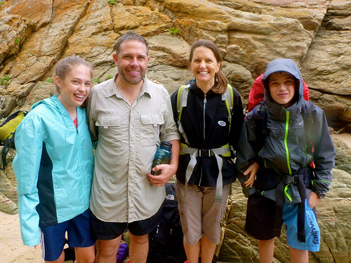
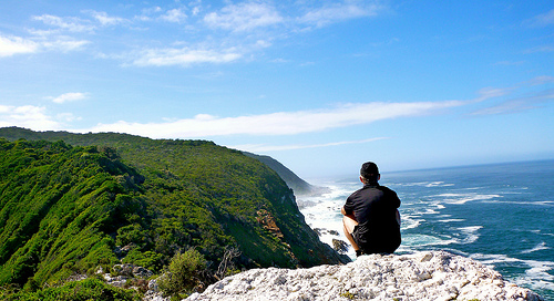
Last day, early morning, climbing out of the tent, I glanced up to see the Marques family high up on the cliff.

A few minutes later, there they were up on a further viewpoint.
… I’m not all that ready to leave the Otter Trail. 😦

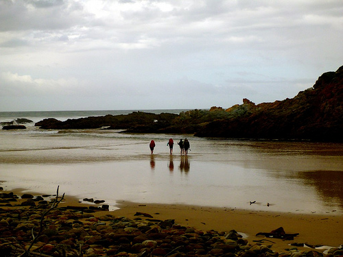
I caught up with the Marques just before dropping down to the Groot River and Nature’s Valley.

Instead of bright sunshine, we had a few drops of rain. The first significant rain in 5 days.

The longest 2km were on pavement to the only restaurant in Nature’s Valley.
Otter Trail certificates are available there. And you’ll be offered a traditional ‘shot’ to celebrate.
There are hostels in Pleasant Valley, served by the Baz Bus. But I caught a ride back to the start, Storms River. Scott and family had decided to stay there one more night.
Cost for that shuttle was about 150 Rand / person. ($16)
I collected my stored luggage at the National Parks office. And shared a hot shower with this mantis.

We saw friendly vervet monkeys there, as well.
I’ll never forget the Otter Trail, one of the best hikes in the world. A life changer.

If you’re interested in hiking the Otter Trail yourself, check our information page.
more of my photos from day 5
day 4 – Otter Trail, South Africa
Trip report by site editor Rick McCharles
day 0 | 1 | 2 | 3 | 4 | 5 | info page
Day 4 = 13.8km (± 6 hours) – Oakhurst huts – Bloukrans crossing – Andre huts
Crossing the Bloukrans River is the crux of the trip. It’s extremely important to arrive there before low tide.
At low tide in good weather, you might barely get your shorts wet. But people have drowned here. 😦
Low tide was 9:19am on our day. It takes 4-6 hours to get there.
Therefore, Rod and Jess left at 03am.
The Marques family at 05:30am.
It was 6:45am, in day light, as I walked away from camp.
A mad rush to get to the river crossing in time, I didn’t take many photos that morning. But had to stop for this picture.
We all managed our time well, arriving at the infamous Bloukrans river crossing right at low tide, 09:19am.
From above, I saw Scott checking route A, by far the BEST way to cross the river.
Conditions were perfect.
Low tide. Low river. No wind. 🙂
This family had crossed the Bloukrans the year before in far worse conditions.
They found it EASY this time.
Route A has you wade out via this sandy surge channel.
By contrast, the swim and exit via Route B (mid-tide) looked horrorshow.
You are supposed to haul yourself up out of the freezing Indian Ocean on one of two ropes.
This one gets you to the low traverse.

The other rope leads you to climb up the cliff, instead.
… I wouldn’t want to try either.
There are Routes C and D for very high water. 😦 … Don’t contemplate either.
Best wait up to 12 hours for the next low tide. Take Route A.
If you are too late in the day, be aware that there is a land route up and over the river known by Rangers. Telephone if you want information on that.
Once across the Bloukrans, you are much relieved. Guaranteed to finish the Otter. It’s easy from there.
Studying the near useless map given you at the start. And the look of the coast, … I gambled that it might be possible to stay low and make it to Andre huts along the coast.
After all, it was low tide. Very early morning.
Why not give it a try?
Sadly, the very last headland is impassable. I made it this far — then had to either backtrack. Or scramble up the cliff to regain the trail.
I scrambled.
Some exposure. Not recommended.
Arriving at the Andre huts early, we had plenty of time to explore.
Over 5 days we saw no big marine life. But plenty of birds.

Check the standard facilities.

My last night. Luxury mattress.
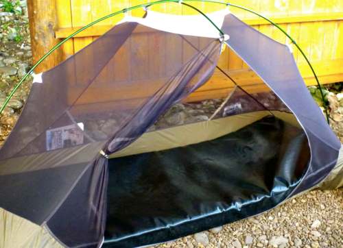
This was the only local visitor to my tent over 5 days.
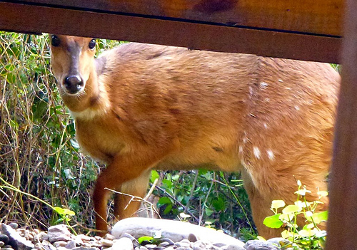
A female “buck“, I assume.
We celebrated our last evening with a bonfire.

Washed completely away by morning.
Goodnight Otter.

more of my photos from day 4
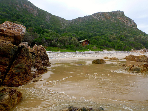
day 3 – Otter Trail, South Africa
Trip report by site editor Rick McCharles
day 0 | 1 | 2 | 3 | 4 | 5 | info page
Day 3 = 7.7km (± 4 hours) – Scott huts – Lottering crossing – Oakhurst huts
Crossing the Lottering River at low tide, or close to low tide, decides your day. Time of departure from camp depends on the time of low tide. It’s almost at the end of your hiking day.
Here’s where you need the tide tables handed out at Storms River reception.
Since low tide was 8:46am this day, everyone was up and departed early.

… Aside from me, that was. I took time for 2 more cups of coffee.

The weather was gorgeous. No wind.
I was further delayed, enjoying the beach, at the easy Elandsbos River crossing.

There are at least 2 ways up the other side. An old eroded scramble. And a newer, safer route more upriver.
What a gorgeous day. My favourite of the 5.

I was much late for low tide by the time I got to Lottering.
That’s Oakhurst, my destination, just the other side of the river.
If you are going to miss the tide, at least arrive when the tide is going out. … Not coming in, as it was when I got there.
Happily, I made it across only just barely getting my shorts wet. 🙂
Rod and Jess were late, too. But super organized.
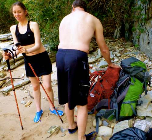
They had individual dry bags for each pack. And a second gigantic (red) dry bag that swallowed both packs.
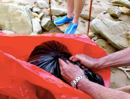
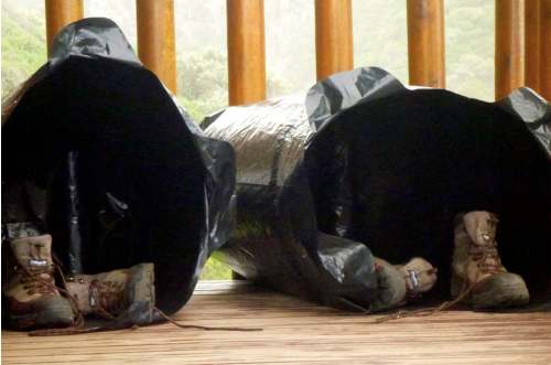
Those are the individual bags airing out after the crossing.
My own system was simpler. Every item in my pack was in waterproof or water resistant bags.
Don’t underestimate the Lottering. You could drown crossing this river in bad weather. The current is stronger than it looks.
The waves bigger at Oakhurst camp than anywhere else on the Otter.
In 2012 wardens offered to hike in meat and drinks for your last night. A menu with prices and a telephone was available in Day 3’s hut. A small service fee was charged.
By 2013 that service had been cancelled. We heard there was some abuse of the customers. Not all the beer ordered was making it to the last huts.
I had another very early night. No beer.
more of my photos from day 3
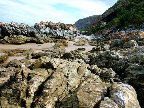
day 2 – Otter Trail, South Africa
Trip report by site editor Rick McCharles
day 0 | 1 | 2 | 3 | 4 | 5 | info page
Day 2 = 7.9km (± 4 hours) – Ngubu huts to Scott huts

Easy day. No rush.
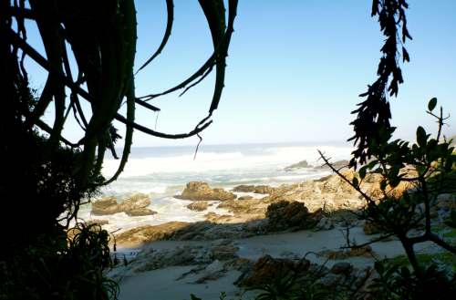
I stopped often to read and contemplate.
At one conspicuous rocky outlier — the Skilderkrans Quartz Promontory — I left a Summit Stone.

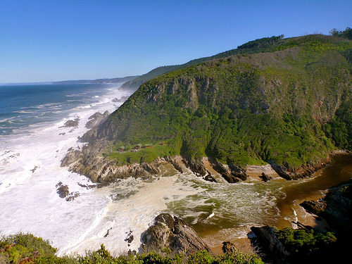
This place is remote.
Looking back.

Looking ahead.
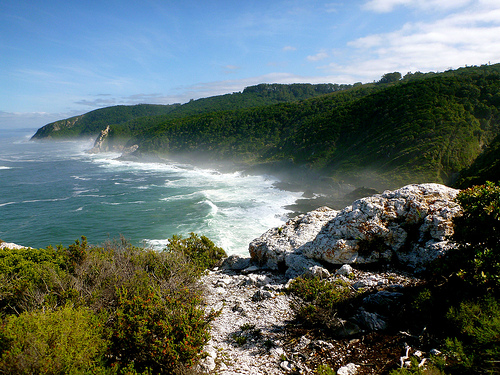
You’d swear you were alone on a lonely coast.
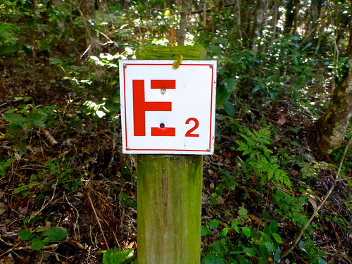
Yet there are emergency escape routes all along the Otter marked E for Evacuation.
I caught up with the Marques family stopped for lunch and a swim.

Like so many similar coastal hikes, the water is stained with tannin.

That’s not dangerous to drink. But it does have an interesting flavour. 🙂
At one time, the trail was much better signed for distance.

Many of those have gone missing over the years.
I’ve got this trip tagged jungle.

In many parts it’s impassable without following human or game trails. Dense fynbos is the natural shrubland or heathland vegetation unique to this part of the world.
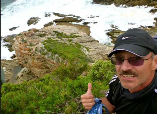
This ocean is cold and choppy. That didn’t stop Scott.

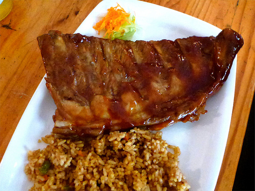
The family had barbecue once again. I shared some of their chicken. And ate my usual meal — smashed potatoes.

Sadly, I missed stopping at Bloubaai beach, the recommended lunch spot. I
a detour off the main trail.

Tell it on the Mountain – PCT
I’m at ADZPCTKO. The kick off party for the Pacific Crest Trail.
Pretty inspiring. 🙂
Check the new PCT movie.
Follow a half dozen of the 300 or so hikers who attempt a Pacific Crest Trail thru-hike every year. Armed with cameras, they give us an insider’s view into what it takes to spend half a year living in the wild.
Click PLAY or watch a sneak peek on YouTube.
Available for purchase on Tellitonthemountain.com and Amazon.
I’m doing research for a future PCT adventure. Likely just the California section.
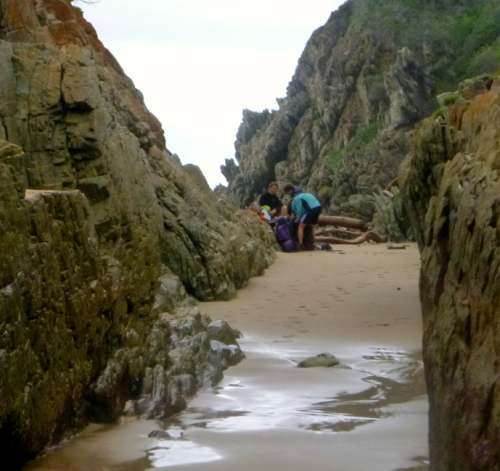
day 1 – Otter Trail, South Africa
Trip report by site editor Rick McCharles
day 0 | 1 | 2 | 3 | 4 | 5 | info page
Day 1 = 4.8km (± 2 hours) – Storms River reception to Ngubu huts
No rush day 1.
I relaxed in the morning. And enjoyed 2 MORE restaurant meals at Storms River Mouth Restcamp, making the obligatory day hike to the Suspension Bridges.
You must register for the Otter at the Park entry gates, not down at the campground — as I had hoped. Carrying my hiking pack, I started rolling the rest of my luggage UP the steep hill to the Park office.
Not one vehicle stopped to offer me a lift. (Best not try to hitchhike in South Africa.)
I did spot a bushbuck crossing the highway. Then a large troop of baboons, the first I’d ever seen in the wild.

Happily the Registration folks let me store my excess luggage for the 4 nights I’d be on the Trail. …
Registration is quick and efficient. The safety video has been out of order some months, so was not required for me.
Each hiker is given a poor map with trail description, suggestions, bird list, etc. Most critical on that one page document is instruction on how to most safely cross the Lottering and Bloukrans rivers.
You are also given tide tables (essential) for the dates of travel.

Start of the Otter, you share the trail and coastline with (many) day hikers.
Requires some boulder hopping with heavy pack.
This trail, 50-years-old in 2013, is rugged but very well maintained. There’s plenty of help. Steps. Bridges. Even a few ropes.
You can’t get lost. Follow the clawless otter.
Water is plentiful.

You are advised to treat all water. I did. Many locals don’t bother.
It took no time at all to reach the first camp. I was pleased to meet Steven and Kimberley, Scott and Claire Marques from Zimbabwe.
Rod and Jess, holidaying from the States, were the other 2 hikers starting same day. They had seen this Puff Adder sunning on the rocks.

Rod had grown up in this region. He’d never seen larger.
It’s not uncommon to see snakes on the Otter Trail. And throughout South Africa. For more information, ask at registration.

There are two huts, toilet and cold shower at all 4 camps, each mandatory stops. Each of the two huts has 6 bunk beds with firm mattresses. Hikers must provide their own blankets/pillows/sleeping bags etc.
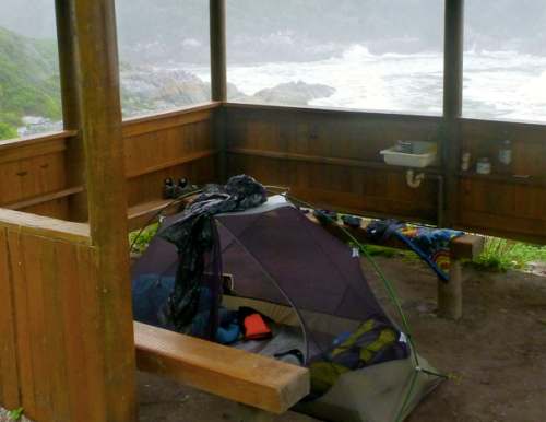
Happily the Marques family got their own hut. Rod and Jess got their own hut. And I tented under the mesh, protected by a roof in the dining hut. Normally tenting is not allowed, but my set-up certainly did no damage to the environment.

Of 12 spots available, only 7 hikers arrived to start. Many folks book a year in advance. There are no refunds. And its not allowed to replace those who don’t arrive.
A permit for the Otter is the most difficult in South Africa. It’s a shame they haven’t modernized registration procedures to get more folks on to the adventure.
A few tent sites should be added to each camp, too.
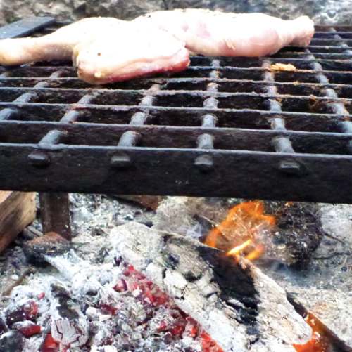
The one thing that unites ALL South Africans is murdering and cooking up animals out of doors.
The word braai (plural braais) is Afrikaans for “barbecue” or “grill”. I carried in frozen chicken.
Sanparks keeps a supply of wood dry underneath the huts. In fact, they were delivering wood fresh each day when we were there.
Two mooching genets made an appearance at dusk. Seems they’ve been gifted — or stolen — grilled meat in the past.
Lightning quick at dusk, we couldn’t get photos. They were gorgeous, though, with both stripes and splotches.
Here’s what they look like.

Finishing the wine I’d carried in, it was an early night. Dark at 6:30pm, the Southern Cross and Milky Way were stunning.
We were all asleep by 8pm. The only sound the crash of huge waves.

more of my photos from day 1
