It’s awesome. The best day hike into Blyde River Canyon.
Starting at the excellent Blyde Canyon Forever Resort there are at least three short routes (1–4 hours) that can also be linked together as a 5 hour walk. Each trail is marked by a different symbol. You won’t get lost.
Of many different possible day hike variations, I did the one recommended to me at Forever Resorts registration.
Leopard Trail descending from the Worlds End viewpoint. Switching to Loerie Trail, a fun, rough scramble back up the creek.
(Easier, but longer, is a return via Guinea-foul trail.)
At Worlds End you get a great vista of famed Three Rondavels, thought to look like the houses or huts of the indigenous peoples.
Three Rondavals
It’s all beautiful heading down into one of the biggest canyons on Earth.
The day I was there was quiet. The only others gawking at the natural scenery were these guys.
My route did not take me all the way down to the river, though you can get down there, if you wish.
It’s free to enter Forever Resorts. (I wished I’d stayed there. The Taj Mahal of campsites.) But costs $5 to hike if you are not a guest. You must check in and out of the hikes. At registration will give you a hand drawn map and details on each trail.
While visiting the must see tourist attraction of Bourke’s Luck Potholes in Blyde Canyon, I checked details on the not-so-popularBelevedere hike.
You must register at Bourke’s Luck. Pay a trail fee of about $5 in addition to the parking fee of $5. Start the hike before Noon and be back by 4pm.
I talked them into letting me start well past 1pm, promising to do a trail run to make up the time. I ended up checking out at about 4:30pm.
The trail down into Blyde River canyon is easy to navigate.
Follow the blue footprints.
Promoted as “strenuous”, I’d more call it “overgrown” and “non-maintained“. Only the most agile will be able to avoid all the spider webs.
It is pretty, though.
Not many tourists get down off the rim into the canyon. I saw nobody else on the trail this day.
The now defunct Belevedere hydro-electric power station is 400m below the Bourke’s Luck Potholes. Built in 1911, it was once the largest of its kind in the southern hemisphere.
A 36-year-old Suncor worker was coming out of a washroom Wednesday afternoon when a black bear attacked and killed her, as several co-workers tried to intervene and scare the animal away.
Family have identified the worker killed at the oilsands site near Fort McMurray as Lorna Weafer, an instrument technician. …
Seven people were working in a group area when the bear attacked the woman and dragged her off …
… co-workers blasted air horns to scare the male bear away. They were not carrying bear spray, Suncor said. …
“We don’t know why this happened and that’s why it’s so important we conduct a full investigation,” Seetal said.
A bear response team made up of Fish and Wildlife officers is investigating, and Occupational Health and Safety will also complete an investigation. …
The goal: to circumnavigate one of the most wonderful and wicked mountain ranges in the world – the Huayhuash, by bicycle.
This was all a spur of the moment idea; part of the vicious cycle of making every adventure more thrilling than the last.
January was the off-season, or rainy season, for the Andes so the wilderness would be completely desolate. The three friends hoped to be the second group to complete this trek on bikes. However, they underestimated the relentless weather they would encounter as they traveled for a week above treeline. …
I first heard of the Long Range Traverse, Gros Morne National ParkNewfoundland, Canada, in Classic Hikes of North America by Peter Potterfield.
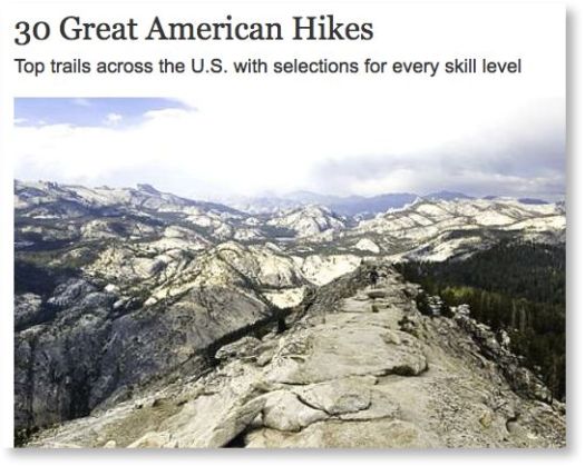
It’s certainly one of the best hikes of North America.
Distance: 23 miles (35 km)
Time: 4-5 days
Newfoundland’s Long Range Traverse is a unique 35-kilometer backcountry route of growing reputation among wilderness cognoscenti. The storied traverse follows the ridgelines and valleys of Newfoundland’s highest peaks where they rise abruptly 2,500 feet above the island’s west coast along the Gulf of St. Lawrence. The landscape here in Gros Morne Naitonal Park is as dramatic as it is remote, carved by glaciers from massive, uplifted blocks of granite that form the plateau. Land-locked fjord-like bodies of water, locally called “ponds,” dominate the views seaward toward the Gulf. …
The route is often described as a 35 km route, or about 23 miles. But that’s measured as the crow flies, and the actual distance walked will be much longer, the result of detours mandated by terrain and the thick patches of tuckamore. …
Mid May to mid September is considered prime time, but most hikers come in July or August. The advantage of off season travel is fewer bugs, the downside is the greater potential for bad weather. …
Last year Gros Morne National Park was threatened by a proposal to drill and frack for oil metres from the park boundary. After a huge public outcry this specific proposal was stopped. However the park is still vulnerable to future industrial proposals. That’s why CPAWS is working with concerned local community members and businesses to encourage the federal and provincial governments to create a buffer zone around the park to permanently protect it from industrialization
Tablelands, found between the towns of Trout River and Woody Point in Gros Morne National Park, look more like a barren desert than traditional Newfoundland. …
Kyle likes African Walking Company and Ultimate Kilimanjaro. They charge $2,000 to $3,500 per climber. Mid-range.
Here are the Ultimate Kilimanjaro trips for autumn 2014.
African Walking Company does not seem to have an easy-to-browse calendar. I emailed them. UPDATE: They got back to me by email, a 7-day trip starting Aug 26th costs $1850. … Those dates are not likely to work for me.
Villarrica is one of the world’s most climbed stratovolcanoes. Guided hikes to the crater are offered from the town of Pucón by several enterprises, but may ascent might be suspended due to cloudiness and in periods of seismic or increased volcanic activity. …