
I hiked Huayhuash in 2004. (annotated PHOTOS) It’s my BEST HIKE to date.
Extreme.
I recommend it only to the most experienced and adventurous trekkers.
Much better is a detailed 2010 trip report by ramblin’ boy:
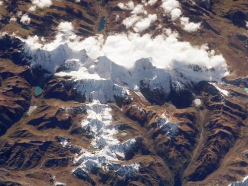
… The satellite image above shows you the mini-range of Huayhuash in the shape of a T; it is about 30 kilometers from one end to the other with six peaks over 6000 meters and a couple of dozen over 5000. It’s like walking in Sagarmatha National Park but without the prayer flags!
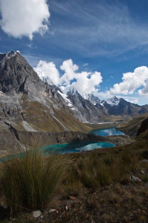
Most of the 125-km long trek is on trails above 4000m and above the tree line so you have a very stark mountain scenery. …
Our trek began with a ride to the new trail head at Llamac in a mini-bus with room for the seven clients, the two guides and cook and his assistant and a whole lot of tenting equipement and food. …
At Llamac we met the arrieros (muleteers) and their burros, all ten of them. They would carry the bulk of our stuff for us; we would walk with day packs containing rain gear, cameras, and a water bottle. I cannot imagine doing this particular trek unsupported, weighed down by all the things you’d need to bring. …
read on – The Huayhuash Circuit: South America’s Finest High-Altitude Trek

Those marvelous 15 days cost only $1350 / person. A great deal since they had a larger group.
They did the Circuit plus climbs of two trekking peaks: Pumarinri and Diablo Mudo.
Sweet.
Check our Huayhuash information page.
