
Towers of Paine 2004

by site editor Rick McCharles

Today I reprint my trip report from 2004.

___

The main reason I travelled to South America was attending the marvels of a thousand Patagonian sights and sounds.

Actually, it was to hike Fitz Roy (Argentina) & Paine(Chile).

fitz

paine_Both are stunning postcards. But which is the better hike?

To get to southern Patagonia we took a 20+ hour bus ride through scrubby, barren Patagonian steppes. I sipped red wine, dozed, listened to music & read — as I had the last two 20+ hour bus rides.

First stop, though, was the Moreno glacier, perhaps the most visited & photographed in the world.

I camped so as to have the fabulous glacier to myself once the buses departed.

moreno_9771the hunky Moreno glacier.

Next a happy rendezvous with Stacey and Bevan, a cool couple from Vancouver. We had hiked Alpamayo together months before. The three of us were psyched to finish our hiking adventures together before going home — as all good Canadians do— for Christmas.

bev_stacey_9798

We went first to Fitz Roy named for Captain Fitzroy of the Beagle. He and Darwin were likely the first Europeans to see the massif.

I feel a kinship with Fitzroy. Despite sharing a dinner table with Darwin for 5 years, he managed to come up with diametrically opposite positions on almost every issue.

While Darwin is a regular guest on Oprah, Fitzroy’s scientific theories have languished! (As has my own modest discovery that sea creatures once lived in the high mountains. It’s true! I can show you the fossilized shells.)

I had high hopes for Fitz Roy as it is far less visited than Paine and more famous with mountain climbers. The book Enduring Patagonia, by Crouch, details the history. I was particularly interested in the tale of the best first ascent in Patagonia, the Super Couloir on Fitz Roy, 1965. The Argentine climber Comesana said his fitness, at the time, was unimproveable.

Even more impressive is The Tower (Cerro Torre), most often climbed by theCompressor route, named for the 150 pound compressor hauled up by Maestri in 1970. This desecrated the mountain with 350 bolts, one of the great controversies in mountaineering. The compressor is still up there near the summit.

(Cheap chortle: one of the top climbers in history is named Athol Whimp. Talk about a boy named Sue!)

Also of note is the smaller Egger tower, sometimes named one of the 7 real summits — the most difficult peaks to climb on the 7 continents.

Unfortunately we had to endure Patagonia — in 3 days we did not see the tops of any of the famous peaks. The weather at Fitz Roy is horrific, even by Patagonian standards of horror. It sits on the largest ice shield anywhere in the world outside Antarctica. Near constant storms rage.

Horizontal rain and gale force winds. Snow at higher altitudes.

I love high wind, though, at night. The sound through the trees is wonderful. Wind is alive, like fire.

Wind batted my tent like a cat playing with a mouse.

We bailed on the Fitz Roy hike a day early. It did not look like the weather would clear. Ever.

Oh well, as Crouch says, It’s not Patagonia unless you hang on the cross for a while.

I was reading Naipaul too & recalled his advice on how to face disappointment, Take it on the Chin. And move on.

On to the Towers of Paine.

87

Super touristy, Paine is, regardless, the highlight for many who tramp South America.

Spectacular and uniquely chiselled peaks, granite towers, stunted & twisted trees, colourful flowers including orchids, huge undeveloped glacial lakes, brilliant glaciers — WOW! — What’s not to love?

Animal life is plentiful: llama-like guanaco, ostrich-like rhea, Andean fox, condors, flamingos, water fowl, hares, the endangered huemul deer. We saw all these. People hiking with us even saw a puma, not uncommon.

We did the 100km+ circuit of the Paine massif; no rush, plenty of time for side trips, in 9 days. Wonderful.

Unlike Fitz Roy, on Paine we had, for the most part, remarkably good weather. On the notoriously stormy Glacier Grey, you could light a match when we arrived at the Pass.

grey_9925Bevan at Glacier Grey

Anemomaniacs be warned, our most vivid memories of Paine are of the wind which often blasts 170km / hour. Several hikers were thrown to the ground. My glasses were whipped off my face and blown 10m. Two pack covers blew off: one recovered by a group a half hour behind; the other never seen again, flying like a balloon out of sight.

59

One night we sheltered in one of the expensive Refugiosas winds I estimated at 140km / hour tried to blow in the windows.

refugio_36sm

At last light (11PM!) Bevan went to check on their tent — it was close to Maytagging away down the valley. All the pegs had pulled out but the weight of 2 packs was justenough. Other friends had their rental tent flattened.

We saw waterfalls blowing UP.

And never before had we seen the wind pick up sheets of water and splash it on to the shore, drenching us at one point

After Paine, the remaining days of my trip were a let down. I moped at the southern extreme of the continent. I did not reach the barbarian coasts of the uttermost part of the world, but I could see it from Punta Arenas.

012 Punta ArenasPunta Arenas. Tierra del Fuego in the distance.

I daren’t cross the water to Fireland, forewarned that fearsome, naked giants live there, tending constant flames to stay warm, even in their canoes. They would devour me sure as shooting.

That’s it.

coffeeI am happy to go home to the best country in the world. Dreaming of a raisin bagel &double double at Tim Horton’s.

Pleased to stop torturing people with my Spanish.

I have a staggering genius for not learning languages. That is not the problem, though — perhaps I just got off the boat yesterday instead of months ago — the problem is my heartbreaking willingness to try to speak Spanish.

I am weary of filling in unnecessary bus roster & hostel registration forms. The amusement of using the nom de plume Richard Cranium is wearing thin. Occupation:grave robber. I invented new passport numbers each time.

When I was last in South America the blanks asked:Religion?. But this trip I was denied the chance to respond: lapsed pagan.

When I wandered into a high security Chilean naval base, I used my New Zealand driver’s licence as ID before being escorted out past red-faced security guards.

What part of the States are you from? The Canadian part. This no longer amuses anyone.

I will miss the plentiful time for reading, one of the great joys of travel. A few holiday recommendations:

 • Kim, Kipling (classic)
 • DaVinci Code, Brown (page turner)
 • Life of Pi, Martel (original, intense)
 • True History of the Kelly Gang, Carey (well wrote)
 • Sea Wolf, London (classic)
 • My Imaginary Country, Isabelle Allende (on Chile)

1molva_Next?

I was gifted a guide book to Molvania, a land untouched by modern dentistry.

Or — last minute berths to Antarctica by ship were going for US$1200 all inclusive 10 days.

hmmmmmm

Rick

related – my Paine and Fitz Roy trekking pages

World’s Best Hikes: Epic Trails

On National Geographic, Doug Schnitzspahn posted an excellent list of the best of the best:

• Mount Kailash Pilgrimage, Tibet
• Israel National Trail, Israel
• North Drakensberg Traverse, South Africa/Lesotho, uKhahlamba/ Drakensberg Park
• Cinque Terre, Sentiero Azzuro, Italy
• Yoshida Trail, Mount Fuji, Japan
• Santa Cruz Trek, Cordillera Blanca, Peru
• Hayduke Trail, Utah and Arizona
• Laugavegurinn/Fimmvörðuháls Pass, Iceland
• The Way of St. James via the French Way, Spain
• Continental Divide Trail, Montana, Idaho, Wyoming, Colorado, New Mexico
• Bibbulmun Track, Australia
• West Highland Way, Scotland (the weakest of the list)
• Shackleton’s Route, South Georgia Island, South Atlantic/Antarctica
• Shipwreck Coast/Shi Shi Beach, Olympic Peninsula, Washington
• GR 20, Corsica, France
• Copper Canyon/Tararecua Canyon, Mexico
• Great Himalaya Trail, Nepal
• Benton MacKaye Trail, Georgia, Tennessee, North Carolina
• The Snowman Trek, Bhutan
• International Appalachian Trail, U.S., Canada, Greenland, Scotland, Spain, Morocco

Snowman Trek
Snowman Trek

Here’s his list of the “most thrilling” treks:

• Besseggen Ridge, Norway
• El Caminito del Rey (The King’s Pathway), Spain
• Leukerbad Via Ferrata, Switzerland
• Devil’s Path, New York State
• Stromboli, Aeolian Islands, Italy
• Aonach Eagach Ridge, Scotland
• Huntington Ravine, Mount Washington, New Hampshire
• Kokoda Trail, Papua New Guinea
• Dry Fork Coyote Gulch, Grand Staircase-Escalante National Monument, Utah
• Black Hole of White Canyon, Utah
• Granite Peak, Absaroka-Beartooth Wilderness, Montana
• Búri Cave, Iceland
• Crypt Lake Trail, Waterton Lakes National Park, Canada
• Pacaya Volcano National Park, Antigua, Guatemala
• Huayna Picchu, Machu Picchu, Peru
• Mount Huashan, China
• Lion’s Head, Table Mountain National Park, South Africa
• Kakum Canopy Walk, Ghana
• Low’s Peak Via Ferrata, Malaysia
• Chadar Trek, Zanskar River Valley, India

Chadar Trek
Chadar Trek

Click through to check any of those you wish.

National Geographic – World’s Best Hikes: Epic Trails

(via The Adventure Blog)

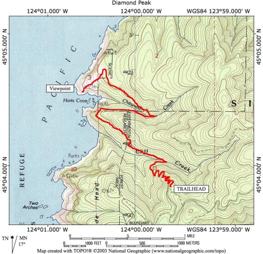
Hart’s Cove Trail, Oregon

Mary recommends this one. 🙂

Distance: 5.4 miles round trip
Elevation gain: 1000 feet
Difficulty: Moderate
Seasons: Year round (Update from KTred: Forest service road 1861 access to the trailhead is closed January 1-July 15th, adding several miles of uninteresting gravel road hiking. You could be fined be the Forest Service for being behind the gate.)


The Hart’s Cove Trail starts out by switchbacking downhill through a young coastal forest. Railroad tie steps here help make footing better. …

Portland Hikers

HartsCoveMap

Makalu Base Camp trek

You can do this route independently. You can do it as a teahouse trek.

640px-SP_at_Makalu_Base_Camp_(3852179714)

Here’s an independent trip report by Sathya:

9th – 27th Oct 2012

Lonely planet : Trekking in the Nepal Himalayas.

Note : The LP guide refers to this trek as a camping trek as of 2009 (when it was published). This trek can currently be done as a tea-house trek. The lodges in this trek are very rustic and there are just 1 or 2 lodges that are open in each of the villages en route. Do not expect anything more than dal-bhat at these lodges. …

Permits – One just needs a TIMS permit for this trek. …

Getting to/from the trailhead (Khandbari):

This is as arduous a task as the trek itself.

Coming from Kathmandu : The best way (most comfortable) to get to this is to take a flight (Buddha air) to Tumlingtar from Kathmandu. … Khandbari is less than an hour’s drive. …

Makalu Base Camp trek
13th Oct : Khandbari to RaniDunga (by jeep) and from there to Num and halfway to Sedua (trek)
14th Oct : Sedua to Tashigaon (2070 M)
15th Oct : Tashigaon to Khongma (3560 M)
16th Oct : Khongma to Dobato via Ghuguru/Tutu La (4050 M), Shipton La (4216 M) and Keke La (4150 M)
17th Oct : Dobato to Yangle Kharka (3600 M)
18th Oct : Yangle Kharka to Langma Le (4400 M)
19th Oct : Langma Le to Makalu Base Camp (~4700 M)
20th Oct : Makalu Base Camp to Yangle Kharka
21st Oct : Yangle Kharka to Khongma
22nd Oct : Khongma to Num
23rd Oct : Num to Khandbari

Sathya’s Trek

makalu map

lost on the Heart Mountain Horseshoe

Heart Mountain is west of Calgary, Alberta …

The 2,149 m (6,020 ft) mountain is easily distinguishable by its heart-shaped summit …

Heartrte2

At the base of the mountain a left turn onto the flat, good quality, Quaite Creek trail delivers us past a pristine swamp with mirror surface water and back to the car. The 11 KM (7 mile) loop …

Hiking with Barry

Barry makes it sound easy. 🙂

Local hiking Guru Kelly Mock recommended that loop, due to an early winter snowfall, but in reverse. Finishing coming down the Hart Mountain trail. We parked at the the Heart Creek trailhead.

P1300741

P1300753

Steve had done the loop before, but in the normal direction. We set off looking to ascend on the Quaite Creek trail.

Heart_Mountain_Hike_Alberta_Topographical

P1300748

Only Sept 13th, there was much more snow than we anticipated. But we hoped the snow would have been blown off the ridges, once we got up there.

P1300776

We tried bushwhacking through deep snow between trees to get up on the windswept ridge.

We tried.

If was tough going, postholing non-stop. For hours. Off trail. 😦

Here’s the highpoint reached.

10687364_689375491152198_2012647043025195073_o

Sadly slipping on that snowfield up to the ridge was a death drop. We turned back, the sun warm, the sky blue, the wet snow … turning to slush.

steep Heart Mtn

Yes. It was steep.

P1300773

We scrambled off trail down a different route, eventually getting back to the regulation track after 8 hours.

10479677_689375787818835_1260580944863415466_o

Phoning Kelly Mock to curse his bad advice, it turned out Kelly had started the Horseshoe in the normal direction, hoping to surprise us half way round.

After a half hour Kelly quit. You’d have to be an idiot to try Heart in these snow conditions. 🙂

Oh well. It was a terrific quad workout.

more of Steve’s and my photos

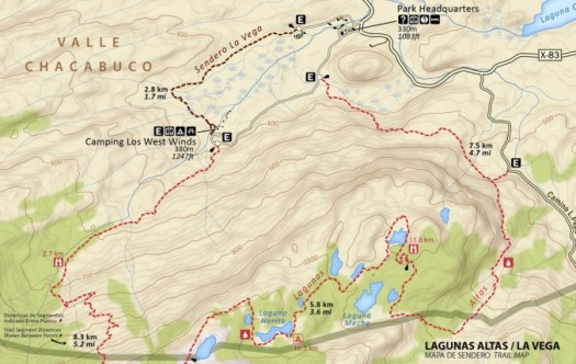
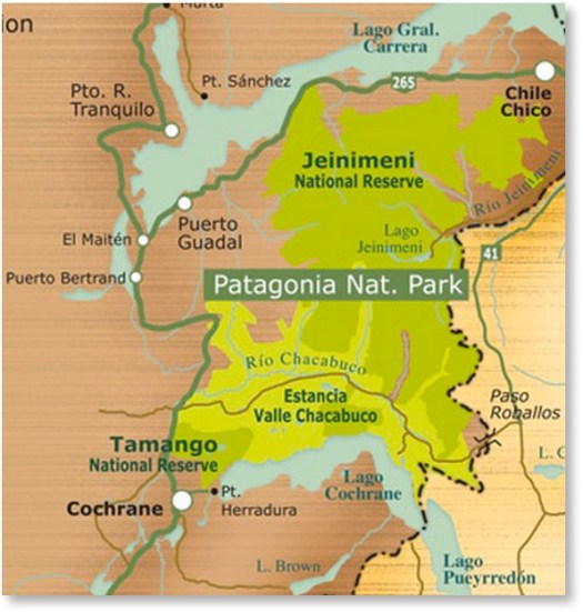
Lagunas Altas Loop, Patagonia National Park

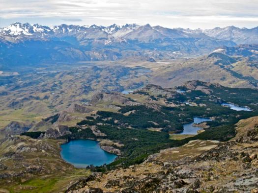
Lagunas Altas, the first major trail constructed at the future Patagonia National Park, offer a challenging day hike or overnight. The 23-km route offers spectacular views in all directions, from the Northern Patagonian Ice Field to the Jeinimeni Mountains. …

Lagunas AltaEstablishing the Lagunas Altas Trail

lakesHow to get there.

Nat Park

Arriving from the north (Santiago/Puerto Montt)

The easiest way to reach the park is to fly to Balmaceda Airport (Coyaique); LAN (www.lan.com) and SKY (www.skyairline.cl) both operate flights to Balmaceda from Santiago and Puerto Montt. Buses also arrive in Coyhaique from points north.

To reach the park from Balmaceda or Coyhaique, drive or take a bus south on the Carretera Austral (route 7). You can rent a car at the Balmaceda airport or in Coyhaique, or catch a bus south in Coyhaique. Three bus companies offer service south from Coyhaique: Buses Don Carlos, Acuario 13, and Buses Sao Paulo. Between the three companies, there’s usually one bus leaving every morning during the high season, around 9 am. Tickets cost ~$20 USD. …

how to get there

related:

• Where to Stay

• Conservation Patagonia

best hiking multitool – 3 essential tips

guest post by Morry Banes

Morry-Knows-Multitools-Logo-copy654There is a sweet spot in packing for your hike that’s just there between having too much stuff on you and not having enough to be comfortable. Finding this sweet spot is all about getting that balance right between the weight and bulk of the stuff you need to carry and their flexibility and usability.

Today, we are going to look into choosing the best multi tool for your needs. These small sidekicks can weigh as little as one standalone tool and can include up to 20.

But how do you know which one of these babies to choose if you decide that you want it?

A smart decision will call for looking beyond the stars and sparkles. Believe me, anybody who owns a multitool will tell you that the 80-20 rule applies here as well – 80% of the time you will be using 20% of the tools included. If you do the research yourself and read some multi tool reviews, you’ll get to the same conclusion.

So, here is what we are going to do here:

•    show you how to look past the advertising tricks and know which are the pieces that you will get the most use of

•    make sure that you are getting a quality tool that you’ll likely pass on to your family
Enough small talk, let’s talk some specifics:

In a highly competitive market there’s a lot of advertising tricks that can deter your attention from what’s important. So, let me give you some tips on how to avoid that.

Tip 1.    Versatility of a multitool

It’s easy to get distracted by the shine, the toothpicks and whatnots when looking at a multitool. A year later, you’ll find yourself looking at pieces that are there but have never been used. Oh, yes, and you paid for them…so, let’s get our essentials right and let’s spare you of those mistakes.
If you are a hiker, just make a mental checklist and look for a multi tool that will include:

•    well-made sturdy pliers and solid wire cutters
•    stainless steel blades, regulars and serrated ones
•    two types of screwdrivers (regular and Philips)
•    can and bottle opener

Chances are high that you’ll be needing most of these. For everything else just ask yourself if you see them being regularly used. Like a toothpick…or that flimsy small scissors? Or the nail clipper?

Tip 2.    Quality of the materials

Ah, quality, a word that’s so easy to throw around. Of course, every company will say that their product is of “highest quality”. But this is such a vague statement and before you know it you find yourself in a clutter of products that all claim to be of “high quality”.

Let’s cut through that clutter here and really learn what’s quality when it comes to multitools – it’s not that complicated after all:

Sub-tips within the tip 2:

What’s quality when it comes to individual pieces?

•    420 stainless steel, if compared size for size, is much stronger than titanium, and it’s an alloy of steel that has very little chromium (just 12%). In plain terms – it will not break and will last much longer

•    When I said pieces in the tip above I meant everything except the blades – 420 steel is a solid choice and included in most multi tools, but there is something better when it comes to the blades and that’s the 154CM steel. This alloy of steel will hold its edge much longer without the need for sharpening.

•    Titanium, in spite of the fact that it’s not as strong as 420 steel will be better for the handles because it will not corrode or rust

So, if you are looking for a multi tool that will likely last you a lifetime, look for these materials. I hope that makes it clear what “quality” is, and you can now look through the advertising shenanigans.

Some of these shenanigans, as far as I am concerned, are terms like:

•    dye-coat steel – which is a different way of saying “it’s not really stainless steel, we just paint so it looks like it is”…

•    “titanium coated” – this one is my favorite because it looks so good and shiny and it’s very hard to resist. Titanium coating will keep the corrosion off for a while until the coating wears off, and your tool starts to rust (usually about the time you warranty expires).

Tip 3.    Safety

This one is simple, read through the reviews and look for a piece that users report can be safely deployed using one hand.

When I say “safely” I mean without cutting yourself. This is not the biggest deals because any piece that meets the criteria we have set in Tip 1 and 2 will be designed smartly so that you can have the multiple pieces open and still use the multi tool safely.

And yes, look for a multi tool that features safety locks.

Final thoughts

If you are a hiker, it’s very likely that the less-is-more rule applies when you are choosing your multitool.
Everything I said here is aimed at you getting the biggest bang for your buck. The last part of the equation are your needs.

So, by all means, do your research, read multi tool reviews, read what other people say, think about how your experiences compare to those of other consumers and then make a calm controlled decision about the best multi tool for yourself.

If anything I said here sticks and helps in the process, the time sharing my experiences could not be better spent.

Stay safe

Helm Creek to Black Tusk

trip report by site editor Rick McCharles
Whistler is a Canadian resort town in the southern Pacific Ranges of the Coast Mountains in the province of British Columbia, Canada, approximately 125 km (78 mi) north of Vancouver. … 

Over two million people visit Whistler annually, primarily for alpine skiing and snowboarding and, in summer, mountain biking …

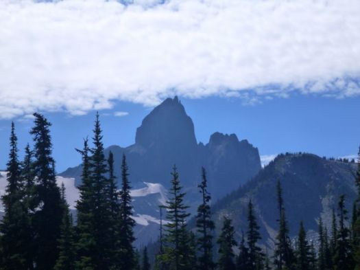
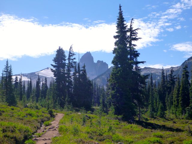
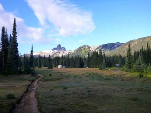
Very few of those 2 million visitors climb up to one of the most iconic Canadian peaks, Black Tusk.

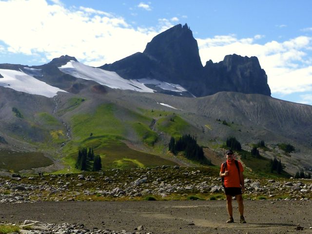
The Black Tusk is a stratovolcano and a pinnacle of volcanic rock in Garibaldi Provincial Park of British Columbia, Canada. At 2,319 m (7,608 ft) above sea level, the upper spire is visible from a great distance in all directions. It is particularly noticeable from the Sea-to-Sky Highway just south of Whistler …


Black Tusk
Black Tusk

Most hikers approach from the Taylor Meadows campground to the south near Garibaldi Lake, although there is a second route from the north that travels by way of Helm Lake. …

Locals advised me to avoid the crowded trailhead off the highway, and hike via the Helm Creek Trail instead. That’s the Cheakamus Lake trailhead, closer to Whistler.

I bought my $10 / person / night camping permit online from BC Parks. You can pay cash at a machine only at the Diamond Head and Garibaldi Lake parking lots, not at the Cheakamus Lake parking lot.

Why doesn’t BC Parks have an office somewhere near Whistler?

Cheakamus Lake to Black Tusk Meadows via Helm Creek:

• Length, 14.5 km; suggested time, 6 to 7 hours one way;
• elevation change, 600 metres.
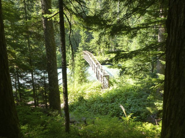
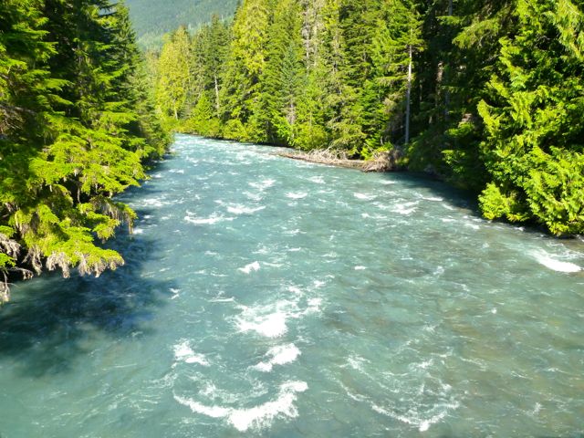
• 1.5 km along the Cheakamus Lake trail, drop down to a bridge across the Cheakamus River.

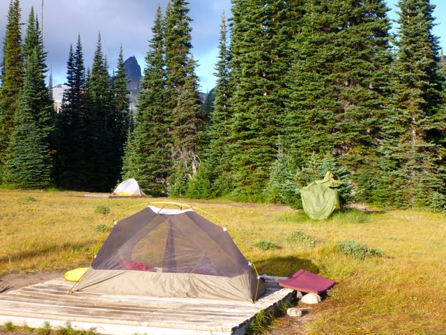
P1300549 P1300552On the other side of the river the trail switchbacks upward steeply to the Helm Creek Campground.

P1300561 P1300566I carried on to gorgeous Black Tusk Meadows.

P1300577Hikers coming down from the south summit told me it was too late in the day for me to start up.

After weighing my options (I was carrying a head lamp) I finally decided to wander the meadows, instead.

P1300572 P1300581 P1300589It turned out to be a leisurely night.

P1300602

Next morning I turned my back on Black Tusk and headed back down to my car.

P1300610 P1300611

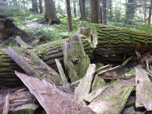
I had time for a sidetrip to pretty Cheakamus Lake via lush temperate rain forest.

P1300622 P1300624 P1300625Black Tusk is off limits to mountain bikes, but the ride to this lake is superb.

All in all, a wonderful 2-day hike.

If I had one more day I would have done the 34km route Helm Creek, Panorama Ridge and Black Tusk shoulder detailed in this 9min video.

Click PLAY or watch Summer hiking featuring Helm Creek, Panorama Ridge and Black Tusk on YouTube.

I might even exit from there to the highway. It’s still possible to hitchhike near Whistler. 🙂

more photos from my hike

related – BC Parks – Garibaldi Provincial Park