dirtbag — a subculture consisting of ski bums, vagabonds and climbers well practiced in the ways of avoiding work, while spending as much time as possible pursuing their outdoor passions. …
holloway — a sunken path worn down due to foot traffic, rain and erosion that has fallen significantly below the vegetative banks on each side. …
krummholz — bent, stunted trees found in mountainous and arctic regions, twisted by steady winds and short growing seasons. …
verglas — a thin coating of ice that forms on rocks overnight, or when snow melts and then refreezes. …
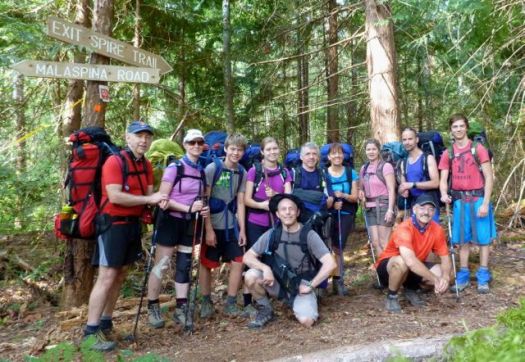
Eleven hikers from flat, dry central Canada – Saskatchewan – met up at Nancy’s bakery in remote Lund, B.C.
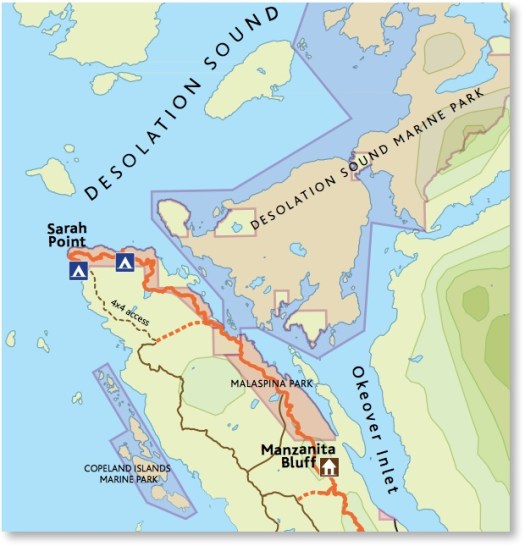
Our plan was to hike from Sarah Point to Powell River in 5 days, 4 nights. The first section of the 180km Sunshine Coast Trail.
We ended up exiting after 2 nights walking out from Manzanita hut right back … to the bakery. 🙂
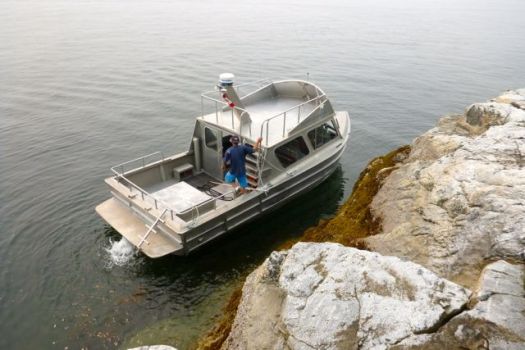
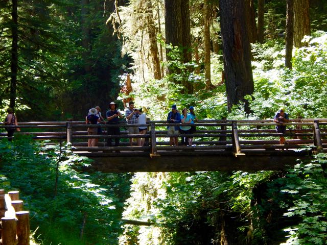
We’d booked a water taxi from Lund to the trailhead at Sarah Point.
Our skipper was excellent. The weather perfect. Yet the scramble up steep, slippery rock to the trailhead was challenging. I’d hate to do it in rough seas.
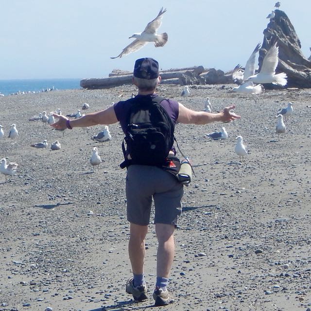
We were off. 🙂
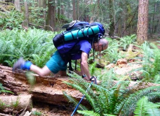
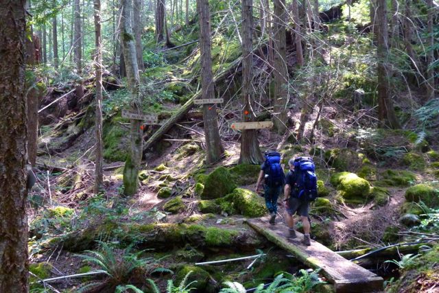
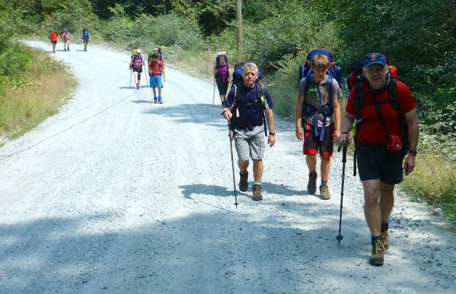
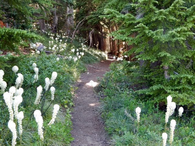
The trail is well flagged but requires frequent scrambles over, under or around fallen trees. Our packs felt very heavy at this point.
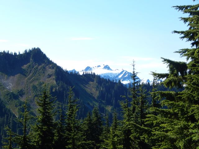
Early July 2015 the Pacific N.W. was atypically hot and humid. Forest fire hazy clouded the sky.
Mosquitoes and wasps were a real pest. Four of our group were stung over 3 days.
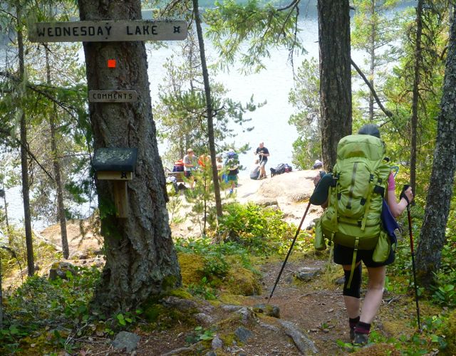
It quickly became evident our large group, starting late in the day, would never make it to our intended destination – camping at Wednesday lake.
Instead we dropped down to a disused campsite at Cochrane Bay. It turned out to be a lovely spot. The pit toilet (which we found the next morning) still in working order.
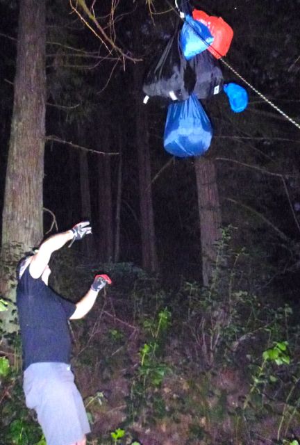
It was dark when we went to hang the food.
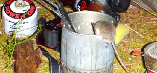
Rodents quickly pounced on my dinner pot (salmon) once I set it on the ground.
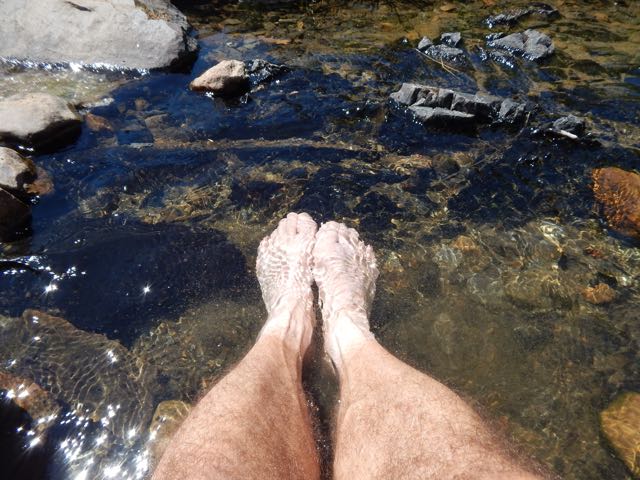
The sea a glassy lake next morning.
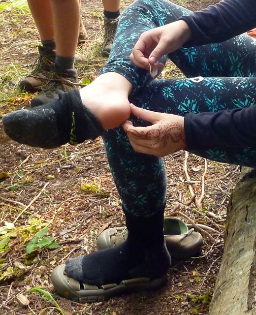
We suffered some foot and knee pain. And morning stiffness, of course.
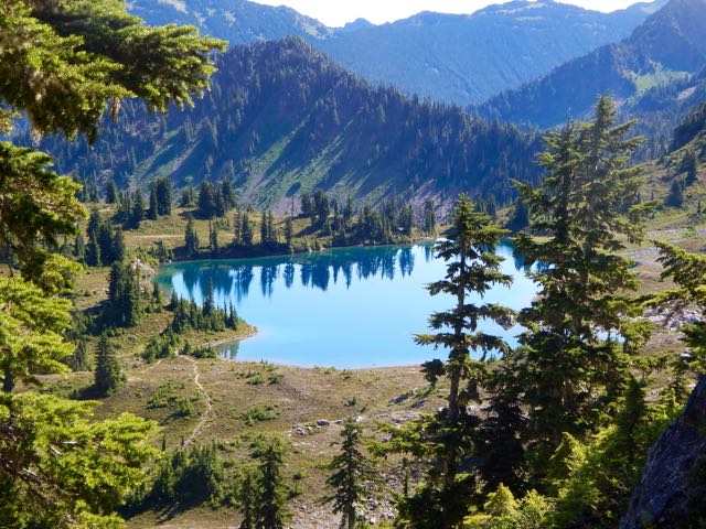
A steep, sweaty climb up from the sea brought us to Wednesday lake where we refilled all our water bottles. You need at least 3 litres / person on this dry section of the Trail.
We needed this refreshing break as the climb up to the Manzanita bluff was particularly gruelling.
Joan’s last hike?
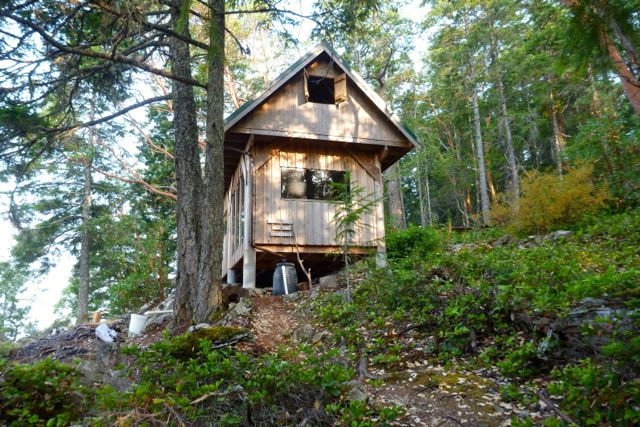
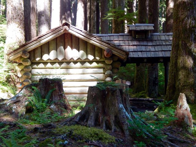
It was with relief that we arrived at Manzanita hut early in the day.
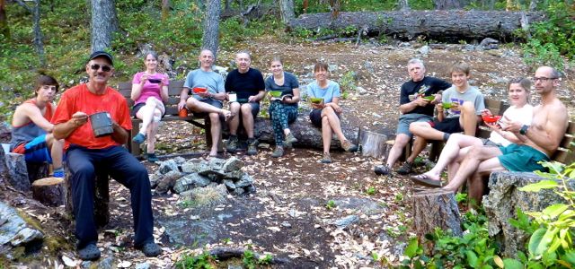
It is a treat to have tables and fire pit after the wilderness camp of the previous night.
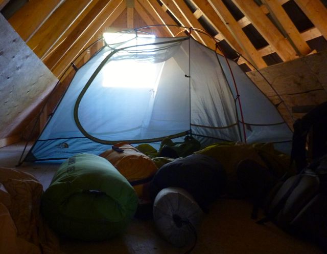
We split up some sleeping in their tents, some in their tents in the loft.
Running low on water, some of the keeners walked about 1.5km down hill to find a stagnant spring. Carried it back up. You need to treat all water on the SCT.
By morning it was decided. We were going to quit the SCT and exit to Lund. Our spiritual leader Bill Wallace and his doppelgänger consulted the guidebook, brochure map and some local day hikers to calculate the best route.
The manly men checked to see if they were strong enough for the escape … by trying to do a chin-up with full pack.
Bill leading the quitters to safety.
Civilization. 🙂
siesta
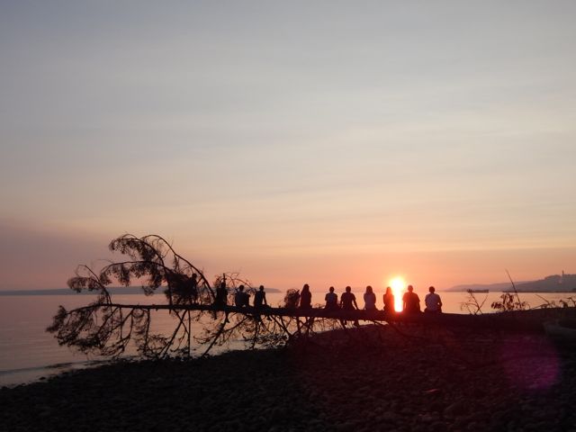
We checked in at the Willingdon Beach campground in Powell River. It’s a good spot, walking distance from the ferry.
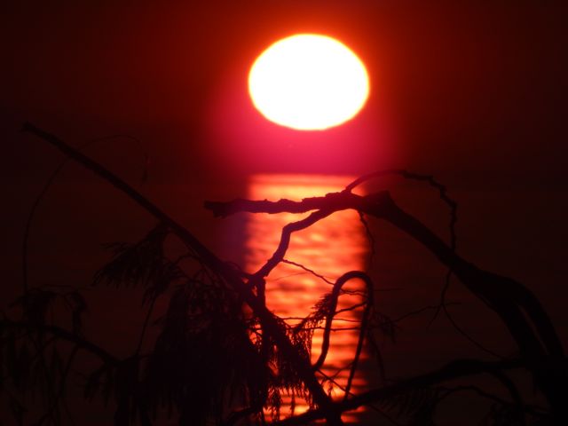
The sunset is gorgeous from here. Sandy descended the steep, slippery cliff to shore faster than anyone else. 🙂
With the extra time we decided to kayak Desolation Sound. It turned out to be the best day of the week!
Back to Saskatoon. Back to reality. 🙂
Lessons learned on the Sunshine Coast Trail:
it’s mostly inland
great vistas are infrequent. Many sections are tree-locked.
it’s rarely flat
much more challenging than expected
Two ladies who had done half the Pacific Crest Trail found the long day from Sarah Point to Manzanita hut a serious day. They went straight to bed after dinner and were gone by 6am next morning. Do not underestimate this trail.
I’m hoping to get back in September / October when the bugs are less a problem. Cold doesn’t worry me.
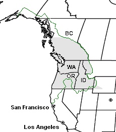
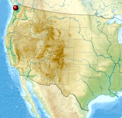
Definitions of the Pacific Northwest region vary and there is no commonly agreed upon boundary, even among Pacific Northwesterners. A common conception of the Pacific Northwest includes … Oregon and Washington as well as British Columbia.
AT A GLANCE
fantastic coastal adventures including the West Coast Trail, our #1 hike in the world
fantastic alpine hiking
easy access via Seattle, Portland or Vancouver
best weather June through September. But there are many great options year round due to the comparatively mild climate
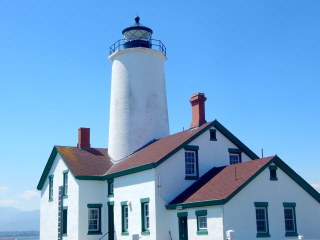
Diana and I wanted to visit the New Dungeness Light, in continuous operation since 1857.
It’s fairly easy to find the trailhead from the highway near Sequim.
Here’s the light station at 34x zoom.
It was a long but interesting day hike.
There was a family of volunteers manning the lighthouse. Father had scheduled this week about 6 years ago when his youngest daughter was age-2. Children must be at least age-8 to stay out here.
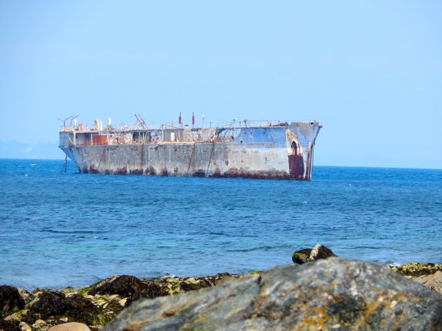
We didn’t catch much sea life. But there were a couple of interesting things out at sea. 🙂
I was en route to hike the Cape Alava to Rialto Beach “Shipwreck Coast” on the Olympic peninsulaend of June.
But when I dropped by the the Wilderness Information Center in Port Angeles on the way to the trailhead, Rangers informed me that famed High Divide Loop (7 Lakes Basin) was open early this year. Winter had dropped very little snow on the high peaks.
I instantly changed my plan. You can hike the Shipwreck Coast almost any time. But the High Divide Loop window is time limited. Late July to mid-October most years.
The High Divide Loop is very weather dependent. I arrived during a heat wave. Blue skies. Quite rare in the high mountains of the rainy coast.
20.3mi (32.6km) including sidetrips to Lunch Lake and Bogachiel Peak
must carry a tent and be completely self-sufficient
cumulative elevation 5200ft
On the advice of a Ranger, I booked 2 campsites:
Deer Lake
Sol Duc Park (near Heart Lake)
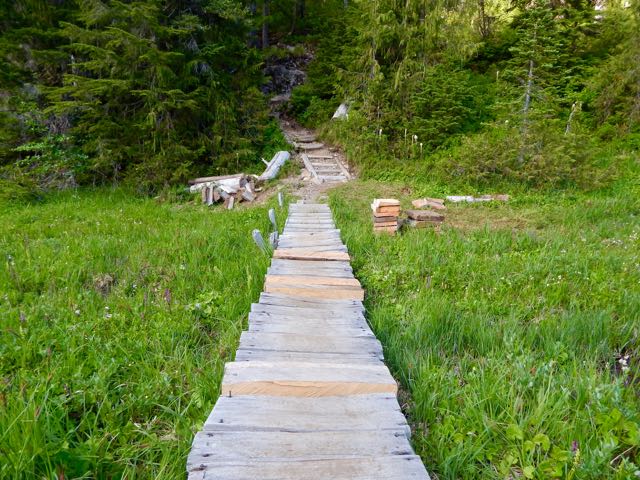
I started with the day hikers heading up to Sol Duc Falls.
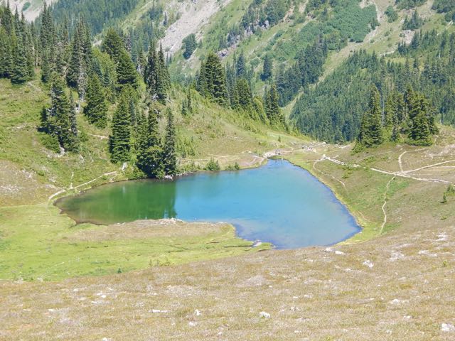
It’s a steep up,up,up from there to Deer lake. Nice campsite. But it did have mosquitos. I was happy to have carried my mesh bug shirt.
The Park was extremely dry while I was there. Normally you get wet feet on this hike. Boardwalk helps.
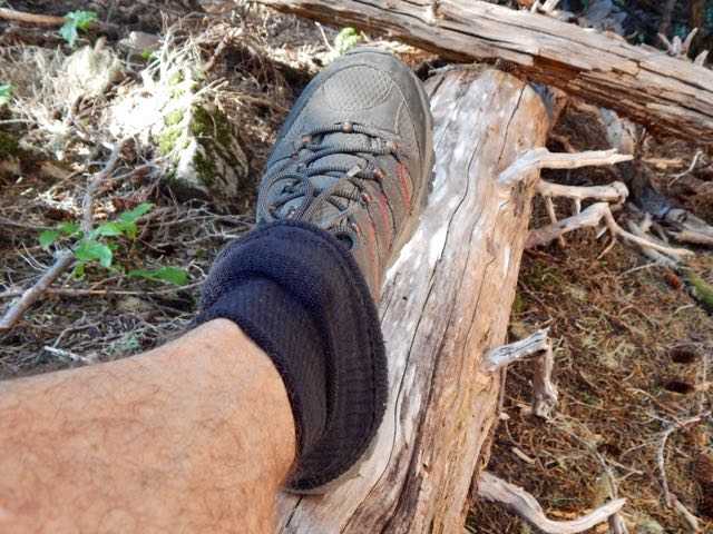
I used the instagator technique to keep pebbles and dust out of my approach shoes.
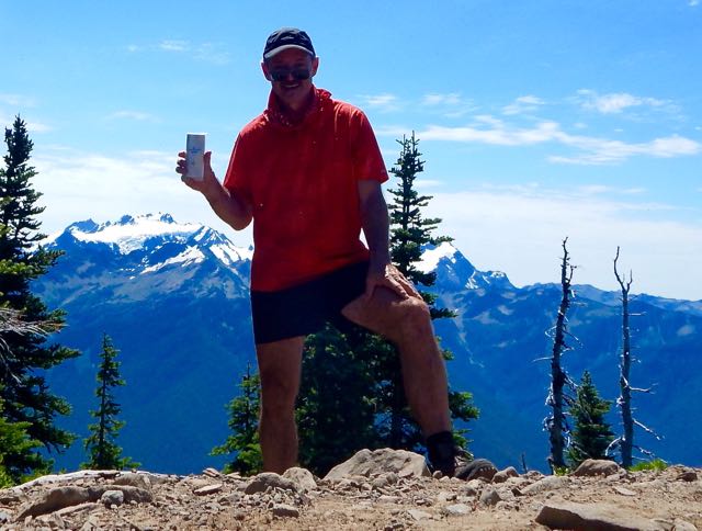
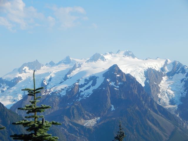
This was my first glimpse of Mt Olympus next morning. I was very pleased the skies stayed clear. This summit is usually cloud shrouded.
Though the old growth forest trails are tranquil, it was fantastic to get above the tree line.
I love the bear grass, but wildflowers were less prolific than expected.
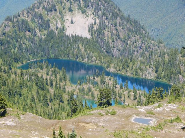
I stashed my pack on the ridge and dropped into into 7 Lakes Basin for some day hiking.
It is marvellous.
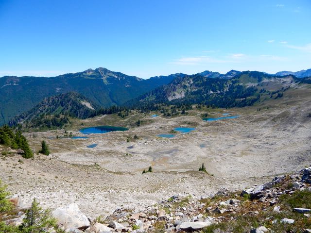
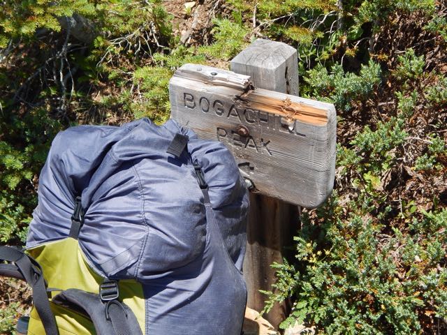
Climbing back up to the ridge I continued to one of the most famous viewpoints in the Olympics, Bogachiel peak.
The ridge walk above the basin is fantastic in clear weather. You look down on the many-more-than-7-lakes.
I was exhausted and dehydrated by the time I finally dropped down towards Heart Lake.
Rangers there told me where I could find good water. There was none on the ridge. 😦
I had been counting on melting snow. Unfortunately I found no snow.
With relief I set up my tent at Sol Duc Park campsite. Washed my feet. And took an hour siesta.
In the late afternoon I made a long day hike past Cat Basin campground to see what my guidebook claimed was the best view of Olympus. I wasn’t disappointed. 🙂
Next morning was an easy downhill exit through old growth. Very mellow.
If you’d like to see 7 Lakes Basin and Mt Olympus for yourself, check our new information page.
The Elwha Dam was a 108-ft (33 m) high dam located in the United States, in the state of Washington, on the Elwha River approximately 4.9 miles (7.9 km) upstream from the mouth of the river on the Strait of Juan de Fuca.
It was taken out in an effort to restore the original habitat, especially for fish breeding.
Looks pretty good in 2015. I did a short day hike from the viewpoint.
You didn’t want to be downstream when the floodgates were unleashed.
Using a therm-a-rest as a backpack “frame” was first suggested to me by Kraig Becker, of The Adventure Blog and Gadling.
Granite Gear Virga backpack with Therm-a-Rest frame
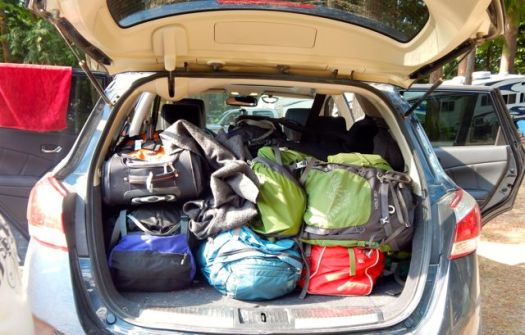
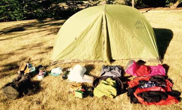
I’m just packing for the Sunshine Coast Trail starting next week. Five days minimum. Probably more. But with chances to resupply.
Sleeping system: MSR Hubba tent, down sleeping bag, silk sleeping bag liner, 3/4 length therm-a-rest, dry bag stuff sack “pillow”, headlamp.
Outdoor clothes: unlined long pants, wicking t-shirt, Gortex jacket, long brim baseball cap. Two pairs of long socks. Two pairs of quick dry underwear. Two bandanas. One Buff. Well tested approach shoes.
Food: Large bear bag, spoon, stove, extra fuel canister. (Start with 5 days grub. Mostly coffee, candy, instant mashed potatoes, instant soup, tuna in a bag.)
Drink: Water bottle, 2 litre soft drink bottle, purification tablets.
Entertainment. Paperback, plenty of audio books on iPhone.
Photography. Camera, extra AA batteries, MacBook Air with power adapter.
Forward this article by Trinity Ludwig to ladies in your hiking group. Trinity completed an 11-month 1,785-mile trek the length of South America. And knows what she’s talking about.
If there’s one thing Alberta Canada is known for, its the stunning National Parks in the Rocky Mountains, an area surprisingly accessible to the UK and Europe. In one corner of the ring we have Jasper, the smaller town but larger National Park, with over 11,000 square kilometres of intrepid wilderness. And in the other it’s Banff, with 6,600 square kilometres to explore, but rich in history and a larger more vibrant town. Both Jasper and Banff are UNESCO World Heritage sites, but which one is best? …
Hiking wise, I’d say Banff is superior. Scenery is slightly better in Jasper. But access and logistics are superb from Banff townsite. It’s the jumping off point for one of our top 10 hikes in the world – Sunshine to Assiniboine.


 Men. You know nothing. 🙂