 besthike.com won the Golden Boots Blogger Award for March, 2016. 🙂
 And over on Health Listed – besthike is #13 of Top 50 Outdoor Adventure Bloggers You Must Follow for 2016
It’s nice to be loved.

Best hikes, treks, tramps in the world.
besthike.com won the Golden Boots Blogger Award for March, 2016. 🙂
And over on Health Listed – besthike is #13 of Top 50 Outdoor Adventure Bloggers You Must Follow for 2016
It’s nice to be loved.
trip report by site editor Rick McCharles
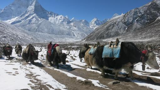
The best hike in the country. One of the best in central America. In fact, this is the highest point in central America at 4,220m (13,850 ft).
Click PLAY or watch a promo video on YouTube.
I was up at 3:30am to check out of my hostel in Xela and walk over to Quetzaltrekkers through dark streets.
4:45am rendezvous. Our group of 10 included two guides, hikers from Canada, the States, England, Switzerland and Germany.

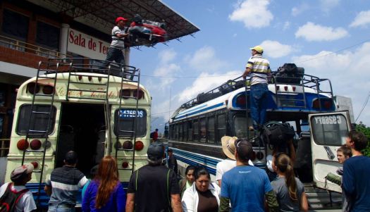
At 5:15am we climbed into a pick-up to get to the hectic Minerva bus depot. We were first to get seats on the chicken bus.

Arriving about 7:30am, we ate a good breakfast at a San Marcos bus station comedor.

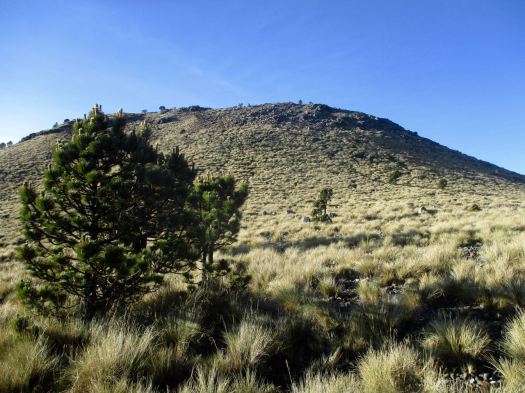
Next was an even more crowded bus to Tuichan. By around 10:00am we started up.
Quetzaltrekkers have no employees. Everyone is a volunteer.

All proceeds go to a children’s charity.
Being a volcano, I feared it would be an unrelenting slog at the same angle. Happily there is a fair bit of variation in the trail – though it is unrelentingly UP.

A highlight are the Hartweg’s pine, a very high altitude species


Spooky in the clouds.

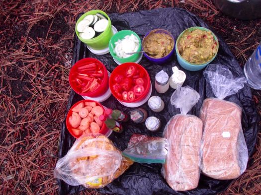
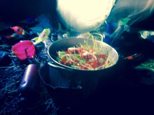
Finally arriving at “base camp” after 4-5 hours, we enjoyed a healthy lunch of local fare.
That was 1000m elevation gain over 4km. Sleeping at about 4000m (13100ft), there’s a real risk of altitude sickness.
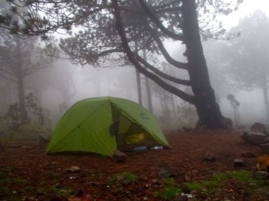
Everyone slept in provided 4 person tents aside from Jordan (who slept in a hammock) and myself who brought my own gear.
We all crashed for siesta, knowing we wouldn’t get much sleep tonight.
We’d planned to climb up to Tajumulco’s second summit, Cerro Concepcion, for sunset. But afternoon rains had come. We stayed in our tents.
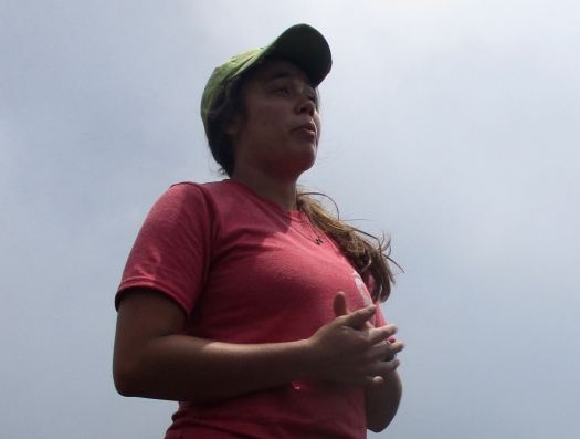
By 6:30pm the rain had stopped. We had dinner and hot drinks, hoping the morning would be clear. This was the second trip for one girl – her first summit clouded over.
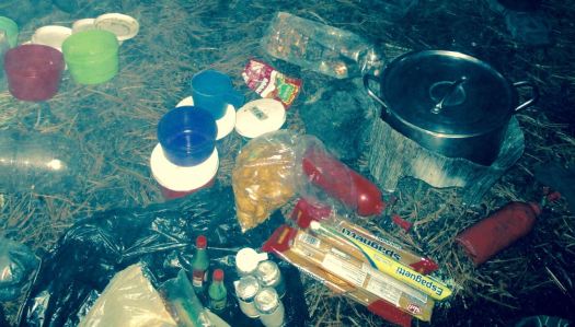
A brazen mouse ran around the cook area.
___ My alarm went off at 3:30am. I’d not slept particularly well.
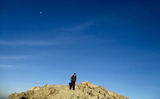
Though we had clear skies and near a full moon, it was dark. My borrowed headlamp died quickly. I followed the lead guide closely to take advantage of her lamp.
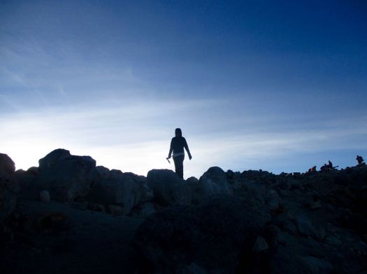
The final 200m is a scramble. Gloves are useful for grabbing stone in the dark.
It went well. All 10 of us at the top before dawn. We huddled in our sleeping bags.
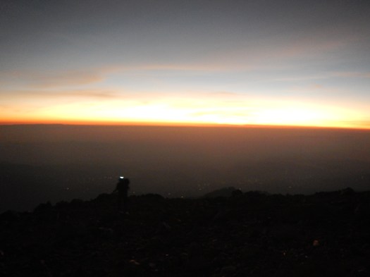
Dawn at 5:30am was gorgeous.


Everyone – at this point – was super happy they had joined the trip.

We stayed on top as long as we could handle the cold wind.
There are views to Mexico. And many other volcanos.

This is volcano shadow.

We descended by a different route, first circumambulating the crater.


Quickly into grassland, we started to get hungry.

The water was boiling for breakfast by the time we got back to camp.

This very popular hike is – sadly – quite littered and vandalized. Instead of leaving my Summit Stone at the summit, I left it in one of the excellent climbing trees at camp. 🙂

No rush. We dried the tents, the sun already very hot at 8am.
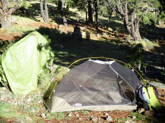
I was impressed with the toilets provided. Happily there are very few insects this high up.

The descent was relaxed. Our climb already a success.
It’s slippery, however. We had numerous falls on the way down. This could be treacherous in the rain.
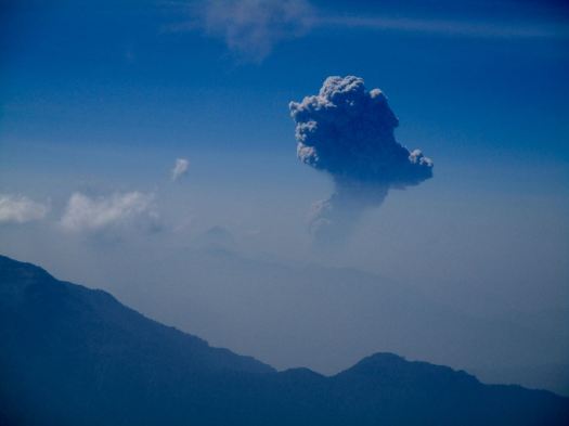
One highlight was seeing the eruption of another volcano – Santiaguito. It’s a near daily occurrence. In fact I’d climbed up another volcano, Santa María, to see that eruption on another hike, 10 years earlier.

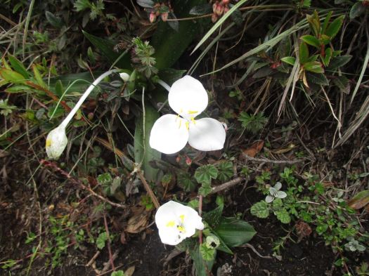
The National flower of Guatemala, Lycaste skinneri, are everywhere. Another highlight.
About Noon we got back to the road. The peak was already clouding up. No doubt it would rain again late afternoon.

We were hungry again for a big lunch at this village restaurant. Most had the fried chicken. And Gallo beer.


We reversed our route. First a bus back to San Marcos. Our driver parked close to our next so they could throw our packs roof-to-roof. (I’d never seen this before.)
In Xela we again climbed into a pick-up truck to return to Quetzaltrekkers by about 4:30pm

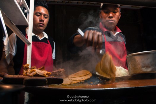
A shower. Some rest. To celebrate some of us got together for street tacos and cheap beer at the Plaza Central.
Tajumulco is highly recommended, so long as you have clear skies in the morning. You can do it on your own, but finding all right buses may be a hassle.
We’ve added this adventure to our list of best hikes in North America.
![]()
See all my full resolution photos on flickr.
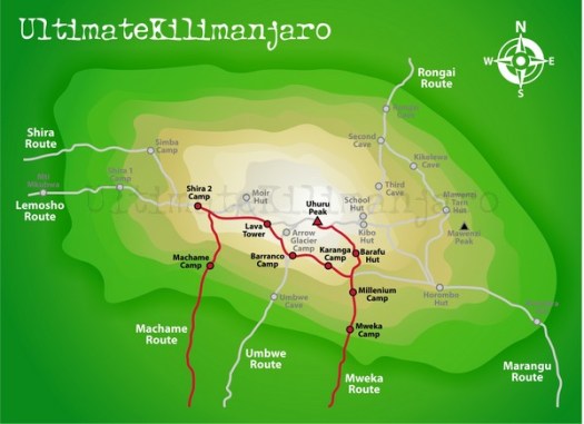
The Machame route is probably the most popular route these days and is also called “the whiskey route”. This route is steeper than the Marangu and Rongai routes and physically more demanding and for that reason better suited for the more determined and fitter climbers (view a map of Machame). …
CNN reporter Brooke Baldwin posted an excellent trip report – Conquering Mount Kilimanjaro: 10 essential lessons

Amanda Zeisset of Adventure Junkies posted a good list for beginners:
4. Every Time I’ve Tried Hiking I End Up Getting Blisters, How Do I Prevent Them?
14. What’s The Best Way To Treat Water?
17. I’m Out Of Shape & Not Fit Enough To Hike For Long Hours, Where Should I Start?
19. None Of My Friends Are Outdoorsy, How Do I Find People To Go Hiking With?
HOW TO GET INTO HIKING – THE 19 MOST COMMON QUESTIONS ANSWERED
Click through to see them all. With answers. 🙂
Leave a comment on that site if you’ve an opinion.

Stingy Nomads:
Choquequirao is quite big, you need at least one full day to explore it.
… buildings with steep roofs, terraces, massive walls.
… views to the valley and canyon from the ruins are stunning, specially at the sunset.
What we really liked about Choquequirao is its quietness, in all day we saw 6 people, you have ruins all to yourself. Unfortunately Peruvian government is planning to build a cable car all the way to the ruins, it’ll bring a lot of money for the region which is good, but at the same time will destroy unique atmosphere. …


Want a grand challenge?
We are looking for an adventurer to try to complete our top 10 hikes of the world in one continuous walking holiday.
We reckon you could start in June and comfortably finish in November with this itinerary:
 + Ausangate Circuit, Peru
+ West Coast Trail, BC, Canada
+ Sunshine to Assiniboine, Alberta, Canada
+ Glacier North Circle, Montana, USA
+ John Muir Trail, California, USA
+ Haute Route (Chamonix-Zermatt), Alps
+ Otter Trail, South Africa
+ Everest Base Camp / 3 Passes, Nepal
+ Tongariro Northern Circuit, New Zealand
+ Overland Track, Tasmania
That’s one round-the-world extravaganza!
Throw in the Huayhuash Circuit in Peru, at the beginning for extra bragging rights.
You have two main options on how tho do the trek to Everest Base Camp, you can either do it through an agency or do it yourself.
Doing an organized tour through an agency is easy but expensive, you will probably be in a big group with someone carrying your bag and organizing where you stay.
Doing it yourself is not hard and plane tickets from Kathmandu to Lukla is the only thing that you have to organize. You follow a very clear path, everybody stays in the same little “towns” with many tea houses, it is not necessary to pre-book anything. …

related – our Everest Base Camp / 3 Passes information page
Click PLAY or watch it on Facebook.
I just got the newest Hubba. It’s somewhat better than the previous model, seems to me.
I’m still using both.
Click PLAY or watch an by the manufacturer on YouTube.
One guy spent 3 years bicycle touring and living out of his Hubba. (The older model.)
My second recommendation would be one of the Big Agnes one person tents.
related – Chris Townsend – Choosing A Wild Camp Site
trip report by site editor Rick McCharles
day 1 | 2 | 3 | 4 | Sunshine Coast Trail information page
I left Elk Hut as early, quickly and quietly as possible. Alex was still sleeping upstairs.
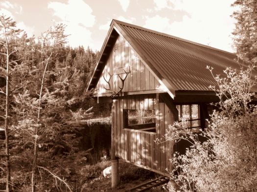
Mice are a problem in some huts. You still need to hang your food.

This would be my last day. I hoped it would be easier hiking, descending back to sea level. And it might have been if I’d not been lost once and diverted twice.
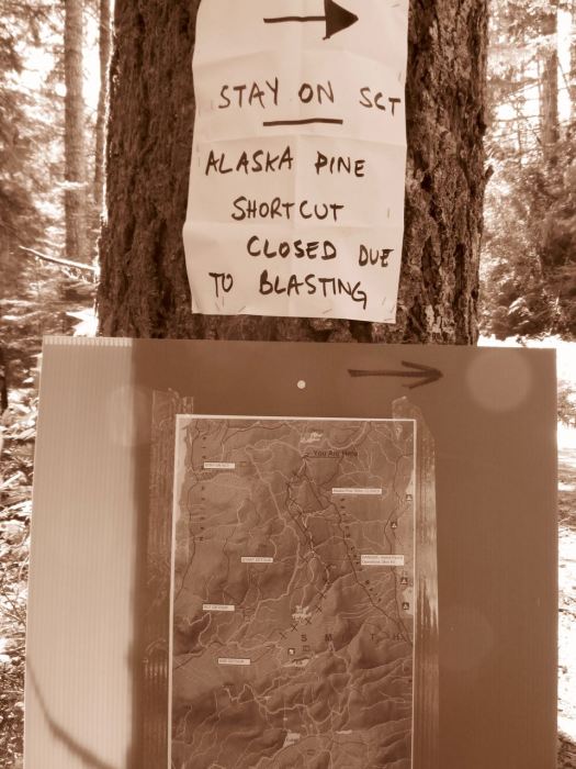
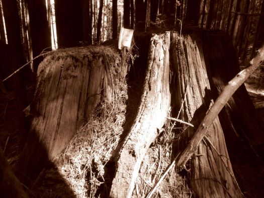
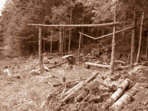
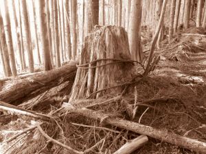
Road building and logging operations are ongoing. It’s not unusual to have to detour around sections of the SCT.
I’d complain more stridently … but one of the detours ended up being a favourite section. Lovely off-trail through temperate rain forest.
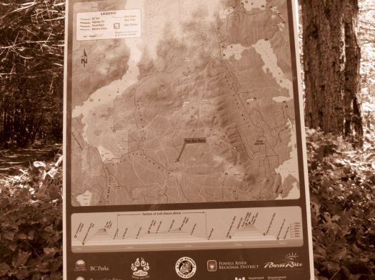
Signage is actually very good on this new, rapidly changing trail. But I still wished I’d brought my GPS.
I left a Summit Stone at one lovely creekside lunch spot.
If you can put up with the bugs, the SCT is endlessly entertaining. Something new around ever corner.


I’ve got one big chunk of the SCT left to do – the Troubridge Trudge (41km for me). I plan to do that in October or November one year to see if the bugs are hibernating.
day 1 | 2 | 3 | 4 | Sunshine Coast Trail information page
