- LENGTH: 50 miles / 80 km
- DURATION: 4-7 days
- TYPE: Circuit
- START / FINISH: St Arnaud (or Mt Robert Carpark)
- BEST TIME: December through April
At the northernmost end of New Zealand’s Southern Alps lies Nelson Lakes National Park. …
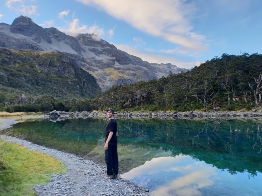
The park is named after two glacier-carved alpine lakes found at it’s northern end — Lake Rotoiti and Lake Rotoroa. These two lakes are tranquil and idyllic, making them great locations for car camping or day walks.
However, the real gems lie deeper into the park at higher elevations. Travers Saddle rewards the keen fit hiker with stunning views of the surrounding mountains. Blue Lake — claimed to have the clearest freshwater in the world — is quite surreal, with colours that dance magically in the sunlight. Lake Constance offers the solitude of a true high-alpine lake environment. …
… this circuit is one of the most stunning multi-day hikes in New Zealand. This trail can get relatively busy in the peak season, although it is not nearly as crowded or expensive as one of the “New Zealand Great Walks”. …
Ultimate Gear Lists – NELSON LAKES & BLUE LAKE HIKING GUIDE