Hiking Strathcona Park on Vancouver Island

Here’s our list of the best hikes in Strathcona, so far:

I spent over 3 weeks hiking Strathcona Provincial Park on Vancouver Island June – October 2020.

Fantastic.

The real experts on this park are Mike Blake and his team at MB Guiding.

If you are looking to organized a guide trip โ€”ย climbing the Golden Hinde, for example โ€”ย go with MB Guiding.


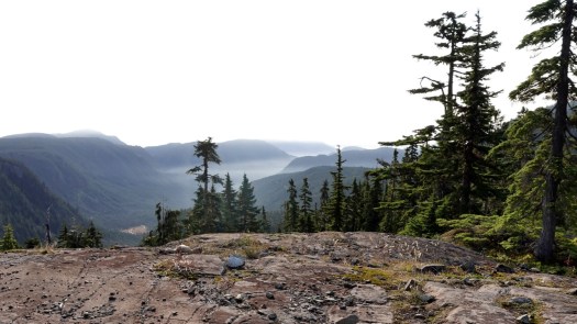
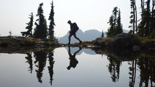
If you’ve never been to Strathcona before, easiest access is via the Paradise Meadows trailhead out of Courtney / Comox which gives easy access to the Forbidden Plateau.

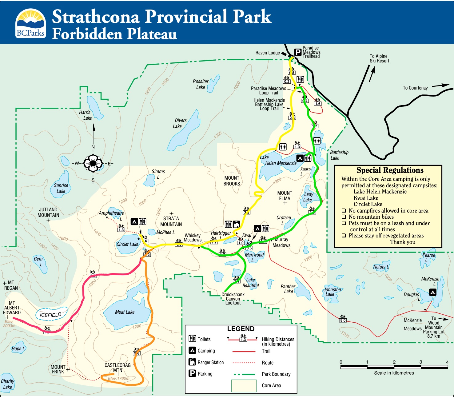
Well signed, well organized, well maintained, there are loops of increasing difficulty depending on your time and the weather.

One loop is wheelchair accessible, for example.

There are trails ideal for kids, as well.

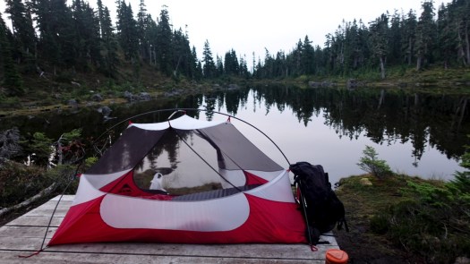
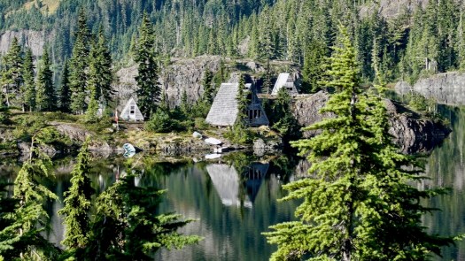
Three campsites on the Forbidden plateau are first-come, first-served. Great value at CAD $10 / person / night.

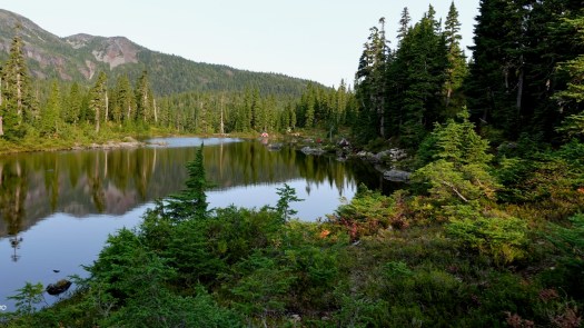
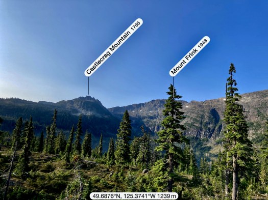
If you want to tent, I’d recommend you head for the furtherest campsite – Circlet Lake.

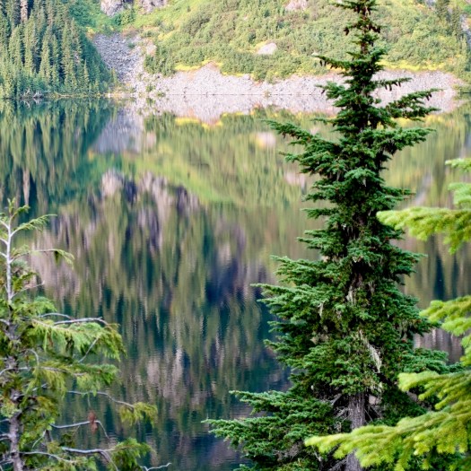
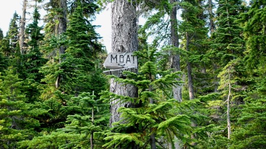
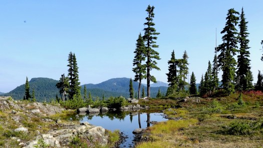
From there are fantastic day hikes to Moat Lake, Castlecrag and/or Mt Albert Edward.


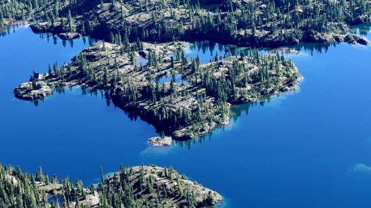
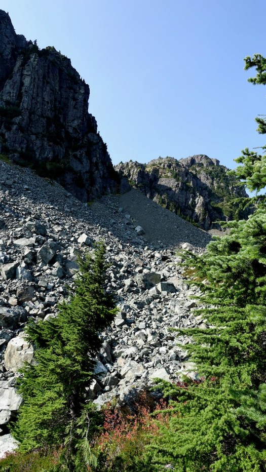
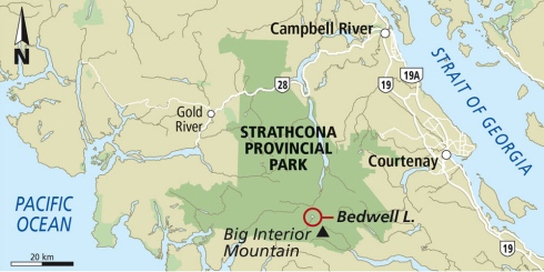
There are even better trails in Strathcona in the more remote section of the park around Buttle Lake. That’s where you find the main car campgrounds.

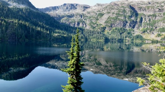
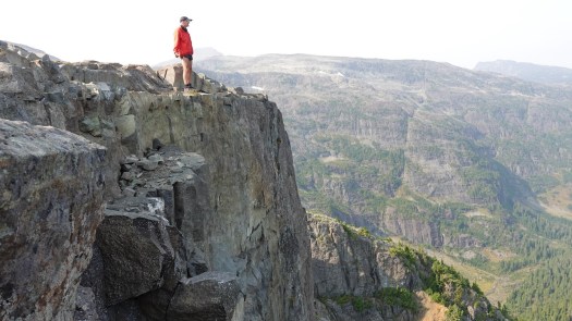
My favourite was Cream Lake via the Bedwell Lakes trails.

Cream Lake

Nearly as good for me was Elk River with a tough side trip up to Elk Pass.

Landslide Lake

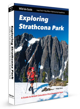
There are many, many more great hikes, of course, well documented in the best hiking guidebook – Exploring Strathcona Park by Stone.

I’ll return to do more.

Seal Bay, Courtenay, British Columbia

Trip report by BestHike editor Rick McCharles.

Seal Bay Regional Nature Park, Courtenay, B.C. offers some of the best walking in the Comox valley.

Easy access. A city bus gets you to the trailhead.

Many of the trails are hikers only. A few allow bikes and horse.

Click PLAY or get a glimpse on YouTube.

Hiking with a TRAILER rather than Backpack

– Easy transportation of luggage on bus, train or airplane

– Prevent common hiking injuries from carrying weight

– Easy to manoeuvre on a variety of terrain

– Easy to handle on steep and rocky ascents and descents

– Ergonomically designed for easy of use and hiking with an armrest

– Holds enough gear to support one, two or three hikers

– Easy to take apart and reassemble

Click PLAY or watch it on YouTube.

Radical Design made that one. Not inexpensive.

This father and son walked Camino de Santiago keeping the gear for both in one trailer. 40KG is maximum load.

Hiking Della Falls, Vancouver Island

Della Falls is located withinย Strathcona Provincial Parkย onย Vancouver Islandย inย British Columbia,ย Canada. … total height of 440ย m (1,440ย ft). ย 

The Canadian Government recognizes Della Falls as the tallest officially measured waterfall. That’s certainly not correct. James Bruce Falls in B.C. is much taller by any criteria, for one.

Meg Cuthbert:

Access: Boat access only, from the far end of Grand Central Lake near Port Alberni.

Canoe Distance: The canoe from Scout Beach Recreation Site is about 20 kilometres, the lake is tip-to-tip 35 kilometres long.

Hike Distance: 16 kilometres one-way from the trail head to Della Falls.

Canoe Difficulty: The wind on the lake tends to pick up in the afternoon, so at times the paddle was quite difficult. Be prepared to lock it in.

Hike Difficulty: The hike is a moderate difficulty, mostly due to the pack on your back. The elevation gain over the 16 kilometres is only 350 metres

Her group paddled in by canoe.

Read her 2019 trip report – Della Falls – Canoe, Hike, Canoe

Click PLAY or watch it on YouTube.

Most hikers book rides on the Della Falls Water Taxi. Both ways.

The real experts on Strathcona Provincial Park are MB Guiding. If you want to hire a guide or get up-to-date information, be sure to check their Della Falls page:

Camping in the Rain

Any idiot can tent in perfect weather.

To stay comfortable in the rain requires the right gear. And skills.

1. Plan for Rain

4. Clothing Layers

5. Bring Waterproof Bags

7. Pick a Good Tent Site

Click through for more:

Camping in the Rain: 10 Tips to Stay Warm and Dry

Photo by Sangeet Rao on Pexels.com

MountainLion.org on that cougar encounter

Mountain lions are much less dangerous to hikers in North America than snake bites, lightning strikes and even bee stings.

But plenty of people have been freaked out by a recent viral video.

ย โ€œThe encounter might have been avoided altogether, but once it happened, the runner did a lot of things right,โ€ says Denise Peterson, a Utah resident and region coordinator with the Mountain Lion Foundation.

โ€œBut individuals and the media are getting a lot of things wrong …

26-year-old Kyle Burgess hasย told reportersย that he was running on a trail in Provoโ€™s Slate Canyon when he saw kittens on the gravel path ahead of him. Thinking they might be bobcat kittens, he started recording video on his phone. When the mother lion appeared, he immediately knew he had made a dangerous mistake.

In the six minutes that follow, the video shows Burgess doing many things correctly: he backed away slowly, continued facing the lion, spoke loudly and firmly, and didnโ€™t try to run away.

The lion followed him for several minutes, occasionally hissing and lunging. โ€œShe clearly did not view him as prey,โ€ says Debra Chase, CEO of the Mountain Lion Foundation.

โ€œThe behavior was meant to chase him away, which it did very well. The mother lion was reacting to a perceived threat to her young.โ€ …

Mountain Lion Foundation Issues Plea for Proper Reporting on Utah Encounter
CC BY-SA 2.0

Atal Tunnel opens more Himalayan Hiking

This historic tunnel, which was inaugurated on October 3, starts from Solang Valley near Manali and ends near the grand Sissu waterfall in Lahaul.

Till now, not many travellers knew about the Sissu waterfall. But now, Atal Tunnel puts it on the … map.

Similarly, it brings the spotlight on Lahaul and underlines how little information is available about this region.

โ€œYou have not seen a setting as beautiful as Lahaul. It is very different from the stark beauty of Spiti. …

A Big Impact: Opening up of new areas of trekking

The opening of Atal Tunnel will finally allow trekkers to venture into the uncharted terrain of Lahaul. Earlier, bad roads and long travel time prevented trekkers from exploring this scenic region. …

How the Opening of Atal Tunnel Affects Trekking in India

Hiking Castlecrag, Vancouver Island

Strathcona Provincial Park, Vancouver Island

Trip report by BestHike editor Rick McCharles.

This was my favourite hike on the Forbidden Plateau.

Click PLAY or watch it on YouTube.

I’d camped at Duck Pond, Circlet Lake campground.

I camped 3 nights at Circlet Lake altogether. Lovely.

From Circlet it’s not far to the Castlecrag trail marked in orange on the map. Look for the sign to Moat Lake.

Click for LARGER version.

I hiked the route marked in orange. Here’s the original Park map online.

This was a foggy and somewhat hazy day.

But plenty clear enough to see where I was headed.

I’d seen lovely Moat Lake the day before from the Albert Edward hike.

For Castlecrag you circumambulate the far side, crossing the worst bridge I’d seen in Strathcona 2020.

En route a helicopter flew into Moat Lake Retreat, an island you can rent with 2 cabins sleeping a total of 10 people. It’s a legacy from when Clinton Wood first built a lodge here in 1934.

In good weather, finding the route is not all that difficult. Follow the cairns and (possibly) ribbons.

Much of this adventure is above the treeline.

Overall the hiking is more difficult than on nearby Edward Albert as there is a fair bit of boulder hopping over avalanche slopes.

Two highlights end of September: no mosquitoes and autumn colours.

The turnoff UP to Castlecrag is not signed. Watch for the big cairn on the right.

Castlecrag 1740m (5709ft) is a satellite peak to Mt Albert Edward 2093m and many serious hikers / trail runners connect the two via Mt Frink. I’d originally planned to do that myself โ€” but found it too difficult and risky on my own. Also, days are short end of September. I might have spent some hours in the dark on the way down.

It’s a short climb from the cairn to the summit of Castlecrag.

I had great fun scrambling around the crags.

See all the full resolution photos from this hike on Flickr.

The best hiking guidebook isย Exploring Strathcona Park. Dead tree version available only.

See our list of the best hikes in North America.ย ย