Not YOU.
Click PLAY or watch it on Instagram.

Best hikes, treks, tramps in the world.
Trip report by BestHike editor Rick McCharles
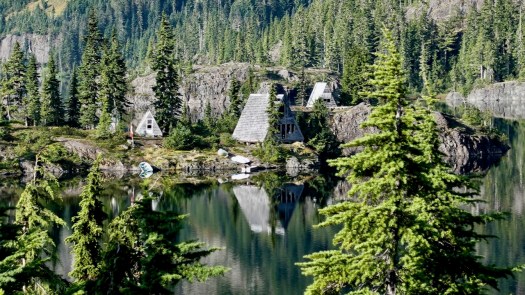
Directly from Innsbruck city centre, you can ride the Nordkette Cable Car to Hafelekar station (2,269m).

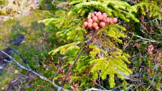
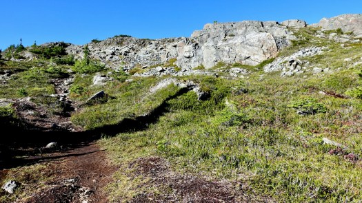
I did the surprisingly rugged hike from the Top of Innsbruck to Pfeishütte — for a delicious pasta lunch.
Click PLAY or watch it on YouTube.
It’s called Goetheweg: Karstube to Pfeishütte on AllTrails.
You might guess the challenge is ridge walking — but there’s nothing with exposure.
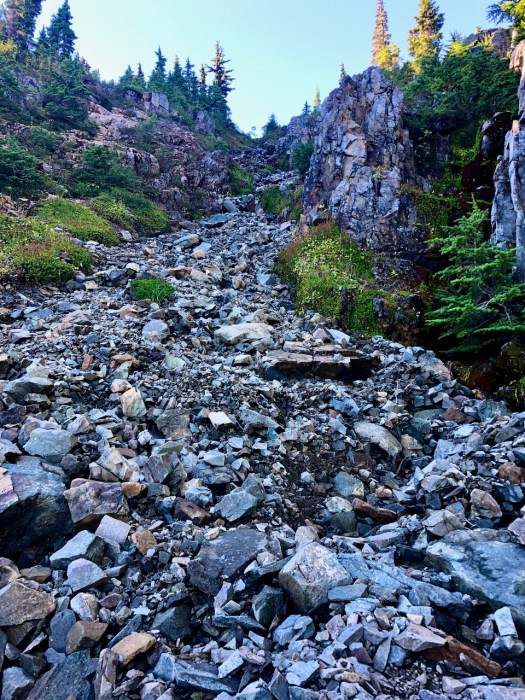
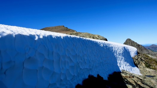
I was wearing trail running shoes in late June. And they were NOT sufficient for the snow, ice, and loose scree. At minimum wear approach shoes. Most Europeans were wearing light hiking boots.
Poles would help for sure. If I did it again I’d carry YakTrax, just in case.
The weather kept changing. My jacket went on and off a dozen times.
Your lift ticket includes entry to the Alpenzoo which we did on the way back to Innsbruck.
It’s small, but well worth the stop. The focus is on animals indigenous to the Alps, though there are over 150 animal species. It’s built on the vertical slope of the mountain.
I was most enthusiastic to see the European Brown Bear and Lynx.


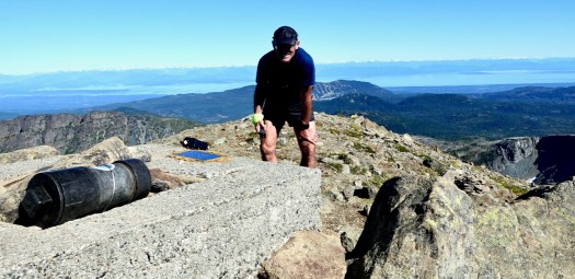
If you get to Innsbruck, this hike is highly recommended. A terrific hiking day.
Note ➙ it’s Europe, so there are easily a dozen variations to this route. You do not need to backtrack, for example. 10Adventures suggests hiking late in the day — sleeping at Pfeishütte — and walking out day two.
Ridge walks are very popular on the (dryer) Alberta side of the Rockies.
One of the best is Tent Ridge Horseshoe.
Summer only as there is avalanche risk in winter.
Click PLAY or watch it on Instagram.
Quincy has the best trip report I’ve seen on this excellent, STEEP lake vista climb close to famed Cathedral Grove on Vancouver Island.
Wesley Ridge is one of my favourite Vancouver Island hikes. The views from the top are incredible, and unlike many of Vancouver Island’s best hikes, the trailhead is easily accessed from the highway. …
DISTANCE: 7.2 KM / 4.5 MI
ELEVATION GAIN: 555 M / 1821 FT
HIKING TIME: 3 HRS
The Wesley Ridge hike starts by plodding along train tracks next to the highway. Don’t worry, they’ve been abandoned for years. …
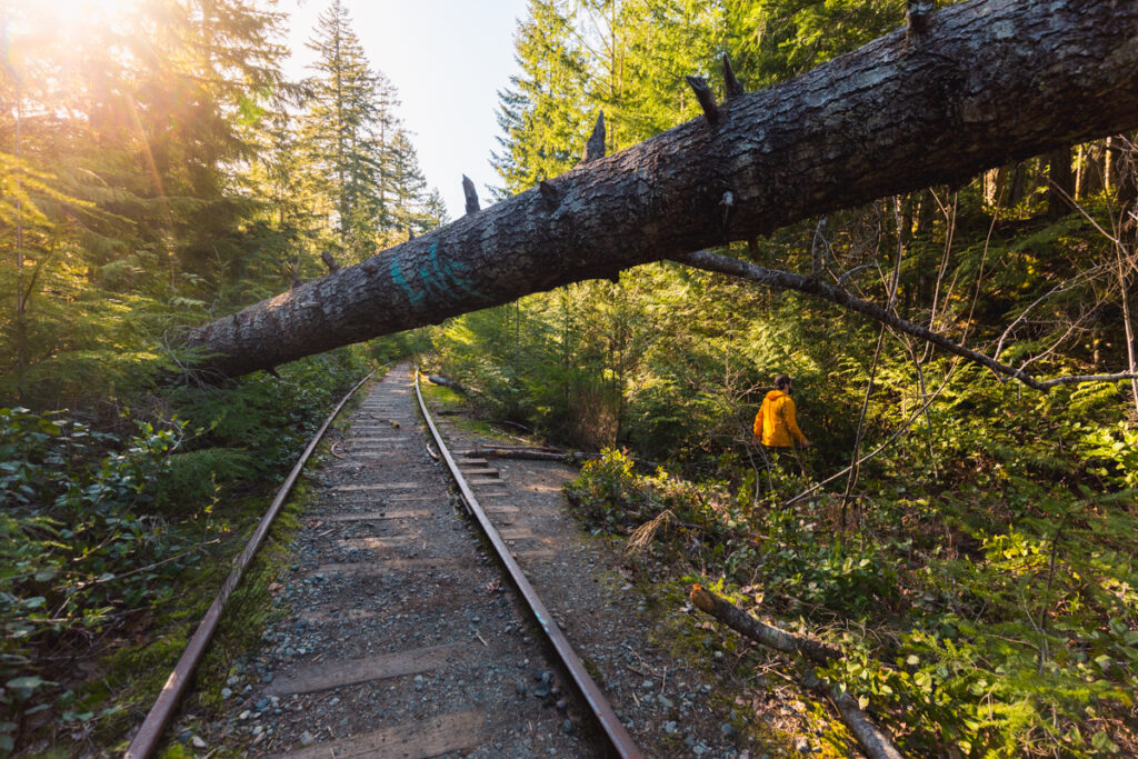
After no more than five minutes, the trail breaks off …. Keep your eyes peeled, as it’s not marked. This fallen tree makes for a pretty good landmark, but there’s no guarantee it will be here forever. ..
Seeing the Elephant – Wesley Ridge

I once climbed up to the Ridge viewpoint — then tried to traverse to the other end of the lake.
#FAIL. 😀
Some of the BEST video clips captured by BestHike editor Rick McCharles in 2023.
Iceland, USA S.W., Norway, Bermuda, Italy, Germany, Switzerland, finishing in British Columbia.
Click PLAY or watch it on YouTube.
For comparison, here’s his 2022 Highlights VIDEO.
Click PLAY or watch it on YouTube.
24km total … about 18km on a sharp ridge! Wow!

World → Europe → Alps → Switzerland → Harder Ridge
Click PLAY or watch Jackson Groves on YouTube.
For details click over to our Harder Ridge information page.
related – The GoPro: ’22 Creator Summit was held in Interlaken. Some of this footage is shot on the ridge.
Click PLAY or watch it on YouTube.
Here’s a graphic representation of the ridge walk, though in the opposite direction from what we recommend.
Click PLAY or watch it on YouTube.

A stunning and unique walk in Norway’s most popular National Park – Jotunheimen.
World → Europe → Norway → Besseggen Ridge
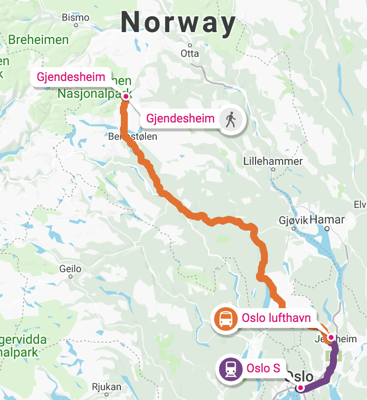
Click PLAY or watch it on YouTube.
For details click over to our Besseggen Ridge information page.
Harder Ridge in Switzerland, also known as Hardergrat (… grat is ridge in German) is our pick for the very best day hike on Earth.
Check our Harder Ridge information page.

let’s go outdoors is posting flyovers of some of the world’s best hikes on YouTube.
Click PLAY or watch one route on Harder Ridge on YouTube.
Trip report by BestHike editor Rick McCharles.
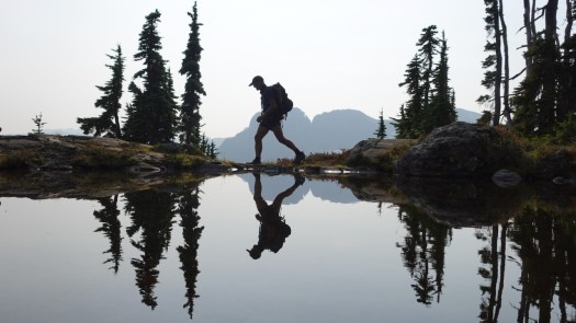
This was my favourite hike on the Forbidden Plateau.
Click PLAY or watch it on YouTube.
I’d camped at Duck Pond, Circlet Lake campground.
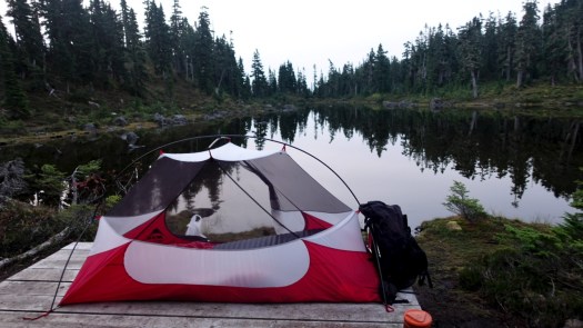
I camped 3 nights at Circlet Lake altogether. Lovely.
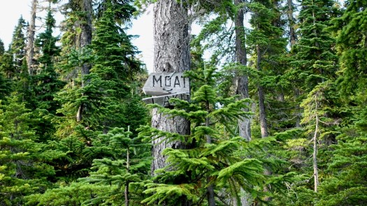
From Circlet it’s not far to the Castlecrag trail marked in orange on the map. Look for the sign to Moat Lake.
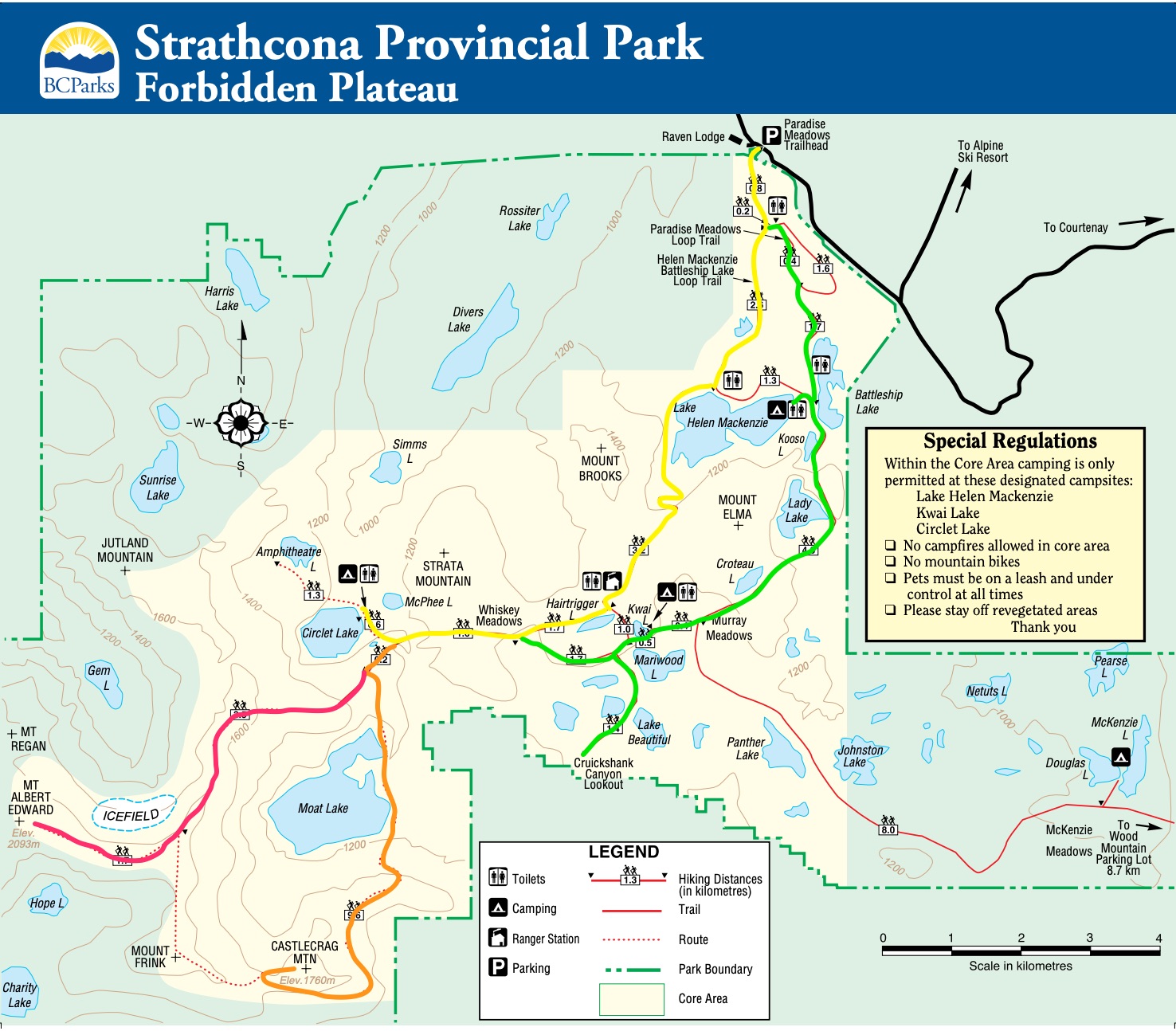
I hiked the route marked in orange. Here’s the original Park map online.
This was a foggy and somewhat hazy day.
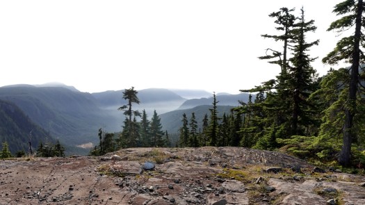
But plenty clear enough to see where I was headed.
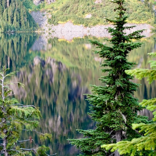
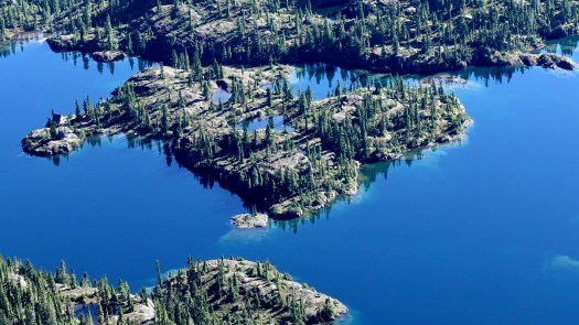
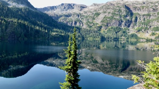
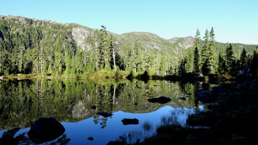
I’d seen lovely Moat Lake the day before from the Albert Edward hike.
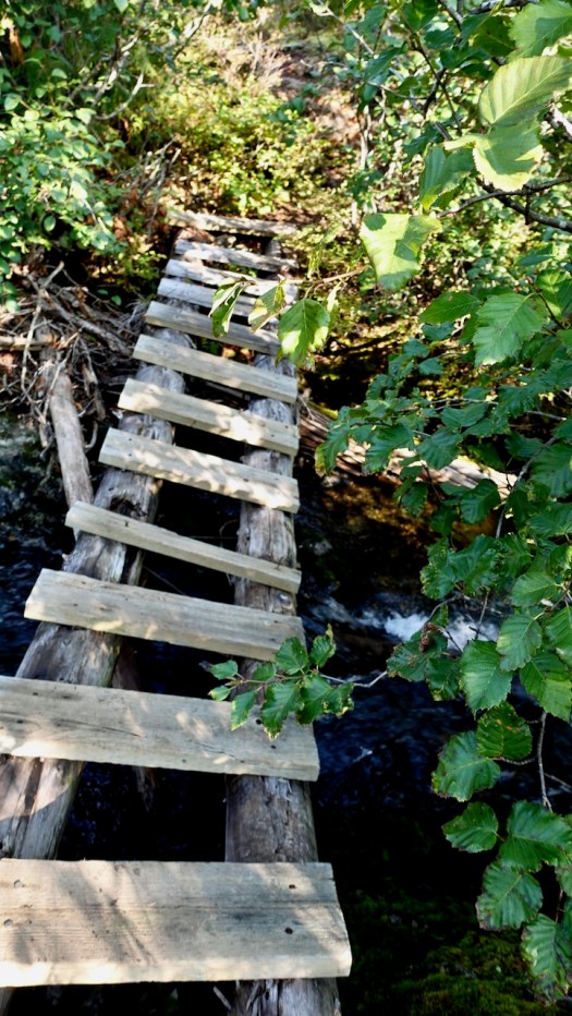
For Castlecrag you circumambulate the far side, crossing the worst bridge I’d seen in Strathcona 2020.
En route a helicopter flew into Moat Lake Retreat, an island you can rent with 2 cabins sleeping a total of 10 people. It’s a legacy from when Clinton Wood first built a lodge here in 1934.
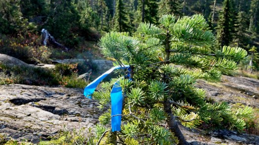
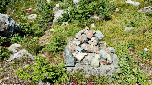
In good weather, finding the route is not all that difficult. Follow the cairns and (possibly) ribbons.
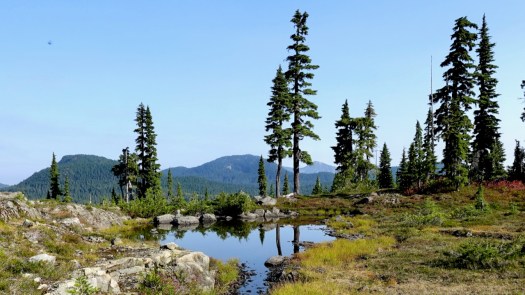
Much of this adventure is above the treeline.
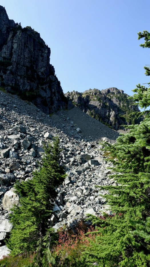
Overall the hiking is more difficult than on nearby Edward Albert as there is a fair bit of boulder hopping over avalanche slopes.
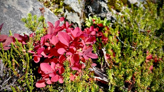
Two highlights end of September: no mosquitoes and autumn colours.
The turnoff UP to Castlecrag is not signed. Watch for the big cairn on the right.
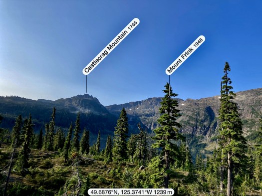
Castlecrag 1740m (5709ft) is a satellite peak to Mt Albert Edward 2093m and many serious hikers / trail runners connect the two via Mt Frink. I’d originally planned to do that myself — but found it too difficult and risky on my own. Also, days are short end of September. I might have spent some hours in the dark on the way down.
It’s a short climb from the cairn to the summit of Castlecrag.
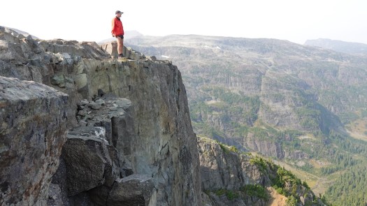
I had great fun scrambling around the crags.
See all the full resolution photos from this hike on Flickr.
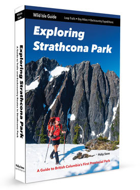
The best hiking guidebook is Exploring Strathcona Park. Dead tree version available only.
See our list of the best hikes in North America.
Trip report by BestHike editor Rick McCharles.
Click PLAY or watch the climb in less than a minute on YouTube.
Mt Albert Edward, 6th highest peak 2093m (6867ft) on Vancouver Island, is well known because it’s visible from Mount Washington Alpine Resort.
It’s named for Albert Edward, Prince of Wales, later King Edward VII.
Most who climb it start at Circlet Lake campground.


From the campground it’s only 5.5km to the summit, but it took much longer for me than I anticipated. Update: that sign on the trail is wrong. It’s significantly further than 5.5km. 😀
The muddiest trail I found was that just departing Duck Pond.
I hiked Circlet to the summit on the trail marked in red.
Here’s the original Park map online.
Bring enough water for the day as there no great gushing streams en route.
At the sign pointing left to Moat Lake, keep right for Edward Albert.

The ascent itself is only medium difficulty IF the weather is good.
Some scrambling.
I had perfect weather. But it can be deadly in normal weather — cloudy, cold, wind. Don’t go for it unless you are confident visibility will hold.

Follow occasional cairns and, possibly, ribbons. Navigation is not all that difficult in good weather.


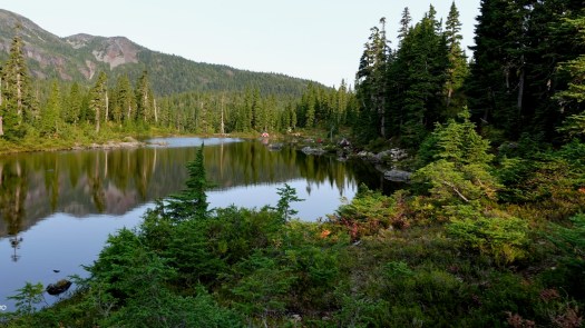
Moat Lake is gorgeous.

At one point you can follow a series of aluminum poles.
Once you reach a wide shoulder leading up to the summit, it’s easy going with terrific views.


Here’s the view looking back on Mt Washington Ski Hill.

Be wary of cornices especially on the north and west sides of the ridge.
There was not much snow left end of September 2020 when I was there.

What a great day!

Some hike 3 peaks (Edward Albert, Frink, and Castlecrag) from Circlet, a tough go!
Other adventures that include Edward Albert summit are the Augerpoint Traverse and Comox Range Traverse.
Me?
I headed back to Circlet Lake for siesta.

See all the full resolution photos from this hike on Flickr.
For more, click PLAY or watch an excellent video on YouTube.
