BestHike #1 โ€“ West Coast Trail, British Columbia

West Coast Trail is our top hike in the world.

Click PLAY or watch a 1-minute preview on YouTube.

West Coast Trail

Challenging in many ways.

So much VARIETY in pristine Canadian coastal wilderness.

Mystic dawns and mind-blowing sunsets. Hidden pocket coves and weird coastal geology.

You’ll never forget the West Coast Trail.

WCT ladders

AT A GLANCE

  • 75 km (47 mi), 5-7 days Pachena Bay <> Gordon River
  • 3-5 day routes possible via Nitinaht Village trailhead
  • southwestern edge of Vancouver Island
  • Pacific Rim National Park
  • Permits required 
  • May 1 – September 30
  • extremely rugged, requires a high level of fitness
  • 6,000+ backpackers / year

Read more on our WCT information page.

Nile Creek waterfalls in Winter

Nile Creek Trail is at least 10km (6mi) out and back near Qualicum on Vancouver Island.

AllTrails does not recommend it November through March as it’s very wet and muddy during winter.

Slippery too. Many rough boardwalks and log bridges.

On the other hand, water is high. The waterfalls and cascades even more impressive than in summer.

Click PLAY or watch it on YouTube. Starting from Charlton Drive, Qualicum Beach.

related – trip report of the second half – Get out and Play – Nile Creek

Top Bridge Trail, Parksville B.C.

Trip report by BestHike editor Rick McCharles.

A surprisingly rugged and interesting 5km day hike connects the town of Parksville with Top Bridge.

It’s official name is the Top Bridge Regional Trail.

In good weather, the bridge is a popular swimming spot.

Click PLAY or watch a December hike on YouTube.

If you have time, I’d strongly recommend continuing past the bridge on to the Englishman River Trail.

Click PLAY or watch it on YouTube.

Snowfall Rathtrevor Park

Rathtrevor Beach near Nanaimo is the most popular Provincial Park on Vancouver Island.

I walk there most mornings.

But on winter solstice, December 21, 2020, that rare thing happened โ€” It snowed.

This is temperate rain forest. Snow on the coast is mostly liquid. ๐Ÿ˜€

Click PLAY or watch it on YouTube.

Snow Rathtrevor

Running Qualicum, Vancouver Island

Qualicum Beach has a population of about 10,000.

It’s a charming retirement community โ€” median age of 65.9 in 2016 โ€” in one of Canada’s best winter climates.

Temperate rain forest is ideal for hiking, cycling or running year round. One highlight of Qualicum are the 400 year old Douglas Fir in their Heritage Forest.

Click PLAY or watch a December run on YouTube.

Qualicum is situated at the foot ofย Mount Arrowsmith, along theย Strait of Georgiaย onย Vancouver Island‘s northeastern coast.

By marneejill

Englishman River Trail, Vancouver Island

Trip report by BestHike editor Rick McCharles.

AllTrails calls this adventure the Englishman River Trailway.

But you don’t need follow the AllTrails 10.5km out and back route.

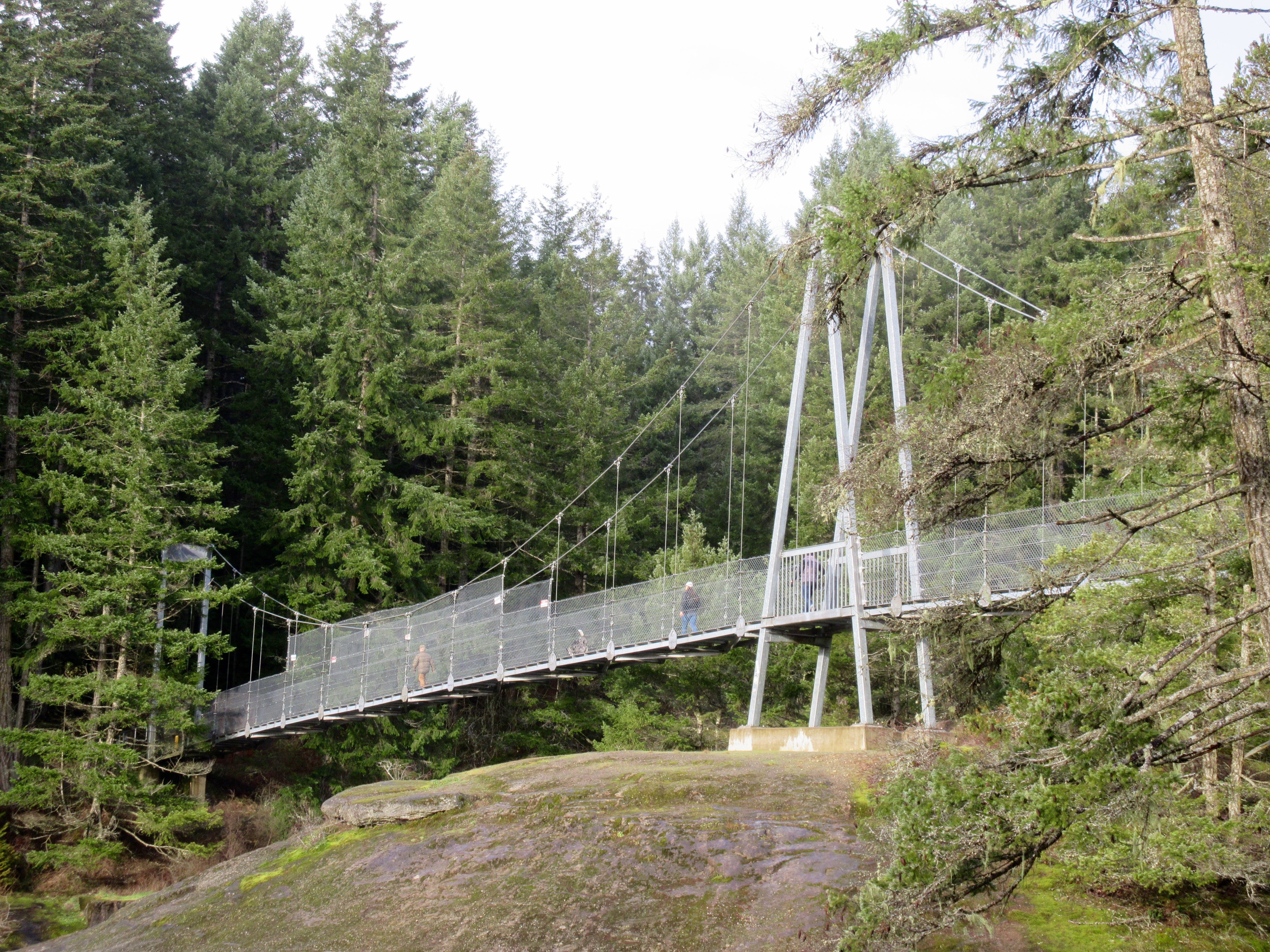
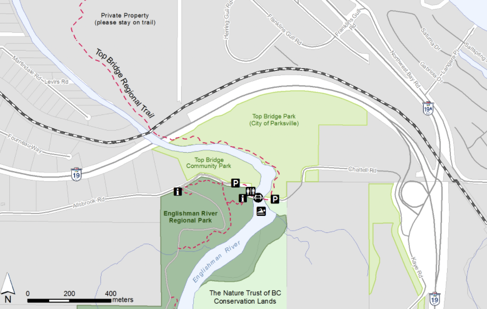
It’s a network of mountain biking / walking trails on the west side of the Englishman River. You can’t really get lost so long as you parallel the water.

I spend a lot of time here as I have family in Parksville.

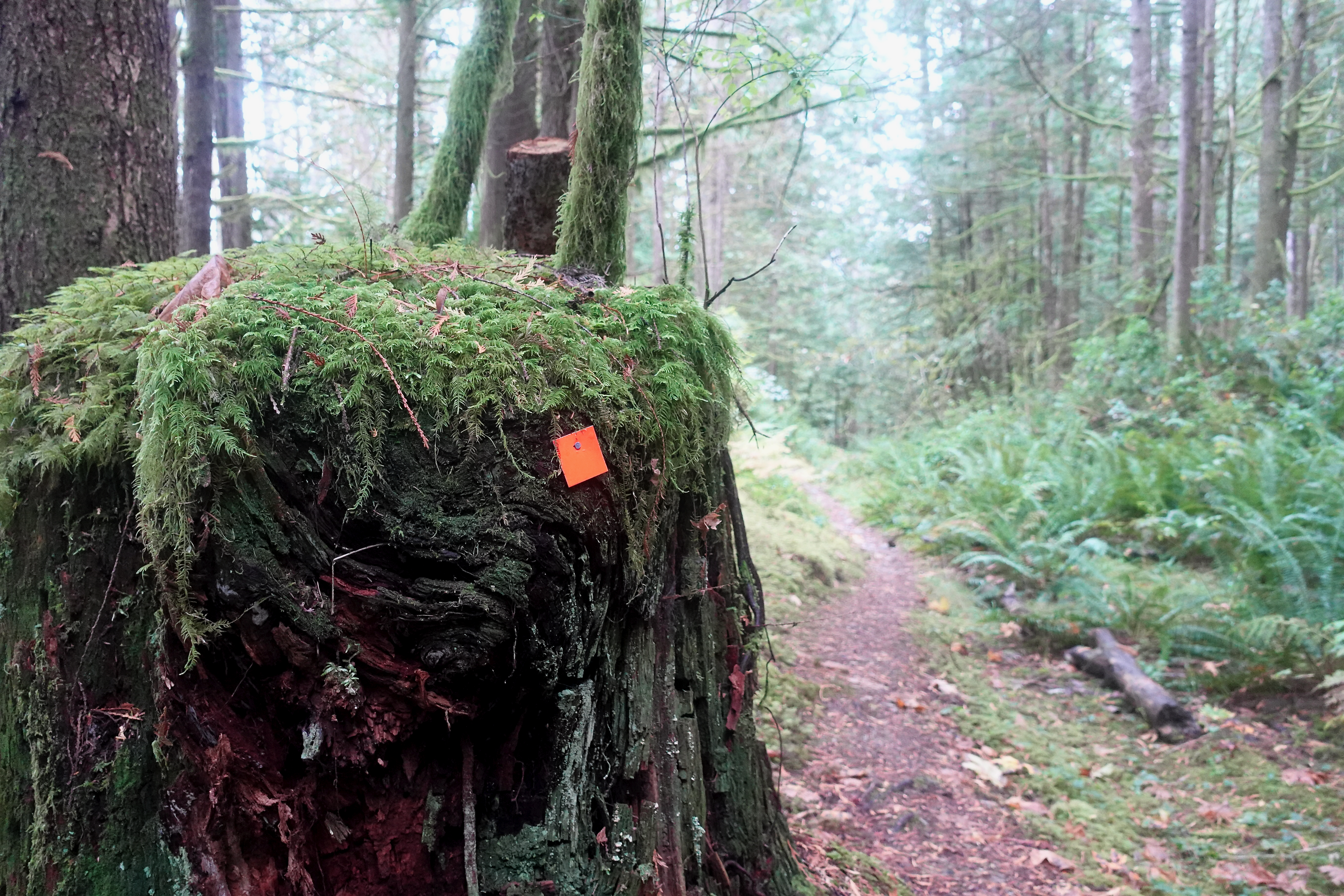
This is temperate rain forest. It can be wet. It can be muddy.

Riparian.

But hiking is accessible year-round. In fact, this video was taken early December.

Click PLAY or watch it on YouTube.

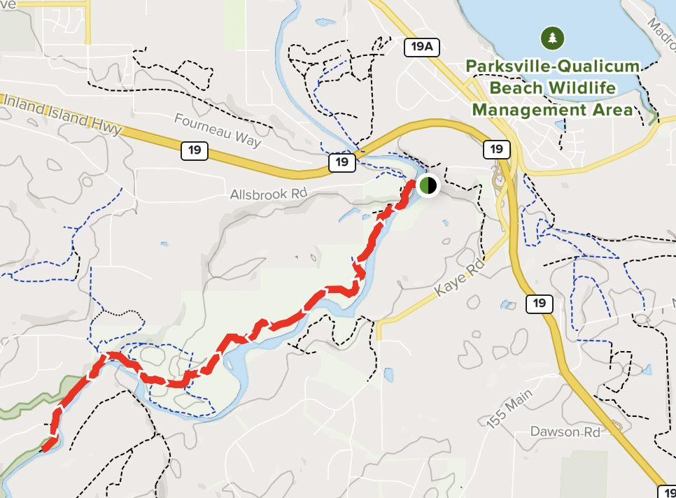
Most people park at the Top Bridge trailhead (green dot) close to highway 19 at Parksville. Head inland along the river for as far as they wish. Then backtrack.

I started on the far left of the map below at Middlegate Road trailhead. Walked to Top Bridge Park close to the highway. About 5km one way plus many side trips.

I often, as well, head the other direction, under the highway towards Parksville on the 5km Top Bridge Regional Trail.

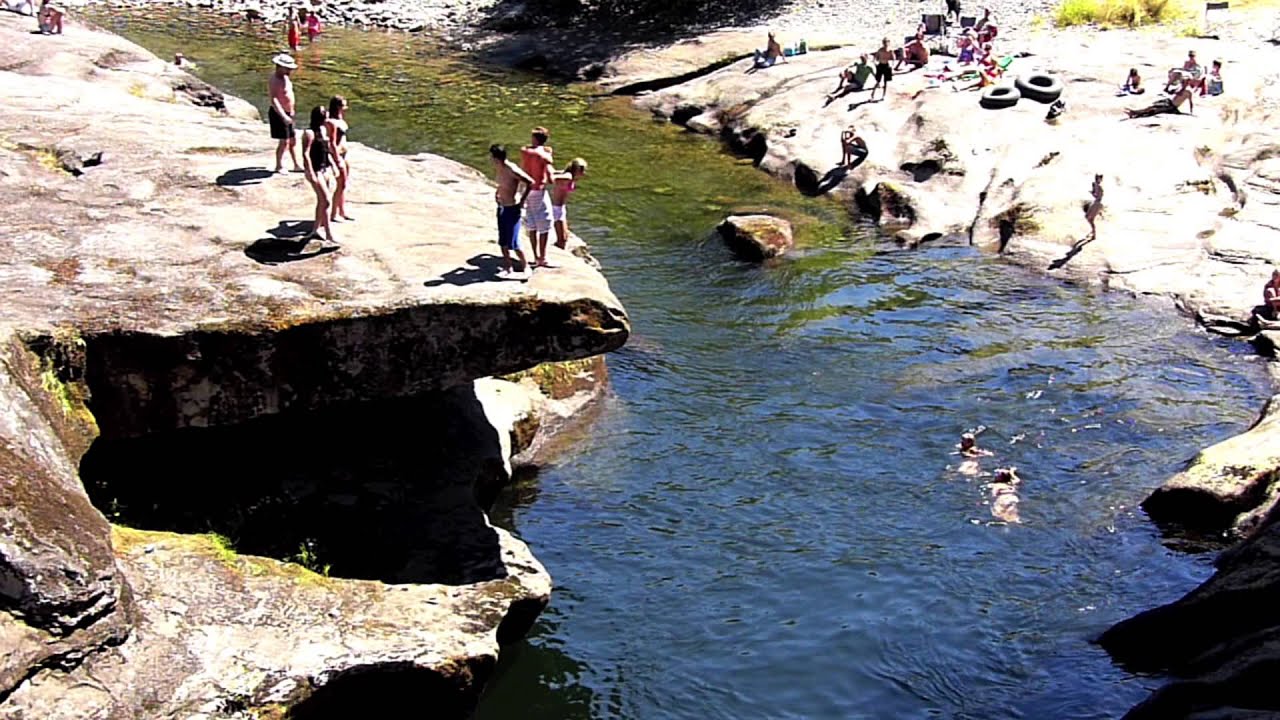
In good weather, the bridge near the parking areas is a popular swimming spot.

Summer

Juan de Fuca Trail, Vancouver Island

Our hike in the world โ€”ย West Coast Trail โ€” was closed all of 2020 due to COVID. Hopefully it will reopen in 2021.

Right next door is the Juan de Fuca Marine Trail.

It’s one of the great alternatives to the WCT. Logistics are much easier. And it’s less expensive.

Vancouver Island experts MB Guiding have a Juan de Fuca Marine Trail Guide online.

Check that for planning. And get a copy of the best hiking guidebook – Coastal Hikes.

Enos Lake, Vancouver Island in Winter

A confusing network of wetland trails is owned by the Fairwinds Community of Nanoose Bay near Nanaimo.

Happily, they are open to the general public. No fishing. No swimming.

Easiest way to get there is from Island Highway 19, turning at the Petro Canada gas station east onto Northwest Bay Road.

I went early December.

Click PLAY or watch my trail run on YouTube.

Click PLAY or watch some drone footage on YouTube.

Details – Vancouver Island View – Enos Lake Trail

Little Qualicum Falls, Vancouver Island

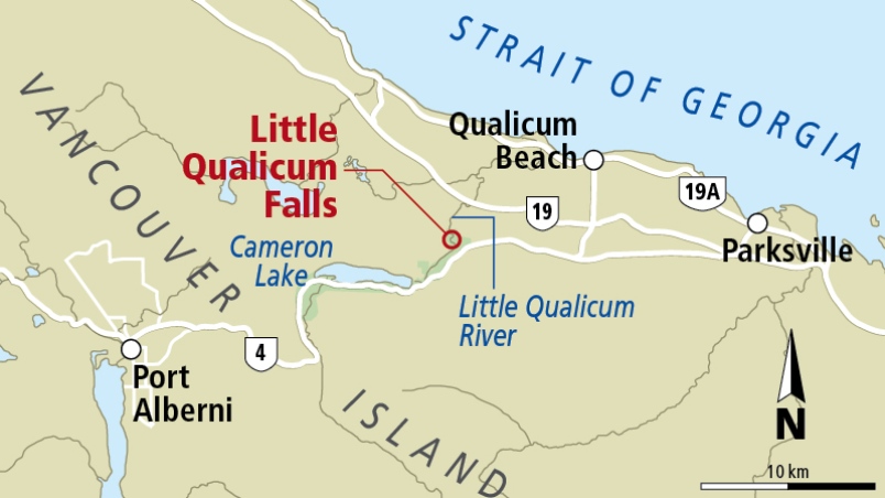
Little Qualicum Falls Provincial Park, established 1940 to protect the old growth forest, offers a terrific 1 hour hike if you are driving between Nanaimo and Port Alberni.

There are plenty of other nearby attractions including Cathedral Grove.

Swimming is possible in good weather. But know that people have drowned here.

Outdoor Vancouver – Little Qualicum Falls Loop

Click PLAY or watch it on YouTube.

Troubridge Trudge – Sunshine Coast Trail, B.C.

Trip report by BestHike editor Rick McCharles.

click for larger version

I’d previously hiked two other sections of the (roughly) 180km Sunshine Coast Trail:

Sarah Point to Manzanita hut (2015)

Mowat Bay to Lois Main (2016)

Pestered by wasps and other biting insects on those two earlier trips, I deliberately returned late season. No bugs.

This time I headed for the Troubridge Trudge section:

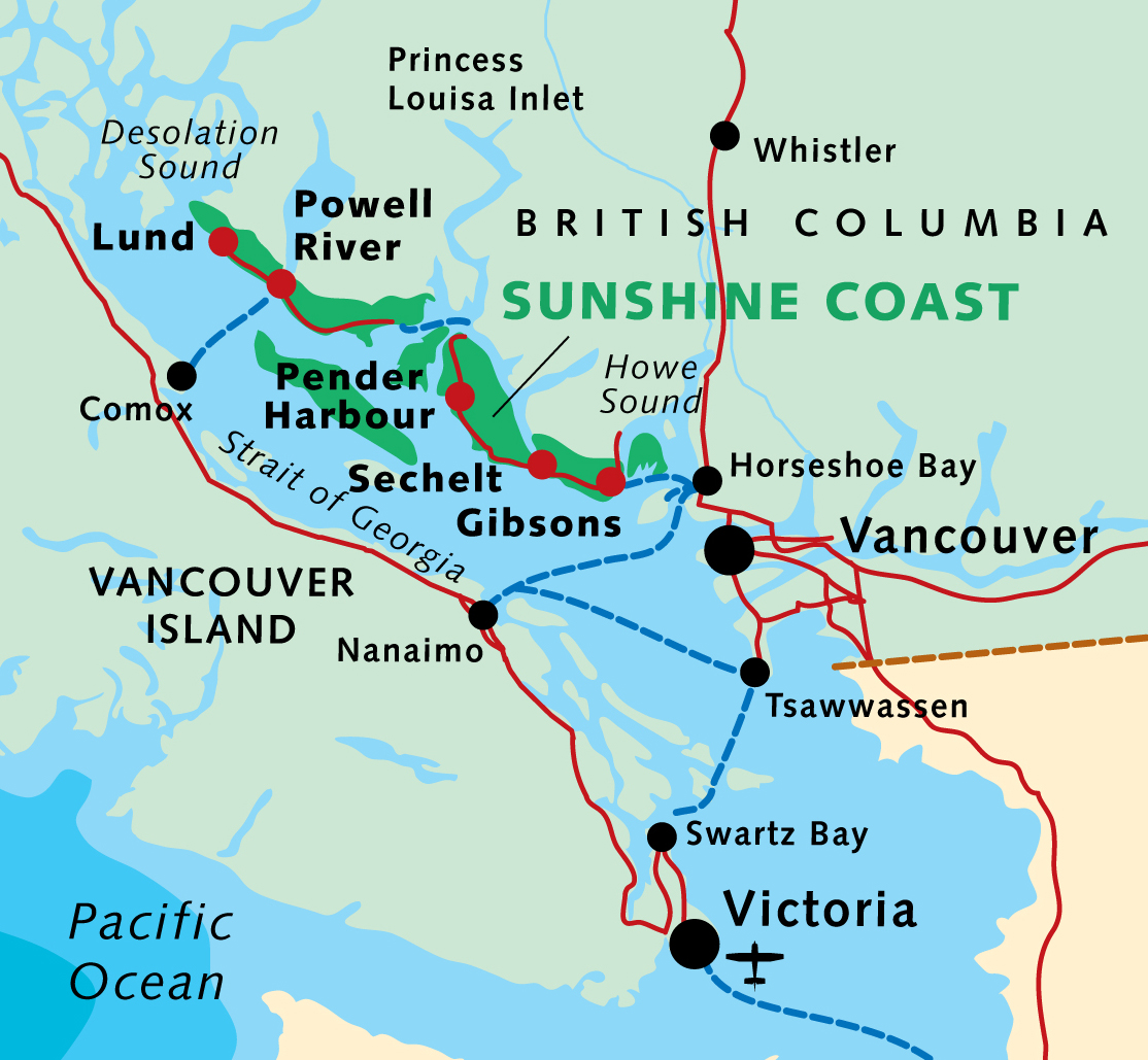
Oct 24 – Lang Bay to Golden Stanley hut (km 145)
Oct 25 – Golden Stanley to Mt Troubridge hut (km 158)
Oct 26 – Troubridge to Fairview Bay hut (km 173)
Oct 27 – Fairview to Lang Bay (km 180)

You can hike 42km in either direction. It’s called the trudge as this is the highest section of the Sunshine Coast Trail.

click for larger version

More maps.


Having reached the Sunshine Coast via ferry from Comox, I stayed in a Powell River hotel.

Harbour at dusk

Weather forecast looking good next morning, I cycled down to Lang Bay.

A lovely autumn day.

Hid my bike in the trees close to the highway near Lang Bay.

Walked the gravel road called Canoe Main to join the Sunshine Coast Trail on Lois lake. (I could have walked Lois Main, the older road.)

Lois lake was created by a dam.

The mountains beyond the lake look tempting.

You eventually turn uphill inland on a trail towards Elephant lake.

It’s steep but not all that far to Golden Stanley hut, completed 2016. It’s not mentioned in my guidebook published 2013, of course.

I was carrying my tent as I’d seen online that the huts were closed due to COVID-19.

But the hut was open after all. Since I was the only person there, I moved in.

Impressive pit toilet.


Oct 25 – Golden Stanley to Mt Troubridge hut (km 158)

Mt Troubridge is the highest point on the Sunshine Coast Trail. I was happy to have good weather.

On the other hand, surprised to see snow at such low elevation in October.

It was Ho Ho Ho. ๐Ÿ˜€

In 2020 everyone takes the newer of two possible trails to the summit. The best route is always well signed.

I still easily reached Troubridge hut by early afternoon.

Here’s how it looks in summer.

And here’s how it looked when I arrived.

Mt Troubridge hut was flown up in pieces by helicopter.

It replaced the Troubridge Hilton, a small communications hut that’s now more used as an emergency shelter on the top of the mountain.

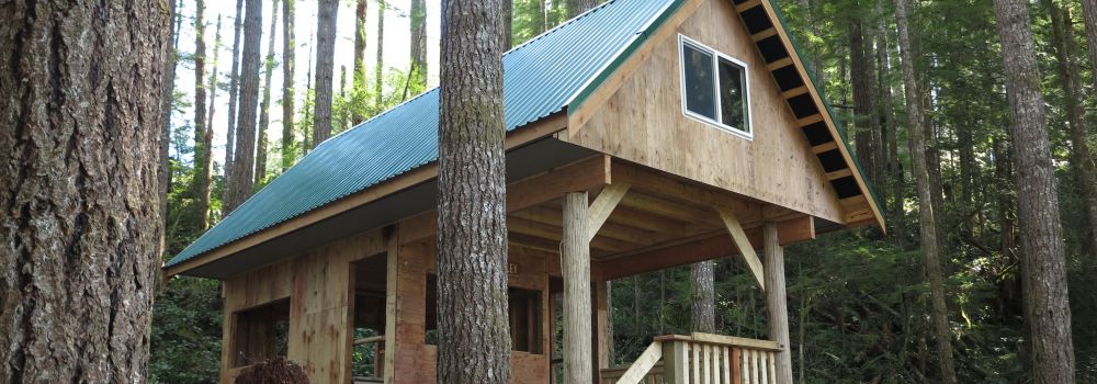
I assumed I’d have Troubridge hut to myself again when Chris and his dog arrived. Rather than sharing a small space, Chris took the A-frame. I stayed in the hut on my own.

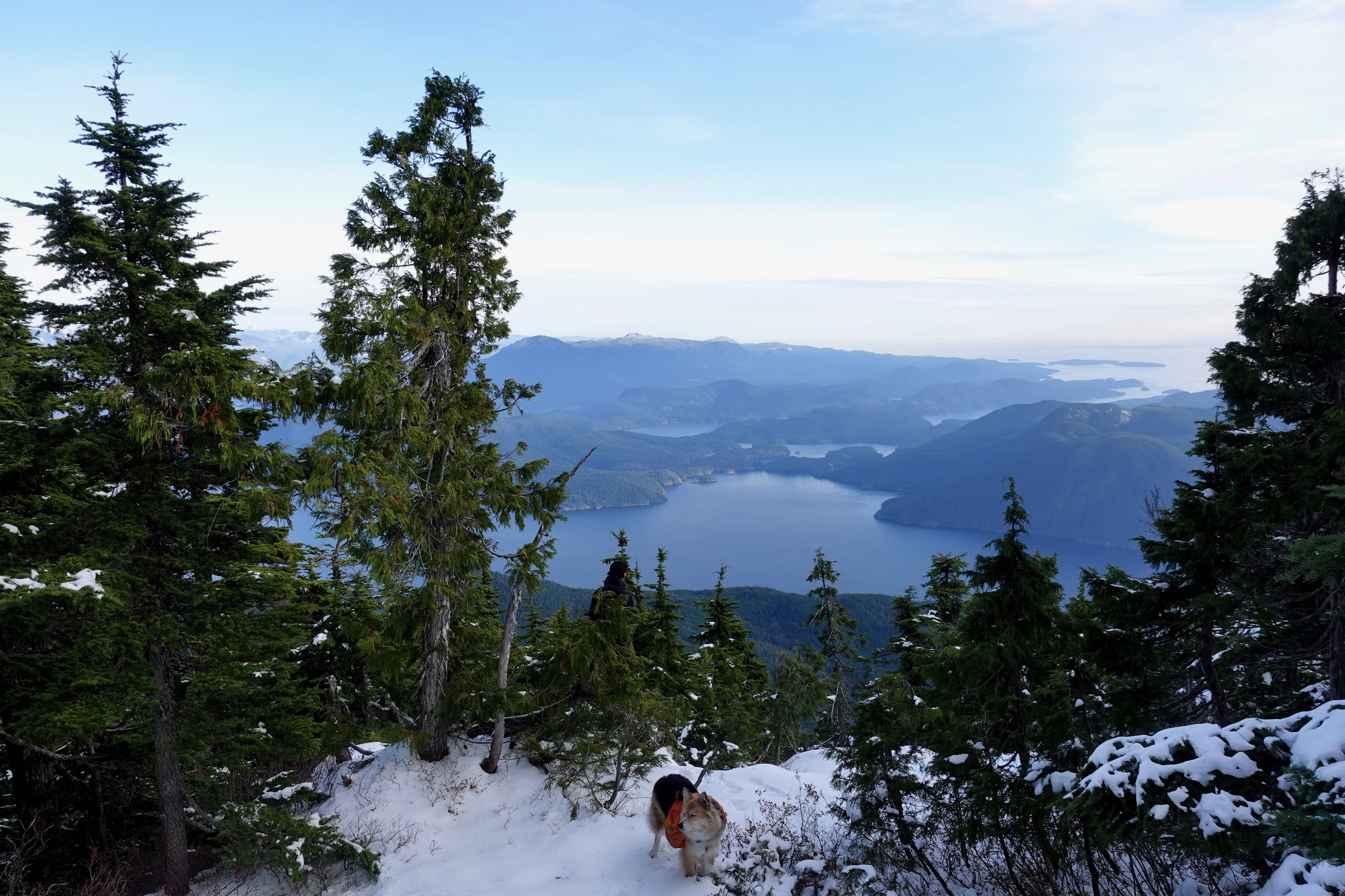
He had the views of Jervis inlet and could see all the way to Powell River.

Turns out winter camping is quite comfortable โ€” when you can sleep in a hut rather than a tent.

I took plenty of winter wonderland video. And later managed to accidentally delete most of it. Somehow. ๐Ÿ˜•


Oct 26 – Troubridge to Fairview Bay hut (km 173)

More good weather. I was worried the descent might be slippery, but new snow was mostly grippy. No problems in approach shoes.

Navigation no problem in winter either.

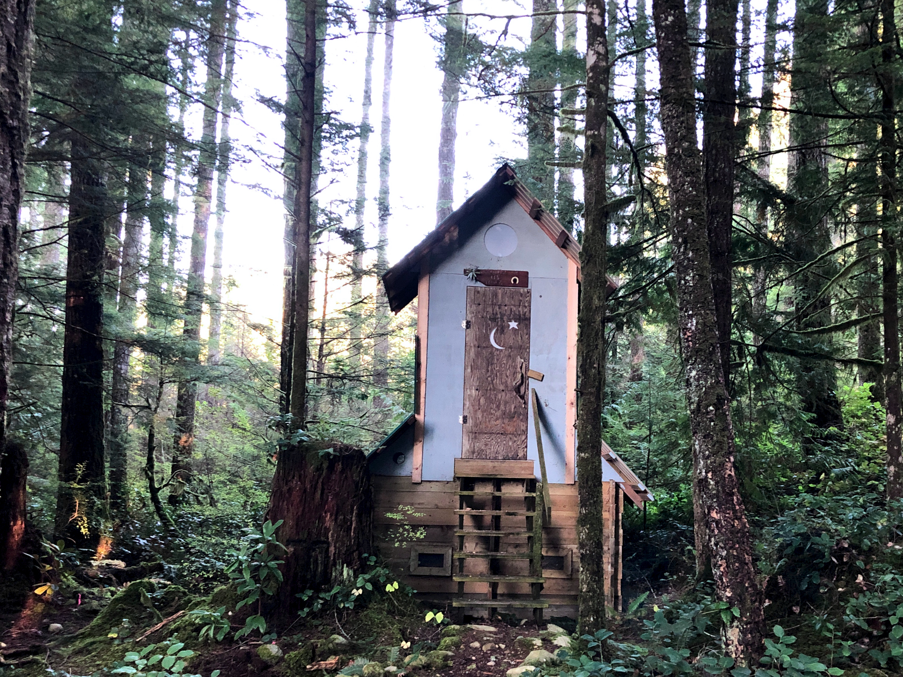
I stopped 800m lower for lunch at Rainy Day lake (km 169) which has a hut.

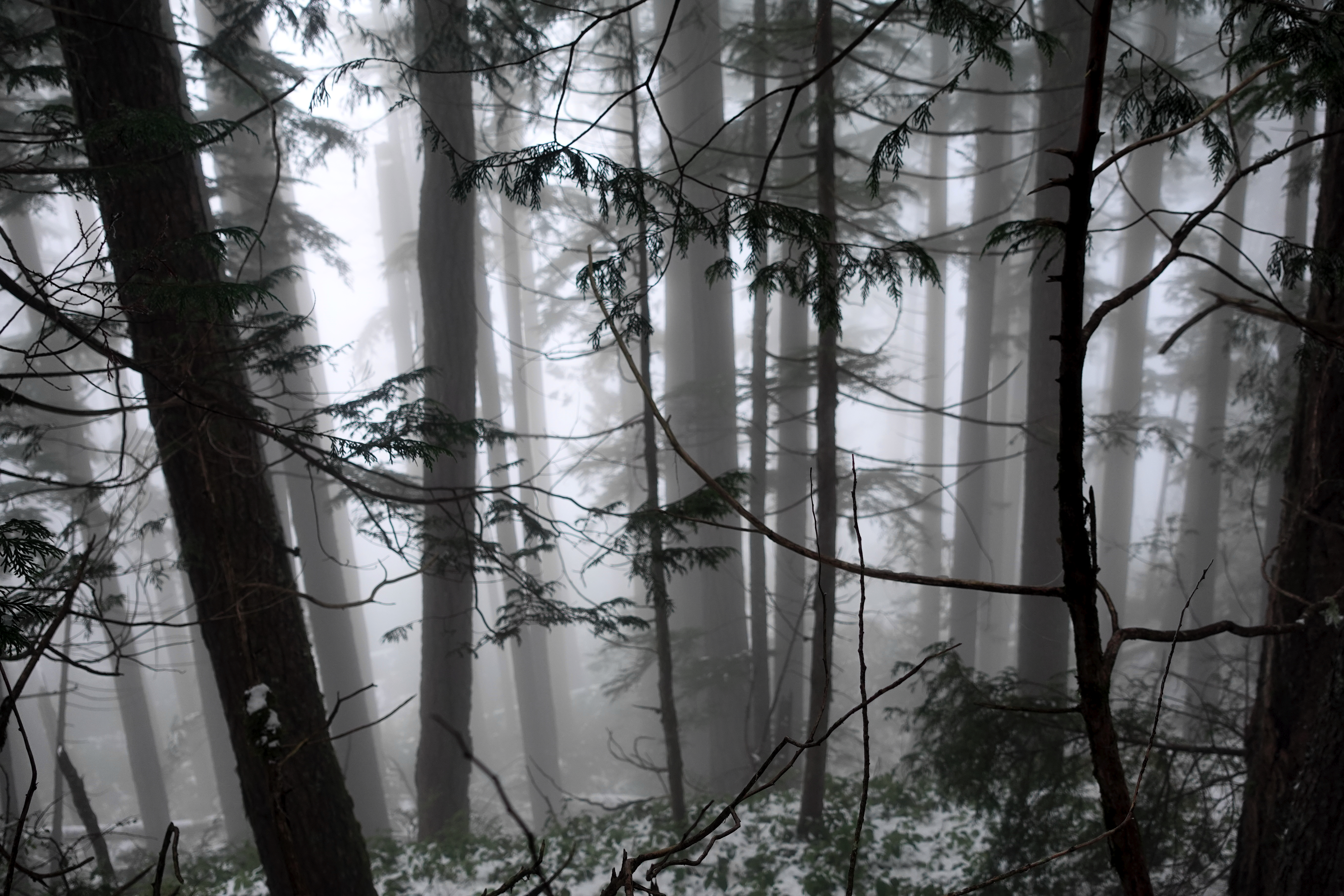
Winter hiking is much different than doing the same thing in summer.

Eventually snow disappeared. Went away. Like magic. ๐Ÿ˜€

It got easier on the way down to Fairview Bay.

Again I had the hut to myself.

And again I had plenty of time for photos.


There’s the ferry I’ll be catching to North Vancouver.

Next morning a leisurely 2 hour walk out. Autumn is my favourite time of year for hiking.

This is the end of the South Coast Trail. But I have one section left to finish, close to Powell River. Looking forward to it already.

I had to telephone the bus for pick-up. But it only cost $2.25 to get me back to Lang Bay where I retrieved my bike.

If you want to learn more about Canada’s longest hut-to-hut hike, check first the official website and our own information page:

BestHike – Sunshine Coast Trail

sunshinecoast-trail.com