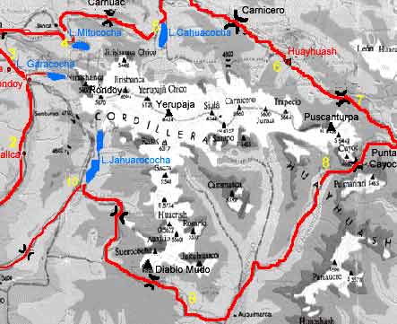
Megan “Hashbrown” Maxwell did Huayhuashalone and independently. She’s one tough hiker.
Still … she felt Huayhuash was the toughest hike of her life.
The Huayhuash Circuit is a beast of a trek. I would only recommend it if you have done a trek before and have an idea of what you’re getting into. I would only recommend going guide-less if you are at a confident level of backpacking experience, have taken the time to acclimatize, and are physically fit and able to carry a pack loaded with a week of food.
This circuit goes over a pass everyday, ranging from 15,400 to 16,500 feet (4,690 to 5,050 meters). This means you will be hiking slower than usual, due to the altitude, and the walking itself is physically taxing. This also means that you will have spectacular views of the Andes every single day. …
CHELSEA and JOSEPH did not want to stay in Alpine Huts. They tented the entire route. Nine days.
From Chamonix to Zermatt, from Mont Blanc to the Matterhorn, how could you go wrong with a hike like this! The Walker’s Haute Route is an absolutely stunning trail that offers what I would consider to be the classic Alps experience: beautiful mountain hamlets, green flower-rich valleys, gorgeous snow-capped peaks and almost constant access to great food and drink. …
In many European countries, wild (not in a designated campsite) camping is illegal and the number of legitimate campsites are few and far between.
In addition, other trip reports for the WHR were claiming that tenting the whole way was impossible due to the terrain and/or that all camping in Switzerland was illegal. Looking a bit closer though it became clear that while wild camping in Switzerland is highly discouraged, it is not “illegal” in all places. You are generally allowed to camp high , but should avoid camping outside of designated sites in the valleys as each canton and town has different laws and can impose a fine for wild camping.
Armed with this information we decided to go ahead with our plan and hike the trail with our tent. We hope this guide will help others who are looking to do the same. …
You should pretty much always have a map when you go hiking (and know how to use it), but the maps for this trail were just stupid expensive and big. Instead, we relied solely on the Kindle version of the Kev Reynolds guide, Chamonix-Zermatt: The Walker’s Haute Route. While we disliked Kev by the end of the hike for his nonchalant writing style, he did manage to get us to Zermatt without major incident or getting lost. …
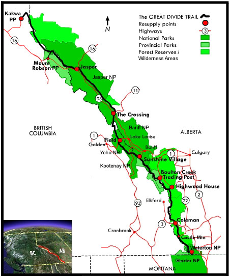
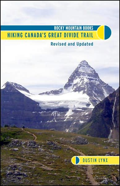
The Great Divide Trail (GDT), is a wilderness hiking trail in the Canadian Rockies. The trail closely follows the Great Divide between Alberta and British Columbia, crossing the divide no fewer than 30 times.
It begins in Waterton Lakes National Park at the Canada-US border (where it connects with the Continental Divide Trail) and ends in Kakwa Provincial Park north of Jasper National Park. The Great Divide Trail is 1,200 km long …
Fewer than 20 people a year thru hike the GDT. If you might be interested, try to get a copy of the only guidebook.
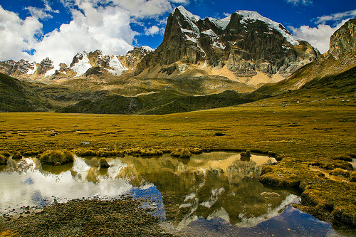
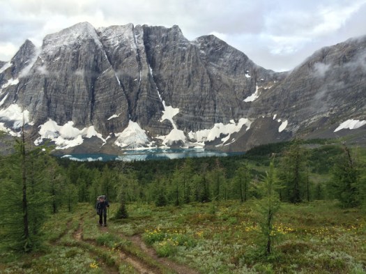
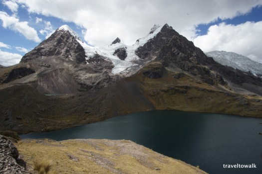
The Ausangate circuit is a trek that is relative untouched by the massive tourism industry in Cusco. Because of that, this is one a hike where there is plenty of solitude. On the flip side, it is much tougher as it is about 1 km higher than Cusco with passes that go over 5 km in elevation (16k ft). …
… the trail is not marked and there are no signs to discriminate trails the locals use trail around the mountain. So, map skills, GPS, or a guide is imperative for a trek like this. All of this is pretty manageable for experienced backpackers.
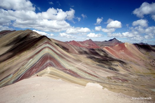
However, we decided to add an additional layer to this already challenging task. There is information out there that the Rainbow Mountains are nearby and provides a side trip possibility. …
I left Elk Hut as early, quickly and quietly as possible. Alex was still sleeping upstairs.
Mice are a problem in some huts. You still need to hang your food.
This would be my last day. I hoped it would be easier hiking, descending back to sea level. And it might have been if I’d not been lost once and diverted twice.
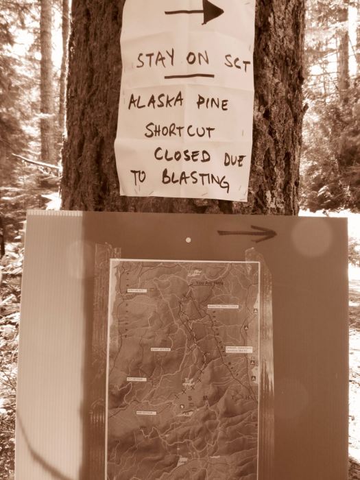
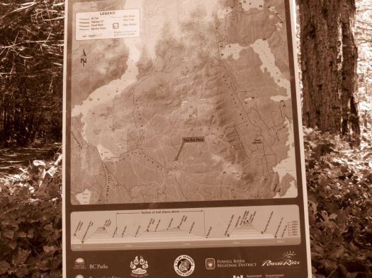
Road building and logging operations are ongoing. It’s not unusual to have to detour around sections of the SCT.
I’d complain more stridently … but one of the detours ended up being a favourite section. Lovely off-trail through temperate rain forest.
Signage is actually very good on this new, rapidly changing trail. But I still wished I’d brought my GPS.
I left a Summit Stone at one lovely creekside lunch spot.
If you can put up with the bugs, the SCT is endlessly entertaining. Something new around ever corner.
I’ve got one big chunk of the SCT left to do – the Troubridge Trudge (41km for me). I plan to do that in October or November one year to see if the bugs are hibernating.
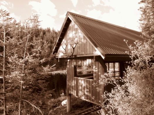
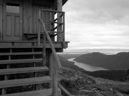
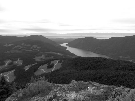
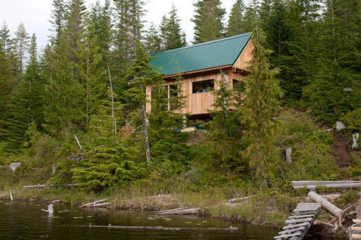
… the Tin Hat hut is an epic 360-degree mountain-top lookout that provides the quintessential view of the rugged mountains, valleys, and lakes that define the Powell River back country experience. This hut is a fully winterized cabin with pellet stove and is located in, arguably, one of the most beautiful spots on the Sunshine Coast Trail. Although it is a climb to get there, the experience is well worth the effort. Summitting this mountain will make you feel like you are, indeed, on top of the world!
It’s the highest elevation point and the biggest attraction of the SCT. I was impressed.
Still early morning, I chatted with Lisa from Calgary in the hut. Then dashed on back down the logging road to where I’d stashed my pack. A savvy hiker like myself doesn’t haul his gear up the mountain unless absolutely necessary. My guidebook hinted at an alternative SCT route that would be easier than the normal steep up and down. 🙂
I was soon lost. 😦
Views were terrific.
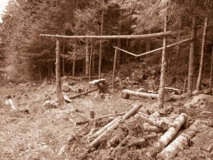
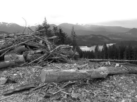
But I found myself on a maze of logging road switchbacks. If you don’t like clear cut, you might not like the Sunshine Coast Trail.
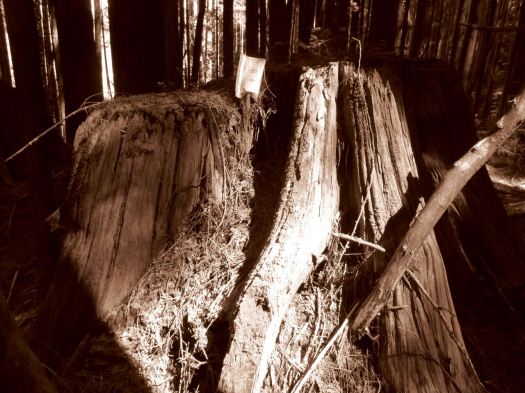
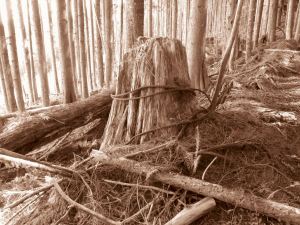
Here you can see an old growth survivor. Secondary growth. And the war zone that is clear cut logging.
Worse than forest devastation, the bugs.
bug shirt
By day 3 I wore my bug shirt non-stop. Flying pests are a very good argument why you should NOT hike the Sunshine Coast Trail. All of the other major B.C. coastal hikes have virtually no bugs
Eventually I found my way back to the SCT.
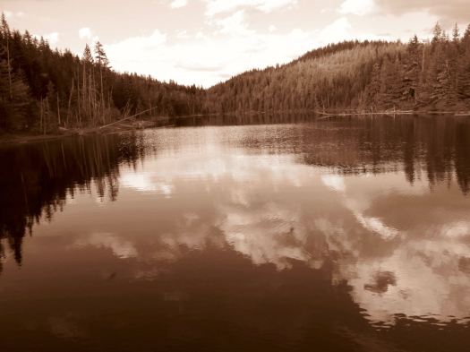
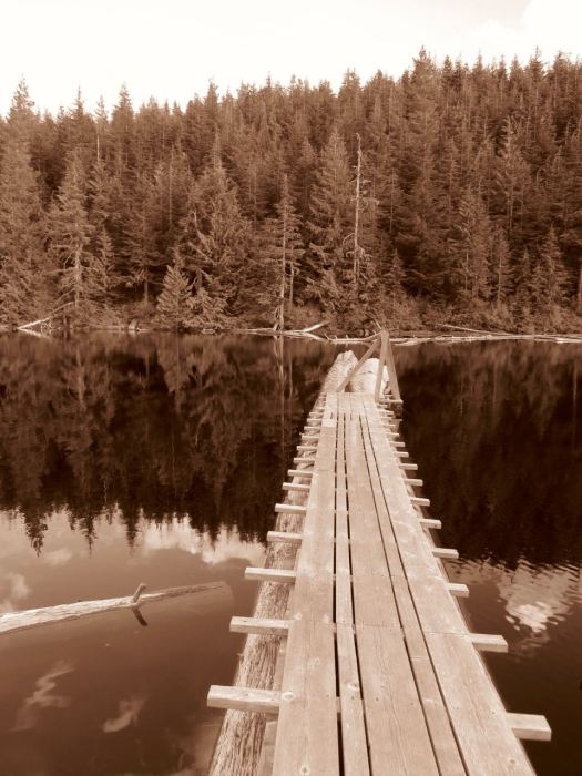
Past Lewis Lake.
On to Elk Lake.
Mosquitos and I had the rustic hut to ourselves. Very tranquil.
Close to dark Alex from Ontario rushed in. Super happy to have made it to the hut in daylight. She’d come from Tin Hat Hut.