hiking Fall Canyon, Death Valley, California

Trip report by site editor Rick McCharles.

12mi return

I was the only one on the Trail June 2nd.

Most hikers feel it is too hot in June to do valley hikes safely.

Actually, 100 degrees in the shade and zero humidity is not all that uncomfortable. I took plenty of water. And I love these slot canyons.

Fall Canyon is one of many colorful ravines in the hills surrounding Death Valley in California; shaped by occasional flash floods that flow from the higher mountains beyond, the canyon is remote and little-visited; deep and moderately narrow for many miles, with occasional shaded, cave-like passageways of great beauty. Some of these narrow, twisting sections are enclosed by smooth granitic walls with an unusual bluish tint. As with most other Southwest canyons, the rocks are layered, but quite differently to the orderly slot canyons of Utah – here the strata are multi-colored, buckled, twisted and eroded, the result of ancient geological forces. Fall Canyon is easily reached and offers a perfect wilderness experience, though it should be avoided during the summer months when the weather becomes too extreme.

more photos

The highlight comes 2.8mi in when you reach this 20ft wall.

3592849470_e2fb633d75

Actually, you’d be crazy to scale this wall without ropes.

Instead look for cairns on the right hand side of the cliff. They lead up to a relatively easy path up and over the obstacle.

The next half mile is the best section.

Location: Fall Canyon is located in the Grapevine Mountains, towards the less-traveled north end of Death Valley National Park. It is close to Titus Canyon, another colorful ravine that is popular because of the rough one-way track that extends through it – this is a 4WD route …

The American Southwest

I left my pack behind (carrying only water) before the cliff. My thinking in hanging it was to keep out scorpions and snakes.

3592041819_953b27a962

In fact I did see one golden snake further up the canyon. And several chuckwallas.
where to hike in Death Valley?

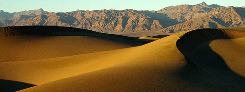
Perhaps Mesquite Flat Sand Dunes?

dunes

Gary Hayes – larger version

Death Valley unfortunately lived up to its name earlier this week, when an Ohio hiker failed to return from a day trip in the park.

On Tuesday morning, May 19, employees at Death Valley National Park received a report of an overdue hiker in the Mesquite Flat Sand Dunes near Stove Pipe Wells Village. The dunes in that area rise nearly 100 feet above the surrounding desert. …

National Parks Traveler

I’ll be careful.

scrambling Lady MacDonald, Canmore, Alberta

I was looking for a good first hike of the season. And a chance to test my full set of gear.

My original plan of scrambling Ha Ling, then wild camping, was abandoned after I heard about a better option from local hiker Kelly Mock.

In fact, I walked out Kelly’s front door directly to the trailhead and up the mountain to this gorgeous vista.

teahouse-view

… Just above the treeline you’ll find a large helicopter landing pad, a steel ramp for paragliders, and the remains of a teahouse that was being constructed but is now abandoned. A gazebo just to the east of the teahouse sits on the edge of a large cliff. The views from here are spectacular. A number of hikers end their hike here as it’s already been a hard push to get this far, and the scree slope above can be daunting for non-scramblers. …

TrailPeak – Mount Lady MacDonald

Actually, it’s an easy and popular hike straight up to the ill fated teahouse. Most do not go higher as it’s recommended you have mountaineering skills on the ridge.

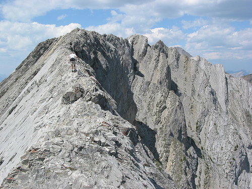
That’s not far wrong. The slippery scree takes you up to a knife edge ridge with killer views into the Cougar Creek drainage. In summer it’s merely daunting.

Lady-MacDonald
flickr – Marc Shandro – larger version

In the Spring it’s hairier. It looks like you might fall right through the melting cornice at spots.

MacDonald-in-April
flickr – iHeartDimSum – larger version

I stopped when I got to the snow.

Lady MacDonald is a terrific option for fit hikers. Each in your group can stop where they want. Most will relax at the teahouse or the gazebo until the adventurous return from the ridge.

This is a good hike with dogs. Don’t let them chase after the resident mountain sheep.

10 essentials for day hiking


According to the Mountaineering: The Freedom of the Hills, the ten essentials of HIKING are:

1. Map
2. Compass (optionally supplemented with a GPS receiver)
3. Sunglasses and sunscreen
4. Extra food and water
hiker 5. Extra clothes
6. Headlamp/flashlight
7. First aid kit
8. Fire starter
9. Matches
10. Knife

Wikipedia

There are many variations on the “essentials”, of course, many combining matches and fire starter, many adding “shelter”.

Personally, I refer to a much more practical list. One put together by Tom Mangan for day hiking in reasonable weather:

Mangan’s 10 Essentials for Happy Hiking

1 – A water supply
2 – A reliable map
3 – Comfortable socks
4 – Comfortable shoes
5 – Underwear that doesn’t chafe
6 – Something to keep crud out of your shoes
7 – Nylon hiking pants
8 – Something to block the sun
9 – Nourishment
10 – The Real 10 essentials

Two-Heel Drive – Mangan’s 10 Essentials for Happy Hiking

Leave a comment if you have any ESSENTIALS for day hiking that are not listed.

hike Angel’s Landing online

Angel’s Landing is one of our best day hikes in North America.

National Parks Traveler points us to an unique feature on the government website for Zion National Park in Utah.

Whether you want to relive a previous trip up Angels Landing, or you’ve never hiked there and want to get an idea of what it’s like, this virtual tour is the way to go. It offers a taste of the wonders of Zion—the sounds of birds calling and the soothing sound of the Virgin River, the sights of pink-hued sandstone cliffs at sunrise and the grand view from the summit.

You control your experience within our virtual tour with videos, pictures, and sounds. All these options come with a price, however—large file size. High-speed Internet access is recommended for viewing the full version of our virtual tour, which may take some time to download. You will also need to have a plug-in installed on your computer — Flash Player. We hope you enjoy your virtual visit to Zion National Park. …

Click through to eHike Angel’s Landing

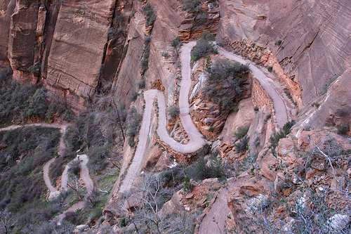
wiggles
flickr – Jess J – larger original

Want to plan a trip to Utah?

Check our besthike information page – Angel’s Landing

related post – should we close Angel’s Landing in Zion?

It wasn’t included on Backpacker Magazine’s list of America’s 10 Most Dangerous Hikes, but should have been.

Trekking The Lebanon Mountain Trail

Have you ever heard of hiking in Lebanon?

Is it safe?

What is the Lebanon Mountain trail?

The Lebanon Mountain trail is the first long distance hiking trail in Lebanon and the Arab world (www.lebanontrail.org). It extends 440km. from Qbaiyat in the north to Marjeyoun in the south. It traverses 75 towns and villages at altitudes from 600m to 1900m. The LMT showcases the natural beauty and cultural wealth of Lebanon’s mountains.

The Lebanon Mountain Trail Association organized the first complete thru-walk of the LMT during the month of April 2009. The core group of 7 hikers explored history and culture, as well as the natural beauty of Lebanon.

Lebanon-hikers

They blogged the journey, an interesting read with plenty of photos.

header-trekking-Lebanon

TrekkingLebanon.com

official trail website – lebanontrail.org

Time Magazine posted a short video on this Adventure.

This could be the start of something much bigger in the Middle East. Just as soon as Peace breaks out there.

this hiker staying with the Bear Vault

Sigh … Rocky Mountain National Park now requires Bear Canisters.

More and more Parks will be doing it in future. Best get used to hiking with one. …

Last summer I saw a bear vault with a night light attached so hikers could find it in the dark. Good idea.

bear-vault-bv500
details – Amazon

2 lb 9oz Bear Vault.

Despite the weight, I think I’ll stick with mine instead of buying an Ursack.

Here’s another happy camper:

… I found that the vault slipped in quite nicely to the top portion of my 60 liter pack. It was also great to have a waterproof container to put dry clothes in (in a zip-lock bag so they didn’t absorb food smell). Towards the end of longer trips its nice to have a waterproof place to put all of our garbage.

Around camp they are a godsend. I’ve used the vaults as stools, chairs, cutting boards, tables, water jugs, and hammers. Just having a flat surface in camp is a treat. Another handy feature is that they are transparent. You can see what you’re reaching in for. Other cannisters I’ve used are a solid plastic and you have to fish everything out/around to find what you’re looking for.

Now I know what you’re thinking. How can you do a good review of a bear cannister without having it attacked by bears? I’m way ahead of you.

While camping this summer by Lake Colden in the High Peaks region of the Adirondacks my BearVaults were put to the test. For those who don’t know, this area is notorious for its black bears. We placed our BearVaults a fair distance from our camp site. In the middle of the night I woke up to hear smashing sounds coming from the direction of our vaults. Thuds came from the vaults smashing into the soil. Loud bangs from the vaults hitting each other and hitting the fallen trees that we had placed them beside. For a good hour these sounds drifted over to our campsite. Then they stopped. In the morning I found the BearVaults 10-15 feet from where I had left them. They were dirty, one had a small scratch on it, but other wise they were intact and the food within in them untouched. …

silverorange stuff – BearVault Bear Canister Review

Fisher_BearVault

audiocast – Wildebeat – The Story of Bear Cans, part 2

Calipidder posted a terrific comparative review of all the available systems.

(via Two-Heel Drive)

do you understand Cap and Trade?

Not exactly hiking, but an important issue for all of us who want protection for the great outdoors.

Hank Green, the EcoGeek explains Cap and Trade in 3:30sec.

Click PLAY or watch it on YouTube.

( via Treehugger – Cap and Trade Explained in Under Four Minutes (Video)

is the Ursack truly bear proof?

I’ve been considering the Ursack system for protecting food from bears.

above_tree-ursack
more photos

Those who try Ursack seem to like the product. But it’s not currently approved for use in the Sierras.

I currently use a 2 lb 9oz Bear Vault. It’s great.

bear-vault-bv500
details – Amazon

… On the other hand, the Ursack V27 that holds almost as much food weighs only 7.5oz. (Recommended is to use a small Brillo pad squeezed under the opening to protect your yummies from mice and insects.)

Calipidder posted a terrific comparative review of all the available systems.

(via Two-Heel Drive)

Sierra High Route – American Adventure


Allie Comeau on the Sierra Blogging Post had to include a Sierra trip as one of her Top 10 American Adventures.

Good call.

It’s on our list of the best hikes in North America. Similar to the famed John Muir Trail, but without wasting so much time and energy descending each day. On the Sierra High Route you try to stay HIGH.

9. Hiking the Sierra High Route, California: The 195-mile stretch between King’s Canyon and Yosemite National Park is not for the faint of heart. This trail, through the country’s most rugged terrain, is challenging to say the least.

This one is dangerous. The expert is Steve Roper.

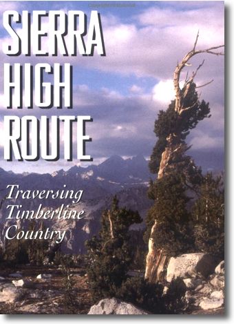
The Sierra High Route (also called the Roper Route) is a cross-country hiking route, 195 miles (314 km) long, through the Sierra Nevada. It was scouted by Steve Roper and described by him in his book Sierra High Route: Traversing Timberline Country (1982; 1997). …

Wikipedia

sierra-high-route

I’m going to need Steve’s guidebook.

Amazon – The Sierra High Route: Traversing Timberline Country